SlideShare ist ein Scribd-Unternehmen logo
1 von 20
SPATIAL PLANNING STRUCTURE
EMERGING TECHNOLOGIES: ECO-TOWNSHIPS
REAL ESTATE AND PROPERTY MANAGEMENT
BY
Prof. Jagjit Singh Ghuman
Former President ITPI, Chief Town Planner & Head T & CP Dept. Govt. of Pb.
and Professor of Physical Planning, Guru Nanak Dev University Amritsar Punjab.
PLANET EARTH
Pawan Guru, Pani Pita, Mata Dhart Mahat,
Diwas Raat Doye Dayi Dayeya, Kheley Sagal Jagat
Life on Earth
• Planet Earth is the only place in our Solar
System where life is known.
• It is home to 1.5 million distinct life forms
and more are being discovered all the time.
• Earth is just far enough away from the Sun for
liquid water and life to exist. If it were any
closer, Earth would be too hot, any further away
and it would be too cold.
• More than 70 per cent of Earth is covered in
water.
• Earth has just the right temperature for its
water to be liquid.
• Mercury and Venus are too hot, and their
water has evaporated.
• Most of Mars’ water is frozen beneath its
surface.
GEO-PHYSICAL
GLOBAL SPATIAL STRUCTURE
Global Land Surface Area 148,940,000 sq.km. (29.2%)
The global land surface area is 148,940,000 KM2 (29.2 %) and constitutes 1/4th of the global
surface area excluding oceans & seas. It is estimated that only 1/8th of the total land resource is suitable
for human habitation—and half of the land area is either desert (14%), high mountains (27%), or other
less suitable terrain. The land-based ecosystem depends upon topsoil and fresh water, and the oceanic
ecosystem depends upon dissolved nutrients washed down from the land. The estimated amount of
irrigated land in 1993 was 2,481,250 km2.The land is also used for building & to construct shelters. In
1993, habitable use of land is approximately is as follows:
Land Use
Percentage
Arable Land Permanent
Crops
Permanent
pastures
Forests and
woodland
Urban
areas
Other
13.13% 4.71% 26% 32% 1.5% 30%
Source: McKinsey Report Urban India 2030 Projections and
Statistics
Geo-Political & Spatial Structure
• The total geographical area of India is 3,287,240 square kilometers (1,269,210 sq mi)
• As per census data 2011, the total population of India is: 1,210,193,422 with a population density of 382
persons/km2 rounded to the nearest integer.
GEO-PHYSICAL STRUCTURE
INDIAN PENINSULAR
S.N
O
UNITS AREA KM
(Sq) (appro)
% OF
TOTAL
AREA
01 Northern
mountains
578,000 17.9
02 Great Plains 550,000 17.1
03 Thar Desert 175,000 5.4
04 Central
Highlands
336,000 10.4
05 Peninsular
Plateaus
1,241,000 38.5
06 Coastal Plains 335,000 10.4
07 Islands 8,300 0.3
Mega-Cities, Urbanization and Economic Growth
India’s rapid economic growth and development is accompanied by the dramatic rise and growth of so-
called mega-cities. People across India and other developing countries flock to cities and urban areas in
search of greater opportunity and higher living standards. The fruits of their labour and the economic
advantages of cities’ financial, human and social capital help fuel India’s development and urbanization.
India will have more than 68 cities with populations of more than one million people by 2030, and more
than 40 percent of Indians will live in cities of greater than one million people by 2025 according to the
McKinsey Global Institute.
INDIA GROWTH DYNAMICS
ECONOMIC PARAMETERS
The “Mckinsey Report on India” identify and prioritize the measures that help accelerate India's economic
development by focusing on India's fiscal deficit and its capital distortions, restrictive labour laws, and
poor infrastructure are the most important barriers to rapid growth. However, research shows that the
most important problems are product and land market barriers, and India has the ability to absorb growth
of the working age population within the dominant microeconomic growth parameters i.e.
• Automotive Sector The continuous liberalization of the automotive sector in India has resulted in
impressive growth and is fast emerging as the world’s largest car & heavy vehicle manufacturer.
• Electric Power Sector India's power sector suffers from near bankrupt organizations, low tariffs for
farmers and domestic consumers, and distribution losses from theft. Privatization and unbundling of
state organizations are the key to growth.
• Housing Construction Sector Productivity is 1/5th of its potential because of the artificial scarcity of
land created by distortions in the land market as well as poor enforcement of standards.
• Retail Banking Sector Deregulation in the 1990s has led to the creation of aggressive and productive
banks, but the sector is still dominated by large public sector banks.
Other key sectors affecting growth are: Industrial; Software; Telecommunications; Steel; Apparel; Dairy
Farming & Processing; Retail; Wheat Farming; etc.
 Town & Country Planning in India, also known as Urban, Regional or Rural Planning or ”Spatial
Planning” is governed by the hierarchy of Geo-Political, Geo-Physical & Administrative
Structure and the Socio-Economic & Cultural life of the people in the Country.
 Land Use Planning secures consistency & continuity in the framing & execution of the National
& State Policies for use & development of the scarce habitable land recourses in general
“Public Interest”.
 Spatial Land Use Planning relates to;
 agricultural activity & availability of fresh water
 industrialisation & level of industrial activity (mining & mineral resources), including marketing, business and
trading economies
 the Physical Form, its composition, shape & size
 Physical Growth comprises of;
 Regional Plans for Resource Regions.
 Master Plans for Cities & Towns.
 Zoning Plans, and Layout Plans etc.
These integrate the perspective urban growth with proposed land uses, including land required for a
well laid out regional & urban transportation network system, urban infrastructure, public utilities &
services in a Spatial Settlement Structure Plan.
SPATIAL LAND USE PLANNING:
A PERSPECTIVE
 Globalization & privatisation of the socio-economic activities
 rapid industrialisation in India
 composition, shape, size & form of the urban settlements have undergone a quantum change
 deficient regional & urban infrastructure,
 sporadic and haphazard location of mega-projects, real estate development of colonies,
 Need to create an “Urban Land Bank” for development purposes through public-private participation
(PPP
 Urbanisation an integral part of spatial growth & development.
 time to bridge the gap in the Urban-Rural divide
 An innovative Spatial Planning approach
 regulating the exploitative & speculative tendencies by the property dealers, colonisers, land
speculators
 planned & organised growth and development of the Metro Regions-Urban Areas
 healthy Physical Urban Structure
1) The post-independent Indian peninsular land resource is 32,87,263 km2 out of which 9.56 %
is in sweet water bodies i.e. other comprises of the Indian Ocean in the south, the Arabian Sea in the
west, and the Bay of Bengal in the east. The estimated population of India by 2011 is 1,19,08,44,000
persons with a density of 382 persons per km2. At present there are 42 cities each with more than 1
million people in India. On the world scale, India’s urbanisation by 2030 will be immense with 68 cities
having more than 1 million people, 13 with more than 4 million, and six megacities with population of 10
million or more, at least two of which (Mumbai and Delhi) will be among the five largest cities of the world
by 2030.
2) Projections made by the McKinsey Global Institute (MGI) predict a general spreading out of
urbanisation across the whole country, impacting almost every state. It shows that the urban population
in five states of India, i.e. Tamil Nadu, Gujarat, Maharashtra & Karnataka, including Punjab, is slated to
outstrip the rural population by 2030. The McKinsey report projects the population of India’s cities from
340 million in 2008 to 590 million by 2030 – i.e. 40 per cent of India’s total population. In short, India will
witness an unparallel urban transformation matched perhaps only by China.
3) Correspondingly the area of Punjab State is 50,362 km2 and has a density of 550 persons /
km2, Haryana State is 44,212 km2 and has a population density of 573 persons / km2. Chandigarh City
UT area is 114 km2 and has a density of 9252 persons per km2. The Chandigarh City Inter State Capital
Region (ISCR) prepared by TCPO GoI comprises of 2421.3 sq.km area and extends upto 35 km. in
Punjab, Haryana & Himachal Pradesh.
GEO-SPATIAL STRUCTURE:
URBAN GROWTH DYNAMICS
4) The McKinsey Global Institute (MGI) also predict that many Indian cities will become larger
than many countries today in terms of both Population and the Gross Domestic Product (GDP). For
instance, Mumbai Metropolitan Region’s GDP is projected to reach $265 billion by 2030, larger than the
GDP of many countries today, including Portugal, Colombia, and Malaysia. The MGI also projects
reduction of poverty as a result of this population explosion, saying that India’s fast-growing and
productive cities will drive a near four-fold increase in India’s per capita income between 2008 and 2030.
The number of households earning less than Rs. 90,000 per year will fall below 20 per cent, while the
number of middle class households (earning between Rs. 200,000 and Rs. 1 million a year) will increase
more than four-fold from 32 million to 147 million. These economic trends will unlock many new growth
markets, many of them not traditionally associated with India, including infrastructure, transportation,
health care, education and recreation.
5) Life for the average city dweller in India would become a lot tougher. Water supply for the
average citizen could drop from an average of 105 ltr. to only 65 ltr. a day with a large section of the
population having no access to potable water at all. India’s cities could leave between 70 to 80 per cent
of the sewage untreated. While private car ownership would increase, shortcomings in the transportation
infrastructure have the potential to create urban gridlock -- similar to the acute congestion that cripples
some Latin American cities. Therefore, till the construction of urban infrastructure is dramatically
increased, India will not be able to bridge the gap between demand and provision of basic services.
6) To meet the needs of this new emerging middle class, the economy will have to build
between 700 and 900 million square mtr. of residential and commercial space a year — equivalent to
adding more than two Mumbai’s or one Chicago every year. In transportation, the projections focuses on
urban infrastructure demand to build 350 to 400 km. of metros and subways every year, more than 20
times the capacity in the past decade. In addition, between 19,000 to 25,000 km. of new road network
would be required to be built every year (including lanes for bus-based rapid transit systems etc.),
equivalent to the backlog in the last decade. But if the current low rate of investment in urban
infrastructure continues then in 20 years time, the urban infrastructure will fall woefully short of what is
necessary to sustain growth in the urban sector.
 Post-Independence (15th Aug, 1947), first priority was given to consolidate & form a Union of the
many Princely States, rehabilitation & settlement of the people from across the borders on the North
East & North West India and construction of the Mega Hydroelectric Project (Bhakra Dam) on the
Satluj River and setting up of the Nangal Township in Punjab. The Constitution of India was
adopted on 26 Nov. 1949 and came into force on 26 Jan. 1950. It provides for Fundamental Rights to
Freedom & Equality of life to all in a Federal System of Governance in the Indian Republic comprising
of 28 States and 7 Union Territories.
 The Nation embarked upon the implementation of its first 5 year Socio-Economic Development Plan
in 1951. The Institute of Town Planners India (ITPI) was set up in 1951.
 The School of Physical Planning & Architecture at Delhi and IIT Kharagpur (WB) were also
established to develop requisite Human Resource in Physical Planning in the country.
 The Chandigarh City as a New Capital for Punjab with statuary provision to regulate its periphery (16
KM radius) was set up in the early 50’s as a symbol of a Free & Resurgent India.
 The first generation of Socio-Economic & Physical Planners i.e. 1951-1971 focused on research &
development in the Agriculture Sector (green revolution), regulate land reforms related to ceiling on
holding of agriculture & urban lands; with equity & justice to all in a Healthy Living Environment.
 In the Pre & Post Independence period i.e. up to 1962, the Provincial Town Planner in the State PWD
(B&R) Dept. looked after the Physical Planning requirements for the Cities & Towns in the State i.e.
formulation of Layout Plans for Municipal Schemes, under the Act 1911 and Development Schemes
under the Town Improvement Act 1922, development of Damaged Areas in Amritsar City, setting up
Model Towns for rehabilitation, marketing centres (new mandi townships) etc.
PHYSICAL PLANNING PERSPECTIVE
IN PUNJAB CHANDIGARH & HARYANA
 The focus on Micro Level Physical Planning i.e. for localities in the local Urban & Rural Area and not
on Comprehensive Physical Planning i.e. Regional Plans or Master Plans for overall growth of Cities
& Towns.
 Long range physical planning requirements in laying out of a network of major roads for safe and
speedy movement of traffic, public utilities and services in the city was successfully achieved through
formulation of municipal schemes at the micro level
 The land for this purpose was created free of cost as part of the Micro level Spatial Planning
Municipal Schemes. This was possible through forethought and advanced Spatial Planning at the
Micro level.
 The National 5 year Fiscal Plan early in the 1960’s, made provision for Town & Country Planning
(Spatial Planning) as a socio-economic need and gave financial assistance to the States to set up
T&CP Departments in the State Services.
 The first Spatial Structure Plan for Human Settlements prepared by TCPO (GOI) and the State
T&CP Depts.
 The Punjab State Spatial Structure Plan including the Border Area Development Plan, aimed at
channelization of the public & private resources.
 Master Plan or Comprehensive Development Plan for the Metropolitan Area, selected Cities & Towns
were also prepared by the State T&CP Dept.
 Micro Planning & Development – provision of socio economic infrastructure and development of
services in the Rural Sector was taken up by the Pb. State T&CP Dept. through Community Block
Development Plans.
 Focal Point Villages;
 Measures taken to check & regulate building construction up to 30 meters along the Scheduled
 Spatial Planning & Development in the urban & rural sectors continued in the 1970’s.
 Nucleus Industrial Townships,
 Free Enterprise Zones (FEZ) later referred to as Special Economic Zone (SEZ) in an around major
cities and towns, namely; Chandigarh Periphery etc.
 Environmental Research Planning and Development Organisation (ERPDO) was set up in the
Pb. State T&CP Dept. in 1981-91 decade.
 Integrated Urban Development Program (IUDP) as a basic tool for implementation of the master
plans.
 Traffic Operations Plan (TOP) for major Cities.
 Study of the Environmentally Critical Wetlands at Harike Patan & Goindwal Sahib.
 The Earth Summit in Rio de Janeiro (1992).
 Sustainable development concepts.; new perceptions in Spatial Planning & Management of the
scarce habitable land resources.
 Introduction of the Punjab Regional, Town Planning & Development Act 1995 by delineating Urban
Planning Areas.
 Changed socio-economic service perspective of the State T&CP Dept. to a Revenue Earning
Department.
 Spatial planning functions & activities of the State Govt. Town & Country Planning Department has
inadvertently shifted to private consultants & agencies.
 Setting up of a number of Development Agencies in the 1991-2001 decade.
 Shortage & proliferation of trained professional Spatial planning human resources.
 Change in the Spatial Planning & Development perspective in India with the 73rd & 74th amendment
of The Constitution of India in 1992, transferring the functions & powers to regulate growth &
development in the urban & rural sectors to the local authorities.
 Establishment of a three tier Panchayati Raj System .
 The municipalities for the major Cities & Towns have skeleton human resources for carrying out
Spatial planning activity.
 In the rural sector there is no human resources to regulate Spatial planning applications at the
community development block.
 The Municipal and Panchayati Raj enactments are often seen as tools for party politics or vote banks.
This presentation on Spatial or Physical Planning with focus on Real Estate & Property Management
aims to help with discussing sustained economic growth in a scarce National & State Land Resource.
Attention is also focussed on the need to bridge the gap created in Physical Planning in the Rural &
Urban Sectors with the 73rd & 74th Amendments in 1992, i.e. the 11th & 12th Schedule: article 243G &
243W of The Constitution of India. It also focuses attention on the need to evolve a viable mechanism for
Spatial Planning at the micro level, namely; Rural Sector i.e. the village (Gram Panchayat), block
(Panchayat Samitti) & the district (Zila Parishad) under the Panchayati Raj System.
 The National & State Policies on “Housing & Urban Development” in the past has
focused on Government interventions with Mega Development Authorities to regulate
growth in major cities & towns in the country.
 The number of “Property Dealers & Colonisors” informal sector have out grown the
formal sector Real Estate, Property Development & Management activities resulting in
land speculation & disposal of properties without basic infrastructure public utilities &
services.
 The formal sector “Governmental & Private Real Estate Developers” have not been
able to check or reverse the process of unauthorised & illegal residential colonies,
increasing the backlog in deficit Infrastructure public utilities & services in the Mega
Cities/Towns in the Country.
 The Government sector or the Mega Real Estate & Property Management
authorities/agencies have not been able to generate self supporting & self sustaining
societies in the urban sector.
REAL ESTATE AND
PROPERTY MANAGEMENT:
Enabling Laws:
The enabling laws to provide civic amenities, public utilities & services including the need for to regulate
subdivision of lands in and around Urban settlements were first introduced as early as 1911,
• Punjab Municipal Act 1911
• Punjab Town Improvement Act 1922.
• Punjab Development of Damaged Areas Act 1952 (built areas in Amritsar City)
• Punjab New Capital Development and Periphery Control Act of 1952.
• Punjab Urban Estates (Development & Regulation) Act 1964,
• Punjab Housing Development Board Act 1972;
• Punjab Sewerage Board Act and the Regulation of Colonies Act 1975
• Punjab Regional and Town Planning Development Act 1995 and the Amendments in 2006
Urban Land Resource:
• Enhanced Public Private Partnership to mobilise Urban Land resource
• Foster Real Estate Developers in the organised “Formal Sector”
• Regulate property dealers and urban market speculators in the “Informal Sector”
Human Resource :
Real estate relates to all properties consisting of land and the buildings on it, along with its natural
resources such as trees, crops, minerals, or water; immovable property and interest vested in it, i.e.
buildings or housing in general.
 The “Formal Sector” in Real Estate Development comprise of corporates, societies and other
organised agencies, established under an Act of the Govt. or registered under the Factories/Societies
& Trust Acts.
 The “Informal Sector” in real estate development comprise of land & property speculators and
dealers who outnumber the players in the organised sector.
 Against 5 real estate developers in the Formal Sector, there are more than 100 property dealers,
land speculators and other operators in the unorganised Informal Sector.
The formal sector Real Estate Development generally have access and inputs to Spatial Planning / real-
estate management and hence ensure quality service in making available developed sites i.e. b for
residential, commercial, industrial, institutional and other purposes. This has substantially contributed to
the organised spatial growth in and around mega cities and towns.
 create awareness and accountability in real estate sector.
 regulate & harness the informal sector
 ensure orderly spatial growth and development of the human settlements
Other Enablers:
 Check the haphazard location of mega-projects multiplexes & malls, multi storey high
rise buildings in the urban peripheries, creating imbalances in the regional & urban
physical structure.
 Restore functional accountability to Physical Planners (Town & Country Planners) in
the state and government services so as to ensure application of the use of land.
 Strategic Environmental Assessment & Land Use Planning including EIA, be made
an essential requirement in all policy making and development processes to safeguard
public interest, the quality of life, health and living conditions of the community in the
region/country.
 To tide over this short fall & deficiency in the “Urban Sector”, environmentally
sustainable “Eco-Townships” in the periphery of urban settlements need to be setup
as self –contained & self-supporting settlements to co-exist with the agriculture activity in
the periphery.
 “Mini Eco-Townships” in less than 50 acres land
 “Mega Eco-Townships” having more than 50 acres land.
Eco-Township Concept:
The key elements in the “New Eco-Townships” strategy should include:
• Economic needs of “New Eco-Township” development, ensuring a balance with social &
environmental parameters including self-supporting & self-sustaining local area societies.
• Deal with all local site related matters i.e. assured accessibility & approaches, free of HT electric
lines, existing green cover, hydrology, storm water drainage, water quality, meteorology & air quality
etc.
• Master Plan, Design & Layout of the site for a viable “Road Network System” for movement of light
& heavy vehicle traffic, including fire safety vehicles and layout of public utilities & services.
• Landscape, contiguous public open spaces, traffic segregated pedestrian walkways, cycle tracks etc.
• Ensure development does not exceed ecological thresholds i.e. morphology & assured soil quality,,
slopes & soil stability, environmentally critical & derelict sites, excavations etc.
• Maintain and hence the quality of local environment, tree plantation etc.
• Provision of public utilities & services, Water Supply, Sewerage including “Sewage Treatment
Plant” and recycle storm & sewage waste water for landscaping & tree plantation.
• Community & society amenities i.e. community centre, club house etc.
• Public & educational, institutional amenities i.e. neighborhood primary & middle schools, sports
ground etc.
• Adequate commercial activity, SCO/SCF or shop booths & where required malls & multiplexes.
• Environmentally sustainable & satisfactory arrangements for solid waste collection & disposal etc.
Thank You

Weitere ähnliche Inhalte

Was ist angesagt?

Chandigarh. city of two plans
Chandigarh. city of two plansChandigarh. city of two plans
Chandigarh. city of two plansJIT KUMAR GUPTA
 
Sustainable City Design: Developing Conceptual Planning Proposal for Eastern ...
Sustainable City Design: Developing Conceptual Planning Proposal for Eastern ...Sustainable City Design: Developing Conceptual Planning Proposal for Eastern ...
Sustainable City Design: Developing Conceptual Planning Proposal for Eastern ...Shahadat Hossain Shakil
 
factors behind the development of Noida
factors behind the development of Noida factors behind the development of Noida
factors behind the development of Noida padamatikona swapnika
 
Delineation of a region ncr - alok tripathi,krishna dutt
Delineation of a region ncr - alok tripathi,krishna duttDelineation of a region ncr - alok tripathi,krishna dutt
Delineation of a region ncr - alok tripathi,krishna duttkrishnadutt1819
 
Community involvement in informal settlements upgrading
Community involvement in informal settlements upgradingCommunity involvement in informal settlements upgrading
Community involvement in informal settlements upgradingAlexander Decker
 
Regional plan 2021 ncr
Regional plan 2021 ncrRegional plan 2021 ncr
Regional plan 2021 ncrkamnagill
 
Rural infrastructure
Rural infrastructureRural infrastructure
Rural infrastructureAzam FA
 
Self Sustainable Integrated Township : A resource-base planning to improve th...
Self Sustainable Integrated Township : A resource-base planning to improve th...Self Sustainable Integrated Township : A resource-base planning to improve th...
Self Sustainable Integrated Township : A resource-base planning to improve th...Sahil Singh Kapoor
 
Feasibility of incentive housing
Feasibility of incentive housingFeasibility of incentive housing
Feasibility of incentive housingOmkar Parishwad
 
Success story - Noida
Success story - NoidaSuccess story - Noida
Success story - NoidaROHIT DABAS
 
Comprehensive Development of Amritsar- Need for A Planning and Urban Develop...
Comprehensive Development  of Amritsar- Need for A Planning and Urban Develop...Comprehensive Development  of Amritsar- Need for A Planning and Urban Develop...
Comprehensive Development of Amritsar- Need for A Planning and Urban Develop...JIT KUMAR GUPTA
 

Was ist angesagt? (20)

Chandigarh. city of two plans
Chandigarh. city of two plansChandigarh. city of two plans
Chandigarh. city of two plans
 
Purvanchal region
Purvanchal regionPurvanchal region
Purvanchal region
 
Sustainable City Design: Developing Conceptual Planning Proposal for Eastern ...
Sustainable City Design: Developing Conceptual Planning Proposal for Eastern ...Sustainable City Design: Developing Conceptual Planning Proposal for Eastern ...
Sustainable City Design: Developing Conceptual Planning Proposal for Eastern ...
 
Urban Development
Urban DevelopmentUrban Development
Urban Development
 
factors behind the development of Noida
factors behind the development of Noida factors behind the development of Noida
factors behind the development of Noida
 
Delineation of a region ncr - alok tripathi,krishna dutt
Delineation of a region ncr - alok tripathi,krishna duttDelineation of a region ncr - alok tripathi,krishna dutt
Delineation of a region ncr - alok tripathi,krishna dutt
 
Community involvement in informal settlements upgrading
Community involvement in informal settlements upgradingCommunity involvement in informal settlements upgrading
Community involvement in informal settlements upgrading
 
Regional plan 2021 ncr
Regional plan 2021 ncrRegional plan 2021 ncr
Regional plan 2021 ncr
 
Rural infrastructure
Rural infrastructureRural infrastructure
Rural infrastructure
 
Humanities question bank
Humanities question bankHumanities question bank
Humanities question bank
 
Sikkim State Report July 2017
Sikkim State Report July 2017Sikkim State Report July 2017
Sikkim State Report July 2017
 
Self Sustainable Integrated Township : A resource-base planning to improve th...
Self Sustainable Integrated Township : A resource-base planning to improve th...Self Sustainable Integrated Township : A resource-base planning to improve th...
Self Sustainable Integrated Township : A resource-base planning to improve th...
 
Feasibility of incentive housing
Feasibility of incentive housingFeasibility of incentive housing
Feasibility of incentive housing
 
Success story - Noida
Success story - NoidaSuccess story - Noida
Success story - Noida
 
Manipur State Report - January 2019
Manipur State Report - January 2019Manipur State Report - January 2019
Manipur State Report - January 2019
 
Comprehensive Development of Amritsar- Need for A Planning and Urban Develop...
Comprehensive Development  of Amritsar- Need for A Planning and Urban Develop...Comprehensive Development  of Amritsar- Need for A Planning and Urban Develop...
Comprehensive Development of Amritsar- Need for A Planning and Urban Develop...
 
Manipur State Report - March 2019
Manipur State Report - March 2019Manipur State Report - March 2019
Manipur State Report - March 2019
 
Meghalaya State Report - January 2019
Meghalaya State Report - January 2019Meghalaya State Report - January 2019
Meghalaya State Report - January 2019
 
Meghalaya june-2017
Meghalaya june-2017Meghalaya june-2017
Meghalaya june-2017
 
Sikkim State Report - February 2017
Sikkim State Report - February 2017Sikkim State Report - February 2017
Sikkim State Report - February 2017
 

Andere mochten auch

6 land & probate records
6 land & probate records6 land & probate records
6 land & probate recordsmedinalibrary
 
Punjab The Land of rivers
Punjab The Land  of riversPunjab The Land  of rivers
Punjab The Land of riversKing Abidi
 
LRMIS Punjab
LRMIS PunjabLRMIS Punjab
LRMIS PunjabAkhuwat
 
The punjab by pratik kashikar
The punjab by pratik kashikarThe punjab by pratik kashikar
The punjab by pratik kashikarforthpillers
 
The magical land of the punjab
The magical land of the punjabThe magical land of the punjab
The magical land of the punjabSrinjoy Das
 
Punjab : a state presentation
Punjab : a state presentationPunjab : a state presentation
Punjab : a state presentationsurabhi agarwal
 
LinkedIn powerpoint
LinkedIn powerpointLinkedIn powerpoint
LinkedIn powerpointguest2137df
 
agriculture ppt
 agriculture ppt agriculture ppt
agriculture ppticon66rt
 

Andere mochten auch (13)

MDA Final internship report 2016
 MDA Final internship report 2016 MDA Final internship report 2016
MDA Final internship report 2016
 
6 land & probate records
6 land & probate records6 land & probate records
6 land & probate records
 
AGRICULTURAL LAND RECORDS
AGRICULTURAL LAND RECORDSAGRICULTURAL LAND RECORDS
AGRICULTURAL LAND RECORDS
 
Agricultural land records
Agricultural land recordsAgricultural land records
Agricultural land records
 
Punjab The Land of rivers
Punjab The Land  of riversPunjab The Land  of rivers
Punjab The Land of rivers
 
Punjab State Report February 2017
Punjab State Report February 2017Punjab State Report February 2017
Punjab State Report February 2017
 
LRMIS Punjab
LRMIS PunjabLRMIS Punjab
LRMIS Punjab
 
The punjab by pratik kashikar
The punjab by pratik kashikarThe punjab by pratik kashikar
The punjab by pratik kashikar
 
Tcpo
TcpoTcpo
Tcpo
 
The magical land of the punjab
The magical land of the punjabThe magical land of the punjab
The magical land of the punjab
 
Punjab : a state presentation
Punjab : a state presentationPunjab : a state presentation
Punjab : a state presentation
 
LinkedIn powerpoint
LinkedIn powerpointLinkedIn powerpoint
LinkedIn powerpoint
 
agriculture ppt
 agriculture ppt agriculture ppt
agriculture ppt
 

Ähnlich wie ISPER - 7th National Seminar_5th-6th April, 2013

Methodology for Preparation of Master Plan
 Methodology for Preparation of Master Plan  Methodology for Preparation of Master Plan
Methodology for Preparation of Master Plan JIT KUMAR GUPTA
 
Methodology for Preparation of Master Plan
Methodology  for  Preparation of Master PlanMethodology  for  Preparation of Master Plan
Methodology for Preparation of Master PlanJIT KUMAR GUPTA
 
Urban growth and urbanization
Urban growth and urbanizationUrban growth and urbanization
Urban growth and urbanizationMamathaNagaraju2
 
Redefining Master Plans to Promote Smart and Sustainable Cities
Redefining Master Plans to Promote Smart and Sustainable CitiesRedefining Master Plans to Promote Smart and Sustainable Cities
Redefining Master Plans to Promote Smart and Sustainable CitiesIRJET Journal
 
Sustainable and Smart urban Transportion
Sustainable and  Smart urban TransportionSustainable and  Smart urban Transportion
Sustainable and Smart urban TransportionJIT KUMAR GUPTA
 
Role and Importance of master plan
Role and Importance of  master planRole and Importance of  master plan
Role and Importance of master planJIT KUMAR GUPTA
 
Urban housing scenario and rental housing in india
Urban housing scenario and rental housing in indiaUrban housing scenario and rental housing in india
Urban housing scenario and rental housing in indiapadamatikona swapnika
 
Rural Strategy Summit
Rural Strategy Summit Rural Strategy Summit
Rural Strategy Summit Mohit Kapoor
 
Thesis - Urban Infrastructure Development
Thesis - Urban Infrastructure DevelopmentThesis - Urban Infrastructure Development
Thesis - Urban Infrastructure DevelopmentRakesh Sasapu
 
Affordable housing in India- A Myth or Relity
  Affordable housing in India- A Myth or Relity  Affordable housing in India- A Myth or Relity
Affordable housing in India- A Myth or RelityJIT KUMAR GUPTA
 
chandigarh experiment with low cost housing
chandigarh experiment with low cost housingchandigarh experiment with low cost housing
chandigarh experiment with low cost housingJIT KUMAR GUPTA
 
Urban infrastructure management in jaipur challenges and oppurtonity by ahmad...
Urban infrastructure management in jaipur challenges and oppurtonity by ahmad...Urban infrastructure management in jaipur challenges and oppurtonity by ahmad...
Urban infrastructure management in jaipur challenges and oppurtonity by ahmad...Dr. Ahmad Jawad Niazi
 
Using land as resource for municipal fianace
Using land as resource for municipal fianaceUsing land as resource for municipal fianace
Using land as resource for municipal fianaceJIT KUMAR GUPTA
 
National Urban Housing and Habitat Policy 2007.pdf
 National Urban Housing and Habitat Policy 2007.pdf National Urban Housing and Habitat Policy 2007.pdf
National Urban Housing and Habitat Policy 2007.pdfThirumeni Madavan
 
How Rural Marking is done by FMCG Company
How Rural Marking is done by FMCG CompanyHow Rural Marking is done by FMCG Company
How Rural Marking is done by FMCG Companyuuuuuuuuuuuuuuuuuu
 
Sky Booming Urban Slums in Metro Cities of India (Special Reference to Charac...
Sky Booming Urban Slums in Metro Cities of India (Special Reference to Charac...Sky Booming Urban Slums in Metro Cities of India (Special Reference to Charac...
Sky Booming Urban Slums in Metro Cities of India (Special Reference to Charac...iosrjce
 
APPLICATION OF GIS FOR URBAN PLANNING amp MANAGEMENT.pdf
APPLICATION OF GIS FOR URBAN PLANNING  amp  MANAGEMENT.pdfAPPLICATION OF GIS FOR URBAN PLANNING  amp  MANAGEMENT.pdf
APPLICATION OF GIS FOR URBAN PLANNING amp MANAGEMENT.pdfWendy Belieu
 

Ähnlich wie ISPER - 7th National Seminar_5th-6th April, 2013 (20)

Methodology for Preparation of Master Plan
 Methodology for Preparation of Master Plan  Methodology for Preparation of Master Plan
Methodology for Preparation of Master Plan
 
Methodology for Preparation of Master Plan
Methodology  for  Preparation of Master PlanMethodology  for  Preparation of Master Plan
Methodology for Preparation of Master Plan
 
Urban growth and urbanization
Urban growth and urbanizationUrban growth and urbanization
Urban growth and urbanization
 
Redefining Master Plans to Promote Smart and Sustainable Cities
Redefining Master Plans to Promote Smart and Sustainable CitiesRedefining Master Plans to Promote Smart and Sustainable Cities
Redefining Master Plans to Promote Smart and Sustainable Cities
 
Sustainable and Smart urban Transportion
Sustainable and  Smart urban TransportionSustainable and  Smart urban Transportion
Sustainable and Smart urban Transportion
 
Role and Importance of master plan
Role and Importance of  master planRole and Importance of  master plan
Role and Importance of master plan
 
Urban housing scenario and rental housing in india
Urban housing scenario and rental housing in indiaUrban housing scenario and rental housing in india
Urban housing scenario and rental housing in india
 
Rural Strategy Summit
Rural Strategy Summit Rural Strategy Summit
Rural Strategy Summit
 
Osprey
OspreyOsprey
Osprey
 
Thesis - Urban Infrastructure Development
Thesis - Urban Infrastructure DevelopmentThesis - Urban Infrastructure Development
Thesis - Urban Infrastructure Development
 
Affordable housing in India- A Myth or Relity
  Affordable housing in India- A Myth or Relity  Affordable housing in India- A Myth or Relity
Affordable housing in India- A Myth or Relity
 
chandigarh experiment with low cost housing
chandigarh experiment with low cost housingchandigarh experiment with low cost housing
chandigarh experiment with low cost housing
 
Urban infrastructure management in jaipur challenges and oppurtonity by ahmad...
Urban infrastructure management in jaipur challenges and oppurtonity by ahmad...Urban infrastructure management in jaipur challenges and oppurtonity by ahmad...
Urban infrastructure management in jaipur challenges and oppurtonity by ahmad...
 
Using land as resource for municipal fianace
Using land as resource for municipal fianaceUsing land as resource for municipal fianace
Using land as resource for municipal fianace
 
National Urban Housing and Habitat Policy 2007.pdf
 National Urban Housing and Habitat Policy 2007.pdf National Urban Housing and Habitat Policy 2007.pdf
National Urban Housing and Habitat Policy 2007.pdf
 
RAAAH
RAAAHRAAAH
RAAAH
 
How Rural Marking is done by FMCG Company
How Rural Marking is done by FMCG CompanyHow Rural Marking is done by FMCG Company
How Rural Marking is done by FMCG Company
 
Sky Booming Urban Slums in Metro Cities of India (Special Reference to Charac...
Sky Booming Urban Slums in Metro Cities of India (Special Reference to Charac...Sky Booming Urban Slums in Metro Cities of India (Special Reference to Charac...
Sky Booming Urban Slums in Metro Cities of India (Special Reference to Charac...
 
APPLICATION OF GIS FOR URBAN PLANNING amp MANAGEMENT.pdf
APPLICATION OF GIS FOR URBAN PLANNING  amp  MANAGEMENT.pdfAPPLICATION OF GIS FOR URBAN PLANNING  amp  MANAGEMENT.pdf
APPLICATION OF GIS FOR URBAN PLANNING amp MANAGEMENT.pdf
 
Excalibur
ExcaliburExcalibur
Excalibur
 

Kürzlich hochgeladen

Proofreading- Basics to Artificial Intelligence Integration - Presentation:Sl...
Proofreading- Basics to Artificial Intelligence Integration - Presentation:Sl...Proofreading- Basics to Artificial Intelligence Integration - Presentation:Sl...
Proofreading- Basics to Artificial Intelligence Integration - Presentation:Sl...David Celestin
 
Unlocking Exploration: Self-Motivated Agents Thrive on Memory-Driven Curiosity
Unlocking Exploration: Self-Motivated Agents Thrive on Memory-Driven CuriosityUnlocking Exploration: Self-Motivated Agents Thrive on Memory-Driven Curiosity
Unlocking Exploration: Self-Motivated Agents Thrive on Memory-Driven CuriosityHung Le
 
Dreaming Music Video Treatment _ Project & Portfolio III
Dreaming Music Video Treatment _ Project & Portfolio IIIDreaming Music Video Treatment _ Project & Portfolio III
Dreaming Music Video Treatment _ Project & Portfolio IIINhPhngng3
 
SOLID WASTE MANAGEMENT SYSTEM OF FENI PAURASHAVA, BANGLADESH.pdf
SOLID WASTE MANAGEMENT SYSTEM OF FENI PAURASHAVA, BANGLADESH.pdfSOLID WASTE MANAGEMENT SYSTEM OF FENI PAURASHAVA, BANGLADESH.pdf
SOLID WASTE MANAGEMENT SYSTEM OF FENI PAURASHAVA, BANGLADESH.pdfMahamudul Hasan
 
AWS Data Engineer Associate (DEA-C01) Exam Dumps 2024.pdf
AWS Data Engineer Associate (DEA-C01) Exam Dumps 2024.pdfAWS Data Engineer Associate (DEA-C01) Exam Dumps 2024.pdf
AWS Data Engineer Associate (DEA-C01) Exam Dumps 2024.pdfSkillCertProExams
 
Report Writing Webinar Training
Report Writing Webinar TrainingReport Writing Webinar Training
Report Writing Webinar TrainingKylaCullinane
 
Uncommon Grace The Autobiography of Isaac Folorunso
Uncommon Grace The Autobiography of Isaac FolorunsoUncommon Grace The Autobiography of Isaac Folorunso
Uncommon Grace The Autobiography of Isaac FolorunsoKayode Fayemi
 
Bring back lost lover in USA, Canada ,Uk ,Australia ,London Lost Love Spell C...
Bring back lost lover in USA, Canada ,Uk ,Australia ,London Lost Love Spell C...Bring back lost lover in USA, Canada ,Uk ,Australia ,London Lost Love Spell C...
Bring back lost lover in USA, Canada ,Uk ,Australia ,London Lost Love Spell C...amilabibi1
 
Jual obat aborsi Jakarta 085657271886 Cytote pil telat bulan penggugur kandun...
Jual obat aborsi Jakarta 085657271886 Cytote pil telat bulan penggugur kandun...Jual obat aborsi Jakarta 085657271886 Cytote pil telat bulan penggugur kandun...
Jual obat aborsi Jakarta 085657271886 Cytote pil telat bulan penggugur kandun...ZurliaSoop
 
Dreaming Marissa Sánchez Music Video Treatment
Dreaming Marissa Sánchez Music Video TreatmentDreaming Marissa Sánchez Music Video Treatment
Dreaming Marissa Sánchez Music Video Treatmentnswingard
 
Zone Chairperson Role and Responsibilities New updated.pptx
Zone Chairperson Role and Responsibilities New updated.pptxZone Chairperson Role and Responsibilities New updated.pptx
Zone Chairperson Role and Responsibilities New updated.pptxlionnarsimharajumjf
 
My Presentation "In Your Hands" by Halle Bailey
My Presentation "In Your Hands" by Halle BaileyMy Presentation "In Your Hands" by Halle Bailey
My Presentation "In Your Hands" by Halle Baileyhlharris
 
Introduction to Artificial intelligence.
Introduction to Artificial intelligence.Introduction to Artificial intelligence.
Introduction to Artificial intelligence.thamaeteboho94
 
lONG QUESTION ANSWER PAKISTAN STUDIES10.
lONG QUESTION ANSWER PAKISTAN STUDIES10.lONG QUESTION ANSWER PAKISTAN STUDIES10.
lONG QUESTION ANSWER PAKISTAN STUDIES10.lodhisaajjda
 
Digital collaboration with Microsoft 365 as extension of Drupal
Digital collaboration with Microsoft 365 as extension of DrupalDigital collaboration with Microsoft 365 as extension of Drupal
Digital collaboration with Microsoft 365 as extension of DrupalFabian de Rijk
 

Kürzlich hochgeladen (17)

in kuwait௹+918133066128....) @abortion pills for sale in Kuwait City
in kuwait௹+918133066128....) @abortion pills for sale in Kuwait Cityin kuwait௹+918133066128....) @abortion pills for sale in Kuwait City
in kuwait௹+918133066128....) @abortion pills for sale in Kuwait City
 
Proofreading- Basics to Artificial Intelligence Integration - Presentation:Sl...
Proofreading- Basics to Artificial Intelligence Integration - Presentation:Sl...Proofreading- Basics to Artificial Intelligence Integration - Presentation:Sl...
Proofreading- Basics to Artificial Intelligence Integration - Presentation:Sl...
 
Unlocking Exploration: Self-Motivated Agents Thrive on Memory-Driven Curiosity
Unlocking Exploration: Self-Motivated Agents Thrive on Memory-Driven CuriosityUnlocking Exploration: Self-Motivated Agents Thrive on Memory-Driven Curiosity
Unlocking Exploration: Self-Motivated Agents Thrive on Memory-Driven Curiosity
 
Dreaming Music Video Treatment _ Project & Portfolio III
Dreaming Music Video Treatment _ Project & Portfolio IIIDreaming Music Video Treatment _ Project & Portfolio III
Dreaming Music Video Treatment _ Project & Portfolio III
 
SOLID WASTE MANAGEMENT SYSTEM OF FENI PAURASHAVA, BANGLADESH.pdf
SOLID WASTE MANAGEMENT SYSTEM OF FENI PAURASHAVA, BANGLADESH.pdfSOLID WASTE MANAGEMENT SYSTEM OF FENI PAURASHAVA, BANGLADESH.pdf
SOLID WASTE MANAGEMENT SYSTEM OF FENI PAURASHAVA, BANGLADESH.pdf
 
AWS Data Engineer Associate (DEA-C01) Exam Dumps 2024.pdf
AWS Data Engineer Associate (DEA-C01) Exam Dumps 2024.pdfAWS Data Engineer Associate (DEA-C01) Exam Dumps 2024.pdf
AWS Data Engineer Associate (DEA-C01) Exam Dumps 2024.pdf
 
Report Writing Webinar Training
Report Writing Webinar TrainingReport Writing Webinar Training
Report Writing Webinar Training
 
Uncommon Grace The Autobiography of Isaac Folorunso
Uncommon Grace The Autobiography of Isaac FolorunsoUncommon Grace The Autobiography of Isaac Folorunso
Uncommon Grace The Autobiography of Isaac Folorunso
 
Bring back lost lover in USA, Canada ,Uk ,Australia ,London Lost Love Spell C...
Bring back lost lover in USA, Canada ,Uk ,Australia ,London Lost Love Spell C...Bring back lost lover in USA, Canada ,Uk ,Australia ,London Lost Love Spell C...
Bring back lost lover in USA, Canada ,Uk ,Australia ,London Lost Love Spell C...
 
Jual obat aborsi Jakarta 085657271886 Cytote pil telat bulan penggugur kandun...
Jual obat aborsi Jakarta 085657271886 Cytote pil telat bulan penggugur kandun...Jual obat aborsi Jakarta 085657271886 Cytote pil telat bulan penggugur kandun...
Jual obat aborsi Jakarta 085657271886 Cytote pil telat bulan penggugur kandun...
 
Dreaming Marissa Sánchez Music Video Treatment
Dreaming Marissa Sánchez Music Video TreatmentDreaming Marissa Sánchez Music Video Treatment
Dreaming Marissa Sánchez Music Video Treatment
 
Zone Chairperson Role and Responsibilities New updated.pptx
Zone Chairperson Role and Responsibilities New updated.pptxZone Chairperson Role and Responsibilities New updated.pptx
Zone Chairperson Role and Responsibilities New updated.pptx
 
ICT role in 21st century education and it's challenges.pdf
ICT role in 21st century education and it's challenges.pdfICT role in 21st century education and it's challenges.pdf
ICT role in 21st century education and it's challenges.pdf
 
My Presentation "In Your Hands" by Halle Bailey
My Presentation "In Your Hands" by Halle BaileyMy Presentation "In Your Hands" by Halle Bailey
My Presentation "In Your Hands" by Halle Bailey
 
Introduction to Artificial intelligence.
Introduction to Artificial intelligence.Introduction to Artificial intelligence.
Introduction to Artificial intelligence.
 
lONG QUESTION ANSWER PAKISTAN STUDIES10.
lONG QUESTION ANSWER PAKISTAN STUDIES10.lONG QUESTION ANSWER PAKISTAN STUDIES10.
lONG QUESTION ANSWER PAKISTAN STUDIES10.
 
Digital collaboration with Microsoft 365 as extension of Drupal
Digital collaboration with Microsoft 365 as extension of DrupalDigital collaboration with Microsoft 365 as extension of Drupal
Digital collaboration with Microsoft 365 as extension of Drupal
 

ISPER - 7th National Seminar_5th-6th April, 2013

  • 1. SPATIAL PLANNING STRUCTURE EMERGING TECHNOLOGIES: ECO-TOWNSHIPS REAL ESTATE AND PROPERTY MANAGEMENT BY Prof. Jagjit Singh Ghuman Former President ITPI, Chief Town Planner & Head T & CP Dept. Govt. of Pb. and Professor of Physical Planning, Guru Nanak Dev University Amritsar Punjab.
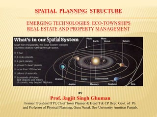
  • 2. PLANET EARTH Pawan Guru, Pani Pita, Mata Dhart Mahat, Diwas Raat Doye Dayi Dayeya, Kheley Sagal Jagat Life on Earth • Planet Earth is the only place in our Solar System where life is known. • It is home to 1.5 million distinct life forms and more are being discovered all the time. • Earth is just far enough away from the Sun for liquid water and life to exist. If it were any closer, Earth would be too hot, any further away and it would be too cold. • More than 70 per cent of Earth is covered in water. • Earth has just the right temperature for its water to be liquid. • Mercury and Venus are too hot, and their water has evaporated. • Most of Mars’ water is frozen beneath its surface.
  • 3. GEO-PHYSICAL GLOBAL SPATIAL STRUCTURE Global Land Surface Area 148,940,000 sq.km. (29.2%) The global land surface area is 148,940,000 KM2 (29.2 %) and constitutes 1/4th of the global surface area excluding oceans & seas. It is estimated that only 1/8th of the total land resource is suitable for human habitation—and half of the land area is either desert (14%), high mountains (27%), or other less suitable terrain. The land-based ecosystem depends upon topsoil and fresh water, and the oceanic ecosystem depends upon dissolved nutrients washed down from the land. The estimated amount of irrigated land in 1993 was 2,481,250 km2.The land is also used for building & to construct shelters. In 1993, habitable use of land is approximately is as follows: Land Use Percentage Arable Land Permanent Crops Permanent pastures Forests and woodland Urban areas Other 13.13% 4.71% 26% 32% 1.5% 30% Source: McKinsey Report Urban India 2030 Projections and Statistics
  • 4. Geo-Political & Spatial Structure • The total geographical area of India is 3,287,240 square kilometers (1,269,210 sq mi) • As per census data 2011, the total population of India is: 1,210,193,422 with a population density of 382 persons/km2 rounded to the nearest integer.
  • 5. GEO-PHYSICAL STRUCTURE INDIAN PENINSULAR S.N O UNITS AREA KM (Sq) (appro) % OF TOTAL AREA 01 Northern mountains 578,000 17.9 02 Great Plains 550,000 17.1 03 Thar Desert 175,000 5.4 04 Central Highlands 336,000 10.4 05 Peninsular Plateaus 1,241,000 38.5 06 Coastal Plains 335,000 10.4 07 Islands 8,300 0.3 Mega-Cities, Urbanization and Economic Growth India’s rapid economic growth and development is accompanied by the dramatic rise and growth of so- called mega-cities. People across India and other developing countries flock to cities and urban areas in search of greater opportunity and higher living standards. The fruits of their labour and the economic advantages of cities’ financial, human and social capital help fuel India’s development and urbanization. India will have more than 68 cities with populations of more than one million people by 2030, and more than 40 percent of Indians will live in cities of greater than one million people by 2025 according to the McKinsey Global Institute.
  • 6. INDIA GROWTH DYNAMICS ECONOMIC PARAMETERS The “Mckinsey Report on India” identify and prioritize the measures that help accelerate India's economic development by focusing on India's fiscal deficit and its capital distortions, restrictive labour laws, and poor infrastructure are the most important barriers to rapid growth. However, research shows that the most important problems are product and land market barriers, and India has the ability to absorb growth of the working age population within the dominant microeconomic growth parameters i.e. • Automotive Sector The continuous liberalization of the automotive sector in India has resulted in impressive growth and is fast emerging as the world’s largest car & heavy vehicle manufacturer. • Electric Power Sector India's power sector suffers from near bankrupt organizations, low tariffs for farmers and domestic consumers, and distribution losses from theft. Privatization and unbundling of state organizations are the key to growth. • Housing Construction Sector Productivity is 1/5th of its potential because of the artificial scarcity of land created by distortions in the land market as well as poor enforcement of standards. • Retail Banking Sector Deregulation in the 1990s has led to the creation of aggressive and productive banks, but the sector is still dominated by large public sector banks. Other key sectors affecting growth are: Industrial; Software; Telecommunications; Steel; Apparel; Dairy Farming & Processing; Retail; Wheat Farming; etc.
  • 7.  Town & Country Planning in India, also known as Urban, Regional or Rural Planning or ”Spatial Planning” is governed by the hierarchy of Geo-Political, Geo-Physical & Administrative Structure and the Socio-Economic & Cultural life of the people in the Country.  Land Use Planning secures consistency & continuity in the framing & execution of the National & State Policies for use & development of the scarce habitable land recourses in general “Public Interest”.  Spatial Land Use Planning relates to;  agricultural activity & availability of fresh water  industrialisation & level of industrial activity (mining & mineral resources), including marketing, business and trading economies  the Physical Form, its composition, shape & size  Physical Growth comprises of;  Regional Plans for Resource Regions.  Master Plans for Cities & Towns.  Zoning Plans, and Layout Plans etc. These integrate the perspective urban growth with proposed land uses, including land required for a well laid out regional & urban transportation network system, urban infrastructure, public utilities & services in a Spatial Settlement Structure Plan. SPATIAL LAND USE PLANNING: A PERSPECTIVE
  • 8.  Globalization & privatisation of the socio-economic activities  rapid industrialisation in India  composition, shape, size & form of the urban settlements have undergone a quantum change  deficient regional & urban infrastructure,  sporadic and haphazard location of mega-projects, real estate development of colonies,  Need to create an “Urban Land Bank” for development purposes through public-private participation (PPP  Urbanisation an integral part of spatial growth & development.  time to bridge the gap in the Urban-Rural divide  An innovative Spatial Planning approach  regulating the exploitative & speculative tendencies by the property dealers, colonisers, land speculators  planned & organised growth and development of the Metro Regions-Urban Areas  healthy Physical Urban Structure
  • 9. 1) The post-independent Indian peninsular land resource is 32,87,263 km2 out of which 9.56 % is in sweet water bodies i.e. other comprises of the Indian Ocean in the south, the Arabian Sea in the west, and the Bay of Bengal in the east. The estimated population of India by 2011 is 1,19,08,44,000 persons with a density of 382 persons per km2. At present there are 42 cities each with more than 1 million people in India. On the world scale, India’s urbanisation by 2030 will be immense with 68 cities having more than 1 million people, 13 with more than 4 million, and six megacities with population of 10 million or more, at least two of which (Mumbai and Delhi) will be among the five largest cities of the world by 2030. 2) Projections made by the McKinsey Global Institute (MGI) predict a general spreading out of urbanisation across the whole country, impacting almost every state. It shows that the urban population in five states of India, i.e. Tamil Nadu, Gujarat, Maharashtra & Karnataka, including Punjab, is slated to outstrip the rural population by 2030. The McKinsey report projects the population of India’s cities from 340 million in 2008 to 590 million by 2030 – i.e. 40 per cent of India’s total population. In short, India will witness an unparallel urban transformation matched perhaps only by China. 3) Correspondingly the area of Punjab State is 50,362 km2 and has a density of 550 persons / km2, Haryana State is 44,212 km2 and has a population density of 573 persons / km2. Chandigarh City UT area is 114 km2 and has a density of 9252 persons per km2. The Chandigarh City Inter State Capital Region (ISCR) prepared by TCPO GoI comprises of 2421.3 sq.km area and extends upto 35 km. in Punjab, Haryana & Himachal Pradesh. GEO-SPATIAL STRUCTURE: URBAN GROWTH DYNAMICS
  • 10. 4) The McKinsey Global Institute (MGI) also predict that many Indian cities will become larger than many countries today in terms of both Population and the Gross Domestic Product (GDP). For instance, Mumbai Metropolitan Region’s GDP is projected to reach $265 billion by 2030, larger than the GDP of many countries today, including Portugal, Colombia, and Malaysia. The MGI also projects reduction of poverty as a result of this population explosion, saying that India’s fast-growing and productive cities will drive a near four-fold increase in India’s per capita income between 2008 and 2030. The number of households earning less than Rs. 90,000 per year will fall below 20 per cent, while the number of middle class households (earning between Rs. 200,000 and Rs. 1 million a year) will increase more than four-fold from 32 million to 147 million. These economic trends will unlock many new growth markets, many of them not traditionally associated with India, including infrastructure, transportation, health care, education and recreation. 5) Life for the average city dweller in India would become a lot tougher. Water supply for the average citizen could drop from an average of 105 ltr. to only 65 ltr. a day with a large section of the population having no access to potable water at all. India’s cities could leave between 70 to 80 per cent of the sewage untreated. While private car ownership would increase, shortcomings in the transportation infrastructure have the potential to create urban gridlock -- similar to the acute congestion that cripples some Latin American cities. Therefore, till the construction of urban infrastructure is dramatically increased, India will not be able to bridge the gap between demand and provision of basic services. 6) To meet the needs of this new emerging middle class, the economy will have to build between 700 and 900 million square mtr. of residential and commercial space a year — equivalent to adding more than two Mumbai’s or one Chicago every year. In transportation, the projections focuses on urban infrastructure demand to build 350 to 400 km. of metros and subways every year, more than 20 times the capacity in the past decade. In addition, between 19,000 to 25,000 km. of new road network would be required to be built every year (including lanes for bus-based rapid transit systems etc.), equivalent to the backlog in the last decade. But if the current low rate of investment in urban infrastructure continues then in 20 years time, the urban infrastructure will fall woefully short of what is necessary to sustain growth in the urban sector.
  • 11.  Post-Independence (15th Aug, 1947), first priority was given to consolidate & form a Union of the many Princely States, rehabilitation & settlement of the people from across the borders on the North East & North West India and construction of the Mega Hydroelectric Project (Bhakra Dam) on the Satluj River and setting up of the Nangal Township in Punjab. The Constitution of India was adopted on 26 Nov. 1949 and came into force on 26 Jan. 1950. It provides for Fundamental Rights to Freedom & Equality of life to all in a Federal System of Governance in the Indian Republic comprising of 28 States and 7 Union Territories.  The Nation embarked upon the implementation of its first 5 year Socio-Economic Development Plan in 1951. The Institute of Town Planners India (ITPI) was set up in 1951.  The School of Physical Planning & Architecture at Delhi and IIT Kharagpur (WB) were also established to develop requisite Human Resource in Physical Planning in the country.  The Chandigarh City as a New Capital for Punjab with statuary provision to regulate its periphery (16 KM radius) was set up in the early 50’s as a symbol of a Free & Resurgent India.  The first generation of Socio-Economic & Physical Planners i.e. 1951-1971 focused on research & development in the Agriculture Sector (green revolution), regulate land reforms related to ceiling on holding of agriculture & urban lands; with equity & justice to all in a Healthy Living Environment.  In the Pre & Post Independence period i.e. up to 1962, the Provincial Town Planner in the State PWD (B&R) Dept. looked after the Physical Planning requirements for the Cities & Towns in the State i.e. formulation of Layout Plans for Municipal Schemes, under the Act 1911 and Development Schemes under the Town Improvement Act 1922, development of Damaged Areas in Amritsar City, setting up Model Towns for rehabilitation, marketing centres (new mandi townships) etc. PHYSICAL PLANNING PERSPECTIVE IN PUNJAB CHANDIGARH & HARYANA
  • 12.  The focus on Micro Level Physical Planning i.e. for localities in the local Urban & Rural Area and not on Comprehensive Physical Planning i.e. Regional Plans or Master Plans for overall growth of Cities & Towns.  Long range physical planning requirements in laying out of a network of major roads for safe and speedy movement of traffic, public utilities and services in the city was successfully achieved through formulation of municipal schemes at the micro level  The land for this purpose was created free of cost as part of the Micro level Spatial Planning Municipal Schemes. This was possible through forethought and advanced Spatial Planning at the Micro level.  The National 5 year Fiscal Plan early in the 1960’s, made provision for Town & Country Planning (Spatial Planning) as a socio-economic need and gave financial assistance to the States to set up T&CP Departments in the State Services.  The first Spatial Structure Plan for Human Settlements prepared by TCPO (GOI) and the State T&CP Depts.  The Punjab State Spatial Structure Plan including the Border Area Development Plan, aimed at channelization of the public & private resources.  Master Plan or Comprehensive Development Plan for the Metropolitan Area, selected Cities & Towns were also prepared by the State T&CP Dept.  Micro Planning & Development – provision of socio economic infrastructure and development of services in the Rural Sector was taken up by the Pb. State T&CP Dept. through Community Block Development Plans.  Focal Point Villages;  Measures taken to check & regulate building construction up to 30 meters along the Scheduled
  • 13.  Spatial Planning & Development in the urban & rural sectors continued in the 1970’s.  Nucleus Industrial Townships,  Free Enterprise Zones (FEZ) later referred to as Special Economic Zone (SEZ) in an around major cities and towns, namely; Chandigarh Periphery etc.  Environmental Research Planning and Development Organisation (ERPDO) was set up in the Pb. State T&CP Dept. in 1981-91 decade.  Integrated Urban Development Program (IUDP) as a basic tool for implementation of the master plans.  Traffic Operations Plan (TOP) for major Cities.  Study of the Environmentally Critical Wetlands at Harike Patan & Goindwal Sahib.  The Earth Summit in Rio de Janeiro (1992).  Sustainable development concepts.; new perceptions in Spatial Planning & Management of the scarce habitable land resources.  Introduction of the Punjab Regional, Town Planning & Development Act 1995 by delineating Urban Planning Areas.  Changed socio-economic service perspective of the State T&CP Dept. to a Revenue Earning Department.
  • 14.  Spatial planning functions & activities of the State Govt. Town & Country Planning Department has inadvertently shifted to private consultants & agencies.  Setting up of a number of Development Agencies in the 1991-2001 decade.  Shortage & proliferation of trained professional Spatial planning human resources.  Change in the Spatial Planning & Development perspective in India with the 73rd & 74th amendment of The Constitution of India in 1992, transferring the functions & powers to regulate growth & development in the urban & rural sectors to the local authorities.  Establishment of a three tier Panchayati Raj System .  The municipalities for the major Cities & Towns have skeleton human resources for carrying out Spatial planning activity.  In the rural sector there is no human resources to regulate Spatial planning applications at the community development block.  The Municipal and Panchayati Raj enactments are often seen as tools for party politics or vote banks. This presentation on Spatial or Physical Planning with focus on Real Estate & Property Management aims to help with discussing sustained economic growth in a scarce National & State Land Resource. Attention is also focussed on the need to bridge the gap created in Physical Planning in the Rural & Urban Sectors with the 73rd & 74th Amendments in 1992, i.e. the 11th & 12th Schedule: article 243G & 243W of The Constitution of India. It also focuses attention on the need to evolve a viable mechanism for Spatial Planning at the micro level, namely; Rural Sector i.e. the village (Gram Panchayat), block (Panchayat Samitti) & the district (Zila Parishad) under the Panchayati Raj System.
  • 15.  The National & State Policies on “Housing & Urban Development” in the past has focused on Government interventions with Mega Development Authorities to regulate growth in major cities & towns in the country.  The number of “Property Dealers & Colonisors” informal sector have out grown the formal sector Real Estate, Property Development & Management activities resulting in land speculation & disposal of properties without basic infrastructure public utilities & services.  The formal sector “Governmental & Private Real Estate Developers” have not been able to check or reverse the process of unauthorised & illegal residential colonies, increasing the backlog in deficit Infrastructure public utilities & services in the Mega Cities/Towns in the Country.  The Government sector or the Mega Real Estate & Property Management authorities/agencies have not been able to generate self supporting & self sustaining societies in the urban sector. REAL ESTATE AND PROPERTY MANAGEMENT:
  • 16. Enabling Laws: The enabling laws to provide civic amenities, public utilities & services including the need for to regulate subdivision of lands in and around Urban settlements were first introduced as early as 1911, • Punjab Municipal Act 1911 • Punjab Town Improvement Act 1922. • Punjab Development of Damaged Areas Act 1952 (built areas in Amritsar City) • Punjab New Capital Development and Periphery Control Act of 1952. • Punjab Urban Estates (Development & Regulation) Act 1964, • Punjab Housing Development Board Act 1972; • Punjab Sewerage Board Act and the Regulation of Colonies Act 1975 • Punjab Regional and Town Planning Development Act 1995 and the Amendments in 2006 Urban Land Resource: • Enhanced Public Private Partnership to mobilise Urban Land resource • Foster Real Estate Developers in the organised “Formal Sector” • Regulate property dealers and urban market speculators in the “Informal Sector”
  • 17. Human Resource : Real estate relates to all properties consisting of land and the buildings on it, along with its natural resources such as trees, crops, minerals, or water; immovable property and interest vested in it, i.e. buildings or housing in general.  The “Formal Sector” in Real Estate Development comprise of corporates, societies and other organised agencies, established under an Act of the Govt. or registered under the Factories/Societies & Trust Acts.  The “Informal Sector” in real estate development comprise of land & property speculators and dealers who outnumber the players in the organised sector.  Against 5 real estate developers in the Formal Sector, there are more than 100 property dealers, land speculators and other operators in the unorganised Informal Sector. The formal sector Real Estate Development generally have access and inputs to Spatial Planning / real- estate management and hence ensure quality service in making available developed sites i.e. b for residential, commercial, industrial, institutional and other purposes. This has substantially contributed to the organised spatial growth in and around mega cities and towns.  create awareness and accountability in real estate sector.  regulate & harness the informal sector  ensure orderly spatial growth and development of the human settlements
  • 18. Other Enablers:  Check the haphazard location of mega-projects multiplexes & malls, multi storey high rise buildings in the urban peripheries, creating imbalances in the regional & urban physical structure.  Restore functional accountability to Physical Planners (Town & Country Planners) in the state and government services so as to ensure application of the use of land.  Strategic Environmental Assessment & Land Use Planning including EIA, be made an essential requirement in all policy making and development processes to safeguard public interest, the quality of life, health and living conditions of the community in the region/country.  To tide over this short fall & deficiency in the “Urban Sector”, environmentally sustainable “Eco-Townships” in the periphery of urban settlements need to be setup as self –contained & self-supporting settlements to co-exist with the agriculture activity in the periphery.  “Mini Eco-Townships” in less than 50 acres land  “Mega Eco-Townships” having more than 50 acres land.
  • 19. Eco-Township Concept: The key elements in the “New Eco-Townships” strategy should include: • Economic needs of “New Eco-Township” development, ensuring a balance with social & environmental parameters including self-supporting & self-sustaining local area societies. • Deal with all local site related matters i.e. assured accessibility & approaches, free of HT electric lines, existing green cover, hydrology, storm water drainage, water quality, meteorology & air quality etc. • Master Plan, Design & Layout of the site for a viable “Road Network System” for movement of light & heavy vehicle traffic, including fire safety vehicles and layout of public utilities & services. • Landscape, contiguous public open spaces, traffic segregated pedestrian walkways, cycle tracks etc. • Ensure development does not exceed ecological thresholds i.e. morphology & assured soil quality,, slopes & soil stability, environmentally critical & derelict sites, excavations etc. • Maintain and hence the quality of local environment, tree plantation etc. • Provision of public utilities & services, Water Supply, Sewerage including “Sewage Treatment Plant” and recycle storm & sewage waste water for landscaping & tree plantation. • Community & society amenities i.e. community centre, club house etc. • Public & educational, institutional amenities i.e. neighborhood primary & middle schools, sports ground etc. • Adequate commercial activity, SCO/SCF or shop booths & where required malls & multiplexes. • Environmentally sustainable & satisfactory arrangements for solid waste collection & disposal etc.