
Empfohlen
Weitere ähnliche Inhalte
Ähnlich wie What is Map.pptx
Ähnlich wie What is Map.pptx (20)
Mehr von shucaybcabdi
Mehr von shucaybcabdi (20)
Kürzlich hochgeladen
Kürzlich hochgeladen (20)
What is Map.pptx
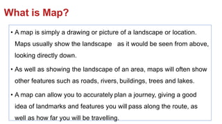
- 1. What is Map? • A map is simply a drawing or picture of a landscape or location. Maps usually show the landscape as it would be seen from above, looking directly down. • As well as showing the landscape of an area, maps will often show other features such as roads, rivers, buildings, trees and lakes. • A map can allow you to accurately plan a journey, giving a good idea of landmarks and features you will pass along the route, as well as how far you will be travelling.
- 2. Cont….. • . A map is a representation of all or part of the Earth drawn on a flat surface at a specific scale. • Maps use a variety of symbols and colours to represent selected features of an area. • Maps were devised because they are much easier to use, store, and transport than globes, and they facilitated the development of much larger scaled representations than was the case with a globe.
- 3. Types of map • General purpose maps (reference maps, ) • show both natural and human-made features such as coastlines, lakes, rivers, boundaries, settlements, roads, rail lines, and others. • Thematic maps, (special-purpose maps, ) illustrate the geographical distribution of a particular theme or phenomenon. Landforms, aspects of climate, vegetation and soil types, demographics, industry, manufacturing, and natural resources are examples of common thematic maps. • topographic maps. • As the term suggests, these maps show the topography or surface features of the landscape through the use of contour lines.
- 4. Cont…. • all maps share common properties or map basics that provide information to assist the reader in studying and interpreting the map. These include • a title, • scale, • legend, • date of publication, • direction, • information about the map projection. • etc
- 5. Cont….. 1. Direction: Direction tells you which way to hold the map. By convention, most maps are made with their top portion directed at North. The North direction is generally indicated by an arrow in the maps 2. Legend is a detailed description of various objects using various signs and symbols contained in the map. 3. Scale: can be defined as the ratio of the distance between two points on the map and the same two points on the Earth’s surface.
- 6. CONTOURING • Introduction • Contour is an imaginary line on the ground surface joining the points of equal elevation. It facilitates depiction of the terrain in a two dimensional plan or map. • Contouring is the Science of representing the vertical dimension of the terrain on a two dimensional map
- 7. • Contour Map • A map showing contour lines is known as contour map. A contour map gives an idea of the altitudes of the surface features as well as their relative position in plan serves the purpose of both, a plan and a section
- 8. Contour interval • It is the vertical distance between any two consecutive contours. The contour interval depends on • a) The nature of the ground (i.e. whether flat or sleep) • b) The scale of the map • c) The purpose of the survey
- 9. Horizontal Equivalent (HE) • It is the horizontal distance between two consecutive contour lines measured to the scale of the map. It is not constant it varies according to the steepness of the ground For steep slopes, the contour lines run close together and for flatter slopes they are widely spaced.
- 10. Characteristics of Contour • The following point are consider which are as follows • 1) All points in a contour line have the same elevation • 2) Flat ground is indicated where the contours are widely separated and steep-slope where they run close together. • 4 ) Equally spaced contour indicates uniform slope. • 5) Irregular contours indicate uneven surface.
- 11. • 6) Approximately concentric closed contours with decreasing values towards centre indicate a pond.. • 7) Approximately concentric closed contours with increasing values towards centre indicate a hill. • 8) Contour lines with U-shape with convexity towards lower ground indicate ridge • 9) Contour lines with V-shaped with convexity towards higher ground indicate valley
- 12. • Contour lines generally do not meet or intersect each other. If contour lines are meeting in some portion, it shows existence of a vertical cliff In this case, several contours coincide and the horizontal equivalent becomes zero. • If contour lines cross each other, it shows existence of overhanging cliffs or a cave
- 13. Purpose of Contouring/Contour Map • Contour survey is carried out at the starting of any engineering project such as a road, railways, canal, Dam, building etc. i) Contour maps are prepared in order to select the most economical or suitable site. ii) It helps to locate the alignment of a canal so that it should follow a ridge line. iii) It helps to mark the alignment of roads and railways so that the quantity of earthwork both in cutting and filling should be minimum.
- 14. Cont.. iv) It helps for getting information about the ground whether it is flat, undulating or mountainous. v) It helps to find the capacity of a reservoir and volume of earthwork especially in a mountainous region. vi) It helps to trace out the given grade of a particular route. vii) It helps to locate the physical features of the ground such as a pond, depression, hill, steep or small slopes.