Prairie megadroughts: drought, proxies and decadal climate variability in the western Canadian interior

Slides supporting a presentation at the University of Stockholm's Department of Physical Geography and Quaternary Geology. Canada is rightly considered a water-rich nation, but persistent drought is still a leading source of risk to agriculture and energy production, particularly in the dry western interior. During the 20th century, the Canadian Prairies were less affected by decadal-scale shifts in hydroclimate than other places in North America, but the relative brevity of instrumental records makes it difficult to evaluate the potential duration and geographic scope of severe drought. Tree-ring and other proxy records show that that parts of the the Canadian Prairies experienced, relatively recently, summer droughts that were more intense and more long lasting than those observed in instrumental records. These past droughts serve as alternative worst-case scenarios that water managers can use to evaluate the resilience of their systems to conditions outside their personal or institutional experience. Comparing regional tree-ring records against the broader North American network also indicates that studies investigating the patterns and mechanisms of past drought across the continent need to consider the potential effects of seasonality biases in paleoclimate proxies.

Empfohlen
Empfohlen
Weitere ähnliche Inhalte
Ähnlich wie Prairie megadroughts: drought, proxies and decadal climate variability in the western Canadian interior
Ähnlich wie Prairie megadroughts: drought, proxies and decadal climate variability in the western Canadian interior (20)
Mehr von Scott St. George
Mehr von Scott St. George (20)
Kürzlich hochgeladen
Kürzlich hochgeladen (20)
Prairie megadroughts: drought, proxies and decadal climate variability in the western Canadian interior
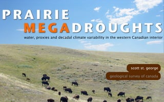
- 1. PRAIRIE MEGADROUGHTS water, proxies and decadal climate variability in the western Canadian interior scott st. george geological survey of canada
- 3. Photo: NASA’s Earth Observatory
- 5. Renewable water resources, by country Brazil Russia Canada USA China India Columbia Peru Zaire 0 2,000 4,000 6,000 km3/y Source: Shiklomanov and Rodda, 2003
- 6. Photo: NASA’s Earth Observatory
- 8. Calgary
- 11. Winnipeg
- 14. Net income, Manitoba Hydro 3 2 0 constant 2009 SEK (billions) -2 -3 1992 1994 1996 1998 2000 2002 2004 2006 2008 Source: Annual reports of the Manitoba Hydro-Electric Board
- 16. AP Photo/U.S. Coast Guard, Lt. Brendan Evans
- 17. Past dynamics ➜ Future behavior PRESENT PAST FUTURE Precipitation Drought risks Discharge Sustainable yield Lake level Flood hazards Soil moisture
- 19. DECADAL VARIABILITY AND PRAIRIE WATER How important is decadal-to-multidecadal variability to the 1 hydroclimate of western Canada and North America?
- 20. DECADAL VARIABILITY AND PRAIRIE WATER How important is decadal-to-multidecadal variability to the 1 hydroclimate of western Canada and North America? PRAIRIE DROUGHTS SINCE AD 1500 What tree rings tell us about severity, persistance and 2 dynamics of past droughts on the Prairies.
- 21. D E CA D AL CLIMAT E VA R I A B I L I T Y
- 22. PDO NEGATIVE AMO NEGATIVE PDO NEGATIVE AMO POSITIVE McCabe et al., Proceedings of the National Academy of Sciences, 2004
- 24. Where is decadal variability strong? in precipitation
- 25. Noise Interannual Trend Multidecadal Decadal
- 26. Normalized variance 10 60°N 8 50°N 6 40°N 4 30°N 2 0 10 20 30 40 50 Period (years) Ault and St. George, Journal of Climate, in submission
- 27. The PDO fingerprint on winter precipitation -0.6 correlation Ault and St. George, Journal of Climate, in submission
- 28. Winter precipitation - decadal band 0% 10% 20% 30% variance
- 29. Northern California winter precipitation Decadal variance = ~30 percent
- 30. Northern California Ault and St. George, Journal of Climate, in submission
- 31. Levee break, Sacramento River Photo: California Department of Water Resources
- 32. Northern California Ault and St. George, Journal of Climate, in submission
- 33. D2M in the ENSO-PDO ‘null’ -0.6 correlation Ault and St. George, Journal of Climate, in submission
- 34. Photo: NASA’s Earth Observatory
- 35. CLIMATE HISTORY OF CANADA Younger Demise of Laurentide Dryas Ice Sheet 20 16 12 8 4 0 THOUSANDS OF YEARS AGO Final Drainage of Lake Agassiz LAST GLACIAL MODERN MAXIMUM OBSERVATIONS
- 37. D R OUGHT FROM P R A IR IE T R EES
- 39. MEGADROUGHT intensity at least equivalent to modern multiyear droughts duration longer than the several years to decade thereof Seager et al., Journal of Climate, 2008
- 41. Martin-Philippe Girardin Canadian Forest Service Greg Pederson United States Geological Survey David Sauchyn Glen MacDonald Emma Watson UCLA University of Regina Environment Canada Erik Nielsen Jacques Tardif Manitoba Geological Survey University of Winnipeg
- 47. 2008
- 48. 1875
- 54. 52
- 55. Calgary
- 56. southern Alberta 10 3 2 5 1 Ringwidth PDSI 0 0 -1 -5 -2 -3 -10 1900 1920 1940 1960 1980 2000 Year (A.D.) St. George et al., Journal of Climate, 2009
- 57. southern Alberta 10 3 2 5 1 Ringwidth PDSI 0 0 -1 -5 r = 0.62 -2 -3 -10 1900 1920 1940 1960 1980 2000 Year (A.D.) St. George et al., Journal of Climate, 2009
- 58. Drought history - western Prairies PDSI 6 4 observations 2 0 -2 tree rings -4 -6 1500 1600 1700 1800 1900 2000 Year (AD) St. George et al., Journal of Climate, 2009
- 59. MEGADROUGHT intensity at least equivalent to modern multiyear droughts duration longer than the several years to decade thereof Seager et al., Journal of Climate, 2008
- 60. 58 oN 1718 - 1722 56 oN 54 oN 52 oN 50 oN 48 oN oW 90 114 oW oW 96 o o 108 W 102 W Ringwidth anomaly (deviations) −2 −1 0 1 2 -2 0 +2
- 61. 1842 to 1876 Below average Above average
- 63. Winnipeg
- 64. Drought history - eastern Prairies PDSI 4 observations 2 0 -2 tree rings -4 1500 1600 1700 1800 1900 2000 Year (AD) St. George et al., Journal of Climate, 2009
- 65. 1680-1720
- 66. Lake Mina
- 67. Lake Mina, Minnesota Pollen-inferred 4 effective moisture (cm) 2 0 -2 -4 1100 1300 1500 1700 1900 Year (AD) St. Jacques et al., Quaternary Science Reviews, 2008
- 68. 1997 Red River flood Photo: Greg Brooks
- 69. no response flood signatures 1 - 2 metres
- 70. Flood damaged Normal growth 68 Photo: Suzana Radivojevic
- 71. 350 years of Red River floods St. George and Nielsen, The Holocene, 2003
- 72. Winnipeg population: 680,000 River diversion Main channel Photo: Greg Brooks
- 76. “ This must be voodoo.” Anonymous water manager
- 79. davidstahle edwardcook malcolmcleveland matttherrel davidmeko henrigrissino-mayer emmawatson brianluckman Tree-ring data document 16th century megadrought over North America EOS 81, p121, 2000
- 80. davidstahle edwardcook malcolmcleveland matttherrel davidmeko henrigrissino-mayer emmawatson brianluckman Tree-ring data document 16th century megadrought over North America but not Canada EOS 81, p121, 2000
- 82. 100% MORE CERTAIN Woodhouse et al., 2006 Meko et al., 2001 80% Upper Colorado River Sacramento River Meko et al., 2007 Colorado River Woodhouse, 2007 Middle Boulder Creek 60% Case and MacDonald, 2003 explained Saskatchewan River Beriault and Sauchyn, 2006 Churchill River Bonin and Burn, 2005 variance Athabasca River 40% Gedalof et al., 2007 Watson and Luckman, 2005 Columbia River Bow River 20% LESS CERTAIN 0% Canada USA
- 83. seasonality
- 84. Medicine Hat, Alberta 25 80 20 15 60 Precipitation mm) Temperature (°C) 10 5 40 0 -5 20 -10 0 -15 Jan Mar May Jul Sep Nov Source: Environment Canada, Adjusted Historical Canadian Climate Data, 1895 – 2006
- 85. St. George et al., unpublished results
- 86. 83
- 87. INSTRUMENTAL PDSI ENSO +0.5 0 correlation coefficient -0.5
- 88. HIGH spatial coherence STRONG connections to remote forcings GOOD hydrological proxy
- 89. LOW spatial coherence MODEST connections to remote forcings POOR hydrological proxy
- 90. 87
- 91. e iv t a rn te l worst-case scenarios a
- 92. FU T U R E D I RE C T ION S
- 94. Experimental snowpack reconstruction Canadian Rockies St. George, unpublished results
- 95. Winter precipitation - decadal band 0% 10% 20% 30% variance
- 96. RANDOM INPUT after Klemeš, Drought prediction: a hydrological perspective, 2000
- 97. RANDOM INPUT STORAGE after Klemeš, Drought prediction: a hydrological perspective, 2000
- 98. RANDOM INPUT STORAGE ‘REDDENED’ OUTPUT after Klemeš, Drought prediction: a hydrological perspective, 2000
- 99. RANDOM INPUT STORAGE ‘REDDENED’ OUTPUT POTENTIAL CLIMATE FORCINGS? after Klemeš, Drought prediction: a hydrological perspective, 2000
- 100. Ault, unpublished results Variance lake records instrumental PDSI tree-ring PDSI precipitation Frequency (yrs)
- 102. CLIMATE direct HYDROLOGY
- 103. CLIMATE direct direct PROXIES HYDROLOGY
- 104. CLIMATE direct direct PROXIES HYDROLOGY indirect
- 105. HYDROLOGY
- 106. Lake Winnipeg and its watershed
- 107. Photo: Erik Nielsen