SlideShare ist ein Scribd-Unternehmen logo
1 von 24
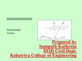
Stereoscopic
Vision
FOR 220 Aerial Photo Interpretation and Forest Measurements
• The pictures used in the
stereo views where in
the form of
"stereographs" which
were two pictures of the
same scene that were
slightly offset and
mounted side-by-side.
Stereoscopic Vision
Stereoscopy
The use of binocular vision to achieve 3-dimensional effects.
Enables you to view an object from 2 different camera
positions to obtain a 3-dimensional view.
Stereo pairs of photographs
Two adjacent, overlapping photographs in the same
flight line.
Stereo views can only be seen in the overlapping portion
of the photos.
Stereoscopic Vision
Stereoscopes:
A binocular optical instrument that helps us view two properly oriented photos to
obtain a 3-dimensional model.
Types of Stereoscopes:
Lens (pocket) stereoscope
Simplest
Least expensive
Small
2-4 x magnification
Used in the field
Stereoscopic Vision
Types of Stereoscopes:
Mirror stereoscope
Photos can be placed separately
for viewing
Used in the field?
Stereoscopic Vision
Types of Stereoscopes:
Scanning mirror stereoscope
A series of lenses and prisms
Relatively expensive
Not used in the field
Stereoscopic Vision
Types of Stereoscopes:
Zoom stereoscope
Variable magnification:
2.5 - 20 x
Very Expensive
Not used in the field
The “Cadillac” of stereoscopes
Stereoscopic Vision
Types of Stereoscopes:
Zoom transfer stereoscope
Variable magnification:
2.5 - 20 x
Used to transfer features from
a stereo-pair of photos onto a
map or other photo
Very Expensive
Not used in the field
1. Obtain 2 photographs consecutively marked on a flight line.
2. Locate and mark the Principal Points on each photograph.
3. Locate and mark the Conjugate Principal Points on each photograph.
4. Line up all 4 points and adjust the distance between photographs to suit your needs.
Stereo Photograph Geometry
Orientation of Stereo Pairs
Flight Line
Note “photo-crab”
Rick Lathrop, Rutgers University
Stereo Photograph Geometry
Where:
h = object height
H = flying height
dP = differential parallax
P = avg. photo base length (avg. distance, PP to CPP)
** Above equation is for level terrain only.
General formula for calculating height using parallax






+
×
=
)( dPP
dPH
h
Stereo Photograph Geometry
1. Determine average photo-base (P)
Average distance between PP and CPP for stereopair
Example: if then
P1 = 4.5 in. P = 4.4 in.
P2 = 4.3 in.
P1
PP CPP
P2
PPCPP
Measurements for parallax height calculations:
Stereo Photograph Geometry
2. Determine differential parallax (dP)
Difference of the distances between feature bases and tops while stereopair is
in stereo viewing postion.
Example: if then
db = 2.06 in. dP = 0.6 in.
dt = 1.46 in.
Measurments for parallax height calculations:
PP CPP PPCPP
db
dt
Stereo Photograph Geometry
Using the measurements from previous slides, “plug and chug”
h = object height (we want this)
H = flying height (2,200 ft. given in flight information)
dP = differential parallax (0.6 in.= 2.06in. - 1.46in.)
P = avg. photo base length (4.4 in.) (avg. distance, PP to CPP)
Example: Computing height using stereoscopic parallax
Solve for h:
h = (2,200 ft. * 0.6 in.) / (4.4 in. + 0.6 in.)
= 1320 ft. in. / 5 in.
= 264 ft.






+
×
=
)( dPP
dPH
h
Stereo Photograph Geometry
Parallax calculations of height are useful where the object of interest is:
On small scale photographs (high altitude flight)
Located at or near the nadir of a single photo.
Obscured on one photo of a stereopair, but the base and top can still be
located.
Flight or camera variables (except aircraft height) are not known.
Stereoplotters - precision instruments designed to duplicate the exact relative position
and orientation of the aerial camera at the time of photo acquisition to recreate the
stereo model. A floating mark can be used trace specific elevations. Relief
displacement is removed creating a planimetric map.
Soft-copy photogrammetry workstations - computer software recreates the stereo
model and allows for digital mapping
Stereo Photograph Geometry
Stereoscopic Plotting Instruments
Photographic distortion and relief displacement are removed during
orthorectification
Orthophoto - rectified aerial photo showing objects in their true planimetric
position
Orthophotoquad - orthophoto in the standard USGS 7.5 minute quadrangle
format with same scale accuracy as USGS topographic maps
DOQ – digital orthophoto quad
DOQQ - digital orthophoto quarter quad
“Native” format of orthophotos is digital
Stereo Photograph Geometry
Orthophotography
Digital Orthophotograph
1 meter pixel size
Georectified to UTM
Panchromatic
Some Color Infrared
Scale 1:24000
DOQ of Mammoth Springs,
Yellowstone National Park

Weitere ähnliche Inhalte

Was ist angesagt?

Aerial Photogrammetry
Aerial Photogrammetry Aerial Photogrammetry
Aerial Photogrammetry Mujeeb Muji
 
Geometry of Aerial photograph
Geometry of Aerial photographGeometry of Aerial photograph
Geometry of Aerial photographApoorva Mathur
 
Height measurement of aerial photograph
Height measurement of aerial photographHeight measurement of aerial photograph
Height measurement of aerial photographvidyasagar university
 
Geometry and types of aerial photographs
Geometry and types of aerial photographsGeometry and types of aerial photographs
Geometry and types of aerial photographsPooja Kumari
 
Photogrammetry: Stereoscopy and Parallax
Photogrammetry: Stereoscopy and ParallaxPhotogrammetry: Stereoscopy and Parallax
Photogrammetry: Stereoscopy and ParallaxAhmed Nassar
 
Image intrepretation
Image intrepretationImage intrepretation
Image intrepretationMeer Raashid
 
Introduction to aerial photography and photogrammetry.ppt
Introduction to aerial photography and photogrammetry.pptIntroduction to aerial photography and photogrammetry.ppt
Introduction to aerial photography and photogrammetry.pptsrinivas2036
 
Types of aerial photographs
Types of aerial photographsTypes of aerial photographs
Types of aerial photographsHARITHANAIR15
 
Aerial photography.pptx
Aerial photography.pptxAerial photography.pptx
Aerial photography.pptxPramoda Raj
 
Landuse landcover mapping
Landuse landcover mappingLanduse landcover mapping
Landuse landcover mappingAditya Kushwaha
 
Thermal remote sensing
Thermal remote sensing   Thermal remote sensing
Thermal remote sensing Rahat Malik
 
Aerial photography abraham thomas
Aerial photography abraham thomasAerial photography abraham thomas
Aerial photography abraham thomasSumant Diwakar
 
BASIC CONCEPTS OF PHOTOGRAMMETRY
BASIC CONCEPTS OF PHOTOGRAMMETRYBASIC CONCEPTS OF PHOTOGRAMMETRY
BASIC CONCEPTS OF PHOTOGRAMMETRYNamitha M R
 

Was ist angesagt? (20)

Aerial Photogrammetry
Aerial Photogrammetry Aerial Photogrammetry
Aerial Photogrammetry
 
Stereoscopic Parallax
Stereoscopic ParallaxStereoscopic Parallax
Stereoscopic Parallax
 
Geometry of Aerial photograph
Geometry of Aerial photographGeometry of Aerial photograph
Geometry of Aerial photograph
 
Stereoscopic parallax
Stereoscopic parallaxStereoscopic parallax
Stereoscopic parallax
 
Height measurement of aerial photograph
Height measurement of aerial photographHeight measurement of aerial photograph
Height measurement of aerial photograph
 
Geometry and types of aerial photographs
Geometry and types of aerial photographsGeometry and types of aerial photographs
Geometry and types of aerial photographs
 
Photogrammetry: Stereoscopy and Parallax
Photogrammetry: Stereoscopy and ParallaxPhotogrammetry: Stereoscopy and Parallax
Photogrammetry: Stereoscopy and Parallax
 
Image intrepretation
Image intrepretationImage intrepretation
Image intrepretation
 
Raster data and Vector data
Raster data and Vector dataRaster data and Vector data
Raster data and Vector data
 
Introduction to aerial photography and photogrammetry.ppt
Introduction to aerial photography and photogrammetry.pptIntroduction to aerial photography and photogrammetry.ppt
Introduction to aerial photography and photogrammetry.ppt
 
Types of aerial photographs
Types of aerial photographsTypes of aerial photographs
Types of aerial photographs
 
Historical Development of Photogrammetry
Historical Development of PhotogrammetryHistorical Development of Photogrammetry
Historical Development of Photogrammetry
 
Aerial photography.pptx
Aerial photography.pptxAerial photography.pptx
Aerial photography.pptx
 
Landuse landcover mapping
Landuse landcover mappingLanduse landcover mapping
Landuse landcover mapping
 
Pre processing
Pre processingPre processing
Pre processing
 
Thermal remote sensing
Thermal remote sensing   Thermal remote sensing
Thermal remote sensing
 
Aerial photography abraham thomas
Aerial photography abraham thomasAerial photography abraham thomas
Aerial photography abraham thomas
 
Relief displacement
Relief displacementRelief displacement
Relief displacement
 
BASIC CONCEPTS OF PHOTOGRAMMETRY
BASIC CONCEPTS OF PHOTOGRAMMETRYBASIC CONCEPTS OF PHOTOGRAMMETRY
BASIC CONCEPTS OF PHOTOGRAMMETRY
 
Georeferencing
GeoreferencingGeoreferencing
Georeferencing
 

Andere mochten auch (17)

stereopsis and types of stereopsis tests
stereopsis and types of stereopsis testsstereopsis and types of stereopsis tests
stereopsis and types of stereopsis tests
 
Stereopsis
Stereopsis  Stereopsis
Stereopsis
 
Stereoscopic Vision
Stereoscopic VisionStereoscopic Vision
Stereoscopic Vision
 
Binocular vision
Binocular visionBinocular vision
Binocular vision
 
Assesment of streopsis
Assesment of streopsisAssesment of streopsis
Assesment of streopsis
 
Binocular single vision ppt
Binocular single vision pptBinocular single vision ppt
Binocular single vision ppt
 
binocular single vision
binocular single visionbinocular single vision
binocular single vision
 
Evaluation of squint
Evaluation of squint Evaluation of squint
Evaluation of squint
 
Binocular vision
Binocular visionBinocular vision
Binocular vision
 
Introduction of photogrammetry
Introduction of photogrammetryIntroduction of photogrammetry
Introduction of photogrammetry
 
Avilgiin tuhai huuli
Avilgiin tuhai huuliAvilgiin tuhai huuli
Avilgiin tuhai huuli
 
Informatica
InformaticaInformatica
Informatica
 
CertificateMTGN Destintion
CertificateMTGN DestintionCertificateMTGN Destintion
CertificateMTGN Destintion
 
La paz
La pazLa paz
La paz
 
DIDÁCTICA DE LAS TICS
DIDÁCTICA DE LAS TICSDIDÁCTICA DE LAS TICS
DIDÁCTICA DE LAS TICS
 
Boss Ltda
Boss LtdaBoss Ltda
Boss Ltda
 
Dia wiki
Dia wikiDia wiki
Dia wiki
 

Ähnlich wie Stereoscopic vision

Aerial photography- Concept and Terminologies
Aerial photography- Concept and Terminologies Aerial photography- Concept and Terminologies
Aerial photography- Concept and Terminologies UTTIYACHATTOPADHYAY2
 
Geometry of Aerial Photographs.pdf
Geometry of Aerial Photographs.pdfGeometry of Aerial Photographs.pdf
Geometry of Aerial Photographs.pdfkunedzimwefrancisca
 
Photogrammetry_nec.pdf
Photogrammetry_nec.pdfPhotogrammetry_nec.pdf
Photogrammetry_nec.pdfUjjwalSubedi8
 
Photogrammetry.pdf
Photogrammetry.pdfPhotogrammetry.pdf
Photogrammetry.pdfBSuresh26
 
Aerial photogrammetry ppt 2
Aerial photogrammetry ppt 2Aerial photogrammetry ppt 2
Aerial photogrammetry ppt 2Mr Amol Ghogare
 
Surveying ii module iii class 1,2
Surveying ii module iii class 1,2Surveying ii module iii class 1,2
Surveying ii module iii class 1,2SHAMJITH KM
 
Photogyammetry-Notes2.pdf
Photogyammetry-Notes2.pdfPhotogyammetry-Notes2.pdf
Photogyammetry-Notes2.pdfpoola2015
 
Mirror Stereoscope.pptx
Mirror Stereoscope.pptxMirror Stereoscope.pptx
Mirror Stereoscope.pptxPavanNadgouda2
 
photogrammetry.pptx
photogrammetry.pptxphotogrammetry.pptx
photogrammetry.pptxmrunmayee20
 
Photogrammatic survey
Photogrammatic surveyPhotogrammatic survey
Photogrammatic surveyRonakModi34
 
PHOTOGRAMMETRY (REMOTE SENSING & GIS).pptx
PHOTOGRAMMETRY  (REMOTE SENSING & GIS).pptxPHOTOGRAMMETRY  (REMOTE SENSING & GIS).pptx
PHOTOGRAMMETRY (REMOTE SENSING & GIS).pptxBSuresh26
 
PhotogrammetryArcGIS_V202108.pdf
PhotogrammetryArcGIS_V202108.pdfPhotogrammetryArcGIS_V202108.pdf
PhotogrammetryArcGIS_V202108.pdfRobertoReinoVargas
 

Ähnlich wie Stereoscopic vision (20)

Aerial photography- Concept and Terminologies
Aerial photography- Concept and Terminologies Aerial photography- Concept and Terminologies
Aerial photography- Concept and Terminologies
 
Geometry of Aerial Photographs.pdf
Geometry of Aerial Photographs.pdfGeometry of Aerial Photographs.pdf
Geometry of Aerial Photographs.pdf
 
Photogrammetry_nec.pdf
Photogrammetry_nec.pdfPhotogrammetry_nec.pdf
Photogrammetry_nec.pdf
 
Photogrammetry.pdf
Photogrammetry.pdfPhotogrammetry.pdf
Photogrammetry.pdf
 
Aerial photogrammetry ppt 2
Aerial photogrammetry ppt 2Aerial photogrammetry ppt 2
Aerial photogrammetry ppt 2
 
Aerial Photography.pptx
Aerial Photography.pptxAerial Photography.pptx
Aerial Photography.pptx
 
Surveying ii module iii class 1,2
Surveying ii module iii class 1,2Surveying ii module iii class 1,2
Surveying ii module iii class 1,2
 
Photogyammetry-Notes2.pdf
Photogyammetry-Notes2.pdfPhotogyammetry-Notes2.pdf
Photogyammetry-Notes2.pdf
 
Mirror Stereoscope.pptx
Mirror Stereoscope.pptxMirror Stereoscope.pptx
Mirror Stereoscope.pptx
 
photogrammetry.pptx
photogrammetry.pptxphotogrammetry.pptx
photogrammetry.pptx
 
Vertical aerial photographs
Vertical aerial photographsVertical aerial photographs
Vertical aerial photographs
 
Introduction to Aerial Photogrammetry
Introduction to Aerial PhotogrammetryIntroduction to Aerial Photogrammetry
Introduction to Aerial Photogrammetry
 
Photogrammatic survey
Photogrammatic surveyPhotogrammatic survey
Photogrammatic survey
 
Photogrammetry
PhotogrammetryPhotogrammetry
Photogrammetry
 
PHOTOGRAMMETRY (REMOTE SENSING & GIS).pptx
PHOTOGRAMMETRY  (REMOTE SENSING & GIS).pptxPHOTOGRAMMETRY  (REMOTE SENSING & GIS).pptx
PHOTOGRAMMETRY (REMOTE SENSING & GIS).pptx
 
Photogrammetry1
Photogrammetry1Photogrammetry1
Photogrammetry1
 
PHOTOGRAMMETRY.pptx
PHOTOGRAMMETRY.pptxPHOTOGRAMMETRY.pptx
PHOTOGRAMMETRY.pptx
 
Photogrammetry-part 1
Photogrammetry-part 1Photogrammetry-part 1
Photogrammetry-part 1
 
PhotogrammetryArcGIS_V202108.pdf
PhotogrammetryArcGIS_V202108.pdfPhotogrammetryArcGIS_V202108.pdf
PhotogrammetryArcGIS_V202108.pdf
 
D04432528
D04432528D04432528
D04432528
 

Mehr von Collation Soft Solutions Pvt.Ltd (12)

Well foundation
Well foundationWell foundation
Well foundation
 
Development of centralized spatial database server for
Development of centralized spatial database server forDevelopment of centralized spatial database server for
Development of centralized spatial database server for
 
Shallowfoundations
ShallowfoundationsShallowfoundations
Shallowfoundations
 
Role of soil brick industry in the degradation of land and environment 1942 (2)
Role of soil brick industry in the degradation of land and environment 1942 (2)Role of soil brick industry in the degradation of land and environment 1942 (2)
Role of soil brick industry in the degradation of land and environment 1942 (2)
 
Photogrammetry 2,Remote sensing-2
Photogrammetry 2,Remote sensing-2Photogrammetry 2,Remote sensing-2
Photogrammetry 2,Remote sensing-2
 
Types of map
Types of mapTypes of map
Types of map
 
Geographical entities,Topology
Geographical entities,TopologyGeographical entities,Topology
Geographical entities,Topology
 
Aerial photo
Aerial photoAerial photo
Aerial photo
 
Remote sensing,Introduction and Basic Concepts
Remote sensing,Introduction and Basic ConceptsRemote sensing,Introduction and Basic Concepts
Remote sensing,Introduction and Basic Concepts
 
Photogrammetry
Photogrammetry Photogrammetry
Photogrammetry
 
Sensors
SensorsSensors
Sensors
 
Unit 5
Unit 5Unit 5
Unit 5
 

Kürzlich hochgeladen

Design For Accessibility: Getting it right from the start
Design For Accessibility: Getting it right from the startDesign For Accessibility: Getting it right from the start
Design For Accessibility: Getting it right from the startQuintin Balsdon
 
notes on Evolution Of Analytic Scalability.ppt
notes on Evolution Of Analytic Scalability.pptnotes on Evolution Of Analytic Scalability.ppt
notes on Evolution Of Analytic Scalability.pptMsecMca
 
Block diagram reduction techniques in control systems.ppt
Block diagram reduction techniques in control systems.pptBlock diagram reduction techniques in control systems.ppt
Block diagram reduction techniques in control systems.pptNANDHAKUMARA10
 
Thermal Engineering Unit - I & II . ppt
Thermal Engineering  Unit - I & II . pptThermal Engineering  Unit - I & II . ppt
Thermal Engineering Unit - I & II . pptDineshKumar4165
 
Employee leave management system project.
Employee leave management system project.Employee leave management system project.
Employee leave management system project.Kamal Acharya
 
Generative AI or GenAI technology based PPT
Generative AI or GenAI technology based PPTGenerative AI or GenAI technology based PPT
Generative AI or GenAI technology based PPTbhaskargani46
 
Online electricity billing project report..pdf
Online electricity billing project report..pdfOnline electricity billing project report..pdf
Online electricity billing project report..pdfKamal Acharya
 
Rums floating Omkareshwar FSPV IM_16112021.pdf
Rums floating Omkareshwar FSPV IM_16112021.pdfRums floating Omkareshwar FSPV IM_16112021.pdf
Rums floating Omkareshwar FSPV IM_16112021.pdfsmsksolar
 
A CASE STUDY ON CERAMIC INDUSTRY OF BANGLADESH.pptx
A CASE STUDY ON CERAMIC INDUSTRY OF BANGLADESH.pptxA CASE STUDY ON CERAMIC INDUSTRY OF BANGLADESH.pptx
A CASE STUDY ON CERAMIC INDUSTRY OF BANGLADESH.pptxmaisarahman1
 
Navigating Complexity: The Role of Trusted Partners and VIAS3D in Dassault Sy...
Navigating Complexity: The Role of Trusted Partners and VIAS3D in Dassault Sy...Navigating Complexity: The Role of Trusted Partners and VIAS3D in Dassault Sy...
Navigating Complexity: The Role of Trusted Partners and VIAS3D in Dassault Sy...Arindam Chakraborty, Ph.D., P.E. (CA, TX)
 
School management system project Report.pdf
School management system project Report.pdfSchool management system project Report.pdf
School management system project Report.pdfKamal Acharya
 
XXXXXXXXXXXXXXXXXXXXXXXXXXXXXXXXXXXXXXXXXXXXXXXXXXXX
XXXXXXXXXXXXXXXXXXXXXXXXXXXXXXXXXXXXXXXXXXXXXXXXXXXXXXXXXXXXXXXXXXXXXXXXXXXXXXXXXXXXXXXXXXXXXXXXXXXXXXXX
XXXXXXXXXXXXXXXXXXXXXXXXXXXXXXXXXXXXXXXXXXXXXXXXXXXXssuser89054b
 
AIRCANVAS[1].pdf mini project for btech students
AIRCANVAS[1].pdf mini project for btech studentsAIRCANVAS[1].pdf mini project for btech students
AIRCANVAS[1].pdf mini project for btech studentsvanyagupta248
 
S1S2 B.Arch MGU - HOA1&2 Module 3 -Temple Architecture of Kerala.pptx
S1S2 B.Arch MGU - HOA1&2 Module 3 -Temple Architecture of Kerala.pptxS1S2 B.Arch MGU - HOA1&2 Module 3 -Temple Architecture of Kerala.pptx
S1S2 B.Arch MGU - HOA1&2 Module 3 -Temple Architecture of Kerala.pptxSCMS School of Architecture
 
Standard vs Custom Battery Packs - Decoding the Power Play
Standard vs Custom Battery Packs - Decoding the Power PlayStandard vs Custom Battery Packs - Decoding the Power Play
Standard vs Custom Battery Packs - Decoding the Power PlayEpec Engineered Technologies
 
COST-EFFETIVE and Energy Efficient BUILDINGS ptx
COST-EFFETIVE  and Energy Efficient BUILDINGS ptxCOST-EFFETIVE  and Energy Efficient BUILDINGS ptx
COST-EFFETIVE and Energy Efficient BUILDINGS ptxJIT KUMAR GUPTA
 
kiln thermal load.pptx kiln tgermal load
kiln thermal load.pptx kiln tgermal loadkiln thermal load.pptx kiln tgermal load
kiln thermal load.pptx kiln tgermal loadhamedmustafa094
 
Introduction to Serverless with AWS Lambda
Introduction to Serverless with AWS LambdaIntroduction to Serverless with AWS Lambda
Introduction to Serverless with AWS LambdaOmar Fathy
 

Kürzlich hochgeladen (20)

Design For Accessibility: Getting it right from the start
Design For Accessibility: Getting it right from the startDesign For Accessibility: Getting it right from the start
Design For Accessibility: Getting it right from the start
 
notes on Evolution Of Analytic Scalability.ppt
notes on Evolution Of Analytic Scalability.pptnotes on Evolution Of Analytic Scalability.ppt
notes on Evolution Of Analytic Scalability.ppt
 
Block diagram reduction techniques in control systems.ppt
Block diagram reduction techniques in control systems.pptBlock diagram reduction techniques in control systems.ppt
Block diagram reduction techniques in control systems.ppt
 
Thermal Engineering Unit - I & II . ppt
Thermal Engineering  Unit - I & II . pptThermal Engineering  Unit - I & II . ppt
Thermal Engineering Unit - I & II . ppt
 
Employee leave management system project.
Employee leave management system project.Employee leave management system project.
Employee leave management system project.
 
Generative AI or GenAI technology based PPT
Generative AI or GenAI technology based PPTGenerative AI or GenAI technology based PPT
Generative AI or GenAI technology based PPT
 
Online electricity billing project report..pdf
Online electricity billing project report..pdfOnline electricity billing project report..pdf
Online electricity billing project report..pdf
 
Rums floating Omkareshwar FSPV IM_16112021.pdf
Rums floating Omkareshwar FSPV IM_16112021.pdfRums floating Omkareshwar FSPV IM_16112021.pdf
Rums floating Omkareshwar FSPV IM_16112021.pdf
 
A CASE STUDY ON CERAMIC INDUSTRY OF BANGLADESH.pptx
A CASE STUDY ON CERAMIC INDUSTRY OF BANGLADESH.pptxA CASE STUDY ON CERAMIC INDUSTRY OF BANGLADESH.pptx
A CASE STUDY ON CERAMIC INDUSTRY OF BANGLADESH.pptx
 
Navigating Complexity: The Role of Trusted Partners and VIAS3D in Dassault Sy...
Navigating Complexity: The Role of Trusted Partners and VIAS3D in Dassault Sy...Navigating Complexity: The Role of Trusted Partners and VIAS3D in Dassault Sy...
Navigating Complexity: The Role of Trusted Partners and VIAS3D in Dassault Sy...
 
Integrated Test Rig For HTFE-25 - Neometrix
Integrated Test Rig For HTFE-25 - NeometrixIntegrated Test Rig For HTFE-25 - Neometrix
Integrated Test Rig For HTFE-25 - Neometrix
 
School management system project Report.pdf
School management system project Report.pdfSchool management system project Report.pdf
School management system project Report.pdf
 
XXXXXXXXXXXXXXXXXXXXXXXXXXXXXXXXXXXXXXXXXXXXXXXXXXXX
XXXXXXXXXXXXXXXXXXXXXXXXXXXXXXXXXXXXXXXXXXXXXXXXXXXXXXXXXXXXXXXXXXXXXXXXXXXXXXXXXXXXXXXXXXXXXXXXXXXXXXXX
XXXXXXXXXXXXXXXXXXXXXXXXXXXXXXXXXXXXXXXXXXXXXXXXXXXX
 
AIRCANVAS[1].pdf mini project for btech students
AIRCANVAS[1].pdf mini project for btech studentsAIRCANVAS[1].pdf mini project for btech students
AIRCANVAS[1].pdf mini project for btech students
 
S1S2 B.Arch MGU - HOA1&2 Module 3 -Temple Architecture of Kerala.pptx
S1S2 B.Arch MGU - HOA1&2 Module 3 -Temple Architecture of Kerala.pptxS1S2 B.Arch MGU - HOA1&2 Module 3 -Temple Architecture of Kerala.pptx
S1S2 B.Arch MGU - HOA1&2 Module 3 -Temple Architecture of Kerala.pptx
 
Standard vs Custom Battery Packs - Decoding the Power Play
Standard vs Custom Battery Packs - Decoding the Power PlayStandard vs Custom Battery Packs - Decoding the Power Play
Standard vs Custom Battery Packs - Decoding the Power Play
 
COST-EFFETIVE and Energy Efficient BUILDINGS ptx
COST-EFFETIVE  and Energy Efficient BUILDINGS ptxCOST-EFFETIVE  and Energy Efficient BUILDINGS ptx
COST-EFFETIVE and Energy Efficient BUILDINGS ptx
 
kiln thermal load.pptx kiln tgermal load
kiln thermal load.pptx kiln tgermal loadkiln thermal load.pptx kiln tgermal load
kiln thermal load.pptx kiln tgermal load
 
Introduction to Serverless with AWS Lambda
Introduction to Serverless with AWS LambdaIntroduction to Serverless with AWS Lambda
Introduction to Serverless with AWS Lambda
 
Call Girls in South Ex (delhi) call me [🔝9953056974🔝] escort service 24X7
Call Girls in South Ex (delhi) call me [🔝9953056974🔝] escort service 24X7Call Girls in South Ex (delhi) call me [🔝9953056974🔝] escort service 24X7
Call Girls in South Ex (delhi) call me [🔝9953056974🔝] escort service 24X7
 

Stereoscopic vision

  • 1. Stereoscopic Vision FOR 220 Aerial Photo Interpretation and Forest Measurements
  • 2. • The pictures used in the stereo views where in the form of "stereographs" which were two pictures of the same scene that were slightly offset and mounted side-by-side.
  • 3. Stereoscopic Vision Stereoscopy The use of binocular vision to achieve 3-dimensional effects. Enables you to view an object from 2 different camera positions to obtain a 3-dimensional view. Stereo pairs of photographs Two adjacent, overlapping photographs in the same flight line. Stereo views can only be seen in the overlapping portion of the photos.
  • 4. Stereoscopic Vision Stereoscopes: A binocular optical instrument that helps us view two properly oriented photos to obtain a 3-dimensional model. Types of Stereoscopes: Lens (pocket) stereoscope Simplest Least expensive Small 2-4 x magnification Used in the field
  • 5. Stereoscopic Vision Types of Stereoscopes: Mirror stereoscope Photos can be placed separately for viewing Used in the field?
  • 6. Stereoscopic Vision Types of Stereoscopes: Scanning mirror stereoscope A series of lenses and prisms Relatively expensive Not used in the field
  • 7. Stereoscopic Vision Types of Stereoscopes: Zoom stereoscope Variable magnification: 2.5 - 20 x Very Expensive Not used in the field The “Cadillac” of stereoscopes
  • 8. Stereoscopic Vision Types of Stereoscopes: Zoom transfer stereoscope Variable magnification: 2.5 - 20 x Used to transfer features from a stereo-pair of photos onto a map or other photo Very Expensive Not used in the field
  • 9. 1. Obtain 2 photographs consecutively marked on a flight line. 2. Locate and mark the Principal Points on each photograph. 3. Locate and mark the Conjugate Principal Points on each photograph. 4. Line up all 4 points and adjust the distance between photographs to suit your needs. Stereo Photograph Geometry Orientation of Stereo Pairs Flight Line Note “photo-crab”
  • 10. Rick Lathrop, Rutgers University
  • 11. Rick Lathrop, Rutgers University
  • 12. Rick Lathrop, Rutgers University
  • 13. Rick Lathrop, Rutgers University
  • 14. Stereo Photograph Geometry Where: h = object height H = flying height dP = differential parallax P = avg. photo base length (avg. distance, PP to CPP) ** Above equation is for level terrain only. General formula for calculating height using parallax       + × = )( dPP dPH h
  • 15. Stereo Photograph Geometry 1. Determine average photo-base (P) Average distance between PP and CPP for stereopair Example: if then P1 = 4.5 in. P = 4.4 in. P2 = 4.3 in. P1 PP CPP P2 PPCPP Measurements for parallax height calculations:
  • 16. Stereo Photograph Geometry 2. Determine differential parallax (dP) Difference of the distances between feature bases and tops while stereopair is in stereo viewing postion. Example: if then db = 2.06 in. dP = 0.6 in. dt = 1.46 in. Measurments for parallax height calculations: PP CPP PPCPP db dt
  • 17. Stereo Photograph Geometry Using the measurements from previous slides, “plug and chug” h = object height (we want this) H = flying height (2,200 ft. given in flight information) dP = differential parallax (0.6 in.= 2.06in. - 1.46in.) P = avg. photo base length (4.4 in.) (avg. distance, PP to CPP) Example: Computing height using stereoscopic parallax Solve for h: h = (2,200 ft. * 0.6 in.) / (4.4 in. + 0.6 in.) = 1320 ft. in. / 5 in. = 264 ft.       + × = )( dPP dPH h
  • 18. Stereo Photograph Geometry Parallax calculations of height are useful where the object of interest is: On small scale photographs (high altitude flight) Located at or near the nadir of a single photo. Obscured on one photo of a stereopair, but the base and top can still be located. Flight or camera variables (except aircraft height) are not known.
  • 19. Stereoplotters - precision instruments designed to duplicate the exact relative position and orientation of the aerial camera at the time of photo acquisition to recreate the stereo model. A floating mark can be used trace specific elevations. Relief displacement is removed creating a planimetric map. Soft-copy photogrammetry workstations - computer software recreates the stereo model and allows for digital mapping Stereo Photograph Geometry Stereoscopic Plotting Instruments
  • 20.
  • 21.
  • 22.
  • 23. Photographic distortion and relief displacement are removed during orthorectification Orthophoto - rectified aerial photo showing objects in their true planimetric position Orthophotoquad - orthophoto in the standard USGS 7.5 minute quadrangle format with same scale accuracy as USGS topographic maps DOQ – digital orthophoto quad DOQQ - digital orthophoto quarter quad “Native” format of orthophotos is digital Stereo Photograph Geometry Orthophotography
  • 24. Digital Orthophotograph 1 meter pixel size Georectified to UTM Panchromatic Some Color Infrared Scale 1:24000 DOQ of Mammoth Springs, Yellowstone National Park