Sangha 2012 Biodiversity in Pigmy Land - Presentation at Geomorphology 2013
•Als PPTX, PDF herunterladen•
3 gefällt mir•574 views

Geomorphologic analysis method using ASTER GDEM v2 digital elevation model over the tropical rainforest : implementation to lakes problematic in Sangha National Park (Central African Republic)

Empfohlen
Weitere ähnliche Inhalte
Was ist angesagt?
Was ist angesagt? (17)
Andere mochten auch
Andere mochten auch (20)
Ähnlich wie Sangha 2012 Biodiversity in Pigmy Land - Presentation at Geomorphology 2013
Ähnlich wie Sangha 2012 Biodiversity in Pigmy Land - Presentation at Geomorphology 2013 (20)
Kürzlich hochgeladen
Kürzlich hochgeladen (20)
Sangha 2012 Biodiversity in Pigmy Land - Presentation at Geomorphology 2013
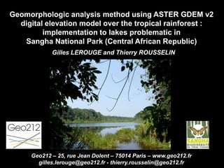
- 1. Geomorphologic analysis method using ASTER GDEM v2 digital elevation model over the tropical rainforest : implementation to lakes problematic in Sangha National Park (Central African Republic) Gilles LEROUGE and Thierry ROUSSELIN Geo212 – 25, rue Jean Dolent – 75014 Paris – www.geo212.fr gilles.lerouge@geo212.fr - thierry.rousselin@geo212.fr
- 2. Location: Northwest of Congo Basin Rainforest Tri-National Park of Sangha (UNESCO – World Heritage of Humanity) South of Bayanga Central African Republic A geomorphological analysis conducted by Geo212 within the scientific program « Sangha Biodiversity on Pygmy land - Insects of the World in Central African Republic » (2011 -2012)
- 3. Context: Dense and Fairly intact rainforest Presence of multiple small lakes No topographic or geological mapping Goals : Contribute to a better understanding of the environmental distribution of the fauna (insects, lizards, frogs…) To draw up the river system map Understand the river system organisation (location / distribution / communication) An old hypothesis : Through photointerpretation, geometries of some of the lakes were interpreted in the littérature as sinkholes of a paleo cryptokarst above continental sands
- 4. Our program is one of the very few scientific exploration programs to have penetrated this forest for more than a century Unfavorable for geological field observations but favorable for geomorphological interpretation : Homogeneous forest with native plant species, trees over 70 m high. A canopy still intact, undisturbed by human activity, maintaining the underlying relief influences.
- 5. First step of the analysis : River system restitution and geomorphological interpretation Choice of SPOT5 HRG image (2008/10/23) : Resolution (2,5m) fits the scale of the objects Choice of a photo- interpretation approach: Geometric accuracy Avoids any artifact related to DEM automatic extraction River system: Covered by forest Low density Sharp contrasts of vegetation Open valley little incised
- 6. Sangha watershed (a tributary of Congo River) Four main flow directions : SSE (Sangha and main tributaries) SW (upstream part of the flow) E or ESE (in the north-east) NW (in the north and north- east) The lakes are located in an arc interfluve area
- 7. Remarkable river system geometries : Opposite curved lines, under folded structure influences Straight lines with angular joints, under faulted structure influences. General flow direction shift in the south, under tilting block influence
- 8. Second step of the analysis : Geomorphological interpretation of ASTER GDEM v2 data : Choice of DEM : Planimetric resolution (30 m) and elevation accuracy (20 m) at the scale of elevation changes searched into the canopy, Less smooth reliefs (essential to detect breaks of slope) Fewer artifacts or holes Global coverage Economic choice
- 9. DEM analysis principles in a rainforest context : Identify and reproduce breaks of slope disrupting the canopy with geological meaning (lithological contrasts …), Forget height variations related to species and wetlands (requires a canopy analysis on the SPOT5 image), Only the most important altitude contrasts are detected (smoothing effect, vertical resolution)
- 10. To the West, Sangha river (wide valley, asymmetrical) From north to south, 360 m to 340 m gradient, High reliefs (450 m) located 3 km from the river on the right bank , Left bank side very open (altitude 450 m are 20 km from the river) To the East, relief over 700 m NNW-SSE morphological axis Increasing altitudes to the north-east Arched valley, Diverging slopes North and South Valleys and ridges straight ENE-WSW To the South Slopes tilted to the SE
- 11. Break of slope Break of slope geometries : Regionally oriented NNW- SSE Morphological structures closing to the north Elliptical structure in the center Chevrons between talwegs Dips interpretation : Periclinal closure Coombs and valley
- 12. Break of slope Folded structures : Major fold axis : NNW-SSE Asymmetrical folds succession (synform / antiform, long limb / short limb) Curved axis on the western limb. Overall structure : Polyharmonic fold Light inverted relief
- 13. Break of slope Faults Straight and narrow valleys Sections with angular joints ENE-WSW orientation: 2 corridors to the north and to the south Associated orientations E-W, NW-SE NNE-SSW NW-SE orientation Intersects the lakes area
- 14. Tilting direction Movement direction of fault Morphostructural interpretation Folds Intersected to the NW and to the SE by fault corridor, Intersected by NW-SE faults ENE-WSW shear zones Tilted southern block to the SE along the shear zone
- 15. Third step of the analysis : Lakes distribution interpretation On the polyharmonic fold western limb In the interfluve area Distributed in a light arched depression Lakes do not have always a circular form, often elongated form No communication observed between the lakes
- 16. Structurally controlled lakes : In an anticline coomb According to the fold axis, shifted by faults Divided by faults into small diamond-shaped basins, isolated by topographic scarps Outside of the coomb, lakes are located just under the break of slope (anaclinal side) In faulted consequent valley
- 17. Flow directions and connections between lakes Lake 1 directly connected to the river system through a consequent valley In the northern part, possible connections between the lakes into the same cataclinal coomb. In the southern part, opening of the coomb on the southern side and flow in this opportunity direction On the western side, direct connections to the river system by consequent valleys Drainage area Flow direction
- 18. Conclusions This example of morphostructural analysis over the Sangha rainforest demonstrates, over a complex and out of the way place, the opportunity to : Establish an accurate structural pattern, Explain the river system logic, Guide the field reconnaissance work. Using ASTER GDEM v2, with its global coverage, this approach can be applied everywhere with an accuracy coherent with the sought after geological objects.
- 19. Geo212 – 25, rue Jean Dolent – 75014 Paris – www.geo212.fr gilles.lerouge@geo212.fr - thierry.rousselin@geo212.fr