Chandrayan final
•Als PPS, PDF herunterladen•
3 gefällt mir•1,172 views

Chandrayaan-1 was India's first lunar orbiter mission, launched in 2007-2008. It was designed to conduct high-resolution remote sensing of the lunar surface using visible, infrared, X-ray and gamma ray instruments over a planned 2-year operational life. The orbiter's objectives included producing a 3D topographical map of the moon and studying the distribution of minerals and chemical elements on the lunar surface. Chandrayaan-1 helped advance India's space science capabilities and achieved its mission goals before its operations concluded in 2009.

Empfohlen
Weitere ähnliche Inhalte
Was ist angesagt?
Was ist angesagt? (20)
Andere mochten auch
Andere mochten auch (20)
Ähnlich wie Chandrayan final
Ähnlich wie Chandrayan final (20)
Mehr von Rupesh Kumar Tiwari
Mehr von Rupesh Kumar Tiwari (20)
Kürzlich hochgeladen
Kürzlich hochgeladen (20)
Chandrayan final
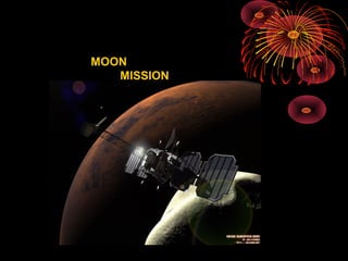
- 1. MOON MISSION
- 2. Chardrayaan-1 is the first Indian Mission to the Moon devoted to high-resolution remote sensing of th e lunar surface features in visible, near infrared, X-ray and low energy gamma ray regions.
- 5. The mission is proposed to be a lunar polar orbiter at an altitude of about 100 km and is planned to be launched by 2007-2008 using indigenous spacecraft and launch vehicle of ISRO. The mission is expected to have an operational life of about 2 years. MOON MISSION
- 6. 1st stage ISRO ’s PSLV will take a 1.5 m cuboid Chandrayan-1 at a launch speed of 10 km/sec. Built somewhat like the weather satellite Kalpana, it will slow down to 8 km/sec. & Join Kalpana almost on the same orbit to Swim around earth first. 240 km 36,000 km
- 7. 240 km 36,000 km The satellites liquid apogee motor will fire, Pushing it out of earth’s magnetic clasp & Take it to 3,86,000 km. On the road to the Moon. 2nd Stage 3,86,000 km
- 8. 3rd stage 200 km Solar Panel of the craft will open up The orbit will be reduced to 200 km. & the craft will get some rest At a speed of about 1 km/ sec. Chandrayan will spend about two weeks going round moon.
- 9. 100 Km. Finally the the orbital altitude will be reduced to 100 km. & there it will circle around for two years Final stage
- 10. When Chandrayan is behind the moon it will store data in memory. When it Comes to our side they will be sent like SMS service.
- 11. Carry out high resolution mapping of topographic features in 3D. Distribution of various minerals and elemental chemical species including radioactive nuclides covering the entire lunar surface using a set of remote sensing payloads. Realize the mission goal of harnessing the science payloads, lunar craft and the launch vehicle with suitable ground support system including DSN station, integration, testing, launching & achieving lunar orbit of ~100 km
- 12. Terrain Mapping Camera (TMC) The purpose of this instrument is to generate high - resolution 3-D cartographic map of the moon using stereoscopic cameras. Hyper Spectral Imager (HySI) Uses a wedge filter and an area array detector to obtain the full “spectrum information of the target” by acquiring image data for mineralogical apping.
- 13. Lunar Laser Ranging Instrument (LLRI) The LLRI is used for providing ranging data for determining the accurate altitude of the spacecraft above the lunar surface. X-ray Fluorescence Spectrometers This payload consists of three parts: Low Energy X-ray detector (LEX) to map the abundance of light elements like Mg, Al, Si, Ca, Ti and Fe. Solar X-ray Monitor to continuously measure the fluxof solar X-rays. High Energy X-ray/ gama-ray detector (HEX) to map the distribution of high atomic number elements over the lunar surface such as 210Pb, 222Rn, U, Th.