Recent Archaeological Discoveries Near Swanlinbar, Co. Cavan
•
1 gefällt mir•804 views

Talk at given at Swanlinbar, Co. Cavan for Breifne Historical Society - Cumann Seanchais Bhreifne, 11th March 2011

Empfohlen
Empfohlen
Weitere ähnliche Inhalte
Andere mochten auch
Andere mochten auch (20)
Ähnlich wie Recent Archaeological Discoveries Near Swanlinbar, Co. Cavan
Ähnlich wie Recent Archaeological Discoveries Near Swanlinbar, Co. Cavan (20)
Mehr von Robert M Chapple
Mehr von Robert M Chapple (15)
Kürzlich hochgeladen
Kürzlich hochgeladen (20)
Recent Archaeological Discoveries Near Swanlinbar, Co. Cavan
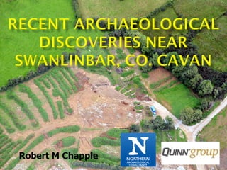
- 2. The townland of Gortlaunaght lies on the western slopes of a foothill of Slieve Rushen, 2.5km to the south- east of the village of Swanlinbar, county Cavan April 2006 - January 2008 Monitored topsoil stripping carried out by Northern Archaeological Consultancy Ltd. for the Quinn Group Ltd. in advance of quarrying. Site discovered in the eastern, central section of the quarry land. Landscape forms a natural shelf of relatively level land, rising abruptly to the se, towards Slieve Rushen. To nw ground falls the valley of the Cladagh and Blackwater rivers.
- 3. Excavations lasted from May to August 2008 Investigated two main sites: A: a sub-rectangular structure B: a sub-circular enclosure Ext 1-3: small areas of archaeology Discovered and test-trenched : C: upstanding rath/ringfort.
- 4. In this relatively small area (c. 500m x 500m), evidence was discovered for continuous settlement and activity from the Middle Neolithic (Phase I) into the Medieval period (Phase VI). That’s over 5000 years of (basically) continuous occupation! Phasing I: Middle Neolithic (c 3500-2900 BC) II: Late Neolithic (c 2900-2350/2200 BC) III: Bronze Age (c 2350/2200-650 BC) IV: Iron Age (c 450 BC-400 AD) V: Early Christian period (c400-1250 AD) VI: Medieval period (c1250-1611 AD)
- 5. .
- 6. One of the fills produced two rim sherds, 22 body sherds and 11 fragments - represented a portion of a substantial decorated Middle Neolithic (c 3500-2900 BC) Globular Bowl with an original rim diameter of 220mm.
- 7. Decoration Upper rim surface: alternating diagonal pairs of incised lines, forming a chevron pattern. Edge of spur : with short diagonal incised lines. Exterior surface: series of closely set incised lines, which produced a lattice pattern.
- 8. The Globular Bowl may be paralleled at such Ulster sites as: Island MacHugh, Co. Tyrone Lough Enagh, Co. Derry/Londonderry Linford Site 4, Co. Antrim Croft Manor, Ballygalley, Co. Antrim Cairncastle Road, Ballygalley, Co. Antrim Other comparable sites include: Townleyhall II, Co. Louth Dalkey Island, Co. Dublin Kilshane, Co. Dublin . A radiocarbon date associated with the Kilshane vessel dated to 3645- 3390 cal BC, placing it in the Middle Neolithic.
- 9. Deliberate deposition within sinkholes is known from various sites (Mell II and Tullyallen I, Co. Louth), it seems unlikely in this instance as metallic slag was recovered from the same fill. Instead, it seems more probable that the vessel had been deposited in a feature that was later subsumed and destroyed by the natural opening up of the sinkhole. This would explain the presence of metallic slag, possibly derived from an adjacent iron working area.
- 11. Late Neolithic (c 2900-2350/2200 BC) activity is represented by the group of features external to the Site B enclosure, near the nw facing entranceway. They formed two short arcs with an intervening pit.
- 12. Upper fill: various flint & chert pieces Bottom fill: Late Neolithic Grooved Ware bowl. Upper fill: Upper fill: chert pieces, quartzite chert & flint flakes, spalls & cores hammer stone & part of BA + part of indeterminate BA vessel Vessel (indeterminate) Bottom fill: 3 chert flakes & Late Neolithic C14 date (2877-2577 cal BC). Top fill: irregular chert end scraper & a portion of an indeterminate BA vessel Bronze Age pottery (indeterminate) Upper fill: chert core & flakes Bronze Age Cinerary Urn (portion)
- 13. Bottom fill: Late Neolithic Grooved Ware bowl. Upper fill: chert & flint flakes, spalls & cores + part of indeterminate BA vessel
- 14. Q: How do you excavate a Late Neolithic Grooved Ware pot?
- 15. Q: How do you excavate a Late Neolithic Grooved Ware pot? A: Very, very carefully!
- 16. Intact basal portion and various other sherds of a Grooved Ware vessel. Rim: simple rounded form. Estimated original rim diameter: 200mm. Decoration: Internal face of rim bore a slight, decorative, groove. Flat base displayed two shallow circumferential incised lines set approximately 5mm apart. Regularity of these grooves suggests that they too were decorative, as opposed to coil joins.
- 17. Knowth, Co. Meath, with a single circular groove on the base. Other sites, which produced comparable material, include: Ballynahatty, Co. Down Bettystown, Co. Meath Ninch – Laytown, Co. Meath Fourknocks Ridge , Co. Meath. Dundrum Sandhills (site 1), Co. Down Cairn L, Lough Crew, Co. Meath Newgrange, Co. Meath Longstone, Co. Tipperary The Gortlaunaght vessel bears most resemblance to the Dundrum-Longstone type. This is the most common and easily identified form of Grooved Ware and is characterised by thin walled bowls with curved rims and rounded rims where the ornament is sparsely applied, but rigidly controlled.
- 18. Bottom fill: 3 chert flakes & Late Neolithic C14 date (2877-2577 cal BC). Top fill: irregular chert end scraper & a portion of an indeterminate BA vessel
- 20. Upper fill: various flint & chert pieces Bottom fill: Late Neolithic Grooved Ware bowl. Upper fill: *Upper fill: chert pieces, quartzite chert & flint flakes, spalls & hammer stone & part of BA cores + part of indeterminate Vessel (indeterminate) BA vessel Bottom fill: 3 chert flakes & Late Neolithic C14 date (2877-2577 cal BC). Top fill: irregular chert end scraper & a portion of an indeterminate BA vessel Bronze Age pottery (indeterminate) Upper fill: chert core & flakes Bronze Age Cinerary Urn (portion)
- 21. Upper fill: 7 chert flakes and a quartzite hammer-stone hammer-stone was made from a large rounded oval quartzite pebble and exhibited two small areas of impact damage (pecking) near one end and two areas on the opposing end, along with evidence of damage to both faces
- 22. It is tempting to see these arcs as a surviving portion of a Late Neolithic structure, none of the features produced any evidence of post pipes (ie decayed posts).
- 23. C428 C446 C425 Problem: The range of surviving depths varies from 0.76m (C425) down to 0.11m (C368 & C436) (mean: 0.29m),. The largest of these would have been suitable for holding a post, but the smaller examples clearly would not. Alternative theory: These pits were created solely for the deposition of ceramics and lithics. The inclusion of a hammer stone and flakes, but without any micro débitage, is evidence against this material being the remains of domestic refuse. While Grooved Ware pottery is sometimes found on domestic sites, it is more usually associated with ritual activities.
- 24. Taken together, the evidence indicates that this group functioned as a ritual area devoted to the structured deposition of ceramics and lithics. Other items that may have been included for deposition in such a ritual-oriented area may have included non-surviving organic materials, including foodstuffs (such as the charred hazelnut shells from C401), items of leather, wood, basketry, or fabric or liquids. The presence of items of Bronze Age date may be accepted either as later, intrusive depositions or as part of a longer cultural continuity.
- 25. The ring ditch
- 26. Internal dimensions: 6.53m (east to west), by 5.97m. Construction technique: subsoil removed but the bedrock was left untouched Fill of ditch produced: small irregular chert flake portion, five sherds of an undecorated Bronze Age vase urn (Early Bronze Age) & 523g of burnt bone, including skull fragments and two teeth Two radiocarbon dates from charcoal from this fill: Location of urn 1212-911 cal BC and 1112-831 cal BC. Suggest a Late Bronze Age date.
- 27. Parallels for undecorated vase urn: Magheraboy, county Derry Drumnakeel, county Antrim Altanagh, county Tyrone Research by Anna Brindley dates the vase urn form to the period from 2000/1980 to 1740 BC. Radiocarbon dates: 1212-813 cal BC … nearly 550 years difference
- 28. No need for any discrepancy: Ring ditch would have existed over a long period before finally becoming invisible on the landscape. Early Bronze Age : construction of the ring ditch; manufacture of the pottery vessel Original form of the site may have included an internal bank and central mound. As no central pit was found within the ring ditch, it is likely that the vessel and the cremated remains would have been incorporated directly into the mound. Theory: Late Bronze Age - site was modified/destroyed & vessel, bone and chert flake were roughly reinterred in the ditch. Why? (Speculative) - changes in ritual /social polity transformations within the wider cultural/power relationships. Although ‘slighted’ or remodelled, such a scenario would not necessarily remove the monument completely from the landscape, which is an important consideration in relation to the Early Christian settlement here.
- 30. Sinkhole black-brown clayey silt Redeposited natural large Bronze Age vessel of cinerary urn form: 16 rim sherds; 10 base sherds & 335 body sherds
- 31. Charred residue noted on the interior surface Evidence of an overspill of organic liquid material on the exterior surface Whatever was being prepared spilled/poured while the ceramic was over a heat source, or was still hot Suggests that the vessel was used in the preparation of food - may equally have been in a ritual as a domestic context
- 32. Parallels for the cinerary urn: Loughbrickland, county Down Urbalreagh, county Antrim unprovenanced example in the Ulster Museum Top two examples were associated with funerary contexts The charred residues on the interior and spillage marks on the exterior surface of the Gortlaunaght example - indicative of food preparation. While it is possible that this related to a domestic utilisation, it may also be seen in a ritual context, associated with funerary feasting or drinking Why was it deposited like this? Neolithic Globular Bowl from sinkhole - interpreted in terms of a natural redeposition This vessel (and two chert pieces) may be part of a ritual deposition. Placed into natural sinkhole (eg Mell 2 & Tullyallen I, Co. Louth) Or … it may be a wholly functional and non-ritual disposal of a domestic cooking vessel into a convenient hole in the ground!
- 33. Burnt mound trough Possible burnt mound trough
- 34. Burnt Mound trough I All fills composed of charcoal-rich deposits of fire-cracked and heat affected stones. Lowest fill dated to 2573-2290 cal BC - transitional period between the Late Neolithic and the Early Bronze Age. Date & form suggest this was a burnt mound trough (even though no remains of a mound survived)
- 35. A second pit filled with burnt Burnt Mound trough II stone (partially destroyed by sinkhole that produced the Globular Bowl), not radiocarbon dated, though it is likely that this too was a burnt mound trough of similar date
- 36. Heated stones dropped into water … suggestions include: cooking food [most usually] saunas/sweat houses or for bathing dying textiles curing hides collection of fats for food preservation brewing [most recently]
- 37. Bronze Age vase urn
- 38. As found: face down in pit Decorated face as excavated
- 39. Bronze Age vase urn : 3 rim sherds & 1 body sherd Brindley dates the vase urn tradition to the period from 2000/1980 to 1740 BC (contemporary with ring ditch vessel) … specifically to the Stage 2 development of the vase tradition (c 1900-1800BC)
- 41. single, annular wall slot measured up to 1m wide, by 0.48m deep formed a somewhat trapezoidal or sub-rectangular shape 15.90m (north to south) by 6.00m at the southern end, narrowing to 3.5m enclosed an area of 49.67m2
- 42. During excavation Post excavation
- 43. centre of the eastern wall: large post pit (1.17m deep) & five ancillary postholes date from charcoal in slot trench: 1889-1684 cal BC (Early to Middle Bronze Age) … but charcoal from a sealed corner posthole dated to 109 cal BC-129 cal AD (Iron Age) of the two dates, the IA one comes from a more secure context flint finds not diagnostic to any one period morphology unlike other BA structures (usually circular) … not that many IA houses either! flint dual- platformed core of red-brown flint
- 44. Morphological problems structure is unusual and difficult to visualise 1:3 ratio of pit-depth to post height above ground suggests that the large post pit in the eastern wall slot could have held a timber of 4.68m, 3.51m of which would have been above ground. As no corresponding post pit was found in the west wall, this would have produced a roofed structure with a distinctly lop-sided appearance.
- 45. Morphological problems fills of the wall slot produced no evidence for any form of plank walling, with the exception of the sw & se corners, which each produced evidence of small postholes. must have been an unusual looking structure!
- 46. Morphological problems alternative theory: this area represents an unroofed ritual enclosure delimited by a post fence within the wall slot and focused on a large post in the eastern wall. post may have been brightly coloured or carved (Native American totem poles).
- 47. carvings of this date are rare – eg the finely crafted stag from Fellbach-Schmiden, Germany Alternatively, it may have been decorated with additional pieces of organic material, including wood, bone, antler or fabric ancillary postholes cut into the sides of the main post pit: repeated acts of replacement/timbers were added to give strength and support to the main post? post pit extends to the east (away from the enclosed area): little desire to disturb the internal area?
- 48. Site B enclosure measured 65m (north-west to south-east), by 50m (c 2683m2), with an entranceway (5.10m wide) to the north- west
- 49. defined on n, w & s sides as a shallow ditch (C189) that cut the subsoil, but left the underlying bedrock untouched
- 50. On e side ditch was largely destroyed by later field ditches - original enclosing bank was preserved beneath the surviving field-bank
- 51. 24 pieces of red deer antler 50 fragments of animal bone (incl. sheep shoulder blade) – some with butchery marks fragments of a heavily degraded cow tooth metallic slag (possibly including part of a furnace bottom. Two radiocarbon dates were returned from the ditch: 654-772 cal AD & 553-658 cal AD (Early Christian period) These suggest that this enclosure, though slightly unusual in the corpus of excavated raths, was occupied from the sixth to eight centuries AD.
- 52. Linear gully (fence line) dated to 669- 889 cal AD: implies that settlement continued into the late ninth century.
- 54. Within the Site B enclosure, there were a number of groups of features that may be rationalised as the remains of structures. In the absence of closely dated finds or radiocarbon determinations, they are considered to be of Early Christian date, chiefly on morphological grounds Fence line Small house/hut gully formed all, or portions of, four sides of a sub-square structure 3.04m (nw-se) x 2.54m (6.89m2)
- 55. More houses/huts/workshops? Fence lines/huts? 3.33m (nw-se) x 2.02m (5.65m2) 3.33m (nw-se) x 2.02m (5.65m2)
- 57. Possible iron working area Pit with iron slag Hearth with iron slag Fence/wattle wall (with iron slag)
- 58. Possible iron working area Pit with iron slag Hearth with iron slag Fence/wattle wall (with iron slag) Or is something else happening here? 20 pieces of burnt animal bone & 5 charred seeds Hearth with stakeholes and (possible) cremated human bone
- 59. Pit with broken quern stone
- 62. Curves parallel to outer ditch … suggests that two are contemporary
- 63. Inner ditch: 64 pieces of animal bone, seven pieces of which were identifiable as cow, including two portions of teeth
- 64. Possible second inner ditch portion
- 65. Problems: feature appeared to cut through upstanding bank: implying relatively modern date for construction. But: likely that this was a later recutting of the feature to make it part of the local field-drainage system. Unfortunately, this junction between the inner and outer ditches and the surviving bank was particularly difficult to interpret, due to the amount of later activity, which complicated and distorted the picture.
- 66. Usual rath diameter: c30m vs. +60m Usual rath ditch: 3m wide & 2m deep + frequently rock-cut vs. 1m wide & 0.60m deep + left bedrock uncut Usual rath bank: 3m wide & 2m high vs. 1m wide & 0.60m high [surviving bank suggests no truncation of site]
- 67. Main enclosure ditch: bedrock uncut
- 68. Was it unfinished? Bedrock left for later? Unfinished inner ditch portions Small bank & ditch would have been ineffective defence But … there is plenty of evidence for Early Christian habitation I suggest: While the enclosing bank and ditch were small – they were considered to be sufficiently large to demarcate the area of the site. Although ineffective as a defense against attack, they would have been sufficient to prevent the entry/exit of roaming cattle.
- 69. How visible was it during the Early Christian period? If still visible (possibly with cultural relevance) choice of site may have been extremely significant - reaffirming the cultural connection to the landscape and tribal power relationships If not visible – site choice may be fortuitous - influenced by the natural shelving on this slope of Slieve Rushen
- 70. Only a suggestion: The fact that the Early Christian activities (although numerous in this portion of the enclosure) do not appear to interfere with the older ring ditch in any way suggests that it was visible and respected enough not to be disturbed
- 71. Activity predating rath construction is well attested at many sites, but evidence for the deliberate selection of older monuments is more equivocal. For example, it has been argued that the building of raths at Mooghaun hill fort, in Co. Clare, was intended to strengthen one group’s claims to the earlier monuments and the social power that they represented. Early Christian reuse of burial sites includes Carrowkeel, Co. Mayo, where a ditched enclosure associated with cremation deposits predated rath occupation. At Carrigaline Middle, Co. Cork, a ditched enclosure associated with early burials was succeeded by a rath.
- 72. Inside the enclosure all dated/suspected Early Christian activity is to the south & south- south-west of the line Approximately half the enclosure was vacant! … why? Division of space: domestic or industrial activity confined one half of the enclosure and the remainder was utilised in a different way … possibly as a compound for the corralling of cattle.
- 73. A previously unrecognised, upstanding rath (Site C) was identified in the north-eastern portion of the current development by the R M Chapple and Stephen Gilmore, during preliminary field work
- 74. Unfortunately, NAC Ltd. did not get to excavate the Site C rath, but we did put some test trenches through the central area and the banks. Recovered finds included metallic slag & furnace bottoms – more evidence for metal working! And one sherd of Everted Rim Ware – 13th -14th centuries
- 75. Vessel may be paralleled at: Tullymongan Lower, county Cavan Abbeylands, near Duleek, county Meath Tullykane, county Meath Stamullin, county Meath
- 76. Gortlaunaght is outstanding for a number of reasons: the rare level of continuity from the Middle Neolithic up to the Medieval period. Evidence for almost every aspect of life in ancient Ireland, including domestic, funerary, ritual, manufacturing and animal husbandry. While all the individual elements of these sites may be paralleled in one way or another, few if any excavated sites demonstrate the lengthy continuum and variety of activity at a single location. Until recent times, there has been a relatively low level of economic and structural development within rural county Cavan, which has resulted in few large-scale excavation projects; a situation has only recently begun to change. In this context, the excavations at Gortlaunaght represent a significant advance in our collective understanding of the prehistory and early history of this county and western Ulster as a whole.
- 77. Thanks to Breifne Historical Society - Cumann Seanchais Bhreifne for inviting me & organising the event To my employers NAC Ltd To the Quinn Group – especially the managers of the Swanlinbar Quarry - for financing the excavations
- 78. www.academia.edu