Driving Behavioral Change for Information Management through Data-Driven Gree...
Final Ite Css
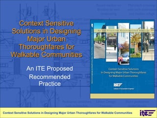
1. Context Sensitive Solutions in Designing Major Urban Thoroughfares for Walkable Communities An ITE Proposed Recommended Practice Context Sensitive Solutions in Designing Major Urban Thoroughfares for Walkable Communities
2. Segment 1 Overview Context Sensitive Solutions in Designing Major Urban Thoroughfares for Walkable Communities
3.
4.
5.
6.
7.
8.
9.
10. CSS: Bringing Place and Thoroughfare Design Together Context Sensitive Solutions in Designing Major Urban Thoroughfares for Walkable Communities E14th Corridor - San Leandro, CA Source: Community, Design + Architecture
11. CSS: Bringing Place and Thoroughfare Design Together Context Sensitive Solutions in Designing Major Urban Thoroughfares for Walkable Communities E14th Corridor - San Leandro, CA Source: Community, Design + Architecture
12. CSS: Bringing Place and Thoroughfare Design Together Context Sensitive Solutions in Designing Major Urban Thoroughfares for Walkable Communities E14th Corridor - San Leandro, CA Source: Community, Design + Architecture
13.
14.
15.
16. Context Zones – An Organizing System for Thoroughfare Design Context Sensitive Solutions in Designing Major Urban Thoroughfares for Walkable Communities Source: Duany Plater-Zyberk and Company Suburban General Urban Urban Center Urban Core
17. CSS vs. Conventional Thoroughfare Design Approach Context Sensitive Solutions in Designing Major Urban Thoroughfares for Walkable Communities Conventional CSS Approach Context : - Urban -Rural Context : - Suburban -General urban -Urban center -Urban core Design criteria primarily based on: - Functional class -Design speed -Forecast travel demand -Level of service Design criteria primarily based on: -Community objectives - Functional class -Thoroughfare type -Adjacent land use
18.
19.
20.
21. Context Zone Descriptions Context Sensitive Solutions in Designing Major Urban Thoroughfares for Walkable Communities
22.
23. Functional Class and Thoroughfare Type in Design Context Sensitive Solutions in Designing Major Urban Thoroughfares for Walkable Communities Criteria Functional Classification Thoroughfare Type Continuity Trip length Movement type Sight distance (speed) Curvature Speed Physical configuration Dimensions
24. Thoroughfare Type and Land Use Establish Design Criteria Context Sensitive Solutions in Designing Major Urban Thoroughfares for Walkable Communities
43. Corridor Planning Process Context Sensitive Solutions in Designing Major Urban Thoroughfares for Walkable Communities
44.
45.
46. Hybrid Network Context Sensitive Solutions in Designing Major Urban Thoroughfares for Walkable Communities
47.
48. CSS in Project Development Context Sensitive Solutions in Designing Major Urban Thoroughfares for Walkable Communities
49. Project Development Process Context Sensitive Solutions in Designing Major Urban Thoroughfares for Walkable Communities
50. Segment 3 CSS Design Framework Context Sensitive Solutions in Designing Major Urban Thoroughfares for Walkable Communities
51.
52.
53. Context Zones – An Organizing System for Thoroughfare Design Context Sensitive Solutions in Designing Major Urban Thoroughfares for Walkable Communities Source: Duany Plater-Zyberk and Company
54.
55. Context Zone Descriptions Context Sensitive Solutions in Designing Major Urban Thoroughfares for Walkable Communities
56.
57.
58.
59.
60.
61.
62.
63. Functional Class and Thoroughfare Type in Design Context Sensitive Solutions in Designing Major Urban Thoroughfares for Walkable Communities Criteria Functional Classification Thoroughfare Type Continuity Trip length Movement type Sight distance (speed) Curvature Speed Physical configuration Dimensions
64. Thoroughfare Type and Land use Establish Design Criteria Context Sensitive Solutions in Designing Major Urban Thoroughfares for Walkable Communities
65. Relationship between Thoroughfare Type and Functional Class Context Sensitive Solutions in Designing Major Urban Thoroughfares for Walkable Communities
90. Segment 4 Design Controls and Thoroughfare Design Context Sensitive Solutions in Designing Major Urban Thoroughfares for Walkable Communities
91.
92.
93. Speed/Accident Severity Relationship Context Sensitive Solutions in Designing Major Urban Thoroughfares for Walkable Communities Source: Anderson, McLean, Farmer, Lee and Brooks, Accident Analysis & Prevention (1997)
94.
95.
96. CSS vs. Conventional Thoroughfare Design Approach Context Sensitive Solutions in Designing Major Urban Thoroughfares for Walkable Communities Conventional CSS Approach Context : Urban Rural Context : Suburban General urban Urban center Urban core Design criteria primarily based on: Functional class Design speed Forecast travel demand Level of service Design criteria primarily based on: Community objectives Functional class Thoroughfare type Adjacent land use
117. Furnishings Zone in Residential Context Context Sensitive Solutions in Designing Major Urban Thoroughfares for Walkable Communities
118. Furnishings Zone in Commercial Context Context Sensitive Solutions in Designing Major Urban Thoroughfares for Walkable Communities
119.
120.
121. Segment 6 Traveled Way Design Context Sensitive Solutions in Designing Major Urban Thoroughfares for Walkable Communities
122.
123.
124.
125.
126.
127.
128.
129.
130. Segment 7 Intersection Design Context Sensitive Solutions in Designing Major Urban Thoroughfares for Walkable Communities
131.
132.
133.
134.
135.
136.
137.
138. Curb Extensions Context Sensitive Solutions in Designing Major Urban Thoroughfares for Walkable Communities
139.
140.
141. Modern Roundabouts Context Sensitive Solutions in Designing Major Urban Thoroughfares for Walkable Communities
142.
Hinweis der Redaktion
Welcome the [class, Web seminar, presentation] to ITE’s Proposed Recommended Practice (PRP) for CSS in designing major urban thoroughfares. Explain that this presentation will be a broad overview of the concepts and principles of CSS as they relate to major urban thoroughfares, and will briefly define how the contexts of community, environment and transportation are linked and will introduce a framework for designing thoroughfares that are compatible with the surrounding context. Describe how the CSS approach to planning and designing thoroughfares differs from conventional methods.
Highlight that CSS responds to broader and more complex community goals and demands that these issues are faced in order to make thoroughfares more compatible and supportive of local conditions and activities. Context sensitive solutions in transportation design is responding to the challenges practitioners face every day, particularly in urban contexts. The role of the engineer or planner involves balancing the needs and desires of the community and various users as listed on this slide.
Describe the overall objectives of the project. Emphasize integration of CSS early in the planning and design process. Primary objective is to provide design guidance.
Explain that this PRP is a joint effort between ITE and the Congress for the New Urbanism. It was initiated to meld the practices of transportation planning and engineering with urban planning and design. The report is sponsored by the Federal Highway Administration and the Environmental Protection Agency. Both agencies played an active role in its development.
The report is the result of a multi-disciplinary team of engineers, planners, architects, land use planners, landscape architects and urban designers and before its publication the report was reviewed by more than 60 professionals from multiple disciplines.
Describe that the PRP is intended to provide design guidance for context sensitive thoroughfares. It briefly covers the basic tenets of CSS and how these principles are integrated into the planning and project development processes at three levels: The network The corridor The individual project such as a roadway segment. The PRP introduces a design framework to describe a systematic approach to the stages of design and describe the elements of thoroughfares and surrounding context to help define compatibility. The guidance in the PRP is consistent with the guidance and flexibility provided in the AASHTO green book.
It is important to emphasize that the PRP focuses on a very specific aspect of transportation— “ major urban thoroughfares in walkable areas.” The definition of “Major” as it relates to the PRP includes arterial and collector streets. The report does not include limited access, high speed, freeways, expressways or parkways, nor does it include local streets. The term “Urban” covers a broad spectrum of metropolitan areas from walkable suburbs to city centers. In the PRP, urban refers to areas, whether they already exist or are a goal for the future, that have a mix of land uses and activities. These areas are compact and integrated enough to make non-automobile travel an attractive way to get around.
Highlight that there are several definitions of CSS, but they all revolve around a basic set of principles or tenets as shown here. In the end, CSS is a process that results in a context sensitive design solution. Point out that thoroughfare design based on these tenets is intended to be a collaborative, inter-disciplinary process that balances many different, and often conflicting, objectives. The ultimate objective is to design a safe street for all users, a street that contributes to, and becomes part of, the context, and a street that fully supports the activities generated by the adjacent land uses.
Emphasize that simulation is one way to illustrate the integration of transportation design into the creation of a place. In this example, the goal of this community is to create a vibrant and economically vital place that has lasting value. This requires a integration of land use, urban design and transportation design, and a combination of public and private investments.
The transportation investment might look like this. It can include vehicle, pedestrian and bicycle safety improvements, and streetscape and landscaping in the public right-of-way. The transportation design helps form an armature for a place—but is it a place? Not yet.
It becomes a place when the transportation and land use contexts are combined and integrated in a compatible way. Make a note of how the buildings orient to the thoroughfare and how the privately-owned areas transition into the publicly-owned areas forming a plaza. [Use pointer] The automobile is accommodated, but prioritized by mode. For example, parking is provided in the rear or under the building, separated from the pedestrian realm making the place easily accessible for all users.
Explain that the contents are divided into planning and design. Review the broad subject matter of the major divisions.
Explain how the guide is aimed at both planning and design practitioners and stakeholders who are users or decision makers for the thoroughfare and surrounding context (area). Describe that different users will use the RP in different ways. -Engineers and planners for guidance. -Design professionals for understanding relationship between thoroughfares and land use, site and building design. -Stakeholders for education and ideas
The purpose of the design framework is to provide a way of defining and classifying both urban context and major thoroughfares. This framework is intended to assist the practitioner in developing a thoroughfare design that is compatible with the surroundings. While people are able to “feel” the characteristics of an urban area, it is difficult to describe the specific features that collectively form different types of urban context. Therefore, the framework introduces the concept of “context zones” to categorize urban development density and intensity into four discrete zones. Once a context has been identified, the design framework uses the conventional functional classification system and a new thoroughfare type classification system to develop the design parameters and physical configuration of the thoroughfare. This will explained further in the next few slides.
Explain that context zones are based on the transect developed by the architect and planner Andres Duany. The transect is a continuum of the natural and built environment ranging from rural to highly urban, divided into seven discreet context zones. For urban areas, use only four of the context zones: these are suburban, general urban, urban center and urban core. [Use pointer] The reason for using context zones is to help the practitioner understand how changes in the context, and the level of activity the context generates, change the design of the thoroughfare. This slide gives examples of how metropolitan areas transition in development intensity from suburban to urban core.
Pose the questions, how does the CSS approach to thoroughfare design differ from the conventional approach? Explain that the table compares a few of the important determinants or design criteria that practitioners use in street design. The conventional approach provides design guidance for essentially two contexts, rural and urban. In the conventional approach the same design criteria are used for urban areas regardless of the intensity or type of development. The CSS approach provides a finer grain of classification in which the design criteria may change. In addition to context zone, the design criteria divides land use into residential and commercial categories which further influence the selection of design criteria. Conventional thoroughfare design is based primarily on functional class, design speed and often is governed by travel demand and level of service criteria. In CSS these are still important criteria, but are balanced with other context-related criteria including community objectives, thoroughfare type and the type and intensity of the adjacent land uses.
Point out that it is important to understand and explain that context and identifying context zones requires understanding of some of the features that create context. List a few of those features, each of which may also influence how thoroughfares are designed. For example, building design and its orientation to the thoroughfare can strongly influence whether an area is auto-oriented or pedestrian-oriented, which in turn affects how the adjacent street should be designed. Low scale buildings that are set far back from the street and surrounded by parking create a suburban auto-oriented environment. The thoroughfare design then might emphasize auto travel and higher speeds. Taller buildings with no setback and ground floor uses oriented to pedestrians creates an urban pedestrian-oriented environment. This building design may lead to greater pedestrian activity and the thoroughfare design might emphasize on-street parking, the width and function of the roadside and streetscape.
Explain that adjacent land use may be overlooked in the conventional design approach. Land use should be considered a design control because it has significant ramifications on thoroughfare design. One of the greatest influences is whether land use is residential or commercial and mixed use, where residential areas might emphasize livability, commercial areas might emphasize economic development, and mixed-use areas balance both livability and economic development. These different factors will influence the design of the thoroughfare.
Two important things to point out in the CSS approach to thoroughfare design: First , the thoroughfare is part of the context and its design contributes to both the character and value of a place. Secondly , the design of the thoroughfare should change as the context changes, both in response to the change in activity and to provide compatibility.
Note that for the transportation professional unfamiliar with land use planning, or architecture, identifying context beyond simply rural or urban can be difficult. Some guidance is necessary, such as this table (report Table 4.1) in the report that provides very general descriptions. However, the CSS approach encourages using multi-disciplinary teams in thoroughfare design, in part to help identify context and the types of activities the design of the thoroughfare needs to support.
Describe the PRP’s design framework introduces a new classification system for thoroughfares, called “thoroughfare types.” It is based on the classic system of boulevards, avenues and streets used for more than a hundred years. Thoroughfare types are used in conjunction with the conventional functional classification, but provide a finer grain of detail for the selection of design criteria. In the design framework, thoroughfare types are used to determine the physical configuration of the thoroughfare and the selection of design criteria. Functional classification, on the other hand, is used to define the thoroughfares’ primary function in the transportation network, and to select certain critical design controls. Explain that functional class is used to determine the type and length of trips being served, the level of land access and the type of freight movement and transit that needs to be accommodated.
Reiterate that thoroughfare type and functional class are used in conjunction to design a thoroughfare, but for different purposes. Functional class identifies the thoroughfare’s function in the larger network and provides input into some of the design parameters. Thoroughfare type is used for selection of most of the design criteria and design controls, and defines the physical configuration and dimensions of the cross-section and intersections.
The PRP provides design parameters and dimensions for thoroughfares under different contexts. This is an example from Tables 6.2 and 6.3 in the report. The parameters into guidance for three aspects of the thoroughfare: -Adjacent land uses (the context) -Roadside area -Traveled way This information is used to develop initial cross-sections. Note: in addition to context zones, the design parameters are divided into predominantly commercial and residential categories, because these distinctions play an important role in the design emphasis.
Like the conventional design approach, the CSS approach relies on critical criteria that control the design of a thoroughfare such as speed, design vehicle, sight distance and location. In CSS these design controls remain critical, but other design controls are emphasized as well, including thoroughfare type, land use and accommodation of pedestrians and bicyclists. Note that level of service is not listed as a design control. In CSS it is a very important factor, and must be considered in the design process, but does not govern the design in the same way that it does in the conventional approach.
Emphasize that in urban areas good levels of service (measured along a thoroughfare in terms of speed) are achieved with operating speeds of 25-30 mph. The process of addressing capacity issues should follow the order of: -The overall network -The corridor -The intersection Safety should be addressed on a case-by-case basis at individual locations.
Speed is probably the single most influential design control in thoroughfare design. In walkable urban areas, speeds range from 25 mph to a maximum of 35 mph. The PRP also addresses thoroughfares with speeds of 40+ mph as a special category called “Mobility Priority Thoroughfares.” This slide lists some of the design considerations that are used to keep urban thoroughfare speeds within the target range. Factors like….
The CSS approach to designing thoroughfares has five general steps. Highlight two of the steps. The first is understanding the community’s vision. This is a frequently overlooked step in the design process. And often times it is a good idea to work with the community’s stakeholders to understand their vision, goals and objectives. Making the thoroughfare compatible with and supportive of the community vision will make the design process and the finished product more successful and will facilitate community acceptance. Make the class aware that in this step the concerns and issues that might later turn out to be stumbling blocks in completing the design are identified. The second step to highlight is the initial design and testing, and not just testing the thoroughfare for capacity as is often done in the conventional approach. Capacity is one of the factors that needs to be considered, but the thoroughfare should be evaluated in the context of the entire network because often the problems at the level of the thoroughfare can be resolved at the scale of the network. Testing includes measuring the ideal design to available RW and other constraints and then prioritizing when all design elements cannot be fit in. Testing also means checking to see if the community’s concerns, issues and vision to the best of ability in the design has been addressed.
For the next few slides, point out that it is useful to think of the thoroughfare in terms of the three components shown in the diagram, the context, the roadside and the traveled way. There is a 4th component not shown, that is intersections.
A schematic diagram of some of the components of an urban thoroughfare design. Point out a few of the components. Explain the complexity of integrating the components, particularly in constrained right-of-way.
When dealing with design issues for the roadside, the area between the face of the curb and the property line, it is again useful to divide the area into zones, each of which has its own function. The width of the roadside zones, and their function, vary by context and the activities generated by the adjacent land uses. That’s why one standard cross-section is usually inadequate to address the ever changing needs of urban roadsides. The PRP contains detailed definitions of the functions of these zones.
Explain on the left is an example of a roadside design that has failed to meet the function of the roadside. Too much was put into a limited space, resulting in a design that is not sensitive to its context. The image on the right was designed for the current context, but also for some future context where there is more activity on the street. Each zone is adequately sized for its intended function.
Describe how roadside design is a lot more than simply determining how wide the sidewalk and the planting strip need to be. In urban areas there are many functions expected of the roadside and its proper design needs careful thought. The roadside is the interface between the public and private properties and sometimes the line is blurred. Here is where the practitioner has the challenging task of integrating land use into thoroughfare design.
Explain that the PRP contains guidance on roadside design elements and dimensions under varying contexts. These, however, are only guidelines. This slide shows a portion of report Table 8.1. The practitioner is encouraged to carefully consider the needed functions (which may be in the future) and allocate the appropriate width. This may require trade-offs with other thoroughfare design elements.
Similar to roadside design the design of the traveled way has a number of components and issues to address that go beyond just the capacity of the street. Often there is not enough right-of-way to design the ideal street so it is up to the designer and the stakeholders to evaluate the trade-offs and determine which elements have high priority.
Intersections are the most complex components of thoroughfare design and where most modal conflicts occur. Intersection design often requires balancing of design priorities to create safe and efficient facilities. Explain that this is a list of just some of the topics that need to be considered.
Describe how the next two slides show an example of some of the considerations in designing an urban intersection. Although it looks like a pretty typical suburban intersection, there are issues that would need to be considered in any re-design. These are highlighted.
This is an example of an after condition with most of the issues addressed. Have the group keep in mind that the CSS approach to thoroughfare design is an opportunity to enhance and improve upon the context, as well as address functional needs.
Stress that CSS does not change the conventional transportation planning process as shown in this flowchart. Explain that CSS complements the transportation planning process by emphasizing a multi-disciplinary and collaborative approach to develop and evaluate a broad spectrum of possible solutions…solutions that attempt to balance all stakeholder interests. Highlight the point that because it is difficult and often not possible to fully balance all interests, CSS ensures a clear assessment and understanding of trade-offs, a critical element if consensus is to be achieved. Point out some of the other benefits and outcomes of CSS…particularly as an opportunity to educate, and to go beyond simply meeting the transportation objectives, it is also an opportunity to enhance the community or environment.
Describe how the basic transportation planning process relates to the project development process. Indicate that CSS principles can be integrated into any or all of the transportation planning steps and that CSS early in the process helps expedite the project development process.
Describe that corridor planning is the step between long-range planning and project development. It is the corridor planning stage that many of the policies and broad design parameters for individual thoroughfares are established. Discuss that corridor planning is an opportunity to address issues and challenges with a broader scope than during the design of an individual thoroughfare, and then point out some of the planning issues that can be addressed at the corridor scale.
Describe the basic corridor planning process and emphasize that this process is very similar to the conventional transportation planning process. Emphasize where public and stakeholder involvement occurs and that these are key steps in establishing the design of the thoroughfare and building consensus. Discuss that early public/stakeholder buy-in to design concepts and project needs and objectives during the corridor planning process can avoid or minimize challenges and obstacles during the design stage of project development.
Reiterate that often the problems experienced at the thoroughfare level can be resolved at the scale of the network. E.g., providing parallel network capacity can reduce congestion on individual thoroughfares. Describe how network planning integrates land use, transportation and urban form: -Establishes the framework upon which land use and urban form is built -Provides the connectivity that links land uses together -Establishes the scale and resolution of the urban area (e.g., block sizes are established by the network and define walkability). Point out some of the important elements when considering connectivity.
Discuss the different types of networks. Most network types can be classified as either dendritic or traditional grid. If time allows, go into the history of the conventional dendritic network design. A good source of this is: Southworth, Michael and Ben-Joseph, Eran. "Street Standards and the Shaping of Suburbia," JAPA, Vol. 61, No. 1, Winter 1995, pp. 65-81. Describe the basic nature/characteristics of each network type: Dendritic: curvilinear, circuitous, cul-de-sacs, designed to isolate neighborhoods, reduces cut-through traffic, based on conventional functional class, which channels traffic from lower order to high order streets Grid: orthogonal or non-orthogonal grid, shorter block lengths, disperses traffic, multiple routes, more connectivity, compact, etc.
Discuss that there have been attempts at creating combinations of dendritic and grid networks, such as this example.
Review the fundamental benefits of connectivity. Use an example to show impact on travel distance and use of major thoroughfares on local streets for internal travel. As a course discussion, open the discussion to the participants and discuss the pros and cons of connectivity.
Break slide to introduce the next section.
Recall the slides on transportation and corridor planning and how those processes relate to project development. Describe that the details of thoroughfare design (and much of the guidance in the PRP) occur in the project development stage. Highlighted boxes show project development stages.
Much of CSS is about creating places. Discuss the key points about placemaking. Places have the right combination attributes that make people want to visit and keep coming back. Emphasize “lasting value” to the community and places that contribute to economic development. Focus on the aspect that successful placemaking is the integration of context and infrastructure.
The purpose of the design framework is to provide a way of defining and classifying both urban context and major thoroughfares. This framework is intended to assist the practitioner in developing a thoroughfare design that is compatible with its surroundings. While people can usually “feel” the characteristics of an urban area it is difficult to describe the specific features that collectively form different types of urban context. Therefore, the framework introduces the concept of “context zones” to categorize urban development density and intensity into four discrete zones. Once a context has been identified, the design framework uses the conventional functional classification system and a new thoroughfare type classification system to develop the design parameters and physical configuration of the thoroughfare. This will be explained further in the next few slides.
Context zones are based on the transect developed by the architect and planner Andres Duany. The transect is a continuum of the natural and built environment ranging from rural to highly urban, divided into seven discreet context zones. For urban areas there are only four of the context zones: these are suburban, general urban, urban center and urban core. [Use pointer]
The reason for using context zones is to help the practitioner understand how changes in the context, and the level of activity the context generates, change the design of the thoroughfare. This slide gives examples of how metropolitan areas transition in development intensity from suburban to urban core.
For the transportation professional unfamiliar with land use planning, or architecture, identifying context beyond simply rural or urban can be difficult. Some guidance is necessary, such as this table (Table 4.1) in the report that provides very general descriptions. However, the CSS approach encourages using multi-disciplinary teams in thoroughfare design, in part to help identify context and the types of activities the design of the thoroughfare needs to support.
Understanding context and identifying context zones require understanding of some of the features that create context. These are a few of those features, each of which may also influence how thoroughfares are designed.
Describe that adjacent land use may be overlooked in the conventional design approach. Land use should be considered a design control because it has significant ramifications on thoroughfare design. One of its greatest influences is whether land use is residential or commercial and mixed use, where residential areas might emphasize livability, commercial areas might emphasize economic development and mixed-use areas balance both livability and economic development. These different emphases will influence the design of the thoroughfare.
The design of the site can create either an auto-, or pedestrian-oriented environment simply by how the buildings are oriented to the thoroughfare, how the parking is configured and how well connected the pedestrian facilities are planned. Discuss the features of site design that differentiate auto and pedestrian orientation.
Explain that building design and its orientation to the thoroughfare can strongly influence whether an area is auto-oriented or pedestrian-oriented, which in turn affects how the adjacent street should be designed. Low scale buildings that are set far back from the street and surrounded by parking create a suburban auto-oriented environment. The thoroughfare design then might emphasize auto travel and higher speeds. Taller buildings with no setback and ground floor uses oriented to pedestrians creates an urban pedestrian-oriented environment. This building design may lead to greater pedestrian activity and the thoroughfare design might emphasize on-street parking, the width and function of the roadside and streetscape.
In urban areas the sense of a street enclosure is important in creating a pedestrian-oriented environment. From the perspective of someone walking on the street, the height of the buildings in relation to the width of the street provides a desirable sense of enclosure. While the height of buildings is outside the purview of the thoroughfare designer, this knowledge is yet another factor that might be considered in determining right-of-way needs or design.
Two important things to remember in the CSS approach to thoroughfare design: First , the thoroughfare is part of the context and its design contributes to both the character and value of a place. Secondly , the design of the thoroughfare should change as the context changes, both in response to the change in activity and to providing compatibility.
Point out that the PRP’s design framework introduces a new classification system for thoroughfares, called “thoroughfare types.” It is based on the classic system of boulevards, avenues and streets used for more than a hundred years. Thoroughfare types are used in conjunction with the conventional functional classification, but provide a finer grain of detail for the selection of design criteria. In the design framework, thoroughfare types are used to determine the physical configuration of the thoroughfare and the selection of design criteria. Functional classification, on the other hand, is used to define the thoroughfares’ primary function in the transportation network, and to select certain critical design controls. Use functional class to determine the type and length of trips being served, the level of land access and the type of freight movement and transit that needs to be accommodated.
Reiterate that thoroughfare type and functional class are used in conjunction to design a thoroughfare, but for different purposes. Functional class identifies the thoroughfare’s function in the larger network and provides input into some of the design parameters. Thoroughfare type is used for selection of most of the design criteria and design controls and defines the physical configuration and dimensions of the cross-section and intersections.
The PRP provides design parameters and dimensions for thoroughfares under different contexts. Tables 6.2 and 6.3, of which, this slide shows a portion, contain these criteria, which are considered starting points in establishing cross-sections. The guidance parameters for three aspects of the thoroughfare are: 1) adjacent land uses (the context) 2) the roadside area 3) the traveled way This information is used to develop initial cross-sections. Note: in addition to context zones, the design parameters are divided into predominantly commercial and residential categories, because these distinctions play an important role in the design emphasis.
Explain that the chart shows the relationship between functional class and thoroughfare type. Only focus on the areas that are not grayed out. Boulevards, which carry higher speed and longer distance travel, are always arterial streets. Avenues, which are shorter streets that serve a land access function and are primary pedestrian and bicycle routes, can range from arterials to collectors. Streets, primarily serving abutting land uses and pedestrian travel, are only collectors or local streets.
Reiterate what thoroughfare type is intended for…..
This chart provides some general characteristics of urban thoroughfares that help in the overall planning of networks and some aspects of designing cross-sections.
Mention that the PRP has a separate chapter on thoroughfares that serve areas where vehicle mobility is a high priority. If time allows, describe what defines a vehicle mobility priority thoroughfare: -Speeds of 40 to 45 mph -Serves auto-oriented and single-land use areas such as a business park, industrial areas, large residential subdivisions -Usually always a multi-lane arterial street, primary freight routes, but can be primary transit corridors -Long blocks, infrequent signalized pedestrian crossings -No on-street parking Emphasize that even vehicle mobility priority thoroughfares should accommodate pedestrians and/or bicyclists (if a bike route). On these types of facilities, pedestrian safety is often defined with wide separation between traffic and sidewalks (buffers) and multi-stage crossings (such as, pedestrian refuges in median).
Describe two examples: Note that these are within areas of single land uses where walking is mostly for recreation as opposed to transportation. Left image is an arterial serving residential subdivisions, right image is a large office park. Highly landscaped corridors. Emphasize how the pedestrian facilities are treated—separation from traffic important.
Boulevards carry longer trips, at generally higher speeds than avenues or streets. A few major design characteristics include: -Boulevards are divided streets usually with 4 or more lanes -They are frequently major transit routes, truck routes and primary emergency response routes -They use access management to improve safety, add capacity and for landscaping or streetscape opportunities
Point out that this is an example of a typical boulevard, the Embarcadero in San Francisco. This is a truly multi-modal street, one of the city’s highest traveled thoroughfares. It has light-rail transit in the median, carries major bus routes, has bike lanes and carries a lot of pedestrians. Unlike many boulevards, it has on-street parking (in some areas the parking is restricted during the peak hours to increase capacity). On-street parking is used to accommodate the ground floor retail in this segment of the Embarcadero and visitors of the residential units in the upper floors.
A special variation of the boulevard is the multi-way boulevard. It is intended to combine a high-capacity facility with pedestrian-oriented frontages with land access and parking. It is not a new concept, but has special design challenges, particularly at intersections. It is primarily characterized by a central multi-lane roadway with separated one-way frontage roads that provide parking and land access. Because of the multiple functions of these types of boulevards, the right-of-way requirements can be substantially more than typical boulevards.
This is one example of a multi-way boulevard in Berkeley, California, Shattuck Avenue. Note that this design has angled parking along the frontage lanes.
In this example, the intersection design challenge uses slip lanes before and after each intersection (like driveways) to accommodate the parked vehicles. This design reduces the conflicts of multi-leg intersections and also works better for pedestrians. Vehicular access to the buildings is from side-streets and alleys, not from the frontage lane.
This is an example of a multi-way boulevard in Albany, New York. In areas that experience snow, the dividing median should be designed to store snow without interfering with the frontage lanes.
Avenues are the “workhorses” of urban areas. They serve many types of areas and have many different functions. These are some of the general characteristics of avenues: -They do not exceed four lanes -Usually they are not divided so they can be narrower and provide access to adjacent land uses, but they could have a landscaped median -These types of thoroughfares are usually more local serving than boulevards and therefore emphasize economic development and pedestrian space
An example of a divided avenue in Addison, Texas.
Finally there are streets. Streets primarily serve land access and provide local connectivity for all modes of travel. These are very low-speed, pedestrian-oriented thoroughfares often serving either commercial main streets or residential neighborhoods. Point out a few characteristics of streets.
Example of a street in Boca Raton, Florida. It is from in a mixed-used development (former shopping center).
Example street in an urban center context in Minneapolis, Minnesota.
Example of a boulevard in a general urban context from Glendale, California. Note the angled parking in this example, a rare design element of boulevards except on multi-way boulevards.
Example of a boulevard in an urban core context, downtown Chicago, Illinois.
Example of a divided avenue in a low-intensity suburban context in Lake Oswego, Oregon.
Example of an avenue in an urban center context from Denver, Colorado.
Again using simulation to show how the combination of thoroughfare design and site and building design evolve an auto-oriented context into a multi-modally oriented context, this example demonstrates how the combination can change the context zone. Current context includes low-intensity and under-utilized land and a basic divided arterial street.
The conversion to a divided boulevard with a moderate intensification of land use to a general urban context (not high enough intensity to require on-street parking). Emphasize compatibility between thoroughfare design and context.
Ultimately, place becomes an urban center. Emphasize balance between transportation function of thoroughfare and pedestrian environment and economic development.
Another simulated example… Wide-high capacity arterial in a developing area. What solutions can maintain capacity, yet still provide a multi-modal thoroughfare in a future urban center? In this example, ample right-of-way can be an opportunity.
… an opportunity to develop a multi-way boulevard, a thoroughfare that can combine a higher-capacity central roadway with local serving frontage lanes.
Discuss that like the conventional design approach, the CSS approach relies on critical criteria that control the design of a thoroughfare such as speed, design vehicle, sight distance and location. In CSS these design controls remain critical, but other design controls are emphasized as well, including thoroughfare type and land use and accommodation of pedestrians and bicyclists. Note that level of service is not listed as a design control. In CSS it is a very important factor, and must be considered in the design process, but does not govern the design in the same way that it does in the conventional approach. In CSS, the community goals and objectives for the corridor set the role for level of service to be used for design.
Of primary importance, the PRP recommends the combined use of a target speed and a design speed. A lower target speed is a key characteristic of thoroughfares in walkable, mixed-use urban areas. Describe these definitions: Target speed - the speed at which vehicles should operate on a thoroughfare in a specific context, consistent with the level of multimodal activity generated by adjacent land uses, to provide both mobility for motor vehicles and a safe environment for pedestrians and bicyclists. The target speed is usually the posted speed limit. Design speed - the speed that governs certain geometric features of the thoroughfare, primarily horizontal curvature, superelevation and sight distance. Design speed is typically higher than the posted speed limit, so as to result in safety conservative values for design criteria such as sight distance or alignment. This report recommends that the design speed be 5 mph over the target speed. Conventionally, design speed has been encouraged to be as high as is practical. In this report a design speed range, linked to the target speed, is recommended based on the functional classification, thoroughfare type and context, including whether the area is predominantly residential or commercial. Design speed then becomes the primary control for determining the following design values: -Minimum intersection sight distance -Minimum sight distance on horizontal and vertical curves -Horizontal and vertical curvature Design speed ranges from 30 to 40 mph in this report (corresponding to target speeds of 25 to 35 mph), a range consistent, but somewhat lower than, the higher end of AASHTO’s recommended range for urban arterial streets.
The speed-crash severity relationship illustrates the benefit of reduced target speeds in walkable urban places. The slide is self-explanatory. Use it to justify the desire to reduce speeds on walkable thoroughfares. Derived from Anderson, McLean, Farmer, Lee and Brooks, Accident Analysis and Prevention (1997).
Speed is probably the single most influential design control in thoroughfare design. In walkable urban areas, target speeds are from 20-25 mph to a maximum of 35 mph. The PRP also addresses thoroughfares with speeds of 40+ mph as a special Category called “Mobility Priority Thoroughfares.” This slide lists some of the design considerations that are used to keep urban thoroughfare speeds with the target range. Factors like….
Explain that another crucial design control is the design vehicle. Transportation engineers are always challenged with designing for large vehicles in constrained conditions. In CSS the concept of design versus control vehicle is introduced. This concept addresses the conventional approach of designing thoroughfares for the largest possible vehicle that might use it. The difference between a design vehicle and a control vehicle is the frequency of the vehicle and the tolerance for encroachment. Design vehicle – a vehicle that must be regularly accommodated without encroachment into the opposing traffic lanes. Control vehicle – a vehicle that infrequently uses a facility and must be accommodated, but encroachment into the opposing traffic lanes, multiple-point turns, or minor encroachment into the roadside is acceptable.
Pose the questions, “how does the CSS approach to thoroughfare design differ from the conventional approach?” This table compares a few of the important determinants or design criteria that practitioners use in street design. The conventional approach provides design guidance for essentially two contexts, rural and urban. In the conventional approach the same design criteria is used for urban areas regardless of the intensity or type of development. The CSS approach provides a finer grain of classification in which the design criteria may change. In addition to context zone, the design criteria divides land use into residential and commercial categories, which further influence the selection of design criteria. Conventional thoroughfare design is based primarily on functional class, design speed and often is governed by travel demand and level of service criteria. In CSS these are still important criteria, but are balanced with other context-related criteria including community objectives, thoroughfare type and the type and intensity of the adjacent land uses.
Emphasize that in urban areas good levels of service (measured along a thoroughfare in terms of speed) are achieved with operating speeds of 25-30 mph (per 2000 Highway Capacity Manual Urban Streets methodology). The process of addressing capacity issues should follow the order of: -The overall network -The corridor -The intersection Safety should be addressed on a case-by-case basis at individual locations
Explain that the CSS approach to designing thoroughfares has five general steps. Highlight two of the steps. The first is understanding the community’s vision. This is a frequently overlooked step in the design process. And often times it is a good idea to work with the community’s stakeholders to understand their vision, goals and objectives. Making the thoroughfare compatible with, and supportive of the community vision, will make the design process and the finished product more successful and will facilitate community acceptance. In this step the concerns and issues that might later turn out to be stumbling blocks in completing the design are identified. The second step to highlight is the initial design and testing, and not just testing the thoroughfare for capacity, as is often done in the conventional approach. Capacity is one of the factors to be considered, but evaluating the thoroughfare in the context of the entire network often times the problems at the level of the thoroughfare can be resolved at the scale of the network. Testing includes measuring the ideal design to available RW and other constraints and then prioritizing design elements when they cannot all fit in. Testing also means checking to see if community’s concerns, issues, and vision to the best of ability in the design has been addressed.
For the next few slides, have the group think of the thoroughfare in terms of the three components shown in the diagram, the context, the roadside and the traveled way. There is a 4th component not shown, that is intersections.
One of the first steps in thoroughfare design is developing the cross-section. Before determining basic geometrics, a number of factors that will influence the outcome of the design should be considered. This slide lists just a few of these considerations. It is important to reiterate that vehicular level of service is one consideration, and may be an important consideration, depending on local objectives. But it needs to be balanced with a multitude of other considerations.
The PRP suggest five stages in developing initial and final thoroughfare cross-sections. As discussed earlier, a thorough knowledge of existing and future context, and selection of an initial compatible thoroughfare type will help identify the general parameters of the street. These general parameters are provided in the PRP in Tables 6.2-6.3. Reiterate that determining the number of lanes should not be based solely on LOS objectives, but that a number of other factors play a role in thoroughfare sizing, including a network capacity analysis.
The last stage involves working within right-of-way or other constraints. If the ideal cross-section cannot fit within the constraints prioritize the various design elements and only apply the highest priority elements. This is discussed in the next slide. Its also important not to try and squeeze in too many design elements. This only results in a poor design. For example, using minimum dimensions for travel lanes, bike lanes, and on-street parking lanes so that bikes can be accommodated only creates an unsafe condition for the bicyclists. If bikes need to be accommodated, it is better to reduce the number of travel lanes or eliminate the parking lane.
When designing in constrained right-of-way, consider developing alternative cross-sections: Optimal to the absolute minimum, which only provides the most highest priority elements. If the absolute minimum cannot be achieved, at least consider changing the thoroughfare type, or implementing the cross-section in increments over time as right-of-way is acquired.
Note that transitions are very important element of thoroughfare design. Functions of transitions include: -Notify drivers they are entering a different context and multi-modal environment -Notify drivers of a speed change -Serve as a gateway into a town center, place, downtown, etc. Discuss the two types of transitions: Geometric transition, use conventional AASHTO, MUTCD guidance (mostly for vehicular transition) Visual, physical and operational transition Highlight and describe the different ways these transitions can be achieved. This is a good location for local examples.
Discuss that the general design parameters referenced in this slide establish a basic set of criteria for initial cross-section design under various contexts and conditions. If using the PRP, refer to the pages. If not using the PRP, perhaps a handout of the tables. Explain that these tables provide just a starting point and that flexibility needs to be applied, to accommodate multiple needs, especially in constrained situations, where not all needs/desires can be met. Highlight the differences in parameters between the walkable and vehicle mobility priority tables (time permitting).
This is an example table from the PRP that provides general design parameters for developing the initial cross-section under varying contexts FOR WALKABLE THOROUGHFARES. Do not try to point out values on the slide (too hard to read) but use this slide to reference pages in the PRP or handouts.
This is an example table from the PRP that provides general design parameters for developing the initial cross-section under varying contexts FOR VEHICLE MOBILITY PRIORITY THOROUGHFARES. Do not try to point out values on the slide (too hard to read) but use this slide to reference pages in PRP or handouts.
Pose the questions, what is the pedestrian realm—the roadside zone–and its function? Describe the physical definition of the roadside. Describe that, depending on the context and function of the adjacent land use, the roadside has many more functions than pedestrian throughput. This element of the thoroughfare has a greater variation in design than the traveled way and can have a significant affect on required right-of-way. Emphasize that often in the conventional design process, when additional R/W is needed, it is taken from the roadside. This element of thoroughfare design is the true interface between the context and the thoroughfare. It requires the most visionary thought from the designer, requiring an full understanding of the future context and functions. It is best if designed in conjunction with multi-disciplinary team of land use planners, urban designers, and landscape architects.
Describe the many functions of the roadside…. Emphasize that function is closely tied to the adjacent land uses (EXISTING OR FUTURE). Plan the roadside for the future adjacent land uses based on community objectives. This may mean requiring additional R/W, or balancing the travelway width with the roadside width.
When dealing with design issues for the roadside, the area between the face of curb and the property line, it is again useful to divide the area into zones, each with its own function. The width of the roadside zones, and their function, vary by context and the activities generated by the adjacent land uses. That’s why one standard cross-section is usually inadequate to address the ever changing needs of urban roadsides. The PRP contains detailed definitions of the functions of these zones (see page 95).
On the left is an example of a roadside design that has failed to meet the function of the roadside. Too much was put into a limited space, resulting in a design that is not sensitive to its context. The image on the right was designed for the current context, but also for some future context where there is more activity on the street. Each zone is adequately sized for its intended function.
Roadside design is a lot more than simply determining how wide the sidewalk and the planting strip needs to be. In urban areas there are many functions expected of the roadside and its proper design needs careful thought. The roadside is the interface between the public and private properties and sometimes the line is blurred. Here is where the practitioner has the challenging task of integrating land use into thoroughfare design.
The PRP contains guidance on roadside design elements and dimensions under varying contexts. These, however, are only guidelines. This slide shows a portion of report Table 8.1. The practitioner is encouraged to carefully consider the needed functions (which may be in the future) and allocate the appropriate width. This may require trade-offs with other thoroughfare design elements.
The edge zone is essentially an operational clearance. Emphasize it does not represent a clear zone. Clear zones rarely can be achieved (and are not desirable) in urbanized areas. Use the PRP considerations and guidelines to highlight a few issues related to design, but generally a minimum dimension is applied for this zone.
Describe the definition of the furnishings zone and what it can be used for. Point out the difference between its function in residential vs. commercial areas. Emphasize that the furnishings zone can be one of the most variable widths of the roadside. Use the PRP considerations and guidelines to highlight a few issues related to design.
This is an example of a furnishings zone in a residential context. Emphasize that in this context the zone is less modestly furnished and narrower, often simply a landscaped strip. Both of these examples are located in Celebration, Florida.
The furnishings zone in commercial contexts ranges from simple zones to accommodate street furniture, utilities and landscaping, to wide zones that accommodate transit stops and outdoor cafes. The example on the left is Santa Cruz, California and the example on the right is Lake Oswego, Oregon.
Describe the definition of the throughway zone and what its function is—primarily for pedestrian passage and must meet ADA minimum requirements. Describe that the frontage zone can vary widely. At a minimum it should provide a shy distance from buildings and opening doors. It sometimes serves a similar purpose to the furnishings zone, in that it can be used for street furniture, outdoor displays and cafes. Use the PRP considerations and guidelines to highlight a few issues related to design. The throughway example shown is from Culver City, California.
Describe the difference between a clear zone on a high speed suburban arterial or rural highway compared to low-speed urban conditions. The best source of information on clear zones is the AASHTO Roadside Design Guide and AASHTO’s A Guide to Achieving Flexibility in Highway Design . Note that each resource provides some discussion on urban conditions. It is important to emphasize that provision of a true clear zone may not be practical or desirable in urban conditions. Usually only an “operational clearance” is provided on urban streets, particularly where on-street parking is provided. Some agencies use shoulders as an urban clear zone, but the provision of shoulders is not advocated in the PRP. This design element is where the practitioner needs to apply judgment in the application of design guidelines or standards. This is a good slide to open a dialogue with the participants.
A schematic diagram of some of the components of an urban thoroughfare design. Point out a few of the components. Explain the complexity of integrating the components, particularly in constrained right-of-way.
Similar to roadside design, the design of the traveled way has a number of components and issues to address that go beyond just the capacity of the street. Again, often times there is not enough right-of-way to design the ideal street so it is up to the designer and the stakeholders to evaluate the trade-offs and determine which elements have high priority.
Emphasize that the PRP is consistent with AASHTO in urban areas with target speeds/design speeds of 35 mph or less: -The PRP recommended basic lane width for arterials is 11 ft. -The PRP basic lane width for collectors can go as low as 10 ft. Point out that the 12 ft. lane width is used on streets with high volumes of transit vehicles and freight. (modern buses can be 10.5 ft. in width mirror to mirror). The determination of lane width goes beyond looking up a dimension in a table…the practitioner should consider the issues listed in the last bullet. Important not to combine minimum dimensions particularly when providing for bicyclists…do not want to squeeze bicyclists in a minimum width lane between minimal parking and travel lane widths.
Describe the functions of a median: -Separation of opposing traffic movements -Width for turning lanes -A highly effective safety feature -Access management -Pedestrian refuge on long crossings (as long as appropriate width is provided) -Landscaping and utilities PRP advocates raised curbed medians and does not necessarily support painted flush medians (for example, continuous two-way turn lanes) in urban areas for pedestrian safety reasons. Highlight some of the dimensions.
This may be one of the more controversial issues in the PRP. There are many issues regarding the safety of trees in medians. At the same time, trees in medians are considered an important community asset and highly desirable in many places. Review the guidelines presented in the slide. Important to highlight the small caliper trees in medians on higher speed streets. This is a good slide to open a dialogue with the participants.
Highlight issues with bike lanes adjacent to on-street parking: -door opening risks -minimal avoidance room Standard practice provides a combined 13 ft., but if R/W is available increase the bike lane width. May want to describe other types of bike facilities not addressed in the PRP: -Shared bike routes using “sharrows” (special bike arrows painted on the pavement). -Back in angled parking to address safety issues of angled parking on bike routes.
Note that dimensions are consistent with AASHTO Green Book. Emphasize 8 ft. wide parking lanes where high parking turnover is expected (commercial areas). Avoid widths below 7 ft. Point out that many drivers park up to 18 in. from curb. Preponderance of SUV’s.
Discuss that mid-block crosswalks are typically not needed in highly urban areas with walkable block sizes and highly connected street networks. Consider midblock crosswalks to achieve good pedestrian spacing…BUT only where there is a strong and high pedestrian crossing demand. The criteria provided is from Safety Effects of Marked vs. Unmarked Crosswalk at Uncontrolled Locations: Executive Summary and Recommended Guidelines, Federal Highway Administration, February 2002, Report No. FHWA RD-01-075.
Explain that intersections are the most complex components of thoroughfare design and where most modal conflicts occur. Intersection design often requires balancing of design priorities to create safe and efficient facilities. This is a list of just some of the topics that need to be considered.
Point out that intersection design in urban areas is a complex process that should be generally based on these principles.
Emphasize that intersection design is the most complex aspect of thoroughfare design and is too broad of a subject to address in detail in the course. These are some of the more common design elements that typically need to be addressed.
The next two slides show an example of some of the considerations in designing an urban intersection. Although it looks like a pretty typical suburban intersection, there are issues that would need to be considered in any re-design. These are highlighted.
This is an example of an after condition, with most of the issues addressed. Keep in mind that the CSS approach to thoroughfare design is an opportunity to enhance and improve upon the context, as well as address functional needs.
Remind participants about design vehicle versus control vehicle. Discuss “effective width,” the actual turning radius of the vehicle within the travel lane as opposed to the exact radius of the curb.
Emphasize the two primary functions of curb extensions: Improves visibility of both pedestrians and vehicles Shortens pedestrian crossing distance Describe that curb extensions are often used in conjunction with bus stops and increases area for transit users to wait and space for bus stop amenities. Remind users that curb extensions can only be used on streets with on-street parking.
Examples of curb extensions. In the left example, point out use of bollards to separate pedestrians from traffic. Some agencies frown upon the use of bollards because they introduce more fixed objects adjacent to travel lanes and in walking zones. In the right example, note that curb extensions are used as landscaping opportunities, but care should be taken as to not reduce the visibility advantage provided by the extensions.
Discuss pros and cons of channelized right turns. In general, avoid their use in urban areas, but can be advantageous. -Where frequent large vehicles turn -At oblique angled intersections Regardless of use, should be designed to accommodate large vehicles and expedite right turns, but at lower speeds.
Discuss pros and con of roundabouts—not always the best solution, but have many good applications. Good resources for information include: NCHRP Synthesis 264: Modern Roundabout Practice in the United States , Transportation Research Board, National Research Council. National Academy Press. Washington, D.C. 1998 Federal Highway Administration. Roundabouts: An Informational Guide . FHWA Publication Number FHWA-RD-00-67, June 2000
Example roundabout photograph.
This is list of issues and topics that are raised the most often during presentations of the PRP. These issues and topics may be the focus of changes to the PRP during the final revisions. This is a good slide to open a dialogue with the participants. Most of the issues are self-explanatory. “ Extensive use of bike lanes” refers to comments that all streets, to be multi-modal, should accommodate bikes and thus have bike lanes or similar facilities. The last issues “acceptance/adoption” refers to adoption by standards setting organizations and acceptance into common use of the PRP guidelines by implementing agencies such as state DOTs and municipal and county departments of public works. Some participants may also ask about the ITE process to adopt the document as a Recommended Practice (RP). May want to review the ITE RP procedures.