Plate Boundaries
•Als PPTX, PDF herunterladen•
56 gefällt mir•64,486 views

Acknowledging the animated objects and some texts to the authors.

Empfohlen
Empfohlen
Weitere ähnliche Inhalte
Was ist angesagt?
Was ist angesagt? (20)
Ähnlich wie Plate Boundaries
Ähnlich wie Plate Boundaries (20)
Mehr von jun de la Ceruz
Kürzlich hochgeladen
Kürzlich hochgeladen (20)
Plate Boundaries
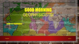
- 1. GOOD MORNING GEOPHYSICISTS! • KNOW THY BOUNDARIES! 8/23/2015FTWIGANJR.
- 5. ACTIVITY Converging Continental Plate and Oceanic Plate 8/23/2015FTWIGANJR.
- 6. What type of plate is Plate A? What about Plate B? Why did you say so? ANSWER: Plate A is an oceanic plate because it is relatively thinner compared to Plate B. While Plate B is a continental plate because it is thicker and floats higher than the other plate. Describe what happens to Plate A as it collides with Plate B? ANSWER: Plate A bends downward because Plate A is denser than Plate B. 8/23/2015FTWIGANJR.
- 7. What do you think will happen to the leading edge of Plate A as it continues to move downward? Why? ANSWER: The leading edge of Plate A will start to melt because the temperature beneath the crust (mantle) is higher. What do you call the molten material? ANSWER: This molten material is called magma. 8/23/2015FTWIGANJR.
- 8. What is formed on top of Plate B? ANSWER: Volcanoes are formed on top of Plate B. As the plates continue to grind against each other , what other geologic event could take place? ANSWER: Earthquake could take place as the plates continue to grind each other. 8/23/2015FTWIGANJR.
- 9. THREE BASIC TYPES OF PLATE BOUNDARIES USGS Graphics 1. CONVERGENT BOUNDARY is where plates collide and one subducts beneath the other is characterized by volcanic activities and earthquake - a process by which one lithospheric plate descends beneath another
- 10. EFFECTS OF PLATE COLLISION 1. Continental Arc Trench System -develops where oceanic plate subducts beneath a plate with continental crust at its leading edge. - Andesitic - e.g. Peru-Chile Trench 8/23/2015FTWIGANJR.
- 13. ACTIVITY Convergence of Two Oceanic Plates 8/23/2015FTWIGANJR.
- 14. Q21. What are the geologic processes/events that will occur because of this plate movement? ANSWER: Subduction Earthquakes Trenches Volcanoes. Q22. What geologic features might form at the surface of Plate A? ANSWER: Volcanoes might form at the surface of Plate A. 8/23/2015FTWIGANJR.
- 15. Q23. If the edge of Plate A suddenly flicks upward, a large amount of water may be displaced. What could be formed at the surface of the ocean? ANSWER: Tsunami or Tidal wave 8/23/2015FTWIGANJR.
- 16. EFFECTS OF PLATE COLLISION 2. Island Arc Trench System -develops where oceanic plate subducts beneath a plate with oceanic crust at its leading edge and a continent trailing some distance behind - basaltic 8/23/2015FTWIGANJR.
- 21. ACTIVITY Convergence of Two Continental Plates 8/23/2015FTWIGANJR.
- 22. Q24. What happened to the strips of clay as they were pushed from opposite ends? ANSWER: The strips of clay buckled upward. Q25. If the strips of clay represent the Earth’s Lithosphere, what do you think is formed in the lithosphere? ANSWER: Mountains are formed in the lithosphere. 8/23/2015FTWIGANJR.
- 23. Q26. What other geologic event could take place with this type of plate movement aside from your answer in Q25? ANSWER: Earthquake will occur due to the collision of two plates Q27. In terms of consequences on the Earths lithosphere, how will you differentiate this type of convergent plate boundary with the other two? ANSWER: Mountains are formed instead of volcanoes because there is no subduction 8/23/2015FTWIGANJR.
- 24. EFFECTS OF PLATE COLLISION 3. Continental Mountain System -develops where two continental plates collide, the surface expression will be a mountain range composed of the folded sedimentary rocks derived from sediments deposited in the sea that previously separated the continental blocks. - a process in which one lithospheric plate stays at the same leveland another plate overrides it
- 28. Q28. What are common in the four pictures? ANSWER: All four pictures show a fissure or a crack between two land masses Q29. What do you think is happening to the Earth’s crust in those pictures? ANSWER: The land masses are moving away from each other 8/23/2015FTWIGANJR.
- 29. Q30. If this event continues for millions of years, what do you think will be the effect on the crust? ANSWER: The distance between the land masses will be far greater than that what is shown in the picture. Q31. Complete the drawing below to illustrate your answer in question number 30. ANSWER:
- 30. THREE BASIC TYPES OF PLATE BOUNDARIES USGS Graphics 2. DIVERGENT BOUNDARY is where plates move apart at the midocean ridges and create new lithosphere/new crust by magma pushing up from the mantle forms submarine mountain range or midoceanic ridge where fissure eruptions of basaltic volcanoes, shallow earthquake activity, creation of ocean floor, and widening of ocean basin occur.
- 32. RED SEA / E. AFRICAN RIFT 8/23/2015FTWIGANJR.
- 33. CONTINENTAL DIVERGENT BOUNDARY: BAJA CALIFORNIA 8/23/2015FTWIGANJR.
- 35. THREE BASIC TYPES OF PLATE BOUNDARIES USGS Graphics 3. TRANSFORM FAULT BOUNDARY is where plates move or slide past one another. is also called conservative boundary. ~ faults neither create nor destroy lithosphere
- 38. Performance Task: Per group or Per individual
- 39. HAWAIIAN ISLANDS What give rise to HAWAIIAN ISLANDS?
- 40. ACTIVITY Drop it Like It’s “Hot Spot” 8/23/2015FTWIGANJR.
- 41. Q36. What can you see on the surface of the bond paper? ANSWER: The surface of the paper, which is directly in contact with the test tube became wet. Q37. Let’s say that the paper represents the Earth’s crust; what do you think is represented by the water in the test tube? ANSWER: Magma from the mantle is represented by the water in the test tube 8/23/2015FTWIGANJR.
- 42. Q38. What geologic features do you think will be formed at the surfaceof the crust? ANSWER: Volcanoes will be formed. Q39. Which of the features, at the surface of the crust, will be the oldest? the youngest? Label these on your paper. ANSWER: The oldest volcano will be the first one that developed while the youngest volcano is the last one that was formed 8/23/2015FTWIGANJR.
- 43. Q40. Which of the features will be the most active? The least active? Label these on your paper. ANSWER: The most active volcano is the youngest one (the one that is currently on top of the magma source). While the least acive volcano is the oldest (because it is already cut-off from the source of magma) 8/23/2015FTWIGANJR.
- 44. HOT SPOT - known as a magma chamber, it is located in the the mantle. - Is an area in the mantle from which hot materials rise as a thermal plume.
- 46. The plate then moves. Notice the volcano moves with the plate, but the hotspot stays were it was.
- 51. HOTSPOT: HAWAII
- 52. ACTIVITY Find the Center Bring the following: drawing compass ruler 8/23/2015FTWIGANJR.
- 53. Q1: Where is the epicenter of this hypothetical earthquake? ANSWER: Cebu City Q2. What difficulty will you encounter if you only have data from two recording stations? ANSWER: Assuming that the two circles will intersect, the circles will intersect at two points. Therefore, there will be two locations that could possibly be the epicenter. 8/23/2015FTWIGANJR.
- 54. Q3. What is the distance of the epicenter from the seismic station? ANSWER: 9000km Q4. What do you think is the importance of determining the epicenter of an earthquake? ANSWER: Locating earthquake epicenters will pinpoint which fault lines are active. Usually, the less active fault line stores great amount of potential energy that could cause major earthquake once released. Therefore, places near fault lines that remain inactive for a long period of time are due to experience a major earthquake. 8/23/2015FTWIGANJR.
- 56. TRIANGULATION METHOD ~ is used to determine the exact location of the epicenter. ~ a method that involves taking seismographic measurements from at least three separate seismic stations. 8/23/2015FTWIGANJR.
- 59. END OF THE LESSON 8/23/2015FTWIGANJR.