Basic Civil Engineering first year Notes- Chapter 4 Building.pptx
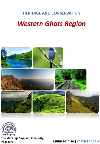
Western ghats region report
1. HERITAGE AND CONSERVATION
The Maharaja Sayajirao University,
Vadodara MURP’2014-16 | PARTH SADARIA
Western Ghats Region
2. Contents
• Introduction
• Parameters for delineation of region
• Biospheres
• Councils & Programs
• Five Year Plans
• Land Use change & Polices
• Planning of ESA’s in Western Ghats: WGEEP
• Impacts
• Impacts of Global Warming on Western Ghats
• Current Schemes (2011-12)-WGDP
• Intensification of Forest Management
3. Introduction
• What is natural conservation?
• Biodiversity
• Biodiversity is the degree of variation of life forms within a
given ecosystem, biome, or an entire planet. It is a measure of
the health of ecosystems. It is in part a function of climate
(Natural Heritage).
• Species, Ecosystem and Genetic Diversity.
• Western Ghats region
• The Western Ghats Hill Ranges run to a length of about 1600 Kms.,
more or less parallel to the west coast of Maharashtra starting from the
mouth of river Tapti in Dhule district of Maharashtra and ending at
Kanyakumari, the southern-most tip of India in Tamil Nadu.
• Activities that aim to protect the natural environment and reduce
or limit the impacts of human activity towards it
• Intrinsic value of nature
• Environmental problems are caused by human exploitation
• We are ethically obliged to protect the environment
SOURCE :planning commission,moef
• Their positioning makes the Western Ghats biologically rich and
biogeographically unique-a veritable treasure house of biodiversity.
• Though covering an area of 1,80,000 square kilometres, or just under
6% of the land area of India, the Western Ghats contain more than
30% of all plant, fish, flora-fauna, bird, and mammal species found in
India.
• Many species are endemic, such as the Nilgiri tahr (Hemitragus
hylocrius) and the Lion-tailed macaque (Macaca silenus), in fact 50%
of India’s amphibians and 67% of fish species are endemic to this
region.
• Western ghat form the catchment area for complex
riverine drainage systems that drain almost 40% of
India.
• The area is one of the world’s ten "Hottest
biodiversity hotspots" and has over 5000 species of
flowering plants, 139 mammal species, 508 bird
species and 179 amphibian species, many
undiscovered species lives in the Western Ghats.
4. Parameters for delineation of region
• Areas: Maharshtra, Karnataka, Kerala and Tamil Nadu;
Satpura Range, Sahyadhri,
Servarayan range, Tirumala range, Nilagiri malai
range.
• The northern portion of the narrow coastal plain
between the Western Ghats and the Arabian Sea is
known as the Konkan Coast or simply Konkan.
• the central portion is called Kanara and the southern
portion is called Malabar region or the Malabar
Coast.
• The foothill region east of the Ghats in Maharashtra
is known as Desh, The largest city within the
mountains is the city of Pune (Poona), in the Desh
region on the eastern edge of the range.
• The area is ecologically sensitive to development and
was declared an ecological hotspot in 1988 through
the efforts of ecologist Norman Myers.
5. Biospheres
• Many National Parks were initially
Wildlife Sanctuaries.
• The Nilgiri Biosphere Reserve comprising
5500 km² of the evergreen forests of
Nagarahole, deciduous forests of Bandipur
National Park and Nugu in Karnataka and
adjoining regions of Wayanad and
Mudumalai National Park in the states of
Kerala and Tamil Nadu forms the largest
contiguous protected area in the Western
Ghats.
• The Western Ghats in Kerala is home to
numerous serene hill stations like Munnar,
Ponmudi and Waynad.
• The Silent Valley National Park in Kerala is
among the last tracts of virgin tropical
evergreen forest in India.
• Agasthyamalai Biosphere Reserve
comprising 1828 km² of
Neyyar, Peppara and Shenduruny Wildlife
Sanctuary and their adjoining areas.
• The GOI established many protected areas including 2 biosphere reserves,
13 National parks to restrict human access, several wildlife sanctuaries to
protect specific endangered species and many Reserve Forests, which are
all managed by the forest departments of their respective state to
preserve some of the eco-regions still undeveloped.
6. Five Year Plans
• The Fifth Plan (1974–1979) - Beneficiary oriented. Activities such as
horticulture, plantation, afforestation, minor irrigation, animal husbandry and
tourism.
• The Sixth Plan(1980–1985) - balance in emphasis between beneficiary
oriented and infrastructural development schemes, keeping in view the vital
importance of ecological restoration and conservation.
• The Seventh Plan(1985–1990) - Maintenance of ecological balance essential
for the life support system. Preservation of the genetic diversity. Restoration of
the ecological damage caused by human interactions. Creation of awareness
among the people and educating them on the far-reaching implications of
ecological degradation and securing their active participation for the eco-
development schemes.
• The Eighth Plan(1992–1997) - Taking up integrated development programmes
on compact watershed basis keeping in view the overriding priorities of eco-
development and eco-restoration as well as the basic needs of the hill people
like food, fodder, fuel and safe drinking water. Efforts would be made to adopt
a sub-plan approach in the WGDP.
Councils & Programs
• Convention on International Trade in Endangered Species of Wild Fauna
and Flora (CITES)
• Ministry of Environment and Forestry (MoEF)
• International Union for Conservation of Nature( IUCN)
• Intensification of Forest Management (IFM)
• Western Ghats Development Program (WGDP)
• Western Ghats Ecology Expert Panel (WGEEP)
• Critical Ecosystem Partnership Fund (CEPF)
• Ashoka Trust for Research in Ecology & Environment (ATREE)
• Ecologically Sensitive Area (ESA)
• Special Central Assistance (SCA)
7. Land Use change & Polices
Forest Cover:
• Forest cover between 1973 and 1995 in the
southern part of the Western Ghats using
satellite data. The study area(Karnataka,
Kerala and Tamil Nadu) of approximately
40,000 sq.km showed a loss of 25.6% in
forest cover over 22 years.
• The dense forest was reduced by 19.5% and
open forest decreased by 33.2%. As a
consequence, degraded forest increased by
26.64%.
• There has been a great deal of spatial
variability in the pattern of forest loss and
land use change throughout the region. Our
estimates of deforestation in the region for
the contemporary period are the highest
reported so far.
1975
1995
8. Planning of ESA’s in Western Ghats: WGEEP
Objective:
• Demarcate areas of the Western Ghats to be notified as Ecologically
Sensitive.
• This will require identifying of landscape elements with clearly defined
norms of land use management.
• Thus the proposed ESAs would have to be categorized into different types,
as their sensitivity levels and patterns vary across the Ghats.
• Two basic issues need to be considered:
• Existing ESAs: There are already notified ESAs supported by the MOEF and
the judiciary.
1. Protected Areas
2. ESAs around Protected Areas
3. Hill-station ESAs
• Proposed ESAs: There are equally and even more biologically valuable
potential ESAs that must be categorised into different types for area specific
management.
1. Areas Proposed but not Notified as ESAs
2. Reserve Forests and Closed Canopy Forests
3. Water Bodies
4. Sacred Groves
5. Specialized Ecosystems
6. Species Based ESAs
• The Protected Areas have already been prioritized based on their legal
status into National Parks, Wildlife Sanctuaries and recently newly
suggested as Community Reserves.
• There are two other useful data sources that are used to plan effective
ESAs:
•Planning a Wildlife Protected Area Network
•Management of National Parks and Sanctuaries
• ESAs around Protected Areas:
• Currently the Ministry of Environment and Forest (MOEF) has mandated
that a 10 km buffer zone around the Protected Areas should be notified
as an ecologically sensitive area.
• However, this ruling has been repeatedly violated around the PAs of the
Northern sector of the Western Ghats.
• There are 18 PAs within and at the periphery of the northern part of the
Ghats.
• The level of protection has been varied and fluctuating due to unclear
management and differences in the prior ownership of the land.
9. Mahableshwar-Panchgani Ecologically Sensitive Area: 237.28 sq km
• The Department of Environment, Maharashtra Government carried out a study
on the environmental status of the Mahabaleshwar plateau in 1982 and stated
if not checked now, the entire plateau may be destroyed within a decade and
rendered unfit for human habitation’.
• (MoEF) had gazette a preliminary notification inviting public objections and
suggestions for
the declaration of Pachmarhi as an Ecologically Sensitive Area. This was the
first hill station to be considered for
declaration as ‘ecologically fragile’.
Sahyadri Ecologically Sensitive Areas (SESA) 4200 sq km.
• In Karnataka in Maharashtra was suggested as an ESA in the Northern Western
Ghats.
• This was first proposed by the National Committee for the Protection of Natural
Resources on June 21, 1999.
Matheran Ecologically Sensitive Areas 214.73 sq km
• It was constituted as an ESA in 2003.
• 200 m buffer zone and consists of the area of the Matheran Municipal Council
and its environs.
10. Acts: Suggestions
THE INDIAN FOREST ACT,
1927 ON RESERVED
FORESTS
The limits of ESAs can
be decided using Geo-informatics to study vegetation,
slope, hydrology etc.
MAHARASHTRA
REGIONAL AND
TOWN PLANNING ACT
1966
Areas that contain high biological values and are
ecologically
fragile are NOT suitable for township development.
Thus most of the western ghats are not suitable for
developing such townships.
FOREST CONSERVATION
ACT, 1980
WITH 1988
AMENDMENTS
This section of the Forest Conservation Act must
be suitably modified and used for protecting ESAs
from further degradation. It should not be possible
for State Governments to remove the Ecologically
Sensitive Area status once it has been created on
good scientific grounds.
ENVIRONMENTAL
PROTECTION
ACT, 1986
The Environment (Protection) Rules, 1986 can
be suitably modified for Ecologically Sensitive Areas
WILDLIFE PROTECTION
ACT,
AMENDED 1993
‘Ecologically Sensitive Area’
be issued to provide a legal framework for Ecologically
Sensitive Areas under the Western Ghats Authority
whereby ESAs can be legally declared.
Impacts
INDUSTRY :
• Maharashtra’s MIDCs, adjacent to the Ghats. These centers are growing as a
consequence of easy access to cheap unskilled rural labor, water that comes
from the forested Ghats sector, energy, for example, the Pirangut Industrial
Estate.
• In Goa, the mining and tourism industries have severely impacted the integrity
of its ecologically diverse landscape elements.
• Mangrove ecosystems in Maharashtra are under heavy pressure as a result of
increase in human activity.
11. ROADS :
The need to link these two economic development zones (coastal zone and the
Deccan Plateau) has led to more roads traversing the Ghats section to move
goods and business services.
An example is the road that connects Pune from the Deccan Plateau to Mahad
on the coast via the Western Ghats in Mulshi Taluka of Pune district, effectively
fragmenting the forests of the Western Ghats in this region.
AGRICULTURE
• Has long been considered an ecological problem.
• Recently irrigated sugarcane based agriculture has replaced traditional
agriculture.
• Eco Sensitive Zone that has been converted to intensive agriculture.
• Factors such as effects of monocropping patterns and the use of fertilizers,
herbicides and pesticides can have serious implications on the biodiversity of
the adjacent PAs. This includes disruption of food chains where insects form
major link species as well as deranging their function of pollinating both forest
plants and crops.
TOURISM
• The tourist facilities on the boundaries of the PA have equally serious impacts
which create high levels of water pollution, large amounts of non-degradable
waste, noise, etc.
NEW TOWNSHIP
• Conversation of agriculture land
• No scientific development
• Neo-townships in the Western Ghats have the most deleterious consequences
for the integrity of the eco-sensitive slopes of the Western Ghats.
Impacts of Global Warming on Western Ghats
RISE
IN
TEMPERATURE
INCREASE IN
GREEN
HOUSE GASES
MELTING OF
ICE
SEA LEVEL
RISE
SINKING
COAST
TSUNAMI &
EARTHQUAKE
FLOOD
EXCESSIVE SUN
STROKE
LOSS OF
BIODIVERSITY
FOREST
FIRE
FOOD
SCARCITY
SPREAD OF
TROPICAL
DISEASES
12. Current Schemes (2011-12) - WGDP
• The objective of scheme is to conserve the forest area of the Western
Ghats except Nilgiris district. It is being implemented in Coimbatore,
Erode, Dindigul, Kanniyakumari, Madurai, Theni, Tirunelveli, Tiruppur and
Virudhunagar districts.
• Fire prevention works, soil and moisture conservation works, anti-
poaching measures and solar fencing are some of the major activities
carried out under this scheme.
• During 2010-2011, an amount of Rs. 2.70 crore has been spent under this
scheme. In Dindigul, Madurai and Theni districts, the scheme has been
implemented at a cost of Rs.1.82 crore through the Tamil Nadu Watershed
Development Agency fund. It is proposed to implement this scheme
during 2011-2012 with an outlay of Rs.3.10 crore.
Intensification of Forest Management
• Integrated Forest Protection Scheme aimed at protecting the forest
resource by strengthening protection measures to control forest fires,
survey and demarcation of forest boundaries to prevent encroachment by
construction of cairns, carrying out fire prevention works, improvement of
roads for better protection, provision of better communication facilities,
preparation of working plans for scientific management of forest divisions
etc.
• With a view to make the Integrated Forest Protection Scheme more broad
based, Government of India revised and renamed this scheme as
"Intensification of Forest Management". In addition to the above
components, four new components have been added in the existing scheme,
which are as follows:
• Protection and Conservation of Sacred Groves.
• Conservation and Restoration of Unique Vegetation and Ecosystems.
• Control and Eradication of Forest Invasive species.
• Preparedness for Meeting Challenges of Bamboo Flowering and Improving
management of Bamboo forests.