
Empfohlen
Empfohlen
Weitere ähnliche Inhalte
Was ist angesagt?
Was ist angesagt? (20)
Andere mochten auch
Ähnlich wie Natural Flood Projects on River Uck
Ähnlich wie Natural Flood Projects on River Uck (20)
Mehr von objectiveassociates
Kürzlich hochgeladen
Kürzlich hochgeladen (20)
Natural Flood Projects on River Uck
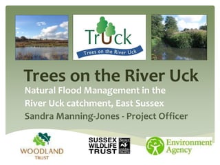
- 1. Trees on the River Uck Natural Flood Management in the River Uck catchment, East Sussex Sandra Manning-Jones - Project Officer
- 2. Need for Change in Approach • Historic management including deepening and straightening – loss of river habitats and species. • Post war increased mechanisation of agricultural practices – demand for increased yield – land drainage. • Widespread loss of floodplain woodland. • Removal of hedgerows (est. loss of 200,000km). • Widespread loss of floodplain meadows. • Reduction in biodiversity – ecosystem services. • Deeply incised river channel. • Increases ‘flashy’ river characteristics. • Led to Water Framework Directive 2000 – the Catchment approach.
- 3. • Historic issues with flooding in Uckfield, East Sussex. • River flooding: 2000. Surface water flooding: 2007 + 2010. • Hard engineered solutions not cost effective or viable. • WFD waterbody failures. • Need for work led by Uckfield Flood forums and locals; catchment model produced by Durham University Phd student using OVERFLOW. • TrUck pilot project partnership formed in May 2012 between: • Woodland Trust - Sussex Wildlife - Environment Agency. All providing different support. • Aims and Objectives: • Investigate and employ Natural Flood Management approach to reduce flood issues in Uckfield. Meet WFD objectives. Inform and engage local landowners and stakeholders around the flooding and river health. About us
- 4. Adur and Ouse Catchment Partnership The Sussex Ouse WFD Projects Flooding Species and Habitats Water Quality TrUck (Trees on the River Uck) Woodland Trust / Sussex Wildlife Trust / Environment Agency MORPH (Middle Ouse Restoration of Physical Habitats) Ouse and Adur Rivers Trust / Environment Agency OUT (Ouse Upstream Thinking) South East Water / Environment Agency
- 5. Natural Flood Management • Range of tools to help slow and store water. • Multiple benefits: River health/wildlife/flood mitigation. • Work with the landscape and natural processes. • Use natural, local materials. • Low installation costs – easy to remove. • One of range of measures – not suited to all locations. • On the floodplain: • Increasing ‘roughness’ (resistance to flood flow): • Floodplain woodland - stores and delays water, increases infiltration to ground, leaf litter acts as sponge for water. • Hedgerows – slow surface water runoff (upto 67%). • Restoring connectivity between river and floodplain: • Large Woody Dams – encouraging out of bank flow in low impact locations (good for river health. Designed to allow fish movement and pinned in place). • Increasing flood spread and storage: • Washlands (can be managed as hay meadows) – encouraged to hold water temporarily and slowly drain.
- 6. • Targeted woodland and hedgerow planting – surface water flow. • Sustainable Urban Drainage Systems (SUDS): • Permeable paving. • Rain gardens. • Water efficiency measures. • Increasing water storage: • Scrapes + ponds. • contour bunds and planting + other Runoff Attenuation Features (RAFs). • Increasing water storage in existing woodlands in under high flow. Benefits for wildlife and river health, meeting WFD objectives. Wider Catchment Measures
- 7. The River Uck sub-catchment • Located in East Sussex, South East England. • Sub-catchment of the River Ouse covering 105km². • Over 200km of rivers and streams. • Some designated sites and priority habitats (High Weald AONB). • Some arable, but predominantly grazing. • Changes in land management: wide scale use of field drains and ditches, urban and farming floodplain development.. • ‘flashy’ catchment – it responds rapidly to rainfall.
- 8. • Major river flooding in Uckfield in 2000. • Urban flooding – surface water runoff. • Town centre ‘flash floods’ in 2007 + 2010. • Soils and topography contribute to flooding. • Weakly permeable clay – water retentive. • Greensand seams issue water under high ground water. • Rapid runoff – steep headwaters with gill woodland. • Town design and floodplain development. • Town centre receives water from an area of 73km². • Channel capacity 60-70 cumecs (over 130 cumecs recorded at Isfield in 2000). Flooding in the Uck
- 9. • Steeper in northern section. • 8 tributary streams – different watershed sizes. River Uck Landscape
- 10. • Project sought to apply outcomes of River Uck OVERFLOW model – new hydrological model by Nick Odoni (Durham University). • Benefits: • Simplified temporal, hydrological model – calibrated to 2000 storm hydrograph. • Allows analysis of flood impacts of NFM measures when added to different locations – and combinations of locations. • Issues: • Phd project – creators now moved on. • Top 20 locations provided – ground truthing – not possible to re-run. Putting Theory into Practice
- 11. Building the Evidence Digital Mapping and Modelling Local knowledge and considerations Data analysis and reporting Site Work + Recommendations Landowner + stakeholder engagement Environmental and Technical data Research and Evidence Dissemination of messages and lessons
- 12. • Lots of existing work – Sussex Wildlife Trust / Sussex Biodiversity Record Centre.
- 13. Uck woodland • Total of 23% woodland cover. • 58% of which is considered to be Ancient Woodland. • Much reduced cover in the flood zone 53ha (12% of EA flood zone 2).
- 14. • Digital mapping software used to identify areas to avoid, and areas that could have potential. • Backwater buffers around urban areas, roads, bridges etc. • <70ha upstream of Uckfield. • Further modelling work underway. • Monitoring: • Difficulties with timescales. • Working on technical documents for baseline. • Reports…
- 15. OART River Habitat Survey Uck Catchment Good and Bad habitats Non Native Invasive Species University of Sussex Ouse Project, Gill Woodlands. Margaret Pilkington
- 16. Delivery • Working with landowners across the catchment in key areas. • Creation of new floodplain and other woodland (<3ha). • Hedgerows planted <1.5km • Increasing woodland water storage. • Large Woody Dam trial. • Further plans to extend these ideas. • Plans for combination of approaches (planting, contour bunds, LWD etc) over large estate within key site. • Continued engagement with key local landowners through targeted workshops.
- 17. Challenges • Time lag related with some NFM – woodland takes 20+years to become functional. • No land directly tied to project. • Landowners: • Takes time for landowners to take on board ideas and build trust. • “Why should upstream landowners help those downstream?” • Demand for yield in difficult market. • Lack of land grants for large schemes…NELMS? • Amenable landowners not always in a prime site. Have little control over landowners instating changes that may be in ‘negative’ areas. • Monitoring outcomes very difficult due to timescales. • Need more detailed landscape and river data – and easy access to exisiting datasets. • Multiple variables and stakeholders. • Limited funding for projects. • Short project timescales – need for rapid results.
- 18. The Future • Growing interest in project and NFM approach. • Some further funding in place for next year – need more to extend timescales. • Continue to work in Uck using targeted engagement – investigating potential in wider Ouse. • Greater focus on SUDs and urban flooding. • Monitoring and analysing data. • Reports and recommendations. • Planting planned next season in key locations. • Events and workshops. • Working with universities and others…
- 19. • www.treesontheriveruck.org.uk • Trees on the River Uck • Project officer: Sandra Manning-Jones • Tel: 07795 116880 • Email: sandramanningjones@gmail.com Contact us!
- 20. Flood flows Multiple Variables Water abstraction Historic land management Vegetation cover Designated sites Urban areas Geology and soils Ground water Landowners Rainfall River users Landuse Channel characteristics Water provision Environmental Flow Water discharges (STW) Climate change Ecosystem Services Farm objectives Habitats and Species Wider publicStakeholders WFD + other legislation Partner organisations