Taganito Hydrometallurgical Processing Plant Project - Environmental Impact Statement
•
2 gefällt mir•8,973 views

Taganito Hydrometallurgical Processing Plant Project Environmental Impact Statement Taganito Mining Corporation Document No.: R08-014 July 2008 pages 1-251

Empfohlen
Weitere ähnliche Inhalte
Was ist angesagt?
Was ist angesagt? (20)
Mehr von No to mining in Palawan
Mehr von No to mining in Palawan (20)
Kürzlich hochgeladen
Kürzlich hochgeladen (20)
Taganito Hydrometallurgical Processing Plant Project - Environmental Impact Statement
- 1. Taganito Hydrometallurgical Processing Plant Project Environmental Impact Statement Taganito Mining Corporation Document No.: R08-014 July 2008
- 2. Environmental Impact Statement R08-014 Prepared for Taganito Mining Corporation Prepared by Maunsell Philippines Inc 11/F Ayala Life - FGU Center, 6811 Ayala Avenue, Makati City, Philippines T +632 843 6336 F +632 843 6125 www.maunsell.com 21 July 2008 51050307 © Maunsell Philippines Inc 2008 The information contained in this document produced by Maunsell Philippines Inc is solely for the use of the Client identified on the cover sheet for the purpose for which it has been prepared and Maunsell Philippines Inc undertakes no duty to or accepts any responsibility to any third party who may rely upon this document. All rights reserved. No section or element of this document may be removed from this document, reproduced, electronically stored or transmitted in any form without the written permission of Maunsell Philippines Inc. Taganito Hydrometallurgical Processing Plant Project Environmental Impact Statement J:5105030701_Administration007_ReportsEIARev 4Rev4. Chapter 1&2 Basic Project Info.21Jul08.doc Revision 4 21 July 2008
- 3. Quality Information Document Environmental Impact Statement Ref 51050307 Date 21 July 2008 Prepared by Maunsell Environmental Study Team Reviewed by Naniel V. Aragones / Jess P. Bayrante / Jo Rowena Garcia Revision History Authorised Revision Revision Date Details Name/Position Signature 0 09/04/2008 Preliminary Issue Jess P. Bayrante Associate Director - Environment 1 18/04/2008 With TMC’s comments Jess P. Bayrante Associate Director - Environment 2 21/04/2008 For EIARC review Jess P. Bayrante Associate Director - Environment 3 28 May 2008 Additional Information Jess P. Bayrante Associate Director - Environment 4 21 July 2008 Final EIS Jess P. Bayrante Associate Director - Environment Taganito Hydrometallurgical Processing Plant Project Environmental Impact Statement J:5105030701_Administration007_ReportsEIARev 4Rev4. Chapter 1&2 Basic Project Info.21Jul08.doc Revision 4 21 July 2008
- 4. Table of Contents Project Fact Sheet i Executive Summary iv 1.0 Basic Project Information 1-1 2.0 Description of the Project’ EIA Process s 2-1 2.1 Terms of Reference of the EIA Study 2-1 2.2 The EIA Team 2-1 2.3 EIA Study Schedule 2-2 2.4 EIA Study Area 2-3 2.5 EIA Methodology 2-3 2.6 Public Participation 2-3 3.0 Project Description 3-1 3.1 Project Location and Area 3-1 3.2 Project Rationale 3-2 3.3 Project Alternatives 3-2 3.4 Project Components 3-5 3.4.1 Hydrometallurgical Processing Plant (HPP) and Associated Facilities 3-9 3.4.2 Auxiliary Facilities 3-22 3.5 Description of Project Phases 3-31 3.5.1 Pre-construction/Pre-operational Phase 3-31 3.5.2 Construction/Development Phase 3-32 3.5.3 Operational Phase 3-32 3.5.4 Abandonment Phase 3-32 3.6 Project Wastes and Built-in Management Measures 3-33 3.7 Manpower Requirements 3-36 3.8 Project Cost 3-36 3.9 Project Duration and Schedule 3-36 4.0 Baseline Environmental Conditions, Impact Assessment and Mitigation 4-1 4.1 The Land 4-1 4.1.1 Land Use and Classification 4-1 4.1.2 Geology and Geomorphology 4-2 4.1.3 Geohazard Analysis 4-7 4.1.4 Terrestrial Flora 4-13 4.1.5 Terrestrial Fauna 4-20 4.2 The Water 4-26 4.2.1 Hydrology and Hydrogeology 4-26 4.2.2 Key Impacts and Mitigating Measures 4-34 4.2.3 Oceanography 4-40 4.2.4 Key Impacts and Mitigating Measures 4-47 4.2.5 Sediment Transport 4-47 4.2.6 Water Quality 4-47 4.2.7 Sediment Quality 4-58 4.2.8 Key Impacts and Mitigating Measures 4-59 4.2.9 Freshwater Biology 4-59 4.2.10 Key Impacts and Mitigating Measures 4-66 4.2.11 Marine Biology 4-66 4.2.12 Key Impacts and Mitigating Measures 4-87 4.3 The Air 4-88 4.3.1 Meteorology 4-88 Taganito Hydrometallurgical Processing Plant Project Environmental Impact Statement J:5105030701_Administration007_ReportsEIARev 4Rev4. Chapter 1&2 Basic Project Info.21Jul08.doc Revision 4 21 July 2008
- 5. 4.3.2 Ambient Air Quality and Noise 4-89 4.3.3 Key Impacts and Mitigating Measures 4-99 4.4 The People 4-107 4.4.1 Demographic Data 4-107 4.4.2 Household Survey 4-109 4.4.3 Key Socio-Economic Conditions 4-110 4.4.4 Community Perception and Social Acceptability 4-112 4.4.5 Project Awareness 4-113 4.4.6 Indigenous People 4-114 4.4.7 Key Impact and Mitigating Measures 4-118 4.4.8 Public Health 4-123 4.4.9 Key Impacts and Mitigating Measures 4-125 5.0 Preliminary Risk Assessment 5-1 5.1 General Risk Assessment 5-1 5.1.1 Conceptual Framework, Approach and Methodology 5-1 5.1.2 Hazard Identification 5-2 5.1.3 Risk Analysis 5-2 5.1.4 Hazard Analysis 5-2 5.1.5 Consequence Analysis 5-6 5.1.6 Frequency Analysis 5-7 5.1.7 Estimation of Risk 5-7 5.1.8 Risk Assessment 5-8 5.2 Environmental Risk Management Plan 5-8 5.2.1 Emergency Response Policy and General Measures 5-8 6.0 Environmental Management Plan 6-1 6.1 Impacts Management Plan 6-1 6.2 Social Development Framework 6-11 6.3 IEC Framework 6-13 6.4 Abandonment/Decommissioning/Rehabilitation Policies 6-16 6.5 Environmental Monitoring Plan 6-16 6.5.1 Self Monitoring Plan 6-16 6.5.2 Multi-Sectoral Monitoring Framework 6-24 6.5.3 Environmental Guarantee and Monitoring Fund Commitment 6-24 6.5.4 Institutional Plan for EMP Implementation 6-24 7.0 References 7-1 Taganito Hydrometallurgical Processing Plant Project Environmental Impact Statement J:5105030701_Administration007_ReportsEIARev 4Rev4. Chapter 1&2 Basic Project Info.21Jul08.doc Revision 4 21 July 2008
- 6. List of Figures 1.0-1 Location Map and Site Development Plan of the Proposed Taganito HPP Project 3.1-1 Project Location Map 3.1-2 Map of Primary Impact Areas 3.1-3 Map of Secondary Project Impact Areas 3.4-1 Taganito HPP Project Site Development Plant 3.4.1-1 Process Flow Chart 3.4.1-2 Material Balance Diagram of the Taganito HPP (for 30kT-Ni as MS + 15kT-Ni as Hydroxide) 3.4.1-3 Water Balance Diagram of the Taganito HPP Project 3.4.2-1 Conceptual Lay-out Plan of the Wharf 3.4.2-2 Proposed Alignment of the Wharf 3.4.2-3 Sectional Views of the Wharf 4.1.2-1 Regional Geologic Map of Mindanao 4.1.2-2 Geologic Cross-sections 4.1.2-3 Soil Fertility Sampling Points 4.1.3-1 Slope map for the Taganito Mines Project area 4.1.3-1 Distribution Map of the Philippines, PHIVOLCS 2000 4.1.3-2 Active Faults Distribution Map of the Philippines, PHIVOLCS 2000 4.1.4-1 Figure Location of the vegetation sampling quadrats 4.1.5-1 Location of the wildlife sampling sites 4.2.1-1 Map showing the Location of the PAGASA Statios (with MAR in mm) Relative to the Taganito Mines Project Area 4.2.1-2 Map showing the Location of the Hydrology Sampling Stations 4.2.1-9 Composite Plot of Annual, Cumulative Annual and Monthly Maximum, Mean and Minimum Rainfall – Mine Site Station 4.2.1-10 Map Showing the Proposed Facilities and Developments in the Different River Basins 4.2.1-11 Calculated Flow Duration Curve at the Proposed Diversion Weir in the Taganito River 4.2.1-12 Calculated Flow Duration Curve at the Proposed Diversion Weir in the Daang Suba River 4.2.1-13 Comparative Flow Duration Curve of Taganito River Under Existing Condition and With Tailings Dam and Diversion Weir (Encircled Ordinates are 0.1 or 10 year and 0.01 or 100- year Exceedance) 4.2.1-14 Comparative Flow Duration Curve of Hayanggabon River Under Existing Condition and With Tailings Dam (Encircled Ordinates are 0.1 or 10-year and 0.01 or 100-year Exceedance 4.2.3-1 Map showing the study area 4.2.3-2 Bathymetry of study area. Contour lines in meters 4.2.3-3 Map showing station locations covered during the field survey 4.2.3-4 Map showing the model domain overlaid by bathymetry in meters 4.2.3-5 Vertical profiles of salinity and temperature 4.2.3-6 Surface current. From drogue measurements 4.2.3-7 Simulated surface current in January (top) and August (bottom) 4.2.3-8 Vertically averaged current in January (top) and August (bottom) simulated by POM 4.2.3-9 Modeled tidal velocities during ebb (left) and flood (right) conditions (from Villanoy and Magno, 2006) 4.2.6-1 Location Map of Water Quality Sampling Stations Taganito Hydrometallurgical Processing Plant Project Environmental Impact Statement J:5105030701_Administration007_ReportsEIARev 4Rev4. Chapter 1&2 Basic Project Info.21Jul08.doc Revision 4 21 July 2008
- 7. 4.2.6-2 Supplementary coastal water quality sampling stations in the coastal waters of Taganito, Carascal Bay, and Canal Bay. The white rectangular outline depicts the area shown in Figure 4.2.6-3. 4.2.6-3 Supplementary coastal water quality sampling stations in the coastal waters of Taganito 4.2.6-4 Cadmium levels in the coastal waters of Taganito, Canal Bay, and Carascal Bay 4.2.6-5 Copper levels in the coastal waters of Taganito, Canal Bay, and Carascal Bay 4.2.6-6 Pb levels in the coastal waters of Taganito, Canal Bay, and Carascal Bay 4.2.9-1 Counts of Aquatic Insect Groups 4.2.9-2 Counts and Number of Taxa of Aquatic Fauna from the Different Sampling Stations 4.2.11-1 Area covered by site reconnaissance of coastal waters 4.2.11-2 Location Map of Marine Sampling Stations 4.2.11-3 Total average densities of soft bottom benthos in the marine Environment of Taganito HPP Site, Surigao 4.2.11-4 Total estimated abundance of crustacean fauna in the marine environment of Taganito HPP Site, Surigao 4.2.11-5 Total estimated abundance of polychaetes in the marine environment of Taganito HPP Site, Surigao 4.2.11-6 Phytoplankton densities in 4 marine stations within the vicinity of Taganito, Surigao 4.2.11-7 Zooplankton densities in 4 marine stations within the vicinity of Taganito, Surigao 4.2.11-8 Zooplankton biomass in 4 marine stations within the vicinity of Taganito, Surigao 4.2.11-9 Shoot density of the different seagrass species recorded per station. Data presented are mean (±)standard error (SE). Hun: Halodule uninervis, Hovs: Halophila ovalis, Thal: halassia hemprichii, Cyro: Cymodocea rotundata, Syri: Syringdoium isoetifolium, Enha: Enhalus acoroides, and Cyse: Cymodocea serrulata 4.2.11-10 Total shoot density of the seagrasses in the different sites surveyed in Claver area. Data presented are mean (±) standard error (SE). 4.2.11-11 Above- (white shaded area) and below- (gray shade area) ground biomass allocation (g dry weight m-2) of the different seagrass species located in white sand (Site 1, A) and north (Site 2, B) of Aling Island, Urbiztondo (Site 4, C), and Taganito (Site 5, D). Data presented are mean ± standard error (SE) 4.2.11-12 Total biomass allocation of seagrasses in the different Sites surveyed around the municipality of Claver. White shaded portion: aboveground; gray shaded portion: belowground biomass. Data presented are mean ± standard error (SE) 4.3.2-1 Location of Air Quality Sampling Stations 4.3.3-1 Predicted 1-hour TSP Ground Level Concentration (ug/Ncm) TSP Highest Value of 94ug/Ncm vs DENR NAAQS of 300ug/Ncm 4.3.3-2 Predicted 1-hour SO2 Ground Level Concentration (ug/Ncm) SO2 Highest Value of 335ug/Ncm vs. DENR NAAQS of 340ug/Ncm 4.3.3-3 Predicted 1-hour NO2 Ground Level Concentration (ug/Ncm) NO2 highest value of 230ug/Ncm vs. DENR NAAQS of 260ug/Ncm 4.3.3-4 Predicted 24-hour TSP Ground Level Concentration (ug/Ncm) TSP Highest Value of 54ug/Ncm vs DENR NAAQGV of 230ug/Ncm 4.3.3-5 Predicted 24-hour SO2 Ground Level Concentration (ug/Ncm) SO2 Highest Value of 135ug/Ncm vs. DENR NAAQGV of 180ug/Ncm 4.3.3-6 Predicted 24-hour NO2 Ground Level Concentration (ug/Ncm) NO2 highest value of 92ug/Ncm vs. DENR NAAGQV of 150ug/Ncm 4.3.3-7 Predicted 30-min H2S Ground Level Concentration (ug/Ncm) H2S highest value of 3.7ug/Ncm vs. DENR NAAQS of 100ug/Ncm Taganito Hydrometallurgical Processing Plant Project Environmental Impact Statement J:5105030701_Administration007_ReportsEIARev 4Rev4. Chapter 1&2 Basic Project Info.21Jul08.doc Revision 4 21 July 2008
- 8. 4.3.3-8 Predicted 1-hour CO Ground Level Concentration (ug/Ncm) CO highest value of 28ug/Ncm vs. DENR NAAQGV of 35ug/Ncm 4.3.3-9 Predicted 8-hour CO Ground Level Concentration (ug/Ncm) CO highest value of 10ug/Ncm vs. DENR NAAQGV of 10ug/Ncm 4.4.1 Settlement Map of All Project-Affected Areas 5.1.1-1 Schematic Flow of Risk Assessment 6.5.1-1 Proposed Marine Monitoring Points 6.5.4-1 TMC Organizational Chart for EMP implementation List of Tables 2.1-1 List of Significant Issues Raised During the Scoping Meetings 2.2-1 The EIA Study Team 2.3-1 EIA Schedule of Activities 2.6-1 List of Public Consultations Conducted 3.4-1 Project Components and Location 3.4.1-1 Description of HPP Circuits 3.4.1-2 H2S Plant Specifications 3.4.1-3 Properties and Quality of Hydrogen Sulfide 3.4.2-1 Tailings Storage Facility Specifications 3.4.2-2 Total reserves of Limestone quarry 3.4.2-3 Stages of Quarrying Operation 3.4.2-4 Description of Materials Storage Facility 3.5.1-1 Project Permits 3.6-1 Potential Project Wastes 3.7-1 Breakdown of Personnel 3.9-1 Project Duration and Work Schedule 4.1.2-1 Geologic Units in the Project Site 4.1.2-2 Soil Fertility Sampling Point Details 4.1.2-3 Soil Properties 4.1.3.-1 Geohazards in relation to slopes 4.1.3-2 Geohazards, Impacts and Mitigation 4.1.3-3 Earthquake Distribution 4.1.3-4 Major Earthquake Generators and Ground Acceleration 4.1.4-1 Location of the sampling Quadrats 4.1.4-2 Species Richness of the Three Types of Vegetation Cover 4.1.4-3 List of the Species at the Open forest and their corresponding importance value (IV) 4.1.4-4 List of the species at the limestone forest and their corresponding importance value (IV) 4.1.4-5 List of the species at the brushland and their corresponding importance value (IV) 4.1.4-6 Diversity indices and number of species for each transect line 4.1.4-7 List of the Mindanao Island endemics recorded from the sampling quadrats 4.1.4-8 List of Species included in the National Red List 4.1.5-1 Locations of the wildlife sampling sites 4.1.5-2 List of noteworthy species in Brgys. Cagdianao, Hayanggabon, Taganito and Sapa 4.2.1-1 List of catchments and corresponding Project area/facility drained 4.2.1-2 Comparative summary of measured and simulated velocity and river flows Taganito Hydrometallurgical Processing Plant Project Environmental Impact Statement J:5105030701_Administration007_ReportsEIARev 4Rev4. Chapter 1&2 Basic Project Info.21Jul08.doc Revision 4 21 July 2008
- 9. 4.2.1-3 Summary of Changes and Runoff and groundwater recharge depths 4.2.6-1 Locations of the Surface Water Quality Sampling Stations 4.2.6-2 Location of the Groundwater quality sampling Stations 4.2.6-3 Location of the Marine and Coastal water Quality sampling Stations 4.2.9-1 Freshwater Benthos in the River Systems Collected by Kick Net 4.2.11-1 Benthic attributes for sites sampled off Barangays Taganito, Hayanggabon and Urbiztondo 4.2.11-2 Species list and counts per station of reef fishes off Taganito 4.2.11-3 List of commercial fishes landed in Hayanggabon 4.2.11-4 Average estimated density (number of individuals/m2 of soft bottom benthos in the marine environment of Taganito Nickel HPP Project, Surigao 4.2.11-5 Density and list of phytoplankton for each station in Taganito, Surigao 4.2.11-6 Density and list of zooplankton for each station in Taganito, Surigao 4.2.11-7 List of seaweed-associated species in seagrass meadows and their relative cover and frequency of occurrences in Claver 4.3.2-1 Air Quality and Noise sampling Stations 4.3.2-2 Methods of Noise Sampling and Air Analysis for SO2, NOx, TSP and PM-10 4.3.2-3 Results of 1-Hour Ambient Air Quality Monitoring 4.3.2-4 Results of 24-Hour Ambient Air Quality Monitoring 4.3.2-5 Air Quality Indices (Source: Annex A of DAO 2000-81) 4.3.2-6 Ambient Noise Levels 4.3.2-7 Philippine Ambient Noise Standards 4.4.1-1 Summary of Demographic Profile :Project-Affected Communities (PACs) 4.4.1-2 Power Supply and Demand 4.4.1-3 Water Supply and Demand 4.4.2-1 Key Features of Project-Affected Communities (PACs) 4.4.3-1 Summary of Basic Household Features of Project-Affected Communities (PACs) 4.4.3-2 Main Source of Income : Project-Affected Communities (PACs) 5.1.4-1 Hazard Materials Associated with the Project 5.1.4-2 Hazard Analysis Matrix 5.1.5-1 Results of External Consequence Computation 5.1.6-1 Results of Frequency Calculation 5.1.7-1 Results of Preliminary Risks Posed by the Project’s Operations 5.2.1-1 List of Equipments for Various Emergency Conditions 6.1-1 Summary of the various impacts and mitigation measures for the different project phases 6.2.1 The Social Development Framework 6.3-1 Information, Education and Communication (IEC) Plan/Framework 6.5-1 Environmental Monitoring Plan (EMoP) with Environmental Quality Performance Levels (EQPLs) List of Plates 3.4-1 Proposed location of HPP at the southern portion of Barangay Hayanggabon 3.4-2 Proposed location of HPP overlooking Telegrapo Island 3.4-3 Proposed location of the Ore preparation Circuit at the north western portion of the mine site called “Taga 2” 3.4-4 Proposed location of the Ore Preparation Circuit 3.4-5 Proposed location of the Ore Preparation Circuit Taganito Hydrometallurgical Processing Plant Project Environmental Impact Statement J:5105030701_Administration007_ReportsEIARev 4Rev4. Chapter 1&2 Basic Project Info.21Jul08.doc Revision 4 21 July 2008
- 10. 3.4-6 Proposed wharf berth located beside the existing wharf facility 3.4-7 Proposed location of the Quarry Site 3.4-8 Proposed Tailings Dam Site Quarry Site 4.1.4-1 The three general vegetation types in the development area: (a) open forest (at the initial stage of regeneration); (b) limestone forest; and (c) brushland) 4.1.6-1 Stands of woody fern observed in Site 1 4.1.6-2 Vegetation cover in Site 1 4.2.6-1 Station SW1 at taganito River. Brownish turbid waters were noted in the wet season in contrast with the clear waters observed during the dry season sampling. Runoff from exposed slopes upstream of the station contribute to the turbidity in the wet season. This station is located upstream of the proposed tailings dawm in Taganito River 4.2.6-2 The station drains an area of the watershed that is currently unaffected by mining operations. Waters during the dry and wet season sampling were noted to be clear. This is considered as a control station and will not be affected by the proposed HPP operations 4.2.6-3 Station SW3 at Taganito River. Brownish, turbid waters were noted in the wet season while clearer waters with a much lower stream flow was noted during the dry season. The station is downstream of an existing siltation pond. It will be downstream of the proposed tailings dam 4.2.6-4 Station SW4 at Taganito River. The station represents the confluence of Stations SW2 and SW3. Clear waters were noted in the dry season. Turbid waters noted in the wet season was due to the turbidity of station of SW2 4.2.6-5 Station SW5 at Taganito River. Slightly turbid waters and high flows were noted during the wet season. Runoff from banks such as that in the foreground primarily contributes to the turbidity. Lower flows and clearer waters were noted in the dry season 4.2.6-6 Station SW6 at Taganito River. High flow and turbid waters were noted during the wet season. Less turbid waters with lower flow was noted in the dry season. The site will be affected by the proposed tailings dam 4.2.6-7 Station SW7 at Tagnito River. Turbid waters were noted during the wet season as compared to the dry season. The site is situated upstream of the proposed tailings disposal dam 4.2.6-8 Station SW8 at Taganito River 4.2.6-9 Station SW9 at Hayanggabon River. Turbid waters were noted during the wet season sampling. The site will be affected by the proposed tailings dam in Hayanggabon River 4.2.6-10 Plate 4.2.6-10. Station SW10 at Hayanggabon River 4.2.6-11 Station SW11 at Sensio Creek. Clear waters were observed in the wet and dry seasons. Sensio Creek is the stream nearest the town site 4.2.6-12 Station SW12 at Magallanes River. The station is near the proposed quarry site 4.2.6-13 Station SW13 at Magallanes River. The station is near the proposed quarry site 4.2.6-14 Station SW14 at Sapa River 4.2.6.15 Station SW15 at Magallanes River. The station is downstream the proposed quarry site 4.2.9-1 The kicknet method of sampling 4.2.9-2 Sorting of aquatic fauna caught by kicknet 4.2.9-3 Brown coloration on riparian vegetation indicating water level during flooding after a heavy rainfall, and erosion of riverbanks at SW 4 4.2.9-4 Rocks at SW11 heavily covered with sediments 4.2.9-5 Station SW1 located in creek at the inlet of a siltation pond 4.2.9-6 Station SW2 located at Taganito River before SW 4 4.2.9-7 Station SW3 which feeds into Taganito River 4.2.9-8 Station SW4 which is downstream of Station 2 along Taganito River Taganito Hydrometallurgical Processing Plant Project Environmental Impact Statement J:5105030701_Administration007_ReportsEIARev 4Rev4. Chapter 1&2 Basic Project Info.21Jul08.doc Revision 4 21 July 2008
- 11. 4.2.9-9 Station SW5 located further downstream of Taganito River 4.2.9-10 Station SW6 located downstream of the discharge of a siltation pond 4.2.9-11 Station SW7 located upstream of Station 6 4.2.9-12 Station SW8 near the Taganito River mouth 4.2.9-13 Station SW9 upstream of Hayanggabon River 4.2.9-14 Station SW10 near Taganito River mouth 4.2.9-15 Station SW11 located near the mouth of Sencio Creek 4.2.9-16 Station SW12 upstream of Magallanes River before confluence with Sapa River 4.2.9-17 Station SW13 downstream of Magallanes River and Sapa River confluence 4.2.9-18 Station SW14 upstream of Sapa River 4.2.9-19 Station SW15 downstream of Magallanes-Paoy River 4.2.11.1-1 Branching Acropora formosa northeast of Aling Island 4.2.11.1-2 Coral growth forms found southwest of Aling Island 4.2.11.1-3 Corals mounds found off Karaang Banwa 4.2.11.1-4 Corals with silt in between depressions off Malingin Islet 4.3.2-1 Air Quality Station No. 1 at TMC Staff House (February 2007) near Ore Preparation Area 4.3.2-2 Air Quality Station No. 2 at the Mine Pit Taga-2 (February 2007 near Proposed Tailings Dam 4.3.2-3 Air Quality Station No. 3 at the Mine Yard Taga-3 (February 2007) near proposed Tailings Dam 4.3.2-4 Air Quality Station No. 4 at the IPs Relocation Site (February 2007) near Ore Preparation Area 4.3.2-5 Air Quality Station No. 5 at Brgy. Taganito (February 2007) near Ore Preparation Area 4.3.2-6 Air Quality Station No. 6 at gawad Kalinga (February 2007) near Ore Preparation Area 4.3.2-7 Air Quality Station No. 7 at Hayanggabon Elementary school (February 2007) Proposed HPP vicinity 4.3.2-8 Air Quality Station No. 8 at Brgy. Hayanggabon (February 2007) Proposed HPP Vicinity 4.3.2-9 Air Quality Station No. 9 at Brgy. Sapa (February 2008) near proposed Limestone Quarry Area 4.3.2-10 Air Quality Station No. 10 at Brgy. Ladgaron (February 2008) near proposed Limestone Quarry Area 4.3.2.11 A Truck Generating Dust in the Mine Yard (May 2007) 4.4.6-1 Mamanua Relocation Site 5.1.4-1 Hazard Material Associated with the Project 5.1.4-2 Hazard Analysis Matrix 5.1.5-1 Results of External Consequences Computation 5.1.6-1 Results of Frequency Calculation 5.1.7-1 Results of Preliminary Risks Posed by the Project’s Operations List of Annexes 1-1 Sworn Accountability Statement of the Project Proponent 1-2 SEC Registration 1-3 Sworn Accountability Statement of the EIA Preparers 2-1 Site Scoping List of Issues 2-2 Attendance Sheet during the Public Scoping 2-3 Technical Scoping Checklist & Attendance Sheet Taganito Hydrometallurgical Processing Plant Project Environmental Impact Statement J:5105030701_Administration007_ReportsEIARev 4Rev4. Chapter 1&2 Basic Project Info.21Jul08.doc Revision 4 21 July 2008
- 12. List of Appendices 3.4.1 Configuration of Power Station 4.1.1 Figure 1 Existing Land Use Map of Municipality of Claver, Surigao del Norte 4.1.1 Figure 2 Proposed Land Use Map of Municipality of Claver, Surigao del Norte 4.1.4 Table 1 Llst of Species Recorded during the Vegetation Survey 4.1.4 Table 2 List of Philippine Endemics from the Sampling Quadrats 4.1.4 Table 1 List of amphibian, reptile and mammal species recorded from Brgys. Cagdianao, Hayanggabon, Taganito, and Sapa, Mun. of Claver, Surigao del Norte 4.1.5 Table 2 List of bird species recorded from Brgys. Cagdianao, Hayanggabon, Taganito, and Sapa, Mun. of Claver, Surigao del Norte 4.1.5 Text 1 Detailed Discussion for Each Group of Wildlife.doc 4.1.5 Text 2 Data Analysis 4.2.1.1 Table 1 Monthly and Annual Rainfall Data (mm) at the Taganito Camp Site (1994 -2006) 4.2.1.1Table 2 Monthly and Annual Rainfall Data (mm) at the Taganito Mine Site (1994 -2006) 4.2.1.1 Table 3a Summary of Peak Wet Season (January 2007) Velocity Measurements and Discharge Computations – Main Taganito River (SW-1) 4.2.1.1 Table 3b Summary of Recession or Less Wet Period (April 2007) Velocity Measurements and Discharge Computations - Main Taganito River (SW-1) 4.2.1 Table 4a Summary of Peak Wet Season (January 2007) Velocity Measurements and Discharge Computations – Daku Creek (SW-2) 4.2.1 Table 4b Summary of Recession or Less Wet Period (April 2007) Velocity Measurements and Discharge Computations - Main Taganito River upstream (SW-2’) 4.2.1 Table 5a Summary of Peak Wet Season (January 2007) Velocity Measurements and Discharge Computations – Daang Suba River (SW-3) 4.2.1Table 5b Summary of Recession or Less Wet Period (April 2007) Velocity Measurements and Discharge Computations - Daang Suba River (SW-3) 4.2.1 Table 6a Summary of Peak Wet Season (January 2007) Velocity Measurements and Discharge Computations – Hayanggabon River (SW-4) 4.2.1 Table 6b Summary of Recession or Less Wet Period (April 2007) Velocity Measurements and Discharge Computations - Hayanggabon River (SW-4) 4.2.1 Table 7a Summary of Peak Wet Season (January 2007) Velocity Measurements and Discharge Computations – Sensio Creek (SW-5) 4.2.1Table 7b Summary of Recession or Less Wet Period (April 2007) Velocity Measurements and Discharge Computations – Sensio Creek (SW-5) 4.2.1Table 8 12-Year Estimated Monthly and Annual Average Discharge, m3/sec. – Taganito River 4.2.1 Table 9 12-Year Estimated Monthly and Annual Average Discharge, m3/sec. – Daang Suba River 4.2.1Table 10 12-Year Estimated Monthly and Annual Average Discharge, m3/sec. – Hayanggabon River 4.2.1 Table 11 12-Year Estimated Monthly and Annual Average Discharge, m3/sec. – Sensio Creek 4.2.1 Table 12 12-Year Estimated Monthly and Annual Average Discharge, m3/sec. – Township River 4.2.1 Table 13 Estimated Monthly and Annual Average Discharge (m3/sec.) for Taganito River With Reduced Catchment Area Due to Tailings Dam No. 1 and Diversion Weir 4.2.1 Table 14 Estimated Monthly and Annual Average Discharge (m3/sec.) for Hayanggabon River With Reduced Catchment Area Due to Tailings Dam No. 3 4.2.1 Table 15 Estimated Potential Evapotranspiration in mm at the Lake Mainit Station Taganito Hydrometallurgical Processing Plant Project Environmental Impact Statement J:5105030701_Administration007_ReportsEIARev 4Rev4. Chapter 1&2 Basic Project Info.21Jul08.doc Revision 4 21 July 2008
- 13. 4.2. Table 16 Monthly and Annual Water Balance Under Existing Conditions – Taganito River Basin 4.2.1 Table 17 Monthly and Annual Water Balance Under Existing Conditions – Daang Suba River Basin 4.2.1 Table 18 Monthly and Annual Water Balance Under Existing Conditions – Hayanggabon River Basin 4.2.1 Table 19 Monthly and Annual Water Balance Under Existing Conditions – Sensio Creek River Basin 4.2.1 Table 20 Monthly and Annual Water Balance Under Existing Conditions – Township River Basin 4.2.1 Table 21 Monthly and Annual Water Balance Under Existing Conditions – Paoy-Magallanes River Basin 4.2.1 Table 22 Monthly and Annual Water Balance Under Existing Conditions – Sapa Creek Basin 4.2.1 Table 23 Monthly and Annual Water Balance With Ore Preparation Area – Taganito River Basin 4.2.1Table 24 Monthly and Annual Water Balance With Decant Pond – Hayanggabon River Basin 4.2.1Table 25 Monthly and Annual Water Balance With HPP – Sensio River Basin 4.2.1 Table 26 Monthly and Annual Water Balance With New Township – Township River Basin 4.2.1.3 General Climatologic Condition 4.2.4 Table 1 Erosion Calculation using the Universal Soil Loss Equation (USLE)1, Area 1 4.2.4 Table 2 Erosion Calculation using the Universal Soil Loss Equation (USLE)1, Area 2 4.2.5 Sediment Transport Study 4.2.6 Table 1 Groundwater Quality with the Appropriate Quality Criteria (Wet Season) 4.2.6 Table 2 Groundwater Quality with the Appropriate Quality Criteria (Dry Season) 4.2.6 Table 3 Groundwater quality with the Appropriate quality Criteria (Additional) 4.2.6 Table 4 Surface Water Quality with the Appropriate Quality Criteria (Wet Season) 4.2.6 Table 5 Surface water Quality with the Appropriate quality Criteria (Dry Season) 4.2.6 Table 6 Surface water Quality with the Appropriate Quality Criteria (Additional) 4.2.6 Table 7 Coastal and Marine Water Quality with Appropriate Quality Criteria (Wer Season) 4.2.6 Table 8 Coastal and Marine Water Quality with the Appropriate Quality Criteria (Dry Season) 4.26. Table 9 Coastal and Marine Water Quality with the Appropriate Quality Criteria (Additional) 4.2.6 Figure 1 Supplementary coastal water Quality sampling Stations in the coastal water of Taganito 4.2.6 Figure 2 Supplementary coastal water Quality Sampling Stations in the coastal waters of Taganito, Carascal Bay and Canal Bay. The white rectangular outline depicts the area shown in Figure 2 4.2.6 Figure 3 Cadmium levels in the coastal waters of Taganito, Canal Bay, and Carascal Bay 4.2.6 Figure 4 Copper levels in the coastal waters of Taganito, Canal Bay, and Carascal Bay 4.2.6 Figure 5 Pb levels in the coastal water of Taganito, Canal Bay, and Carascal Bay 4.2.7 Table 1 Heavy Metal Concentrations in the Stream and marine Sediments (Wet Season) 4.2.7 Table 2 Heavy Metal Concentration in the Stream and Marine Sediments (Dry Season) 4.2.7 Table 3 Index of Geo-accumulation (Wet Season) 4.2.7 Table 4 Index of Geo- accumulation (Dry Season) 4.2.7 Table 5 Index of Geo-accumulation (additional) 4.2.6 Table 6 Pollution Class Based on 1 geo 4.2.11.3 Table 1 Average estimated density of soft bottom benthos by station at the Taganito HPP Site, Surigao Taganito Hydrometallurgical Processing Plant Project Environmental Impact Statement J:5105030701_Administration007_ReportsEIARev 4Rev4. Chapter 1&2 Basic Project Info.21Jul08.doc Revision 4 21 July 2008
- 14. 4.2.11.4 Table 1 Nitrate concentrations in 4 marine stations within the vicinity of Taganito, Surigao 4.2.11.4 Table 2 Nitrate concentrations in 4 marine stations within the vicinity of Taganito, Surigao 4.2.11.4 Table 3 Phosphate concentrations in 4 marine stations within the vicinity of Taganito, Surigao 4.2.11.4 Table 4 Ammonium concentrations in 4 marine stations within the vicinity of Taganito, Surigao 4.3.1.1 Figure 2 Annual Wind Rose Data (Surigao City) – 1997 to 1996 4.3.1 Figure 4 Frequency of Tropical Cyclone Passage 4.3.1 Table 1 Climatological Normals 4.3.1 Table 2 Climatological Extreme 4.3.3 Limitations and Assumptions of Air Modeling 4.3.3 Figure 1 Predicted 30-min H2S Ground Level Concentration (ug/Ncm) H2S highest value of 3.7ug/Ncm vs. DENR NAAQS of 100ug/Ncm at 800 m W of the proposed HPP 4.3.3 Figure 2 Predicted 1-hour CO Ground Level Concentration (ug/Ncm) CO highest value of 28ug/Ncm vs. DENR NAAQGV of 35ug/Ncm at the tailings dam at Taga 3 4.3.3 Figure 3 Predicted 1-hour CO Ground Level Concentration (ug/Ncm) CO highest value of 10ug/Ncm vs. DENR NAAQGV of 10ug/Ncm at the tailings dam at Taga 2 4.4.1a Household Population by age-Group, Sex, Municipality of Claver, 2000 4.4.1b Literacy and Illiteracy Rate by Sex Per Barangay from 6 years old 15 years old SY 2004-2005 4.4.1c Literacy and Illiteracy Rate by Sex Per Barangay from 16 years old and above 4.4.2 Perception Survey Questionnaire 4.4.3 Table 1 Monthly Cash Income Features of Households 4.4.4 Table 1 Degree of Support or Opposition to the Proposed HPP Project, All PACs 4.4.4 Table2a Degree of Support or Opposition to the Proposed HPP Project, Hayanggabon 4.4.4 Table 2b Degree of Support or Opposition to the Proposed HPP Project, Cagdianao 4.4.4 Table 2c Degree of Support or Opposition to the Proposed HPP Project, Taganito 4.4.4 Table 2d Degree of Support or Opposition to the Proposed HPP Project, Sapa 4.4.5 Table 1 Fears and Apprehensions About the HPP Project 4.4.7 Table 1 Aggregate Wages of Construction Workers (Skilled and Unskilled) 4.4.7 Table 2 Aggregate Value of Local Purchases of Construction Workers 4.4.7 Table 3 Employment Days Created or Sustained by Local Purchases of Construction Workers 4.4.7 Table 4 Employment Days Created or Sustained by Local Purchases of Construction Workers 4.4.7 Table 5 Aggregate Wages of HPP Workers (Skilled and Unskilled) 4.4.7 Table 6 Aggregate Value of Local Purchases of HPP Workers 4.4.7 Table 7 Employment Days Created or Sustained by Local Purchases of HPP Workers (15% of Retail Price) 4.4.7 Table 8 Employment Days Created or Sustained by Local Purchases of HPP Workers (25% of Retail Price) 4.4.7 Table 9 Aggregate Value of Local Purchases of Town Site Residents and Corresponding Employment Days Created 4.4.8.1 Table 1 Vital Health Statistics of Claver, Surigao del Norte, 2003- 2007 4.4.8.1 Table 2 Ten Leading Causes of Morbidity in Claver, Surigao del Norte, 2003-2007 4.4.8.1 Table 3 Ten Leading Causes of Mortality in Claver, Surigao del Norte, 2003-2007 4.4.8.1 Table 4 Environmental Health and Sanitation Profile of Claver, Surigao del Norte, 2004 Taganito Hydrometallurgical Processing Plant Project Environmental Impact Statement J:5105030701_Administration007_ReportsEIARev 4Rev4. Chapter 1&2 Basic Project Info.21Jul08.doc Revision 4 21 July 2008
- 15. 4.4.8.1 Table 4 Environmental Health and Sanitation Profile of Claver, Surigao del Norte, 2004 4.4.8.1 Table 5 Health Personnel in Claver, Surigao del Norte, 2003-2007 4.4.8.1 Table 6 Health Facilities in Claver, surigao del Norte, 2007 4.4.8.2 Table 1 Vital Health Statistics of Impact Barangays, 2003-2007 4.4.8.3 Table 1 Leading Causes of Morbidity, Barangay Cagdianao, Claver, Surigao del Norte, 2003-2007 4.4.8.3 Table 2 Ten Leading Causes of Morbidity, Barangay Hayanggabon, Claver, Surigao del Norte, 2002-2006 4.4.8.3 Table 3 Ten Leading Causes of Morbidity, Barangay Sapa, Claver, Surigao del Norte, 2003- 2007 4.4.8.3 Table 4 Ten Leading Causes of Morbidity (by age group), Barangay Taganito, Claver, Surigao del Norte from October to December 2006 4.4.8.3 Table 5 Ten Leading Causes of Morbidity (by gender), Barangay Hayanggabon, Claver, Surigao del Norte, 2002-2006 4.4.8.4 Table 1 Leading Causes of Mortality, Barangay Cagdianao, Claver, Surigao del Norte 2003- 2007 4.4.8.4 Table 2 Leading Causes of Mortality, Barangay Hayanggabon, Claver, Surigao del Norte 2003-2007 4.4.8.4 Table 3 Leading Causes of Mortality, Barangay Sapa, Claver, Surigao del Norte 2003-2007 4.4.8.5 Table 1 Environmental Health and Sanitation Indices of the Impact Barangays 4.4.8.6 Table 1 Health Personnel in the Impact Barangays (2007) 4.4.8.7 Table 1 Health Facilities in Barangay Cagdianao, Claver, Surigao del Norte, 2007 5.1.1 Relevant IAEA-TECDOC-727 Manual Tables List of Abbreviations and Technical Nomenclature o degrees o C degrees Celsius % percent /day per day α alpha µg/Ncm microgram per normal cubic meter µg/Nm3 microgram per normal cubic meter µM micromole µm micrometer AA algal assemblages AB non-living components or abiotics AE actual evapotranspiration Al Aluminum AMPSA Application for Mineral Production Sharing Agreement ANSI American National Standards Institute API American Petroleum Institute As Arsenic AS/NZS Australian Standards/New Zealand Standards ASME American Society of Mechanical Engineers BHS Barangay Health Station BOD Biological Oxygen Demand BSWM Bureau of Soils and Water Management Ca Calcium Ca(OH)2 Calcium Hydroxide / slaked lime Taganito Hydrometallurgical Processing Plant Project Environmental Impact Statement J:5105030701_Administration007_ReportsEIARev 4Rev4. Chapter 1&2 Basic Project Info.21Jul08.doc Revision 4 21 July 2008
- 16. CAA Clean Air Act CaO Calcium Oxide / lime CBR Crude Birth Rate CCD Counter Current Decantation Cd Cadmium CENRO Community Environment and Natural Resources Office CH3OH Methanol CLUP Comprehensive Land Use Plan cm centimeter cm2 square centimeter cmd cubic meters per day CMS cubic meters per second CO2 Carbon Dioxide COD Chemical Oxygen Demand CP Certification Precondition Cr Chromium CTD Conductivity Temperature Depth CTWG Community Technical Working Group cu.m cubic meter CVD Cardio Vascular Diseases ∆ delta D depth d/y days per year DAO Department of Environment and Natural Resources Administrative Order day-1 per day dBA decibels dbh diameter at breast height DC/DCA dead coral DCS Distributed Control System DENR Department of Environment and Natural Resources DEPED Department of Education DI Dominance Index DILG Department of Interior and Local Government DMT dry metric tons DO Dissolved Oxygen DOH Department of Health DTI Department of Trade and Industry E East ECC Environmental Compliance Certificate EGF Environmental Guarantee Fund EIA Environmental Impact Assessment EIS Environmental Impact Statement EL elevation Environmental Management Bureau-Department of Environment and Natural EMB-DENR Resources EMF Environmental Monitoring Fund EMoP Environmental Monitoring Plan EMP Environmental Management Plan EQPL Environmental Quality Performance Levels ERA Environmental Risk Assessment ERP Emergency Response Plan ESA Environmental Site Assessment Taganito Hydrometallurgical Processing Plant Project Environmental Impact Statement J:5105030701_Administration007_ReportsEIARev 4Rev4. Chapter 1&2 Basic Project Info.21Jul08.doc Revision 4 21 July 2008
- 17. FDC Flow Duration Curve Fe Iron FGD Focus Group Discussion FPIC Free and Prior Informed Consent g gravity g gas g DW m-2 grams dry weight per square meter gC/m3 gram Carbon per cubic meter GLC ground level concentration GOP Government of the Philippines GPS Global Positioning System GW Ground Water H2 Hydrogen H2O Water H2S Hydrogen Sulfide H2SO4 Sulfuric Acid has hectares HC hard coral Hg Mercury HH household head HLA High Level Alarm HLZ High Level Interlock HPA High Pressure Alarm HPAL High Pressure Acid Leach Section HPP Hydrometallurgical Processing Plant IAEA International Atomic Energy Agency IEC Information, Education and Communication Igeo Index of Geo-accumulation ind m-3 individuals per cubic meter individuals/m2 individuals per square meter INK Iglesia ni Kristo IP Indigenous People IUCN International Union for Conservation of Nature IV Importance Value KBMS Karaang Banwa Marine Sanctuary kg kilogram kg/cm2 kilogram per square centimeter kg/t kilogram per ton KII Key Informant Interview kJ kilojoule kJ/mol kilojoule per mole km kilometer km2 square kilometer kPaG kiloPascal Gauge kt kilo ton kwh kilowatt hour lcpd liters per capita per day LGU Local Government Unit LLA Low Level Alarm LLZ Low Level Interlock lps liters per second LTO Land Transportation Office Taganito Hydrometallurgical Processing Plant Project Environmental Impact Statement J:5105030701_Administration007_ReportsEIARev 4Rev4. Chapter 1&2 Basic Project Info.21Jul08.doc Revision 4 21 July 2008
- 18. LWUA Local Water Utilities Administration m meter m/s meters per second m2 square meter m-2 per square meter m3 cubic meter m-3 per cubic meter m3/s cubic meters per second MAR Mean Annual Rainfall MCLE Matte Chlorine Leach Electrowinning MCM million cubic meter mD meter diameter MEF Minimum Environmental Flow Mg Magnesium mg milligram Mg(OH)2 Magnesium Hydroxide mg/kg milligram per kilogram MGB Mines and Geosciences Bureau mH meter height MHO Municipal Health Office mID meter inner diameter million m3 million cubic meter mL milliliter mL meter level mm millimeter mm/month millimeters per month MMT Multipartite Monitoring Team Mn Manganese Mo. monthly MOA Memorandum of Agreement MPDC Municipal Planning and Development Coordinator MPDO Municipal Planning and Development Office MPSA Mineral Production Sharing Agreement MRF Materials Recovery Facility MS Mixed Sulfide MSDS Materials Safety Data Sheets MSM Maximum Soil Moisture MT metric ton MT/d metric tons per day MT/h metric tons per hour MT/hour metric tons per hour MT/y metric tons per year MW megawatt N North N2 Nitrogen NAAQG National Ambient Air Quality Guidelines NAAQGV National Ambient Air Quality Guidelines Values NAAQS National Ambient Air Quality Standards NaHS Sodium Hydrosulfide NAMRIA National Mapping and Resource Information Authority NaOH Sodium Hydroxide NCIP National Council for Indigenous People Taganito Hydrometallurgical Processing Plant Project Environmental Impact Statement J:5105030701_Administration007_ReportsEIARev 4Rev4. Chapter 1&2 Basic Project Info.21Jul08.doc Revision 4 21 July 2008
- 19. NGO Non Government Organization NH Nickel Hydroxide NHRC National Hydraulic Research Center NIGS National Institute of Geological Sciences NNW North North West NO2 Nitrogen Dioxide NOx Nitrogen Oxides NPCC National Pollution Control Commission NSO National Statistics Office NW North West NWRB National Water Resources Board NWRC National Water Resources Council OT other fauna P precipitation PAC Project Affected Communities PAGASA Philippine Atmospheric, Geophysical and Astronomical Services Administration Pb Lead PCO Pollution Control Officer PE potential evapotranspiration PENRO Provincial Environment and Natural Resources Office PGA Peak Ground Acceleration PHIVOLCS Philippine Institure of Volcanology and Seismology PhP Philippine Peso PM10 Particulate Matter measuring 10 micrometers or less PNSDW Philippine National Standards for Drinking Water POM Princeton Ocean Model PPE Personal Protective Equipment ppm parts per million ppt parts per thousand PSA Pressure Swing Adsorption psu practical salinity unit RIDF Rainfall-Intensity-Duration-Frequency RO run-off S Sulfur SC soft coral SDF Social Development Framework SDMP Social Development and Management Program SE standard error SE South East SEASEE Southeast Asia Seismology and Earthquake Engineering shoots m-2 shoots per square meter Si Silica SO2 Sulfur Dioxide SOx Sulfur Oxides sq km square kilometer sq. m square meter sqm square meter SSE South South East STG Steam Turbine Generator STP Septage Treatment Plant TDS Total Dissolved Solids TESDA Technical Education Skills Development Authority Taganito Hydrometallurgical Processing Plant Project Environmental Impact Statement J:5105030701_Administration007_ReportsEIARev 4Rev4. Chapter 1&2 Basic Project Info.21Jul08.doc Revision 4 21 July 2008
- 20. TMC Taganito Mining Corporation tree/m tree per meter TSP Total Suspended Particulates TSS Total Suspended Solids UPLB-CFNR University of the Philippines Los Banos-College of Forestry and Natural Resources USEPA United States Environmental Protection Agency USGS NEIC United States Geological Survey National Earthquake Information Center Zn Zinc ZnS Zinc Sulfide Taganito Hydrometallurgical Processing Plant Project Environmental Impact Statement J:5105030701_Administration007_ReportsEIARev 4Rev4. Chapter 1&2 Basic Project Info.21Jul08.doc Revision 4 21 July 2008
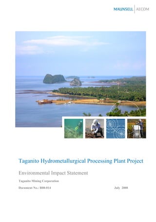
- 21. Project Fact Sheet Project Name Taganito Hydrometallurgical Processing Plant (HPP) Project Project Location Barangays Taganito, Hayanggabon, Cagdianao and Sapa, Municipality of Claver, Surigao del Norte (See Figure 1.0-1) Nature of Project Construction and operation of a HPP and auxiliary facilities Production Capacity Annual Output: 45,000 metric tons of Nickel in Mixed Sulfide (MS) Product and/or Nickel Hydroxide (NH) Product and 4,500 metric tons of Cobalt in the Mixed Sulfide (MS) Product Proponent Name Taganito Mining Corporation (TMC) Proponent’s 4th Floor, BMMC Building (formerly Solid Mills Building), De La Rosa cor. Address Adelantado Streets, Legaspi Village, 1229 Makati City Proponent’s Contact Tel Nos: (02) 893-4679; (02) 8934689; (02) 8126074 Numbers Fax No: (02) 8126075 The Environmental Impact Assessment (EIA) Study conducted for the Taganito Hydrometallurgical Processing Plant Project is consistent with the revised Procedural Manual for DAO 30-2003 of August 2007. The Terms of Reference used in the conduct of the EIA Study was based on the environmental impacts identified for an ore processing project and the issues and concerns solicited during the public and technical scoping meetings conducted on 29-30 January 2008. Prior to the conduct of the EIA Study, a series of public consultations were made by TMC. The issues raised during the public Location Map of the Project consultations include possible negative environmental impacts of the project and the benefits that the project may potentially provide. During the public scoping, the issues mentioned include the kind of chemicals that will be used and how will they be disposed of, the exact locations of the plant and other facilities, and the benefits of the project. Based on the results of the IEC activities conducted by TMC, the stakeholders were perceived to be generally receptive of the project. The Baseline Environment The existing environmental conditions were assessed by conducting surveys and sampling for the various modules involving the land, water, air and the people. Taganito Hydrometallurgical Processing Plant Project Environmental Impact Statement J:5105030701_Administration007_ReportsEIARev 4Rev4. Chapter 1&2 Basic Project Info.21Jul08.doc Revision 4 21 July 2008 Page i
- 22. The proposed project site is characterized by an ophiolitic suite of rocks and three distinct soil units. The slope gradient ranges from rolling to moderately steep slopes. The area has three general vegetation cover: brushland, limestone forest, and open forest. Of the 163 total number of species, there are 58 Philippine endemics, three of which are Mindanao endemics. Eight species are included in the Philippine National Red List. Faunal survey recorded a total of 97 wildlife vertebrate species which is consists of four amphibians, four reptiles, 75 birds and 14 mammals. Twenty-five species are endemics (i.e., 24 Philippine endemics and one Mindanao endemic). Two are near endemics. Population status ranges from uncommon to common; while habitat is from grassland-parang type to ultramafic and limestone forests (in this case heavily disturbed). Four species (i.e., three birds and one mammal) are listed in the IUCN 2007, 2007 Redlist of Threatened Species. Groundwater, surface water and marine water samples were collected and were tested for various water quality parameters corresponding to the PNSDW and DAO 90-34 criteria. Except for the dry season sampling in GW2, all groundwater stations have been tested positive for both total and fecal coliforms. All heavy metal levels, except for chromium, are within the PNSDW limits. Only TDS level particularly in station GW2 and GW3 exceeded the required limit during the wet season sampling. For surface water stations, only total and fecal coliform levels exceeded the DAO 90-34 water quality criteria in direct-impact streams. For marine waters, all parameters are in compliance with the prescribed criteria, except for fecal coliform and dissolved copper (naturally elevated in the coastal waters of Taganito and other regions of North Eastern Mindanao). The coral reef study showed that the reefs off Taganito can be classified as relatively good with an average cover of 51%, which is higher than the average coral cover of 32.3% obtained by Nanola et al., 2004 for the entire Philippines. Soft bottom assemblage had recorded a total of 35 taxa with an estimated average density of 3,403 individuals/m2. Some of the stations were observed to be covered with reddish silt. However, there is no indication that it has an adverse impact on the soft bottom fauna. The phytoplankton assemblage collected was typical of coastal waters, being dominated by diatoms. The dominance of the identified zooplankton larval forms (nauplii and copepodite) is a positive indicator of good turnover of standing stock translating to food available for pelagic fish. The number of fish larvae is also quite notable at 1,061 ind m-3, for a promising fish stock. Most of the detected concentrations of TSP, PM10, SO2 and NO2 are less than the NAAQS and NAAQGV. Exceedance of TSP levels is attributed to the vehicular traffic within the mine site area. On the otherhand, the very low detected SO2 and NO2 levels indicate the natural background of the area where emissions are derived from vehicles/fuel burning equipment and use of fire wood for cooking. Noise levels are all within their respective DENR limits. Of the ten stations, three are under Class D; two are under Class AA and the rest under Class A using the NPCC classification. The project-affected communities (PAC) are basically of mainstream stock (Surigaonon and Cebuano-speaking settlers and their descendants). Only Barangay Taganito has a compact visible indigenous community of 20 Mamanua families. Except for Sapa (6%), households in the PACs derived their cash income from employment (45 – 53%). Employment is the largest contributor (52 – 66% of households) to household cash income except in Sapa (5%). A household survey was conducted among the PACs. Sixty-six percent of the respondents think that the proposed HPP project is “generally good for the community, Surigao del Norte, and the Philippines”, 2% believe that it will benefit only other people but not me, my family or my community”, 12% think that the project is “neither good nor bad but not harmful” while 13% think that it is “harmful/risky.” Overall, for all PACs as one area, respondents gave a mean rating of 7.58 out of a scale of 0 to 10 where 10 means that they are strongly in favor of the project and 0 if they are strongly against it. Taganito Hydrometallurgical Processing Plant Project Environmental Impact Statement J:5105030701_Administration007_ReportsEIARev 4Rev4. Chapter 1&2 Basic Project Info.21Jul08.doc Revision 4 21 July 2008 Page ii
- 23. Key Impacts and Mitigating Measures The key impacts identified for the proposed project are: • Site preparation activities for the various facilities will result to the alteration of landuse/landscape as well as loss of habitat • Land purchase for the project use might cause displacement and/or unequitable renumerations • The quarry operation of the limestone will result to change in topography, clearing of vegetation and siltation Ecologically and economically important species (based on the species inventory) will be raised in the nursery and will be used for rehabilitation of cleared areas, if appropriate. Landowners/tenants and/or status of ownership will be identified. An agreement between the owner and TMC will be made. TMC will implement a compensation package based on existing laws and regulations, as necessary. Excavation in benches will be implemented in quarry areas to reduce the risk of slope failure as well as minimize surface erosion. Slope stabilization measures will be implemented as needed in areas prone to collapse. A plan for surface water drainage management will be developed to further reduce the risk of related slope failure. Taganito Hydrometallurgical Processing Plant Project Environmental Impact Statement J:5105030701_Administration007_ReportsEIARev 4Rev4. Chapter 1&2 Basic Project Info.21Jul08.doc Revision 4 21 July 2008 Page iii
- 24. Executive Summary Brief Project Description Project Location and Area The Taganito HPP Project covers an approximate area of 1,000 hectares and is located within Barangays Taganito, Hayanggabon, Cagdianao and Sapa in the Municipality of Claver, Surigao del Norte Province. Project Rationale The project will enhance the resource utilization capacity of Taganito Mining Corporation (TMC) through the processing of laterite both from stockpile and in-situ. In effect, the project will provide the technology which will enable TMC to utilise Location Map of the Project laterite as raw material. The project will also generate taxes and fees, provide employment and contribute to community development projects and economic activities on a local and national level and further augment the existing social development programs. Project Components The table below summarizes the project components: Component Description Location Hydrometallurgical Will contain high pressure acid leach circuit, Plant will be located south of Processing Plant sulfurization circuit, hydroxide circuit, waste Hayanggabon. (HPP) and water treatment, chemical and reagent associated preparation circuits, boiler and power plant, acid facilities plant facility, H2S plant facility, slaked lime plant facility, administration office, vehicle shelters, storage facilities and waste management facilities Tailings Storage Tailings dam will be designed to handle Tailings dams will be built Facility approximately 6.7 million DMT of generated west of the HPP. The decant tailings from the HPP per year. A decant pond pond will be located shall be built to handle the tailings discharge. immediately north of the tailings dam and west of the HPP Limestone Quarry Quarry operations are designed for an annual The site is located in and its associated output of 2 Million MT of limestone material. A Barangay Sapa, facilities (e.g. haul hauling road is approximately 30 km to the HPP. approximately 13 km west of road) the HPP Water Supply Will include diversion weirs and a desalinization Weirs of water supply system System facility for seawater shall be located at the Taganito and Daang Suba Rivers; Collecting pond will be located within the HPP. Desalinization facility will be Taganito Hydrometallurgical Processing Plant Project Environmental Impact Statement J:5105030701_Administration007_ReportsEIARev 4Rev4. Chapter 1&2 Basic Project Info.21Jul08.doc Revision 4 21 July 2008 Page iv
- 25. Component Description Location located in Barangay Hayanggabon Wharf Berths and Will handle chemical tankers (for acid and Wharf Area beside existing associated methanol), bulk cargo (for MS products and causeway facilities (e.g. sulphur) and coal barge. vehicle shelter, administration Vehicle shelter will be used for installation, Near the vicinity of the Pier office) maintenance and repair facility for vehicles Site Materials Storage Materials Storage Facilities shall be erected for Barangay Taganito Facility the following materials: MS and NH – products storage facility with approximate area of 2,800 m2 Coal – concrete paved yard with an approximate area of 21,000 m2 Slaked Lime – concrete paved yard with an approximate area of 20,000 m2 Sulfur – concrete paved yard with an approximate area of 20,000 m2 Ore – unpaved with an approximate area of 80,000 m2 Ash Disposal Pit For disposal of ash from power plant Barangay Taganito Townsite The proposed townsite will include houses (with Barangay Cagdianao a capacity of approximately 10,000 residents), buildings (e.g. school, church, hospital, hotel), amusement facilities (e.g. golf course, park, playing field) and other amenities. Production Capacity Rate Annual Output: 45,000 metric tons of Nickel in Mixed Sulfide (MS) Product and/or Nickel Hydroxide (NH) Product and 4,500 metric tons of Cobalt in the Mixed Sulfide (MS) Product Types of Waste The following are wastes that may be generated during the HPP operation and the built-in management measures that will be implemented: Possible wastes that maybe generated Built-in Management Measures A. Hydrometallurgical Processing Plant and Associated Facilities HPAL Circuit - heavy metal leach residue (Al, Fe, heavy metals will go to tailings dam after final Cr, Si, Ca) neutralization Sulfurization Circuit – H2S emissions, ZnS and ZnS and barren liquor will go to tailings dam barren liquor which contains Mg, Mn, Al, Si, Ca and after final neutralization; H2S emissions will be H2SO4 very minimal and will pass through scrubbers. Concentration will be within the standard. Hydroxide Circuit – Barren liquor which contains Identified wastes will go to tailings dam after Mg, Mn, Al, Si, Ca and H2SO4 final neutralization H2S Plant – Sulfur residue Identified wastes will go to tailings dam after final neutralization Taganito Hydrometallurgical Processing Plant Project Environmental Impact Statement J:5105030701_Administration007_ReportsEIARev 4Rev4. Chapter 1&2 Basic Project Info.21Jul08.doc Revision 4 21 July 2008 Page v
- 26. Slaked Lime Kiln Plant - TSP, SOx, NOx, CO Concentration of emissions will be kept within standards Acid Plant Operation – cooling tower blow down Identified wastes will go to tailings dam after and waste heat boiler blow down final neutralization Coal-Fired Power Plant – TSP, SOx, NOx, CO, Ash to ash disposal pit; Dust collectors will be ash in place; low sulfur content coal and high efficiency combustion will be utilized for the operation B. Tailings Storage Facility – decant pond Effluent recycled as process water in main effluent HPP; supernatant discharged to sea near wharf C. Limestone Quarry – run-off with increased Gravitational drainage will be employed for hardness due to calcium ions from quarry, the quarrying face. Drainage ditches will be limestone dust/ TSP created on the quarrying roads and sand basins for draining supernatant water to the river. Drainage ditches will also be created on the transportation roads and set facilities for sedimentary sands to prevent polluted water from flowing into the river D. Materials Storage Facility – TSP, coal dust, Provision for containment facility/clean sulfur dust from stockyards, slake formed from up/disposal of expired materials deposition of limestone dust, spills/excess/expired Ca(OH)2 or Mg(OH)2 and other chemicals, lubricants/used oils and batteries from maintenance/repair, condemned equipment, used tires E. Townsite – sewage from residential, institutional Solid waste to go to MRF; waste water and commercial sources, run-off contaminated by collection system/treatment; medical waste fertilizer/pesticides from golf course, vehicle disposal based on DOH guidelines; fuels, oils emissions, solid waste especially from market, fuels and grease will be collected by an accredited oils, grease from vehicles and equipment, medical waste treatment company waste Manpower Requirement A maximum of 4,000 construction workers will be required during the peak construction period of the project. During operations, the HPP and its auxiliary facilities (excluding the limestone quarry) will potentially employ 1,100 personnel. Approximately 200 people will be needed for the limestone quarry operations. Project Cost The total capital investment for the project is estimated at almost US Dollars 3 Billion. Annual operation costs will be about US Dollars 200 Million based on an annual maximum output of 45,000- Ton Nickel and 4,500-Ton Cobalt Production Project Phases Phases of the project include pre-construction, construction/ development phase, operational phases and abandonment phase. Taganito Hydrometallurgical Processing Plant Project Environmental Impact Statement J:5105030701_Administration007_ReportsEIARev 4Rev4. Chapter 1&2 Basic Project Info.21Jul08.doc Revision 4 21 July 2008 Page vi
- 27. Project Duration and Schedule The project is envisioned to last for 30 years. Presented below is the schedule for the construction activities of the project. Pre-commissioning and commissioning of the HPP will follow right after construction activities are completed. Y1 Y2 Y3 Y4 Y5 Activities -1 1 2 3 4 5 6 7 8 9 10 11 12 13 14 15 16 17 18 19 20 21 22 23 24 25 26 27 28 29 30 31 32 33 34 35 36 37 38 39 40 41 42 43 44 45 46 47 48 49 50 51 52 53 54 Infrastructure Detailed Engineering Ore prep.&Storage Design of Facilities Process plant Ore prep. & Storage Procurement Process Plant Construction Infrastructure Civil Process Plant Ore Prep. & Storage Ore prep. & Storage Mechanical Infrastructure Process Plant Electrical and Process Plant Infrastructure Ore prep. & Storage Taganito Hydrometallurgical Processing Plant Project Environmental Impact Statement J:5105030701_Administration007_ReportsEIARev 4Rev4. Chapter 1&2 Basic Project Info.21Jul08.doc Revision 4 21 July 2008 Page vii
- 28. Brief Summary of Project’s EIA Process The Terms of Reference used for this EIA Study was consistent with the revised Procedural Manual for DAO 30-2003 (August 2007). The members of the EIA Team are composed of multi-disciplinary specialists and experts who have extensive experience in the conduct of EIA studies for projects in the various industry sectors. Role/Specialization Name EIA Study Team Project Director Jess Bayrante Project Manager Naniel Aragones Hydrologist Ben Rojas Water Quality Specialist Aries Milay Sediment Transport Specialist Fernando Siringan Geohazard Specialist Malvin Kenneth Manueli Risk Assessment Specialist Jake Tio Geologist Malvin Kenneth Manueli Air Dispersion Modeller Moreno Penalba Air Quality Specialist Melissa Manguiat Terrestrial Vegetation Specialist Abba Grace Sanchez Terrestrial Wildlife Specialist Michael de Guia Aquatic Biota Specialist Naniel Aragones Coral Reef Specialist Lambert Meñez Seagrass Specialist Napo Cayabyab Plankton Specialist Kathleen Silvano Reef Fish Specialist Naniel Aragones Benthos Specialist Marivene Santos Oceanographer Charina Repollo Socio-economic/Stakeholder Consultation Specialist Willy Palarca Anthropologist Felixberto Roquia Public Health Specialist Romeo Quizon Peer Reviewer Jo Rowena Garcia Environmental Scientist Kathleen Anne Cruz Environmental Scientist Ronaldo Lacsamana Proponent Team Vice President Reynaldo Vigilia Assistant Vice President Conrado Tambiloc Jr. Technical Services Manager Rogelio Cadano Taganito Hydrometallurgical Processing Plant Project Environmental Impact Statement J:5105030701_Administration007_ReportsEIARev 4Rev4. Chapter 1&2 Basic Project Info.21Jul08.doc Revision 4 21 July 2008 Page viii
- 29. Study Period The EIA Study was conducted from January 2007 to April 2008. Below is the EIA schedule of activities. Date Activities 28 January 2008 Project Briefing at the Site 29 January 2008 Site Scoping 30 January 2008 Technical Scoping Meeting January 2007 Primary Data Collection – Wet Season Sampling April 2007 Primary Data Collection – Dry Season Sampling January 2007 to February 2008 Secondary Data Collection February 2008 Additional Primary Data Collection February 2007 to April 2008 Data Analysis and EIS Preparation The various modular studies and primary surveys were conducted at the perceived direct impact areas which include the HPP area and the proposed locations of the auxiliary facilities, which will all be located within the jurisdiction of Claver. The study area, along with the proposed locations of the various structures is shown in Figure 1.0-1. EIA Methodology The EIA approach and methodology was based on the revised Procedural Manual of DAO 30-2003. Consistent with the data and information requirements indicated in the approved Technical Scoping Checklist, the study team collected secondary information from different government agencies. Dialogues, liaison and coordination meetings and interviews were also conducted with TMC, local officials, and representatives of stakeholders. Primary data were obtained through sampling and surveys to supplement the secondary information. Summary of Public Participation in Scoping and EIA Study Below is a summary of the public participation activities prior to and during the EIA Study: Pre-EIA Activities • Meetings with Community Technical Working Group; Community meetings/consultations in Barangays Taganito, Urbiztondo and Hayanggabon; Radio program news release; EIA Activities • Public Scoping Meeting; household and perception surveys; key informant interviews with representatives of stakeholders including the Mamanuas. Taganito Hydrometallurgical Processing Plant Project Environmental Impact Statement J:5105030701_Administration007_ReportsEIARev 4Rev4. Chapter 1&2 Basic Project Info.21Jul08.doc Revision 4 21 July 2008 Page ix
- 30. Summary of Baseline Characterization Ecosystem Findings Land The project site is characterized by ultramafic rocks, mainly composed of peridotites and serpentinite and three soil units (residual soil, transported unconsolidated recent alluvial deposits and swamp deposits). The slope gradient is undulating and rolling reaching up to 18% to moderately steep and steep slopes up to 50 %. Among the identified probable geohazards include earthquake, landslide, liquefaction, flooding, erosion, tsunami and coastal erosion. The area has three general vegetation cover: brushland, limestone, and open forest (at the early stage of regeneration). A total of 163 morpho-species were recorded with families Moraceae and Myrtaceae as the most speciose. There are 58 Philippine endemics, three of which are Mindanao endemics. Eight species are included in the Philippine National Red List, which include three Philippine endemic and one Mindanao endemic. Faunal survey recorded a total of 97 wildlife vertebrate species which consists of four amphibians, four reptiles, 75 birds and 14 mammals. Twenty-five species are endemics (i.e., 24 Philippine endemics and one Mindanao endemic). Two are near endemics. Population status ranges from uncommon to common; while habitat is from grassland-parang type to ultramafic and limestone forests (in this case heavily disturbed). Four species (i.e., three birds and one mammal) are listed in the IUCN 2007, 2007 Redlist of Threatened Species. Water The proposed Taganito HPP Project covers six river basins namely: Taganito (subcatchment: Daku creek), Daang Suba, Hayanggabon, Sensio, Townsite (unnamed) and Baoy-Magallanes (subcatchment: Sapa creek) Rivers. The water balance for the basins considered for the Taganito project generally indicates that the project area currently has a large volume of surface water (49.2% to 51.4% MAR) and groundwater recharge (25.8% to 26.5% MAR). Water requirement for the construction of diversion weirs and tailings dam is very minimal as compared to the water supply that may be available from groundwater resources and river run-offs. However, during operations, the dependable flow of Daang Suba and Taganito River is only about 61% of the combined total water requirement of 53,000 cmd for processing, power plant cooling and domestic water supply. Construction of the plant buildings and facilities and other auxiliary components of the project will decrease the percolation in the new built-up area while increasing the surface run-off. The increase in the water run-off is estimated to be at 5% to 16.6% while the decrease in the groundwater recharge is expected to be 5.3% to 15%. The proposed tailings dam will cut-off the flow from the headwaters of Daku, Daang Suba and Hayanggabon catchments. The diversion weirs at Taganito and Daang Suba will also reduce the streamflow. The annual mean flow reductions for the Taganito River and Hayanggabon River are 70% and 90% respectively. Daang Suba will have an almost 100% flow reduction. A decrease in the flood discharge and flood peaks will be experienced with the establishment of the tailings dam and diversion weirs. Thus, possible impacts in the downstream areas are also minimized. Taganito Hydrometallurgical Processing Plant Project Environmental Impact Statement J:5105030701_Administration007_ReportsEIARev 4Rev4. Chapter 1&2 Basic Project Info.21Jul08.doc Revision 4 21 July 2008 Page x