Lake Baikal (englisch)
•
1 gefällt mir•908 views

Prensentation about the lake Baikal (Russia), for my billingual Geographie teaching.

Empfohlen
Weitere ähnliche Inhalte
Was ist angesagt?
Andere mochten auch
Ähnlich wie Lake Baikal (englisch)
Ähnlich wie Lake Baikal (englisch) (20)
Kürzlich hochgeladen
Kürzlich hochgeladen (20)
Lake Baikal (englisch)
- 1. LAKE BAIKAL 1
- 2. Content Location and General Facts 3 Geographic Dimensions 5 Climate 5 Flora and Fauna 7 The Baikal-Rift 8 Islands 9 Economy 10 Infra Structure 11 Nature Conservation 12 Tourism 13 Sources 14 2
- 3. Location and General Facts The lake Baikal is situated in the south-east of Russia. In the Siberian Mountains. coordinates : 53° N, 108° E height above the sea level : 455 m area : 31. 492 km² (without islands) length of the lake : 637 km width of the lake : 82 km volume : max. 23.000 m³ scale : 2.125 km max deepness : 1.637 m features : - lake with the biggest volume, deepest and oldest freshwater lake of the world UNESCO World-Nature- Legacy - 3
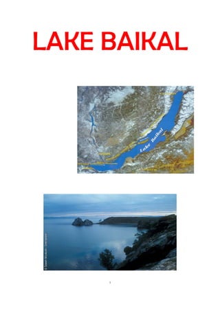
- 4. The lake Baikal is in the south-siberian mountains on the border between the “Oblast Irkuts” on the western and northern bank and the Republic of Burjatian on the southern and western bank. The lake is surrounded by many high mountains. map of the lake baikal 4
- 5. Geographic Dimensions The lake Baikal, which surface is 31.429 km² big, is with an age of 25 million years the oldest and with a deepness of 1.637 m the deepest lake of our planet. The lake, which scale ca 2.125 km amounts, is from south-east to north-east 637 km long (centreline of the lake) and maximal 82 km wide. The average width is 48 km. Climate In the area around the lake dominates a continental climate. Over the year are ca. 2000 sun hours, in wich the month December is the one with the poorest solar radiation and the month June with the biggest. The annual precipitation is 458mm and the average temperature is -1,2 °C. climate graph of Irkutsk (a city in the south of the lake baikal) 5 The climatic conditions differentiate very much in the different seasons.
- 6. Winter: The winters (November-March) are with average temperatures around – 20 °C dry-cold, form begin of November until the end of march dominates permafrost. In the mountains around the lake is snow from the middle September until the end of June, during in the valleys snow just from middle November until begin of April lies. The deepest temperatures to fall of -40 °C. ice on lake Baikal in the winter moths Spring and Autumn: The spring (April/May) and the autumn (September/October) have are in each case with just 2 months not such a long period. Frost in nights can presence until June and already again at the of August. Summer: The summers (July-August) are with average temperatures around 15 °C and temperatures on day around ca 20 °C relatively warm. In summertime most of the annual rain falls. 6
- 7. summertime around lake Baikal Flora and Fauna The Baikal area has a very high density of plants and animals which just life in this area. This a inimitably flora and fauna. Over 1.500 animal-and 1000 plant species are endemic. (they live just there and nowhere else) There are many spices of fish and other animals which live in the water. A reason for this diversity of water animals is, the fact that the lake Baikal constant becomes deeper and deeper. That's why the animals have enough time to change their way of life and can acclimatize the situation. But there are much more animals in this area which doesn’t live in the water. Maybe more than 300 different species of birds live in the Baikal area. Also many different plants grow in the area around the lake Baikal. The National Park Lake Baikal is over 2 million hectares big. In that national park live many different animals e.g. lynxes, bears and harts, here they can grow up and live under healthy conditions. Many rare kinds of plants are also in the national park. The vegetations zone around lake Baikal is called Conifer-Forest. 7
- 8. a blue “tour flower” The Baikal-Rift The lake Baikal is part of continental Rift zone (Rift break). This Baikal-Rift has developed in million years and every year it becomes 2 cm deeper. That rift develops because of splits in the earth's crust, conditioned of collisions with the southern Indian-Plate wich pushes between the the Amuran-Plate and the Euroasian-Plate. That's why the Baikal-Rift accrues, on which the lake Baikal is situated. The split on that the lake is, is 1.600 km long and soon as 6 km deep. 8
- 9. the Baikal-Rift Islands In the lake Baikal are 22 bigger islands and on the banks are many isles. The biggest island is Olchon near the west-bank. That island is is 730 km² big and 72 km long, the mountains are 1.276 high (821 over sea level). The biggest peninsula is Swjatoj Nos (“holy nose”) at the east-bank. 9
- 10. Economy After the second World war the industrialisation was promoted with much money. Many factories and mines were build. In special the manufacturing of cellulose and paper. The fishing became more import end and many cities around the lake became bigger. One of the greatest projects and new factories is the Paper- and Cellulose factory in Baikalsk. 2003 the company got 22,4 million $ for modernization. But the the hoped success didn’t came and so many people lost their jobs. Also many hectares of forest were destroyed. But there are much more different sectors of industry in the Baikal area. Also very importend for that region is mining. Marble, oil, gas and more is won around the lake Baikal. In other ways the shipbuilding is very important too. There are much big dockyards around the lake. Because many people and company's need ships to transport things over the lake. The giant forests in the area are used for timber. But because of deforestation many areas of forest were destroyed. 10
- 11. Infra Structure Cities and Towns: Here some Examples for cities and towns near and around lake baikal: Babuschkin- a small town at the southern bank Baikalsk- at the southern bank Irkutsk- a bit away from the south-western bench Nischneangarsk- city in the north of lake Baikal Irkutsk Trafic: Most of the people live in the cities and towns a bit away from the lake. Near the benches the region is sparsely populated. There are not so many roads which come direct to the lake. In the north and in the south are 2 importend railways. In the north the “Baikal- Amur-Magistral” and in the south the “Transsiberrian Railway”. This railways are very importend for the infra structure of that region. International Airports are for example in Irkutsk or Ulan-Ude. 11
- 12. the Transsiberian Railway When the Baikal lake is frozen over the winter months, it is used as street. That ´s why you can just reach some villages and islands over that “frozen streets” in winter, which are called “Zimink”. Nature Conservation Because of a big destroying of the environment around the lake, the government began to start projects against pollution and such things. In many areas reservations and national parks were opened to save rare species of animals and plants. There for example the Lena-Naturereservat in the west of the lake or the Bargusin-Naturereservat in the east. There are much more national park, e.g. on the island of Olchon. The lakel is surrounded by a “coast-saving zone” In 1966 the Baikal-Region became a UNESCO World-Nature- Legacy. 12
- 13. Tourism In some regions around the lake new areas for tourists were build. Many people enjoy the quietness and the in some region healthy environment. On some islands you can relax and so on. People how like holidays with adventures will like the Baikal area, there they can climb and hunt or make interesting walks in the wild. A very popular hobby is fishing, because of the many different fish in the lake. In some parts of the lake is the water temperature in July and August sometimes around 18 °C. But that s not so often. The most time of the year the temperature is around 10 °C and in winter it is frozen. In wintertime ice-skating and races with cars on the frozen lake are popular. Sometimes people can surf on lake Baikal, because often there are waves which are more than 3m high. summer in the Baikal area 13
- 14. Sources File created by Florian Nitschmann and Nils Valerian. Internet: www.wikipedia.org www.google.de/bilder Bücher: Das Große Schülerlexikon Brockhaus 14