SlideShare ist ein Scribd-Unternehmen logo
1 von 23
Downloaden Sie, um offline zu lesen
Car Free Maine
Making the Connections

Social Networks   Transit Networks        4
                                         1C
                                     Wpu
                                     5

                  Full Pitch Deck
CarFree Maine
                                                           2

Suite of Location-Based Networking Tools designed to
enhance non-automotive transportation connections
throughout the State of Maine.

Local outreach effort builds on local partnerships and
forges strong connections between transportation
providers, government agencies, local tourism bureaus,
chambers of commerce, NGOs and local businesses

Marketing effort focuses on young adults in NY and
Boston Metros between the age’s of 18-30 and 30-40 years
old
Emerging generations are moving into
 downtowns, driving less, walking
 more, living in smaller homes[...], preferring local
 businesses, [...] prioritizing health, going green and
 valuing community and social networking like
 never before.-Neil Takemoto www.cooltownstudios.com


Farmers Market               Cafe'
• In the City of Boston (not                                                                      Boston Metro Region Commuters

             including Cambridge, Newton
           etc...) almost 92,000 people do
                  not own a vehicle.                                                                               41 %
          • Almost 300,000 people                                                                                                           50%

          commute to work via Public
           Transportation Regionwide                                                                                       10%
          • More than half of all Transit
           Users are in the 24-44yr/old                                                                            Car, truck, or van -- drove alone
                                                                                                                   Car, truck, or van -- carpooled
                      Age Group                                                                                    Public Transportation


          •        1/3 of users                                                                             Commute via Public Transportation

                  (100,000) use                                                                                           5%5%5%
                                                                                                                                          14%

                  Mobile Transit                                                                                    14%


                     Apps*
                                                                                                                                   58%

          Statistics from, 2005-2009 American Community Survey 5-Year Estimates
                                                                                                                  16 to 19 years         20 to 24 years
                                                                                                                  25 to 44 years         45 to 54 years
*Joshua Robin,  Director of Innovation and Special Projects at the MBTA, http://transportationnation.org/         55 to 59 years         60 years and over
                 2011/05/13/boston-upwards-of-13-of-ridersM-use-transit-app-tools/)
“Young people aren't simply
   swapping cars for buses or bikes;
   they are choosing to own and use
   other technology instead, such as
   smartphones and tablet
   computers.”                               -www.shareable.com


                                                                  “Carmakers' next problem:
"Previous generations found freedom and
                                                                       Generation Y
flexibility through the car.  But Generation                        People in their teens and twenties are more
Ys find their freedom and flexibility by                                interested in gadgets than cars”
staying connected to their friends, family
and workplaces through the various                                 http://www.msnbc.msn.com/id/39970363/ns/business-autos/


information devices - like their laptops, or
iphones.
"They can stay connected on a bus or a
                                                                  “ 	                     	 
train. They can bring the office with them.                                               	                              	 
They can bring their study with them.
They can bring their friends with them.
                                                                                      	  	                     	             	 
They can't if they're driving."                                                        ”
 -- Peter Newman, Curtin University, Perth, Australia,
quoted in the West Australian, www.humantransit.org

                                                                   Article: http://adage.com/digital/article?article_id=144155
What if you want to get
 out of the city every
once in awhile? Where
 can you go without a
          car?
You can take the train to Maine!

                 Nearly 500,000 people a
                   year ride the Amtrak
                  Downeaster between
                   Boston and Portland
                 Maine with an extension
                     to Freeport and
                 Brunswick scheduled for
                 operation in Fall of 2012.   7
Welcome to Maine                                     20 Miles
  Downtown, Shops, Beaches, Hotels Attractions, Mountains?
          “You can’t get there from here”


                                         ?                      ?!!!


  We’ve arrived in Maine...
                                                                                  8
        Now what?
  Getting from the train station to hotels, beaches, trails, restaurants etc...
   can be confusing for the uninitiated. Without convenient connections
  many potential riders see no other option than to rent or drive their own
  vehicle instead. Which means spending a third of their budget on gas,
                  and a third of their time sitting in traffic.
Out of the 12 stops between Boston
and Brunswick only Freeport lacks a
  fixed-route local transit system.
 Other connections include Intercity
  busses, an extensive island ferry
   system and the Maine Eastern
  Railroad to Rockland. However,       9
keeping track of these connections
       can seem impossible.
Solution                   CarFree Maine


 After researching and planning the trip on
   the CarFree Maine web page, the user
  finds the local transit connection via the
          GPS-enabled Mobile app              10
11

■   Simple interface allows personalized travel
    choices involving multiple transportation
    networks, modes, schedules and wayfinding
    systems.                                                  Brunswick
■   Utilizes collaborative mapping/Geo-
    networking technology
■   Promotes Sustainable Transportation by             Ride      Stay    Book


    connecting riders to underutilized portions of
    transit networks
■   Interface will be optimized for user-generated
                                                       Eat       Bike     Walk


    content on both web and mobile platforms
■   Allows users to post reviews via                   Find      Map    Position

    OpenStreetMap portal, video logs and social
    networking profiles (Integration w/Facebook,
    TripAdvisor, Yelp, Gowalla, Foursquare, Twitter,
    Wikitude...)
Brunswick                     Brunswick
                                     Transportation


Ride      Stay    Reserve
                              Rail       Bus        Tickets


Eat       Bike     Walk
                            CarShare      Bike        Trails


See       Learn    Map
                            Closest     Schedules     Maps


                                                               12
Browser Window
             http://www.carfreemaine.org/                                                      Search                     x


CarFreeMaine
Routes              Local                  Map              Connect                 Book          Media          Blog


                                                                                                Mobile App
 Express                        see all
                                                 Local                        see all
                                                                                                  Map your route, make
                                                                                                   suggestions, share
                                                                                                  waypoints, photos and
                                                                                                    videos, get group
                                                                                    CarFree Maine discounts and more!


Transportation Resources Along the Maine         Destinations, Events, Activities
                 Coast
                                                                                               Connect With


                                                                                                                          13
Browser Window


CarFreeMaine-Transportation

rail    bus   ferry   carshare   cycling

Transit Options
       Brunswick
                                            +2


   Freeport
   Portland
                                             +2


   Old Orchard Beach
                                                 +2

   Saco/Biddeford
   Wells
   Dover                                              14
The Plan
                         Market


           Development


           Research
 Concept


Concept and Development
       Strategies
Social Transportation
Mobile
                                              Open Source/Commons


                                                           GeoCaching
    GPS Navigation


                      Collaborative Mapping

                                                  Online Mapping Formats
 Location/GeoSocial                                 (GTFS, GIS, KML)
     Networks                 OpenStreetMap


  Social Media                                Electronic Data

  Tf
Social Transit
   A few innovative programs such as NextTrain, Roadify and
  Waze utilize user-generated content to provide data where
      proprietary systems are ineffective. User-Generated
   Applications can be incredibly effective if they reach the
critical mass of user-interaction . Waze founder Diann Eisnor
 recommends the following formula for building a user base-


Build                     Play                       Value                       Critical
                                                                                  Mass

  From a presentation by WAZE founder Diann Eisnor “Game Mechanics and LBS: Crossing the LBS Chasm”
Build                                                                                                              18


       Technology                                                    Community
          Interface                       Mapping                          Online                      Offline
                                        Database of existing
          Web Features-
           User Profiles,
                                           transit options           Communities of
                                        combination of GTFS,                                     Local Partnerships
         Dashboard,Listing,              OSM, AVL, Open511              Interest
         Recommendations                      formats

          Mobile Features-                  Trip Planner-                “Livable Streets”,        Non-Profits, Tourism
        Timestamps, Tracking,         OpenTripPlanner, NextBus,       Streetsblog, Streetfilms,    Bureaus, Chambers of
       Check-ins, Media Upload,       Catapulter, must operate on    “#CarFree” Boston Music      Commerce, Downtown
         Real-Time Reviewing               multiple formats               Scene, Cyclists              Association

                                                                         “OffManhattan”,
      Integration- HTML5/Native          Transit-Map Overlay                                     MDOT, NNEPRA, GPCOG,
                                                                     “Planetizen””Treehugger”
      Hybrid App, Web and Mobile                 Design                                            PACTS, MBTA, MCT
                                                                      “Bostonist” Gothamist”
       utilize Open API Integration       inspired by NextMap

                                                                                                   Business Sponsors-
       “Freemium” Services-                                                                      LLBEAN, Outfitters, Cycle
                                                                           Travel Blogs
       Direct Booking, Planning,                                                                  Shops. Concert/Festival
          Full Tour Packages,                                                                           Promoters
                Discounts
                                                                        Beta Community of “Transit Pioneers”
     Inventory of Transit Alternatives along                                     (Early Adopters)
               Downeaster Corridor
                                                                        Local Partnerships (Non-Profits, Local
User-Friendly Interface utilizing GO-SYNC (GTFS-
                                                                    Businesses, Universities, Transit Agencies etc...)
 OSM Syncronization) and TRB Multimodal Data
Play                                                      19


Successful developers often provide incentives
      to encourage users-participation.

                 “Geo-Social” Networks like foursquare
                     and Gowalla add elements of
                  gameplay by awarding “badges” and
                            “mayorships”


          “Local Deal-a-day” platforms such as Groupon and
             Living Social are some of the fastest growing
              segments in the e-commerce space and are
          increasingly utilized in tandem with foursquare and
                                 Gowalla.
Play                                                           20


 Green Branding meets Game
         Mechanics
      While some “green enrepreneurs” have found it difficult
      to sell a product based on environmental impact alone,
        the “green brand” can provide a powerful incentive
                  when applied to game mechanics.

Incentives will be given for users to-
•       Upload geotagged data
                                                Possible incentives-
•        contribute map visuals
• Utilize as many transit modes and         • Carbon Footprint Calculator
           systems as possible              •     Carbon “Credits”
•    suggest a trip, route, vacation or     •      “Mode Shares”
                   place                    •      Calorie Counter
•   contribute travelog (including video,   •        Mileage Log
            blog, photo, audio)             • Fuel Savings Calculator
Value                                             ➡   Spends less money on Gas,
                                                                                   Insurance, Parking, Tolls
                                                                              ➡            More exercise
                                                                              ➡ Low-Impact accessibility to
                                                                               recreation, wilderness protected
  Local Economy                                                                               areas
➡ Downtown Businesses near rail/transit                                       ➡ More time to read, write, research
                                                                                    etc... instead of driving
  find more customers with less vehicle
                    traffic
➡ Online packages can include Hotels,
                                                        User
 Restaurants, Thrift Store Hunts, Bicycle
 Shops, Outdoor Outfitters, Rafting Trips,                                     Transit Providers
                  Kayaking
➡ Ability to reach younger customer base                                          ➡       Increase Ridership
➡ access to transit can be key factor in                                          ➡ Free, Accurate, Real-Time Data
    attracting educated talent for the                                            ➡ Ability to engage directly with
                 workforce                                                            customers and stakeholders
➡ Coordination with Farmer’s Markets,                                             ➡ Saves money on consulting fees
 Art’s Events, Festivals, Fairs, Museums                                          ➡      Data on multimodal travel
                     etc...                                                           patterns helps identify “weak
➡ Coordination with “Nature-Based                                                 links”in the multimodal system and
                                                                                     allows for efficient allocation of
               Tourism” Brand               Environment                                         resources
                            ➡            Less Cars=Less Carbon                    ➡ In-App Booking Capability
                            ➡ Transit use, walking, cycling promotes dense,         streamlines ticketing procedures
                                       mixed-use village centers
                            ➡              Density=Less Sprawl
                            ➡ Less Sprawl= Protects family farmland, wildlife
                                    habitat, wetlands, open spaces
                            ➡ Less Sprawl= less toxic runoff from pavement
                            ➡      State and National parks made more
                                   accessible with less of an impact
Critical
                                      Mass                                         22

    Applications that rely on user-generated content must reach a
    “Critical Mass” threshold of roughly 300 users to be effective.
    The challenge in Maine is to reach this critical mass in an area
                   of relative low population density.
    Goal- Identify “Champions”, “Lighthouse Customers” i.e. small percentage of
      highly engaged users who contribute majority of content in early phase
■     Potential “Lighthouse Customers”- Cyclists, Urbanists, Environmentalists,
      “#CarFree”, Students, Adventure Travelers, “Green Tourism”, Backpackers,
      Cycle Camping families, Boaters, Agritourist’s (Farmer’s Markets, CSAs,
      Common Ground Fair etc), Climate Activists, Artwalk Tours

■     Expanded User Base- Arts/Cultural Tourists, Conference Attendees, Film
      Festival-goers, Music Festival-goers, Shoppers, Thrift Store Explorers, Retirees,
      Minor League Sports Fans, Young Families, Seasonal Residents, Island
      Residents, Summer Campers/Counselors, Skiers, Winter Sports enthusiasts
Further
  Information
                                                                                     23

 Presentations-                                  Presentations can be found at
The CarFree Corridor-                            www.carfreemaine.org, or
Detailed presentation outlining existing and     http://www.slideshare.net/newmediatransit
potential locations where CarFree travel is      email-ajawitz@newmediatransit.com
             possible in Maine                   Twitter-@carfreemaine
Why CarFree?-
Market research outlining the social/economic
impact of automobile dependency on rural areas
and why Generation Y is overwhelmingly
rejecting the Car.

 Why Maine?-
Outlines specific strategies for the implementation
  of regionally-appropriate transit technologies.
Argues that public transportation can be a viable
                option in rural areas

Weitere ähnliche Inhalte

Ähnlich wie CarFree Maine project enhances non-auto transportation connections throughout the state

futuristic urban transit system for small cities_the dissertation
futuristic urban transit system for small cities_the dissertationfuturistic urban transit system for small cities_the dissertation
futuristic urban transit system for small cities_the dissertationMridul Bhandari
 
Uber Mobility Summit - Dec 2016
Uber Mobility Summit - Dec 2016Uber Mobility Summit - Dec 2016
Uber Mobility Summit - Dec 2016FabMob
 
Possible impacts of ICT based demand-responsive public transportation schemes...
Possible impacts of ICT based demand-responsive public transportation schemes...Possible impacts of ICT based demand-responsive public transportation schemes...
Possible impacts of ICT based demand-responsive public transportation schemes...Tristan Wiggill
 
Multimodal Impact Fees - Using Advanced Modeling Tools
Multimodal Impact Fees - Using Advanced Modeling ToolsMultimodal Impact Fees - Using Advanced Modeling Tools
Multimodal Impact Fees - Using Advanced Modeling ToolsJonathan Slason
 
Workshop Innovation in Africa - Context, challenges & opportunities for urban...
Workshop Innovation in Africa - Context, challenges & opportunities for urban...Workshop Innovation in Africa - Context, challenges & opportunities for urban...
Workshop Innovation in Africa - Context, challenges & opportunities for urban...BRTCoE
 
Business case 1: Soft mobility in Rennes Metropole
Business case 1: Soft mobility in Rennes Metropole Business case 1: Soft mobility in Rennes Metropole
Business case 1: Soft mobility in Rennes Metropole FogGuru MSCA Project
 
Ericsson ConsumerLab - Commuters expect more
Ericsson ConsumerLab - Commuters expect moreEricsson ConsumerLab - Commuters expect more
Ericsson ConsumerLab - Commuters expect moreEricsson
 
NFC Forum MaaS Case Studies
NFC Forum MaaS Case StudiesNFC Forum MaaS Case Studies
NFC Forum MaaS Case StudiesNFC Forum
 
Microtransit and Digital Infrastructure
Microtransit and Digital InfrastructureMicrotransit and Digital Infrastructure
Microtransit and Digital InfrastructureRPO America
 
Expanding Usage of Cellular Phones -1991
Expanding Usage of Cellular Phones -1991Expanding Usage of Cellular Phones -1991
Expanding Usage of Cellular Phones -1991Dominique Mintz
 
Corridors of uncertainty submitted
Corridors of uncertainty submittedCorridors of uncertainty submitted
Corridors of uncertainty submittedKate Pangbourne
 
The Digital Matatus Story: The Power of Open Data in Transport - Jacqueline M...
The Digital Matatus Story: The Power of Open Data in Transport - Jacqueline M...The Digital Matatus Story: The Power of Open Data in Transport - Jacqueline M...
The Digital Matatus Story: The Power of Open Data in Transport - Jacqueline M...WRI Ross Center for Sustainable Cities
 
Future Of Transportation Poll Summary
Future Of Transportation Poll SummaryFuture Of Transportation Poll Summary
Future Of Transportation Poll SummaryHouston Tomorrow
 
Future Of Transportation Poll Summary (032910)
Future Of Transportation Poll Summary (032910)Future Of Transportation Poll Summary (032910)
Future Of Transportation Poll Summary (032910)Transportation for America
 
Community-Based Assessment of Transportation Needs, Vivian Satterfield, OPAL ...
Community-Based Assessment of Transportation Needs, Vivian Satterfield, OPAL ...Community-Based Assessment of Transportation Needs, Vivian Satterfield, OPAL ...
Community-Based Assessment of Transportation Needs, Vivian Satterfield, OPAL ...Forth
 

Ähnlich wie CarFree Maine project enhances non-auto transportation connections throughout the state (20)

Smart Connections - FINAL
Smart Connections - FINALSmart Connections - FINAL
Smart Connections - FINAL
 
futuristic urban transit system for small cities_the dissertation
futuristic urban transit system for small cities_the dissertationfuturistic urban transit system for small cities_the dissertation
futuristic urban transit system for small cities_the dissertation
 
Uber Mobility Summit - Dec 2016
Uber Mobility Summit - Dec 2016Uber Mobility Summit - Dec 2016
Uber Mobility Summit - Dec 2016
 
Possible impacts of ICT based demand-responsive public transportation schemes...
Possible impacts of ICT based demand-responsive public transportation schemes...Possible impacts of ICT based demand-responsive public transportation schemes...
Possible impacts of ICT based demand-responsive public transportation schemes...
 
Multimodal Impact Fees - Using Advanced Modeling Tools
Multimodal Impact Fees - Using Advanced Modeling ToolsMultimodal Impact Fees - Using Advanced Modeling Tools
Multimodal Impact Fees - Using Advanced Modeling Tools
 
Workshop Innovation in Africa - Context, challenges & opportunities for urban...
Workshop Innovation in Africa - Context, challenges & opportunities for urban...Workshop Innovation in Africa - Context, challenges & opportunities for urban...
Workshop Innovation in Africa - Context, challenges & opportunities for urban...
 
Business case 1: Soft mobility in Rennes Metropole
Business case 1: Soft mobility in Rennes Metropole Business case 1: Soft mobility in Rennes Metropole
Business case 1: Soft mobility in Rennes Metropole
 
t4ma_Fast_Forward_FINAL
t4ma_Fast_Forward_FINALt4ma_Fast_Forward_FINAL
t4ma_Fast_Forward_FINAL
 
Ericsson ConsumerLab - Commuters expect more
Ericsson ConsumerLab - Commuters expect moreEricsson ConsumerLab - Commuters expect more
Ericsson ConsumerLab - Commuters expect more
 
NFC Forum MaaS Case Studies
NFC Forum MaaS Case StudiesNFC Forum MaaS Case Studies
NFC Forum MaaS Case Studies
 
Microtransit and Digital Infrastructure
Microtransit and Digital InfrastructureMicrotransit and Digital Infrastructure
Microtransit and Digital Infrastructure
 
Background Data
Background DataBackground Data
Background Data
 
Public Transportation
Public TransportationPublic Transportation
Public Transportation
 
How mobile is transforming passenger transportation
How mobile is transforming passenger transportationHow mobile is transforming passenger transportation
How mobile is transforming passenger transportation
 
Expanding Usage of Cellular Phones -1991
Expanding Usage of Cellular Phones -1991Expanding Usage of Cellular Phones -1991
Expanding Usage of Cellular Phones -1991
 
Corridors of uncertainty submitted
Corridors of uncertainty submittedCorridors of uncertainty submitted
Corridors of uncertainty submitted
 
The Digital Matatus Story: The Power of Open Data in Transport - Jacqueline M...
The Digital Matatus Story: The Power of Open Data in Transport - Jacqueline M...The Digital Matatus Story: The Power of Open Data in Transport - Jacqueline M...
The Digital Matatus Story: The Power of Open Data in Transport - Jacqueline M...
 
Future Of Transportation Poll Summary
Future Of Transportation Poll SummaryFuture Of Transportation Poll Summary
Future Of Transportation Poll Summary
 
Future Of Transportation Poll Summary (032910)
Future Of Transportation Poll Summary (032910)Future Of Transportation Poll Summary (032910)
Future Of Transportation Poll Summary (032910)
 
Community-Based Assessment of Transportation Needs, Vivian Satterfield, OPAL ...
Community-Based Assessment of Transportation Needs, Vivian Satterfield, OPAL ...Community-Based Assessment of Transportation Needs, Vivian Satterfield, OPAL ...
Community-Based Assessment of Transportation Needs, Vivian Satterfield, OPAL ...
 

Mehr von Harpswell Coastal Academy (10)

Build it again! 2012
Build it again! 2012Build it again! 2012
Build it again! 2012
 
Transit Hacks: Maine Mini-Maker Faire 9/8/12
Transit Hacks: Maine Mini-Maker Faire 9/8/12Transit Hacks: Maine Mini-Maker Faire 9/8/12
Transit Hacks: Maine Mini-Maker Faire 9/8/12
 
The Transit Hub
The Transit HubThe Transit Hub
The Transit Hub
 
Open data factsheet v2
Open data factsheet v2Open data factsheet v2
Open data factsheet v2
 
Civic Engagement Examples
Civic Engagement ExamplesCivic Engagement Examples
Civic Engagement Examples
 
Beta transportation authority
Beta transportation authorityBeta transportation authority
Beta transportation authority
 
Tale of Two Cities Portland Maine/Oregon
Tale of Two Cities Portland Maine/OregonTale of Two Cities Portland Maine/Oregon
Tale of Two Cities Portland Maine/Oregon
 
Community challenge grants
Community challenge grantsCommunity challenge grants
Community challenge grants
 
Car Free in Maine?
Car Free in Maine?Car Free in Maine?
Car Free in Maine?
 
CarFree Coast of Maine
CarFree Coast of MaineCarFree Coast of Maine
CarFree Coast of Maine
 

CarFree Maine project enhances non-auto transportation connections throughout the state

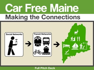
  • 1. Car Free Maine Making the Connections Social Networks Transit Networks 4 1C Wpu 5 Full Pitch Deck
  • 2. CarFree Maine 2 Suite of Location-Based Networking Tools designed to enhance non-automotive transportation connections throughout the State of Maine. Local outreach effort builds on local partnerships and forges strong connections between transportation providers, government agencies, local tourism bureaus, chambers of commerce, NGOs and local businesses Marketing effort focuses on young adults in NY and Boston Metros between the age’s of 18-30 and 30-40 years old
  • 3. Emerging generations are moving into downtowns, driving less, walking more, living in smaller homes[...], preferring local businesses, [...] prioritizing health, going green and valuing community and social networking like never before.-Neil Takemoto www.cooltownstudios.com Farmers Market Cafe'
  • 4. • In the City of Boston (not Boston Metro Region Commuters including Cambridge, Newton etc...) almost 92,000 people do not own a vehicle. 41 % • Almost 300,000 people 50% commute to work via Public Transportation Regionwide 10% • More than half of all Transit Users are in the 24-44yr/old Car, truck, or van -- drove alone Car, truck, or van -- carpooled Age Group Public Transportation • 1/3 of users Commute via Public Transportation (100,000) use 5%5%5% 14% Mobile Transit 14% Apps* 58% Statistics from, 2005-2009 American Community Survey 5-Year Estimates 16 to 19 years 20 to 24 years 25 to 44 years 45 to 54 years *Joshua Robin,  Director of Innovation and Special Projects at the MBTA, http://transportationnation.org/ 55 to 59 years 60 years and over 2011/05/13/boston-upwards-of-13-of-ridersM-use-transit-app-tools/)
  • 5. “Young people aren't simply swapping cars for buses or bikes; they are choosing to own and use other technology instead, such as smartphones and tablet computers.” -www.shareable.com “Carmakers' next problem: "Previous generations found freedom and Generation Y flexibility through the car.  But Generation People in their teens and twenties are more Ys find their freedom and flexibility by interested in gadgets than cars” staying connected to their friends, family and workplaces through the various http://www.msnbc.msn.com/id/39970363/ns/business-autos/ information devices - like their laptops, or iphones. "They can stay connected on a bus or a “ train. They can bring the office with them. They can bring their study with them. They can bring their friends with them. They can't if they're driving." ” -- Peter Newman, Curtin University, Perth, Australia, quoted in the West Australian, www.humantransit.org Article: http://adage.com/digital/article?article_id=144155
  • 6. What if you want to get out of the city every once in awhile? Where can you go without a car?
  • 7. You can take the train to Maine! Nearly 500,000 people a year ride the Amtrak Downeaster between Boston and Portland Maine with an extension to Freeport and Brunswick scheduled for operation in Fall of 2012. 7
  • 8. Welcome to Maine 20 Miles Downtown, Shops, Beaches, Hotels Attractions, Mountains? “You can’t get there from here” ? ?!!! We’ve arrived in Maine... 8 Now what? Getting from the train station to hotels, beaches, trails, restaurants etc... can be confusing for the uninitiated. Without convenient connections many potential riders see no other option than to rent or drive their own vehicle instead. Which means spending a third of their budget on gas, and a third of their time sitting in traffic.
  • 9. Out of the 12 stops between Boston and Brunswick only Freeport lacks a fixed-route local transit system. Other connections include Intercity busses, an extensive island ferry system and the Maine Eastern Railroad to Rockland. However, 9 keeping track of these connections can seem impossible.
  • 10. Solution CarFree Maine After researching and planning the trip on the CarFree Maine web page, the user finds the local transit connection via the GPS-enabled Mobile app 10
  • 11. 11 ■ Simple interface allows personalized travel choices involving multiple transportation networks, modes, schedules and wayfinding systems. Brunswick ■ Utilizes collaborative mapping/Geo- networking technology ■ Promotes Sustainable Transportation by Ride Stay Book connecting riders to underutilized portions of transit networks ■ Interface will be optimized for user-generated Eat Bike Walk content on both web and mobile platforms ■ Allows users to post reviews via Find Map Position OpenStreetMap portal, video logs and social networking profiles (Integration w/Facebook, TripAdvisor, Yelp, Gowalla, Foursquare, Twitter, Wikitude...)
  • 12. Brunswick Brunswick Transportation Ride Stay Reserve Rail Bus Tickets Eat Bike Walk CarShare Bike Trails See Learn Map Closest Schedules Maps 12
  • 13. Browser Window http://www.carfreemaine.org/ Search x CarFreeMaine Routes Local Map Connect Book Media Blog Mobile App Express see all Local see all Map your route, make suggestions, share waypoints, photos and videos, get group CarFree Maine discounts and more! Transportation Resources Along the Maine Destinations, Events, Activities Coast Connect With 13
  • 14. Browser Window CarFreeMaine-Transportation rail bus ferry carshare cycling Transit Options Brunswick +2 Freeport Portland +2 Old Orchard Beach +2 Saco/Biddeford Wells Dover 14
  • 15. The Plan Market Development Research Concept Concept and Development Strategies
  • 16. Social Transportation Mobile Open Source/Commons GeoCaching GPS Navigation Collaborative Mapping Online Mapping Formats Location/GeoSocial (GTFS, GIS, KML) Networks OpenStreetMap Social Media Electronic Data Tf
  • 17. Social Transit A few innovative programs such as NextTrain, Roadify and Waze utilize user-generated content to provide data where proprietary systems are ineffective. User-Generated Applications can be incredibly effective if they reach the critical mass of user-interaction . Waze founder Diann Eisnor recommends the following formula for building a user base- Build Play Value Critical Mass From a presentation by WAZE founder Diann Eisnor “Game Mechanics and LBS: Crossing the LBS Chasm”
  • 18. Build 18 Technology Community Interface Mapping Online Offline Database of existing Web Features- User Profiles, transit options Communities of combination of GTFS, Local Partnerships Dashboard,Listing, OSM, AVL, Open511 Interest Recommendations formats Mobile Features- Trip Planner- “Livable Streets”, Non-Profits, Tourism Timestamps, Tracking, OpenTripPlanner, NextBus, Streetsblog, Streetfilms, Bureaus, Chambers of Check-ins, Media Upload, Catapulter, must operate on “#CarFree” Boston Music Commerce, Downtown Real-Time Reviewing multiple formats Scene, Cyclists Association “OffManhattan”, Integration- HTML5/Native Transit-Map Overlay MDOT, NNEPRA, GPCOG, “Planetizen””Treehugger” Hybrid App, Web and Mobile Design PACTS, MBTA, MCT “Bostonist” Gothamist” utilize Open API Integration inspired by NextMap Business Sponsors- “Freemium” Services- LLBEAN, Outfitters, Cycle Travel Blogs Direct Booking, Planning, Shops. Concert/Festival Full Tour Packages, Promoters Discounts Beta Community of “Transit Pioneers” Inventory of Transit Alternatives along (Early Adopters) Downeaster Corridor Local Partnerships (Non-Profits, Local User-Friendly Interface utilizing GO-SYNC (GTFS- Businesses, Universities, Transit Agencies etc...) OSM Syncronization) and TRB Multimodal Data
  • 19. Play 19 Successful developers often provide incentives to encourage users-participation. “Geo-Social” Networks like foursquare and Gowalla add elements of gameplay by awarding “badges” and “mayorships” “Local Deal-a-day” platforms such as Groupon and Living Social are some of the fastest growing segments in the e-commerce space and are increasingly utilized in tandem with foursquare and Gowalla.
  • 20. Play 20 Green Branding meets Game Mechanics While some “green enrepreneurs” have found it difficult to sell a product based on environmental impact alone, the “green brand” can provide a powerful incentive when applied to game mechanics. Incentives will be given for users to- • Upload geotagged data Possible incentives- • contribute map visuals • Utilize as many transit modes and • Carbon Footprint Calculator systems as possible • Carbon “Credits” • suggest a trip, route, vacation or • “Mode Shares” place • Calorie Counter • contribute travelog (including video, • Mileage Log blog, photo, audio) • Fuel Savings Calculator
  • 21. Value ➡ Spends less money on Gas, Insurance, Parking, Tolls ➡ More exercise ➡ Low-Impact accessibility to recreation, wilderness protected Local Economy areas ➡ Downtown Businesses near rail/transit ➡ More time to read, write, research etc... instead of driving find more customers with less vehicle traffic ➡ Online packages can include Hotels, User Restaurants, Thrift Store Hunts, Bicycle Shops, Outdoor Outfitters, Rafting Trips, Transit Providers Kayaking ➡ Ability to reach younger customer base ➡ Increase Ridership ➡ access to transit can be key factor in ➡ Free, Accurate, Real-Time Data attracting educated talent for the ➡ Ability to engage directly with workforce customers and stakeholders ➡ Coordination with Farmer’s Markets, ➡ Saves money on consulting fees Art’s Events, Festivals, Fairs, Museums ➡ Data on multimodal travel etc... patterns helps identify “weak ➡ Coordination with “Nature-Based links”in the multimodal system and allows for efficient allocation of Tourism” Brand Environment resources ➡ Less Cars=Less Carbon ➡ In-App Booking Capability ➡ Transit use, walking, cycling promotes dense, streamlines ticketing procedures mixed-use village centers ➡ Density=Less Sprawl ➡ Less Sprawl= Protects family farmland, wildlife habitat, wetlands, open spaces ➡ Less Sprawl= less toxic runoff from pavement ➡ State and National parks made more accessible with less of an impact
  • 22. Critical Mass 22 Applications that rely on user-generated content must reach a “Critical Mass” threshold of roughly 300 users to be effective. The challenge in Maine is to reach this critical mass in an area of relative low population density. Goal- Identify “Champions”, “Lighthouse Customers” i.e. small percentage of highly engaged users who contribute majority of content in early phase ■ Potential “Lighthouse Customers”- Cyclists, Urbanists, Environmentalists, “#CarFree”, Students, Adventure Travelers, “Green Tourism”, Backpackers, Cycle Camping families, Boaters, Agritourist’s (Farmer’s Markets, CSAs, Common Ground Fair etc), Climate Activists, Artwalk Tours ■ Expanded User Base- Arts/Cultural Tourists, Conference Attendees, Film Festival-goers, Music Festival-goers, Shoppers, Thrift Store Explorers, Retirees, Minor League Sports Fans, Young Families, Seasonal Residents, Island Residents, Summer Campers/Counselors, Skiers, Winter Sports enthusiasts
  • 23. Further Information 23 Presentations- Presentations can be found at The CarFree Corridor- www.carfreemaine.org, or Detailed presentation outlining existing and http://www.slideshare.net/newmediatransit potential locations where CarFree travel is email-ajawitz@newmediatransit.com possible in Maine Twitter-@carfreemaine Why CarFree?- Market research outlining the social/economic impact of automobile dependency on rural areas and why Generation Y is overwhelmingly rejecting the Car. Why Maine?- Outlines specific strategies for the implementation of regionally-appropriate transit technologies. Argues that public transportation can be a viable option in rural areas