SlideShare ist ein Scribd-Unternehmen logo
1 von 264
Downloaden Sie, um offline zu lesen
Final Report
Hawkesbury-Nepean River System Coastal
Management Program Stage 1 Scoping Study
Prepared for Hornsby Shire Council
16 April 2020
Hornsby Shire Council | 16 April 2020
Hawkesbury-Nepean River System Coastal Management Program Stage 1 Scoping Study
19010166_R01_V03
Document Status
Version Doc type Reviewed by Approved by Date issued
1 Draft Report ND; ABM ND 18.12.2019
2 Revised Draft ND ND 27.02.2020
3 Final Report ND; CB ND; CB 16.04.2020
Project Details
Project Name Hawkesbury-Nepean River System Coastal Management Program
Stage 1 Scoping Study
Client Hornsby Shire Council
Client Project Manager Ana Rubio
Water Technology Project Manager Christopher Beadle
Water Technology Project Director Tony McAlister
Authors Christopher Beadle;Neil Dufty;Jenni Kremer
Document Number 19010166_R01_V03
COPYRIGHT
Water Technology Pty Ltd has produced this document in accordance with instructions from Hornsby Shire Council for
their use only. The concepts and information contained in this document are the copyright of Water Technology Pty Ltd.
Use or copying of this document in whole or in part without written permission of Water Technology Pty Ltd constitutes an
infringement of copyright.
Water Technology Pty Ltd does not warrant this document is definitive nor free from error and does not accept liability for
any loss caused, or arising from, reliance upon the information provided herein.
Cover photograph courtesy of Destination NSW.
Suite 3, Level 1, 20 Wentworth Street
Parramatta NSW 2150
Telephone 02 8080 7346
ACN 093 377 283
ABN 60 093 377 283
Hornsby Shire Council | 16 April 2020
Hawkesbury-Nepean River System Coastal Management Program Stage 1 Scoping Study
19010166_R01_V03
EXECUTIVE SUMMARY
The Hawkesbury-Nepean River system is a major
social, environmental and economic asset for the
state of New South Wales. This extensive estuary
system encompasses the Hawksbury-Nepean River,
Pittwater, Brisbane Water and Broken Bay, which
span the Greater Sydney and Hunter - Central Coast
regions. Together, these provide a stunning natural
environment, areas of cultural significance, a
multitude of social and recreational benefits, and are
a key contributor to the regional economy.
In accordance with the NSW Coastal Management
Framework, management of the estuary system and
its tributaries will be guided by a Coastal
Management Program (CMP). The six (6) councils
that border the tidal waterways of the system have
agreed to work together through Stage 1 of an
integrated, whole of system CMP. The councils are:
◼ Central Coast
Council
◼ Hornsby Shire
Council
◼ Hawkesbury City
Council
◼ Ku-ring-gai
Council
◼ The Hills Shire
Council
◼ Northern Beaches
Council
The purpose of the CMP is to set the long-term
strategy for the coordinated management of the
system and its catchment. The CMP seeks to
achieve the objectives of the Coastal Management
Act through a program that will identify coastal
management issues, pressures, and risks - and the
actions required to address these issues in a
strategic and integrated way.
This Scoping Study represents the first of five stages
in the CMP Process. As per the requirements of the
NSW Coastal Management Manual, this study has
reviewed the history of managing the river system,
developed a shared understanding of the current
situation, and identified the strategic path of the
remaining CMP stages, which include:
◼ Stage 2: A detailed assessment of risks,
vulnerabilities and opportunities;
◼ Stage 3: Identification and evaluation of
management actions;
◼ Stage 4: Preparation, exhibition and adoption
of the CMP; and
◼ Stage 5: Implementation, monitoring and
evaluation
Values of the Hawkesbury-Nepean River System
The Hawkesbury-Nepean River system includes a
diverse range of natural environments, including
aquatic ecosystems that span both marine and
freshwater, and terrestrial ecosystems that include
the riparian zone and catchment systems. The
system possesses significant biodiversity and
conservation value, and contains a vast array of
freshwater and coastal wetlands - including
mangrove forests, seagrass beds, and saltmarshes.
These habitats support a diverse assemblage of
ecosystems, including a number of endangered
ecological communities and over 130 vulnerable and
threatened species.
Land use across the wider Hawkesbury-Nepean
catchment is diverse. The majority of the catchment
(more than 70%) comprises undeveloped bushland
and national parks, with agricultural use and forestry
also prominent across the upper catchment. Areas of
high intensity urban development are common
across the lower catchment, particularly within the
Greater Sydney and Central Coast regions, with
isolated pockets in the upstream catchments. The
Hawkesbury-Nepean Catchment also provides
drinking water for 5 million people across Greater
Sydney, and the upstream catchment also provides
for local rural water supplies (for example Goulburn,
Bowral and Lithgow).
The system and its catchment provide spectacular
scenic amenity and a vast array of recreational
opportunities to both the local community and its
visitors. It contains some of the most popular and
heavily trafficked waterways in the state, largely as a
result of its proximity to Sydney and Central Coast.
There are over 100,000 boat licence holders in the
Hawkesbury River, Pittwater and Brisbane Water
region and over 40,000 registered recreational
vessels.
The estuary is also a significant contributor to the
“blue economy” of the Greater Sydney and Central
Coast regions. It supports the aquaculture (oysters
farming), commercial fishing and tourism industries,
and provides substantial economic value in the form
of its ecosystem services.
Hornsby Shire Council | 16 April 2020
Hawkesbury-Nepean River System Coastal Management Program Stage 1 Scoping Study
19010166_R01_V03
Pressures and Threats Facing the Estuary
A first-pass risk assessment has been undertaken as
part of this Scoping Study, which has identified that
the river system is facing a number of pressures that
threaten its environmental, social and economic
values. Many of these threats will increase over the
coming decades due to population growth within the
catchment and the impacts of climate change. These
pressures range from smaller localised issues, up to
larger scale, system-wide threats that will require a
coordinated and collaborative management
approach.
Coastal inundation and sea level rise represent a
significant issue over future planning horizons for a
number of low-lying communities and critical
infrastructure across the Brisbane Water, Pittwater
and the Hawkesbury River estuaries. Many of these
communities will be exposed to permanent
inundation, or an increased frequency of temporary
inundation associated king tides and coastal and
catchment flooding.
Catchment runoff and urban stormwater discharge
are a major source of water quality issues at various
locations across the study area. Water quality has
also historically been affected by runoff associated
with agricultural activities across the catchment and
point source discharges from waste water treatment
facilities. These water quality issues across the
system can affect estuary health and aquatic
ecosystems, recreational amenity and the local
aquaculture industry.
Other key threats include the disturbance of riparian
and aquatic habitat, and the presence of invasive
species and diseases. Blooms of harmful algal
species have historically occurred across both the
upper and lower Hawkesbury River, with associated
environmental, social and economic impacts.
The study has also identified a number of emerging
pressures that will increasingly affect the system
over the coming decades. The Greater Sydney
Regional Plan identifies a number of major
development areas within the Hawkesbury-Nepean
catchment that will house a significant population
increase over the next twenty years. This will also
include substantial industrial and commercial
precincts – including the Western Sydney
International Airport. This intensification of urban
development across the catchment will result in a
significant increase in the urban and industrial
discharges into the river system.
Another major challenge identified by the project
stakeholders is the lack of coordination across the
river system and catchment between the estuary
councils, catchment councils, and state government
agencies. This has historically resulted significant
jurisdictional ambiguity across governance bodies,
and a reduced ability to address system-wide issues
and threats.
The Benefits of a CMP
The stakeholder engagement activities undertaken
as part of this scoping study demonstrated significant
support for the development of a CMP across a
broad range of local and state government agencies.
The CMP will provide an opportunity to develop a
strategic, long-term approach to estuary and
catchment management, and improve coordination
across local governments and state government
agencies. It provides an opportunity to link with local,
regional and state planning initiatives, as well as
programs and strategies across the upper
catchment. Through this approach, the CMP can
improve river health across not just the estuarine
reach of the study area - but across the waterways
and contributing catchment of the wider
Hawkesbury-Nepean River system.
The CMP will provide a robust and defensible
platform to secure funding from the NSW
Government's Coastal and Estuary Grants Program
and other potential funding sources, and support the
implementation of projects that will provide tangible
benefits to the local community right across the
catchment. This is vital to ensure safe and
sustainable access to the river system, protect public
assets from current and future hazards, and maintain
healthy ecosystems and biodiversity.
The Scope of the CMP
The project steering committee has decided to adopt
a system-wide approach to the CMP, in recognition
of the fact that important physical and ecological
processes extend across the waterways, catchment
and foreshores of the Hawkesbury-Nepean River
system. The study area of the CMP therefore
includes the Hawkesbury-Nepean River system, the
Brisbane Water Estuary, the Pittwater Estuary and
Hornsby Shire Council | 16 April 2020
Hawkesbury-Nepean River System Coastal Management Program Stage 1 Scoping Study
19010166_R01_V03
Broken Bay - as well as the wider contributing
Hawkesbury-Nepean catchment.
This system-wide approach will provide a vehicle for
the coordinated and strategic management of the
river system, and create a program that can more
effectively and efficiently address catchment scale
issues, threats & risks. This approach can also foster
alignment with regional and strategic planning
initiatives.
Furthermore, there may be significant cost savings
associated with this approach, compared to
developing multiple CMPs for the each of the
individual estuaries (Brisbane Water, Pittwater, and
the Hawkesbury River). The system-wide CMP can
harness economies of scale and provide a platform
for attracting government and/or private funds to
address larger (catchment scale) issues and threats.
Governance
Governance of the estuary is multi-layered, with the
waterways and foreshores owned and managed by
a wide variety of stakeholders across multiple levels
of government.
This scoping study has recommended a governance
structure for the remaining stages of the CMP. The
program should be led by a project steering
committee, which will be comprised of the six estuary
councils and the Department of Planning, Industry
and Environment (DPIE). The steering committee will
be supported by a series of advisory bodies
comprising of relevant state government agencies,
councils from the upper catchment, indigenous
interest groups, and a community reference group. It
is also recommended that the CMP implement a paid
part-time project coordinator during Stage 2, in order
to manage the project on a day-to-day basis and
oversee the development and implementation of the
program.
Stakeholder and Community Engagement
The development of the CMP will include extensive
engagement with the local community and user
groups, relevant government agencies, and
indigenous peoples.
As part of this Scoping Study, a Stakeholder and
Community Engagement Strategy has been
prepared for the remaining stages of the CMP
development process. The strategy has been
prepared in accordance with the requirements of the
NSW Coastal Management Manual.
The Way Forward
This report has identified a number of studies
required during Stage 2 to fill critical data gaps and
inform sound management decisions.
A business case and forward plan for development
of the five-staged program has also been developed,
based on the requirements of the subsequent
stages. It is estimated that the CMP will take around
2½ to 4 years to progress through Stages 2 through
to 4. The fifth and final stage will involve the ongoing
implementation of the program over a 10-year period
thereafter.
The overall cost of developing the CMP will likely be
in the range of $1.0-1.7 million (Stages 2 to 4
inclusive), but will depend on a number of factors
moving forward. The CMP is eligible for financial
assistance from the NSW Coastal and Estuary
Grants Program, administered by DPIE. Other
funding sources should also be pursued.
TABLE EX-1: CMP FORWARD PROGRAM
Stage Approx.
Cost
Approx.
Timing
Stage 2: Determine
Risks,
Vulnerabilities and
Opportunities
$580k-$1.1m
15-24
months
Stage 3 –
Response
Identification and
Evaluation
$310-470k
9-15
months
Stage 4 – Finalise,
Exhibit and Certify
the CMP
$120-230k
9-12
months
Total $1.0-1.7m 2½ - 4 yrs
Following approval and certification of the CMP at
the completion of Stage 4, the CMP will be
implemented in Stage 5 by the partner councils via
the Integrated Planning and Reporting framework,
and Community Strategic Plans. This framework will
guide the implementation of the CMP and ensure all
required monitoring and reporting is completed. It will
also provide a framework for the review and
assessment of CMP outcomes.
Hornsby Shire Council | 16 April 2020
Hawkesbury-Nepean River System Coastal Management Program Stage 1 Scoping Study
19010166_R01_V03
CONTENTS
1 INTRODUCTION 1
1.1 Background 1
1.2 The NSW Coastal Management Framework 1
1.3 The Hawkesbury-Nepean River System Coastal Management Program 2
1.4 The Study Area 3
1.5 Governance Structure for Stage 1 9
1.6 Structure of this Report 10
2 PURPOSE, VISION AND OBJECTIVES 11
2.1 Purpose 11
2.2 Vision 11
2.3 Objectives 11
3 STRATEGIC CONTEXT FOR THE CMP 13
3.1 Methods and Limitations 13
3.2 Environmental Context 14
3.3 Governance Context 28
3.4 Policy Context 36
3.5 Management and Planning Context 43
3.6 Economic Context 53
3.7 Social and Cultural Context 56
4 STAKEHOLDER ENGAGEMENT 61
4.1 CMP Engagement Requirements 61
4.2 CMP Engagement Guidelines 61
4.3 Stakeholder Analysis 62
4.4 Community Profile 66
4.5 Previous Study Area Engagement and Existing Strategies 68
4.6 Stage 1 Engagement 71
4.7 Community and Stakeholder Engagement Strategy 75
5 SCOPE AND STUDY AREA 76
5.1 Spatial Extent 76
5.2 Coastal Management Areas 80
6 COASTAL MANAGEMENT ARRANGEMENTS 87
6.1 Existing Studies and Management Plans 87
6.2 Implementation of Existing Management Plans 91
6.3 Monitoring Programs 92
6.4 Challenges and Opportunities for Estuary and Catchment Management 95
7 CMP DELIVERY AND GOVERNANCE STRUCTURE 97
7.1 Spatial Scale of CMP Delivery 97
Hornsby Shire Council | 16 April 2020
Hawkesbury-Nepean River System Coastal Management Program Stage 1 Scoping Study
19010166_R01_V03
7.2 CMP Governance 100
8 FIRST-PASS RISK ASSESSMENT 106
8.1 Methods and Limitations 106
8.2 Values 106
8.3 Threats and Stressors 111
8.4 First Pass Risk Assessment 115
8.5 Key Issues 116
9 KNOWLEDGE GAP ANALYSIS 123
9.1 Knowledge Gap Analysis 123
9.2 Studies to be Prepared in Stage 2 127
10 FORWARD PROGRAM 134
10.1 Overview of CMP Stages 134
10.2 Forward Program 136
10.3 Planning Proposals 137
10.4 Implementation 138
11 BUSINESS CASE 139
11.1 The Benefits of Undertaking a CMP 139
11.2 Support for the CMP Process 141
11.3 Funding Mechanisms and Cost Sharing 141
11.4 CMP Workplan and Cost Structure 143
12 REFERENCES 147
APPENDICES
Appendix A Community & Stakeholder Engagement Plan
Appendix B Overview of Existing Knowledge and Data
Appendix C CMP Linkages to Existing Plans
Appendix D Stage 1 Stakeholder Enagagement Summaries
Appendix E Management Plan - Audit of Implementation
Appendix F First Pass Risk Assessment
Appendix G Knowledge Gap Analysis
LIST OF FIGURES
Figure 1-1 The NSW Coastal Management Framework 2
Figure 1-2 The CMP Process 3
Figure 1-3 The Warragamba Dam (Source: iNSW ) 4
Figure 1-4 Wisemans Ferry 4
Figure 1-5 Hawkesbury River at Brooklyn (Source: DPIE, 2019c) 5
Figure 1-6 Pittwater Estuary (Source: DPIE, 2019c) 5
Hornsby Shire Council | 16 April 2020
Hawkesbury-Nepean River System Coastal Management Program Stage 1 Scoping Study
19010166_R01_V03
Figure 1-7 Brisbane Water Estuary (Source: DPIE, 2019c) 6
Figure 1-8 Broken Bay (Source: DPIE, 2019c) 6
Figure 1-9 Locality Plan 8
Figure 1-10 Stage 1 CMP Steering Committee 9
Figure 1-11 Additional Stage 1 Project Stakeholders 9
Figure 3-1 Sedimentary Zones of the Hawkesbury (Source: Devoy et al,1994) 15
Figure 3-2 Land Use Across Lower Hawkesbury River Catchment (Source: ABRES, 2016).
Hawkesbury-Nepean Catchment in Red Outline 17
Figure 3-3 Erosion at Umina Beach in 2015 (Left) and 1986 Flood at Windsor (Right) 23
Figure 3-4 Longneck Lagoon (Source: NPWS) 24
Figure 3-5 Posidonia Australis (Source: DPI) 25
Figure 3-6 Black Rockcod (Source: DPI) 26
Figure 3-7 Project Coast Climate Change Impacts for the Sydney Region (NSW Adapt, 2019) 28
Figure 3-8 NSW State Government Agencies Relevant to the CMP 31
Figure 3-9 Dharug National Park (Source: NPWS) 32
Figure 3-10 ANZ Water Quality Management Framework (Source: NWQMS, 2019) 44
Figure 3-11 The Risk-Based Framework (Source: OEH, 2017) 45
Figure 3-12 Ettalong Channel Dredging (Source: Daily Telegraph) 46
Figure 3-13 A Metropolis of Three Cities – The Greater Sydney Region Plan (Source: GSC, 2018) 47
Figure 3-14 Integrated Planning and Reporting Framework (Source: NSW OLG, 2019) 50
Figure 3-15 Hawkesbury River Aquaculture (Source: ABC News) 54
Figure 3-16 Kayaking the Hawkesbury (Source: Destination NSW) 55
Figure 3-17 Bridge 2 Bridge Water Ski Classic 59
Figure 3-18 Recreational Boating in Pittwater (Left) and Surfing at Ocean Beach (Right) 60
Figure 4-1 IAP2 Spectrum 62
Figure 4-2 Sample Output Using Social Atlas 68
Figure 4-3 Workshop Discussion Forums as part of Workshop #1 73
Figure 4-4 Workshop Discussion Forums as part of Workshop #2 73
Figure 4-5 “World Café” Sessions as part of Workshop #2 74
Figure 5-1 Coastal Environment Area and Coastal Use Area 78
Figure 5-2 Coastal Wetlands and Littoral Rainforests 79
Figure 6-1 The Brisbane Water CZMP 88
Figure 6-2 Coastal Hazard Study: Mapping for Pearl Beach 90
Figure 6-3 Water Quality Monitoring Sites Across the Estuary Reach 93
Figure 6-4 Streamwatch Water Monitoring Sites Across the Study Area 94
Figure 7-1 Proposed CMP Governance Structure 105
Figure 8-1 Algal Bloom in Berowra Creek in 2016 (Source: Daily Telegraph) 120
Figure 10-1 Estimated Project Program 137
Figure 10-2 Relationship Between the IP&R Framework and the CMP (Source:OEH, 2018h) 138
Figure 11-1 Riverboat Tourism in The Estuary (Source: The Australian) 139
LIST OF TABLES
Table 3-1 Establishing the Strategic Context of the CMP 13
Table 3-2 Estuary Classifications (Roy et al, 2001) 14
Hornsby Shire Council | 16 April 2020
Hawkesbury-Nepean River System Coastal Management Program Stage 1 Scoping Study
19010166_R01_V03
Table 3-3 Land Use Composition Across the Study Area Catchments (Roper et al, 2011) 16
Table 3-4 Major Infrastructure Across the Estuarine Reach of the Study Area 18
Table 3-5 WWTP’s Managed by Sydney Water Across the Hawkesbury-Nepean Catchment 18
Table 3-6 Estuary Catchment Hydrology (Roper et al, 2011) 20
Table 3-7 Estuary Habitat Parameters (Roper et al, 2011) 24
Table 3-8 Local Government Areas Intersecting the Study Area Catchments 28
Table 3-9 Overview of Roles and Responsibilities of Councils Across the Coastal Zone 29
Table 3-10 National Parks Intersecting the Hawkesbury-Nepean Catchment 32
Table 3-11 Relevant Legislation 39
Table 3-12 Existing Coastal and Estuary Management Plans 43
Table 3-13 Local Planning Documents for Partner Councils 52
Table 3-14 Economic Value of Agriculture, Forestry and Fishing 53
Table 3-15 Hawkesbury River Aquaculture Statistics 53
Table 3-16 Approximate Economic Valuation of Hawkesbury River Estuary Ecosystem Services 54
Table 3-17 Partner Council Tourism Data (Source: Community id, 2019) 55
Table 3-18 Aboriginal and Torres Strait Islander Population Across the Study Area 56
Table 3-19 Population Growth Across the Study Area 2016-2036 58
Table 3-20 Population Growth Across Partner Councils 2016-2036 58
Table 3-21 Projected High Growth Population Areas Across Western Sydney 2016-2036 58
Table 4-1 Key Community Groups in the Study Area 63
Table 4-2 Community Profile Across the LGAs 67
Table 5-1 Summary of Existing Coastal Vulnerability Assessments for the Study Area 83
Table 5-2 Applicibility of Existing Hazard Mapping to the CVA 86
Table 6-1 Summary of Management Plan Audit 92
Table 7-1 SWOT Analysis for using System-Wide Approach for CMP Governance 99
Table 7-2 Governance Structure Summary 104
Table 8-1 NSW River and Marine Water Quality Objectives Community and Environmental Values and
Uses (NSW Government, 1999), and Application to Hawkesbury-Nepean River System 109
Table 8-2 Additional Estuary and Catchment Values 110
Table 8-3 Summary of Threats 112
Table 8-4 Consequence Definitions, adapted from MEMA TARA (BMT WBM, 2017) 115
Table 8-5 Likelihood Definitions, adapted from MEMA TARA (BMT WBM, 2017) 115
Table 8-6 Risk Assessment Matrix, adapted from MEMA TARA (BMT WBM, 2017) 116
Table 8-7 Present Day Hish Risk Threats and Key Issues 117
Table 8-8 Future / Emerging High-Risk Stressors and Key Issues 122
Table 9-1 Major Bodies of Work Addressing Risks, Vulnerabilities and Opportunities 125
Table 9-2 Knowledge Gap Analysis Framework 126
Table 9-3 Knowledge Gap Implications 126
Table 9-4 Summary of Knowledge Gap Analysis 128
Table 9-5 Studies to be Prepared During Stage 2 of the CMP 129
Table 10-1 Planning Proposal Overview for Coastal Management Areas 137
Table 11-1 Potential Cost Sharing Arrangements 143
Table 11-2 Preliminary Work Plan for and Cost Structure for Stages 2 145
Table 11-3 Preliminary Work Plan for and Cost Structure for Stages 3 and 4 146
Hornsby Shire Council | 16 April 2020
Hawkesbury-Nepean River System Coastal Management Program Stage 1 Scoping Study
19010166_R01_V03
1 INTRODUCTION
1.1 Background
The Hawkesbury-Nepean River system is a major social, environmental and economic asset for the state of
New South Wales (NSW). It is the largest river system in the Greater Sydney and Central Coast regions, and
contains beautiful iconic beaches, sprawling waterways and tributaries, and areas of social and cultural
significance. Along with being a key economic driver for the region, the coastal zone also contains a passionate
local community, who are heavily invested in its utility and management.
Future coastal management for the Hawkesbury-Nepean River System will take the form of a Coastal
Management Program (CMP). The six (6) councils that border the tidal waterways of the system are partnering
to understand what is required for the development of an integrated, whole of system CMP. These councils
comprise:
◼ Central Coast Council;
◼ Hawkesbury City Council;
◼ The Hills Shire Council;
◼ Hornsby Shire Council;
◼ Ku-ring-gai Council; and
◼ Northern Beaches Council.
The purpose of CMP would be to establish an integrated program to support the coordinated management
and ecologically sustainable development of the Hawkesbury-Nepean River system - which includes the major
estuaries of Brisbane Water, Pittwater, the Hawkesbury River and Broken Bay - in order to maintain and
enhance its social, cultural, economic and environmental values. For the purposes of this report, references
to “The Hawkesbury-Nepean River system” refer to the overall river system comprising the Hawkesbury-
Nepean River, Brisbane Water, Pittwater, and Broken Bay.
This Hawkesbury-Nepean River system CMP Stage 1 Scoping Study has been prepared through collaboration
and to develop a shared understanding of the system and its management. The study also describes the
proposed approach for undertaking Stage 2 to Stage 5 of the CMP - consistent with the NSW Coastal
Management Framework.
This study has been prepared in accordance with the requirements outlined in the Coastal Management
Manual (OEH, 2018a), in consultation with the NSW Department of Planning, Industry and Environment
(DPIE), the six partner councils, and key state agencies and associated stakeholders (e.g. wider catchment
councils) that play a role in the management of the Hawkesbury-Nepean River system.
1.2 The NSW Coastal Management Framework
The NSW coast provides a multitude of values and uses for the community. This competition for use and
enjoyment places the coastline under increasing pressure (OEH, 2018a). Planning for coastal communities
must carefully balance the need to provide jobs, housing, community facilities and transport for a changing
population while maintaining the unique qualities and recreational activities and, managing risks associated
with development along our coastlines (DPIE, 2019).
Sustainable management of the coastal zone involves councils, their communities and public authorities
balancing a diverse range of challenges and opportunities. The context is one of rapid environmental, social
and economic change along with dynamic coastal processes affecting the open coast, estuaries and coastal
lakes (OEH, 2018a).
In order to plan for development, protect environmental assets and manage coastal hazards across the state,
the NSW Government has developed the NSW Coastal Management Framework, which includes changes to
Hornsby Shire Council | 16 April 2020
Hawkesbury-Nepean River System Coastal Management Program Stage 1 Scoping Study
19010166_R01_V03
legislation and planning policy that aims to provide an integrated framework for coastal management across
the state.
Key components of the framework include:
◼ Coastal Management Act 2016 (CM Act): Provides for the integrated management of the coastal
environment of NSW consistent with the principles of ecologically sustainable development, for the social,
cultural and economic wellbeing of the people of the state.
◼ Marine Estate Management Act 2014 (MEM Act): Provides for the management of the marine estate of
NSW in a manner that promotes a biologically diverse, healthy and productive marine estate and facilitates
the economic cultural, social and recreational use of the marine estate.
◼ Coastal Management State Environmental Planning Policy 2018 (CM SEPP): One of the key
environmental planning instruments for land-use planning in the coastal zone. It gives effect to the
objectives of the CM Act 2016, and delivers on the statutory management objectives of the act by
specifying how development proposals are to be assessed if they fall within the coastal zone.
◼ The advent of CMPs: A five stage coastal management process intended to set the long-term strategy for
the coordinated management of the coastal zone for a given region;
◼ The NSW Coastal Management Manual (The Manual): A manual that sets forth mandatory requirements
(Part A) and provides guidance to coastal councils (Part B) for the preparation, development, adoption,
implementation, amendment, and review of CMPs.
◼ The NSW Coastal Council – which is responsible for advising the Minister on coastal issues, as well as
reviewing and approving local council CMPs (when requested by the Minister to do so).
A schematic of the NSW Coastal Management Framework is provided in Figure 1-1.
FIGURE 1-1 THE NSW COASTAL MANAGEMENT FRAMEWORK
1.3 The Hawkesbury-Nepean River System Coastal Management Program
The purpose of a CMP is to set the long-term strategy for the coordinated management of the coastal zone of
a given area, with a focus on achieving coastal management objectives at a local and estuary-wide level whilst,
also achieving the objects of the CM Act. It provides an opportunity for councils, public authorities and local
communities to clearly identify and balance competing interests and priorities in the coastal zone.
Hornsby Shire Council | 16 April 2020
Hawkesbury-Nepean River System Coastal Management Program Stage 1 Scoping Study
19010166_R01_V03
More broadly, a CMP may be prepared by one or
more local councils for a given area. The area that a
CMP covers may comprise all or part of the coastal
zone of one local government area. Alternatively,
where important natural features such as coastal
sediment compartments or estuaries cover multiple
LGA’s, neighbouring Councils may choose to/are
encouraged to collaborate and prepare a CMP
covering the entire system irrespective of the
jurisdictional boundaries.
A CMP is prepared and implemented through a five
staged risk management process described in the
NSW Coastal Management Manual and depicted in
Figure 1-2. This process is intended to help councils
and their communities to identify and manage risks
to the environmental, social and economic values of
the coast. The Manual sets forth mandatory
requirements for CMPs, but also provides guidance
regarding their preparation, development, adoption,
implementation, and review.
The Manual provides information to help councils to
develop, evaluate and select management actions
that provide feasible and effective measures to
manage the coastal environment. These actions are then incorporated into councils’ land-use planning
instruments, Community Strategic Plans and Integrated Planning and Reporting (IP&R) Framework,
established under the Local Government Act 1993.
In undertaking this Scoping Study, the six partner councils fulfil the first stage of the CMP process. The primary
purpose of a Stage 1 Scoping Study is to:
◼ Review the history of managing the coastal zone;
◼ Develop a shared understanding of the current situation; and
◼ Identify the focus of the future CMP.
Stage 1 builds on and integrates with previous work, including existing plans and strategies, technical studies
and stakeholder input. It guides councils in formulating appropriate strategies and actions in later stages of the
process (Stages 2 to 5).
1.4 The Study Area
The Hawkesbury-Nepean is one of the most important river systems in NSW, and is the largest estuary system
in the Greater Sydney and Central Coast regions. The system occupies a unique location and bounds
Australia’s most populous city to the north and the west, and is situated to the immediate south of a vibrant
and growing Central Coast.
Under the CM Act, councils are required to take a systems approach to coastal management, that looks at
coastal zone issues in the broader, catchment scale context. For large estuary systems like Brisbane Water,
Pittwater, and the Hawkesbury River, a CMP must consider the relationship and interdependence between
coastal zone, waterway and catchment systems in order to effectively address system-wide issues and risks,
and promote coordination and collaboration across agencies. Therefore, the study area for the CMP comprises
the tidal waterways of the Hawkesbury-Nepean River system, including the Brisbane Water Estuary, the
FIGURE 1-2 THE CMP PROCESS
Hornsby Shire Council | 16 April 2020
Hawkesbury-Nepean River System Coastal Management Program Stage 1 Scoping Study
19010166_R01_V03
Pittwater Estuary, the Hawkesbury River Estuary and Broken Bay, as well as their contributing catchments.
Catchment land uses are described in more detail in Section 3.2.2.
The Hawkesbury-Nepean is the longest coastal
catchment in NSW (DPI, 2019). At over 470 km long,
the river extends from south of Goulburn all the way to
Broken Bay. The river drains over 21,400 km2 of wider
catchment land (DPI, 2019), of which an estimated 70%
is forested, 25% is agricultural and around 5% is
urbanised (HNCMA, 2005; WRL, 2003). The river-
system receives flows from the Grose River to the west
and the Nepean to the south, which includes a major
hydrological control of the Warragamba Dam – see
Figure 1-3).
The tidal waterways of the Hawkesbury River
commence at the confluence of the Grose River at
Yarramundi, and extend around 145 km downstream to
the open coast at Broken Bay. The following notable
coastal features (and their tributaries) are included in
the study area (as depicted in Figure 1-9):
◼ Broken Bay
◼ Pittwater Estuary
◼ The Brisbane Water Estuary
◼ Patonga Creek
◼ Cowan Creek
◼ Mullet Creek
◼ Mooney Mooney Creek
◼ Berowra Creek
◼ Marramarra Creek
◼ Mangrove Creek
◼ Macdonald River
◼ Webbs Creek
◼ The Colo River
◼ Cattai Creek
◼ South Creek
◼ Rickabys Creek
◼ The Grose River
From its upstream tidal limit, the Hawkesbury River follows a generally northerly direction, with a relatively
sandy composition, and passes through the towns of Richmond and Windsor (which are the largest settlements
on the river). Here the river exhibits large meanders and relatively wide floodplains. There are also lagoons
and floodplain wetlands like Pitt Town Lagoon and Long Neck Lagoon. At Windsor, the river links with South
Creek, which already receives a significant amount of the urban runoff from Sydney's western suburbs and it
is currently planned to see significant additional urban development. From Windsor to Sackville the river is
wide and deep, and the foreshore is relatively cleared and cultivated (HCC, 2019).
From Sackville to Spencer (Figure 1-4) the river is
characterised by steep sandstone cliffs,
undeveloped foreshore reserve and a series of low-
density floodplain settlements (HCC, 2019). On this
stretch the river passes through Lower Portland,
where it receives the Colo River. From here the river
meanders in an overall north-easterly direction, until
it reaches a sharp change of course at the riverside
community of Wisemans Ferry (where it is joined by
the Macdonald River). This portion of the river is
popular with recreational boating, particularly water
skiing and wakeboarding. Here its course turns
south-eastwards, and the surrounding landscape is
FIGURE 1-3 THE WARRAGAMBA DAM (SOURCE:
INSW )
FIGURE 1-4 WISEMANS FERRY
Hornsby Shire Council | 16 April 2020
Hawkesbury-Nepean River System Coastal Management Program Stage 1 Scoping Study
19010166_R01_V03
largely comprised of the undeveloped foreshore
reserves of the Dharug and Marramarra national
parks. The Lower Hawkesbury river is unique in that
the foreshore contains significant stretches of
forested areas with relatively little foreshore
development.
At the small foreshore settlement of Spencer, the
river receives Mangrove Creek from the north, and
then around 10 km farther downstream, it also links
with Marramarra and Berowra Creeks. At the
Mooney Mooney and Brooklyn region (Figure 1-5),
the river contains a number of small riverside
settlements such as Bar Point, Milsons Passage,
Dangar Island and Little Wobby, and the river is
traversed by major transport connections that link Sydney to the Central Coast - including the M1 Pacific
Motorway and the Sydney-Central coast rail bridge.
The Pittwater Estuary is located on the southern side of Broken Bay, at the Tasman Sea entrance (see
Figure 1-6). It is a tide dominated drowned valley estuary (Roy, 2001). The estuary extends from Newport and
Church Point in the south to its mouth at Broken Bay, and has over 52 km of foreshore and a water surface
area of around 17 km2 (CLT, 2009). Pittwater contains a range of complex physical processes which are
governed by the large entrance and the estuary's capacity for exchange with ocean water (L&T, 2002). The
tide range across the estuary is largely similar to that of the open coast.
The foreshores of Pittwater are lined by number of
bays, beaches and headlands. Major tributary creeks
of the Pittwater include Careel Creek, Salt Pan Creek,
Mona Vale Main Drain, Cahill Creek, McCarrs Creek
and Salvation Creek (L&T, 2002). Many other small
unnamed creeks also drain to the estuary. The system
also includes Scotland Island, which is located
towards the southern end of the estuary in between
Church Point and Clareville and contains a small
community of permanent residents. The island is
approximately 900 metres in diameter, and is only
accessible by boat.
The estuary is an important resource locally and
regionally, and is highly valued for its unique
environmental setting, delicate estuarine habitats,
and its contribution to the local economy and community (NBC, 2017). It is also a major recreational and
cultural asset for the region that experiences a high intensity of recreational use, particularly during the peak
summer period.
Pittwater has a catchment of nearly 6000 ha which extends from Mona Vale and Warriewood in the south to
along the eastern ridge of the Peninsula leading to Palm Beach and then along the western ridge leading to
West Head (L&T, 2002). The eastern and southern areas of the catchment are heavily urbanised, include the
suburbs of Palm Beach, Clareville, Newport, Bay View and Church Point. To its west, Pittwater is primarily
bounded by Ku-ring-gai Chase National Park, which comprises a large area of the Pittwater sub-catchment.
FIGURE 1-5 HAWKESBURY RIVER AT BROOKLYN
(SOURCE: DPIE, 2019C)
FIGURE 1-6 PITTWATER ESTUARY (SOURCE:
DPIE, 2019C)
Hornsby Shire Council | 16 April 2020
Hawkesbury-Nepean River System Coastal Management Program Stage 1 Scoping Study
19010166_R01_V03
The Brisbane Water Estuary (Figure 1-7) is located on the northern side of Broken Bay, and is a wave
dominated barrier estuary with an open entrance (Roy, 2001). The estuary extends from Gosford in the north,
down to its mouth at Broken Bay, and has over 90 km of foreshore and a water surface area of around 27 km2
(CLT, 2009). The estuary itself is relatively shallow and contains a number of small embayments and inlets.
There are five major waterways that comprise the Brisbane Water Estuary as identified in the Brisbane Water
Plan of Management (GCC, 1995). They are:
◼ Entrance Reach between The Rip and Half Tide
Rocks;
◼ Woy Woy Reach, including Pelican Island, Riley’s
Island and St Hubert’s Island;
◼ Kincumber Broadwater;
◼ Brisbane Water (upstream of Pelican Island); and
◼ Woy Woy Bay and Woy Woy Inlet.
Brisbane Water has a catchment of nearly 15,000 ha,
and drains a number of major creek and waterways.
These include, Narara Creek which enters the estuary
at Gosford, Coorumbine Creek, Erina Creek,
Kincumber Creek, Woy Woy Creek, as well as many
other smaller creeks and tributaries. The Brisbane water catchment contains a variety of land uses, and is
around 50% undeveloped bushland and national parks (including Brisbane Water National Park). The estuary
also contains areas of high-density urban development, including the population centres of Gosford, Erina,
Kincumber, Saratoga, Davistown, Empire Bay, Woy Woy, Ettalong and Umina. Brisbane Water also includes
the canal estate suburb of St Huberts Island, which was developed in the mid-1970s and is accessed by via
bridge at Daley’s Point. Two islands within the estuary, Pelican Island and Riley’s Island, function as nature
reserves and remain largely unaffected by development (CLT, 2008).
The Hawkesbury River, Pittwater and Brisbane
Water estuaries all interface with the Tasman Sea at
Broken Bay (see Figure 1-8), which is classified as
a semi–mature tide-dominated drowned valley
estuary. Broken Bay is exposed to coastal
processes along with beaches and rocky foreshores
in the northern portion of Pittwater and Patonga,
Pearl, Umina and Ocean Beaches. The bay also
contains a series of smaller coastal estuaries such
as Patonga Creek, Pearl Beach Lagoon and
Ettalong Creek which are each situated adjacent to
coastal communities. Cowan Creek, which drains
into Broken Bay, is a main arm of the estuary that
contains the recreational boating hubs of Cottage
Point and Bobbin Head.
The tidal waterways and foreshore span across six (6) LGAs (the partner councils), with an additional eighteen
(18) LGAs encompassed across the wider Hawkesbury-Nepean Catchment (either wholly or partly).
The Hawkesbury-Nepean River system comprises a highly connected network of hydrological, and ecological
systems, made up of a complex array of aquatic, riparian and terrestrial habitats. The entire Hawkesbury-
Nepean catchment is known to contain over 1,100 native vertebrates (including fish, amphibians, reptiles, birds
FIGURE 1-7 BRISBANE WATER ESTUARY
(SOURCE: DPIE, 2019C)
FIGURE 1-8 BROKEN BAY (SOURCE: DPIE, 2019C)
Hornsby Shire Council | 16 April 2020
Hawkesbury-Nepean River System Coastal Management Program Stage 1 Scoping Study
19010166_R01_V03
and mammals) and 1,700 invertebrates (HNCMA, 2005). The Australian estuaries database has classified the
Hawkesbury River as having 'high' conservation value, with a 'real' conservation threat (BMT WMB, 2008).
The area’s accessibility to the population of Sydney and the Central Coast, the open waterway with sheltered
bays and harbours, and its scenic quality make it a very popular destination for a large number of recreational
visitors (WBM, 2006b). The river system is also a major economic asset for the Greater Sydney and Central
Coast regions. The system directly supports the agriculture and aquaculture industries that provide much of
the regions fresh food, as well as supporting numerous other mining, manufacturing and processing industries
across the catchment - as well as recreation and tourism (WSU, 2019).
For the purposes of this report, references to “The Hawkesbury-Nepean River system” refer to the overall river
system that includes estuary systems of the Hawkesbury River, Brisbane Water, Pittwater, and Broken Bay.
Hornsby Shire Council | 16 April 2020
Hawkesbury-Nepean River System Coastal Management Program Stage 1 Scoping Study Page 8
19010166_R01_V03
FIGURE 1-9 LOCALITY PLAN
Hornsby Shire Council | 16 April 2020
Hawkesbury-Nepean River System Coastal Management Program Stage 1 Scoping Study
19010166_R01_V03
1.5 Governance Structure for Stage 1
The Stage 1 Scoping study is being overseen by a project steering committee (under the leadership of Hornsby
Shire Council) which is comprised of the six (6) partner councils and a range of other state government
organisations and Local Aboriginal Land Councils (LALCs). A list of the steering committee organisation
members is provided in Figure 1-10 below.
FIGURE 1-10 STAGE 1 CMP STEERING COMMITTEE
In addition to the project steering committee, a range of other organisations and councils from the wider
Hawkesbury-Nepean catchment were engaged as part of the Scoping Study (as discussed in Section 4).
These additional project stakeholders are provided in Figure 1-11. During development of the Scoping Study,
a letter was sent to all councils within the wider Hawkesbury-Nepean drainage catchment (see Section 3.3.1)
to inform them about the Scoping Study process.
FIGURE 1-11 ADDITIONAL STAGE 1 PROJECT STAKEHOLDERS
A governance structure for the remaining stages of the CMP has been recommended as part of this study, and
is provided in Section 7.
Hornsby Shire Council | 16 April 2020
Hawkesbury-Nepean River System Coastal Management Program Stage 1 Scoping Study
19010166_R01_V03
1.6 Structure of this Report
This report meets the requirements of a Stage 1 Scoping Study set out in the Manual. It includes the following
components:
◼ Section 2 outlines the purpose, vision and objectives of the CMP;
◼ Section 3 provides the strategic context for the CMP, including background information regarding the local
environmental processes, governance, applicable policy and management plans, as well as the social
and economic use of the waterway;
◼ Section 4 provides an overview of the stakeholder engagement activities undertaken during Stage 1, and
those required during the remaining stages of the CMP;
◼ Section 5 provides an overview of the study area for the CMP;
◼ Section 6 summarises the existing coastal zone management plans in place across the estuary;
◼ Section 7 describes a proposed governance structure for delivery of the remaining stages of the CMP;
◼ Section 8 details a first-pass risk assessment which identifies the major threats and pressures facing the
river system;
◼ Section 9 provides a gap analysis and recommends further studies required to fill key knowledge gaps
during Stage 2 of the CMP;
◼ Section 10 outlines a forward program for completion of Stages 2 to 4; and
◼ Section 11 outlines a business case for development of the CMP, and discusses the benefits of
undertaking the program.
Effective engagement and communication are important aspects of a successful CMP. A key component of
this Scoping Study is the development of a Community and Stakeholder Engagement Plan (provided in
Appendix A). This Strategy outlines which organisations should be involved in the review, preparation and
implementation of the CMP, how they will be offered engagement opportunities and how their input will be
incorporated into the planning process.
Hornsby Shire Council | 16 April 2020
Hawkesbury-Nepean River System Coastal Management Program Stage 1 Scoping Study
19010166_R01_V03
2 PURPOSE, VISION AND OBJECTIVES
2.1 Purpose
The purpose of the CMP is to set the long-term strategy for the coordinated management of the Hawkesbury-
Nepean River system, encompassing the estuaries of Broken Bay, Pittwater, The Hawkesbury River and
Brisbane Water. The CMP seeks to achieve the objectives of the CM Act through a program to identify coastal
management issues, pressures, risks and opportunities - and the actions required to address these issues in
a strategic and integrated way.
2.2 Vision
A local vision statement has been developed to help stakeholders identify with the future of the Hawkesbury-
Nepean River system, encourage a sense of community ownership of the actions in the CMP, and foster
commitment to its preparation and implementation. The vision statement for this CMP has been developed
through consultation with the six (6) partner councils for the project. It is intended to reflect the multitude of
values the Hawkesbury River system provides, and special place that it holds as one of the most prominent
river systems in the nation. The vision statement for the CMP is:
2.3 Objectives
A suite of objectives has been developed for the CMP, in order to ensure that the outcomes of the CMP are
consistent with the principles of ecologically sustainable development for the social, cultural and economic
well-being of the six partner Council LGAs. They have been developed ensuring consistency and compatibility
with the objectives set forth in the following earlier works:
◼ The NSW Coastal Management Act (2016);
◼ The Coastal Management State Environmental Planning Policy (2018);
◼ The Sydney Regional Environmental Plan No 20 - Hawkesbury-Nepean River (1997);
◼ The Central Coast Regional Plan 2036 (DPE, 2017);
◼ The Greater Sydney Regional Plan (GSC, 2018);
◼ The Community Strategic Plans of the six partner councils;
◼ The Greater Sydney Local Land Services Local Strategic Plan 2016-2021 (GSLLS, 2016);
◼ The Hawkesbury-Nepean Catchment Action Plan 2013-2023 (HNCMA, 2013);
◼ The NSW Water Quality and River Flow Objectives for the Hawkesbury River (NSW Government, 1999);
◼ The Marine Quality Objectives for NSW Ocean Waters (DECW, 2006);
“To preserve and enhance the environmental, social and
economic values of the Hawkesbury-Nepean River system and its
catchment for current and future generations, and ensure its
status as one of Australia’s premier river systems”
Hornsby Shire Council | 16 April 2020
Hawkesbury-Nepean River System Coastal Management Program Stage 1 Scoping Study
19010166_R01_V03
◼ The Australian and New Zealand Guidelines for Fresh and Marine Water Quality (ANZECC &, ARMCANZ
2000);
◼ Lower Hawkesbury-Nepean River Nutrient Management Strategy (DECCW, 2010)
◼ The Marine Estate Management Strategy (MEMA, 2018); and
◼ The NSW Risk-based Framework for Considering Waterway Health Outcomes in Strategic Land-use
Planning Decisions (OEH, 2017)
The objectives of the CMP have been outlined in broad terms, to establish the overall strategic direction of the
program. It is anticipated that these objectives will undergo further refinement in consultation with the local
community during later stages of the CMP. Currently, the objectives of the Hawkesbury River CMP are:
a) to protect and enhance the integrity and resilience of the environmental values of the Hawkesbury
River, Brisbane Water and Pittwater estuaries, including healthy, diverse aquatic ecosystems.
b) to maintain and protect water quality across the system and its impacts on environmental, social and
economic values - including ecological condition, recreational amenity and agricultural uses;
c) to maintain and preserve the unique scenic amenity and natural character of the Hawkesbury River,
Brisbane Water and Pittwater estuaries;
d) to support the social and cultural values of the system and maintain public access and recreational
amenity;
e) to maintain the health, safety and wellbeing of those using the coastal zone (both directly and
indirectly) - and to protect the health of human consumers of aquatic foods;
f) to acknowledge Aboriginal peoples’ spiritual, social, customary and economic use of the Hawkesbury
and to protect local indigenous cultural heritage;
g) to recognise the coastal zone as a vital economic zone and to support sustainable coastal economies
such as recreational fishing, aquaculture and tourism;
h) to facilitate appropriate management of the coastal zone through ecologically sustainable
development, and the promotion of sustainable land use planning and decision-making that is
consistent with regional and local strategic plans;
i) to mitigate current and future risks from population growth, urbanisation and coastal hazards (erosion
and inundation of foreshores caused by tidal waters and the action of waves, including the interaction
of those waters with catchment flooding);
j) to ensure co-ordination between relevant government and public authorities relating to the river system
- and to facilitate the proper integration of management activities across all levels of government;
k) to maintain meaningful engagement with the community, and to support public participation in coastal
management and planning, and to create greater public awareness, education and understanding of
coastal processes and management actions;
l) to encourage and facilitate research and monitoring – and to maintain the scientific and educational
values of the river system;
m) to support the objects of the Marine Estate Management Act 2014; and
n) to align with the NSW Risk-based Framework for Considering Waterway Health Outcomes in Strategic
Land-use Planning Decisions.
Hornsby Shire Council | 16 April 2020
Hawkesbury-Nepean River System Coastal Management Program Stage 1 Scoping Study
19010166_R01_V03
3 STRATEGIC CONTEXT FOR THE CMP
3.1 Methods and Limitations
In order to understand and address coastal management issues in a risk framework, there needs to be a clear
understanding of the internal and external context in which the CMP is undertaken. Therefore, as part of the
Scoping Study, a review has been undertaken of the strategic context for coastal management in the
Hawkesbury-Nepean River system – in order to ensure that subsequent stages of the CMP address relevant
management issues and that the overall direction of the program is carefully considered. This task has been
based on a review of existing information and data, and information supplied by project stakeholders via
workshops undertaken during the study.
The overall strategic context for the CMP has been broken down into a series of categories, outlined in Table 3-
1 below. Whilst these issues will be studied in further detail during later stages of the CMP, it is important to
have a broad understanding of them at the project outset.
TABLE 3-1 ESTABLISHING THE STRATEGIC CONTEXT OF THE CMP
Context Description of Strategic Context Drivers
Environmental What are the environmental features and processes affecting the coastal zone?
▪ Regional geology and geomorphology
▪ The predominant land use across the catchment and projected future development
▪ Local coastal & estuary processes, including waves, water levels, winds, extreme
events, sediment transport, erosion, storm tide inundation and water quality
▪ Local estuarine ecology, habitat extent and health, terrestrial biodiversity and
catchment characteristics
▪ Potential climate change impacts
Governance What is the governance context of the CMP?
▪ The political and governance context and the relationships between the partner
councils, adjoining councils and other public authorities
Policy What is the relevant legislation and policy governing the coastal zone?
▪ The relevant local, state and federal legislation and policies, land tenure and land
managed as national park or crown reserve
Economic What is the economic importance of the coastal zone?
▪ The economic value of the coastline – including economic activity dependant on the
coastal zone, such as tourism, commercial and recreational fishing and aquaculture
Management
and Planning
What is the strategic planning framework that the CMP must fit within?
▪ The relevant coastal and estuary management plans in place across the study area
▪ Relevant state, regional and local plans and strategies
Social and
Cultural
What are the social and heritage values of the coastal zone?
▪ Indigenous and non-indigenous heritage values of the study area
▪ Population growth and demographic changes
▪ The recreational uses and community values of the coastal zone
Hornsby Shire Council | 16 April 2020
Hawkesbury-Nepean River System Coastal Management Program Stage 1 Scoping Study
19010166_R01_V03
3.2 Environmental Context
3.2.1 Geomorphology
The Hawkesbury-Nepean River system is a deeply incised freshwater to estuarine system and is among the
largest along the east coast of Australia (Hughes, 1998). The estuarine reach occupies a drowned river gorge
carved into Triassic Hawkesbury sandstone (Roy et al., 1980). The channel is flanked locally by steep bedrock
valley walls, and laterally restricted back-plain swamps with fringing mangrove stands (Hughes, 1998). The
estuary possesses a thick sequence of sediments and occurs in a tectonically stable region (Roy and Thom,
1981; Roy, 1984). The Quaternary period saw a rise in sea level of about 130 metres which drowned the lower
Hawkesbury River together with a large part of the eastern Australian coast. The resulting marine, fluvial and
swamp deposits were formed by tides, waves, flood and wind - and are observed across the floodplain of the
Hawkesbury River and its tributaries (Roy and Thom, 1981).
From a geomorphological perspective, the estuarine reach of the Hawkesbury-Nepean River system is
comprised of three predominant waterways that connect to the Tasman Sea via Broken Bay:
◼ The Hawkesbury River Estuary;
◼ The Brisbane Water Estuary; and
◼ The Pittwater Estuary.
Key estuary classification details for each of these waterways are provided in Table 3-2.
TABLE 3-2 ESTUARY CLASSIFICATIONS (ROY ET AL, 2001)
Estuary Estuary
Group
Estuary Type Evolution
stage
Water
Area
(km2
)
Catchment
Area (km2
)
Length of
foreshore
(km)
Brisbane Water
Wave
dominated
Barrier estuary Youthful 27.2 170 125^
Hawkesbury
River
Tide
dominated
Drowned valley
estuary
Semi-mature 100.0 21,400 810#
Pittwater
Tide
dominated
Drowned valley
estuary
Youthful 17.3 77 52*
^ sourced from CLT (2008); * sourced from L&T (2003); #
sourced from CM SEPP Mapping and approximate only.
The Brisbane Water Estuary is classified as a wave dominated barrier estuary with an open entrance (Roy,
2001). Brisbane Water contains a pronounced tidal delta (both ebb and flood) comprising marine sands. The
delta extends from the Broken Bay entrance approximately to Pelican Island (CLT, 2008), and takes the form
of a series of relatively mobile shoals that are affected by the complex morphological and hydrodynamical
processes at the estuary entrance. The central basins of the estuary, such as The Broadwater, are quite
different sedimentary environments, and typically comprise organic rich, sub-tidal mud and sandy mud. These
fluvial sediments are derived from the catchment and are delivered to the estuary via freshwater inflows from
tributary creeks or rivers (CLT, 2008).
The Pittwater Estuary is classified as a relatively youthful, tide dominated, drowned valley estuary. Pittwater is
classified as being in a ‘youthful’ stage of development due to the limited extent of fluvial reclamation and its
extensive and deep mud basin (L&T, 2003). The deep mud basin presently comprises Pleistocene sediments
that are overlain by deposited Holocene marine sediments (Roy, 1980) in the form of a flood tide delta. The
tidal delta extends around 2 km into the estuary southward from the mouth to a drop-over approximately
located around Observation Point. Pittwater is still slowly accumulating fine sediment within the deep mud
Hornsby Shire Council | 16 April 2020
Hawkesbury-Nepean River System Coastal Management Program Stage 1 Scoping Study
19010166_R01_V03
basin, while coarser fluvial sediments are accumulating within fluvial deltas closer to the tributary sources (L&T,
2003).
The present-day Hawkesbury River Estuary is divisible into three broad sedimentary zones, as per Nichol et
al (1997) and depicted in Figure 3-1:
◼ Zone A is an outer marine-dominated zone extending around 6 km upstream from the mouth of the estuary
within Broken Bay estuary mouth that is characterised by a large, subtidal sandy flood-tidal delta. Ocean
wave energy is partially dissipated by this flood-tidal delta, so that tidal level fluctuations are the
predominant marine mechanism operating further landward. The sediments within the mouth of Broken
Bay are primarily Holocene sediments sourced from the continental shelf and transported landward
following the end of the last ice age some 17,000 years ago (L&T, 2003).
◼ Zone B represents the central basin with deposition of finer grained sediments derived from the river
catchment. This is essentially a low-energy environment characterised by sub-tidal and intertidal muds
and muddy sands.
◼ Zone C represents the bulk of the Hawkesbury Estuary System, and is river-dominated comprising
distributary channels, levees, and overbank floodplain deposits of mixed lithologies. The upper reaches
of the zone occupy deeply incised bedrock valleys.
The estuary is considered semi-mature, and this is exemplified in the upper estuary where geological studies
(Nichol et al., 1997) have shown that in the mid-Holocene, estuarine conditions existed well upstream of the
present riverine channel zone but have been displaced downstream as the estuary infilled.
Hubble and Harris (1994) surmised that the upstream channel morphology is mostly of a fluvial nature and
shaped by infrequent flood events rather than by the tides. The channel width of the estuary decreases
exponentially from the entrance, from roughly 3,500 m at Broken Bay to around 150 m at the tidal limit at
Yarramundi (Hughes et al, 1998). The depth of the estuary decreases from 15 to 20 m in Broken Bay to roughly
10 m at 100 km inland, and around 2 m at the tidal limit.
FIGURE 3-1 SEDIMENTARY ZONES OF THE HAWKESBURY (SOURCE: DEVOY ET AL,1994)
Hornsby Shire Council | 16 April 2020
Hawkesbury-Nepean River System Coastal Management Program Stage 1 Scoping Study
19010166_R01_V03
The CMP study area lies wholly within the wider Broken Bay coastal sediment compartment, which extends
from Third Point to Barrenjoey Head – in between the Sydney Northern Beaches and Central Coast sediment
compartments.
3.2.2 Land Use and Development
A breakdown of the land use across the various sub-catchments of the study area is provided in Table 3-3
below, based on Roper et al (2011) and review of local coastal and estuary process studies. The land use
across the lower Hawkesbury River catchment is also depicted in Figure 3-2. The land uses across the
catchment mainly include urban areas, conservation and natural environment areas, and agricultural use such
as grazing. The majority of the wider Hawkesbury-Nepean catchment (>70%) comprises undeveloped
bushland and national parks – and almost half of the catchment is protected in over 1 million hectares of
national parks and reserves. However, the distribution of land use across the catchment varies geographically.
TABLE 3-3 LAND USE COMPOSITION ACROSS THE STUDY AREA CATCHMENTS (ROPER ET AL, 2011)
Land Use Brisbane Water Hawkesbury-
Nepean
Pittwater
Catchment Size (excluding water area) 14,380 ha 2,130,000 ha 5,970 ha
Bushland / National Park 48% 72% 71%
Urban 25% 2% 20%
Rural / semi-urban 18% <1% 9%
Agricultural 6% 26% <1%
Other 3% 3% <1%
The upper Hawkesbury-Nepean catchment is dominated by natural bushland, agricultural use and forestry.
Grazing is by far the dominant agricultural land use by area in the catchment, although horticultural (turf and
vegetable) farming is also common throughout the region.
Within the tidal waterway catchment, the Upper Hawkesbury catchment contains a variety of land uses. The
region from Yarramundi to Cattai contains a mix of low intensity urban development and rural agricultural land
– with localised pockets of higher intensity urban development at areas such as Windsor and Richmond.
Agricultural use comprises horticultural production and grazing. The Colo and Macdonald River Catchments
are majority natural bushland in the National Parks estate, with low intensity riverside settlements scattered
along the foreshore.
The Lower Hawkesbury catchment also contains a significant coverage of national parks. Agricultural land use
across the catchment includes market gardening, orchards, nurseries, poultry production, stud farms and low
intensity grazing (DLWC, 1997). Some industrial land use exists across this area, with Somersby, Kariong and
Peats Ridge comprising local industrial centres (WRL, 2003). Foreshore development along the Lower
Hawkesbury Estuary is very limited, with small localised pockets of development situated amongst the vast
expanses of undeveloped foreshore reserve. These include Brooklyn, Dangar Island, Little Wobby, Mooney
Mooney Point, Milson Passage, Bar Point and Cheero Point. In some cases, these settlements are only
accessible by boat. Along Mangrove Creek, riverside settlements are found at Marlow, Spencer, Wendoree
Park, Never Fail Park and Lower Mangrove, and upstream there is development at Laughtondale and
Wiseman’s Ferry (BMT WBM, 2008).
Across the Brisbane Water catchment, much of the western and southwest of the catchment in occupied by
Brisbane Water National Park and Bouddi National Park respectively (CLT, 2008). The catchment is partly
urbanised, with major concentrations of development located at Gosford in the north, and the region of Umina
Beach, Ettalong Beach and Woy Woy in the southwest (CLT, 2008). Across the Pittwater Estuary catchment,
Hornsby Shire Council | 16 April 2020
Hawkesbury-Nepean River System Coastal Management Program Stage 1 Scoping Study
19010166_R01_V03
land use has generally changed since European settlement from bushland areas to urban residential areas on
the southern and eastern shores, and these are amongst the most intensively developed foreshores on the
Hawkesbury estuary (Kimmerikong, 2005). Conversely, the western shores have more or less remained as
undisturbed bushland including the Ku-ring-gai Chase National Park (L&T, 2003).
FIGURE 3-2 LAND USE ACROSS LOWER HAWKESBURY RIVER CATCHMENT (SOURCE: ABRES, 2016).
HAWKESBURY-NEPEAN CATCHMENT IN RED OUTLINE
Major Infrastructure across the Study Area
A range of critical infrastructure exists across the coastal zone of the estuary, managed by a range of private
and public bodies. Some key items are broken down below by LGA in Table 3-4.
Hornsby Shire Council | 16 April 2020
Hawkesbury-Nepean River System Coastal Management Program Stage 1 Scoping Study
19010166_R01_V03
TABLE 3-4 MAJOR INFRASTRUCTURE ACROSS THE ESTUARINE REACH OF THE STUDY AREA
Type Infrastructure
Major
Bridges
▪ Sydney to Newcastle Railway Bridge
▪ The Brooklyn Bridge (the M1 motorway)
▪ Peats Ferry Bridge (Pacific Highway)
▪ Greens Rd Bridge, Lower Portland
▪ The Windsor Bridge (the Hawkesbury River
Bridge)
▪ Richmond Bridge. Richmond
▪ The Rip Bridge, Brisbane Water
▪ Spike Milligan Bridge, Woy Woy
▪ Woy Woy Railway Bridge
▪ Gosford Rail Bridge
Car Ferries ▪ Sackville Ferry
▪ Lower Portland Ferry
▪ Webbs Creek Ferry
▪ Wisemans Ferry
▪ Berowra Waters Ferry
Service
Pipelines
▪ The Wilton to Newcastle trunk pipeline (the ‘northern trunk’) of the NSW Gas Network
passes under the Hawkesbury River in between Mooney Mooney and Marlow
Marinas ▪ There are 26 marinas located in the estuary that provide a total of total of 1,686 wet
berths (Roylat, 2013). These include:
▪ 9 marinas in the Brooklyn area
▪ 8 marinas in Pittwater
▪ 5 marinas in the Brisbane Water area
▪ 2 marinas in the Cowan Creek area
and
▪ 2 marinas at Berowra Waters
Wharves ▪ Roylat (2013) estimates that there are around 93 public wharves across the estuary
(downstream of Wisemans Ferry), including 29 located in Pittwater, and 43 in Brisbane
Water;
▪ Commuter berths are estimated to total 282 across the system (Roylat, 2013), including
40 in the Berowra Creek sub-catchment, 140 in the Brooklyn sub-catchment and 95 in
Pittwater.
▪ The total replacement value for all moored and berthed vessels on the Hawkesbury River
estuary is estimated at $1.5 billion, of which $1.06 billion worth, or more than two thirds
by value, are located in Pittwater (Roylat, 2013).
Boat
Ramps
▪ Of the approximately 40 boat ramp facilities located in the estuary, including:
▪ 23 in Brisbane Water
▪ 16 in The Hawkesbury River; and
▪ 3 in Pittwater
There are over 40 wastewater treatment plants (WWTPs) and Water Recycling Plants (WRPs) that discharge
to the Hawkesbury-Nepean River System (BMT WBM, 2013a) that are managed by a range of local councils
across the study area, as well as Sydney Water. Those managed by Sydney Water as listed in Table 3-5 for
reference.
TABLE 3-5 WWTP’S MANAGED BY SYDNEY WATER ACROSS THE HAWKESBURY-NEPEAN CATCHMENT
Plant Discharge Location
Wastewater
Treatment
Plants
Brooklyn Hawkesbury River, Brooklyn
Hornsby Heights Calna Creek to Berowra Creek
North Richmond Redbank Creek to the Hawkesbury River
Riverstone Eastern Creek to South Creek
Wallacia Warragamba River
Hornsby Shire Council | 16 April 2020
Hawkesbury-Nepean River System Coastal Management Program Stage 1 Scoping Study
19010166_R01_V03
Plant Discharge Location
West Hornsby Waitara Creek to Berowra Creek
Winmalee Unnamed creek to the Nepean River
Water
Recycling
Plants
Castle Hill Cattai Creek
Penrith Some excess discharged to Boundary Creek
Picton Some excess discharged to Stonequarry Creek
Quakers Hill Some excess discharged to Breakfast Creek
Richmond Excess overflows to Rickabys Creek
Rouse Hill Excess discharged to Second Ponds Creek via wetlands to Cattai
Creek
St Marys Some excess discharged to South Creek
West Camden Remainder discharged via Matahill Creek to the Nepean River
3.2.3 Catchment and Estuary Processes
Catchment Hydrology and Inundation
A snapshot of the hydrology for the three estuary catchments is provided in Table 3-6 below, based on Roper
et al (2011). As discussed, the total catchment area of the Hawkesbury River Estuary is very large, just over
20,000 km2. However, freshwater discharge into the estuary is relatively modest. Generally speaking, the
fluvial flow into the Hawkesbury River estuary is highly skewed towards small discharges, and the general
pattern of freshwater discharge is one of extended low-flow conditions punctuated by short-duration, large-
magnitude floods. Hughes et al (1998) found that floods often have discharge rates up to 3 orders of magnitude
larger than the mean. Flow in the river is also influenced by licenced extractors for agricultural and industrial
use (BMT WBM, 2013a). Natural river flows are relatively low, owing to the network of dams and weirs across
the system, primarily and the extraction of water for metropolitan water supply (BMT WBM, 2013a).
WaterNSW releases five megalitres (ML) of water each day from Warragamba Dam to dilute effluent discharge
from the Wallacia sewage treatment plant into the Warragamba River. Another 17 ML of water is released
each day in winter, increasing to 25 ML in summer, for Sydney Water to extract at its North Richmond Water
Filtration Plant. These releases are specified in the Water Sharing Plan for the Greater Metropolitan Region
Unregulated River Water Sources 2011. In the 2010 Metropolitan Water Plan, investigations into a new
environmental flow release regime from Warragamba Dam were announced. The Department of Finance and
Services is currently coordinating these investigations with substantial contributions from WaterNSW
(WaterNSW, 2020).
In the lower estuary, catchment flooding may infrequently dominate the hydrodynamics of the main channel.
Large scale flooding in the Hawkesbury-Nepean catchment results in a significant flow of freshwater and a net
downstream flow through the Lower Hawkesbury. During a large flood, freshwater inputs of more than
1,000,000 ML/day may be discharged through the river (BMT WBM, 2008).
A number of coastal and catchment flood studies have been undertaken across the Hawkesbury River estuary
over the years, and generally speaking, interpretation of numerous studies over the years suggest that the
catchment flooding governs the design water levels upstream of the Brooklyn Bridge (approximately – noting
that this will be different for each event).Given the response time of the catchment and the fact that the flood
peaks will reach the lower regions of the Hawkesbury-Nepean after several days have passed, it is considered
that elevated ocean levels are unlikely to coincide with the catchment flood peak in the Hawkesbury River
Estuary (WMA, 2019).
Hornsby Shire Council | 16 April 2020
Hawkesbury-Nepean River System Coastal Management Program Stage 1 Scoping Study
19010166_R01_V03
TABLE 3-6 ESTUARY CATCHMENT HYDROLOGY (ROPER ET AL, 2011)
Estuary Catchment Annual Catchment
Rainfall (mm/yr)
Approx. Average
Annual Flow (ML/yr)
Runoff Coefficient
Brisbane Water 1,100 45,000 0.25
Hawkesbury River 750 2,400,000 0.15
Pittwater 1,100 6,000 0.11
The catchment of the Brisbane Water estuary is comparatively more urbanised than the Hawkesbury River
estuary or Pittwater, with a significantly higher runoff coefficient. Within Brisbane Water, catchment flooding
tends to dominate in the various upstream regions of the contributing tributaries, whilst elevated water levels
govern flooding across the Broadwater and estuary entrance (CLT, 2008). Catchment flooding also has
significant impacts across the estuary’s various bays and inlets, notably Fagans Bay and Woy Woy Inlet.
Within Pittwater, catchment flows to the estuary have only minor, local impacts on hydraulic processes and
flooding is generally governed by coastal storm tides.
Water Quality
The water quality of the Hawkesbury River is influenced by flows from local catchments, flows from wastewater
treatment plants, spills and environmental releases from storages (BMT WBM, 2013a).
In the upper estuary, in the reach from Yarramundi to Windsor, monthly water quality monitoring undertaken
by WaterNSW (formerly the Sydney Catchment Authority) since 2000 indicates that the water quality is
generally good with low turbidity and metal concentrations (BMT WBM, 2013a). Water quality is generally
compliant with ANZECC (2000) guidelines for pH, turbidity, total and filterable phosphorus concentrations,
however some issues regarding dissolved oxygen and nitrogen have been identified (BMT WBM, 2013a).
The poorest water quality in the Hawkesbury River occurs in the reach between the inflows of Windsor and
Sackville due to high nutrient concentrations – and these have historically resulted in infestations of aquatic
weeds and persistent algal blooms. The poor water quality is largely due to effluent from wastewater treatment
plants (WWTPs) that discharge into South Creek and Cattai Creek, and the intensive agricultural areas that
contribute high nutrient loads to the river, particularly during wet weather (Kimmerikong 2005). Trend analysis
undertaken by Sydney Water has shown that nutrient concentrations have gradually decreased over time
(1994-2011) due to enhanced catchment management processes and installation of catchment remediation
devices that treat catchment run-off improving the water quality (BMT WBM, 2013a; HSC, 2015;Sydney Water,
2019). Despite the reduced nutrient concentrations, algal blooms are still prevalent between Windsor and
Sackville and as far downstream as along Berowra Creek (Kimmerikong 2005; HSC, 2019a). Diffuse runoff
from agriculture and stormwater sources are also a large contributor to the local water quality issues. Bacterial
contamination also contributes to poor water quality, in particular upstream of Berowra Creek that is heavily
influenced by urban run-off and during wet-weather discharges from WWTPs.
Overall, the water quality at the majority of long-term freshwater sampling sites around Hornsby LGA has
remained relatively stable despite an ever-growing population and increasing development pressure (HSC,
2019a). Waterways in urban areas are displaying symptoms of ‘urban stream syndrome’ consistent with other
Australian and international urban areas (Vietz et al 2015). Estuarine sites between Wisemans Ferry and
Brooklyn are exhibiting impacts from pressures that extend well beyond the Hornsby LGA, particularly with
regards to increasing nutrient concentrations coming from the upstream areas of Wisemans Ferry. Bacteria
levels at estuarine sites are low and mostly compliant with the reference sites, however Marramarra Creek and
Crosslands Reserve sites are close to the tidal limits and susceptible to freshwater catchment inputs. Industrial
sites still remain a source of poor water quality, hence audits and education will be rolled out to improve the
level of water quality.
Hornsby Shire Council | 16 April 2020
Hawkesbury-Nepean River System Coastal Management Program Stage 1 Scoping Study
19010166_R01_V03
In the lower estuary, most indicators show generally good water quality due to increased flushing and mixing
of oceanic waters – however there are impacts from the issues experienced further upstream. Studies by
DECCW (2009) have showed that turbidity within the estuary generally decreases with distance downstream
from the tidal limit. In the lower estuary, median turbidity values are generally below 10 NTU (WRL, 2002).
However, Hughes (1998) also showed that a localised turbidity maximum occurs between 30 and 40 km from
the estuary mouth. This local maximum coincides with an intertidal and subtidal mud deposition zone, located
between 20 and 50 km from the estuary mouth, which has experienced significant shoaling (i.e. net mud
accumulation) since the early twentieth century.
Within the Brisbane Water Estuary, there is a relatively high degree of spatial variability in water quality. Heavy
rainfall events and the associated urban runoff occurs relatively sporadically and can have a significant, short-
term impact on estuarine water quality (CLT, 2009). This process is the most pronounced near the mouth of
the various tributaries, particularly in Correa Bay, Kincumber Creek and in The Broadwater near the mouths
of Narara and Erina Creeks. Generally speaking, the lowest water quality is exhibited within Kincumber Creek,
due to the heavily urbanised catchment, however the highest pollutant loads arrive from Narara Creek owing
to the higher magnitude of flows.
Within Pittwater, the water quality is generally considered acceptable, however temporarily degraded water
quality during heavy rainfall, particularly from a human health perspective, is observed for some beaches and
embayments owing to urban stormwater runoff. Water clarity is generally considered high in the main estuary
body, although L&T (2003) showed that the various tributaries and Scotland Island experience elevated
turbidity during rainfall events due to runoff from urban development.
A number of swimming and recreational sites are actively monitored by partner Council as part of the
Beachwatch program or as part of in-house Council’s water quality monitoring program.
Salinity
During periods of modal runoff, the Hawkesbury estuary is partially mixed, with the limit of marine saline
intrusion located around 70 km upstream of the mouth at Sackville (Nichol, 1997). Under these conditions,
longitudinal salinity gradients initiate density currents that promote the seaward flow of fresh surface waters
that overlie the landward flow of saline bottom waters. Upstream of this 70km limit, the estuary is permanently
characterised by a freshwater tidal reach (Kimmerikong, 2005).
Within Brisbane Water, the estuary generally exhibits oceanic levels of salinity across the lower reaches and
the main broadwater, whilst brackish conditions occur along various upstream regions of the contributing
tributaries with the degree of brackishness depending on rainfall and catchment inflows. Salinity across
Pittwater generally matches that of the open ocean, and fresher catchment flows are rapidly mixed and
absorbed by the estuary upon discharge.
Tides
Tides on the central NSW coastline are semi diurnal with diurnal inequalities. That is, there are two high tides
and two low tides per day that are generally at different levels (i.e. the two high tide levels are different in any
one day). The mean spring tide range is about 1.3 m and the maximum tide range is around 2.0 m at the
coastline, with HAT around +1.1 mAHD.
The tide range within the various estuaries generally reduce with distance upstream. The tide affected part of
the Hawkesbury is around 140 km long, with the tidal limit located at the Grose River confluence at Yarramundi.
Hughes (1998) showed the tide range within the estuary increases slightly to a maximum of 2.1 m at
Gunderman (around 50 km upstream from Broken Bay) and then decreases to zero at the tidal limit (Hughes
et al, 1998). The tidal phase lag is around 2 hours from Broken Bay to Wisemans Ferry, and around 5 hours
to Windsor. Information regarding the tidal limits of the various estuaries is provided in MHL (2005), and the
reader is directed to that document for further detail regarding the tidal limits of the estuaries various tributaries.
Hornsby Shire Council | 16 April 2020
Hawkesbury-Nepean River System Coastal Management Program Stage 1 Scoping Study
19010166_R01_V03
The tidal range across the Pittwater estuary is relatively constant and is consistent with the Broken Bay tides.
This suggests that Broken Bay tides propagate into and out of the estuary with minimal transformation or
modification. There is approximately a 5-minute phase lag in the tides between the estuary entrance and
Newport.
The tidal range across the Brisbane Water estuary is reduced relative to Broken Bay tides, and there is
significant spatial variability in the tidal range across the estuary. Tides at Ettalong are attenuated by of the
order of 15% from the ocean range due to the presence of the tidal delta at the entrance (CLT, 2008). The Rip
is a major control on tidal range in the upper estuary and the volume of water exchanged between Brisbane
Water and Broken Bay. This feature is located between Ettalong and Woy Woy. There is a significant reduction
in the tidal range upstream of The Rip and a phase change of approximately 1-hour in the tidal signal. The
maximum tide range within the estuary broadwater is around half that of the open ocean (MHL, 2012).
Wave Climate
The regional wave climate is a dominant factor in the coastal processes of the lower estuary. The deep-water
wave climate of the central NSW coast comprises a highly variable wind wave (local seas) climate, combined
with a persistent long period, moderate to high energy east to south-easterly Tasman Sea swell. Modal
offshore significant wave heights are in the range of 0.5-2.0 metres with spectral peak periods predominantly
in the range 7-12 seconds (Kulmar et al, 2013). The wave climate is periodically affected by large wave events
originating from offshore storms systems – which include east coast lows and southerly secondary lows
(WRL, 2011).
Waves within Pittwater and Brisbane Water estuaries are generally dominated by attenuated offshore swell
near their entrances, but local wind wave activities farther upstream. These local wind waves have significantly
shorter wave periods than swell, generally around 1 to 3 seconds, and within the estuaries they are generally
limited by the available fetch across the water body.
Coastal and Estuarine Erosion
Bank erosion is a significant issue throughout much of the Upper Hawkesbury River Estuary (BMT WBM
(2013a). Causes of bank erosion include wind waves, boat wash, uncontrolled stock access, sediment
starvation and slumping, and lack of riparian vegetation (Kimmerikong, 2005). Bank erosion is also common
around foreshore structures throughout the upper estuary, as a result of “end effects” from diversion of flows
(BMT WBM, 2013a). Generally speaking, the vulnerability of riverbanks to erosion across the Lower
Hawkesbury River estuary is somewhat lower (WRL, 2014), owing to the high prevalence of natural rock
armouring across the foreshore and the fact that a significant extent of the foreshore is in a natural state
occurring within the NSW National Parks estate. As such, foreshore development and grazing hard hoof stock
is generally absent, and native riparian vegetation is generally intact (WRL, 2014).
Foreshore erosion across Brisbane Water is relatively common, and CLT (2009) found that there is a high
potential for long term shoreline recession within Brisbane Water Estuary because beach recovery is limited
by the lack of swell wave energy. In some locations this process is exacerbated by a combination of climate
change effects such as changes in storm intensity and frequency, projected sea-level rise (SLR) and
uncontrolled shoreline development.
Historically, the Broken Bay Beaches have been the most exposed to storm erosion within the study area.
Beaches, including Pearl Beach and Umina are directly exposed to the southerly and easterly Tasman sea
swell, and are periodically affected by significant storm erosion events. Historically, erosion issues have been
observed between Ocean Beach, Ettalong and Booker Bay, and such erosion can threaten the adjacent
coastal infrastructure and assets.
Hornsby Shire Council | 16 April 2020
Hawkesbury-Nepean River System Coastal Management Program Stage 1 Scoping Study
19010166_R01_V03
The northern regions of Pittwater (Mackerel Beach in the west and north of observation point on the eastern
shores) are also exposed to the strong southerly to easterly swells that are generated by east coast lows and
other storm events.
Historical Storm Events
In terms of coastal storm events, the key storms to have affected the lower estuary occurred in May-June
1974, May-June 1978, September 1985, August 1986, September 1995, May 1997, and June-July 2007
(WorleyParsons, 2014). In more recent times, the study area has also been affected by the east coast low
(ECL) events of April 2015 and June 2016. The highest water levels ever recorded across the lower estuary
(including Brisbane Water and Pittwater) occurred during the severe east coast low event of May 1974, which
generated close to 100 years ARI storm tide conditions (CLT, 2008 and L&T, 2003).
The April 2015 ECL event generated significant erosion across the Broken Bay beaches – particularly at Pearl
Beach and Ocean Beach (see Figure 3-3) including Bradley’s Beach on Dangar Island. Coastal erosion and
inundation associated with the June 2016 ECL event was reported along the whole NSW coastline. The event
produced between a 5- and 10-year ARI significant wave height at the Sydney Waverider Buoy, with a
maximum recorded Hs of 6.5 m (Burston et al, 2017) and an associated peak wave period of around 14
seconds. Storm related erosion was reported from this event at Pearl Beach and Umina/Ocean Beach, whilst
impacts were also recorded within Pittwater at Great Mackerel Beach and to a lesser extent to the north of
Observation Point.
FIGURE 3-3 EROSION AT UMINA BEACH IN 2015 (LEFT) AND 1986 FLOOD AT WINDSOR (RIGHT)
In terms of catchment flooding, the largest flood on record in the Hawkesbury-Nepean Valley occurred in June
1867 when the river level reached 19.7 metres Australian Height Datum (AHD) at Windsor (Ribbons et al,
2015). Other significant floods across the upper estuary (as measured at Windsor) include November 1961,
June 1964, June 1975, March 1978, August 1986 (see Figure 3-3), May 1988, August 1990, February 1992
and February 2020.
3.2.4 Study Area Ecology & Biodiversity
Despite 200 years of European settlement, the Hawkesbury-Nepean catchment remains an area of
considerable biodiversity (Recher, 1993). The Hawkesbury-Nepean River system represents the interface
between a range of different environments, comprising both marine and freshwater, as well as terrestrial and
aquatic. Within these broad environments exists a wide array of different habitats ranging from terrestrial
(bushland), to intertidal (wetlands/saltmarsh, mangroves, mudflats), and aquatic habitats such as seagrass
beds, submerged rock platforms and sandy or muddy estuarine beds (CLT, 2008). The system provides a
diversity of habitats for a range of terrestrial and aquatic species, and the river system supports some
significant natural assets such as Nature Reserves and State protected wetlands (CLT, 2008; Astles et al
2010).
Hornsby Shire Council | 16 April 2020
Hawkesbury-Nepean River System Coastal Management Program Stage 1 Scoping Study
19010166_R01_V03
Flora
There is a variety of aquatic and riparian vegetation that is present across the study area. Statistics for key
estuary habitat parameters, as adopted from Roper et al (2011), are provided in Table 3-7. This table quantifies
the relative distribution of seagrass, mangrove and saltmarsh throughout the three predominant waterways of
the study area.
TABLE 3-7 ESTUARY HABITAT PARAMETERS (ROPER ET AL, 2011)
Estuary Catchment Area of Seagrass (ha) Area of Mangrove (ha) Area of Saltmarsh (ha)
Brisbane Water 558 208 112
Hawkesbury River 92 983 288
Pittwater 185 18 3
Total 835 1209 403
The upper reaches of the estuary are generally comprised of freshwater wetlands. Riparian vegetation is an
important component of the Upper Hawkesbury River estuarine ecology due to its provision of habitat and role
in bank stabilisation. However, the riparian vegetation is in relatively poor condition throughout the upper
estuary (BMT WBM, 2013b) due to a number of threats that include clearing, grazing, boat wake related
erosion, and the invasion of exotic weeds. Nonetheless, some tributaries in the upper estuary are in relatively
good condition, including Webbs Creek and the Colo River (BMT WBM, 2013b).
Large freshwater back-swamps and lagoons occur
across the floodplain. This includes Pitt Town
Lagoon and Long Neck Lagoon (see Figure 3-4),
which are both listed on the register of the National
Estate. Further downstream of Sackville, wetland
formation is often limited by the presence of steep
sandstone cliff formations.
The transition from freshwater wetlands to
estuarine wetlands occurs just downstream of
Wiseman's Ferry, and estuarine wetlands are
common throughout the Lower Hawkesbury (BMT
WBM, 2008). These estuarine wetlands are
characterised by the presence of significant
mangrove and saltmarsh communities, with swamp oak (Casuarina glauca), common reed (Phragmites
australis) and paperbark (Melaleuca quinquenervia) found along freshwater margins higher up the estuary
(Astles et al, 2010). Riparian vegetation in the catchment is dominated by stands of river oak (Casuarina
cunninghamiana), with water gum (Tristania laurina) also present along the river and creek banks of the wetter
and more protected areas (DPI, 2006). The largest estuarine wetlands are found at the confluence of Mangrove
Creek and the Hawkesbury River, and along Marramarra Creek in Big Bay (Kimmerikong, 2005). Communities
of mixed saltmarsh and mangroves are also found in Coba Bay, Peats Bight, Mangrove Creek opposite the
junction to Popran Creek; end of Calna Creek and Calabash Bay in Berowra Creek and Piles Creek near the
junction with Mooney Mooney Creek (ACUN, 2003). The area between Mooney Mooney and Brooklyn holds
the three largest areas of seagrasses (south of Dangar Island, at the entrance to Brooklyn Harbour and
entrance to Sandbrook inlet) in the Lower Hawkesbury in addition to small patches along the upper tidal area
of Berowra Creek and the various arms of Cowan Creek.
The Brisbane Water Estuary contains a range of seagrass, mangrove and saltmarsh habitats. It contains over
500 ha of seagrass habitats that form meadows in the soft sediments of the near-shore estuarine waters (CLT,
2008). The most common species across the estuary are Eelgrass (Zostera capricorni), Paddleweed
FIGURE 3-4 LONGNECK LAGOON (SOURCE: NPWS)
Hornsby Shire Council | 16 April 2020
Hawkesbury-Nepean River System Coastal Management Program Stage 1 Scoping Study
19010166_R01_V03
(Halophila australis.), and Strapweed (Posidonia
australis). Zostera and Posidonia are prevalent
across Kincumber, Cockle Bay and Cockle
Channel, whilst large communities also exist
across Riley’s Island and The Broadwater.
Halophila is the least prevalent in terms of spatial
coverage (CLT, 2008), and is generally confined
to Wagstaffe Point in the vicinity of the entrance
shoals.
Large communities of mangrove forests exist
around Riley’s Island and Pelican Island, which
are largely undeveloped and undisturbed.
Mangrove communities also exist at the north-
eastern corner of the Broadwater, near Erina, and
within the Fagans Bay Inlet and Narara Creek.
Saltmarsh communities occur along the major
creeks and are generally fringed by Estuarine Swamp Forest dominated by swamp oak, with an understorey
of sedges and rushes (CLT, 2008).
The riparian and fringing terrestrial vegetation of the Pittwater estuary consists of remnant urban bushland and
riparian vegetation on the eastern side of the estuary, and extensive Eucalypt bushland areas along the
western shoreline within Ku-ring-gai Chase National Park (L&T, 2003). Table 3-7 shows a relative scarcity of
mangroves and saltmarsh within the Pittwater Estuary, which can be attributed to a lack of suitable substrate,
reflecting the steep topography and limited tidal flat development in the estuary (L&T, 2003). Nonetheless, the
largest mangrove areas occur in Careel Bay and McCarrs Creek, with smaller areas recorded at the head of
several embayments. The primary habitat throughout the estuary is that of seagrass. Zostera is most common
along shallow areas of Barrenjoey Beach and Careel Bay, and in small isolated patches in other parts of the
estuary. Posidonia is generally found in the deeper waters adjoining Zostera, while narrow beds also exist
around Clareville, Bayview, Church Point, Scotland Island, Elvina/Lovett Bays, and the north-west shoreline
of Pittwater (adjacent to and south of Great Mackerel Beach). Halophila generally forms mixed assemblages
with Zostera and Posidonia throughout the estuary (L&T, 2003).
A high-level assessment of study area fauna was undertaken through interrogation of the national “Protected
Matters Search Tool” developed by the Department of Environment and Energy (accessed on the 26/09/2019).
The search showed a number of vulnerable and endangered ecological communities (EECs), including:
◼ Blue Gum High Forest of the Sydney Basin
Bioregion
◼ Castlereagh Scribbly Gum and Agnes Banks
Woodlands of the Sydney Basin Bioregion
◼ Coastal Swamp Oak (Casuarina glauca)
Forest of New South Wales and South East
Queensland ecological community
◼ Coastal Upland Swamps in the Sydney Basin
Bioregion
◼ Littoral Rainforest and Coastal Vine Thickets
of Eastern Australia
◼ Posidonia australis seagrass meadows of the
Manning-Hawkesbury ecoregion
◼ Shale Sandstone Transition Forest of the
Sydney Basin Bioregion
◼ Subtropical and Temperate Coastal Saltmarsh
◼ Turpentine-Ironbark Forest of the Sydney
Basin Bioregion
◼ Western Sydney Dry Rainforest and Moist
Woodland on Shale
The study area also contains over 59 vulnerable plant species, such as the Magenta Lilly Pilly (Syzygium
paniculatum) and the Tranquility Mintbush (Prostanthera askania).
FIGURE 3-5 POSIDONIA AUSTRALIS (SOURCE: DPI)
Hornsby Shire Council | 16 April 2020
Hawkesbury-Nepean River System Coastal Management Program Stage 1 Scoping Study
19010166_R01_V03
Fauna
The extensive range of aquatic and riparian habitat across the estuary system supports a diverse assemblage
of species. The entire Hawkesbury-Nepean catchment is known to contain over 1,100 native vertebrates
(including fish, amphibians, reptiles, birds and mammals) and 1,700 invertebrates (HNCMA, 2005).
This includes over 160 species of fish (DLWC, 1997; WRL, 2003). The native fish populations within the system
comprise potamodromous species that undertake migration wholly within freshwater systems, catadromous
species which migrate between freshwater and sea, and amphidromous species, that complete non-breeding
migrations between freshwater and sea (DPI Fisheries
2006; Harris et al., 1994).
Of these native species, a number are listed as
threatened. Important indigenous freshwater fish
species found within the upper estuary include the
Macquarie perch (Macquaria australasica), and the
Australian grayling (Prototroctes maraena). Notable
threatened estuarine species, including the Black
Rockcod (Epinephelus daemelii, see Figure 3-6) are
also known to occur in the Hawkesbury River estuary
(BMT WBM, 2013a). Both of these species have been
affected by threats such as introduced species, as well
as other factors such as reduced water quality,
increased fishing pressure, and habitat degradation
(BMT WBM, 2014a; DPI Fisheries 2006). The White’s Seahorse (Hippocampus whitei) is also listed as
threatened and has recorded populations within Brisbane Water. The region also supports an array of aquatic
macroinvertebrates including insects, prawns, crayfish, native oysters and freshwater mussels.
A high-level assessment of study area fauna was undertaken through interrogation of the national “Protected
Matters Search Tool” developed by the Department of Environment and Energy (accessed on the 26/09/2019).
The search returned over 60 threatened species records including:
◼ 36 vulnerable species of birds, including the Curlew Sandpiper (Calidris ferruginea) and Eastern Curlew
(Numenius madagascariensis);
◼ 14 species of mammals, such as the Spot-tailed Quoll (Dasyurus maculatus) and the Southern Brown
Bandicoot (Isoodon obesulus);
◼ 6 species of reptile such as the Green Turtle (Chelonia mydas) and 6 species of frogs including the Green
and Golden Bell Frog (Litoria aurea); and
◼ 3 vulnerable fish species (as discussed above).
The Broken Bay area hosts a number of marine mammals such as Australian and New Zealand Fur seals and
seasonally a variety of whales.
All these species are dependent on healthy waterways and access to a range of diverse aquatic habitats for
their survival. A number of bird surveys, including migratory birds, have been undertaken by Councils and
volunteer groups like Bird Life Australia (P&J Smith, 2012). Active conservation and habitat protection is
undertaken in numerous parts of the catchment, including the national parks and nature reserves managed by
NPWS.
The CMP should not only consider habitats and species that are known to occur but also identify opportunities
to support both marine and terrestrial species that could potentially utilise the study area.
FIGURE 3-6 BLACK ROCKCOD (SOURCE: DPI)
Hornsby Shire Council | 16 April 2020
Hawkesbury-Nepean River System Coastal Management Program Stage 1 Scoping Study
19010166_R01_V03
3.2.5 Climate Change
Climate change will affect the natural, social and economic welfare of NSW (Adapt NSW, 2019). There are a
number of impacts associated with climate change that are projected to affect the Hawkesbury-Nepean River
system and its contributing catchment. These include:
◼ Mean sea level rise: Global sea levels are rising and increasing the risk to coastal communities from
inundation and erosion. The current rate of mean sea level rise is estimated at around 3mm/year (White,
2014), with projected sea levels expected to increase by between 0.23m and 0.88m by 2090 (CoastAdapt,
2018a), depending on future emission pathways. Further detail around sea level rise projections is given
in the Intergovernmental Panel on Climate Change (IPCC) Fifth Assessment Report (IPCC, 2013).
◼ Floods and Storms: The frequency and intensity of floods and storms are likely to be affected by climate
change (IPCC, 2013). Rainfall extremes are projected to increase throughout the 21st century, whilst the
frequency and intensity of east coast lows is also expected to change, which in turn will affect water
resources along the catchments of the northern NSW coastline.
◼ Ocean/estuarine Impacts: In addition to sea level rise, climate change is expected to result in changes
to the air temperature, water quality (Temperature, Salinity ,Turbidity, Suspended Solids) and chemistry
(Oxygen, nutrients, pH and alkalinity, Chlorophyll-a) of coastal and estuarine systems. This will also impact
on heat budget; hydrodynamic and mixing in particular after rainfall; effect on sediment dynamics (WRL,
2019). This includes ocean acidification and the impacts of warmer oceans on soft coral and fisheries.
◼ Water Resources: Climate change is projected to impact the hydrological system through changes in
rainfall regimes, groundwater recharge and surface runoff. This is projected to result in a number of flow-
on effects including impacts to salinity, erosion, water quality and aquatic biodiversity. Altered rainfall and
drought regimes may place additional strain of water extraction - threatening water availability, access,
and even quality.
◼ Heat: Heatwaves are a significant hazard, and have been responsible for more human deaths in Australia
than any other natural hazard (Adapt NSW, 2019). Temperatures in NSW are projected to increase across
the 21st century. Apart from human health impacts, changes in heat have the potential to affect a number
of other important systems including emergency management, infrastructure, transport, primary industries
and the environment (Adapt NSW, 2019).
◼ Bushfires: Climate projections show that much of southern Australia may become warmer and drier, and
as a result is likely to bring an increasing bushfire risk. The NSW Government estimates that, by 2050,
extreme fire danger days in south-eastern Australia may occur 5 to 65 per cent more frequently than at
present (Adapt NSW, 2019).
◼ Biodiversity: Rising air and ocean temperatures, increased sea levels, potential changes in fire regimes,
water quality and ocean chemistry will have wide-ranging impacts on biodiversity and pose a serious threat
to native species and ecosystems (Adapt NSW, 2019). This may intensify existing threats such as habitat
loss, weeds, pest animals and drought. Coastal wetlands, salt marshes, and mangroves are highly
vulnerable to inundation as sea levels rise, unless they can migrate inland unimpeded. More frequent
droughts in upland and coastal areas may also reduce the flow of freshwater into these brackish
ecosystems, contributing to marsh dieback and shoreline retreat.
A summary of projected climate change impacts as supplied by NSW Adapt is provided in Figure 3-7.
Hawkesbury-Nepean River System Coastal Management Program Stage 1 Scoping Study

Weitere ähnliche Inhalte

Was ist angesagt?

5. Community involvement in implementation of the RBMP - Ann Phelan, Mick Kan...
5. Community involvement in implementation of the RBMP - Ann Phelan, Mick Kan...5. Community involvement in implementation of the RBMP - Ann Phelan, Mick Kan...
5. Community involvement in implementation of the RBMP - Ann Phelan, Mick Kan...Environmental Protection Agency, Ireland
 
2. The road ahead - European water policy and developments - Dr Leanne Roche,...
2. The road ahead - European water policy and developments - Dr Leanne Roche,...2. The road ahead - European water policy and developments - Dr Leanne Roche,...
2. The road ahead - European water policy and developments - Dr Leanne Roche,...Environmental Protection Agency, Ireland
 
13. The BRIDE project: working for multiple benefits - Donal Sheehan, BRIDE P...
13. The BRIDE project: working for multiple benefits - Donal Sheehan, BRIDE P...13. The BRIDE project: working for multiple benefits - Donal Sheehan, BRIDE P...
13. The BRIDE project: working for multiple benefits - Donal Sheehan, BRIDE P...Environmental Protection Agency, Ireland
 
Policy and Financing on Seweraga and Septage Management in the Philippines
Policy and Financing on Seweraga and Septage Management in the PhilippinesPolicy and Financing on Seweraga and Septage Management in the Philippines
Policy and Financing on Seweraga and Septage Management in the Philippinesinfosanitasi
 
Waters and Communities Water Framework Directive guide and community involvem...
Waters and Communities Water Framework Directive guide and community involvem...Waters and Communities Water Framework Directive guide and community involvem...
Waters and Communities Water Framework Directive guide and community involvem...Environmental Protection Agency, Ireland
 
14. Funding communities to engage in protecting waters - Fran Igoe, LAWPRO
14. Funding communities to engage in protecting waters - Fran Igoe, LAWPRO14. Funding communities to engage in protecting waters - Fran Igoe, LAWPRO
14. Funding communities to engage in protecting waters - Fran Igoe, LAWPROEnvironmental Protection Agency, Ireland
 
ANALYSIS OF SEWAGE TREATMENT AT JAFFNA
ANALYSIS OF SEWAGE TREATMENT AT JAFFNAANALYSIS OF SEWAGE TREATMENT AT JAFFNA
ANALYSIS OF SEWAGE TREATMENT AT JAFFNAVj NiroSh
 
ICLR Friday Forum: Flood Mitigation Planning in BC's Lower Mainland (April 20...
ICLR Friday Forum: Flood Mitigation Planning in BC's Lower Mainland (April 20...ICLR Friday Forum: Flood Mitigation Planning in BC's Lower Mainland (April 20...
ICLR Friday Forum: Flood Mitigation Planning in BC's Lower Mainland (April 20...glennmcgillivray
 
Treatment plant relocation
Treatment plant relocationTreatment plant relocation
Treatment plant relocationDacia Johnson
 
Sustainable closter initative update
Sustainable closter initative   updateSustainable closter initative   update
Sustainable closter initative updateCharles Graham
 
GIS Application: Environmental Rescource Inventory for NJ Coastal Borough
GIS Application:  Environmental Rescource Inventory for NJ Coastal BoroughGIS Application:  Environmental Rescource Inventory for NJ Coastal Borough
GIS Application: Environmental Rescource Inventory for NJ Coastal Boroughkdevine5
 
Stratford Area Watershed Improvement Plan
Stratford Area Watershed Improvement PlanStratford Area Watershed Improvement Plan
Stratford Area Watershed Improvement PlanTown of Stratford, PEI
 
State-of-the-River2004
State-of-the-River2004State-of-the-River2004
State-of-the-River2004John Hartig
 
10. Greening our towns and cities using Green Infrastructure - John Stack, Du...
10. Greening our towns and cities using Green Infrastructure - John Stack, Du...10. Greening our towns and cities using Green Infrastructure - John Stack, Du...
10. Greening our towns and cities using Green Infrastructure - John Stack, Du...Environmental Protection Agency, Ireland
 
Renewing Our Vision - Trends analysis
Renewing Our Vision - Trends analysis Renewing Our Vision - Trends analysis
Renewing Our Vision - Trends analysis CHCRPA
 
Environment and Natural Resources Civil Society (ENR-CSO) Network Memorandum ...
Environment and Natural Resources Civil Society (ENR-CSO) Network Memorandum ...Environment and Natural Resources Civil Society (ENR-CSO) Network Memorandum ...
Environment and Natural Resources Civil Society (ENR-CSO) Network Memorandum ...Dr. Joshua Zake
 

Was ist angesagt? (20)

13. Engaging with Local Communities - Fran Igoe
13. Engaging with Local Communities - Fran Igoe13. Engaging with Local Communities - Fran Igoe
13. Engaging with Local Communities - Fran Igoe
 
5. Community involvement in implementation of the RBMP - Ann Phelan, Mick Kan...
5. Community involvement in implementation of the RBMP - Ann Phelan, Mick Kan...5. Community involvement in implementation of the RBMP - Ann Phelan, Mick Kan...
5. Community involvement in implementation of the RBMP - Ann Phelan, Mick Kan...
 
12. Community Water Officer introductions - Sheevaun Thompson
12. Community Water Officer introductions - Sheevaun Thompson12. Community Water Officer introductions - Sheevaun Thompson
12. Community Water Officer introductions - Sheevaun Thompson
 
2. The road ahead - European water policy and developments - Dr Leanne Roche,...
2. The road ahead - European water policy and developments - Dr Leanne Roche,...2. The road ahead - European water policy and developments - Dr Leanne Roche,...
2. The road ahead - European water policy and developments - Dr Leanne Roche,...
 
13. The BRIDE project: working for multiple benefits - Donal Sheehan, BRIDE P...
13. The BRIDE project: working for multiple benefits - Donal Sheehan, BRIDE P...13. The BRIDE project: working for multiple benefits - Donal Sheehan, BRIDE P...
13. The BRIDE project: working for multiple benefits - Donal Sheehan, BRIDE P...
 
Policy and Financing on Seweraga and Septage Management in the Philippines
Policy and Financing on Seweraga and Septage Management in the PhilippinesPolicy and Financing on Seweraga and Septage Management in the Philippines
Policy and Financing on Seweraga and Septage Management in the Philippines
 
Waters and Communities Water Framework Directive guide and community involvem...
Waters and Communities Water Framework Directive guide and community involvem...Waters and Communities Water Framework Directive guide and community involvem...
Waters and Communities Water Framework Directive guide and community involvem...
 
Catchments ie Citizen Science - Paddy Morris, EPA
Catchments ie Citizen Science - Paddy Morris, EPACatchments ie Citizen Science - Paddy Morris, EPA
Catchments ie Citizen Science - Paddy Morris, EPA
 
14. Funding communities to engage in protecting waters - Fran Igoe, LAWPRO
14. Funding communities to engage in protecting waters - Fran Igoe, LAWPRO14. Funding communities to engage in protecting waters - Fran Igoe, LAWPRO
14. Funding communities to engage in protecting waters - Fran Igoe, LAWPRO
 
ANALYSIS OF SEWAGE TREATMENT AT JAFFNA
ANALYSIS OF SEWAGE TREATMENT AT JAFFNAANALYSIS OF SEWAGE TREATMENT AT JAFFNA
ANALYSIS OF SEWAGE TREATMENT AT JAFFNA
 
ICLR Friday Forum: Flood Mitigation Planning in BC's Lower Mainland (April 20...
ICLR Friday Forum: Flood Mitigation Planning in BC's Lower Mainland (April 20...ICLR Friday Forum: Flood Mitigation Planning in BC's Lower Mainland (April 20...
ICLR Friday Forum: Flood Mitigation Planning in BC's Lower Mainland (April 20...
 
Treatment plant relocation
Treatment plant relocationTreatment plant relocation
Treatment plant relocation
 
Sustainable closter initative update
Sustainable closter initative   updateSustainable closter initative   update
Sustainable closter initative update
 
GIS Application: Environmental Rescource Inventory for NJ Coastal Borough
GIS Application:  Environmental Rescource Inventory for NJ Coastal BoroughGIS Application:  Environmental Rescource Inventory for NJ Coastal Borough
GIS Application: Environmental Rescource Inventory for NJ Coastal Borough
 
Stratford Area Watershed Improvement Plan
Stratford Area Watershed Improvement PlanStratford Area Watershed Improvement Plan
Stratford Area Watershed Improvement Plan
 
Texas Water Development Board Update
Texas Water Development Board UpdateTexas Water Development Board Update
Texas Water Development Board Update
 
State-of-the-River2004
State-of-the-River2004State-of-the-River2004
State-of-the-River2004
 
10. Greening our towns and cities using Green Infrastructure - John Stack, Du...
10. Greening our towns and cities using Green Infrastructure - John Stack, Du...10. Greening our towns and cities using Green Infrastructure - John Stack, Du...
10. Greening our towns and cities using Green Infrastructure - John Stack, Du...
 
Renewing Our Vision - Trends analysis
Renewing Our Vision - Trends analysis Renewing Our Vision - Trends analysis
Renewing Our Vision - Trends analysis
 
Environment and Natural Resources Civil Society (ENR-CSO) Network Memorandum ...
Environment and Natural Resources Civil Society (ENR-CSO) Network Memorandum ...Environment and Natural Resources Civil Society (ENR-CSO) Network Memorandum ...
Environment and Natural Resources Civil Society (ENR-CSO) Network Memorandum ...
 

Ähnlich wie Hawkesbury-Nepean River System Coastal Management Program Stage 1 Scoping Study

Greater thames estuary fish migration roadmap
Greater thames estuary fish migration roadmapGreater thames estuary fish migration roadmap
Greater thames estuary fish migration roadmapWanda Bodnar
 
Climate Change Impacts on the Goals of the New York-New Jersey Harbor Estuary...
Climate Change Impacts on the Goals of the New York-New Jersey Harbor Estuary...Climate Change Impacts on the Goals of the New York-New Jersey Harbor Estuary...
Climate Change Impacts on the Goals of the New York-New Jersey Harbor Estuary...Sabrina Ramkhelawan
 
SOHC 2014 Program FINAL Lo Res
SOHC 2014 Program FINAL Lo ResSOHC 2014 Program FINAL Lo Res
SOHC 2014 Program FINAL Lo ResElizabeth Riggs
 
NZCA submission on Next steps for fresh water April 2016
NZCA submission on Next steps for fresh water April 2016NZCA submission on Next steps for fresh water April 2016
NZCA submission on Next steps for fresh water April 2016Mark Christensen
 
Rccas presentation gm 11_14_13sm
Rccas presentation gm 11_14_13smRccas presentation gm 11_14_13sm
Rccas presentation gm 11_14_13smgreenbelt82
 
Traveston Dam: The Ramsar Ramifications
Traveston Dam: The Ramsar RamificationsTraveston Dam: The Ramsar Ramifications
Traveston Dam: The Ramsar Ramificationsgreatermary
 
Salton sea omega project final narrative 10 29 17
Salton sea omega project final narrative 10 29 17Salton sea omega project final narrative 10 29 17
Salton sea omega project final narrative 10 29 17Jack Mosel
 
French Broad River Economic Impact Study
French Broad River Economic Impact StudyFrench Broad River Economic Impact Study
French Broad River Economic Impact StudyMary Roderick
 
2019 09-coa-waterkeeper-comment
2019 09-coa-waterkeeper-comment2019 09-coa-waterkeeper-comment
2019 09-coa-waterkeeper-commentLOWaterkeeper
 

Ähnlich wie Hawkesbury-Nepean River System Coastal Management Program Stage 1 Scoping Study (20)

Greater thames estuary fish migration roadmap
Greater thames estuary fish migration roadmapGreater thames estuary fish migration roadmap
Greater thames estuary fish migration roadmap
 
backgrounder_lmfls
backgrounder_lmflsbackgrounder_lmfls
backgrounder_lmfls
 
HuronBufferPaper_Mar08
HuronBufferPaper_Mar08HuronBufferPaper_Mar08
HuronBufferPaper_Mar08
 
SNEAPA 2013 Thursday d1 3_30_scenario_climate_10-10-13-final
SNEAPA 2013 Thursday d1 3_30_scenario_climate_10-10-13-finalSNEAPA 2013 Thursday d1 3_30_scenario_climate_10-10-13-final
SNEAPA 2013 Thursday d1 3_30_scenario_climate_10-10-13-final
 
Climate Change Impacts on the Goals of the New York-New Jersey Harbor Estuary...
Climate Change Impacts on the Goals of the New York-New Jersey Harbor Estuary...Climate Change Impacts on the Goals of the New York-New Jersey Harbor Estuary...
Climate Change Impacts on the Goals of the New York-New Jersey Harbor Estuary...
 
State of rivers_report
State of rivers_reportState of rivers_report
State of rivers_report
 
Appalachia_MH_7.7
Appalachia_MH_7.7Appalachia_MH_7.7
Appalachia_MH_7.7
 
SOHC 2014 Program FINAL Lo Res
SOHC 2014 Program FINAL Lo ResSOHC 2014 Program FINAL Lo Res
SOHC 2014 Program FINAL Lo Res
 
NZCA submission on Next steps for fresh water April 2016
NZCA submission on Next steps for fresh water April 2016NZCA submission on Next steps for fresh water April 2016
NZCA submission on Next steps for fresh water April 2016
 
Rccas presentation gm 11_14_13sm
Rccas presentation gm 11_14_13smRccas presentation gm 11_14_13sm
Rccas presentation gm 11_14_13sm
 
Presentation 4: Mitigation Strategies
Presentation 4: Mitigation StrategiesPresentation 4: Mitigation Strategies
Presentation 4: Mitigation Strategies
 
Traveston Dam: The Ramsar Ramifications
Traveston Dam: The Ramsar RamificationsTraveston Dam: The Ramsar Ramifications
Traveston Dam: The Ramsar Ramifications
 
Dam guide for communities
Dam guide for communitiesDam guide for communities
Dam guide for communities
 
National waterpolicy
National waterpolicyNational waterpolicy
National waterpolicy
 
Nwp 2002
Nwp 2002Nwp 2002
Nwp 2002
 
Essay On Water Management
Essay On Water ManagementEssay On Water Management
Essay On Water Management
 
Salton sea omega project final narrative 10 29 17
Salton sea omega project final narrative 10 29 17Salton sea omega project final narrative 10 29 17
Salton sea omega project final narrative 10 29 17
 
Krueger on wcssp strategy tribal habitat conf 2010
Krueger on wcssp strategy tribal habitat conf 2010Krueger on wcssp strategy tribal habitat conf 2010
Krueger on wcssp strategy tribal habitat conf 2010
 
French Broad River Economic Impact Study
French Broad River Economic Impact StudyFrench Broad River Economic Impact Study
French Broad River Economic Impact Study
 
2019 09-coa-waterkeeper-comment
2019 09-coa-waterkeeper-comment2019 09-coa-waterkeeper-comment
2019 09-coa-waterkeeper-comment
 

Kürzlich hochgeladen

Hook Up Call Girls Rajgir 9332606886 High Profile Call Girls You Can Get T...
Hook Up Call Girls Rajgir   9332606886  High Profile Call Girls You Can Get T...Hook Up Call Girls Rajgir   9332606886  High Profile Call Girls You Can Get T...
Hook Up Call Girls Rajgir 9332606886 High Profile Call Girls You Can Get T...Sareena Khatun
 
Fuel Cells and Hydrogen in Transportation - An Introduction
Fuel Cells and Hydrogen in Transportation - An IntroductionFuel Cells and Hydrogen in Transportation - An Introduction
Fuel Cells and Hydrogen in Transportation - An IntroductionGlenn Rambach
 
Delivery in 20 Mins Call Girls Dungarpur 9332606886Call Girls Advance Cash O...
Delivery in 20 Mins Call Girls Dungarpur  9332606886Call Girls Advance Cash O...Delivery in 20 Mins Call Girls Dungarpur  9332606886Call Girls Advance Cash O...
Delivery in 20 Mins Call Girls Dungarpur 9332606886Call Girls Advance Cash O...kumargunjan9515
 
Top Call Girls in Bishnupur 9332606886 High Profile Call Girls You Can Get...
Top Call Girls in Bishnupur   9332606886  High Profile Call Girls You Can Get...Top Call Girls in Bishnupur   9332606886  High Profile Call Girls You Can Get...
Top Call Girls in Bishnupur 9332606886 High Profile Call Girls You Can Get...Sareena Khatun
 
Call Girls in Gachibowli / 8250092165 Genuine Call girls with real Photos and...
Call Girls in Gachibowli / 8250092165 Genuine Call girls with real Photos and...Call Girls in Gachibowli / 8250092165 Genuine Call girls with real Photos and...
Call Girls in Gachibowli / 8250092165 Genuine Call girls with real Photos and...kumargunjan9515
 
Top Call Girls in Dholpur { 9332606886 } VVIP NISHA Call Girls Near 5 Star Hotel
Top Call Girls in Dholpur { 9332606886 } VVIP NISHA Call Girls Near 5 Star HotelTop Call Girls in Dholpur { 9332606886 } VVIP NISHA Call Girls Near 5 Star Hotel
Top Call Girls in Dholpur { 9332606886 } VVIP NISHA Call Girls Near 5 Star Hotelkumargunjan9515
 
Sensual Call Girls in Surajpur { 9332606886 } VVIP NISHA Call Girls Near 5 St...
Sensual Call Girls in Surajpur { 9332606886 } VVIP NISHA Call Girls Near 5 St...Sensual Call Girls in Surajpur { 9332606886 } VVIP NISHA Call Girls Near 5 St...
Sensual Call Girls in Surajpur { 9332606886 } VVIP NISHA Call Girls Near 5 St...kumargunjan9515
 
Russian Call girl Dubai 0503464457 Dubai Call girls
Russian Call girl Dubai 0503464457 Dubai Call girlsRussian Call girl Dubai 0503464457 Dubai Call girls
Russian Call girl Dubai 0503464457 Dubai Call girlsMonica Sydney
 
Call Girls in Tiruppur 9332606886 ust Genuine Escort Model Sevice
Call Girls in Tiruppur  9332606886  ust Genuine Escort Model SeviceCall Girls in Tiruppur  9332606886  ust Genuine Escort Model Sevice
Call Girls in Tiruppur 9332606886 ust Genuine Escort Model Sevicekumargunjan9515
 
High Profile Call Girls Service in Udhampur 9332606886 High Profile Call G...
High Profile Call Girls Service in Udhampur   9332606886  High Profile Call G...High Profile Call Girls Service in Udhampur   9332606886  High Profile Call G...
High Profile Call Girls Service in Udhampur 9332606886 High Profile Call G...kumargunjan9515
 
Low Rate Call Girls Boudh 9332606886 HOT & SEXY Models beautiful and charmin...
Low Rate Call Girls Boudh  9332606886 HOT & SEXY Models beautiful and charmin...Low Rate Call Girls Boudh  9332606886 HOT & SEXY Models beautiful and charmin...
Low Rate Call Girls Boudh 9332606886 HOT & SEXY Models beautiful and charmin...Sareena Khatun
 
Book Call Girls in Kathua { 9332606886 } VVIP NISHA Call Girls Near 5 Star Hotel
Book Call Girls in Kathua { 9332606886 } VVIP NISHA Call Girls Near 5 Star HotelBook Call Girls in Kathua { 9332606886 } VVIP NISHA Call Girls Near 5 Star Hotel
Book Call Girls in Kathua { 9332606886 } VVIP NISHA Call Girls Near 5 Star Hotelkumargunjan9515
 
Environmental Topic : Soil Pollution by Afzalul Hoda.pptx
Environmental Topic : Soil Pollution by Afzalul Hoda.pptxEnvironmental Topic : Soil Pollution by Afzalul Hoda.pptx
Environmental Topic : Soil Pollution by Afzalul Hoda.pptxafzalulhoda98
 
Call Girl in Faridabad ₹7.5k Pick Up & Drop With Cash Payment #8168257667
Call Girl in Faridabad ₹7.5k Pick Up & Drop With Cash Payment #8168257667Call Girl in Faridabad ₹7.5k Pick Up & Drop With Cash Payment #8168257667
Call Girl in Faridabad ₹7.5k Pick Up & Drop With Cash Payment #8168257667Hyderabad Escorts Agency
 
Call girl in Ajman 0503464457 Ajman Call girl services
Call girl in Ajman 0503464457 Ajman Call girl servicesCall girl in Ajman 0503464457 Ajman Call girl services
Call girl in Ajman 0503464457 Ajman Call girl servicesMonica Sydney
 
High Profile Escort in Abu Dhabi 0524076003 Abu Dhabi Escorts
High Profile Escort in Abu Dhabi 0524076003 Abu Dhabi EscortsHigh Profile Escort in Abu Dhabi 0524076003 Abu Dhabi Escorts
High Profile Escort in Abu Dhabi 0524076003 Abu Dhabi EscortsMonica Sydney
 
case-study-marcopper-disaster in the philippines.pdf
case-study-marcopper-disaster in the philippines.pdfcase-study-marcopper-disaster in the philippines.pdf
case-study-marcopper-disaster in the philippines.pdfgarthraymundo123
 
Trusted call girls in Fatehabad 9332606886 High Profile Call Girls You Can...
Trusted call girls in Fatehabad   9332606886  High Profile Call Girls You Can...Trusted call girls in Fatehabad   9332606886  High Profile Call Girls You Can...
Trusted call girls in Fatehabad 9332606886 High Profile Call Girls You Can...kumargunjan9515
 
Yil Me Hu Spring 2024 - Nisqually Salmon Recovery Newsletter
Yil Me Hu Spring 2024 - Nisqually Salmon Recovery NewsletterYil Me Hu Spring 2024 - Nisqually Salmon Recovery Newsletter
Yil Me Hu Spring 2024 - Nisqually Salmon Recovery NewsletterNisqually River Council
 

Kürzlich hochgeladen (20)

Jumping Scales and Producing peripheries.pptx
Jumping Scales and Producing peripheries.pptxJumping Scales and Producing peripheries.pptx
Jumping Scales and Producing peripheries.pptx
 
Hook Up Call Girls Rajgir 9332606886 High Profile Call Girls You Can Get T...
Hook Up Call Girls Rajgir   9332606886  High Profile Call Girls You Can Get T...Hook Up Call Girls Rajgir   9332606886  High Profile Call Girls You Can Get T...
Hook Up Call Girls Rajgir 9332606886 High Profile Call Girls You Can Get T...
 
Fuel Cells and Hydrogen in Transportation - An Introduction
Fuel Cells and Hydrogen in Transportation - An IntroductionFuel Cells and Hydrogen in Transportation - An Introduction
Fuel Cells and Hydrogen in Transportation - An Introduction
 
Delivery in 20 Mins Call Girls Dungarpur 9332606886Call Girls Advance Cash O...
Delivery in 20 Mins Call Girls Dungarpur  9332606886Call Girls Advance Cash O...Delivery in 20 Mins Call Girls Dungarpur  9332606886Call Girls Advance Cash O...
Delivery in 20 Mins Call Girls Dungarpur 9332606886Call Girls Advance Cash O...
 
Top Call Girls in Bishnupur 9332606886 High Profile Call Girls You Can Get...
Top Call Girls in Bishnupur   9332606886  High Profile Call Girls You Can Get...Top Call Girls in Bishnupur   9332606886  High Profile Call Girls You Can Get...
Top Call Girls in Bishnupur 9332606886 High Profile Call Girls You Can Get...
 
Call Girls in Gachibowli / 8250092165 Genuine Call girls with real Photos and...
Call Girls in Gachibowli / 8250092165 Genuine Call girls with real Photos and...Call Girls in Gachibowli / 8250092165 Genuine Call girls with real Photos and...
Call Girls in Gachibowli / 8250092165 Genuine Call girls with real Photos and...
 
Top Call Girls in Dholpur { 9332606886 } VVIP NISHA Call Girls Near 5 Star Hotel
Top Call Girls in Dholpur { 9332606886 } VVIP NISHA Call Girls Near 5 Star HotelTop Call Girls in Dholpur { 9332606886 } VVIP NISHA Call Girls Near 5 Star Hotel
Top Call Girls in Dholpur { 9332606886 } VVIP NISHA Call Girls Near 5 Star Hotel
 
Sensual Call Girls in Surajpur { 9332606886 } VVIP NISHA Call Girls Near 5 St...
Sensual Call Girls in Surajpur { 9332606886 } VVIP NISHA Call Girls Near 5 St...Sensual Call Girls in Surajpur { 9332606886 } VVIP NISHA Call Girls Near 5 St...
Sensual Call Girls in Surajpur { 9332606886 } VVIP NISHA Call Girls Near 5 St...
 
Russian Call girl Dubai 0503464457 Dubai Call girls
Russian Call girl Dubai 0503464457 Dubai Call girlsRussian Call girl Dubai 0503464457 Dubai Call girls
Russian Call girl Dubai 0503464457 Dubai Call girls
 
Call Girls in Tiruppur 9332606886 ust Genuine Escort Model Sevice
Call Girls in Tiruppur  9332606886  ust Genuine Escort Model SeviceCall Girls in Tiruppur  9332606886  ust Genuine Escort Model Sevice
Call Girls in Tiruppur 9332606886 ust Genuine Escort Model Sevice
 
High Profile Call Girls Service in Udhampur 9332606886 High Profile Call G...
High Profile Call Girls Service in Udhampur   9332606886  High Profile Call G...High Profile Call Girls Service in Udhampur   9332606886  High Profile Call G...
High Profile Call Girls Service in Udhampur 9332606886 High Profile Call G...
 
Low Rate Call Girls Boudh 9332606886 HOT & SEXY Models beautiful and charmin...
Low Rate Call Girls Boudh  9332606886 HOT & SEXY Models beautiful and charmin...Low Rate Call Girls Boudh  9332606886 HOT & SEXY Models beautiful and charmin...
Low Rate Call Girls Boudh 9332606886 HOT & SEXY Models beautiful and charmin...
 
Book Call Girls in Kathua { 9332606886 } VVIP NISHA Call Girls Near 5 Star Hotel
Book Call Girls in Kathua { 9332606886 } VVIP NISHA Call Girls Near 5 Star HotelBook Call Girls in Kathua { 9332606886 } VVIP NISHA Call Girls Near 5 Star Hotel
Book Call Girls in Kathua { 9332606886 } VVIP NISHA Call Girls Near 5 Star Hotel
 
Environmental Topic : Soil Pollution by Afzalul Hoda.pptx
Environmental Topic : Soil Pollution by Afzalul Hoda.pptxEnvironmental Topic : Soil Pollution by Afzalul Hoda.pptx
Environmental Topic : Soil Pollution by Afzalul Hoda.pptx
 
Call Girl in Faridabad ₹7.5k Pick Up & Drop With Cash Payment #8168257667
Call Girl in Faridabad ₹7.5k Pick Up & Drop With Cash Payment #8168257667Call Girl in Faridabad ₹7.5k Pick Up & Drop With Cash Payment #8168257667
Call Girl in Faridabad ₹7.5k Pick Up & Drop With Cash Payment #8168257667
 
Call girl in Ajman 0503464457 Ajman Call girl services
Call girl in Ajman 0503464457 Ajman Call girl servicesCall girl in Ajman 0503464457 Ajman Call girl services
Call girl in Ajman 0503464457 Ajman Call girl services
 
High Profile Escort in Abu Dhabi 0524076003 Abu Dhabi Escorts
High Profile Escort in Abu Dhabi 0524076003 Abu Dhabi EscortsHigh Profile Escort in Abu Dhabi 0524076003 Abu Dhabi Escorts
High Profile Escort in Abu Dhabi 0524076003 Abu Dhabi Escorts
 
case-study-marcopper-disaster in the philippines.pdf
case-study-marcopper-disaster in the philippines.pdfcase-study-marcopper-disaster in the philippines.pdf
case-study-marcopper-disaster in the philippines.pdf
 
Trusted call girls in Fatehabad 9332606886 High Profile Call Girls You Can...
Trusted call girls in Fatehabad   9332606886  High Profile Call Girls You Can...Trusted call girls in Fatehabad   9332606886  High Profile Call Girls You Can...
Trusted call girls in Fatehabad 9332606886 High Profile Call Girls You Can...
 
Yil Me Hu Spring 2024 - Nisqually Salmon Recovery Newsletter
Yil Me Hu Spring 2024 - Nisqually Salmon Recovery NewsletterYil Me Hu Spring 2024 - Nisqually Salmon Recovery Newsletter
Yil Me Hu Spring 2024 - Nisqually Salmon Recovery Newsletter
 

Hawkesbury-Nepean River System Coastal Management Program Stage 1 Scoping Study

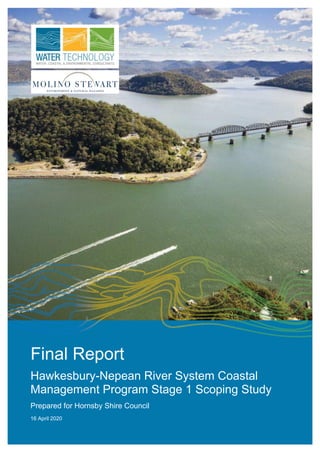
  • 1. Final Report Hawkesbury-Nepean River System Coastal Management Program Stage 1 Scoping Study Prepared for Hornsby Shire Council 16 April 2020
  • 2. Hornsby Shire Council | 16 April 2020 Hawkesbury-Nepean River System Coastal Management Program Stage 1 Scoping Study 19010166_R01_V03 Document Status Version Doc type Reviewed by Approved by Date issued 1 Draft Report ND; ABM ND 18.12.2019 2 Revised Draft ND ND 27.02.2020 3 Final Report ND; CB ND; CB 16.04.2020 Project Details Project Name Hawkesbury-Nepean River System Coastal Management Program Stage 1 Scoping Study Client Hornsby Shire Council Client Project Manager Ana Rubio Water Technology Project Manager Christopher Beadle Water Technology Project Director Tony McAlister Authors Christopher Beadle;Neil Dufty;Jenni Kremer Document Number 19010166_R01_V03 COPYRIGHT Water Technology Pty Ltd has produced this document in accordance with instructions from Hornsby Shire Council for their use only. The concepts and information contained in this document are the copyright of Water Technology Pty Ltd. Use or copying of this document in whole or in part without written permission of Water Technology Pty Ltd constitutes an infringement of copyright. Water Technology Pty Ltd does not warrant this document is definitive nor free from error and does not accept liability for any loss caused, or arising from, reliance upon the information provided herein. Cover photograph courtesy of Destination NSW. Suite 3, Level 1, 20 Wentworth Street Parramatta NSW 2150 Telephone 02 8080 7346 ACN 093 377 283 ABN 60 093 377 283
  • 3. Hornsby Shire Council | 16 April 2020 Hawkesbury-Nepean River System Coastal Management Program Stage 1 Scoping Study 19010166_R01_V03 EXECUTIVE SUMMARY The Hawkesbury-Nepean River system is a major social, environmental and economic asset for the state of New South Wales. This extensive estuary system encompasses the Hawksbury-Nepean River, Pittwater, Brisbane Water and Broken Bay, which span the Greater Sydney and Hunter - Central Coast regions. Together, these provide a stunning natural environment, areas of cultural significance, a multitude of social and recreational benefits, and are a key contributor to the regional economy. In accordance with the NSW Coastal Management Framework, management of the estuary system and its tributaries will be guided by a Coastal Management Program (CMP). The six (6) councils that border the tidal waterways of the system have agreed to work together through Stage 1 of an integrated, whole of system CMP. The councils are: ◼ Central Coast Council ◼ Hornsby Shire Council ◼ Hawkesbury City Council ◼ Ku-ring-gai Council ◼ The Hills Shire Council ◼ Northern Beaches Council The purpose of the CMP is to set the long-term strategy for the coordinated management of the system and its catchment. The CMP seeks to achieve the objectives of the Coastal Management Act through a program that will identify coastal management issues, pressures, and risks - and the actions required to address these issues in a strategic and integrated way. This Scoping Study represents the first of five stages in the CMP Process. As per the requirements of the NSW Coastal Management Manual, this study has reviewed the history of managing the river system, developed a shared understanding of the current situation, and identified the strategic path of the remaining CMP stages, which include: ◼ Stage 2: A detailed assessment of risks, vulnerabilities and opportunities; ◼ Stage 3: Identification and evaluation of management actions; ◼ Stage 4: Preparation, exhibition and adoption of the CMP; and ◼ Stage 5: Implementation, monitoring and evaluation Values of the Hawkesbury-Nepean River System The Hawkesbury-Nepean River system includes a diverse range of natural environments, including aquatic ecosystems that span both marine and freshwater, and terrestrial ecosystems that include the riparian zone and catchment systems. The system possesses significant biodiversity and conservation value, and contains a vast array of freshwater and coastal wetlands - including mangrove forests, seagrass beds, and saltmarshes. These habitats support a diverse assemblage of ecosystems, including a number of endangered ecological communities and over 130 vulnerable and threatened species. Land use across the wider Hawkesbury-Nepean catchment is diverse. The majority of the catchment (more than 70%) comprises undeveloped bushland and national parks, with agricultural use and forestry also prominent across the upper catchment. Areas of high intensity urban development are common across the lower catchment, particularly within the Greater Sydney and Central Coast regions, with isolated pockets in the upstream catchments. The Hawkesbury-Nepean Catchment also provides drinking water for 5 million people across Greater Sydney, and the upstream catchment also provides for local rural water supplies (for example Goulburn, Bowral and Lithgow). The system and its catchment provide spectacular scenic amenity and a vast array of recreational opportunities to both the local community and its visitors. It contains some of the most popular and heavily trafficked waterways in the state, largely as a result of its proximity to Sydney and Central Coast. There are over 100,000 boat licence holders in the Hawkesbury River, Pittwater and Brisbane Water region and over 40,000 registered recreational vessels. The estuary is also a significant contributor to the “blue economy” of the Greater Sydney and Central Coast regions. It supports the aquaculture (oysters farming), commercial fishing and tourism industries, and provides substantial economic value in the form of its ecosystem services.
  • 4. Hornsby Shire Council | 16 April 2020 Hawkesbury-Nepean River System Coastal Management Program Stage 1 Scoping Study 19010166_R01_V03 Pressures and Threats Facing the Estuary A first-pass risk assessment has been undertaken as part of this Scoping Study, which has identified that the river system is facing a number of pressures that threaten its environmental, social and economic values. Many of these threats will increase over the coming decades due to population growth within the catchment and the impacts of climate change. These pressures range from smaller localised issues, up to larger scale, system-wide threats that will require a coordinated and collaborative management approach. Coastal inundation and sea level rise represent a significant issue over future planning horizons for a number of low-lying communities and critical infrastructure across the Brisbane Water, Pittwater and the Hawkesbury River estuaries. Many of these communities will be exposed to permanent inundation, or an increased frequency of temporary inundation associated king tides and coastal and catchment flooding. Catchment runoff and urban stormwater discharge are a major source of water quality issues at various locations across the study area. Water quality has also historically been affected by runoff associated with agricultural activities across the catchment and point source discharges from waste water treatment facilities. These water quality issues across the system can affect estuary health and aquatic ecosystems, recreational amenity and the local aquaculture industry. Other key threats include the disturbance of riparian and aquatic habitat, and the presence of invasive species and diseases. Blooms of harmful algal species have historically occurred across both the upper and lower Hawkesbury River, with associated environmental, social and economic impacts. The study has also identified a number of emerging pressures that will increasingly affect the system over the coming decades. The Greater Sydney Regional Plan identifies a number of major development areas within the Hawkesbury-Nepean catchment that will house a significant population increase over the next twenty years. This will also include substantial industrial and commercial precincts – including the Western Sydney International Airport. This intensification of urban development across the catchment will result in a significant increase in the urban and industrial discharges into the river system. Another major challenge identified by the project stakeholders is the lack of coordination across the river system and catchment between the estuary councils, catchment councils, and state government agencies. This has historically resulted significant jurisdictional ambiguity across governance bodies, and a reduced ability to address system-wide issues and threats. The Benefits of a CMP The stakeholder engagement activities undertaken as part of this scoping study demonstrated significant support for the development of a CMP across a broad range of local and state government agencies. The CMP will provide an opportunity to develop a strategic, long-term approach to estuary and catchment management, and improve coordination across local governments and state government agencies. It provides an opportunity to link with local, regional and state planning initiatives, as well as programs and strategies across the upper catchment. Through this approach, the CMP can improve river health across not just the estuarine reach of the study area - but across the waterways and contributing catchment of the wider Hawkesbury-Nepean River system. The CMP will provide a robust and defensible platform to secure funding from the NSW Government's Coastal and Estuary Grants Program and other potential funding sources, and support the implementation of projects that will provide tangible benefits to the local community right across the catchment. This is vital to ensure safe and sustainable access to the river system, protect public assets from current and future hazards, and maintain healthy ecosystems and biodiversity. The Scope of the CMP The project steering committee has decided to adopt a system-wide approach to the CMP, in recognition of the fact that important physical and ecological processes extend across the waterways, catchment and foreshores of the Hawkesbury-Nepean River system. The study area of the CMP therefore includes the Hawkesbury-Nepean River system, the Brisbane Water Estuary, the Pittwater Estuary and
  • 5. Hornsby Shire Council | 16 April 2020 Hawkesbury-Nepean River System Coastal Management Program Stage 1 Scoping Study 19010166_R01_V03 Broken Bay - as well as the wider contributing Hawkesbury-Nepean catchment. This system-wide approach will provide a vehicle for the coordinated and strategic management of the river system, and create a program that can more effectively and efficiently address catchment scale issues, threats & risks. This approach can also foster alignment with regional and strategic planning initiatives. Furthermore, there may be significant cost savings associated with this approach, compared to developing multiple CMPs for the each of the individual estuaries (Brisbane Water, Pittwater, and the Hawkesbury River). The system-wide CMP can harness economies of scale and provide a platform for attracting government and/or private funds to address larger (catchment scale) issues and threats. Governance Governance of the estuary is multi-layered, with the waterways and foreshores owned and managed by a wide variety of stakeholders across multiple levels of government. This scoping study has recommended a governance structure for the remaining stages of the CMP. The program should be led by a project steering committee, which will be comprised of the six estuary councils and the Department of Planning, Industry and Environment (DPIE). The steering committee will be supported by a series of advisory bodies comprising of relevant state government agencies, councils from the upper catchment, indigenous interest groups, and a community reference group. It is also recommended that the CMP implement a paid part-time project coordinator during Stage 2, in order to manage the project on a day-to-day basis and oversee the development and implementation of the program. Stakeholder and Community Engagement The development of the CMP will include extensive engagement with the local community and user groups, relevant government agencies, and indigenous peoples. As part of this Scoping Study, a Stakeholder and Community Engagement Strategy has been prepared for the remaining stages of the CMP development process. The strategy has been prepared in accordance with the requirements of the NSW Coastal Management Manual. The Way Forward This report has identified a number of studies required during Stage 2 to fill critical data gaps and inform sound management decisions. A business case and forward plan for development of the five-staged program has also been developed, based on the requirements of the subsequent stages. It is estimated that the CMP will take around 2½ to 4 years to progress through Stages 2 through to 4. The fifth and final stage will involve the ongoing implementation of the program over a 10-year period thereafter. The overall cost of developing the CMP will likely be in the range of $1.0-1.7 million (Stages 2 to 4 inclusive), but will depend on a number of factors moving forward. The CMP is eligible for financial assistance from the NSW Coastal and Estuary Grants Program, administered by DPIE. Other funding sources should also be pursued. TABLE EX-1: CMP FORWARD PROGRAM Stage Approx. Cost Approx. Timing Stage 2: Determine Risks, Vulnerabilities and Opportunities $580k-$1.1m 15-24 months Stage 3 – Response Identification and Evaluation $310-470k 9-15 months Stage 4 – Finalise, Exhibit and Certify the CMP $120-230k 9-12 months Total $1.0-1.7m 2½ - 4 yrs Following approval and certification of the CMP at the completion of Stage 4, the CMP will be implemented in Stage 5 by the partner councils via the Integrated Planning and Reporting framework, and Community Strategic Plans. This framework will guide the implementation of the CMP and ensure all required monitoring and reporting is completed. It will also provide a framework for the review and assessment of CMP outcomes.
  • 6. Hornsby Shire Council | 16 April 2020 Hawkesbury-Nepean River System Coastal Management Program Stage 1 Scoping Study 19010166_R01_V03 CONTENTS 1 INTRODUCTION 1 1.1 Background 1 1.2 The NSW Coastal Management Framework 1 1.3 The Hawkesbury-Nepean River System Coastal Management Program 2 1.4 The Study Area 3 1.5 Governance Structure for Stage 1 9 1.6 Structure of this Report 10 2 PURPOSE, VISION AND OBJECTIVES 11 2.1 Purpose 11 2.2 Vision 11 2.3 Objectives 11 3 STRATEGIC CONTEXT FOR THE CMP 13 3.1 Methods and Limitations 13 3.2 Environmental Context 14 3.3 Governance Context 28 3.4 Policy Context 36 3.5 Management and Planning Context 43 3.6 Economic Context 53 3.7 Social and Cultural Context 56 4 STAKEHOLDER ENGAGEMENT 61 4.1 CMP Engagement Requirements 61 4.2 CMP Engagement Guidelines 61 4.3 Stakeholder Analysis 62 4.4 Community Profile 66 4.5 Previous Study Area Engagement and Existing Strategies 68 4.6 Stage 1 Engagement 71 4.7 Community and Stakeholder Engagement Strategy 75 5 SCOPE AND STUDY AREA 76 5.1 Spatial Extent 76 5.2 Coastal Management Areas 80 6 COASTAL MANAGEMENT ARRANGEMENTS 87 6.1 Existing Studies and Management Plans 87 6.2 Implementation of Existing Management Plans 91 6.3 Monitoring Programs 92 6.4 Challenges and Opportunities for Estuary and Catchment Management 95 7 CMP DELIVERY AND GOVERNANCE STRUCTURE 97 7.1 Spatial Scale of CMP Delivery 97
  • 7. Hornsby Shire Council | 16 April 2020 Hawkesbury-Nepean River System Coastal Management Program Stage 1 Scoping Study 19010166_R01_V03 7.2 CMP Governance 100 8 FIRST-PASS RISK ASSESSMENT 106 8.1 Methods and Limitations 106 8.2 Values 106 8.3 Threats and Stressors 111 8.4 First Pass Risk Assessment 115 8.5 Key Issues 116 9 KNOWLEDGE GAP ANALYSIS 123 9.1 Knowledge Gap Analysis 123 9.2 Studies to be Prepared in Stage 2 127 10 FORWARD PROGRAM 134 10.1 Overview of CMP Stages 134 10.2 Forward Program 136 10.3 Planning Proposals 137 10.4 Implementation 138 11 BUSINESS CASE 139 11.1 The Benefits of Undertaking a CMP 139 11.2 Support for the CMP Process 141 11.3 Funding Mechanisms and Cost Sharing 141 11.4 CMP Workplan and Cost Structure 143 12 REFERENCES 147 APPENDICES Appendix A Community & Stakeholder Engagement Plan Appendix B Overview of Existing Knowledge and Data Appendix C CMP Linkages to Existing Plans Appendix D Stage 1 Stakeholder Enagagement Summaries Appendix E Management Plan - Audit of Implementation Appendix F First Pass Risk Assessment Appendix G Knowledge Gap Analysis LIST OF FIGURES Figure 1-1 The NSW Coastal Management Framework 2 Figure 1-2 The CMP Process 3 Figure 1-3 The Warragamba Dam (Source: iNSW ) 4 Figure 1-4 Wisemans Ferry 4 Figure 1-5 Hawkesbury River at Brooklyn (Source: DPIE, 2019c) 5 Figure 1-6 Pittwater Estuary (Source: DPIE, 2019c) 5
  • 8. Hornsby Shire Council | 16 April 2020 Hawkesbury-Nepean River System Coastal Management Program Stage 1 Scoping Study 19010166_R01_V03 Figure 1-7 Brisbane Water Estuary (Source: DPIE, 2019c) 6 Figure 1-8 Broken Bay (Source: DPIE, 2019c) 6 Figure 1-9 Locality Plan 8 Figure 1-10 Stage 1 CMP Steering Committee 9 Figure 1-11 Additional Stage 1 Project Stakeholders 9 Figure 3-1 Sedimentary Zones of the Hawkesbury (Source: Devoy et al,1994) 15 Figure 3-2 Land Use Across Lower Hawkesbury River Catchment (Source: ABRES, 2016). Hawkesbury-Nepean Catchment in Red Outline 17 Figure 3-3 Erosion at Umina Beach in 2015 (Left) and 1986 Flood at Windsor (Right) 23 Figure 3-4 Longneck Lagoon (Source: NPWS) 24 Figure 3-5 Posidonia Australis (Source: DPI) 25 Figure 3-6 Black Rockcod (Source: DPI) 26 Figure 3-7 Project Coast Climate Change Impacts for the Sydney Region (NSW Adapt, 2019) 28 Figure 3-8 NSW State Government Agencies Relevant to the CMP 31 Figure 3-9 Dharug National Park (Source: NPWS) 32 Figure 3-10 ANZ Water Quality Management Framework (Source: NWQMS, 2019) 44 Figure 3-11 The Risk-Based Framework (Source: OEH, 2017) 45 Figure 3-12 Ettalong Channel Dredging (Source: Daily Telegraph) 46 Figure 3-13 A Metropolis of Three Cities – The Greater Sydney Region Plan (Source: GSC, 2018) 47 Figure 3-14 Integrated Planning and Reporting Framework (Source: NSW OLG, 2019) 50 Figure 3-15 Hawkesbury River Aquaculture (Source: ABC News) 54 Figure 3-16 Kayaking the Hawkesbury (Source: Destination NSW) 55 Figure 3-17 Bridge 2 Bridge Water Ski Classic 59 Figure 3-18 Recreational Boating in Pittwater (Left) and Surfing at Ocean Beach (Right) 60 Figure 4-1 IAP2 Spectrum 62 Figure 4-2 Sample Output Using Social Atlas 68 Figure 4-3 Workshop Discussion Forums as part of Workshop #1 73 Figure 4-4 Workshop Discussion Forums as part of Workshop #2 73 Figure 4-5 “World Café” Sessions as part of Workshop #2 74 Figure 5-1 Coastal Environment Area and Coastal Use Area 78 Figure 5-2 Coastal Wetlands and Littoral Rainforests 79 Figure 6-1 The Brisbane Water CZMP 88 Figure 6-2 Coastal Hazard Study: Mapping for Pearl Beach 90 Figure 6-3 Water Quality Monitoring Sites Across the Estuary Reach 93 Figure 6-4 Streamwatch Water Monitoring Sites Across the Study Area 94 Figure 7-1 Proposed CMP Governance Structure 105 Figure 8-1 Algal Bloom in Berowra Creek in 2016 (Source: Daily Telegraph) 120 Figure 10-1 Estimated Project Program 137 Figure 10-2 Relationship Between the IP&R Framework and the CMP (Source:OEH, 2018h) 138 Figure 11-1 Riverboat Tourism in The Estuary (Source: The Australian) 139 LIST OF TABLES Table 3-1 Establishing the Strategic Context of the CMP 13 Table 3-2 Estuary Classifications (Roy et al, 2001) 14
  • 9. Hornsby Shire Council | 16 April 2020 Hawkesbury-Nepean River System Coastal Management Program Stage 1 Scoping Study 19010166_R01_V03 Table 3-3 Land Use Composition Across the Study Area Catchments (Roper et al, 2011) 16 Table 3-4 Major Infrastructure Across the Estuarine Reach of the Study Area 18 Table 3-5 WWTP’s Managed by Sydney Water Across the Hawkesbury-Nepean Catchment 18 Table 3-6 Estuary Catchment Hydrology (Roper et al, 2011) 20 Table 3-7 Estuary Habitat Parameters (Roper et al, 2011) 24 Table 3-8 Local Government Areas Intersecting the Study Area Catchments 28 Table 3-9 Overview of Roles and Responsibilities of Councils Across the Coastal Zone 29 Table 3-10 National Parks Intersecting the Hawkesbury-Nepean Catchment 32 Table 3-11 Relevant Legislation 39 Table 3-12 Existing Coastal and Estuary Management Plans 43 Table 3-13 Local Planning Documents for Partner Councils 52 Table 3-14 Economic Value of Agriculture, Forestry and Fishing 53 Table 3-15 Hawkesbury River Aquaculture Statistics 53 Table 3-16 Approximate Economic Valuation of Hawkesbury River Estuary Ecosystem Services 54 Table 3-17 Partner Council Tourism Data (Source: Community id, 2019) 55 Table 3-18 Aboriginal and Torres Strait Islander Population Across the Study Area 56 Table 3-19 Population Growth Across the Study Area 2016-2036 58 Table 3-20 Population Growth Across Partner Councils 2016-2036 58 Table 3-21 Projected High Growth Population Areas Across Western Sydney 2016-2036 58 Table 4-1 Key Community Groups in the Study Area 63 Table 4-2 Community Profile Across the LGAs 67 Table 5-1 Summary of Existing Coastal Vulnerability Assessments for the Study Area 83 Table 5-2 Applicibility of Existing Hazard Mapping to the CVA 86 Table 6-1 Summary of Management Plan Audit 92 Table 7-1 SWOT Analysis for using System-Wide Approach for CMP Governance 99 Table 7-2 Governance Structure Summary 104 Table 8-1 NSW River and Marine Water Quality Objectives Community and Environmental Values and Uses (NSW Government, 1999), and Application to Hawkesbury-Nepean River System 109 Table 8-2 Additional Estuary and Catchment Values 110 Table 8-3 Summary of Threats 112 Table 8-4 Consequence Definitions, adapted from MEMA TARA (BMT WBM, 2017) 115 Table 8-5 Likelihood Definitions, adapted from MEMA TARA (BMT WBM, 2017) 115 Table 8-6 Risk Assessment Matrix, adapted from MEMA TARA (BMT WBM, 2017) 116 Table 8-7 Present Day Hish Risk Threats and Key Issues 117 Table 8-8 Future / Emerging High-Risk Stressors and Key Issues 122 Table 9-1 Major Bodies of Work Addressing Risks, Vulnerabilities and Opportunities 125 Table 9-2 Knowledge Gap Analysis Framework 126 Table 9-3 Knowledge Gap Implications 126 Table 9-4 Summary of Knowledge Gap Analysis 128 Table 9-5 Studies to be Prepared During Stage 2 of the CMP 129 Table 10-1 Planning Proposal Overview for Coastal Management Areas 137 Table 11-1 Potential Cost Sharing Arrangements 143 Table 11-2 Preliminary Work Plan for and Cost Structure for Stages 2 145 Table 11-3 Preliminary Work Plan for and Cost Structure for Stages 3 and 4 146
  • 10. Hornsby Shire Council | 16 April 2020 Hawkesbury-Nepean River System Coastal Management Program Stage 1 Scoping Study 19010166_R01_V03 1 INTRODUCTION 1.1 Background The Hawkesbury-Nepean River system is a major social, environmental and economic asset for the state of New South Wales (NSW). It is the largest river system in the Greater Sydney and Central Coast regions, and contains beautiful iconic beaches, sprawling waterways and tributaries, and areas of social and cultural significance. Along with being a key economic driver for the region, the coastal zone also contains a passionate local community, who are heavily invested in its utility and management. Future coastal management for the Hawkesbury-Nepean River System will take the form of a Coastal Management Program (CMP). The six (6) councils that border the tidal waterways of the system are partnering to understand what is required for the development of an integrated, whole of system CMP. These councils comprise: ◼ Central Coast Council; ◼ Hawkesbury City Council; ◼ The Hills Shire Council; ◼ Hornsby Shire Council; ◼ Ku-ring-gai Council; and ◼ Northern Beaches Council. The purpose of CMP would be to establish an integrated program to support the coordinated management and ecologically sustainable development of the Hawkesbury-Nepean River system - which includes the major estuaries of Brisbane Water, Pittwater, the Hawkesbury River and Broken Bay - in order to maintain and enhance its social, cultural, economic and environmental values. For the purposes of this report, references to “The Hawkesbury-Nepean River system” refer to the overall river system comprising the Hawkesbury- Nepean River, Brisbane Water, Pittwater, and Broken Bay. This Hawkesbury-Nepean River system CMP Stage 1 Scoping Study has been prepared through collaboration and to develop a shared understanding of the system and its management. The study also describes the proposed approach for undertaking Stage 2 to Stage 5 of the CMP - consistent with the NSW Coastal Management Framework. This study has been prepared in accordance with the requirements outlined in the Coastal Management Manual (OEH, 2018a), in consultation with the NSW Department of Planning, Industry and Environment (DPIE), the six partner councils, and key state agencies and associated stakeholders (e.g. wider catchment councils) that play a role in the management of the Hawkesbury-Nepean River system. 1.2 The NSW Coastal Management Framework The NSW coast provides a multitude of values and uses for the community. This competition for use and enjoyment places the coastline under increasing pressure (OEH, 2018a). Planning for coastal communities must carefully balance the need to provide jobs, housing, community facilities and transport for a changing population while maintaining the unique qualities and recreational activities and, managing risks associated with development along our coastlines (DPIE, 2019). Sustainable management of the coastal zone involves councils, their communities and public authorities balancing a diverse range of challenges and opportunities. The context is one of rapid environmental, social and economic change along with dynamic coastal processes affecting the open coast, estuaries and coastal lakes (OEH, 2018a). In order to plan for development, protect environmental assets and manage coastal hazards across the state, the NSW Government has developed the NSW Coastal Management Framework, which includes changes to
  • 11. Hornsby Shire Council | 16 April 2020 Hawkesbury-Nepean River System Coastal Management Program Stage 1 Scoping Study 19010166_R01_V03 legislation and planning policy that aims to provide an integrated framework for coastal management across the state. Key components of the framework include: ◼ Coastal Management Act 2016 (CM Act): Provides for the integrated management of the coastal environment of NSW consistent with the principles of ecologically sustainable development, for the social, cultural and economic wellbeing of the people of the state. ◼ Marine Estate Management Act 2014 (MEM Act): Provides for the management of the marine estate of NSW in a manner that promotes a biologically diverse, healthy and productive marine estate and facilitates the economic cultural, social and recreational use of the marine estate. ◼ Coastal Management State Environmental Planning Policy 2018 (CM SEPP): One of the key environmental planning instruments for land-use planning in the coastal zone. It gives effect to the objectives of the CM Act 2016, and delivers on the statutory management objectives of the act by specifying how development proposals are to be assessed if they fall within the coastal zone. ◼ The advent of CMPs: A five stage coastal management process intended to set the long-term strategy for the coordinated management of the coastal zone for a given region; ◼ The NSW Coastal Management Manual (The Manual): A manual that sets forth mandatory requirements (Part A) and provides guidance to coastal councils (Part B) for the preparation, development, adoption, implementation, amendment, and review of CMPs. ◼ The NSW Coastal Council – which is responsible for advising the Minister on coastal issues, as well as reviewing and approving local council CMPs (when requested by the Minister to do so). A schematic of the NSW Coastal Management Framework is provided in Figure 1-1. FIGURE 1-1 THE NSW COASTAL MANAGEMENT FRAMEWORK 1.3 The Hawkesbury-Nepean River System Coastal Management Program The purpose of a CMP is to set the long-term strategy for the coordinated management of the coastal zone of a given area, with a focus on achieving coastal management objectives at a local and estuary-wide level whilst, also achieving the objects of the CM Act. It provides an opportunity for councils, public authorities and local communities to clearly identify and balance competing interests and priorities in the coastal zone.
  • 12. Hornsby Shire Council | 16 April 2020 Hawkesbury-Nepean River System Coastal Management Program Stage 1 Scoping Study 19010166_R01_V03 More broadly, a CMP may be prepared by one or more local councils for a given area. The area that a CMP covers may comprise all or part of the coastal zone of one local government area. Alternatively, where important natural features such as coastal sediment compartments or estuaries cover multiple LGA’s, neighbouring Councils may choose to/are encouraged to collaborate and prepare a CMP covering the entire system irrespective of the jurisdictional boundaries. A CMP is prepared and implemented through a five staged risk management process described in the NSW Coastal Management Manual and depicted in Figure 1-2. This process is intended to help councils and their communities to identify and manage risks to the environmental, social and economic values of the coast. The Manual sets forth mandatory requirements for CMPs, but also provides guidance regarding their preparation, development, adoption, implementation, and review. The Manual provides information to help councils to develop, evaluate and select management actions that provide feasible and effective measures to manage the coastal environment. These actions are then incorporated into councils’ land-use planning instruments, Community Strategic Plans and Integrated Planning and Reporting (IP&R) Framework, established under the Local Government Act 1993. In undertaking this Scoping Study, the six partner councils fulfil the first stage of the CMP process. The primary purpose of a Stage 1 Scoping Study is to: ◼ Review the history of managing the coastal zone; ◼ Develop a shared understanding of the current situation; and ◼ Identify the focus of the future CMP. Stage 1 builds on and integrates with previous work, including existing plans and strategies, technical studies and stakeholder input. It guides councils in formulating appropriate strategies and actions in later stages of the process (Stages 2 to 5). 1.4 The Study Area The Hawkesbury-Nepean is one of the most important river systems in NSW, and is the largest estuary system in the Greater Sydney and Central Coast regions. The system occupies a unique location and bounds Australia’s most populous city to the north and the west, and is situated to the immediate south of a vibrant and growing Central Coast. Under the CM Act, councils are required to take a systems approach to coastal management, that looks at coastal zone issues in the broader, catchment scale context. For large estuary systems like Brisbane Water, Pittwater, and the Hawkesbury River, a CMP must consider the relationship and interdependence between coastal zone, waterway and catchment systems in order to effectively address system-wide issues and risks, and promote coordination and collaboration across agencies. Therefore, the study area for the CMP comprises the tidal waterways of the Hawkesbury-Nepean River system, including the Brisbane Water Estuary, the FIGURE 1-2 THE CMP PROCESS
  • 13. Hornsby Shire Council | 16 April 2020 Hawkesbury-Nepean River System Coastal Management Program Stage 1 Scoping Study 19010166_R01_V03 Pittwater Estuary, the Hawkesbury River Estuary and Broken Bay, as well as their contributing catchments. Catchment land uses are described in more detail in Section 3.2.2. The Hawkesbury-Nepean is the longest coastal catchment in NSW (DPI, 2019). At over 470 km long, the river extends from south of Goulburn all the way to Broken Bay. The river drains over 21,400 km2 of wider catchment land (DPI, 2019), of which an estimated 70% is forested, 25% is agricultural and around 5% is urbanised (HNCMA, 2005; WRL, 2003). The river- system receives flows from the Grose River to the west and the Nepean to the south, which includes a major hydrological control of the Warragamba Dam – see Figure 1-3). The tidal waterways of the Hawkesbury River commence at the confluence of the Grose River at Yarramundi, and extend around 145 km downstream to the open coast at Broken Bay. The following notable coastal features (and their tributaries) are included in the study area (as depicted in Figure 1-9): ◼ Broken Bay ◼ Pittwater Estuary ◼ The Brisbane Water Estuary ◼ Patonga Creek ◼ Cowan Creek ◼ Mullet Creek ◼ Mooney Mooney Creek ◼ Berowra Creek ◼ Marramarra Creek ◼ Mangrove Creek ◼ Macdonald River ◼ Webbs Creek ◼ The Colo River ◼ Cattai Creek ◼ South Creek ◼ Rickabys Creek ◼ The Grose River From its upstream tidal limit, the Hawkesbury River follows a generally northerly direction, with a relatively sandy composition, and passes through the towns of Richmond and Windsor (which are the largest settlements on the river). Here the river exhibits large meanders and relatively wide floodplains. There are also lagoons and floodplain wetlands like Pitt Town Lagoon and Long Neck Lagoon. At Windsor, the river links with South Creek, which already receives a significant amount of the urban runoff from Sydney's western suburbs and it is currently planned to see significant additional urban development. From Windsor to Sackville the river is wide and deep, and the foreshore is relatively cleared and cultivated (HCC, 2019). From Sackville to Spencer (Figure 1-4) the river is characterised by steep sandstone cliffs, undeveloped foreshore reserve and a series of low- density floodplain settlements (HCC, 2019). On this stretch the river passes through Lower Portland, where it receives the Colo River. From here the river meanders in an overall north-easterly direction, until it reaches a sharp change of course at the riverside community of Wisemans Ferry (where it is joined by the Macdonald River). This portion of the river is popular with recreational boating, particularly water skiing and wakeboarding. Here its course turns south-eastwards, and the surrounding landscape is FIGURE 1-3 THE WARRAGAMBA DAM (SOURCE: INSW ) FIGURE 1-4 WISEMANS FERRY
  • 14. Hornsby Shire Council | 16 April 2020 Hawkesbury-Nepean River System Coastal Management Program Stage 1 Scoping Study 19010166_R01_V03 largely comprised of the undeveloped foreshore reserves of the Dharug and Marramarra national parks. The Lower Hawkesbury river is unique in that the foreshore contains significant stretches of forested areas with relatively little foreshore development. At the small foreshore settlement of Spencer, the river receives Mangrove Creek from the north, and then around 10 km farther downstream, it also links with Marramarra and Berowra Creeks. At the Mooney Mooney and Brooklyn region (Figure 1-5), the river contains a number of small riverside settlements such as Bar Point, Milsons Passage, Dangar Island and Little Wobby, and the river is traversed by major transport connections that link Sydney to the Central Coast - including the M1 Pacific Motorway and the Sydney-Central coast rail bridge. The Pittwater Estuary is located on the southern side of Broken Bay, at the Tasman Sea entrance (see Figure 1-6). It is a tide dominated drowned valley estuary (Roy, 2001). The estuary extends from Newport and Church Point in the south to its mouth at Broken Bay, and has over 52 km of foreshore and a water surface area of around 17 km2 (CLT, 2009). Pittwater contains a range of complex physical processes which are governed by the large entrance and the estuary's capacity for exchange with ocean water (L&T, 2002). The tide range across the estuary is largely similar to that of the open coast. The foreshores of Pittwater are lined by number of bays, beaches and headlands. Major tributary creeks of the Pittwater include Careel Creek, Salt Pan Creek, Mona Vale Main Drain, Cahill Creek, McCarrs Creek and Salvation Creek (L&T, 2002). Many other small unnamed creeks also drain to the estuary. The system also includes Scotland Island, which is located towards the southern end of the estuary in between Church Point and Clareville and contains a small community of permanent residents. The island is approximately 900 metres in diameter, and is only accessible by boat. The estuary is an important resource locally and regionally, and is highly valued for its unique environmental setting, delicate estuarine habitats, and its contribution to the local economy and community (NBC, 2017). It is also a major recreational and cultural asset for the region that experiences a high intensity of recreational use, particularly during the peak summer period. Pittwater has a catchment of nearly 6000 ha which extends from Mona Vale and Warriewood in the south to along the eastern ridge of the Peninsula leading to Palm Beach and then along the western ridge leading to West Head (L&T, 2002). The eastern and southern areas of the catchment are heavily urbanised, include the suburbs of Palm Beach, Clareville, Newport, Bay View and Church Point. To its west, Pittwater is primarily bounded by Ku-ring-gai Chase National Park, which comprises a large area of the Pittwater sub-catchment. FIGURE 1-5 HAWKESBURY RIVER AT BROOKLYN (SOURCE: DPIE, 2019C) FIGURE 1-6 PITTWATER ESTUARY (SOURCE: DPIE, 2019C)
  • 15. Hornsby Shire Council | 16 April 2020 Hawkesbury-Nepean River System Coastal Management Program Stage 1 Scoping Study 19010166_R01_V03 The Brisbane Water Estuary (Figure 1-7) is located on the northern side of Broken Bay, and is a wave dominated barrier estuary with an open entrance (Roy, 2001). The estuary extends from Gosford in the north, down to its mouth at Broken Bay, and has over 90 km of foreshore and a water surface area of around 27 km2 (CLT, 2009). The estuary itself is relatively shallow and contains a number of small embayments and inlets. There are five major waterways that comprise the Brisbane Water Estuary as identified in the Brisbane Water Plan of Management (GCC, 1995). They are: ◼ Entrance Reach between The Rip and Half Tide Rocks; ◼ Woy Woy Reach, including Pelican Island, Riley’s Island and St Hubert’s Island; ◼ Kincumber Broadwater; ◼ Brisbane Water (upstream of Pelican Island); and ◼ Woy Woy Bay and Woy Woy Inlet. Brisbane Water has a catchment of nearly 15,000 ha, and drains a number of major creek and waterways. These include, Narara Creek which enters the estuary at Gosford, Coorumbine Creek, Erina Creek, Kincumber Creek, Woy Woy Creek, as well as many other smaller creeks and tributaries. The Brisbane water catchment contains a variety of land uses, and is around 50% undeveloped bushland and national parks (including Brisbane Water National Park). The estuary also contains areas of high-density urban development, including the population centres of Gosford, Erina, Kincumber, Saratoga, Davistown, Empire Bay, Woy Woy, Ettalong and Umina. Brisbane Water also includes the canal estate suburb of St Huberts Island, which was developed in the mid-1970s and is accessed by via bridge at Daley’s Point. Two islands within the estuary, Pelican Island and Riley’s Island, function as nature reserves and remain largely unaffected by development (CLT, 2008). The Hawkesbury River, Pittwater and Brisbane Water estuaries all interface with the Tasman Sea at Broken Bay (see Figure 1-8), which is classified as a semi–mature tide-dominated drowned valley estuary. Broken Bay is exposed to coastal processes along with beaches and rocky foreshores in the northern portion of Pittwater and Patonga, Pearl, Umina and Ocean Beaches. The bay also contains a series of smaller coastal estuaries such as Patonga Creek, Pearl Beach Lagoon and Ettalong Creek which are each situated adjacent to coastal communities. Cowan Creek, which drains into Broken Bay, is a main arm of the estuary that contains the recreational boating hubs of Cottage Point and Bobbin Head. The tidal waterways and foreshore span across six (6) LGAs (the partner councils), with an additional eighteen (18) LGAs encompassed across the wider Hawkesbury-Nepean Catchment (either wholly or partly). The Hawkesbury-Nepean River system comprises a highly connected network of hydrological, and ecological systems, made up of a complex array of aquatic, riparian and terrestrial habitats. The entire Hawkesbury- Nepean catchment is known to contain over 1,100 native vertebrates (including fish, amphibians, reptiles, birds FIGURE 1-7 BRISBANE WATER ESTUARY (SOURCE: DPIE, 2019C) FIGURE 1-8 BROKEN BAY (SOURCE: DPIE, 2019C)
  • 16. Hornsby Shire Council | 16 April 2020 Hawkesbury-Nepean River System Coastal Management Program Stage 1 Scoping Study 19010166_R01_V03 and mammals) and 1,700 invertebrates (HNCMA, 2005). The Australian estuaries database has classified the Hawkesbury River as having 'high' conservation value, with a 'real' conservation threat (BMT WMB, 2008). The area’s accessibility to the population of Sydney and the Central Coast, the open waterway with sheltered bays and harbours, and its scenic quality make it a very popular destination for a large number of recreational visitors (WBM, 2006b). The river system is also a major economic asset for the Greater Sydney and Central Coast regions. The system directly supports the agriculture and aquaculture industries that provide much of the regions fresh food, as well as supporting numerous other mining, manufacturing and processing industries across the catchment - as well as recreation and tourism (WSU, 2019). For the purposes of this report, references to “The Hawkesbury-Nepean River system” refer to the overall river system that includes estuary systems of the Hawkesbury River, Brisbane Water, Pittwater, and Broken Bay.
  • 17. Hornsby Shire Council | 16 April 2020 Hawkesbury-Nepean River System Coastal Management Program Stage 1 Scoping Study Page 8 19010166_R01_V03 FIGURE 1-9 LOCALITY PLAN
  • 18. Hornsby Shire Council | 16 April 2020 Hawkesbury-Nepean River System Coastal Management Program Stage 1 Scoping Study 19010166_R01_V03 1.5 Governance Structure for Stage 1 The Stage 1 Scoping study is being overseen by a project steering committee (under the leadership of Hornsby Shire Council) which is comprised of the six (6) partner councils and a range of other state government organisations and Local Aboriginal Land Councils (LALCs). A list of the steering committee organisation members is provided in Figure 1-10 below. FIGURE 1-10 STAGE 1 CMP STEERING COMMITTEE In addition to the project steering committee, a range of other organisations and councils from the wider Hawkesbury-Nepean catchment were engaged as part of the Scoping Study (as discussed in Section 4). These additional project stakeholders are provided in Figure 1-11. During development of the Scoping Study, a letter was sent to all councils within the wider Hawkesbury-Nepean drainage catchment (see Section 3.3.1) to inform them about the Scoping Study process. FIGURE 1-11 ADDITIONAL STAGE 1 PROJECT STAKEHOLDERS A governance structure for the remaining stages of the CMP has been recommended as part of this study, and is provided in Section 7.
  • 19. Hornsby Shire Council | 16 April 2020 Hawkesbury-Nepean River System Coastal Management Program Stage 1 Scoping Study 19010166_R01_V03 1.6 Structure of this Report This report meets the requirements of a Stage 1 Scoping Study set out in the Manual. It includes the following components: ◼ Section 2 outlines the purpose, vision and objectives of the CMP; ◼ Section 3 provides the strategic context for the CMP, including background information regarding the local environmental processes, governance, applicable policy and management plans, as well as the social and economic use of the waterway; ◼ Section 4 provides an overview of the stakeholder engagement activities undertaken during Stage 1, and those required during the remaining stages of the CMP; ◼ Section 5 provides an overview of the study area for the CMP; ◼ Section 6 summarises the existing coastal zone management plans in place across the estuary; ◼ Section 7 describes a proposed governance structure for delivery of the remaining stages of the CMP; ◼ Section 8 details a first-pass risk assessment which identifies the major threats and pressures facing the river system; ◼ Section 9 provides a gap analysis and recommends further studies required to fill key knowledge gaps during Stage 2 of the CMP; ◼ Section 10 outlines a forward program for completion of Stages 2 to 4; and ◼ Section 11 outlines a business case for development of the CMP, and discusses the benefits of undertaking the program. Effective engagement and communication are important aspects of a successful CMP. A key component of this Scoping Study is the development of a Community and Stakeholder Engagement Plan (provided in Appendix A). This Strategy outlines which organisations should be involved in the review, preparation and implementation of the CMP, how they will be offered engagement opportunities and how their input will be incorporated into the planning process.
  • 20. Hornsby Shire Council | 16 April 2020 Hawkesbury-Nepean River System Coastal Management Program Stage 1 Scoping Study 19010166_R01_V03 2 PURPOSE, VISION AND OBJECTIVES 2.1 Purpose The purpose of the CMP is to set the long-term strategy for the coordinated management of the Hawkesbury- Nepean River system, encompassing the estuaries of Broken Bay, Pittwater, The Hawkesbury River and Brisbane Water. The CMP seeks to achieve the objectives of the CM Act through a program to identify coastal management issues, pressures, risks and opportunities - and the actions required to address these issues in a strategic and integrated way. 2.2 Vision A local vision statement has been developed to help stakeholders identify with the future of the Hawkesbury- Nepean River system, encourage a sense of community ownership of the actions in the CMP, and foster commitment to its preparation and implementation. The vision statement for this CMP has been developed through consultation with the six (6) partner councils for the project. It is intended to reflect the multitude of values the Hawkesbury River system provides, and special place that it holds as one of the most prominent river systems in the nation. The vision statement for the CMP is: 2.3 Objectives A suite of objectives has been developed for the CMP, in order to ensure that the outcomes of the CMP are consistent with the principles of ecologically sustainable development for the social, cultural and economic well-being of the six partner Council LGAs. They have been developed ensuring consistency and compatibility with the objectives set forth in the following earlier works: ◼ The NSW Coastal Management Act (2016); ◼ The Coastal Management State Environmental Planning Policy (2018); ◼ The Sydney Regional Environmental Plan No 20 - Hawkesbury-Nepean River (1997); ◼ The Central Coast Regional Plan 2036 (DPE, 2017); ◼ The Greater Sydney Regional Plan (GSC, 2018); ◼ The Community Strategic Plans of the six partner councils; ◼ The Greater Sydney Local Land Services Local Strategic Plan 2016-2021 (GSLLS, 2016); ◼ The Hawkesbury-Nepean Catchment Action Plan 2013-2023 (HNCMA, 2013); ◼ The NSW Water Quality and River Flow Objectives for the Hawkesbury River (NSW Government, 1999); ◼ The Marine Quality Objectives for NSW Ocean Waters (DECW, 2006); “To preserve and enhance the environmental, social and economic values of the Hawkesbury-Nepean River system and its catchment for current and future generations, and ensure its status as one of Australia’s premier river systems”
  • 21. Hornsby Shire Council | 16 April 2020 Hawkesbury-Nepean River System Coastal Management Program Stage 1 Scoping Study 19010166_R01_V03 ◼ The Australian and New Zealand Guidelines for Fresh and Marine Water Quality (ANZECC &, ARMCANZ 2000); ◼ Lower Hawkesbury-Nepean River Nutrient Management Strategy (DECCW, 2010) ◼ The Marine Estate Management Strategy (MEMA, 2018); and ◼ The NSW Risk-based Framework for Considering Waterway Health Outcomes in Strategic Land-use Planning Decisions (OEH, 2017) The objectives of the CMP have been outlined in broad terms, to establish the overall strategic direction of the program. It is anticipated that these objectives will undergo further refinement in consultation with the local community during later stages of the CMP. Currently, the objectives of the Hawkesbury River CMP are: a) to protect and enhance the integrity and resilience of the environmental values of the Hawkesbury River, Brisbane Water and Pittwater estuaries, including healthy, diverse aquatic ecosystems. b) to maintain and protect water quality across the system and its impacts on environmental, social and economic values - including ecological condition, recreational amenity and agricultural uses; c) to maintain and preserve the unique scenic amenity and natural character of the Hawkesbury River, Brisbane Water and Pittwater estuaries; d) to support the social and cultural values of the system and maintain public access and recreational amenity; e) to maintain the health, safety and wellbeing of those using the coastal zone (both directly and indirectly) - and to protect the health of human consumers of aquatic foods; f) to acknowledge Aboriginal peoples’ spiritual, social, customary and economic use of the Hawkesbury and to protect local indigenous cultural heritage; g) to recognise the coastal zone as a vital economic zone and to support sustainable coastal economies such as recreational fishing, aquaculture and tourism; h) to facilitate appropriate management of the coastal zone through ecologically sustainable development, and the promotion of sustainable land use planning and decision-making that is consistent with regional and local strategic plans; i) to mitigate current and future risks from population growth, urbanisation and coastal hazards (erosion and inundation of foreshores caused by tidal waters and the action of waves, including the interaction of those waters with catchment flooding); j) to ensure co-ordination between relevant government and public authorities relating to the river system - and to facilitate the proper integration of management activities across all levels of government; k) to maintain meaningful engagement with the community, and to support public participation in coastal management and planning, and to create greater public awareness, education and understanding of coastal processes and management actions; l) to encourage and facilitate research and monitoring – and to maintain the scientific and educational values of the river system; m) to support the objects of the Marine Estate Management Act 2014; and n) to align with the NSW Risk-based Framework for Considering Waterway Health Outcomes in Strategic Land-use Planning Decisions.
  • 22. Hornsby Shire Council | 16 April 2020 Hawkesbury-Nepean River System Coastal Management Program Stage 1 Scoping Study 19010166_R01_V03 3 STRATEGIC CONTEXT FOR THE CMP 3.1 Methods and Limitations In order to understand and address coastal management issues in a risk framework, there needs to be a clear understanding of the internal and external context in which the CMP is undertaken. Therefore, as part of the Scoping Study, a review has been undertaken of the strategic context for coastal management in the Hawkesbury-Nepean River system – in order to ensure that subsequent stages of the CMP address relevant management issues and that the overall direction of the program is carefully considered. This task has been based on a review of existing information and data, and information supplied by project stakeholders via workshops undertaken during the study. The overall strategic context for the CMP has been broken down into a series of categories, outlined in Table 3- 1 below. Whilst these issues will be studied in further detail during later stages of the CMP, it is important to have a broad understanding of them at the project outset. TABLE 3-1 ESTABLISHING THE STRATEGIC CONTEXT OF THE CMP Context Description of Strategic Context Drivers Environmental What are the environmental features and processes affecting the coastal zone? ▪ Regional geology and geomorphology ▪ The predominant land use across the catchment and projected future development ▪ Local coastal & estuary processes, including waves, water levels, winds, extreme events, sediment transport, erosion, storm tide inundation and water quality ▪ Local estuarine ecology, habitat extent and health, terrestrial biodiversity and catchment characteristics ▪ Potential climate change impacts Governance What is the governance context of the CMP? ▪ The political and governance context and the relationships between the partner councils, adjoining councils and other public authorities Policy What is the relevant legislation and policy governing the coastal zone? ▪ The relevant local, state and federal legislation and policies, land tenure and land managed as national park or crown reserve Economic What is the economic importance of the coastal zone? ▪ The economic value of the coastline – including economic activity dependant on the coastal zone, such as tourism, commercial and recreational fishing and aquaculture Management and Planning What is the strategic planning framework that the CMP must fit within? ▪ The relevant coastal and estuary management plans in place across the study area ▪ Relevant state, regional and local plans and strategies Social and Cultural What are the social and heritage values of the coastal zone? ▪ Indigenous and non-indigenous heritage values of the study area ▪ Population growth and demographic changes ▪ The recreational uses and community values of the coastal zone
  • 23. Hornsby Shire Council | 16 April 2020 Hawkesbury-Nepean River System Coastal Management Program Stage 1 Scoping Study 19010166_R01_V03 3.2 Environmental Context 3.2.1 Geomorphology The Hawkesbury-Nepean River system is a deeply incised freshwater to estuarine system and is among the largest along the east coast of Australia (Hughes, 1998). The estuarine reach occupies a drowned river gorge carved into Triassic Hawkesbury sandstone (Roy et al., 1980). The channel is flanked locally by steep bedrock valley walls, and laterally restricted back-plain swamps with fringing mangrove stands (Hughes, 1998). The estuary possesses a thick sequence of sediments and occurs in a tectonically stable region (Roy and Thom, 1981; Roy, 1984). The Quaternary period saw a rise in sea level of about 130 metres which drowned the lower Hawkesbury River together with a large part of the eastern Australian coast. The resulting marine, fluvial and swamp deposits were formed by tides, waves, flood and wind - and are observed across the floodplain of the Hawkesbury River and its tributaries (Roy and Thom, 1981). From a geomorphological perspective, the estuarine reach of the Hawkesbury-Nepean River system is comprised of three predominant waterways that connect to the Tasman Sea via Broken Bay: ◼ The Hawkesbury River Estuary; ◼ The Brisbane Water Estuary; and ◼ The Pittwater Estuary. Key estuary classification details for each of these waterways are provided in Table 3-2. TABLE 3-2 ESTUARY CLASSIFICATIONS (ROY ET AL, 2001) Estuary Estuary Group Estuary Type Evolution stage Water Area (km2 ) Catchment Area (km2 ) Length of foreshore (km) Brisbane Water Wave dominated Barrier estuary Youthful 27.2 170 125^ Hawkesbury River Tide dominated Drowned valley estuary Semi-mature 100.0 21,400 810# Pittwater Tide dominated Drowned valley estuary Youthful 17.3 77 52* ^ sourced from CLT (2008); * sourced from L&T (2003); # sourced from CM SEPP Mapping and approximate only. The Brisbane Water Estuary is classified as a wave dominated barrier estuary with an open entrance (Roy, 2001). Brisbane Water contains a pronounced tidal delta (both ebb and flood) comprising marine sands. The delta extends from the Broken Bay entrance approximately to Pelican Island (CLT, 2008), and takes the form of a series of relatively mobile shoals that are affected by the complex morphological and hydrodynamical processes at the estuary entrance. The central basins of the estuary, such as The Broadwater, are quite different sedimentary environments, and typically comprise organic rich, sub-tidal mud and sandy mud. These fluvial sediments are derived from the catchment and are delivered to the estuary via freshwater inflows from tributary creeks or rivers (CLT, 2008). The Pittwater Estuary is classified as a relatively youthful, tide dominated, drowned valley estuary. Pittwater is classified as being in a ‘youthful’ stage of development due to the limited extent of fluvial reclamation and its extensive and deep mud basin (L&T, 2003). The deep mud basin presently comprises Pleistocene sediments that are overlain by deposited Holocene marine sediments (Roy, 1980) in the form of a flood tide delta. The tidal delta extends around 2 km into the estuary southward from the mouth to a drop-over approximately located around Observation Point. Pittwater is still slowly accumulating fine sediment within the deep mud
  • 24. Hornsby Shire Council | 16 April 2020 Hawkesbury-Nepean River System Coastal Management Program Stage 1 Scoping Study 19010166_R01_V03 basin, while coarser fluvial sediments are accumulating within fluvial deltas closer to the tributary sources (L&T, 2003). The present-day Hawkesbury River Estuary is divisible into three broad sedimentary zones, as per Nichol et al (1997) and depicted in Figure 3-1: ◼ Zone A is an outer marine-dominated zone extending around 6 km upstream from the mouth of the estuary within Broken Bay estuary mouth that is characterised by a large, subtidal sandy flood-tidal delta. Ocean wave energy is partially dissipated by this flood-tidal delta, so that tidal level fluctuations are the predominant marine mechanism operating further landward. The sediments within the mouth of Broken Bay are primarily Holocene sediments sourced from the continental shelf and transported landward following the end of the last ice age some 17,000 years ago (L&T, 2003). ◼ Zone B represents the central basin with deposition of finer grained sediments derived from the river catchment. This is essentially a low-energy environment characterised by sub-tidal and intertidal muds and muddy sands. ◼ Zone C represents the bulk of the Hawkesbury Estuary System, and is river-dominated comprising distributary channels, levees, and overbank floodplain deposits of mixed lithologies. The upper reaches of the zone occupy deeply incised bedrock valleys. The estuary is considered semi-mature, and this is exemplified in the upper estuary where geological studies (Nichol et al., 1997) have shown that in the mid-Holocene, estuarine conditions existed well upstream of the present riverine channel zone but have been displaced downstream as the estuary infilled. Hubble and Harris (1994) surmised that the upstream channel morphology is mostly of a fluvial nature and shaped by infrequent flood events rather than by the tides. The channel width of the estuary decreases exponentially from the entrance, from roughly 3,500 m at Broken Bay to around 150 m at the tidal limit at Yarramundi (Hughes et al, 1998). The depth of the estuary decreases from 15 to 20 m in Broken Bay to roughly 10 m at 100 km inland, and around 2 m at the tidal limit. FIGURE 3-1 SEDIMENTARY ZONES OF THE HAWKESBURY (SOURCE: DEVOY ET AL,1994)
  • 25. Hornsby Shire Council | 16 April 2020 Hawkesbury-Nepean River System Coastal Management Program Stage 1 Scoping Study 19010166_R01_V03 The CMP study area lies wholly within the wider Broken Bay coastal sediment compartment, which extends from Third Point to Barrenjoey Head – in between the Sydney Northern Beaches and Central Coast sediment compartments. 3.2.2 Land Use and Development A breakdown of the land use across the various sub-catchments of the study area is provided in Table 3-3 below, based on Roper et al (2011) and review of local coastal and estuary process studies. The land use across the lower Hawkesbury River catchment is also depicted in Figure 3-2. The land uses across the catchment mainly include urban areas, conservation and natural environment areas, and agricultural use such as grazing. The majority of the wider Hawkesbury-Nepean catchment (>70%) comprises undeveloped bushland and national parks – and almost half of the catchment is protected in over 1 million hectares of national parks and reserves. However, the distribution of land use across the catchment varies geographically. TABLE 3-3 LAND USE COMPOSITION ACROSS THE STUDY AREA CATCHMENTS (ROPER ET AL, 2011) Land Use Brisbane Water Hawkesbury- Nepean Pittwater Catchment Size (excluding water area) 14,380 ha 2,130,000 ha 5,970 ha Bushland / National Park 48% 72% 71% Urban 25% 2% 20% Rural / semi-urban 18% <1% 9% Agricultural 6% 26% <1% Other 3% 3% <1% The upper Hawkesbury-Nepean catchment is dominated by natural bushland, agricultural use and forestry. Grazing is by far the dominant agricultural land use by area in the catchment, although horticultural (turf and vegetable) farming is also common throughout the region. Within the tidal waterway catchment, the Upper Hawkesbury catchment contains a variety of land uses. The region from Yarramundi to Cattai contains a mix of low intensity urban development and rural agricultural land – with localised pockets of higher intensity urban development at areas such as Windsor and Richmond. Agricultural use comprises horticultural production and grazing. The Colo and Macdonald River Catchments are majority natural bushland in the National Parks estate, with low intensity riverside settlements scattered along the foreshore. The Lower Hawkesbury catchment also contains a significant coverage of national parks. Agricultural land use across the catchment includes market gardening, orchards, nurseries, poultry production, stud farms and low intensity grazing (DLWC, 1997). Some industrial land use exists across this area, with Somersby, Kariong and Peats Ridge comprising local industrial centres (WRL, 2003). Foreshore development along the Lower Hawkesbury Estuary is very limited, with small localised pockets of development situated amongst the vast expanses of undeveloped foreshore reserve. These include Brooklyn, Dangar Island, Little Wobby, Mooney Mooney Point, Milson Passage, Bar Point and Cheero Point. In some cases, these settlements are only accessible by boat. Along Mangrove Creek, riverside settlements are found at Marlow, Spencer, Wendoree Park, Never Fail Park and Lower Mangrove, and upstream there is development at Laughtondale and Wiseman’s Ferry (BMT WBM, 2008). Across the Brisbane Water catchment, much of the western and southwest of the catchment in occupied by Brisbane Water National Park and Bouddi National Park respectively (CLT, 2008). The catchment is partly urbanised, with major concentrations of development located at Gosford in the north, and the region of Umina Beach, Ettalong Beach and Woy Woy in the southwest (CLT, 2008). Across the Pittwater Estuary catchment,
  • 26. Hornsby Shire Council | 16 April 2020 Hawkesbury-Nepean River System Coastal Management Program Stage 1 Scoping Study 19010166_R01_V03 land use has generally changed since European settlement from bushland areas to urban residential areas on the southern and eastern shores, and these are amongst the most intensively developed foreshores on the Hawkesbury estuary (Kimmerikong, 2005). Conversely, the western shores have more or less remained as undisturbed bushland including the Ku-ring-gai Chase National Park (L&T, 2003). FIGURE 3-2 LAND USE ACROSS LOWER HAWKESBURY RIVER CATCHMENT (SOURCE: ABRES, 2016). HAWKESBURY-NEPEAN CATCHMENT IN RED OUTLINE Major Infrastructure across the Study Area A range of critical infrastructure exists across the coastal zone of the estuary, managed by a range of private and public bodies. Some key items are broken down below by LGA in Table 3-4.
  • 27. Hornsby Shire Council | 16 April 2020 Hawkesbury-Nepean River System Coastal Management Program Stage 1 Scoping Study 19010166_R01_V03 TABLE 3-4 MAJOR INFRASTRUCTURE ACROSS THE ESTUARINE REACH OF THE STUDY AREA Type Infrastructure Major Bridges ▪ Sydney to Newcastle Railway Bridge ▪ The Brooklyn Bridge (the M1 motorway) ▪ Peats Ferry Bridge (Pacific Highway) ▪ Greens Rd Bridge, Lower Portland ▪ The Windsor Bridge (the Hawkesbury River Bridge) ▪ Richmond Bridge. Richmond ▪ The Rip Bridge, Brisbane Water ▪ Spike Milligan Bridge, Woy Woy ▪ Woy Woy Railway Bridge ▪ Gosford Rail Bridge Car Ferries ▪ Sackville Ferry ▪ Lower Portland Ferry ▪ Webbs Creek Ferry ▪ Wisemans Ferry ▪ Berowra Waters Ferry Service Pipelines ▪ The Wilton to Newcastle trunk pipeline (the ‘northern trunk’) of the NSW Gas Network passes under the Hawkesbury River in between Mooney Mooney and Marlow Marinas ▪ There are 26 marinas located in the estuary that provide a total of total of 1,686 wet berths (Roylat, 2013). These include: ▪ 9 marinas in the Brooklyn area ▪ 8 marinas in Pittwater ▪ 5 marinas in the Brisbane Water area ▪ 2 marinas in the Cowan Creek area and ▪ 2 marinas at Berowra Waters Wharves ▪ Roylat (2013) estimates that there are around 93 public wharves across the estuary (downstream of Wisemans Ferry), including 29 located in Pittwater, and 43 in Brisbane Water; ▪ Commuter berths are estimated to total 282 across the system (Roylat, 2013), including 40 in the Berowra Creek sub-catchment, 140 in the Brooklyn sub-catchment and 95 in Pittwater. ▪ The total replacement value for all moored and berthed vessels on the Hawkesbury River estuary is estimated at $1.5 billion, of which $1.06 billion worth, or more than two thirds by value, are located in Pittwater (Roylat, 2013). Boat Ramps ▪ Of the approximately 40 boat ramp facilities located in the estuary, including: ▪ 23 in Brisbane Water ▪ 16 in The Hawkesbury River; and ▪ 3 in Pittwater There are over 40 wastewater treatment plants (WWTPs) and Water Recycling Plants (WRPs) that discharge to the Hawkesbury-Nepean River System (BMT WBM, 2013a) that are managed by a range of local councils across the study area, as well as Sydney Water. Those managed by Sydney Water as listed in Table 3-5 for reference. TABLE 3-5 WWTP’S MANAGED BY SYDNEY WATER ACROSS THE HAWKESBURY-NEPEAN CATCHMENT Plant Discharge Location Wastewater Treatment Plants Brooklyn Hawkesbury River, Brooklyn Hornsby Heights Calna Creek to Berowra Creek North Richmond Redbank Creek to the Hawkesbury River Riverstone Eastern Creek to South Creek Wallacia Warragamba River
  • 28. Hornsby Shire Council | 16 April 2020 Hawkesbury-Nepean River System Coastal Management Program Stage 1 Scoping Study 19010166_R01_V03 Plant Discharge Location West Hornsby Waitara Creek to Berowra Creek Winmalee Unnamed creek to the Nepean River Water Recycling Plants Castle Hill Cattai Creek Penrith Some excess discharged to Boundary Creek Picton Some excess discharged to Stonequarry Creek Quakers Hill Some excess discharged to Breakfast Creek Richmond Excess overflows to Rickabys Creek Rouse Hill Excess discharged to Second Ponds Creek via wetlands to Cattai Creek St Marys Some excess discharged to South Creek West Camden Remainder discharged via Matahill Creek to the Nepean River 3.2.3 Catchment and Estuary Processes Catchment Hydrology and Inundation A snapshot of the hydrology for the three estuary catchments is provided in Table 3-6 below, based on Roper et al (2011). As discussed, the total catchment area of the Hawkesbury River Estuary is very large, just over 20,000 km2. However, freshwater discharge into the estuary is relatively modest. Generally speaking, the fluvial flow into the Hawkesbury River estuary is highly skewed towards small discharges, and the general pattern of freshwater discharge is one of extended low-flow conditions punctuated by short-duration, large- magnitude floods. Hughes et al (1998) found that floods often have discharge rates up to 3 orders of magnitude larger than the mean. Flow in the river is also influenced by licenced extractors for agricultural and industrial use (BMT WBM, 2013a). Natural river flows are relatively low, owing to the network of dams and weirs across the system, primarily and the extraction of water for metropolitan water supply (BMT WBM, 2013a). WaterNSW releases five megalitres (ML) of water each day from Warragamba Dam to dilute effluent discharge from the Wallacia sewage treatment plant into the Warragamba River. Another 17 ML of water is released each day in winter, increasing to 25 ML in summer, for Sydney Water to extract at its North Richmond Water Filtration Plant. These releases are specified in the Water Sharing Plan for the Greater Metropolitan Region Unregulated River Water Sources 2011. In the 2010 Metropolitan Water Plan, investigations into a new environmental flow release regime from Warragamba Dam were announced. The Department of Finance and Services is currently coordinating these investigations with substantial contributions from WaterNSW (WaterNSW, 2020). In the lower estuary, catchment flooding may infrequently dominate the hydrodynamics of the main channel. Large scale flooding in the Hawkesbury-Nepean catchment results in a significant flow of freshwater and a net downstream flow through the Lower Hawkesbury. During a large flood, freshwater inputs of more than 1,000,000 ML/day may be discharged through the river (BMT WBM, 2008). A number of coastal and catchment flood studies have been undertaken across the Hawkesbury River estuary over the years, and generally speaking, interpretation of numerous studies over the years suggest that the catchment flooding governs the design water levels upstream of the Brooklyn Bridge (approximately – noting that this will be different for each event).Given the response time of the catchment and the fact that the flood peaks will reach the lower regions of the Hawkesbury-Nepean after several days have passed, it is considered that elevated ocean levels are unlikely to coincide with the catchment flood peak in the Hawkesbury River Estuary (WMA, 2019).
  • 29. Hornsby Shire Council | 16 April 2020 Hawkesbury-Nepean River System Coastal Management Program Stage 1 Scoping Study 19010166_R01_V03 TABLE 3-6 ESTUARY CATCHMENT HYDROLOGY (ROPER ET AL, 2011) Estuary Catchment Annual Catchment Rainfall (mm/yr) Approx. Average Annual Flow (ML/yr) Runoff Coefficient Brisbane Water 1,100 45,000 0.25 Hawkesbury River 750 2,400,000 0.15 Pittwater 1,100 6,000 0.11 The catchment of the Brisbane Water estuary is comparatively more urbanised than the Hawkesbury River estuary or Pittwater, with a significantly higher runoff coefficient. Within Brisbane Water, catchment flooding tends to dominate in the various upstream regions of the contributing tributaries, whilst elevated water levels govern flooding across the Broadwater and estuary entrance (CLT, 2008). Catchment flooding also has significant impacts across the estuary’s various bays and inlets, notably Fagans Bay and Woy Woy Inlet. Within Pittwater, catchment flows to the estuary have only minor, local impacts on hydraulic processes and flooding is generally governed by coastal storm tides. Water Quality The water quality of the Hawkesbury River is influenced by flows from local catchments, flows from wastewater treatment plants, spills and environmental releases from storages (BMT WBM, 2013a). In the upper estuary, in the reach from Yarramundi to Windsor, monthly water quality monitoring undertaken by WaterNSW (formerly the Sydney Catchment Authority) since 2000 indicates that the water quality is generally good with low turbidity and metal concentrations (BMT WBM, 2013a). Water quality is generally compliant with ANZECC (2000) guidelines for pH, turbidity, total and filterable phosphorus concentrations, however some issues regarding dissolved oxygen and nitrogen have been identified (BMT WBM, 2013a). The poorest water quality in the Hawkesbury River occurs in the reach between the inflows of Windsor and Sackville due to high nutrient concentrations – and these have historically resulted in infestations of aquatic weeds and persistent algal blooms. The poor water quality is largely due to effluent from wastewater treatment plants (WWTPs) that discharge into South Creek and Cattai Creek, and the intensive agricultural areas that contribute high nutrient loads to the river, particularly during wet weather (Kimmerikong 2005). Trend analysis undertaken by Sydney Water has shown that nutrient concentrations have gradually decreased over time (1994-2011) due to enhanced catchment management processes and installation of catchment remediation devices that treat catchment run-off improving the water quality (BMT WBM, 2013a; HSC, 2015;Sydney Water, 2019). Despite the reduced nutrient concentrations, algal blooms are still prevalent between Windsor and Sackville and as far downstream as along Berowra Creek (Kimmerikong 2005; HSC, 2019a). Diffuse runoff from agriculture and stormwater sources are also a large contributor to the local water quality issues. Bacterial contamination also contributes to poor water quality, in particular upstream of Berowra Creek that is heavily influenced by urban run-off and during wet-weather discharges from WWTPs. Overall, the water quality at the majority of long-term freshwater sampling sites around Hornsby LGA has remained relatively stable despite an ever-growing population and increasing development pressure (HSC, 2019a). Waterways in urban areas are displaying symptoms of ‘urban stream syndrome’ consistent with other Australian and international urban areas (Vietz et al 2015). Estuarine sites between Wisemans Ferry and Brooklyn are exhibiting impacts from pressures that extend well beyond the Hornsby LGA, particularly with regards to increasing nutrient concentrations coming from the upstream areas of Wisemans Ferry. Bacteria levels at estuarine sites are low and mostly compliant with the reference sites, however Marramarra Creek and Crosslands Reserve sites are close to the tidal limits and susceptible to freshwater catchment inputs. Industrial sites still remain a source of poor water quality, hence audits and education will be rolled out to improve the level of water quality.
  • 30. Hornsby Shire Council | 16 April 2020 Hawkesbury-Nepean River System Coastal Management Program Stage 1 Scoping Study 19010166_R01_V03 In the lower estuary, most indicators show generally good water quality due to increased flushing and mixing of oceanic waters – however there are impacts from the issues experienced further upstream. Studies by DECCW (2009) have showed that turbidity within the estuary generally decreases with distance downstream from the tidal limit. In the lower estuary, median turbidity values are generally below 10 NTU (WRL, 2002). However, Hughes (1998) also showed that a localised turbidity maximum occurs between 30 and 40 km from the estuary mouth. This local maximum coincides with an intertidal and subtidal mud deposition zone, located between 20 and 50 km from the estuary mouth, which has experienced significant shoaling (i.e. net mud accumulation) since the early twentieth century. Within the Brisbane Water Estuary, there is a relatively high degree of spatial variability in water quality. Heavy rainfall events and the associated urban runoff occurs relatively sporadically and can have a significant, short- term impact on estuarine water quality (CLT, 2009). This process is the most pronounced near the mouth of the various tributaries, particularly in Correa Bay, Kincumber Creek and in The Broadwater near the mouths of Narara and Erina Creeks. Generally speaking, the lowest water quality is exhibited within Kincumber Creek, due to the heavily urbanised catchment, however the highest pollutant loads arrive from Narara Creek owing to the higher magnitude of flows. Within Pittwater, the water quality is generally considered acceptable, however temporarily degraded water quality during heavy rainfall, particularly from a human health perspective, is observed for some beaches and embayments owing to urban stormwater runoff. Water clarity is generally considered high in the main estuary body, although L&T (2003) showed that the various tributaries and Scotland Island experience elevated turbidity during rainfall events due to runoff from urban development. A number of swimming and recreational sites are actively monitored by partner Council as part of the Beachwatch program or as part of in-house Council’s water quality monitoring program. Salinity During periods of modal runoff, the Hawkesbury estuary is partially mixed, with the limit of marine saline intrusion located around 70 km upstream of the mouth at Sackville (Nichol, 1997). Under these conditions, longitudinal salinity gradients initiate density currents that promote the seaward flow of fresh surface waters that overlie the landward flow of saline bottom waters. Upstream of this 70km limit, the estuary is permanently characterised by a freshwater tidal reach (Kimmerikong, 2005). Within Brisbane Water, the estuary generally exhibits oceanic levels of salinity across the lower reaches and the main broadwater, whilst brackish conditions occur along various upstream regions of the contributing tributaries with the degree of brackishness depending on rainfall and catchment inflows. Salinity across Pittwater generally matches that of the open ocean, and fresher catchment flows are rapidly mixed and absorbed by the estuary upon discharge. Tides Tides on the central NSW coastline are semi diurnal with diurnal inequalities. That is, there are two high tides and two low tides per day that are generally at different levels (i.e. the two high tide levels are different in any one day). The mean spring tide range is about 1.3 m and the maximum tide range is around 2.0 m at the coastline, with HAT around +1.1 mAHD. The tide range within the various estuaries generally reduce with distance upstream. The tide affected part of the Hawkesbury is around 140 km long, with the tidal limit located at the Grose River confluence at Yarramundi. Hughes (1998) showed the tide range within the estuary increases slightly to a maximum of 2.1 m at Gunderman (around 50 km upstream from Broken Bay) and then decreases to zero at the tidal limit (Hughes et al, 1998). The tidal phase lag is around 2 hours from Broken Bay to Wisemans Ferry, and around 5 hours to Windsor. Information regarding the tidal limits of the various estuaries is provided in MHL (2005), and the reader is directed to that document for further detail regarding the tidal limits of the estuaries various tributaries.
  • 31. Hornsby Shire Council | 16 April 2020 Hawkesbury-Nepean River System Coastal Management Program Stage 1 Scoping Study 19010166_R01_V03 The tidal range across the Pittwater estuary is relatively constant and is consistent with the Broken Bay tides. This suggests that Broken Bay tides propagate into and out of the estuary with minimal transformation or modification. There is approximately a 5-minute phase lag in the tides between the estuary entrance and Newport. The tidal range across the Brisbane Water estuary is reduced relative to Broken Bay tides, and there is significant spatial variability in the tidal range across the estuary. Tides at Ettalong are attenuated by of the order of 15% from the ocean range due to the presence of the tidal delta at the entrance (CLT, 2008). The Rip is a major control on tidal range in the upper estuary and the volume of water exchanged between Brisbane Water and Broken Bay. This feature is located between Ettalong and Woy Woy. There is a significant reduction in the tidal range upstream of The Rip and a phase change of approximately 1-hour in the tidal signal. The maximum tide range within the estuary broadwater is around half that of the open ocean (MHL, 2012). Wave Climate The regional wave climate is a dominant factor in the coastal processes of the lower estuary. The deep-water wave climate of the central NSW coast comprises a highly variable wind wave (local seas) climate, combined with a persistent long period, moderate to high energy east to south-easterly Tasman Sea swell. Modal offshore significant wave heights are in the range of 0.5-2.0 metres with spectral peak periods predominantly in the range 7-12 seconds (Kulmar et al, 2013). The wave climate is periodically affected by large wave events originating from offshore storms systems – which include east coast lows and southerly secondary lows (WRL, 2011). Waves within Pittwater and Brisbane Water estuaries are generally dominated by attenuated offshore swell near their entrances, but local wind wave activities farther upstream. These local wind waves have significantly shorter wave periods than swell, generally around 1 to 3 seconds, and within the estuaries they are generally limited by the available fetch across the water body. Coastal and Estuarine Erosion Bank erosion is a significant issue throughout much of the Upper Hawkesbury River Estuary (BMT WBM (2013a). Causes of bank erosion include wind waves, boat wash, uncontrolled stock access, sediment starvation and slumping, and lack of riparian vegetation (Kimmerikong, 2005). Bank erosion is also common around foreshore structures throughout the upper estuary, as a result of “end effects” from diversion of flows (BMT WBM, 2013a). Generally speaking, the vulnerability of riverbanks to erosion across the Lower Hawkesbury River estuary is somewhat lower (WRL, 2014), owing to the high prevalence of natural rock armouring across the foreshore and the fact that a significant extent of the foreshore is in a natural state occurring within the NSW National Parks estate. As such, foreshore development and grazing hard hoof stock is generally absent, and native riparian vegetation is generally intact (WRL, 2014). Foreshore erosion across Brisbane Water is relatively common, and CLT (2009) found that there is a high potential for long term shoreline recession within Brisbane Water Estuary because beach recovery is limited by the lack of swell wave energy. In some locations this process is exacerbated by a combination of climate change effects such as changes in storm intensity and frequency, projected sea-level rise (SLR) and uncontrolled shoreline development. Historically, the Broken Bay Beaches have been the most exposed to storm erosion within the study area. Beaches, including Pearl Beach and Umina are directly exposed to the southerly and easterly Tasman sea swell, and are periodically affected by significant storm erosion events. Historically, erosion issues have been observed between Ocean Beach, Ettalong and Booker Bay, and such erosion can threaten the adjacent coastal infrastructure and assets.
  • 32. Hornsby Shire Council | 16 April 2020 Hawkesbury-Nepean River System Coastal Management Program Stage 1 Scoping Study 19010166_R01_V03 The northern regions of Pittwater (Mackerel Beach in the west and north of observation point on the eastern shores) are also exposed to the strong southerly to easterly swells that are generated by east coast lows and other storm events. Historical Storm Events In terms of coastal storm events, the key storms to have affected the lower estuary occurred in May-June 1974, May-June 1978, September 1985, August 1986, September 1995, May 1997, and June-July 2007 (WorleyParsons, 2014). In more recent times, the study area has also been affected by the east coast low (ECL) events of April 2015 and June 2016. The highest water levels ever recorded across the lower estuary (including Brisbane Water and Pittwater) occurred during the severe east coast low event of May 1974, which generated close to 100 years ARI storm tide conditions (CLT, 2008 and L&T, 2003). The April 2015 ECL event generated significant erosion across the Broken Bay beaches – particularly at Pearl Beach and Ocean Beach (see Figure 3-3) including Bradley’s Beach on Dangar Island. Coastal erosion and inundation associated with the June 2016 ECL event was reported along the whole NSW coastline. The event produced between a 5- and 10-year ARI significant wave height at the Sydney Waverider Buoy, with a maximum recorded Hs of 6.5 m (Burston et al, 2017) and an associated peak wave period of around 14 seconds. Storm related erosion was reported from this event at Pearl Beach and Umina/Ocean Beach, whilst impacts were also recorded within Pittwater at Great Mackerel Beach and to a lesser extent to the north of Observation Point. FIGURE 3-3 EROSION AT UMINA BEACH IN 2015 (LEFT) AND 1986 FLOOD AT WINDSOR (RIGHT) In terms of catchment flooding, the largest flood on record in the Hawkesbury-Nepean Valley occurred in June 1867 when the river level reached 19.7 metres Australian Height Datum (AHD) at Windsor (Ribbons et al, 2015). Other significant floods across the upper estuary (as measured at Windsor) include November 1961, June 1964, June 1975, March 1978, August 1986 (see Figure 3-3), May 1988, August 1990, February 1992 and February 2020. 3.2.4 Study Area Ecology & Biodiversity Despite 200 years of European settlement, the Hawkesbury-Nepean catchment remains an area of considerable biodiversity (Recher, 1993). The Hawkesbury-Nepean River system represents the interface between a range of different environments, comprising both marine and freshwater, as well as terrestrial and aquatic. Within these broad environments exists a wide array of different habitats ranging from terrestrial (bushland), to intertidal (wetlands/saltmarsh, mangroves, mudflats), and aquatic habitats such as seagrass beds, submerged rock platforms and sandy or muddy estuarine beds (CLT, 2008). The system provides a diversity of habitats for a range of terrestrial and aquatic species, and the river system supports some significant natural assets such as Nature Reserves and State protected wetlands (CLT, 2008; Astles et al 2010).
  • 33. Hornsby Shire Council | 16 April 2020 Hawkesbury-Nepean River System Coastal Management Program Stage 1 Scoping Study 19010166_R01_V03 Flora There is a variety of aquatic and riparian vegetation that is present across the study area. Statistics for key estuary habitat parameters, as adopted from Roper et al (2011), are provided in Table 3-7. This table quantifies the relative distribution of seagrass, mangrove and saltmarsh throughout the three predominant waterways of the study area. TABLE 3-7 ESTUARY HABITAT PARAMETERS (ROPER ET AL, 2011) Estuary Catchment Area of Seagrass (ha) Area of Mangrove (ha) Area of Saltmarsh (ha) Brisbane Water 558 208 112 Hawkesbury River 92 983 288 Pittwater 185 18 3 Total 835 1209 403 The upper reaches of the estuary are generally comprised of freshwater wetlands. Riparian vegetation is an important component of the Upper Hawkesbury River estuarine ecology due to its provision of habitat and role in bank stabilisation. However, the riparian vegetation is in relatively poor condition throughout the upper estuary (BMT WBM, 2013b) due to a number of threats that include clearing, grazing, boat wake related erosion, and the invasion of exotic weeds. Nonetheless, some tributaries in the upper estuary are in relatively good condition, including Webbs Creek and the Colo River (BMT WBM, 2013b). Large freshwater back-swamps and lagoons occur across the floodplain. This includes Pitt Town Lagoon and Long Neck Lagoon (see Figure 3-4), which are both listed on the register of the National Estate. Further downstream of Sackville, wetland formation is often limited by the presence of steep sandstone cliff formations. The transition from freshwater wetlands to estuarine wetlands occurs just downstream of Wiseman's Ferry, and estuarine wetlands are common throughout the Lower Hawkesbury (BMT WBM, 2008). These estuarine wetlands are characterised by the presence of significant mangrove and saltmarsh communities, with swamp oak (Casuarina glauca), common reed (Phragmites australis) and paperbark (Melaleuca quinquenervia) found along freshwater margins higher up the estuary (Astles et al, 2010). Riparian vegetation in the catchment is dominated by stands of river oak (Casuarina cunninghamiana), with water gum (Tristania laurina) also present along the river and creek banks of the wetter and more protected areas (DPI, 2006). The largest estuarine wetlands are found at the confluence of Mangrove Creek and the Hawkesbury River, and along Marramarra Creek in Big Bay (Kimmerikong, 2005). Communities of mixed saltmarsh and mangroves are also found in Coba Bay, Peats Bight, Mangrove Creek opposite the junction to Popran Creek; end of Calna Creek and Calabash Bay in Berowra Creek and Piles Creek near the junction with Mooney Mooney Creek (ACUN, 2003). The area between Mooney Mooney and Brooklyn holds the three largest areas of seagrasses (south of Dangar Island, at the entrance to Brooklyn Harbour and entrance to Sandbrook inlet) in the Lower Hawkesbury in addition to small patches along the upper tidal area of Berowra Creek and the various arms of Cowan Creek. The Brisbane Water Estuary contains a range of seagrass, mangrove and saltmarsh habitats. It contains over 500 ha of seagrass habitats that form meadows in the soft sediments of the near-shore estuarine waters (CLT, 2008). The most common species across the estuary are Eelgrass (Zostera capricorni), Paddleweed FIGURE 3-4 LONGNECK LAGOON (SOURCE: NPWS)
  • 34. Hornsby Shire Council | 16 April 2020 Hawkesbury-Nepean River System Coastal Management Program Stage 1 Scoping Study 19010166_R01_V03 (Halophila australis.), and Strapweed (Posidonia australis). Zostera and Posidonia are prevalent across Kincumber, Cockle Bay and Cockle Channel, whilst large communities also exist across Riley’s Island and The Broadwater. Halophila is the least prevalent in terms of spatial coverage (CLT, 2008), and is generally confined to Wagstaffe Point in the vicinity of the entrance shoals. Large communities of mangrove forests exist around Riley’s Island and Pelican Island, which are largely undeveloped and undisturbed. Mangrove communities also exist at the north- eastern corner of the Broadwater, near Erina, and within the Fagans Bay Inlet and Narara Creek. Saltmarsh communities occur along the major creeks and are generally fringed by Estuarine Swamp Forest dominated by swamp oak, with an understorey of sedges and rushes (CLT, 2008). The riparian and fringing terrestrial vegetation of the Pittwater estuary consists of remnant urban bushland and riparian vegetation on the eastern side of the estuary, and extensive Eucalypt bushland areas along the western shoreline within Ku-ring-gai Chase National Park (L&T, 2003). Table 3-7 shows a relative scarcity of mangroves and saltmarsh within the Pittwater Estuary, which can be attributed to a lack of suitable substrate, reflecting the steep topography and limited tidal flat development in the estuary (L&T, 2003). Nonetheless, the largest mangrove areas occur in Careel Bay and McCarrs Creek, with smaller areas recorded at the head of several embayments. The primary habitat throughout the estuary is that of seagrass. Zostera is most common along shallow areas of Barrenjoey Beach and Careel Bay, and in small isolated patches in other parts of the estuary. Posidonia is generally found in the deeper waters adjoining Zostera, while narrow beds also exist around Clareville, Bayview, Church Point, Scotland Island, Elvina/Lovett Bays, and the north-west shoreline of Pittwater (adjacent to and south of Great Mackerel Beach). Halophila generally forms mixed assemblages with Zostera and Posidonia throughout the estuary (L&T, 2003). A high-level assessment of study area fauna was undertaken through interrogation of the national “Protected Matters Search Tool” developed by the Department of Environment and Energy (accessed on the 26/09/2019). The search showed a number of vulnerable and endangered ecological communities (EECs), including: ◼ Blue Gum High Forest of the Sydney Basin Bioregion ◼ Castlereagh Scribbly Gum and Agnes Banks Woodlands of the Sydney Basin Bioregion ◼ Coastal Swamp Oak (Casuarina glauca) Forest of New South Wales and South East Queensland ecological community ◼ Coastal Upland Swamps in the Sydney Basin Bioregion ◼ Littoral Rainforest and Coastal Vine Thickets of Eastern Australia ◼ Posidonia australis seagrass meadows of the Manning-Hawkesbury ecoregion ◼ Shale Sandstone Transition Forest of the Sydney Basin Bioregion ◼ Subtropical and Temperate Coastal Saltmarsh ◼ Turpentine-Ironbark Forest of the Sydney Basin Bioregion ◼ Western Sydney Dry Rainforest and Moist Woodland on Shale The study area also contains over 59 vulnerable plant species, such as the Magenta Lilly Pilly (Syzygium paniculatum) and the Tranquility Mintbush (Prostanthera askania). FIGURE 3-5 POSIDONIA AUSTRALIS (SOURCE: DPI)
  • 35. Hornsby Shire Council | 16 April 2020 Hawkesbury-Nepean River System Coastal Management Program Stage 1 Scoping Study 19010166_R01_V03 Fauna The extensive range of aquatic and riparian habitat across the estuary system supports a diverse assemblage of species. The entire Hawkesbury-Nepean catchment is known to contain over 1,100 native vertebrates (including fish, amphibians, reptiles, birds and mammals) and 1,700 invertebrates (HNCMA, 2005). This includes over 160 species of fish (DLWC, 1997; WRL, 2003). The native fish populations within the system comprise potamodromous species that undertake migration wholly within freshwater systems, catadromous species which migrate between freshwater and sea, and amphidromous species, that complete non-breeding migrations between freshwater and sea (DPI Fisheries 2006; Harris et al., 1994). Of these native species, a number are listed as threatened. Important indigenous freshwater fish species found within the upper estuary include the Macquarie perch (Macquaria australasica), and the Australian grayling (Prototroctes maraena). Notable threatened estuarine species, including the Black Rockcod (Epinephelus daemelii, see Figure 3-6) are also known to occur in the Hawkesbury River estuary (BMT WBM, 2013a). Both of these species have been affected by threats such as introduced species, as well as other factors such as reduced water quality, increased fishing pressure, and habitat degradation (BMT WBM, 2014a; DPI Fisheries 2006). The White’s Seahorse (Hippocampus whitei) is also listed as threatened and has recorded populations within Brisbane Water. The region also supports an array of aquatic macroinvertebrates including insects, prawns, crayfish, native oysters and freshwater mussels. A high-level assessment of study area fauna was undertaken through interrogation of the national “Protected Matters Search Tool” developed by the Department of Environment and Energy (accessed on the 26/09/2019). The search returned over 60 threatened species records including: ◼ 36 vulnerable species of birds, including the Curlew Sandpiper (Calidris ferruginea) and Eastern Curlew (Numenius madagascariensis); ◼ 14 species of mammals, such as the Spot-tailed Quoll (Dasyurus maculatus) and the Southern Brown Bandicoot (Isoodon obesulus); ◼ 6 species of reptile such as the Green Turtle (Chelonia mydas) and 6 species of frogs including the Green and Golden Bell Frog (Litoria aurea); and ◼ 3 vulnerable fish species (as discussed above). The Broken Bay area hosts a number of marine mammals such as Australian and New Zealand Fur seals and seasonally a variety of whales. All these species are dependent on healthy waterways and access to a range of diverse aquatic habitats for their survival. A number of bird surveys, including migratory birds, have been undertaken by Councils and volunteer groups like Bird Life Australia (P&J Smith, 2012). Active conservation and habitat protection is undertaken in numerous parts of the catchment, including the national parks and nature reserves managed by NPWS. The CMP should not only consider habitats and species that are known to occur but also identify opportunities to support both marine and terrestrial species that could potentially utilise the study area. FIGURE 3-6 BLACK ROCKCOD (SOURCE: DPI)
  • 36. Hornsby Shire Council | 16 April 2020 Hawkesbury-Nepean River System Coastal Management Program Stage 1 Scoping Study 19010166_R01_V03 3.2.5 Climate Change Climate change will affect the natural, social and economic welfare of NSW (Adapt NSW, 2019). There are a number of impacts associated with climate change that are projected to affect the Hawkesbury-Nepean River system and its contributing catchment. These include: ◼ Mean sea level rise: Global sea levels are rising and increasing the risk to coastal communities from inundation and erosion. The current rate of mean sea level rise is estimated at around 3mm/year (White, 2014), with projected sea levels expected to increase by between 0.23m and 0.88m by 2090 (CoastAdapt, 2018a), depending on future emission pathways. Further detail around sea level rise projections is given in the Intergovernmental Panel on Climate Change (IPCC) Fifth Assessment Report (IPCC, 2013). ◼ Floods and Storms: The frequency and intensity of floods and storms are likely to be affected by climate change (IPCC, 2013). Rainfall extremes are projected to increase throughout the 21st century, whilst the frequency and intensity of east coast lows is also expected to change, which in turn will affect water resources along the catchments of the northern NSW coastline. ◼ Ocean/estuarine Impacts: In addition to sea level rise, climate change is expected to result in changes to the air temperature, water quality (Temperature, Salinity ,Turbidity, Suspended Solids) and chemistry (Oxygen, nutrients, pH and alkalinity, Chlorophyll-a) of coastal and estuarine systems. This will also impact on heat budget; hydrodynamic and mixing in particular after rainfall; effect on sediment dynamics (WRL, 2019). This includes ocean acidification and the impacts of warmer oceans on soft coral and fisheries. ◼ Water Resources: Climate change is projected to impact the hydrological system through changes in rainfall regimes, groundwater recharge and surface runoff. This is projected to result in a number of flow- on effects including impacts to salinity, erosion, water quality and aquatic biodiversity. Altered rainfall and drought regimes may place additional strain of water extraction - threatening water availability, access, and even quality. ◼ Heat: Heatwaves are a significant hazard, and have been responsible for more human deaths in Australia than any other natural hazard (Adapt NSW, 2019). Temperatures in NSW are projected to increase across the 21st century. Apart from human health impacts, changes in heat have the potential to affect a number of other important systems including emergency management, infrastructure, transport, primary industries and the environment (Adapt NSW, 2019). ◼ Bushfires: Climate projections show that much of southern Australia may become warmer and drier, and as a result is likely to bring an increasing bushfire risk. The NSW Government estimates that, by 2050, extreme fire danger days in south-eastern Australia may occur 5 to 65 per cent more frequently than at present (Adapt NSW, 2019). ◼ Biodiversity: Rising air and ocean temperatures, increased sea levels, potential changes in fire regimes, water quality and ocean chemistry will have wide-ranging impacts on biodiversity and pose a serious threat to native species and ecosystems (Adapt NSW, 2019). This may intensify existing threats such as habitat loss, weeds, pest animals and drought. Coastal wetlands, salt marshes, and mangroves are highly vulnerable to inundation as sea levels rise, unless they can migrate inland unimpeded. More frequent droughts in upland and coastal areas may also reduce the flow of freshwater into these brackish ecosystems, contributing to marsh dieback and shoreline retreat. A summary of projected climate change impacts as supplied by NSW Adapt is provided in Figure 3-7.