1. LAND USE PLANNING AND MACRO ZONING IN KUMASI, GHANA
1.Background
The city of Kumasi, after Accra is the second largest in Ghana, with a population of 2 million
(G.S.S, 2012). With regards to an annual population growth rate of 5.4%, Kumasi stands out as
one of the fastest growing cities in Ghana (Cobbinah & Amoako 2012). As the second largest city
in Ghana, Kumasi has experienced substantial political, physical, demographic and cultural
transformation during the past decades, and remains as the capital of the Ashanti Region of Ghana
(Amoako et al. 2014). In spite of the domination of the Ashantis being the major ethnic group in
Ghana, Kumasi is principally a diverse city with its sole uniqueness as a crossing point from all
parts of Ghana, and a central end point for migrants from northern part and rural areas of Ghana
(Cobbinah & Amoako 2012; Amoako et al. 2014). Kumasi Central Market, which is located at the
city center.
Considering a population of 201,551 in 1960, it increased to 293,947 in 1970, 401,934 in 1984 and
1,170,270 in 2000 (G.S.S, 2005). This is reflective of the inter-censal growth rate of 5.4%. In
relation to the national and Ashanti regional growth rate of 3.4% and 2.7% respectively, the
population of Kumasi has been increasing at rapid rate. This unique growth of the population
between 1984 and 2000 has made Kumasi the most densely populated district in the Ashanti
Region which accounts for nearly a third of the region’s population (Kumasi Metropolitan
Assembly (KMA, 2006).
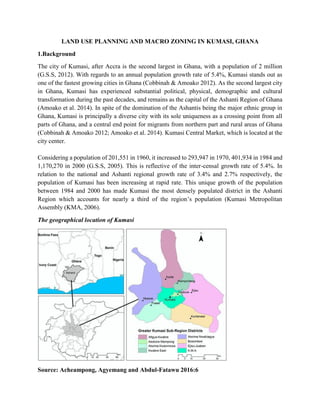
The geographical location of Kumasi
Source: Acheampong, Agyemang and Abdul-Fatawu 2016:6
2. 2.The concept of land use planning
Land use planning is regarded as the process which involves the art and science of ordering the
use of land, character and siting of buildings and /or physical development, alignment of
communication routes: roads, trams, railway, and utilities (water, sewerage); so as to ensure a
maximum practicable degree of economy, safety, convenience, harmony and beauty (aesthetics)
within a human settlement such as: cities, urban or rural areas (Keeble Lewis, 1969). Land use
planning often regarded as Town and Country Planning gained prominence in the UK after the
industrial revolution; where there was the need to provide better housing and basic social
services(sanitation, health and water) for citizens.
2.The nature of land use planning?
The main idea underpinning the concept of land use planning involves conscious effort; to stage
development overtime, ensuring orderliness and control of physical development in a human
settlement, also to ensure a sustainable urban development in the now and future. This concept is
also characterized by what is often known as the ‘planning process’, where problems within the
said settlement are identified (site analysis/physical survey) in each sector : social, economic and
environment. Afterwards, needs are assessed, which leads to the formulation of goals and
objectives, during this stage a goal compatibility matrix is done to refine goals and objectives set.
The next stage of the planning process is implementation of the said land use plan begins and after
that a monitoring and evaluation sets in and re-plan begins, since the process is cyclical in nature.
This concept of land use planning offers a powerful land instrument which determines the urban
form and structure of a settlement. The main reason of this land instrument is to bring to bear the
basic principles of human settlement, namely: economy, safety, convenience, harmony and beauty
(aesthetics). The concept of land use planning is mostly used as an intervention to safeguard land
as a social and public good from land market failure(information asymmetry). Land use planning
is likely to fail if there are no strong legal framework and efficient Institutional infrastructure
system. It is rigid and quite difficult to adapt to current land market conditions due to top down
approach to urban planning.
3.How is Land use planning done in Ghana?
Land use planning is mostly backed by an ‘Act’ or ‘Ordinance’ or a ‘Statute’ or law depending on
the Jurisdiction. In Ghana, the Act backing land use planning is The Cap 84 Ordinance (1945),
Local Government Act 462(1993), which gives the District Assembly the powers and function to
control physical development within each District or Municipality, Metropolitan area, since the
entire country is declared a planning area. There is also the need for the Planning authority during
the planning process to distribute rights that is, designating land for specific uses like residential,
commercial, industrial and recreational, agricultural uses. These rights (benefits) is associated with
obligations (cost). One of the concept which complement land use planning is ‘Zoning’.
3. Correspondingly, a decentralized planning system was initiated to enhance a wide-range of
community-based strategy to urban planning through the formulation of Metropolitan, Municipal
and District Assemblies (MMDAs) in 1988. This structure of planning came in to full effect
following the promulgation of Local Government Act of 1993 (Act 462) which acknowledged all
communities in Ghana as statutory planning areas. Some planning regulations such as the National
Development Planning Systems Act of 1994 (Act 480) and National Building Regulation Act (LI
1630) were passed to back sustainable planning practices in Ghana (Cobbinah and Korah, 2015).
The above mentioned legislations in addition to Town Country Planning Ordinance 1945, Cap 84,
laid down a framework for MMDAs to practice land use planning functions at the district and local
levels, and without partiality authorized the MMDAs to prohibit, abate, remove, pull down or alter
so as to bring into conformity with the approved plan, a physical development which does not
conform to the approved plan, or the abatement, removal, demolition or alteration of which is
necessary for the implementation of an approved plan (Local Government Act of 1993 (Act 462),
Section 53).
3.1Development and Building permit procedure in Kumasi, Ghana
Summary of acquiring a development/building permit in Kumasi Metropolitan Assembly
Requirements
1. Proof of Ownership- Land title
2. Site plans 3copies
3. Building Plans 3 copies which is certified by a qualified architect or structural engineer
4. Some developers or applicants may require a permit from statutory consultees such as Fire
Service Division, Environmental Protection Agency, Urban Roads that is when a developer intends
to construct a Gas filling station, a certificate from the above agencies subjected to fulfil certain
conditionality.
Procedure
1. Check out for the proof of land ownership- title deed or lease period/indenture
2. Check out from the Town and Country Planning Department if the site conforms to the layout
or planning scheme of the said area to be developed.
3. After these steps, the developer is directed to the Kumasi Metropolitan Assembly revenue Unit
to pick up an application form
4. Before the approval of the Statutory Planning Committee(SPC) known as (Kumasi Planning
Committee), a Technical Sub-Committee (TSC)meet to vet the building plans of the applicant
based on technical merits, this committee is made up of the various Technical Departments in the
Statutory Planning Committee (Town and Country Planning Department &Works Department).
4. 5. The recommendation of the TSC is then considered by the SPC, which is taken into
consideration during approval process. At this stage some of the application may be rejected,
deferred or accepted by the SPC. The development and building permit are approved concurrently.
5.Concept of Zoning
This concept evolved in the early 20th
century in America (1916) in New York. The concept of
zoning was to secure the welfare, wealth, health (safety), morals of citizens in shanty
neighborhoods in Manhattan. The theory underpinning zoning is the incompatibility of land use
activities, that is, heavy industrial versus High class residential zone. Where incompatible uses
repel each other compatible uses attract each other due to health, convenience and safety issues.
In view of this, the principle of Police Power (government) is constantly used to ensure harmony.
Zoning is the foundation for all regulation Authority in English Common Law Countries.
6.Why Zoning?
Zoning as a land instrument is employed to the public sector, policy approach to manage privately
owned land. Also, ordering the use of land (Public interest). Further, the public broadly designates
how land may be used (District uses). The establishment of specific land uses within broad activity
areas is practically evident in this land instrument; such as density, Height zones, Floor Area Ratio.
The major reason why zoning is crucial to every urban development is to enhance uniform land
use regulation (harmony). Hence different zones for different types of activities cannot be under
estimated
7.How Zoning is done?
The basic zones within a Zoning region includes: Residential, Commercial and Industrial uses.
The acquisition of property rights within these zones are in accordance to lay down criteria or set
of regulations, standards, conditionality’s and or requirements. The list of criteria include: Permit
(Residential), Conditional (Commercial), and Prohibited (Industrial) uses. Zoning is done to
distinguish use right among owners, and also to have great difference between zones.
Zoning has gone through series of changes and has attained success over the years, but has been
faced with quite number of challenges these include:
7.1Strength
1. Long established Legal and administrative history
2. Simple to formulate
3. Simple to explain
4. Simple to administer
5. Allows for rapid coverage of large geographic area
6. Relatively inexpensive to formulate and implement large area covered
5. 7.2Challenges
1. Easy to modify
2. Has been shown to be prone to bribery, due to monopoly of land use
3. Requires an enforcement mechanism and efficient administrative infrastructure system
4. Inadequate technical and institutional capacity to facilitate
5. Lack of Political commitment/willingness
6. Inadequate involvement of professional bodies on providing solutions or advice to the
utilization of Zoning and Land use Planning
8.Conclusion
Land use planning and macro zoning can be used in various jurisdiction as a very powerful
instrument with a proper legal and institutional framework in place. Moreover, these instruments
if used appropriately can serve as a wealth distribution instrument since is a means of capturing
land value increase often known as unearned increment which gives public bodies the advantage
to recapture value increment. Moreover it is an effective tool to help control development and
manage land use in a well-coordinated manner to bring orderliness in every human settlement
especially in a fast urbanizing world.
6. REFERENCES
1. Keeble, Lewis (1969), Principles and Practice of Town and Country Planning, London.
2. Cobbinah,P. B., and Korah, P. I., 2015. Religion gnaws urban planning: the geography of
places of worship in Kumasi, Ghana. Institute for Land Water and Society, Charles Sturt
University, Albury, Australia; Department of Spatial Planning &Environment, Faculty of
Spatial Science, University of Groningen, Groningen, The Netherlands. Accessed at :
International Journal of Urban Sustainable Development, 2015
http://dx.doi.org/10.1080/19463138.2015.1074581
3. Cobbinah PB, Amoako C. 2012. Urban sprawl and the loss of peri-urban land in Kumasi,
Ghana. Int J Soc Hum Sci. 6:388–397.
4. Local Government Act 462, (1993) Arrangement of Sections Part One Districts and District
Assemblies.pp1-64.Accessed
:http://www.epa.gov.gh/ghanalex/acts/Acts/LOCAL%20GOVERNMENT%20ACT,1993
.pdf (26/04/2106)
5. G.S.S (2005). Population Data Analysis Reports, volume 2, policy implications of the
population Growth Trend Data.
6. Kumasi Metropolitan Assembly (2006). District Medium Term Development Plan.
Kumasi- Ghana
7. Amoako C, Cobbinah PB, Niminga-Beka R. 2014. Urban infrastructure design and
pedestrian safety in the Kumasi central business district, Ghana. J Transp Saf Secur.
6:235–256.
8. Acheampong, R.A., Agyemang F.S. K., and Abdul-Fatawu, M., 2016.Quantifying the spatio-
temporal patterns of settlement growth in a metropolitan region of Ghana.
9.