
Empfohlen
Weitere ähnliche Inhalte
Andere mochten auch
Andere mochten auch (18)
Mehr von Rahul Rakshit
Mehr von Rahul Rakshit (13)
Kürzlich hochgeladen
Kürzlich hochgeladen (20)
holmes
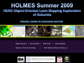
- 1. Albert Decatur | Dan Runfola | Nick Giner | Rahul Rakshit Advisors: Prof. Colin Polsky | Prof. Robert Gilmore Pontius, Jr
- 2. Research Questions How can we produce a very high resolution land- cover dataset for a large suburban landscape? How are lawns of varying extents spatially distributed across the landscape? How can we use virtual globes to assess the accuracy of the dataset? HOLMES http://sites.google.com/site/heromapmanual/ 2 1
- 3. Overall Project Goals Create a land-cover data set for 26 towns in NE Massachusetts Use virtual field work to assess the accuracy of the data Produce land-cover summaries at various geographies (e.g. parcels or census blocks) Develop a tutorial for object-oriented classification of high- resolution imagery Streamline data production by developing automated data processing models HOLMES http://sites.google.com/site/heromapmanual/ 3 2
- 4. Study Area Worcester HOLMES http://sites.google.com/site/heromapmanual/ 4 3
- 6. Object-oriented classification methodology HOLMES http://sites.google.com/site/heromapmanual/ 5 5
- 7. HERO Mapping Project http://sites.google.com/site/heromapmanual/ 5
- 8. Object-oriented classification methodology ‘05 Aerial Photos Woburn, MA HERO Mapping Project http://sites.google.com/site/heromapmanual/ 6 6
- 9. Aerial Object-oriented classification methodology Training Segmentation Sites Classification Edge Aggregation Post Manual Matching and Merging Processing Editing Final Thematic Validation Layers: Product Impervious •Impervious Sand •Water Water •Wetlands Wetlands Bare Soil Coniferous Deciduous Fine Green/ Grass HERO Mapping Project http://sites.google.com/site/heromapmanual/ 6 6
- 10. Object-oriented classification methodology HOLMES http://sites.google.com/site/heromapmanual/ 7 7
- 11. Object-oriented classification methodology HOLMES http://sites.google.com/site/heromapmanual/ 8
- 14. 40 40 HOLMES http://sites.google.com/site/heromapmanual/ 10
- 25. Out Impervious Water Wetlands Bare Soil Coniferous Deciduous Fine Green/ Grass HOLMES http://sites.google.com/site/heromapmanual/ 19
- 26. Data Analysis HOLMES
- 27. Percentage Land-cover by Town Data Analysis Woburn Ipswich Sand Grass 1% 15% Bare Soil 26% Imperviou Deciduou s s 7% 32% Wetland Coniferou 7% Water s 4% 8% HOLMES HOLMES http://sites.google.com/site/heromapmanual/ 21 20
- 28. Percentage Land-cover by Census Block: #44010 All Parcels within Census Block Data Analysis Census Block as a Whole census block parcels selected HOLMES http://sites.google.com/site/heromapmanual/ 22 9
- 29. Data Analysis Percentage Land-cover by Parcel: 7 Roman Rd: #710309 9 Roman Rd: #710308 Impervious 11% Impervious 20% Grass Coniferous Grass 44% 24% 48% Coniferous 24% Deciduous Deciduous 17% 12% Images courtesy of Google street view HOLMES http://sites.google.com/site/heromapmanual/ 23 21
- 30. Automation Streamline data preparation and processing Reduce manual steps as well as likelihood of error Save time and increase productivity HOLMES http://sites.google.com/site/heromapmanual/ 24 22
- 31. Analysis Model Data Processing Models HOLMES http://sites.google.com/site/heromapmanual/ 27 25
- 32. Percentage of fine green Per Parcel, Burlington in 2005 (For parcels with fine green category) 900 750 Number of Parcels 600 450 300 150 0 0 10 20 30 40 50 60 70 80 90 100 Percentage of fine green HOLMES http://sites.google.com/site/heromapmanual/ 29 27
- 33. Validation by virtual fieldwork
- 34. Google Earth and Microsoft Virtual Earth Better Science : Stratified truly random sampling that is temporally matching Very Intuitive Saves time and money HOLMES http://sites.google.com/site/heromapmanual/ 30 30
- 44. Virtual Fieldwork Land-cover Bare Fine Grand Soil Coniferous Deciduous Green Impervious Water Wetlands Total Bare Definiens Land-cover Soil 34 1 1 1 3 40 Coniferous 37 2 1 40 Deciduous 3 55 2 60 Fine Green 1 1 57 1 60 Impervious 44 44 Water 40 40 Wetlands 40 40 Grand Total 38 39 58 59 50 40 40 324 HOLMES http://sites.google.com/site/heromapmanual/ 45 41
- 45. Online Tutorial
- 47. Acknowledgements We sincerely thank: •Prof. Colin Polsky •Prof. Robert Gilmore Pontius Jr. •National Science Foundation •BES (Baltimore) LTER: Jarlath O'Neil-Dunne, Weiqi Zhou, & Morgan Grove •MassGIS •Clark University HERO program This material is based upon work supported by the National Science Foundation under Grant No. 0709685 Any opinions, findings, & conclusions or recommendations expressed in this material are those of the author(s) & do not necessarily reflect the views of the National Science Foundation. HOLMES http://sites.google.com/site/heromapmanual/ 46 13
Hinweis der Redaktion
- Subset in Burlington, segmented scale 10
- Same subset in Burlington, segmented scale 40
- Same subset in Burlington, segmented scale 100
- Same subset in Burlington, segmented scale 200
- Aerial photograph 45cm resolution 2005 MassGIS 4 band, eastern Burlington
- Same aerial, segmented scale 40
- Land-cover classification