Geomatics UK Ltd is an established land surveying company in Britain offering clients high quality & economical topographic surveying services ranging from simple land & building surveys to detailed topographic surveys & aerial topographic surveys as well.
http://www.geomatics-uk.com
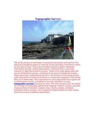
1. Topographic Surveys
The whole process of delineation of property boundaries starting from the
planning & designing phase to marking out the boundary lines thrive mainly
on the land surveys. They carry out data analysis & gather necessary
information through careful observations, measurements in the land,
research of legal documents & reviews. These minor data details pave the
way to dimensional surveys, architectural surveys & mechanical surveys.
These data help in determining the 2D or 3D structure of the piece of land.
Later documents of historical evidence or record are prepared in PDF format
files out of these data. The maps based on such documents find a great use
in dimensional surveys, architectural surveys, boundary surveys,
topographic surveys & judicial surveys. The land surveys cover the whole
lot of things including data gathering & mapping, location surveys, accurate
measurements of elevation, length, area, volume, angles, vertical &
horizontal control surveys, their analysis & implementation to fulfill varied
kind of surveying & drafting needs faster.