Workshop research and monitoring
•
1 gefällt mir•493 views

Dynamic Dunes Congress 2015 Workshop: Research and monitoring - Bas Arens

Empfohlen
Empfohlen
Weitere ähnliche Inhalte
Mehr von PWN
Mehr von PWN (20)
Kürzlich hochgeladen
Kürzlich hochgeladen (20)
Workshop research and monitoring
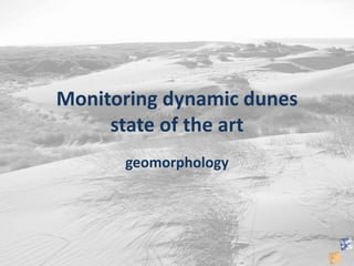
- 1. Monitoring dynamic dunes state of the art geomorphology
- 2. White dunes
- 3. Grey dunes
- 5. What to measure? interest parameter Sand transport (process) Events Gradients Sand transport (result) Height changes: deflation, accumulation Sediment budget Landscape dynamics Areas bare sand, colonized, sand burial Geomorphic features Blowouts, Carves, mobile dunes, dune building
- 6. Measuring landscape form Method Accuracy Reliability Costs Advantage Disadvantage Air photographs +/- High High Retrospective Expensive Problems with data gathering Recording date Field mapping +/- Medium- high Medium-high Recording date
- 7. • Air photo – Bare-vegetated – Shapes – Evolution in time
- 9. Measuring Process sand transport indirectly Method Accuracy Reliability Costs Advantage Disadvantage Erosion pins + Low Low Easy, 1D Risk for data loss 1D Augering +/- High Low Easy, 1D Retrospective Accuracy? Profile GPS ++ High Medium Easy, 2D 2D Lidar +/- High High 3D Accuracy Photogram. Drone +/- high Medium-high 3D No data in vegetation
- 10. • Erosion pins – Spot measurements – Risk of data loss -10 -5 0 5 10 1-1 1-2 1-3 1-4 1-5 1-6 1-7 1-8 1-9 heightchange(cm) pin number Kraansvlak transect 1 24/9 to 1/10/99 1/10 to 12/11/99 12/11 to 3/12/99
- 11. • Augering – Spot measurements – Accuracy
- 12. • Transects – Accurate – 2D
- 13. • LIDAR – Not accurate in vegetation – Not usable for small changes
- 14. Measuring Process sand transport directly Method Accuracy Reliability Costs Advantage Disadvantage Sand catchers 1 knik ? +/- Low – high easy Splash erosion Sand catchers 2 ? +/- Low-high easy Data loss Electronic device +/- +/- high High resolution data Complicated expensive
- 16. • Sand traps – Spot measurements – Transport direction – Accuracy?? – Difficult to translate to deposition or erosion