SlideShare ist ein Scribd-Unternehmen logo
1 von 29
25 Years of GRASS GIS Meeting “Present and Future of the GRASS User community in Japan” Markus Neteler Fondazione E Mach – IASMA Center of Research and Innovation Italy, markus.neteler@iasma.it OSGeo Japan – OSGeo.jp Tokyo, Nomura Research Institute, Marunouchi Center
GRASS: 25 years of GFOSS 1987 USA (GRASS 2.0,  no Web!) 1995 USA 1997, Univ. of Hannover, Germany 2002 ITC-irst Trento + Baylor ITC-irst 2002 Today...
Member of OSGeo.org (Open Source Geospatial Foundation) ,[object Object]
Written in C language,  800k SLOC,  portable s ource code (32/64bit;  various operating systems and hardware platforms), modular GRASS: The portable GIS Open Source GIS:  GRASS Communities:   www.grass-verein.de , www.gfoss.it ,  www.osgeo.jp ,  www.osgeo.it ,  www.osgeo.de  ... GNU/Linux MacOSX MS-Windows iPAQ (2002)
New Windows Installers: OSGeo4W  and winGRASS stand-alone
GRASS: command line and graphical user interfaces 1982.. .. 1995 Since 2007.. … today
GRASS GIS: new graphical user interface Written in Python/wxWidgets ,[object Object]
Powerful Future:
Cartography tool Location Wizard Attribute manager
GRASS GIS: new digitizer New GRASS Digitizer: ,[object Object]
Object and vector transfer from background maps
Vector objects editing: ,[object Object],[object Object],[object Object],[object Object],[object Object],[object Object]
Ongoing: Localization of GRASS GIS Status:   Several hundred messages have been translated    in January 2010 (MEXT project)
Geostatistics with GRASS and R-stats R statistical software is run inside a GRASS session:  R reads and writes data directly from/to GRASS
A comparison of hiking paths in Val di Fassa, Italy Rot : existing path Blau : calculated with r.walk r.walk improved again in GRASS 6.5+ Arrival Start Autor:  M. Franchi, “Young researchers wanted” award (PBZ, 2006) r.walk: Walking connectivity
r.walk: Terrain accessibility Hiking in complex  terrain
GRASS terrain data elaboration Topographic index Solar energy Geomorphometry
Overlay of geocoded historical maps  (1840) to recent orthophotos LANDSAT ETM+ color composite (from free archive) GRASS image processing
GRASS image processing: Atmospheric correction Haze reduction in LANDSAT ETM+ with Tasseled Cap transform Also available: 6S integration in GRASS (i.atcorr) METEOSAT, GOES east/west, NOAA AVHRR, SPOT HRV, LANDSAT TM and ETM+, IRS 1C-LISS, ASTER (ALOS + Ikonos in prep.)
GRASS visualization: Orthophotos over Lidar-DEM/DSM Visualization in GRASS-NVIZ tool
GIS and Remote sensing unit at FEM: Spatial modelling  of disease vectors, biodiversity and beyond http://gis.fem-environment.eu
GIS Modelling and Remote Sensing Time series elaboration of satellite data for  disease dynamics and ecological modelling GIS modelling for risk analysis SELECTED PUBLICATIONS: ,[object Object]
Carpi G., Cagnacci F., Neteler M., Rizzoli A, 2008:  Tick infestation on roe deer in relation to geographic and remotely-sensed climatic variables in a tick-borne encephalitis endemic area . Epidem. and Infection, 136, pp. 1416-1424
M. Neteler, 2005:  Time series processing of MODIS satellite data for landscape epidemiological applications . Intl J Geoinf., 1(1), pp. 133-138 Tiger mosquito (Ae. Albopictus) risk http://gis.fem-environment.eu °C LAND SURFACE TEMPERATURE  (LST) Data enhancements in complex Alpine terrain 1 1 1 1 1 1 1 1 1 1 1 1 1 1 1 1 1 1 5 10 15 20 0.1 0.2 0.3 0.4 0.5 0.6 0.7 10day periods (2003) ‏ 2 2 2 2 2 2 2 2 2 2 2 2 2 2 2 2 2 2 2 3 3 3 3 3 3 3 3 3 3 3 3 3 3 3 3 3 3 3 3 1 2 3 Cavedine (570m a.s.l) ‏ Val di Non (610m a.s.l) ‏ Levico  (760m a.s.l) ‏ April EVI 10km 3 1 2 Enhanced Vegetation Index  (EVI) “Spring/autumn detection”: Trentino 2003 Effect of valley orientation  and exposition
Original MODIS LST map, QA layer applied as filter Second and third filter stage applied to MODIS LST map [°C] [°C] Undetected outliers (clouds) MODIS LST (Aqua satellite) 1 st  June 2003, 13:30 solar time
Original MODIS LST map, QA layer applied as filter Reconstructed MODIS LST map [°C] [°C] MODIS LST (Aqua satellite) 1 st  June 2003, 13:30 solar time
Reconstructed LST time series  versus meteo data Missing data due to clouds etc. Available now: >  11000 LST maps (4/day) LST and meteo-data are two independent data sets Examples for  ,[object Object]
16-day period aggregated means
Linear regression for trend analysis Neteler, M., 2010: Estimating daily LST in mount. env. by reconstr. MODIS LST data.  Rem. Sens.  2(1), 333-351

Weitere ähnliche Inhalte

Was ist angesagt?

Processing Landsat 8 Multi-Spectral Images with GRASS Tools & the potential o...
Processing Landsat 8 Multi-Spectral Images with GRASS Tools & the potential o...Processing Landsat 8 Multi-Spectral Images with GRASS Tools & the potential o...
Processing Landsat 8 Multi-Spectral Images with GRASS Tools & the potential o...Shaun Lewis
 
Planet: Imaging Earth Every Day
Planet: Imaging Earth Every DayPlanet: Imaging Earth Every Day
Planet: Imaging Earth Every DaySafe Software
 
Nottingham hack soc
Nottingham hack socNottingham hack soc
Nottingham hack socSK53
 
Training and hands-on SNAP Sentinel-1 IW SLC Interferogram and Displacement
Training and hands-on SNAP Sentinel-1 IW SLC Interferogram and DisplacementTraining and hands-on SNAP Sentinel-1 IW SLC Interferogram and Displacement
Training and hands-on SNAP Sentinel-1 IW SLC Interferogram and DisplacementEmmanuel Mathot
 
SFScon 21 - Silvia Franceschi Andrea Antonello - Smash a customizable cross-p...
SFScon 21 - Silvia Franceschi Andrea Antonello - Smash a customizable cross-p...SFScon 21 - Silvia Franceschi Andrea Antonello - Smash a customizable cross-p...
SFScon 21 - Silvia Franceschi Andrea Antonello - Smash a customizable cross-p...South Tyrol Free Software Conference
 
Use case of Disaster Management System by using Geopaparazzi and MapGuide Ope...
Use case of Disaster Management System by using Geopaparazzi and MapGuide Ope...Use case of Disaster Management System by using Geopaparazzi and MapGuide Ope...
Use case of Disaster Management System by using Geopaparazzi and MapGuide Ope...Hirofumi Hayashi
 
SBAS-DInSAR processing on the ESA Geohazards Exploitation Platform
SBAS-DInSAR processing on the ESA Geohazards Exploitation PlatformSBAS-DInSAR processing on the ESA Geohazards Exploitation Platform
SBAS-DInSAR processing on the ESA Geohazards Exploitation PlatformEmmanuel Mathot
 
FV_IGARSS11.ppt
FV_IGARSS11.pptFV_IGARSS11.ppt
FV_IGARSS11.pptgrssieee
 
OpenGeoData Italia - Roma - Simone Cortesi | Maurizio Napolitano | openstreet...
OpenGeoData Italia - Roma - Simone Cortesi | Maurizio Napolitano | openstreet...OpenGeoData Italia - Roma - Simone Cortesi | Maurizio Napolitano | openstreet...
OpenGeoData Italia - Roma - Simone Cortesi | Maurizio Napolitano | openstreet...Simone Cortesi
 
2018 GIS in Government: Pits and False Hills and Spikes, Oh My Fixing Blunder...
2018 GIS in Government: Pits and False Hills and Spikes, Oh My Fixing Blunder...2018 GIS in Government: Pits and False Hills and Spikes, Oh My Fixing Blunder...
2018 GIS in Government: Pits and False Hills and Spikes, Oh My Fixing Blunder...GIS in the Rockies
 
Geopaparazzi, state of the art
Geopaparazzi, state of the artGeopaparazzi, state of the art
Geopaparazzi, state of the artHirofumi Hayashi
 
JGrass: The Horton Machine
JGrass: The Horton MachineJGrass: The Horton Machine
JGrass: The Horton MachineAndrea Antonello
 
Implementation and integration of GPU-accelerated easyWave for instant tsunam...
Implementation and integration of GPU-accelerated easyWave for instant tsunam...Implementation and integration of GPU-accelerated easyWave for instant tsunam...
Implementation and integration of GPU-accelerated easyWave for instant tsunam...Martin Hammitzsch
 
EGU 2012 ESSI: The FOSS GIS Workbench on the GFZ Load Sharing Facility compu...
EGU 2012 ESSI:  The FOSS GIS Workbench on the GFZ Load Sharing Facility compu...EGU 2012 ESSI:  The FOSS GIS Workbench on the GFZ Load Sharing Facility compu...
EGU 2012 ESSI: The FOSS GIS Workbench on the GFZ Load Sharing Facility compu...Peter Löwe
 
Smash & Geopaparazzi - State of the art 2021
Smash & Geopaparazzi - State of the art 2021Smash & Geopaparazzi - State of the art 2021
Smash & Geopaparazzi - State of the art 2021Andrea Antonello
 
Geopaparazzi - NEVER OUT OF DATA IN THE FIELD
Geopaparazzi - NEVER OUT OF DATA IN THE FIELDGeopaparazzi - NEVER OUT OF DATA IN THE FIELD
Geopaparazzi - NEVER OUT OF DATA IN THE FIELDAndrea Antonello
 
GRASS as a Temporal GIS - Sören Gebbert
GRASS as a Temporal GIS - Sören GebbertGRASS as a Temporal GIS - Sören Gebbert
GRASS as a Temporal GIS - Sören GebbertLuis_de_Sousa
 

Was ist angesagt? (18)

Processing Landsat 8 Multi-Spectral Images with GRASS Tools & the potential o...
Processing Landsat 8 Multi-Spectral Images with GRASS Tools & the potential o...Processing Landsat 8 Multi-Spectral Images with GRASS Tools & the potential o...
Processing Landsat 8 Multi-Spectral Images with GRASS Tools & the potential o...
 
Planet: Imaging Earth Every Day
Planet: Imaging Earth Every DayPlanet: Imaging Earth Every Day
Planet: Imaging Earth Every Day
 
Nottingham hack soc
Nottingham hack socNottingham hack soc
Nottingham hack soc
 
Training and hands-on SNAP Sentinel-1 IW SLC Interferogram and Displacement
Training and hands-on SNAP Sentinel-1 IW SLC Interferogram and DisplacementTraining and hands-on SNAP Sentinel-1 IW SLC Interferogram and Displacement
Training and hands-on SNAP Sentinel-1 IW SLC Interferogram and Displacement
 
SFScon 21 - Silvia Franceschi Andrea Antonello - Smash a customizable cross-p...
SFScon 21 - Silvia Franceschi Andrea Antonello - Smash a customizable cross-p...SFScon 21 - Silvia Franceschi Andrea Antonello - Smash a customizable cross-p...
SFScon 21 - Silvia Franceschi Andrea Antonello - Smash a customizable cross-p...
 
Use case of Disaster Management System by using Geopaparazzi and MapGuide Ope...
Use case of Disaster Management System by using Geopaparazzi and MapGuide Ope...Use case of Disaster Management System by using Geopaparazzi and MapGuide Ope...
Use case of Disaster Management System by using Geopaparazzi and MapGuide Ope...
 
SBAS-DInSAR processing on the ESA Geohazards Exploitation Platform
SBAS-DInSAR processing on the ESA Geohazards Exploitation PlatformSBAS-DInSAR processing on the ESA Geohazards Exploitation Platform
SBAS-DInSAR processing on the ESA Geohazards Exploitation Platform
 
FV_IGARSS11.ppt
FV_IGARSS11.pptFV_IGARSS11.ppt
FV_IGARSS11.ppt
 
OpenGeoData Italia - Roma - Simone Cortesi | Maurizio Napolitano | openstreet...
OpenGeoData Italia - Roma - Simone Cortesi | Maurizio Napolitano | openstreet...OpenGeoData Italia - Roma - Simone Cortesi | Maurizio Napolitano | openstreet...
OpenGeoData Italia - Roma - Simone Cortesi | Maurizio Napolitano | openstreet...
 
2018 GIS in Government: Pits and False Hills and Spikes, Oh My Fixing Blunder...
2018 GIS in Government: Pits and False Hills and Spikes, Oh My Fixing Blunder...2018 GIS in Government: Pits and False Hills and Spikes, Oh My Fixing Blunder...
2018 GIS in Government: Pits and False Hills and Spikes, Oh My Fixing Blunder...
 
Geopaparazzi, state of the art
Geopaparazzi, state of the artGeopaparazzi, state of the art
Geopaparazzi, state of the art
 
JGrass: The Horton Machine
JGrass: The Horton MachineJGrass: The Horton Machine
JGrass: The Horton Machine
 
Implementation and integration of GPU-accelerated easyWave for instant tsunam...
Implementation and integration of GPU-accelerated easyWave for instant tsunam...Implementation and integration of GPU-accelerated easyWave for instant tsunam...
Implementation and integration of GPU-accelerated easyWave for instant tsunam...
 
EGU 2012 ESSI: The FOSS GIS Workbench on the GFZ Load Sharing Facility compu...
EGU 2012 ESSI:  The FOSS GIS Workbench on the GFZ Load Sharing Facility compu...EGU 2012 ESSI:  The FOSS GIS Workbench on the GFZ Load Sharing Facility compu...
EGU 2012 ESSI: The FOSS GIS Workbench on the GFZ Load Sharing Facility compu...
 
Smash & Geopaparazzi - State of the art 2021
Smash & Geopaparazzi - State of the art 2021Smash & Geopaparazzi - State of the art 2021
Smash & Geopaparazzi - State of the art 2021
 
Grass
GrassGrass
Grass
 
Geopaparazzi - NEVER OUT OF DATA IN THE FIELD
Geopaparazzi - NEVER OUT OF DATA IN THE FIELDGeopaparazzi - NEVER OUT OF DATA IN THE FIELD
Geopaparazzi - NEVER OUT OF DATA IN THE FIELD
 
GRASS as a Temporal GIS - Sören Gebbert
GRASS as a Temporal GIS - Sören GebbertGRASS as a Temporal GIS - Sören Gebbert
GRASS as a Temporal GIS - Sören Gebbert
 

Ähnlich wie 25 Years of GRASS GIS

GRASS and OSGeo: a framework for archeology
GRASS and OSGeo: a framework for archeologyGRASS and OSGeo: a framework for archeology
GRASS and OSGeo: a framework for archeologyMarkus Neteler
 
Deriving environmental indicators from massive spatial time series using open...
Deriving environmental indicators from massive spatial time series using open...Deriving environmental indicators from massive spatial time series using open...
Deriving environmental indicators from massive spatial time series using open...Markus Neteler
 
SFScon17 - Markus Neteler: "Leveraging the Copernicus Sentinel satellite data...
SFScon17 - Markus Neteler: "Leveraging the Copernicus Sentinel satellite data...SFScon17 - Markus Neteler: "Leveraging the Copernicus Sentinel satellite data...
SFScon17 - Markus Neteler: "Leveraging the Copernicus Sentinel satellite data...South Tyrol Free Software Conference
 
2017 01-12 esa-gep_overview
2017 01-12 esa-gep_overview2017 01-12 esa-gep_overview
2017 01-12 esa-gep_overviewESA
 
From a niche to a global user community: Open Source GIS and OSGeo
From a niche to a global user community: Open Source GIS and OSGeoFrom a niche to a global user community: Open Source GIS and OSGeo
From a niche to a global user community: Open Source GIS and OSGeoMarkus Neteler
 
Free GIS Software meets zoonotic diseases: From raw data to ecological indica...
Free GIS Software meets zoonotic diseases: From raw data to ecological indica...Free GIS Software meets zoonotic diseases: From raw data to ecological indica...
Free GIS Software meets zoonotic diseases: From raw data to ecological indica...Markus Neteler
 
Application packaging and systematic processing in earth observation exploita...
Application packaging and systematic processing in earth observation exploita...Application packaging and systematic processing in earth observation exploita...
Application packaging and systematic processing in earth observation exploita...terradue
 
WaPOR version 3 - Annemarie Klaasse - eLeaf - 05 May 2023.pdf
WaPOR version 3 - Annemarie Klaasse - eLeaf - 05 May 2023.pdfWaPOR version 3 - Annemarie Klaasse - eLeaf - 05 May 2023.pdf
WaPOR version 3 - Annemarie Klaasse - eLeaf - 05 May 2023.pdfWaPOR
 
2017 esa gep_overview
2017 esa gep_overview2017 esa gep_overview
2017 esa gep_overviewESA
 
Automated change detection in grass gis
Automated change detection in grass gisAutomated change detection in grass gis
Automated change detection in grass gisCOGS Presentations
 
Geopsy: Seismic Vibration Processing
Geopsy: Seismic Vibration ProcessingGeopsy: Seismic Vibration Processing
Geopsy: Seismic Vibration ProcessingAli Osman Öncel
 
Quanti-litative Revolution in GIS
Quanti-litative Revolution in GISQuanti-litative Revolution in GIS
Quanti-litative Revolution in GISAndy Petrella
 
rworldmap: A New R package for Mapping Global Data
rworldmap: A New R package for Mapping Global Datarworldmap: A New R package for Mapping Global Data
rworldmap: A New R package for Mapping Global DataDr. Volkan OBAN
 
Big Spatial(!) Data Processing mit GeoMesa. AGIT 2019, Salzburg, Austria.
Big Spatial(!) Data Processing mit GeoMesa. AGIT 2019, Salzburg, Austria.Big Spatial(!) Data Processing mit GeoMesa. AGIT 2019, Salzburg, Austria.
Big Spatial(!) Data Processing mit GeoMesa. AGIT 2019, Salzburg, Austria.Anita Graser
 
Free and open source software for remote sensing and GIS
Free and open source software for remote sensing and GISFree and open source software for remote sensing and GIS
Free and open source software for remote sensing and GISNopphawanTamkuan
 

Ähnlich wie 25 Years of GRASS GIS (20)

GRASS and OSGeo: a framework for archeology
GRASS and OSGeo: a framework for archeologyGRASS and OSGeo: a framework for archeology
GRASS and OSGeo: a framework for archeology
 
Deriving environmental indicators from massive spatial time series using open...
Deriving environmental indicators from massive spatial time series using open...Deriving environmental indicators from massive spatial time series using open...
Deriving environmental indicators from massive spatial time series using open...
 
Sentinel-2 Semantic Data & Information Cube Austria
Sentinel-2 Semantic Data & Information Cube AustriaSentinel-2 Semantic Data & Information Cube Austria
Sentinel-2 Semantic Data & Information Cube Austria
 
SFScon17 - Markus Neteler: "Leveraging the Copernicus Sentinel satellite data...
SFScon17 - Markus Neteler: "Leveraging the Copernicus Sentinel satellite data...SFScon17 - Markus Neteler: "Leveraging the Copernicus Sentinel satellite data...
SFScon17 - Markus Neteler: "Leveraging the Copernicus Sentinel satellite data...
 
2017 01-12 esa-gep_overview
2017 01-12 esa-gep_overview2017 01-12 esa-gep_overview
2017 01-12 esa-gep_overview
 
From a niche to a global user community: Open Source GIS and OSGeo
From a niche to a global user community: Open Source GIS and OSGeoFrom a niche to a global user community: Open Source GIS and OSGeo
From a niche to a global user community: Open Source GIS and OSGeo
 
Free GIS Software meets zoonotic diseases: From raw data to ecological indica...
Free GIS Software meets zoonotic diseases: From raw data to ecological indica...Free GIS Software meets zoonotic diseases: From raw data to ecological indica...
Free GIS Software meets zoonotic diseases: From raw data to ecological indica...
 
In sar 1-1-2011
In sar 1-1-2011In sar 1-1-2011
In sar 1-1-2011
 
Application packaging and systematic processing in earth observation exploita...
Application packaging and systematic processing in earth observation exploita...Application packaging and systematic processing in earth observation exploita...
Application packaging and systematic processing in earth observation exploita...
 
SAGA GIS 2.0.7
SAGA GIS 2.0.7SAGA GIS 2.0.7
SAGA GIS 2.0.7
 
WaPOR version 3 - Annemarie Klaasse - eLeaf - 05 May 2023.pdf
WaPOR version 3 - Annemarie Klaasse - eLeaf - 05 May 2023.pdfWaPOR version 3 - Annemarie Klaasse - eLeaf - 05 May 2023.pdf
WaPOR version 3 - Annemarie Klaasse - eLeaf - 05 May 2023.pdf
 
2017 esa gep_overview
2017 esa gep_overview2017 esa gep_overview
2017 esa gep_overview
 
Automated change detection in grass gis
Automated change detection in grass gisAutomated change detection in grass gis
Automated change detection in grass gis
 
Geopsy: Seismic Vibration Processing
Geopsy: Seismic Vibration ProcessingGeopsy: Seismic Vibration Processing
Geopsy: Seismic Vibration Processing
 
Quanti-litative Revolution in GIS
Quanti-litative Revolution in GISQuanti-litative Revolution in GIS
Quanti-litative Revolution in GIS
 
rworldmap: A New R package for Mapping Global Data
rworldmap: A New R package for Mapping Global Datarworldmap: A New R package for Mapping Global Data
rworldmap: A New R package for Mapping Global Data
 
Big Spatial(!) Data Processing mit GeoMesa. AGIT 2019, Salzburg, Austria.
Big Spatial(!) Data Processing mit GeoMesa. AGIT 2019, Salzburg, Austria.Big Spatial(!) Data Processing mit GeoMesa. AGIT 2019, Salzburg, Austria.
Big Spatial(!) Data Processing mit GeoMesa. AGIT 2019, Salzburg, Austria.
 
Free and open source software for remote sensing and GIS
Free and open source software for remote sensing and GISFree and open source software for remote sensing and GIS
Free and open source software for remote sensing and GIS
 
goGPS (November 2013)
goGPS (November 2013)goGPS (November 2013)
goGPS (November 2013)
 
Introduction to gis
Introduction to gisIntroduction to gis
Introduction to gis
 

Mehr von Markus Neteler

OSGeo ireland keynote 2017 by Markus Neteler
OSGeo ireland keynote 2017 by Markus NetelerOSGeo ireland keynote 2017 by Markus Neteler
OSGeo ireland keynote 2017 by Markus NetelerMarkus Neteler
 
10 years of OSGeo - Happy Birthday
10 years of OSGeo - Happy Birthday10 years of OSGeo - Happy Birthday
10 years of OSGeo - Happy BirthdayMarkus Neteler
 
OSGeo: projects, incubation and infrastructure
OSGeo: projects, incubation and infrastructureOSGeo: projects, incubation and infrastructure
OSGeo: projects, incubation and infrastructureMarkus Neteler
 
GRASS GIS 7: your reliable geospatial number cruncher
GRASS GIS 7: your reliable geospatial number cruncherGRASS GIS 7: your reliable geospatial number cruncher
GRASS GIS 7: your reliable geospatial number cruncherMarkus Neteler
 
GRASS GIS lightening talk at FOSS4G 2006
GRASS GIS lightening talk at FOSS4G 2006GRASS GIS lightening talk at FOSS4G 2006
GRASS GIS lightening talk at FOSS4G 2006Markus Neteler
 
The need of Interoperability in Office and GIS formats
The need of Interoperability in Office and GIS formatsThe need of Interoperability in Office and GIS formats
The need of Interoperability in Office and GIS formatsMarkus Neteler
 
Community based software development: The GRASS GIS project
Community based software development: The GRASS GIS projectCommunity based software development: The GRASS GIS project
Community based software development: The GRASS GIS projectMarkus Neteler
 

Mehr von Markus Neteler (7)

OSGeo ireland keynote 2017 by Markus Neteler
OSGeo ireland keynote 2017 by Markus NetelerOSGeo ireland keynote 2017 by Markus Neteler
OSGeo ireland keynote 2017 by Markus Neteler
 
10 years of OSGeo - Happy Birthday
10 years of OSGeo - Happy Birthday10 years of OSGeo - Happy Birthday
10 years of OSGeo - Happy Birthday
 
OSGeo: projects, incubation and infrastructure
OSGeo: projects, incubation and infrastructureOSGeo: projects, incubation and infrastructure
OSGeo: projects, incubation and infrastructure
 
GRASS GIS 7: your reliable geospatial number cruncher
GRASS GIS 7: your reliable geospatial number cruncherGRASS GIS 7: your reliable geospatial number cruncher
GRASS GIS 7: your reliable geospatial number cruncher
 
GRASS GIS lightening talk at FOSS4G 2006
GRASS GIS lightening talk at FOSS4G 2006GRASS GIS lightening talk at FOSS4G 2006
GRASS GIS lightening talk at FOSS4G 2006
 
The need of Interoperability in Office and GIS formats
The need of Interoperability in Office and GIS formatsThe need of Interoperability in Office and GIS formats
The need of Interoperability in Office and GIS formats
 
Community based software development: The GRASS GIS project
Community based software development: The GRASS GIS projectCommunity based software development: The GRASS GIS project
Community based software development: The GRASS GIS project
 

Kürzlich hochgeladen

presentation ICT roal in 21st century education
presentation ICT roal in 21st century educationpresentation ICT roal in 21st century education
presentation ICT roal in 21st century educationjfdjdjcjdnsjd
 
ICT role in 21st century education and its challenges
ICT role in 21st century education and its challengesICT role in 21st century education and its challenges
ICT role in 21st century education and its challengesrafiqahmad00786416
 
Exploring Multimodal Embeddings with Milvus
Exploring Multimodal Embeddings with MilvusExploring Multimodal Embeddings with Milvus
Exploring Multimodal Embeddings with MilvusZilliz
 
Axa Assurance Maroc - Insurer Innovation Award 2024
Axa Assurance Maroc - Insurer Innovation Award 2024Axa Assurance Maroc - Insurer Innovation Award 2024
Axa Assurance Maroc - Insurer Innovation Award 2024The Digital Insurer
 
"I see eyes in my soup": How Delivery Hero implemented the safety system for ...
"I see eyes in my soup": How Delivery Hero implemented the safety system for ..."I see eyes in my soup": How Delivery Hero implemented the safety system for ...
"I see eyes in my soup": How Delivery Hero implemented the safety system for ...Zilliz
 
ProductAnonymous-April2024-WinProductDiscovery-MelissaKlemke
ProductAnonymous-April2024-WinProductDiscovery-MelissaKlemkeProductAnonymous-April2024-WinProductDiscovery-MelissaKlemke
ProductAnonymous-April2024-WinProductDiscovery-MelissaKlemkeProduct Anonymous
 
AWS Community Day CPH - Three problems of Terraform
AWS Community Day CPH - Three problems of TerraformAWS Community Day CPH - Three problems of Terraform
AWS Community Day CPH - Three problems of TerraformAndrey Devyatkin
 
Biography Of Angeliki Cooney | Senior Vice President Life Sciences | Albany, ...
Biography Of Angeliki Cooney | Senior Vice President Life Sciences | Albany, ...Biography Of Angeliki Cooney | Senior Vice President Life Sciences | Albany, ...
Biography Of Angeliki Cooney | Senior Vice President Life Sciences | Albany, ...Angeliki Cooney
 
[BuildWithAI] Introduction to Gemini.pdf
[BuildWithAI] Introduction to Gemini.pdf[BuildWithAI] Introduction to Gemini.pdf
[BuildWithAI] Introduction to Gemini.pdfSandro Moreira
 
TrustArc Webinar - Unlock the Power of AI-Driven Data Discovery
TrustArc Webinar - Unlock the Power of AI-Driven Data DiscoveryTrustArc Webinar - Unlock the Power of AI-Driven Data Discovery
TrustArc Webinar - Unlock the Power of AI-Driven Data DiscoveryTrustArc
 
Cyberprint. Dark Pink Apt Group [EN].pdf
Cyberprint. Dark Pink Apt Group [EN].pdfCyberprint. Dark Pink Apt Group [EN].pdf
Cyberprint. Dark Pink Apt Group [EN].pdfOverkill Security
 
Cloud Frontiers: A Deep Dive into Serverless Spatial Data and FME
Cloud Frontiers:  A Deep Dive into Serverless Spatial Data and FMECloud Frontiers:  A Deep Dive into Serverless Spatial Data and FME
Cloud Frontiers: A Deep Dive into Serverless Spatial Data and FMESafe Software
 
Modular Monolith - a Practical Alternative to Microservices @ Devoxx UK 2024
Modular Monolith - a Practical Alternative to Microservices @ Devoxx UK 2024Modular Monolith - a Practical Alternative to Microservices @ Devoxx UK 2024
Modular Monolith - a Practical Alternative to Microservices @ Devoxx UK 2024Victor Rentea
 
AXA XL - Insurer Innovation Award Americas 2024
AXA XL - Insurer Innovation Award Americas 2024AXA XL - Insurer Innovation Award Americas 2024
AXA XL - Insurer Innovation Award Americas 2024The Digital Insurer
 
Apidays New York 2024 - The value of a flexible API Management solution for O...
Apidays New York 2024 - The value of a flexible API Management solution for O...Apidays New York 2024 - The value of a flexible API Management solution for O...
Apidays New York 2024 - The value of a flexible API Management solution for O...apidays
 
Strategies for Landing an Oracle DBA Job as a Fresher
Strategies for Landing an Oracle DBA Job as a FresherStrategies for Landing an Oracle DBA Job as a Fresher
Strategies for Landing an Oracle DBA Job as a FresherRemote DBA Services
 
DEV meet-up UiPath Document Understanding May 7 2024 Amsterdam
DEV meet-up UiPath Document Understanding May 7 2024 AmsterdamDEV meet-up UiPath Document Understanding May 7 2024 Amsterdam
DEV meet-up UiPath Document Understanding May 7 2024 AmsterdamUiPathCommunity
 
EMPOWERMENT TECHNOLOGY GRADE 11 QUARTER 2 REVIEWER
EMPOWERMENT TECHNOLOGY GRADE 11 QUARTER 2 REVIEWEREMPOWERMENT TECHNOLOGY GRADE 11 QUARTER 2 REVIEWER
EMPOWERMENT TECHNOLOGY GRADE 11 QUARTER 2 REVIEWERMadyBayot
 
Emergent Methods: Multi-lingual narrative tracking in the news - real-time ex...
Emergent Methods: Multi-lingual narrative tracking in the news - real-time ex...Emergent Methods: Multi-lingual narrative tracking in the news - real-time ex...
Emergent Methods: Multi-lingual narrative tracking in the news - real-time ex...Zilliz
 

Kürzlich hochgeladen (20)

presentation ICT roal in 21st century education
presentation ICT roal in 21st century educationpresentation ICT roal in 21st century education
presentation ICT roal in 21st century education
 
ICT role in 21st century education and its challenges
ICT role in 21st century education and its challengesICT role in 21st century education and its challenges
ICT role in 21st century education and its challenges
 
Exploring Multimodal Embeddings with Milvus
Exploring Multimodal Embeddings with MilvusExploring Multimodal Embeddings with Milvus
Exploring Multimodal Embeddings with Milvus
 
Axa Assurance Maroc - Insurer Innovation Award 2024
Axa Assurance Maroc - Insurer Innovation Award 2024Axa Assurance Maroc - Insurer Innovation Award 2024
Axa Assurance Maroc - Insurer Innovation Award 2024
 
"I see eyes in my soup": How Delivery Hero implemented the safety system for ...
"I see eyes in my soup": How Delivery Hero implemented the safety system for ..."I see eyes in my soup": How Delivery Hero implemented the safety system for ...
"I see eyes in my soup": How Delivery Hero implemented the safety system for ...
 
ProductAnonymous-April2024-WinProductDiscovery-MelissaKlemke
ProductAnonymous-April2024-WinProductDiscovery-MelissaKlemkeProductAnonymous-April2024-WinProductDiscovery-MelissaKlemke
ProductAnonymous-April2024-WinProductDiscovery-MelissaKlemke
 
AWS Community Day CPH - Three problems of Terraform
AWS Community Day CPH - Three problems of TerraformAWS Community Day CPH - Three problems of Terraform
AWS Community Day CPH - Three problems of Terraform
 
Biography Of Angeliki Cooney | Senior Vice President Life Sciences | Albany, ...
Biography Of Angeliki Cooney | Senior Vice President Life Sciences | Albany, ...Biography Of Angeliki Cooney | Senior Vice President Life Sciences | Albany, ...
Biography Of Angeliki Cooney | Senior Vice President Life Sciences | Albany, ...
 
[BuildWithAI] Introduction to Gemini.pdf
[BuildWithAI] Introduction to Gemini.pdf[BuildWithAI] Introduction to Gemini.pdf
[BuildWithAI] Introduction to Gemini.pdf
 
TrustArc Webinar - Unlock the Power of AI-Driven Data Discovery
TrustArc Webinar - Unlock the Power of AI-Driven Data DiscoveryTrustArc Webinar - Unlock the Power of AI-Driven Data Discovery
TrustArc Webinar - Unlock the Power of AI-Driven Data Discovery
 
Cyberprint. Dark Pink Apt Group [EN].pdf
Cyberprint. Dark Pink Apt Group [EN].pdfCyberprint. Dark Pink Apt Group [EN].pdf
Cyberprint. Dark Pink Apt Group [EN].pdf
 
Cloud Frontiers: A Deep Dive into Serverless Spatial Data and FME
Cloud Frontiers:  A Deep Dive into Serverless Spatial Data and FMECloud Frontiers:  A Deep Dive into Serverless Spatial Data and FME
Cloud Frontiers: A Deep Dive into Serverless Spatial Data and FME
 
Modular Monolith - a Practical Alternative to Microservices @ Devoxx UK 2024
Modular Monolith - a Practical Alternative to Microservices @ Devoxx UK 2024Modular Monolith - a Practical Alternative to Microservices @ Devoxx UK 2024
Modular Monolith - a Practical Alternative to Microservices @ Devoxx UK 2024
 
AXA XL - Insurer Innovation Award Americas 2024
AXA XL - Insurer Innovation Award Americas 2024AXA XL - Insurer Innovation Award Americas 2024
AXA XL - Insurer Innovation Award Americas 2024
 
+971581248768>> SAFE AND ORIGINAL ABORTION PILLS FOR SALE IN DUBAI AND ABUDHA...
+971581248768>> SAFE AND ORIGINAL ABORTION PILLS FOR SALE IN DUBAI AND ABUDHA...+971581248768>> SAFE AND ORIGINAL ABORTION PILLS FOR SALE IN DUBAI AND ABUDHA...
+971581248768>> SAFE AND ORIGINAL ABORTION PILLS FOR SALE IN DUBAI AND ABUDHA...
 
Apidays New York 2024 - The value of a flexible API Management solution for O...
Apidays New York 2024 - The value of a flexible API Management solution for O...Apidays New York 2024 - The value of a flexible API Management solution for O...
Apidays New York 2024 - The value of a flexible API Management solution for O...
 
Strategies for Landing an Oracle DBA Job as a Fresher
Strategies for Landing an Oracle DBA Job as a FresherStrategies for Landing an Oracle DBA Job as a Fresher
Strategies for Landing an Oracle DBA Job as a Fresher
 
DEV meet-up UiPath Document Understanding May 7 2024 Amsterdam
DEV meet-up UiPath Document Understanding May 7 2024 AmsterdamDEV meet-up UiPath Document Understanding May 7 2024 Amsterdam
DEV meet-up UiPath Document Understanding May 7 2024 Amsterdam
 
EMPOWERMENT TECHNOLOGY GRADE 11 QUARTER 2 REVIEWER
EMPOWERMENT TECHNOLOGY GRADE 11 QUARTER 2 REVIEWEREMPOWERMENT TECHNOLOGY GRADE 11 QUARTER 2 REVIEWER
EMPOWERMENT TECHNOLOGY GRADE 11 QUARTER 2 REVIEWER
 
Emergent Methods: Multi-lingual narrative tracking in the news - real-time ex...
Emergent Methods: Multi-lingual narrative tracking in the news - real-time ex...Emergent Methods: Multi-lingual narrative tracking in the news - real-time ex...
Emergent Methods: Multi-lingual narrative tracking in the news - real-time ex...
 

25 Years of GRASS GIS

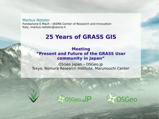
  • 1. 25 Years of GRASS GIS Meeting “Present and Future of the GRASS User community in Japan” Markus Neteler Fondazione E Mach – IASMA Center of Research and Innovation Italy, markus.neteler@iasma.it OSGeo Japan – OSGeo.jp Tokyo, Nomura Research Institute, Marunouchi Center
  • 2. GRASS: 25 years of GFOSS 1987 USA (GRASS 2.0, no Web!) 1995 USA 1997, Univ. of Hannover, Germany 2002 ITC-irst Trento + Baylor ITC-irst 2002 Today...
  • 3.
  • 4. Written in C language, 800k SLOC, portable s ource code (32/64bit; various operating systems and hardware platforms), modular GRASS: The portable GIS Open Source GIS: GRASS Communities: www.grass-verein.de , www.gfoss.it , www.osgeo.jp , www.osgeo.it , www.osgeo.de ... GNU/Linux MacOSX MS-Windows iPAQ (2002)
  • 5. New Windows Installers: OSGeo4W and winGRASS stand-alone
  • 6. GRASS: command line and graphical user interfaces 1982.. .. 1995 Since 2007.. … today
  • 7.
  • 9. Cartography tool Location Wizard Attribute manager
  • 10.
  • 11. Object and vector transfer from background maps
  • 12.
  • 13. Ongoing: Localization of GRASS GIS Status: Several hundred messages have been translated in January 2010 (MEXT project)
  • 14. Geostatistics with GRASS and R-stats R statistical software is run inside a GRASS session: R reads and writes data directly from/to GRASS
  • 15. A comparison of hiking paths in Val di Fassa, Italy Rot : existing path Blau : calculated with r.walk r.walk improved again in GRASS 6.5+ Arrival Start Autor: M. Franchi, “Young researchers wanted” award (PBZ, 2006) r.walk: Walking connectivity
  • 16. r.walk: Terrain accessibility Hiking in complex terrain
  • 17. GRASS terrain data elaboration Topographic index Solar energy Geomorphometry
  • 18. Overlay of geocoded historical maps (1840) to recent orthophotos LANDSAT ETM+ color composite (from free archive) GRASS image processing
  • 19. GRASS image processing: Atmospheric correction Haze reduction in LANDSAT ETM+ with Tasseled Cap transform Also available: 6S integration in GRASS (i.atcorr) METEOSAT, GOES east/west, NOAA AVHRR, SPOT HRV, LANDSAT TM and ETM+, IRS 1C-LISS, ASTER (ALOS + Ikonos in prep.)
  • 20. GRASS visualization: Orthophotos over Lidar-DEM/DSM Visualization in GRASS-NVIZ tool
  • 21. GIS and Remote sensing unit at FEM: Spatial modelling of disease vectors, biodiversity and beyond http://gis.fem-environment.eu
  • 22.
  • 23. Carpi G., Cagnacci F., Neteler M., Rizzoli A, 2008: Tick infestation on roe deer in relation to geographic and remotely-sensed climatic variables in a tick-borne encephalitis endemic area . Epidem. and Infection, 136, pp. 1416-1424
  • 24. M. Neteler, 2005: Time series processing of MODIS satellite data for landscape epidemiological applications . Intl J Geoinf., 1(1), pp. 133-138 Tiger mosquito (Ae. Albopictus) risk http://gis.fem-environment.eu °C LAND SURFACE TEMPERATURE (LST) Data enhancements in complex Alpine terrain 1 1 1 1 1 1 1 1 1 1 1 1 1 1 1 1 1 1 5 10 15 20 0.1 0.2 0.3 0.4 0.5 0.6 0.7 10day periods (2003) ‏ 2 2 2 2 2 2 2 2 2 2 2 2 2 2 2 2 2 2 2 3 3 3 3 3 3 3 3 3 3 3 3 3 3 3 3 3 3 3 3 1 2 3 Cavedine (570m a.s.l) ‏ Val di Non (610m a.s.l) ‏ Levico (760m a.s.l) ‏ April EVI 10km 3 1 2 Enhanced Vegetation Index (EVI) “Spring/autumn detection”: Trentino 2003 Effect of valley orientation and exposition
  • 25. Original MODIS LST map, QA layer applied as filter Second and third filter stage applied to MODIS LST map [°C] [°C] Undetected outliers (clouds) MODIS LST (Aqua satellite) 1 st June 2003, 13:30 solar time
  • 26. Original MODIS LST map, QA layer applied as filter Reconstructed MODIS LST map [°C] [°C] MODIS LST (Aqua satellite) 1 st June 2003, 13:30 solar time
  • 27.
  • 29. Linear regression for trend analysis Neteler, M., 2010: Estimating daily LST in mount. env. by reconstr. MODIS LST data. Rem. Sens. 2(1), 333-351
  • 30.
  • 31. In total 128 nodes with 400 Gb RAM
  • 33. Linux operating system, blades diskless
  • 34. Used for heavy GIS data processing
  • 36. Queue system for job management (Grid Engine)
  • 37.
  • 39.
  • 41.
  • 42.
  • 43. 52N WPS : Java
  • 45. ZOO project - various languages
  • 46. ... Web Ch. Schwartze, Geoinformatics FCE CTU 2008 Web Processing Service - WPS
  • 47.
  • 48. r.cost : 50x faster
  • 49. r.watershed : time consumption reduced from n to log(n)
  • 50. r.horizon (new) + r.sun (rewritten): faster, improved Improved...
  • 51. v.out.ascii : attribute export added
  • 52. v.out.gpsbabel : new, export to GPS
  • 53. v.buffer, v.delaunay, v.parallel: rewritten (Google SoC 2008 projects)
  • 54. wxPython digitizer : Undo function added
  • 55. wxPython GUI : MS-Windows portable Additionally: > 230 bug tickets fixed R-GRASS-Interface: now fast data exchange
  • 56.
  • 57. r.external : link raster maps instead of import (think WPS!)
  • 58. v.colors : new, easy vector color tables
  • 59. v.generalize : new, 10 vector generalization algorithms
  • 60. v.out.gpsbabel : new, export to GPS
  • 61. and even more... d.split.frame, r.colors.stddev, r.grow.distance, v.to.3d
  • 62.
  • 63. Raster processing: .cost, r.walk, r.watershed: faster by orders of magnitude (10x – 1000x)
  • 64.
  • 65. v.krige : new kriging (using gstat/R)
  • 66.
  • 67. Improved Python API , read/write GRASS rasters to/from NumPy
  • 68. WPS support implemented in parser (c, c++, python, shell)
  • 70.  
  • 71. ARIGATO.... … thanks to OSGeo.JP for making this trip possible!