SlideShare ist ein Scribd-Unternehmen logo
1 von 26
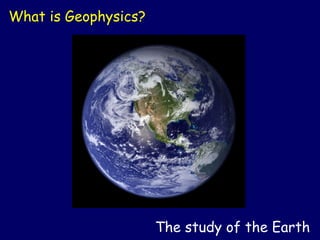
What is Geophysics?


                      The study of the Earth
What is Geophysics?


          The study of tectonic plates and earthquakes
What is Geophysics?


        Earth Structure by USGS
              www.usgs.gov


                The study of the composition of the Earth
What is Geophysics?
                              Turtle Mountain


                      Frank Slide


                      The study of natural hazards
What does a Geophysicist do?


                        Explores for oil and gas
What does a Geophysicist do?


                         Shoots seismic surveys
What does a Geophysicist do?


                                    recording truck
geophones
            energy source


                                 reflecting boundary

                                 reflecting boundary


                            Shoots seismic surveys
What does a Geophysicist do?


       Vibroseis trucks


                          Shoots seismic surveys
What does a Geophysicist do?


                  Shoots seismic surveys in Africa
What does a Geophysicist do?


             Shoots seismic surveys in the mountains
What does a Geophysicist do?


                           Process seismic data
What does a Geophysicist do?


                         Seismic Image of Ancient Reef in Alberta
                                  [400 million years old]


     Uses computer technology to interpret seismic data
What does a Geophysicist do?


     Uses computer technology to interpret seismic data
What does a Geophysicist do?


     Uses high tech visualization to interpret seismic data
What does a Geophysicist do?


              Collects aeromagnetic and gravity data
What does a Geophysicist do?


                           Finds water in Malawi
What does a Geophysicist do?


                   Archaeological surveys in Israel
What does a Geophysics student do?


        Surveys in the Arctic Islands as though on Mars
What does a Geophysics student do?


                      Goes on geology field trips
What does a Geophysics student do?


                    Goes to geophysics field school
What does a Technologist do?


                               Data management
Who hires Geophysicists and Technologists?
• The Petroleum Industry
      oil and gas exploration and production
• Engineering Companies
      environmental studies
• Mining Companies
      mineral resource exploration
• Universities
      teaching and research
• Governments
      regulatory agencies
Education requirements?

• B.Sc in geophysics, physics, mathematics, geology,
earth science or computer science
     (see details under “Careers in Geophysics” at
www.cseg.ca)

• Diploma or certificate from a
technical college

• Licensing by your provincial regulatory
      association (APEGGA in Alberta)
How much does a Geophysicist earn per year?

With an oil company:
• New hire: $40,000-70,000
• 5 years experience: $70,000-100,000
• 10 years experience: $90,000-140,000
• 20 years experience: $130,000-150,000


  * based on 2006 data
How much does a
       Geophysical Technologist earn?
With an oil company:
• New hire: $32,000-$44,000
• 5 years experience: $56,000
• 10 years experience: $72,000
• 20 years experience: $75,000

* based on 2004 data
More info?


Visit our website:
www.cseg.ca

Weitere ähnliche Inhalte

Was ist angesagt?

Seismic Refraction Surveying
Seismic Refraction SurveyingSeismic Refraction Surveying
Seismic Refraction Surveying
Ali Osman Öncel
 

Was ist angesagt? (20)

Similarities and differences between gravity and magnetic
Similarities and differences between gravity and magneticSimilarities and differences between gravity and magnetic
Similarities and differences between gravity and magnetic
 
Principles of seismic data interpretation m.m.badawy
Principles of seismic data interpretation   m.m.badawyPrinciples of seismic data interpretation   m.m.badawy
Principles of seismic data interpretation m.m.badawy
 
Seismic interpretation work flow final ppt
Seismic interpretation work flow final pptSeismic interpretation work flow final ppt
Seismic interpretation work flow final ppt
 
Seismic Refraction Surveying
Seismic Refraction SurveyingSeismic Refraction Surveying
Seismic Refraction Surveying
 
2 D 3D_ seismic survey
2 D 3D_ seismic survey2 D 3D_ seismic survey
2 D 3D_ seismic survey
 
Applications Gravity survey Magnetic survey Electrical resistivity survey Sei...
Applications Gravity survey Magnetic survey Electrical resistivity survey Sei...Applications Gravity survey Magnetic survey Electrical resistivity survey Sei...
Applications Gravity survey Magnetic survey Electrical resistivity survey Sei...
 
2 d and 3d land seismic data acquisition and seismic data processing
2 d and 3d land seismic data acquisition and seismic data processing2 d and 3d land seismic data acquisition and seismic data processing
2 d and 3d land seismic data acquisition and seismic data processing
 
Introduction of sequence stratigraphy
Introduction of sequence stratigraphyIntroduction of sequence stratigraphy
Introduction of sequence stratigraphy
 
Basics of seismic interpretation
Basics of seismic interpretationBasics of seismic interpretation
Basics of seismic interpretation
 
Gravity & magnetic methods in geology
Gravity & magnetic methods in geologyGravity & magnetic methods in geology
Gravity & magnetic methods in geology
 
What is Geophysics?
What is Geophysics?What is Geophysics?
What is Geophysics?
 
Survey design
Survey designSurvey design
Survey design
 
Seismic data processing
Seismic data processingSeismic data processing
Seismic data processing
 
Lecture 23 april29 static correction
Lecture 23 april29 static correctionLecture 23 april29 static correction
Lecture 23 april29 static correction
 
Geophysical methods brief summary
Geophysical methods brief summaryGeophysical methods brief summary
Geophysical methods brief summary
 
Seismic Instrumentation
Seismic InstrumentationSeismic Instrumentation
Seismic Instrumentation
 
Geophysical survey
Geophysical surveyGeophysical survey
Geophysical survey
 
Geophysical methods
Geophysical methodsGeophysical methods
Geophysical methods
 
Introduction to Seismic Method
Introduction to Seismic Method Introduction to Seismic Method
Introduction to Seismic Method
 
Magnetic Survey
Magnetic SurveyMagnetic Survey
Magnetic Survey
 

Andere mochten auch

What is-geophysics
What is-geophysicsWhat is-geophysics
What is-geophysics
sidra sheikh
 
Landslide ppt (Prepared by sanjog Macwan)
Landslide ppt (Prepared by sanjog Macwan)Landslide ppt (Prepared by sanjog Macwan)
Landslide ppt (Prepared by sanjog Macwan)
sanjog macwan
 
Geophysics: Overview
Geophysics: OverviewGeophysics: Overview
Geophysics: Overview
guest20c737
 
Chapter 7 dams and reservoirs
Chapter 7 dams and reservoirsChapter 7 dams and reservoirs
Chapter 7 dams and reservoirs
Mohammed Salahat
 

Andere mochten auch (16)

Chapter 8 Fetter Geology of Groundwater Occurrence-Gaza Strip
Chapter 8 Fetter Geology  of Groundwater Occurrence-Gaza StripChapter 8 Fetter Geology  of Groundwater Occurrence-Gaza Strip
Chapter 8 Fetter Geology of Groundwater Occurrence-Gaza Strip
 
Türkiye and earthquakes
Türkiye and earthquakesTürkiye and earthquakes
Türkiye and earthquakes
 
ÖNCEL AKADEMİ: INTRODUCTION TO GEOPHYSICS
ÖNCEL AKADEMİ: INTRODUCTION TO GEOPHYSICSÖNCEL AKADEMİ: INTRODUCTION TO GEOPHYSICS
ÖNCEL AKADEMİ: INTRODUCTION TO GEOPHYSICS
 
Landslides A Major Threat
Landslides A Major ThreatLandslides A Major Threat
Landslides A Major Threat
 
What is-geophysics
What is-geophysicsWhat is-geophysics
What is-geophysics
 
Landslide ppt (Prepared by sanjog Macwan)
Landslide ppt (Prepared by sanjog Macwan)Landslide ppt (Prepared by sanjog Macwan)
Landslide ppt (Prepared by sanjog Macwan)
 
Mineralogy 1
Mineralogy 1Mineralogy 1
Mineralogy 1
 
Mineralogy
MineralogyMineralogy
Mineralogy
 
Landslides
LandslidesLandslides
Landslides
 
Geophysics: Overview
Geophysics: OverviewGeophysics: Overview
Geophysics: Overview
 
Structural Geology II
Structural Geology IIStructural Geology II
Structural Geology II
 
Ground Water (Unit-V)
Ground Water (Unit-V)Ground Water (Unit-V)
Ground Water (Unit-V)
 
groundwater
groundwatergroundwater
groundwater
 
Engineering Geology (Civil Engineering Applications)
Engineering Geology (Civil Engineering Applications)Engineering Geology (Civil Engineering Applications)
Engineering Geology (Civil Engineering Applications)
 
Chapter 7 dams and reservoirs
Chapter 7 dams and reservoirsChapter 7 dams and reservoirs
Chapter 7 dams and reservoirs
 
Structural Geology
Structural Geology Structural Geology
Structural Geology
 

Ähnlich wie What is-geophysics

Geoscope
GeoscopeGeoscope
Topic 1 introduction
Topic 1 introductionTopic 1 introduction
Topic 1 introduction
Kaleb Wilson
 

Ähnlich wie What is-geophysics (20)

what-is-geophysics-121214060506-phpapp01.pdf
what-is-geophysics-121214060506-phpapp01.pdfwhat-is-geophysics-121214060506-phpapp01.pdf
what-is-geophysics-121214060506-phpapp01.pdf
 
Geoscope
GeoscopeGeoscope
Geoscope
 
GEOPHYICS.pptx
GEOPHYICS.pptxGEOPHYICS.pptx
GEOPHYICS.pptx
 
1605174417-geol-305-1-introduction.ppt
1605174417-geol-305-1-introduction.ppt1605174417-geol-305-1-introduction.ppt
1605174417-geol-305-1-introduction.ppt
 
GEOLOGY FOR CIVIL ENGINEERING. Introduction to Engineering Geology.pdf
GEOLOGY FOR CIVIL ENGINEERING. Introduction to Engineering Geology.pdfGEOLOGY FOR CIVIL ENGINEERING. Introduction to Engineering Geology.pdf
GEOLOGY FOR CIVIL ENGINEERING. Introduction to Engineering Geology.pdf
 
Invention of g.r.irlapati_s_geoscope
Invention of g.r.irlapati_s_geoscopeInvention of g.r.irlapati_s_geoscope
Invention of g.r.irlapati_s_geoscope
 
Modern techniques for prediction of earthquakes.pptx
Modern techniques for prediction of earthquakes.pptxModern techniques for prediction of earthquakes.pptx
Modern techniques for prediction of earthquakes.pptx
 
مقدمة وتعريف قناة جيوفيليا ونبذة قصيرة عن علم الجيولوجيا
مقدمة وتعريف قناة جيوفيليا ونبذة قصيرة عن علم الجيولوجيا مقدمة وتعريف قناة جيوفيليا ونبذة قصيرة عن علم الجيولوجيا
مقدمة وتعريف قناة جيوفيليا ونبذة قصيرة عن علم الجيولوجيا
 
Conclusive Results
Conclusive ResultsConclusive Results
Conclusive Results
 
Arc explorer project[1]
Arc explorer project[1]Arc explorer project[1]
Arc explorer project[1]
 
Topic 1 introduction
Topic 1 introductionTopic 1 introduction
Topic 1 introduction
 
seismic data acq.ppt
seismic data acq.pptseismic data acq.ppt
seismic data acq.ppt
 
Arc explorer project[1]
Arc explorer project[1]Arc explorer project[1]
Arc explorer project[1]
 
Predicting and mapping soil properties using proximal/remote sensing by Zhou ...
Predicting and mapping soil properties using proximal/remote sensing by Zhou ...Predicting and mapping soil properties using proximal/remote sensing by Zhou ...
Predicting and mapping soil properties using proximal/remote sensing by Zhou ...
 
Geophysical methods
Geophysical methodsGeophysical methods
Geophysical methods
 
Similarities between gravity and magnetics and application of different geoph...
Similarities between gravity and magnetics and application of different geoph...Similarities between gravity and magnetics and application of different geoph...
Similarities between gravity and magnetics and application of different geoph...
 
OSIRIS-REx
OSIRIS-RExOSIRIS-REx
OSIRIS-REx
 
SCOPE OF IT IN GEOLOGY. Discuss importance of it.
SCOPE OF IT IN GEOLOGY. Discuss importance of it.SCOPE OF IT IN GEOLOGY. Discuss importance of it.
SCOPE OF IT IN GEOLOGY. Discuss importance of it.
 
AMG_2015
AMG_2015AMG_2015
AMG_2015
 
52 Million Points and Counting: A New Stratification Approach for Mapping Glo...
52 Million Points and Counting: A New Stratification Approach for Mapping Glo...52 Million Points and Counting: A New Stratification Approach for Mapping Glo...
52 Million Points and Counting: A New Stratification Approach for Mapping Glo...
 

Mehr von Mansoor Siddique

Mehr von Mansoor Siddique (11)

Total Quality Management
Total Quality Management Total Quality Management
Total Quality Management
 
What is-six-sigma
What is-six-sigmaWhat is-six-sigma
What is-six-sigma
 
Water and Sanitation Program
Water and Sanitation Program Water and Sanitation Program
Water and Sanitation Program
 
BISP presentation
BISP presentation BISP presentation
BISP presentation
 
Kashf ul-Mahjoob-Urdu
Kashf ul-Mahjoob-UrduKashf ul-Mahjoob-Urdu
Kashf ul-Mahjoob-Urdu
 
Conflict and Negotiation Presentation
Conflict and Negotiation PresentationConflict and Negotiation Presentation
Conflict and Negotiation Presentation
 
E&D Rules 1973
E&D Rules 1973E&D Rules 1973
E&D Rules 1973
 
BISP, Presentation
BISP, Presentation BISP, Presentation
BISP, Presentation
 
Alternate Model Of Ppp
Alternate Model Of PppAlternate Model Of Ppp
Alternate Model Of Ppp
 
My Presentation In Ncrd
My Presentation In NcrdMy Presentation In Ncrd
My Presentation In Ncrd
 
Nexus Between Hrd And Bssfa (Revised)
Nexus Between Hrd And Bssfa (Revised)Nexus Between Hrd And Bssfa (Revised)
Nexus Between Hrd And Bssfa (Revised)
 

What is-geophysics

  • 1. What is Geophysics? The study of the Earth
  • 2. What is Geophysics? The study of tectonic plates and earthquakes
  • 3. What is Geophysics? Earth Structure by USGS www.usgs.gov The study of the composition of the Earth
  • 4. What is Geophysics? Turtle Mountain Frank Slide The study of natural hazards
  • 5. What does a Geophysicist do? Explores for oil and gas
  • 6. What does a Geophysicist do? Shoots seismic surveys
  • 7. What does a Geophysicist do? recording truck geophones energy source reflecting boundary reflecting boundary Shoots seismic surveys
  • 8. What does a Geophysicist do? Vibroseis trucks Shoots seismic surveys
  • 9. What does a Geophysicist do? Shoots seismic surveys in Africa
  • 10. What does a Geophysicist do? Shoots seismic surveys in the mountains
  • 11. What does a Geophysicist do? Process seismic data
  • 12. What does a Geophysicist do? Seismic Image of Ancient Reef in Alberta [400 million years old] Uses computer technology to interpret seismic data
  • 13. What does a Geophysicist do? Uses computer technology to interpret seismic data
  • 14. What does a Geophysicist do? Uses high tech visualization to interpret seismic data
  • 15. What does a Geophysicist do? Collects aeromagnetic and gravity data
  • 16. What does a Geophysicist do? Finds water in Malawi
  • 17. What does a Geophysicist do? Archaeological surveys in Israel
  • 18. What does a Geophysics student do? Surveys in the Arctic Islands as though on Mars
  • 19. What does a Geophysics student do? Goes on geology field trips
  • 20. What does a Geophysics student do? Goes to geophysics field school
  • 21. What does a Technologist do? Data management
  • 22. Who hires Geophysicists and Technologists? • The Petroleum Industry oil and gas exploration and production • Engineering Companies environmental studies • Mining Companies mineral resource exploration • Universities teaching and research • Governments regulatory agencies
  • 23. Education requirements? • B.Sc in geophysics, physics, mathematics, geology, earth science or computer science (see details under “Careers in Geophysics” at www.cseg.ca) • Diploma or certificate from a technical college • Licensing by your provincial regulatory association (APEGGA in Alberta)
  • 24. How much does a Geophysicist earn per year? With an oil company: • New hire: $40,000-70,000 • 5 years experience: $70,000-100,000 • 10 years experience: $90,000-140,000 • 20 years experience: $130,000-150,000 * based on 2006 data
  • 25. How much does a Geophysical Technologist earn? With an oil company: • New hire: $32,000-$44,000 • 5 years experience: $56,000 • 10 years experience: $72,000 • 20 years experience: $75,000 * based on 2004 data
  • 26. More info? Visit our website: www.cseg.ca