Plan Bothnia. Creating, collecting and sharing data
•Als PPTX, PDF herunterladen•
1 gefällt mir•262 views

Presentation given in the Plan Bothnia stakeholders conference in Riga, Latvia (6.02.2012)

Empfohlen
Empfohlen
Weitere ähnliche Inhalte
Mehr von Manuel Frias
Mehr von Manuel Frias (20)
Kürzlich hochgeladen
Kürzlich hochgeladen (20)
Plan Bothnia. Creating, collecting and sharing data
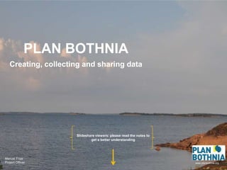
- 1. PLAN BOTHNIA Creating, collecting and sharing data Slideshare viewers: please read the notes to get a better understanding Manuel Frias Project Officer www.planbothnia.org
- 2. We need data! KoneCranes
- 7. Important areas for marine traffic
- 8. Where are the CONFLICTS? Nature protection and interest areas for wind
- 9. We like sharing! Ed Yourdon
- 10. ” Planning processes should be open and transparent ” ” Data should be openly accessible ” HELCOM-VASAB MSP Principles
- 11. planbothnia.org
- 13. Don’t forget to visit planbothnia.org!! Thank you!
Hinweis der Redaktion
- About one year ago Hermanni proposed me to work in the Plan Bothnia project. When he told me about it I thought it was an attractive and challenging project. Attractive because it was transboundary MSP is quite unique and challenging because we would need to collect and create a lot of data.
- I am sure you agree that for a successful MSP data is the most critical and important part of the process. For example, this is a picture of a wind turbine in the Bothnian Sea. The only one so far. To plan this turbine a lot of questions needed to be answered: is there enough wind? Is it shallow enough to build the turbine? Are there any nature protection areas around? Are there shipping lanes crossing?...
- Data is crucial and in the beginning of this project we didn’t have almost any. We started almost from an ”empty” sea. I say ”almost” because luckily we had HELCOM. HELCOM is the best example of an open regional database. We got a lot of data to start the project but we needed more and more specific for the Bothnian Sea.
- So we started almost from 0 and now we have more than 130 datasets. Nature protection, fisheries, wind interest areas... All in less than one year? How did we achieve that?
- This is thanks to these people. They are our heroes and heroines and probably the most important part of this project. They are partners and people who are collaborating with us. Behind data there is always people who create, collect and who work hard.
- Thanks to these people we have maps like this. This map shows where fishermen fish herring in the Baltic Sea. Herring is the most important fish on the Bothnian Sea. Most catches in the Baltic Sea take place here. This map is unique. There is nothing with such detail in the whole Baltic Sea area. It’s made with VMS (Vessel Monitoring System) and catch logs from fish boats. Our Swedish partner created it.
- Another example is this map showing maritime traffic. We have to analyse where the main routes are, whether traffic is increasing or decreasing and the possibility of new routes in the future.
- We also need to know where the conflicts are: Where do different uses overlap. In this map the red spots are areas where nature protection and areas suitable for wind power overlap.
- I showed you that we have tons of data, should we just keep it for ourselves? From the beginning we thought that it would be best to share our data and processes. Why? Because we think that we all benefit from sharing data and being open. There is no point in keeping all knowledge for ourselves.
- We also follow the HELCOM-VASAB recommendation. According to the HELCOM-VASAB MSP Principles ”Planning processes...” and ”Data should be...”
- How do we try to be open and transparent? We built a webpage which we update regularly and from this webpage you can access EVERYTHING. For example, in the blog we talk about our activities, it’s interactive so you can leave comments; in the calendar you can find our latest deadlines and events; you can also find pictures of our meetings and our travels; from our twitter account we follow people with similar interests... And if you want to keep informed of our activities please subscribe to our blog so that you can get our blog posts in your mail.
- I left the map service to the end because it’s a very important component. From here you can see: how much data do we have; what does it look like; you can overlap layers, view several layers at the same time, analysis... You can even download data!
- To end my presentation I would like to encourage to visit our website and to participate, comment or give ideas. As said we are open to new suggestions!