Reservior planning
•Als PPT, PDF herunterladen•
17 gefällt mir•8,679 views

third year diploma in civil engineering SUB- W.R.E

Empfohlen
Weitere ähnliche Inhalte
Was ist angesagt?
Was ist angesagt? (20)
Ähnlich wie Reservior planning
Ähnlich wie Reservior planning (20)
Kürzlich hochgeladen
Kürzlich hochgeladen (20)
Reservior planning
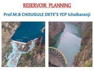
- 1. RESERVOIR PLANNING Prof.M.B CHOUGULE DKTE’S YCP Ichalkaranji
- 2. What is a Reservoir- • It is an area developed by water body due to construction of dam. • TYPE: • Storage Reservoirs. • Flood Control Reservoirs. • Retarding Reservoirs. • Detention Reservoirs. • Distribution Reservoirs. • Multipurpose Reservoirs. • Balancing Reservoirs.
- 3. Reservoir Planning For the best and efficient design of Irrigation project the investigation is must so it is carried out in three stages Surveys for Irrigation project : 1. Reconnaissance Survey 2. Preliminary Survey 3. Detailed Survey / Construction Survey
- 4. Reconnaissance Survey :- In reconnaissance survey the find out number of project sites where storage of water can be done. In this survey inspection of region is done and data collected physically without using precise survey instrument. In reconnaissance survey following information is collected. The size of catchment area, vegetation in the catchment area, soil type, slopes, existing ponds, Command area, Dam site, rainfall, river gauge data, population supporting the scheme, history of other nearby scheme.
- 5. Preliminary Survey :- This survey is carried out by experienced supervision with modern instruments it may take few month to one or two year depending on size of project. It is carried out in dry season with careful planning. Preliminary survey divided into parts 1. Engineering survey 2. Hydrological survey 3. Geological survey
- 6. 1. Engineering Survey :- In this type of survey various types of surveys are carried out such as Plane table survey, Traverse survey, aerial and photographic survey etc. the aim of this survey is to prepare a contoured map of the site. Contour map gives the following information. 1. Water spread. 6. Area elevation curve 2. Capacity of the reservoir. 7.Storage elevation curve 3. Suitable dam site. 4. Site for waste weir and outlets. 5. Arrangement of lines of communication 6. Map of the area to indicate the land property to be surveyed
- 7. 2. Hydrological Survey :- Whenever any storage work is constructed, it is very essential to ascertain that required amount of water will be available at the site for storage. Therefore hydrological survey is of catchment area is done to collect the data for determining availability of water for the reservoir. It is necessary for 1. To study runoff pattern and to estimate yield. 2. To determine maximum discharge. 3. Determination of hydrograph of worst flood to determine spillway capacity and its capacity.
- 8. 3. Geological/Exploration Survey :- It is done in two stages i) Survey inspection and surface mapping. ii) Sub surface exploration. Sub surface exploration gives information 1. Water tightness of the basin 2. Stability of foundation for the dam. 3. Faulty structure in the basin. 4. Type and depth of overburden. 5. Ground water condition of region. 6. Location of quarry sites for construction materials.
- 9. Detailed Survey :- After the preliminary survey only a few sites are selected for further consideration. In this type of survey office studies and estimates for each of the selected site is prepared. Detailed designs of various storage structures are prepared in the drawing office and the cost is worked out. So the relative merits and demerits of two or more sites are take into consideration so as to adopt one site finally.
- 10. . • Data collected in detailed survey • 1)survey of command area. • 2)type of suitable dam. • 3)boring/trial pits at dam site. • 4)detailed report of soil . • 5)detail of area under submergence. • 6)details of people comes under influence. • 7)existing sediment problem if any. • 8) material available, quarry sites available nearby the project. • 9)gauging of river.
- 11. Points to be considered for the site selection of reservoir :- 1. Stable foundation for the dam should be available. 2. At the selected site, the river valley should be narrow so that the length of the dam may be short. 3. The proposed reservoir basin should be water tight and free from cracks, fissures so that there is no loss of water due to percolation. 4. The reservoir basin should not submerged valuable land properties.
- 12. Points to be considered for the site selection of reservoir :- 5. The tributaries which carry high content of sediments should be avoided. 6. The site should be such that the optimum storage capacity is available for the desired purpose. 7. The site should be easily accessible by road and railway. 8. The construction materials should be available in nearby area.
- 13. Data to be collected for irrigation project :- The preliminary investigation consists of 1. Approximate quantity of water. 2. Period of deficient water supply. 3. Technical feasibility of project such as i) command area, ii) nature of soil, iii) types of crops, iv) demand for water at present and in future. 4. Approximate cost of all proposed works.
- 14. Data to be collected for irrigation project :- The detailed investigation consists of 1. Soil survey 2. Field work for availability of water 3. Gauging of river 4. Fixing dam site 5. Availability of materials of construction 6. Sedimentation problem 7. Contour survey of reservoir basin 8. Types of dams 9. Alignment of main canals
- 15. Area Elevation and Storage Elevation Curve Area – Capacity Curve :- The area capacity curve is useful in: 1) Deciding capacity of reservoir. 2) Water spread of reservoir. 3) Elevation of water at any point can be calculated. 4) Determining control levels of dam.
- 17. Area elevation curve:- From the contour plan of reservoir site the area of successive contours A1,A2,A3………An are determined with the help of planimeter. The area A1 is minimum at the bottom of the basin and area An is maximum at the top of the basin. This curves gives the area submerged at different elevation.
- 20. Storage - elevation or volume elevation curve:- The volume of the storage of water between successive contours is calculated by prismoidal formula. The volume of storage between successive contours, goes on increasing from bottom of the basin towards its top.
- 22. Silting of reservoirs :- Silting of reservoirs means the deposition of silt and clay. This mainly occurs when runoff occurs Runoff contain smaller soil particles such as silt clay, fine sand which may deposited at the bed of reservoir which reduces the storage capacity of reservoir. When these particles reaches into reservoir tries to settle down due to action of gravity, coarser one settle down while fine remain suspension therefore it is very essential to check silting of dam and water stored in reservoir.
- 25. Method to reduces the entry of silt:- Pre- constructing method 1. Selection of proper dam site such that catchment area has less erodable portion. 2. Constructing the dam in stages. 3. Providing vegetation screens. 4. Proper reservoir design causing silt water to escape.
- 26. . • 1. Pre-constructing measures: • i. Selection of dam site: Silting can be reduced by choosing the reservoir site in such a way as to exclude the run off from easily erodible catchment. As silting reduces it increases capacity of reservoir. • ii. Construction of the dam in stages: The dam should be built lower, and raised subsequently when some of its capacity gets silted up. Therefore the life of a reservoir can be prolonged by constructing the dam in stages. • iii. Construction of check dams: The sediment inflow can be controlled by constructing smaller check dams across the river contributing major sediment load and trap large amount of coarser sediments. • iv. Vegetation screens: Vegetation’s trap large amount of sediments which reduces entry of silt in reservoir and helps to increase life of dam. • v. Construction of under sluices in the dam: The dam is provided with openings that is under sluices in its base, so as to remove the more silted water on the downstream side. •
- 27. . • 2. Post-constructing measures • i. Removal of post flood water: The sediment content increases just after the floods; therefore attempts are generally made not to collect this water, which reduces sediment load on reservoir. • ii. Mechanical stirring of the sediment: The deposited silt is scoured and disturbed by mechanical mean, so as to keep it in a moving state, thus helps in pushing it towards the sluices. • iii. Erosion control and soil conservation: this includes all those general methods which are adopted to reduce erosion of soil. Because when the soil erosion is reduced, automatically, the sedimentation problem is reduced •
- 28. Post constructing method • Removal of post flood water. • Dredging. • Mechanical stirring. • Soil conservation method.
- 33. Factor affecting Silting :- 1. Catchment Area : - In case of fan shaped catchment the amount of deposition of finer soil fractions will be more as compared to fern shaped catchment. 2. Slope of country : - If the slope is steep more particles are deposited through runoff 3. Climatic condition :- climatic condition also affect the production of silting like dryness, rain, heat helps in production of silting. 4. Nature of surface soil :- If soil is loose, silting is more along with runoff.
- 34. . • 1. Catchment area: If catchment area is more, silting will be more. If catchment area is less, silting will be less. • 2. Shape of catchment: If catchment area is fan shaped, siltingwill be more. If catchment area is fern shaped, silting will be less. • 3. Slope of country: If slope is steep, more particles will be erodes because of high velocity of runoff & will be deposited in reservoir basin and vice versa. • 4. Climatic condition: Dry and rainy climate helps in production of more silt material. • 5. Nature of surface soil: If soil is weathered or loose it can be easily flow with runoff and deposited in reservoir.
- 35. Control Level in Dam :-
- 36. Control Level in Dam :- 1. Top Bund Level (TBL) : - This is RL of dam top which depends on capacity, storage flood lift & free board. The height of dam at any section is difference between TBL & GL. 2. High Flood Level (HFL) : - It is the maximum RL up to which water can rise in the reservoir. 3. Full Tank Level (FTL) :- Water in reservoir is stored up to a level known as FTL or FRL. Usually the crest of spillway is kept at this level. 4. Lowest Water Level (LWL) :- It is the lowest RL of water surface in the reservoir. If water goes below LWL then water can not be drawn out of the reservoir.
- 37. 1. Dead storage: - The storage below lowest sill level (LSL) can not be used and hence it is called as dead storage. LSL is a upstream sill level is kept 50cm to 100cm below LWL. This is generally equal to volume of silt. 2. Live storage : - the storage between LWL and FTL is called as live storage. Live storage = irrigation requirement + Tank losses 3. Gross storage :- It is the storage at FTL in the reservoir. Gross storage = Dead storage + Live storage 4. Free Board :- It is the vertical distance between TBL and HFL. It is clear margin kept as a measure of safety so that wave form should not cross dam. 5. Parent stream:- it is the river across which dam is constructed.
- 38. FIXING CONTROL LEVELS • The procedure for fixing the control levels of reservoir is called water planning and data required for this is as follows. • The catchment area (A.Km2) its classification and rainfall data. • The command area , proposed crop pattern, delta or duty losses and intensity of irrigation. • area capacity curve. • The rate of silting, life of reservoir, L section. • The rate of tank losses.
- 39. PROCEDURE • 1 yield is determined from catchment area and rainfall data which gives dependable yield. • 2 crop water requirement (CWR) find out crop water requirement per month, per season, per year from gross command area for respective projects. • I.e. large, small, medium etc. while finding out CWR transit losses are included at head of canal
- 40. FIXING LWL • The dead storage is decided depending upon the quantity of silt coming through runoff, its size, its shape and type of soil, shape of catchment. • The life of reservoir is considered to be equal to the number of years required to fill up the reservoir by silt up to LSL. • these years are generally taken as 100 years, it is fixed as the highest of below. • 1) RL corresponding to silt storage capacity. • Silt capacity= rate of silting x CA (Km2) x life (years) • 2) RL of sill of sluice at under section calculated from- tail end of distribution system. • 3)RL of corresponding to 10% of gross storage.
- 41. Fixing FTL • For fixing FTL annual demand and available yield is calculated and compared the lesser of two is adopted as value of gross storage and from this FTL is obtained. • The various control levels of reservoir are fixed as follows • TO FIX L.S.L/L.W.L/D.S.L. • It is highest of following: • 1)R.L. corresponding to silt storage capacity. • =rate of silting x catchment area x life of dam • (m3/km2/year) (km2) (year) • rate of silting is = 200 to 500 m3 / km2/year • 2) R.L. corresponding to 10% of gross storage or C.W.R • 3) R.L. of bed of cannel at head + full supply depth of canal.
- 42. FIXING OF H.F.L, F.R.L and T.B.L • F.R.L is fixed at gross storage. The gross storage is taken as lesser of demand and supply. • H.F.L= F.R.L+ Flood Lift (H) • H is assumed between 2 to 3 M • T.B.L = H.F.L + Free board • Free board is assumed depending upon the height of dam.
- 43. WATER SPREAD AREA: • Water spread area is spread of reservoir on upstream side at high flood level. All land within high flood level contour comes under water spread area. • FLOOD ABSORPTION CAPACITY: It is volume of water in reservoir between HFL and FTL. • COMMAND AREA SURVEY: 1) to find out the culturable command area. 2) to fix the alignment of canal in distribution work. 3) To decide number of water shed. 4) To know about unculturable command area.For this purpose spot level contouring method is adopted
- 44. PROCEDURE FOR COMMAND AREA SURVEY: • 1) the village map should be made with the preliminary survey as gross command area which is taken as horizontal control. • 2)and vertical control is established by fixing TBM on plinths, parapet ( i.e. of bridges and well ) • 3) then village maps are taken to field and positions of leveling staff is marked and readings are taken simultaneously and RL is calculated and should be marked on map directly other than this the while doing command area survey the other info should be collected which is • 1)strata type, its depth 4) Existing irrigation. • 2) population and their occupation. • 3) number of wells and ground water table.
- 45. PROJECT REPORT • The executive engineer is the in charge of project and he should prepare project report which consist of following points: • 1) HISTORY: any past history available with respect to previous in that catchment area and its comparison with proposed project. • 2) IRRIGATION DETAIL: it include the following items: canal, required for proposed project, lay out of canal cross drainage work and other structure required for irrigation work. • 3) CONSTRUCTION DETAIL: it include , material required for project, if special equipment, tools are to be required then these must be included in it, total planning of work, duration of work, its completion time etc.
- 46. ECONOMY: • Total cost of project with current bye laws. Total estimation item wise with abstract sheet, details of total revenue generation after completion of project, it should include provision of maintenance cost per year etc. • APPENDICES: • 1) important points of project. 6) schedule of rate. • 2) site plan. 7) any communication • 3) photographs. Made w.r.t project • 4) different tables and datas. with other • 5) estimation quantity in detail. dept, there Suggestion , and important views etc.