Weitere ähnliche Inhalte
Mehr von lschmidt1170 (20)
Kürzlich hochgeladen (20)
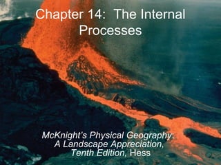
Ch14
- 1. Chapter 14: The Internal
Processes
McKnight’s Physical Geography:
A Landscape Appreciation,
Tenth Edition, Hess
- 2. The Internal Processes
• The Impact of Internal Processes on the
Landscape
• From Rigid Earth to Plate Tectonics
• Plate Tectonics
• Volcanism
• Diatrophism
• Folding
• Faulting
• The Complexities of Crustal Configuration
2© 2011 Pearson Education, Inc.
- 3. The Impact of Internal Processes
on the Landscape
• Internal processes build terrain
• Reshape the crustal surface of Earth
• Have been taking place for billions of years
• Typically the effects do not act independently
• Earthquakes and volcanoes
3© 2011 Pearson Education, Inc.
- 4. From Rigid Earth to Plate
Tectonics
• Continents seem fixed from
human perspective
• Until midtwentieth century,
scientists believed Earth’s
continents were rigid
• Continental drift—Pangaea
• Evidence includes similar
geologic features on coasts of
different continents
• Continents fit together
4© 2011 Pearson Education, Inc.
Figure 14-1
- 5. From Rigid Earth to Plate
Tectonics
• Paleontology supports
continental drift
• Glaciated continents
reconstructed made sense
• Rejected by most scientists
at the time (1920s), but
accepted today
5© 2011 Pearson Education, Inc.
Figure 14-5
- 6. Plate Tectonics
• The evidence
– Plate boundaries
• Earthquakes occur
along lines
• Correspond with
locations of trenches
and ridges in the
seafloor
6© 2011 Pearson Education, Inc.
Figure 14-7
- 7. Plate Tectonics
– Seafloor spreading
• Midocean ridges formed
by magma rising up from
the mantle
• New basaltic ocean floor
created, moves away from
ridge
• At trenches, older
lithosphere descends into
the asthenosphere where
it is recycled—subduction
7© 2011 Pearson Education, Inc.
Figure 14-8
- 8. Plate Tectonics
– Paleomagnetism
• Iron in cooled magma
orients itself with the
magnetic poles of Earth
• Provides a record of past
magnetic fields
• Magnetic field has
changed orientation at
least 170 times
• Should be symmetry in
magnetic orientation
• Used to verify age of
ocean floor rock and
seafloor spreading
8© 2011 Pearson Education, Inc.
Figure 14-10
- 9. Plate Tectonics
• Plate tectonics
– Theory behind motion of
lithospheric plates
– Plates float on
asthenosphere
– 7 major plates,
7 intermediate plates,
12 smaller plates
– Smaller plates are large
plates that are being
subducted
9© 2011 Pearson Education, Inc.
Figure 14-11
- 10. Plate Tectonics
• Driving plate tectonics
– Slow convection in
Earth’s mantle
– Convection can push
plates away from each
other
– Most motion results from
plates pulled by
subduction of dense
oceanic lithosphere
– Ongoing area of
research
10© 2011 Pearson Education, Inc.
Figure 14-11
- 11. Plate Tectonics
• Plate boundaries
– Divergent boundaries
• Plates move away from
each other
• Asthenosphere wells up in
the plate opening
• Represented by a
midocean ridge
• Associated with shallow-
focus earthquakes and
volcanic activity
• Constructive
• Continental rift valley, proto-
ocean
11© 2011 Pearson Education, Inc.
Figure 14-13
- 12. Plate Tectonics
• Convergent boundaries
– Collisions between plates
– Destructive
– Three primary collisions:
• Oceanic-continental—oceanic plate sinks since more
dense; subduction
– Forms oceanic trench and continental mountains (i.e.,
Cascades, Andes)
– Earthquakes occur along margin
– Volcano formation along the plates—continental volcanic arc
– Forms metamorphic rocks—blueschist (above)
12© 2011 Pearson Education, Inc.
- 13. Plate Tectonics
– Three primary collisions (cont.)
• Oceanic-oceanic
– Subduction results in undersea
trench formation
– Deep and shallow earthquakes
– Island volcanic arc
• Continental-continental
– No subduction since two plates
are highly buoyant
– Builds huge mountain ranges
– Volcanoes are rare
– Shallow earthquakes are
relatively common
13© 2011 Pearson Education, Inc. Figure 14-15
- 14. Plate Tectonics
• Transform boundaries
– Two boundaries slip
past each other laterally
– Transform faults
– Neither creates nor
destroys crust
– Commonly produce
shallow focus
earthquakes
– San Andreas fault
14© 2011 Pearson Education, Inc.
Figure 14-18
- 15. Plate Tectonics
• The rearrangement
– 450 million years ago,
one supercontinent
existed
– Broke up 200 million
years ago
• Laurasia
• Gondwanaland
– Arrangement to the
current continental
configuration
15© 2011 Pearson Education, Inc.
Figure 14-19
- 16. Plate Tectonics
• The Pacific Ring of Fire
– Plate boundaries exist
all around the Pacific
Rim
– Primarily subduction
zones
– 75% of all volcanoes lie
in the Ring of Fire
16© 2011 Pearson Education, Inc.
Figure 14-20
- 17. Plate Tectonics
• Additions to basic plate
tectonic theory
– Mantle plumes
• localized hot areas not
associated with plate
boundaries
• Move with the plate, so
eventually become
inactive
• Hot spot trail
• Hawaiian islands
17© 2011 Pearson Education, Inc.
Figure 14-22
- 18. Plate Tectonics
– Accreted Terranes
– Piece of lithosphere
carried by a plate that
eventually collides and
fuses (accretes) with
another plate
18© 2011 Pearson Education, Inc.
Figure 14-24
- 19. Plate Tectonics
• The questions
– Midcontinental mountain range formation (i.e., the
Appalachians)
– Number of plates and plate sizes have changed over
Earth’s history
– Why are there earthquakes in the middle of continental
plates?
– Why are plates different sizes?
– Why do plates form where they do?
19© 2011 Pearson Education, Inc.
- 20. Volcanism
• Definition—all phenomena
connected to the origin and
movement of molten rock
• Extrusive volcanism—
occurs on Earth’s surface,
often shortened to
volcanism
• Intrusive volcanism—
occurs below surface,
plutonic activity
20© 2011 Pearson Education, Inc.
Figure 14-26
- 21. Volcanism
• Volcanism
– Magma versus lava
– Violent or gentle eruptions
– Pyroclastic material
– Some self destruct (i.e.,
Krakatau in 1883)
21© 2011 Pearson Education, Inc.
Figure 14-26
- 23. Volcanism
• Magma chemistry and styles of eruption
– Nature of eruption determined by magma chemistry,
also by confining pressure
– Quantity of silica in magma is critical
• High silica magma—felsic magma—granite
• Intermediate silica—andesitic magma—diorite
• Low silica—mafic magma—basalt
– High silica eruptions—pyroclastic
– Low silica eruptions—quiet, nonexplosive
– Intermediate—some combination of the two
23© 2011 Pearson Education, Inc.
- 24. Volcanism
• Volcanic activity
– Relatively temporary
features on the landscape
– Much of Earth’s water
originated from water vapor
from volcanic eruptions
– Magma contains major
elements required for plant
growth
– Provides soil fertility
24© 2011 Pearson Education, Inc.
Figure 14-29
- 25. Volcanism
• Lava flows
– Lava generally flows horizontally,
parallel to the surface along
which it flows
– Eventually cools in horizontal
orientation, strata
– Streams flowing through lava
flows result in irregular or
fragmented surface
– Uniform cooling results in
hexagonal structure
25© 2011 Pearson Education, Inc.
Figure 14-30
- 26. Volcanism
• Flood basalt
– Most extensive lava flows
come from hot spots
– Flood basalt is a vast
accumulation of lava
build up
– Correlated with mass
extinctions
26© 2011 Pearson Education, Inc.
Figure 14-31
- 27. Volcanism
• Volcanic peaks
– Shield volcanoes
• Layer upon layer of
solidified lava flows
• Little pyroclastic material
• Hawaiian islands are an
example
27© 2011 Pearson Education, Inc.
Figure 14-32
- 28. Volcanism
• Volcanic peaks (cont.)
– Composite Volcano
• Emit higher silica lavas
(andesite lava)
• Form symmetric, steep
sided volcanoes
• Pyroclastics from explosive
lava flows alternate with
nonexplosive flows
• Pyroclastic flows produce
steep slopes, lava holds it
together
28© 2011 Pearson Education, Inc.
Figure 14-34
- 29. Volcanism
• Volcanic peaks (cont.)
– Lava domes
• Masses of very viscous
lava that do not flow far
• Lava bulges from the vent,
dome grows by expansion
from below and lava within
• Some lava domes form
inside of composite
volcanoes
29© 2011 Pearson Education, Inc.
Figure 14-36
- 30. Volcanism
• Volcanic peaks (cont.)
– Cinder cones
• Smallest volcanic
mountains
• Basaltic magma is
common
• Slopes form from
pyroclastic materials
• Generally found in
association with other
volcanoes
30© 2011 Pearson Education, Inc.
Figure 14-38
- 31. Volcanism
• Volcanic peaks (cont.)
– Calderas
• Result from a volcano that
explodes, collapses, or
both
• Immense, basin-shaped
depression; larger than
original crater
• Crater Lake in Oregon is
an example
– Volcanic necks
• Pipe or throat of an old
volcano that filled with solid
lava
31© 2011 Pearson Education, Inc.
Figure 14-40
- 32. Volcanism
• Volcanic hazards
– Volcanic gases—mainly
water vapor, but can cause
acid rain and alter global
climate
– Lava flows—cause
immense property damage
– Eruption clouds—gas and
ash material clouds that
extend up to 16 km into the
atmosphere, drop large rock
fragments called “bombs”
32© 2011 Pearson Education, Inc.
Figure 14-45
- 33. Volcanism
• Volcanic hazards (cont.)
– Pyroclastic flows—
avalanche of hot gases
and material, up to 100
mph
– Volcanic mud flows
(lahars)—result from
heavy rain and/or snow
melt during an eruption
33© 2011 Pearson Education, Inc.
Figure 14-44
- 34. Volcanism
• Monitoring volcanic hazards
– Research to locate previous pyroclastic flows and lahars
– Tiltmeters, measure the slope of a volcano to look for swelling
– Monitor earthquake activity
34© 2011 Pearson Education, Inc.
- 35. Volcanism
• Igneous features
– Igneous intrusion—rock
formed beneath the
Earth’s surface
penetrates the crust—
pluton
– Stoping
– Scheme for classifying
igneous intrusions
35© 2011 Pearson Education, Inc.
Figure 14-48
- 36. Volcanism
• Igneous features (cont.)
– Batholiths—large,
subterranean body of
indefinite depth; important in
mountain building
– Stocks—similar to a batholith
but much smaller
– Laccoliths—slow-moving,
viscous magma forced
between horizontal layers of
rock; builds up a mushroom
shaped mass
36© 2011 Pearson Education, Inc.
Figure 14-49
- 37. Volcanism
• Igneous features (cont.)
– Dikes—vertical sheet of
magma thrust upward into
preexisting rock; long and
narrow
– Sills—long, thin body whose
orientation is determined by
preexisting rocks
– Veins—molten material
forces itself into smaller
fractures in preexisting rock,
takes irregular shapes
37© 2011 Pearson Education, Inc.
Figure 14-50
- 38. Diatrophism
• Refers to the deformation
of Earth’s crust
• Two primary types of
diatrophism, folding and
faulting
38© 2011 Pearson Education, Inc.
Figure 14-53
- 39. Folding
• Results when rock is
subjected to lateral
compression
• Can take place on any
scale
• Can vary in complexity
• Two types
– Anticline/upfold, can be
forced to have reverse
orientation, an overturned
fold
– Syncline/downfold—
overthrust fold 39© 2011 Pearson Education, Inc.
Figure 14-51
- 40. Faulting
• Occurs when rock breaks
accompanied by displacement
• Occurs along zones of
weakness in the crust, fault
zones
• Fault lines
• Begin as sudden ruptures, but
can result in large (hundreds
of km) faults over millions of
year
• Fault scarps
40© 2011 Pearson Education, Inc.
Figure 14-54
- 42. Faulting
• Fault-produced landforms
– Tilted fault-block
mountains; one side of the
fault block is tilted steeply
relative to the other
– Horst: uplift of a land block
between two parallel faults
– Graben: downthrown land
block between two parallel
faults
42© 2011 Pearson Education, Inc.
Figure 14-59
Figure 14-57
- 43. Faulting
• Strike-slip faulting
landforms
– Linear fault trough
• Small depressions in the
trough known as sags
• Sag ponds
• Offset drainage channels
• Shutter ridge
43© 2011 Pearson Education, Inc.
Figure 14-60
- 44. Faulting
• Earthquakes
– Vibration in Earth resulting from sudden displacement
along a fault
• Earthquake waves
– Energy released by earthquakes moves in several types
of seismic waves that originate at the center of fault
motion, the origin
– Ground above origin experiences strongest jolt, the
epicenter
– P-waves versus S-waves
44© 2011 Pearson Education, Inc.
- 45. Faulting
• Earthquake magnitude—relative
amount of energy released during
an earthquake
– Logarithmic scale, 32nd power
– Richter scale
– Strongest recorded
earthquake—9.5 in Chile
• Shaking intensity
– Intensity of ground shaking not
consistent during an earthquake
– Mercalli intensity scale
45© 2011 Pearson Education, Inc.
- 46. Faulting
• Earthquake hazards
– Most damage from ground
shaking
– Liquefaction of moist
sediments
– Landslides
– Water movements in lakes
and oceans (i.e., tsunamis)
46© 2011 Pearson Education, Inc.
Tsunami damage in Kodiak, AK
Image courtesy of NOAA
- 47. The Complexities of Crustal
Configuration
• All these processes are interrelated
• An example: Glacier National Park
– Was below sea level for millions of years
– Vast amounts of sedimentary rock
– Igneous activity added variety to the sedimentary rock
– Igneous intrusions created a sill and numerous dikes
– Tremendous mountain building and associated uplift
combined with lateral pressure from the west resulted in a
vast rupture and faulting
– Whole block moved by Lewis Overthrust
– Had Precambrian sedimentary rock over Cretaceous
strata
47© 2011 Pearson Education, Inc.
- 48. The Complexities of Crustal
Configuration
• Mountains without roots, Chief Mountain
48© 2011 Pearson Education, Inc.
Figure 14-64
- 49. Summary
• Internal processes build terrain and modify terrain
• Plate tectonics describe the motion of lithospheric plates
• There is widespread evidence of plate tectonics
• There are three primary types of collisions that occur
within lithospheric plates
• The continents have rearranged themselves from a
single supercontinent, Pangaea, to the arrangement
today
• Volcanism describes the motions of molten rock
• The chemistry of magma changes the type of eruption
that takes place
49© 2011 Pearson Education, Inc.
- 50. Summary
• There are four primary types of volcanic mountains
• Numerous volcanic hazards are a great threat to life and
property
• In addition to volcanoes, numerous intrusive processes
modify the landscape
• Diatrophism refers to the modification of Earth’s crust
• Folding is the bending of rock over long time scales due
to continuous external pressure
• Faulting is a weakness in the crust
50© 2011 Pearson Education, Inc.
- 51. Summary
• There are four primary types of faults
• Different landforms result from each of these four types
of faults
• Earthquakes result from a sudden displacement along a
fault
• There are numerous hazards associated with
earthquakes
• While the processes were considered individually, they
are all interrelated
51© 2011 Pearson Education, Inc.