
Empfohlen
Weitere ähnliche Inhalte
Was ist angesagt?
Was ist angesagt? (20)
Andere mochten auch
Andere mochten auch (20)
Ähnlich wie Urban higher glasgow
Ähnlich wie Urban higher glasgow (20)
Mehr von lmc017
Kürzlich hochgeladen
Kürzlich hochgeladen (20)
Urban higher glasgow
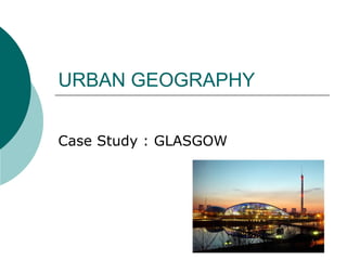
- 1. URBAN GEOGRAPHY Case Study : GLASGOW
- 2. Site & Situation Site – where the original settlement has been built Situation – where it is in the surrounding area “A city is both geography and history; it is the expression of what people have done with a place through time. Geographically, it springs from situation and site. More precisely a city is the site at which the situation has significance; it is the choice of site which successfully exploits it situation.”
- 3. The Origin and Growth of settlements Most large cities have developed in a location where both the site and the situation have been an advantage. The site was often the original reason for a settlement to develop, whereas the situation may explain why a settlement remains small or grows into a town or city.
- 4. Settlements were usually built on particular sites which were advantageous to early dwellers : Defensive Sites – on a hill, surrounded by water Route Centres – where valleys meet, the focus of routes Bridging Points – an easy place to cross a river Wet Site – Close to water in a dry area (springlines) Dry Site – On higher, dry area close to wet land e.g. marsh or flooding rivers Gap site – sheltered between 2 hills Aspect (occasionally) – the position in relation to the sun may have been important in upland valleys
- 5. Classification All settlements can be identified in the pyramid below – a hierarchy ! Megalopolis Large City Small City GLASGOW Large Town Small Town Village Hamlet Individual Building e.g Farmhouse
- 6. Reasons for choosing a site changes through time ! Pre 1750 Good Defence Close to water supply Close to woodland On useful farmland Sheltered site Flat land or suitable building site Good communications
- 7. Continued… After 1800 Close to resources (raw materials) Close to Ports Faster communication Pleasant Environment
- 8. GLASGOW – Site & Location Glasgow began on the North bank of the River Clyde. This was a bridging point over the River which meant that it became a route centre. Although on the flood plain of the Clyde, a large drumlin swarm gave dry point sites for early important buildings e.g. Cathedral and University. Glasgow University Glasgow Cathedral
- 9. The river provided fishing and allowed transportation (although the river was shallow) However, the deepening, straightening and removal of rock bars (blasting) in the early 1800s was to lead to the rapid growth of the city as a Port trading with the empire.
- 10. The growth of the railways and building of the canal further added to Glasgow's excellent transport Network. This network in turn influenced the whole of Western and Central Scotland (Sphere of Influence) In addition, Glasgow possessed the important raw materials of the Industrial Revolution, coal, iron ore and limestone.
- 11. This lead to its rapid growth as an industrial city (Industrial Revolution & WWII) the main products were ships, heavy engineering, textiles and chemicals. This meant that Glasgow had a narrow industrial base and would lead to major problems once these markets declined (competition!)
- 12. Since then Glasgow has changed more than any other British city (with regard to Function) but these changes have been largely successful and Glasgow is not a renowned city in areas such as culture, administration/ finance & shopping.
- 13. FUNCTIONS OF GLASGOW Originally began as a route centre and bridging point. It grew as a market town, religious centre and educational centre. It remains important as an industrial town. It provides recreation and leisure services for its population and its hinterland. It has become a popular tourist city (city breaks, conferences & exhibitions). It is an important shopping centre and is Scotland's main (jointly with Edinburgh) administrative centre. It was once a port although no longer important the river fronts have stimulated development.
- 14. Landuse Zones in Glasgow CENTRAL BUSINESS DISTRCT (CBD) What can you see from the OS map that suggests that this is the CBD of Glasgow ?
- 15. CENTRAL BUSINESS DISTRICT Accessibility both to the rest of the city and the surrounding area (convergence of roads/railway) and usually near the oldest part of town perhaps beside a castle/cathedral It will vary in size depending on the size of the city. An area of interacting landscapes and is usually dynamic (changing) with the exception of the historic core. High land values - upward growth of buildings Location may change through time e.g. Originally at the High Street to George Square, Argyll Street and Sauchiehall Street Grid Iron Street pattern
- 16. High maybe multi storey buildings – must build up! High density of buildings Lack of open space Large Department Stores, modern shopping malls and pedestrian precincts Offices, banks, Town Hall Cinemas, theatres, clubs Bus and Railway stations Busy traffic flow and pedestrian flow Multi storey car parks
- 17. The main land uses include retail outlets, these vary from :- High turnover department stores e.g. Debenhams, John Lewis, House of Fraser and the top national stores e.g. M&S. They occupy many floors have large frontages (display) and prefer corner sites to maximise pedestrian flow. They have a wide range of goods, large workforces and depend on a high turnover (shoppers!) Specialist Shops e.g. clothing, jewellery, games, shops etc. These offer customers the potential to compare shops – items usually portable Food & Drink Outlets (convenience shops) can either cater for shoppers/city centre workers or for evening visitors. e.g. tobacconists, cafes, newsagents, fruit shops, book shops, music shops ( highly specialised).
- 18. Also found are the main HQ of Insurance offices, banks, travel companies and local government. e.g. TH They can be easily accessed by workforce and clients. Accessibility- For the same reasons there is a concentration of theatres, restaurants, exhibitions. Residential Population – Overall population density is low (high property prices) difficulties with parking, pollution (noise) and the size of properties Other Users – Transport termini (buses/trains), colleges and universities, green space e.g. George Sq, certain industries (fashion/publishing) and on the edge of the CBD – schools, churches (many changed purpose) and hospitals.
- 19. Traffic – Pedestrian/Vehicle Roads and pavements make up the largest proportion of the CBD Usually grid iron Pedestrian flow high especially at peak times Major congestion problems at rush hours
- 20. Here are some examples of features you'd find in Glasgow: •high/multi-storey buildings - Hilton Hotel •modern shopping mall/pedestrian precinct - Buchanan Galleries •lack of open space - Merchant City •department stores - Frasers •cultural/historical buildings - Gallery of Modern Art •entertainment - Royal Concert Hall, Cineworld •transport centres - Buchanan Street Bus Station •multi-storey car parks - Buchanan Galleries •grid iron street pattern - Sauchiehall Street, Bath Street, Renfield Street •rush hour - M8/Kingston Bridge
- 21. Old Inner City Zone Factories/Housing GR5665 What can you see to suggest that this is the old Inner city zone of Glasgow ?
- 22. Why were inner city areas built surrounding the CBD? Old heavy industrial factories were near the city centre market. Low cost housing like tenements were built quickly for poorly paid workers who needed to live close to work. People in poor inner city areas were able to make use of city centre amenities.
- 23. Old Inner City Zone Factories/Housing GR5665 Look carefully at the slides of Glasgow can you spot the following features ? Features Include: Canals/railways Breweries, bakeries, engineering works, textile factories Old factories and houses were built during the 19th C when people walked to work (no cars) little open space left between the buildings The street pattern is often grid iron In Scotland - housing is tenements; in England terraces Problems - overcrowding, poor sanitation due to buildings more cheaply built than in CBD
- 24. Inner City Areas – problems led to redevelopment Located, in older cities, near the centre and surrounding the CBD. Inner city areas are identified by physical features and often by negative socio-economic features: high density of buildings and lack of good quality open space eg. parks older,19C low-cost housing - likely to be tenements in Scotland and terraced housing in England slum housing derelict land old declining industry a declining population with high unemployment large areas of re-development or urban regeneration limited convenience shopping facilities high levels of air pollution from traffic, and visual pollution in the form of vandalism and graffiti areas demolished and used for motorways and ring roads
- 25. Re-Generation Schemes Many inner city areas have now been improved through urban re-generation schemes. Think of examples you know from your own area. Improvements in areas like The Gorbals and Govan on Clydeside, in Glasgow, include: new housing, such as high rise flats renovation of older housing, often tenements environmental improvements by landscaping, improving docklands attracting a mix of inhabitants for example, by introducing luxury flats increased employment opportunities by opening restaurants, leisure centres and government offices such as the Scottish Office upgrading shopping areas and improving road links
- 27. * TODAY* many of these areas are being redeveloped again Many multi stories knocked down (damp), social problems Areas have been landscaped and new homes built (tenement style again) to encourage people back to living in the inner city
- 28. Suburbia Substantial growth in the last 50 years. Located on the outer fringes/outskirts of urban areas Expensive modern homes (often detatched/semi- detatched/front & rear garden/off street parking/garages) Low density Close to the green belt (woodland/ recreation/water/farmland/parks) Room for expansion but increasing pressure and conflict/ increasing value of land and costs Accessible by road for commuting into CBD or along modern ring road network to other towns/industrial estates/science parks Street patterns with local roads separate from through traffic, cul-de-sacs, crescents A range of suitable services (health clinics/local convenience shops and small shopping g areas/golf courses/parks and schools
- 29. Suburbia (Council & Privately Owned) – Car Based Younger buildings than in CBD Street pattern - crescents and cul-de-sacs (dead ends); this slows down traffic to make the streets safer More detached and semi- detached houses; as the land is less expensive people have gardens Less factories than the inner city More open space and parks Many people commute from here to work in shops and offices in the C.B.D. Less pollution than the centre of the city
- 30. Satellite Estates Due to urban regeneration schemes many new estates were built in the 1950/60s on the urban fringe to help people move away from poor housing conditions in the Inner City. Examples in Glasgow include : Easterhouse, Castlemilk Here many new homes have been built to replace those built in the 50s.
- 31. New Industrial Areas – On the Outskirts of the city They have modern factories with car parks The factories are laid out in an orderly fashion -they are planned areas The buildings are usually lower than in the old industrial areas The areas are landscaped with, trees, bushes, flowers and grass They are kept apart from the residential areas They found close to good road transport links Less pollution than the centre of the city - electricity is almost always used as the power source, and there are very few chimneys
- 32. Glasgow Example Hillington Industrial Estate was built in the 1950s to encourage new business o Glasgow after the decline of heavy engineering. It was at that time on the outskirts of the city. Today it is surrounded by housing. Then Now
- 33. Greenbelt / Urban Fringe Established to “check the unrestricted sprawl of built-up areas to safeguard the surrounding countryside from further encroachment and to prevent towns merging into one another.” The open area of the land is preserved for farming and recreation. Planning permission is not usually allowed for building but pressure is on green belt to release land to create more housing, industry and communications. You can see clearly the pressure that is on the green Belt surrounding Glasgow!!
- 34. Traffic Congestion - Causes Many people working in the C.B.D. which may have narrow streets Shortage of off-street parking which means people park on the roads and so increase congestion People not using public transport - either because it is less convenient, too expensive or not available More people own and use cars
- 35. Traffic Congestion -Solutions Ring roads and by-passes; these can be unpopular as countryside around towns and cities are lost when they are built Park and Ride - you park your car on the edge of the built up area and then ride a bus or train into the C.B.D. One way streets to speed up traffic flow Multi-storey car parks Banning cars from the from the C.B.D., either with pedestrianised streets (e.g. Buchanan Street in Glasgow) or by stopping them coming into the city centre at all. Cars are banned from the centre of Milan (Italy) on Sundays. Charging car drivers when they enter the city centre