Rivers 3
•
2 gefällt mir•1,611 views

River management strategies include channelization through river realignment and re-sectioning, and bank protection through embankments and vegetation management. These strategies have limitations such as causing flooding downstream, accumulating sediments, destroying habitats, and being costly to implement and maintain.

Empfohlen
Weitere ähnliche Inhalte
Was ist angesagt?
Was ist angesagt? (20)
Andere mochten auch
Andere mochten auch (20)
Ähnlich wie Rivers 3
Ähnlich wie Rivers 3 (20)
Mehr von krishnanunni menon
Rivers 3
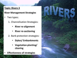
- 1. Topic: Rivers 3 River Management Strategies • Two types: 1. Channelisation Strategies: • River re‐alignment • River re‐sectioning 2. Bank protection strategies: • Dykes/ Embankments • Vegetation planting/ clearing • Effectiveness of strategies
- 2. River Channel Management Why manage river channels?
- 6. Flooding occurs when: 1. Clearance of vegetation increase surface runoff sudden increase in river volume 2. Period of heavy and continuous rainfall river exceeds carrying capacity These may be triggered by: • Global warming – Extreme weather phenomena called El Nino and La Nina effect
- 8. River Channel Management Strategies Two types of strategies 1. Channelisation Strategies: Change the river • River re‐alignment channel shape/ • River re‐sectioning length, etc. 2. Bank protection strategies: • Dykes/ Embankments Make changes to • Vegetation planting/ clearing the river banks
- 9. 1. Channelisation Strategies • River re‐alignment • River re‐sectioning
- 10. 1.1 River Re‐alignment • Straightening of river channel to increase speed of river water to flow away from an area more quickly & wash away sediments accumulated on river bed reduce flooding in that area Source: http://www.defra.gov.uk/enviro n/fcd/policy/mrcomp/Image6.gi f
- 11. River re‐alignment E.g. Mississippi River (USA) has Straightening been shortened of river = river by 240 km to re-alignment reduce threat of flooding.
- 12. 1.2 River Re‐sectioning • Widening and deepening of river channel. • Increase channel’s ability to hold water decrease likelihood of floods Or, • Smoothening of river beds and banks with cement and granite less friction allow water to flow away more quickly reduce likelihood of floods • E.g. Singapore River ay Boat Quay
- 13. River re‐sectioning Widen & Deepen river = River Re- Sectioning
- 14. 2. Bank Protection Strategies • Dykes/ embankments • Vegetation planting/ clearing
- 15. 2.1 Bank Protection (Embankments) 1. Dykes/ Artificial levees : Walls of sand, stone or concrete built along rivers increase river capacity to hold water reduce flooding 2. Protects banks from erosion by force of running water reduced sediments flowing into river increase river capacity less flood • E.g. Artificial embankments along river of Pasir Ris Park, Singapore
- 16. Embankments: Dykes/ Levees Dykes
- 17. Dykes
- 18. 2.2.1 Vegetation Planting • Roots of trees and plants holds soil together stabilise river banks • Vegetation also slows down rate of surface runoff prevent large amount of water entering river at any one time • Reduced surface runoff less sediments transported river channel does not become shallower reduce flood occurrence • E.g. Joint effort to protect mangroves along Mekong River.
- 20. 2.2.2 Vegetation Clearing • Weight of vegetation may add stress to river banks and cause them to collapse • Fallen trees or branches in the river bed cause obstruction to river flow – Reduce speed of flow of river – Increase likelihood of flooding • E.g. Vegetation clearance done on Geylang River near Tanjong Rhu, Singapore.
- 23. Limitations of River Channel Management Strategies 1. Causes flooding downstream 2. Accumulation of sediments 3. Loss of marine life and wetlands 4. High cost of building and maintenance
- 24. Effectiveness of River Channel Management Strategies 1. Flooding downstream Increase in speed of river due to channelisation may result in flooding downstream Hence, flooding is not reduced. They can still occur in another part of the river.
- 25. Recall: River re‐alignment strategy Increase in speed of flow due to re- alignment upstream may cause flooding downstream.
- 26. Recall: River re‐sectioning strategy Increase in speed of flow due to re- sectioning upstream may cause flooding downstream.
- 27. Effectiveness of River Channel Management Strategies 2.1 Accumulation of sediments • Channelisation allows rivers to flow at higher speed. • Sediments, previously deposited on river bed are carried downstream into sea/ ocean. • Result: less sunlight reach seabed, affect growth of marine life such as coral reefs
- 28. Recall: River re‐alignment strategy Accumulation of sediments
- 29. Effectiveness of River Channel Management Strategies 2.2 Accumulation of sediments • Bank protection measures such as dykes causes sediments to accumulate behind these structures • Sediments build‐up over time river channel become shallower still flood with continuous rain • Higher dykes need to be built/ money spent to dig out accumulated sediments
- 30. Recall: Building of dykes Sediments accumulated behind structures makes the river shallower E.g. Build up of sediments along lower course of Yellow River, China, making the channel shallower over the years.
- 31. Effectiveness of River Channel Management Strategies 3. Loss of marine life and wetlands 1.Too much vegetation prevents sunlight from reaching river bed kill aquatic life affect aquatic food chains 2.Changing river course, lining of banks with concrete destroys plants and animal habitats 3.Channelisation leads to disappearance of wetlands. i.e. river flows over smaller area with shortening of river course
- 32. Recall: River re‐alignment strategy Loss of Loss of wetlands wetlands
- 33. Effectiveness of River Channel Management Strategies 4. High cost of building and maintenance • Expensive to build and maintain river defenses • Resources and manpower needed for river realignment and re‐sectioning. • Aesthetically unappealing
- 34. In summation… Name of strategy/ Flooding Accumulation Loss of Expensive to Limitation(s) Downstream of Sediments wetlands & build & marine life maintain Re‐alignment √ √ √ √ Channelisation (downstream) Re‐sectioning √ √ √ √ (downstream) Building of √ (behind √ embankments structures) Bank protection Clearing Vegetation √ Planting Vegetation √