Middle School Cloud Types
•Als PPT, PDF herunterladen•
36 gefällt mir•17,389 views

This document provides information about the different types of clouds for middle school students. It describes the key characteristics of 12 common clouds: cumulus, cumulonimbus, stratus, stratocumulus, altocumulus, altostratus, nimbostratus, cirrus, cirrocumulus, and cirrostratus. For each cloud type, it discusses their appearance, the atmospheric conditions needed for formation, and some basic facts. The document also includes learning activities like a video, worksheet, and quiz to help students learn to identify and understand the different cloud types.

Empfohlen
Weitere ähnliche Inhalte
Was ist angesagt?
Was ist angesagt? (20)
Andere mochten auch
Andere mochten auch (20)
Ähnlich wie Middle School Cloud Types
Ähnlich wie Middle School Cloud Types (20)
Kürzlich hochgeladen
Kürzlich hochgeladen (20)
Middle School Cloud Types
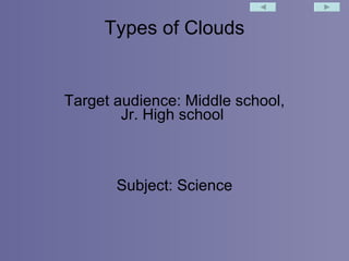
- 1. Types of Clouds Target audience: Middle school, Jr. High school Subject: Science
- 2. Common Clouds and what they look like.
- 14. Name Appearance Conditions Facts Hail, wind and lightening are on the way Thunderstorms with heavy rain Giant thunderhead clouds Cumulonimbus Seen at low or lower-middle heights Rain or snow likely Dark, heavy water-droplet clouds Stratocumulus Mean good weather, but can mean a change in weather Seen in clear skies Wispy ice clouds Cirrus Made of ice and water at middle heights Rain or snow likely Blue-gray, blanket-like Altocumulus Clouds can grow. If growing late in day, indicates change in weather Fair weather Fluffy, lower clouds Cumulus Light rain, drizzle, or flurries likely Overcast skies Flat, low clouds Stratus
- 15. Label Me! altocumulus, altostratus, cirrocumulus, cirrostratus, cirrus, cumulonimbus , cumulus , fog , nimbostratus , stratus, stratocumulus
- 16. Answer worksheet
Hinweis der Redaktion
- My audience will be Middle School and Jr. High School students and I will be teaching them the types of clouds using various resources.
- This will be the opening picture, this is a good visual reference for the students because it lists the clouds names shows their appearances and the average altitude for each cloud. Before I bring the picture in, I have a learning moment to see if the students know any of the cloud names already! 2 nd week changes (fly in picture)
- Cumulus clouds have three different types and I will explain these different types of cumulus clouds and let them take notes. 2 nd week changes (text box used)
- These clouds usually bring heavy storms and will have lightning with them.
- These clouds are more commonly known as fog or mist instead of clouds, these clouds are very low because they have lots of precipitation and form when its cool therefore sinking to the ground.
- These clouds form on blue skied days up high and are usually moving pretty fast.
- Altocumulus clouds are very high up in the atmosphere so they aren't influenced by thermals, this is why they only create light rain.
- These clouds are very high up in the sky and cause pretty sunsets because of the light bouncing off of them, they do not create precipitation.
- More commonly known as the “rain” cloud, these clouds bring heavy storms and have a slow rainfall, this cloud can also make snow or sleet.
- These wispy clouds form on bright sunny days and are usually seen quickly through the sky. These clouds do not create precipitation.
- Very similar to the cirrus cloud, but the only difference is this cloud does produce precipitation and lots of it, it you see lots of these clouds together you will know you are going to have bad weather soon. 2 nd week changes arrow for emphasis and text box
- Exactly like the cirrus cloud but are not easily spotted, and when they are spotted they produce optical effects. These clouds do not produce precipitation.
- This is the chart I talked about in my action plan, in this chart students will fill out the name of the cloud, the appearance of the cloud, the conditions the clouds best form in, and a few facts about the cloud that they found interesting. (2 nd week changes-present filled in and then students will be given a blank chart. Answers may vary in facts column)
- Answers: left to right, top to bottom – cirrostratus, cirrus, cirrocumulus, altostratus, altocumulus, cumulonimbus, stratocumulus, stratus, nimbostratus, cumulus, fog 2 nd week addition
- Action plan, goals, answer sheet and rubric 2 nd week changes