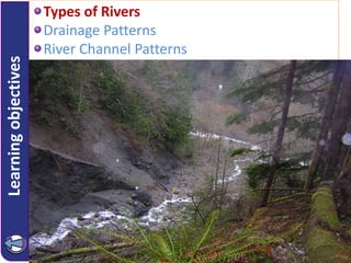
SlideShare ist ein Scribd-Unternehmen logo
1 von 47
Learningobjectives Types of Rivers
Drainage Patterns
River Channel Patterns
The hydrologic cycle
ga.water.usgs.gov/edu/charts/waterdistribution.gif
Types of Rivers
• Rivers are very dependent on climate and
their characteristics are closely related to the
precipitation and evaporation regimes in their
drainage areas.
• Four types:
– Perennial or permanent rivers
– Periodic rivers
– Episodic rivers
– Exotic
www.aquatic.uoguelph.ca/rivers/chintro.htm
Permanent / Perennial Rivers
• Rivers that flow all year e.g. Orange (Gariep), Kunene, Zambezi.
• River channel reaches water table throughout the year.
• Orange River used to be non-perennial before the construction of
the Gariep Dam.
Periodic / Non-Perennial Rivers
• Only flow during the rainy season e.g. Berg River (seen below)
• Water table must rise enough to feed the river when it is not raining
Episodic Rivers
• Only flow for short periods after heavy rain e.g. Nassob (Namibia).
• May have some permanent pools where bed intercepts water table.
• It is an important water source in desert regions.
Exotic Rivers
• Rise in humid areas with high rainfall and flow through dry areas.
• Gariep river rises in the Drakensberg moutains (high rainfall) and
flows through the Northern Cape (dry region).
Relationship between the water tables and types of rivers
Schuters:
Pg.155
Orange River Rivers
Learningobjectives Types of Rivers
Drainage Patterns
River Channel Patterns
Drainage Patterns
Schuters Pg.150 and 151
Dendritic drainage
pattern
•Occurs in regions
where the rock is
uniform in its
resistance to
erosion.
•Shaped like the
branches of a
tree.
•Consequent and
subsequent streams
meet at acute
angles.
Rectangular drainage pattern
• Rectangular drainage patterns
have rt.-angled bends in the
tributaries and the main streams.
• Streams are not parallel to each
other.
Rectangular drainage pattern
Trellis drainage pattern
• Occurs in regions the
sedimentary rock is folded or
where there are alternate
layers of hard and soft rock.
• The main stream and tributaries
join at rt. angles.
• Streams are parallel with short
tributaries.
Trellis Drainage Pattern
Radial drainage pattern
• The stream flows down a
dome shaped feature e.g. an
isolated hill  volcanic dome 
spitskop.
Deranged drainage pattern
• A deranged pattern is found in a
region that is geological young.
• Haphazard shape.
• Streams entering lakes and marshes in
a haphazard pattern.
• Common drainage patterns that are structurally controlled
Superimposed (Inherited) Streams / Drainage
A stream establishes its course in rock layers.
The covering rock is removed and the stream imposes its course on
underlying rock of a completely different structure.
River is younger than the structures they flow through.
E.g. The Vaal river in the vicinity of Parys (in the Free State) breaks
through two quartzite hills instead of following a course around them.
Copyright © Houghton Mifflin
Company. All rights reserved.
Geology, 14b–20
Figure 14-12a Superposed Streams
Copyright © Houghton Mifflin
Company. All rights reserved.
Geology, 14b–21
Figure 14-12b Superposed Streams (cont’d)
Copyright © Houghton Mifflin
Company. All rights reserved.
Geology, 14b–22
Figure 14-12c Superposed Streams (cont’d)
Source: Jeff Lepore/Photo Researchers Inc.
Antecedent Streams / Drainage
A stream existed on an earlier landscape which was subsequently raised.
 The stream was able to maintain its original course in spite of uplift
(or the formation of a mountain or a ridge).
 Antecedent streams are therefore older than the structures they
flow through.
 e.g. The lower part of the Orange river retained its course and
eroded downwards at the same rate that the mountains of the
escarpment formed.
 The stream cut through the obstruction as it formed.
Copyright © Houghton Mifflin
Company. All rights reserved.
Geology, 14b–24
Figure 14-13a Antecedent Streams
Copyright © Houghton Mifflin
Company. All rights reserved.
Geology, 14b–25
Figure 14-13b Antecedent Streams (cont’d)
Superposed Stream
Development of
Water gap
Folded Units
Erosion and downcutting
through young
horizontal units
Identify this Stream Pattern
Superimposed and
Antecedent Streams
• Superimposed streams is one
whose valley and direction of
flow were developed much later
than the underlying structure,
and the river possessed sufficient
stream power to cut through
these underlying structures.
• An antecedent stream is one
whose path of flow within a
valley was established before the
mountainous structure was
uplifted
Schuters Pg.174
Schuters pg 179
Schuters pg 179
Drainage Basin Development
Schuters Pg.151*
Answers
1) Trellis
2) Dendritic
Tree pattern, tributaries joins main stream at acute angles..
Activity 13: Identifying drainage patterns Pg.135
Learningobjectives Types of Rivers
Drainage Patterns
River Channel Patterns (Stream flow Characteristics)
River Channel Patterns / Stream flow characteristics
Identify the stream flow characteristic of the following river:
Meandering Stream
 River winds from side to side
 River flows over loose silt
and clay
 The banks are fairly stable
 The river starts to wind due
to irregularities in the
channel (corkscrew action)
 Lateral shifting takes place
(meanders shift downstream)
 Fastest flow speeds occur on
the outer bank (undercut
slope) resulting in erosion
 Slowest flow occurs on the
inner bank (slip-off) slope
resulting in deposition
Schuters:
Pg.170
Features of erosion and deposition
Schuters: Pg.170
Click here for animation
1) Describe what happens on the outside of the bend
2) Describe what happens on the inside of the bend
3) What causes the corkscrew motion?
Meandering rivers
http://www.aquatic.uoguelph.ca/rivers/chphys.htm
A meander becomes more pronounced as the
streamline shifts between the river banks.
Formation of an oxbow lake
• Small meanders
– steep gradient
– coarse particles
Gradient
• Big meanders
– gentle gradient
– fine particles
Meanders in
the Amazon
Basin
McKenzie River
meanders and
glacial lakes
Identify the stream flow characteristic of the following river:
Braided stream
 The velocity of the river is
reduced and this causes the
river to split and rejoin
many times
 The river flows over loose
sandy alluvium
 The banks of the river are
unstable and lateral erosion
occurs easily
 As a result of the wide
channel, the river flows
slowly and large deposits of
alluvium form islands in the
middle of the river.
River Channel Patterns / Stream flow characteristics
• Braided Pattern = steep slope + high stream
power + coarse bed materials changes to gentle
gradient and slows down depositing material
Braided channel
earthsci.org/teacher/basicgeol/stream/stream.html#Erosion%20by%20Streams
Braided
River
Braided geometry, Matanuksa River, Alaska
Braided River, Shyok
River, India
Identify the stream flow characteristic of the following river:
Straight Stream
Rock-controlled channel
o The river flows in straight and
twisting sections
o It is characterized by many rocky
banks, rapids and waterfalls
o The rock barriers on the sides
and riverbed prevent the river
from determining its own channel
pattern
River Channel Patterns / Stream flow characteristics
Identify the drainage pattern and describe the underlying topography.

Weitere ähnliche Inhalte

Was ist angesagt?

Was ist angesagt? (20)

Davis Theory -William Morris Davis- Geomophology Chapter
Davis Theory -William Morris Davis- Geomophology ChapterDavis Theory -William Morris Davis- Geomophology Chapter
Davis Theory -William Morris Davis- Geomophology Chapter
 
Glacial processes and their land forms.
Glacial processes and their land forms.Glacial processes and their land forms.
Glacial processes and their land forms.
 
Glacier formation and landforms
Glacier formation and landformsGlacier formation and landforms
Glacier formation and landforms
 
Glacial landforms (geomorphology)
Glacial landforms (geomorphology) Glacial landforms (geomorphology)
Glacial landforms (geomorphology)
 
Fluvial Geomorphology
Fluvial GeomorphologyFluvial Geomorphology
Fluvial Geomorphology
 
Fluvial morphology
Fluvial morphologyFluvial morphology
Fluvial morphology
 
Ground water exploration
Ground water explorationGround water exploration
Ground water exploration
 
Floodplain presentation
Floodplain presentationFloodplain presentation
Floodplain presentation
 
Meandering rivers
Meandering riversMeandering rivers
Meandering rivers
 
GEOGRAPHY YEAR 10: RIVER LANDFORMS
GEOGRAPHY YEAR 10: RIVER LANDFORMSGEOGRAPHY YEAR 10: RIVER LANDFORMS
GEOGRAPHY YEAR 10: RIVER LANDFORMS
 
River profile
River profileRiver profile
River profile
 
Fluvial depositional landform geomorphology
Fluvial depositional  landform geomorphologyFluvial depositional  landform geomorphology
Fluvial depositional landform geomorphology
 
Drainage Basins
Drainage BasinsDrainage Basins
Drainage Basins
 
Ground water
Ground waterGround water
Ground water
 
Karst topography
Karst topographyKarst topography
Karst topography
 
River processes
River processesRiver processes
River processes
 
Geological action of river
Geological action of riverGeological action of river
Geological action of river
 
River Presentation
River PresentationRiver Presentation
River Presentation
 
Geomorphology and its application to hydrogeology
Geomorphology and its application to hydrogeologyGeomorphology and its application to hydrogeology
Geomorphology and its application to hydrogeology
 
Coastal Geomorphology Landforms Of Wave Erosion & Deposition
Coastal Geomorphology Landforms Of Wave Erosion & DepositionCoastal Geomorphology Landforms Of Wave Erosion & Deposition
Coastal Geomorphology Landforms Of Wave Erosion & Deposition
 

Andere mochten auch

Fluvial Process And Related Land Forms
Fluvial Process And Related Land Forms Fluvial Process And Related Land Forms
Fluvial Process And Related Land Forms
sileshi
 
Rivers Drainage Basin
Rivers Drainage BasinRivers Drainage Basin
Rivers Drainage Basin
Mrs Coles
 
Drainage system
Drainage systemDrainage system
Drainage system
Nikhil Jp
 
Rivers & Environments
Rivers & EnvironmentsRivers & Environments
Rivers & Environments
Sadman Ridoy
 
El Nino stills winter winds across the southern Canadian Prairies
El Nino stills winter winds across the southern Canadian PrairiesEl Nino stills winter winds across the southern Canadian Prairies
El Nino stills winter winds across the southern Canadian Prairies
Scott St. George
 
Types of water by group 2
Types of water by group 2Types of water by group 2
Types of water by group 2
e-twinning
 
Forum david hetherington
Forum david hetheringtonForum david hetherington
Forum david hetherington
llica
 

Andere mochten auch (20)

Fluvial Process And Related Land Forms
Fluvial Process And Related Land Forms Fluvial Process And Related Land Forms
Fluvial Process And Related Land Forms
 
River
RiverRiver
River
 
Rivers Drainage Basin
Rivers Drainage BasinRivers Drainage Basin
Rivers Drainage Basin
 
PPT on India's Drainage System (River System)
PPT on India's Drainage System (River System) PPT on India's Drainage System (River System)
PPT on India's Drainage System (River System)
 
Drainage system
Drainage systemDrainage system
Drainage system
 
Savannah River Basin Drought_October 2012
Savannah River Basin Drought_October 2012Savannah River Basin Drought_October 2012
Savannah River Basin Drought_October 2012
 
SURFACE WATER ISSUES IN THE GMA 7 JPINT PLANNING PROCESS
SURFACE WATER ISSUES IN THE GMA 7 JPINT PLANNING PROCESSSURFACE WATER ISSUES IN THE GMA 7 JPINT PLANNING PROCESS
SURFACE WATER ISSUES IN THE GMA 7 JPINT PLANNING PROCESS
 
Rivers & Environments
Rivers & EnvironmentsRivers & Environments
Rivers & Environments
 
El Nino stills winter winds across the southern Canadian Prairies
El Nino stills winter winds across the southern Canadian PrairiesEl Nino stills winter winds across the southern Canadian Prairies
El Nino stills winter winds across the southern Canadian Prairies
 
Types of water by group 2
Types of water by group 2Types of water by group 2
Types of water by group 2
 
Forum david hetherington
Forum david hetheringtonForum david hetherington
Forum david hetherington
 
Physical Geography Lecture 16 - Fluvial Geomorphology 120516
Physical Geography Lecture 16 - Fluvial Geomorphology 120516Physical Geography Lecture 16 - Fluvial Geomorphology 120516
Physical Geography Lecture 16 - Fluvial Geomorphology 120516
 
Urban settlements
Urban settlementsUrban settlements
Urban settlements
 
Drainage...class 9 cbse
Drainage...class 9 cbseDrainage...class 9 cbse
Drainage...class 9 cbse
 
Revise Rivers
Revise RiversRevise Rivers
Revise Rivers
 
Drainage of india
Drainage of indiaDrainage of india
Drainage of india
 
surface water
surface watersurface water
surface water
 
Surface Water modelling using Remote Sensing
Surface Water modelling using Remote SensingSurface Water modelling using Remote Sensing
Surface Water modelling using Remote Sensing
 
Coastal defense structures
Coastal defense structuresCoastal defense structures
Coastal defense structures
 
Prentice Hall Earth Science ch06 Surface Water, Ground Water
Prentice Hall Earth Science ch06 Surface Water, Ground WaterPrentice Hall Earth Science ch06 Surface Water, Ground Water
Prentice Hall Earth Science ch06 Surface Water, Ground Water
 

Ähnlich wie Types of Rivers

Rivers presentation
Rivers presentationRivers presentation
Rivers presentation
Zahid Rao
 
Channels and characteristics AQA
Channels and characteristics AQAChannels and characteristics AQA
Channels and characteristics AQA
anicholls1234
 
Rivers - George Mather, Chris Hancox, Alex Owen and Michael Soley
Rivers - George Mather, Chris Hancox, Alex Owen and Michael SoleyRivers - George Mather, Chris Hancox, Alex Owen and Michael Soley
Rivers - George Mather, Chris Hancox, Alex Owen and Michael Soley
Keith Phipps
 
River Changes And Landforms
River Changes And LandformsRiver Changes And Landforms
River Changes And Landforms
whiskeyhj
 

Ähnlich wie Types of Rivers (20)

River erosion
River erosionRiver erosion
River erosion
 
River Erosion and its Associated fetures
River Erosion and its Associated feturesRiver Erosion and its Associated fetures
River Erosion and its Associated fetures
 
Rivers presentation
Rivers presentationRivers presentation
Rivers presentation
 
River Profiles
River ProfilesRiver Profiles
River Profiles
 
River_Landform.ppt
River_Landform.pptRiver_Landform.ppt
River_Landform.ppt
 
River Landforms
River LandformsRiver Landforms
River Landforms
 
Unit 12 River training work.pdf
Unit 12 River training work.pdfUnit 12 River training work.pdf
Unit 12 River training work.pdf
 
Running water as an agent of Erosion
Running water as an agent of ErosionRunning water as an agent of Erosion
Running water as an agent of Erosion
 
Running water-Geomorhology Chapter
Running water-Geomorhology ChapterRunning water-Geomorhology Chapter
Running water-Geomorhology Chapter
 
Grade 12 notes (Geomorphology) .pdf
Grade 12 notes (Geomorphology) .pdfGrade 12 notes (Geomorphology) .pdf
Grade 12 notes (Geomorphology) .pdf
 
CH-1 Introduction to River Hydraulics.pdf
CH-1 Introduction to River Hydraulics.pdfCH-1 Introduction to River Hydraulics.pdf
CH-1 Introduction to River Hydraulics.pdf
 
Channels and characteristics AQA
Channels and characteristics AQAChannels and characteristics AQA
Channels and characteristics AQA
 
Chapter 1: Introduction to River Hydraulics
Chapter 1: Introduction to River HydraulicsChapter 1: Introduction to River Hydraulics
Chapter 1: Introduction to River Hydraulics
 
Drainage pattern and their significance
Drainage pattern and their significanceDrainage pattern and their significance
Drainage pattern and their significance
 
Humid geomorphic environment
Humid geomorphic environmentHumid geomorphic environment
Humid geomorphic environment
 
Rivers - George Mather, Chris Hancox, Alex Owen and Michael Soley
Rivers - George Mather, Chris Hancox, Alex Owen and Michael SoleyRivers - George Mather, Chris Hancox, Alex Owen and Michael Soley
Rivers - George Mather, Chris Hancox, Alex Owen and Michael Soley
 
River Changes And Landforms
River Changes And LandformsRiver Changes And Landforms
River Changes And Landforms
 
Work's of river, winds, seas and their Engineering Importance
Work's of river, winds, seas and their Engineering ImportanceWork's of river, winds, seas and their Engineering Importance
Work's of river, winds, seas and their Engineering Importance
 
13.4 Stages of a River.ppt
13.4 Stages of a River.ppt13.4 Stages of a River.ppt
13.4 Stages of a River.ppt
 
Sec 3 Rivers
Sec 3 RiversSec 3 Rivers
Sec 3 Rivers
 

Mehr von John Lanser

Mehr von John Lanser (15)

What is Geography Information Systems (GIS)
What is Geography Information Systems (GIS)What is Geography Information Systems (GIS)
What is Geography Information Systems (GIS)
 
SW Cape Region
SW Cape RegionSW Cape Region
SW Cape Region
 
Remote sensing
Remote sensing Remote sensing
Remote sensing
 
Mass Movement
Mass MovementMass Movement
Mass Movement
 
Temperate Cyclones
Temperate CyclonesTemperate Cyclones
Temperate Cyclones
 
Microclimates
MicroclimatesMicroclimates
Microclimates
 
Hurricanes
HurricanesHurricanes
Hurricanes
 
Informal Sector
Informal SectorInformal Sector
Informal Sector
 
Strategies for Industrial Development
Strategies for Industrial DevelopmentStrategies for Industrial Development
Strategies for Industrial Development
 
PWV and PE Regions
PWV and PE RegionsPWV and PE Regions
PWV and PE Regions
 
Durban- Pinetown region
Durban- Pinetown regionDurban- Pinetown region
Durban- Pinetown region
 
Seondary and tertiary sectors in SA
Seondary and tertiary sectors in SASeondary and tertiary sectors in SA
Seondary and tertiary sectors in SA
 
Mining in SA
Mining in SAMining in SA
Mining in SA
 
Structure of SA economy
Structure of SA economyStructure of SA economy
Structure of SA economy
 
Agriculture in SA
Agriculture in SAAgriculture in SA
Agriculture in SA
 

Kürzlich hochgeladen

ppt your views.ppt your views of your college in your eyes
ppt your views.ppt your views of your college in your eyesppt your views.ppt your views of your college in your eyes
ppt your views.ppt your views of your college in your eyes
ashishpaul799
 
會考英文會考英文會考英文會考英文會考英文會考英文會考英文會考英文會考英文會考英文會考英文
會考英文會考英文會考英文會考英文會考英文會考英文會考英文會考英文會考英文會考英文會考英文會考英文會考英文會考英文會考英文會考英文會考英文會考英文會考英文會考英文會考英文會考英文
會考英文會考英文會考英文會考英文會考英文會考英文會考英文會考英文會考英文會考英文會考英文
中 央社
 

Kürzlich hochgeladen (20)

ppt your views.ppt your views of your college in your eyes
ppt your views.ppt your views of your college in your eyesppt your views.ppt your views of your college in your eyes
ppt your views.ppt your views of your college in your eyes
 
Incoming and Outgoing Shipments in 2 STEPS Using Odoo 17
Incoming and Outgoing Shipments in 2 STEPS Using Odoo 17Incoming and Outgoing Shipments in 2 STEPS Using Odoo 17
Incoming and Outgoing Shipments in 2 STEPS Using Odoo 17
 
UNIT – IV_PCI Complaints: Complaints and evaluation of complaints, Handling o...
UNIT – IV_PCI Complaints: Complaints and evaluation of complaints, Handling o...UNIT – IV_PCI Complaints: Complaints and evaluation of complaints, Handling o...
UNIT – IV_PCI Complaints: Complaints and evaluation of complaints, Handling o...
 
Post Exam Fun(da) Intra UEM General Quiz - Finals.pdf
Post Exam Fun(da) Intra UEM General Quiz - Finals.pdfPost Exam Fun(da) Intra UEM General Quiz - Finals.pdf
Post Exam Fun(da) Intra UEM General Quiz - Finals.pdf
 
Basic Civil Engg Notes_Chapter-6_Environment Pollution & Engineering
Basic Civil Engg Notes_Chapter-6_Environment Pollution & EngineeringBasic Civil Engg Notes_Chapter-6_Environment Pollution & Engineering
Basic Civil Engg Notes_Chapter-6_Environment Pollution & Engineering
 
How to the fix Attribute Error in odoo 17
How to the fix Attribute Error in odoo 17How to the fix Attribute Error in odoo 17
How to the fix Attribute Error in odoo 17
 
Post Exam Fun(da) Intra UEM General Quiz 2024 - Prelims q&a.pdf
Post Exam Fun(da) Intra UEM General Quiz 2024 - Prelims q&a.pdfPost Exam Fun(da) Intra UEM General Quiz 2024 - Prelims q&a.pdf
Post Exam Fun(da) Intra UEM General Quiz 2024 - Prelims q&a.pdf
 
An Overview of the Odoo 17 Discuss App.pptx
An Overview of the Odoo 17 Discuss App.pptxAn Overview of the Odoo 17 Discuss App.pptx
An Overview of the Odoo 17 Discuss App.pptx
 
Morse OER Some Benefits and Challenges.pptx
Morse OER Some Benefits and Challenges.pptxMorse OER Some Benefits and Challenges.pptx
Morse OER Some Benefits and Challenges.pptx
 
Matatag-Curriculum and the 21st Century Skills Presentation.pptx
Matatag-Curriculum and the 21st Century Skills Presentation.pptxMatatag-Curriculum and the 21st Century Skills Presentation.pptx
Matatag-Curriculum and the 21st Century Skills Presentation.pptx
 
slides CapTechTalks Webinar May 2024 Alexander Perry.pptx
slides CapTechTalks Webinar May 2024 Alexander Perry.pptxslides CapTechTalks Webinar May 2024 Alexander Perry.pptx
slides CapTechTalks Webinar May 2024 Alexander Perry.pptx
 
會考英文會考英文會考英文會考英文會考英文會考英文會考英文會考英文會考英文會考英文會考英文
會考英文會考英文會考英文會考英文會考英文會考英文會考英文會考英文會考英文會考英文會考英文會考英文會考英文會考英文會考英文會考英文會考英文會考英文會考英文會考英文會考英文會考英文
會考英文會考英文會考英文會考英文會考英文會考英文會考英文會考英文會考英文會考英文會考英文
 
Telling Your Story_ Simple Steps to Build Your Nonprofit's Brand Webinar.pdf
Telling Your Story_ Simple Steps to Build Your Nonprofit's Brand Webinar.pdfTelling Your Story_ Simple Steps to Build Your Nonprofit's Brand Webinar.pdf
Telling Your Story_ Simple Steps to Build Your Nonprofit's Brand Webinar.pdf
 
Capitol Tech Univ Doctoral Presentation -May 2024
Capitol Tech Univ Doctoral Presentation -May 2024Capitol Tech Univ Doctoral Presentation -May 2024
Capitol Tech Univ Doctoral Presentation -May 2024
 
The Ultimate Guide to Social Media Marketing in 2024.pdf
The Ultimate Guide to Social Media Marketing in 2024.pdfThe Ultimate Guide to Social Media Marketing in 2024.pdf
The Ultimate Guide to Social Media Marketing in 2024.pdf
 
Danh sách HSG Bộ môn cấp trường - Cấp THPT.pdf
Danh sách HSG Bộ môn cấp trường - Cấp THPT.pdfDanh sách HSG Bộ môn cấp trường - Cấp THPT.pdf
Danh sách HSG Bộ môn cấp trường - Cấp THPT.pdf
 
MichaelStarkes_UncutGemsProjectSummary.pdf
MichaelStarkes_UncutGemsProjectSummary.pdfMichaelStarkes_UncutGemsProjectSummary.pdf
MichaelStarkes_UncutGemsProjectSummary.pdf
 
Basic Civil Engineering notes on Transportation Engineering, Modes of Transpo...
Basic Civil Engineering notes on Transportation Engineering, Modes of Transpo...Basic Civil Engineering notes on Transportation Engineering, Modes of Transpo...
Basic Civil Engineering notes on Transportation Engineering, Modes of Transpo...
 
Navigating the Misinformation Minefield: The Role of Higher Education in the ...
Navigating the Misinformation Minefield: The Role of Higher Education in the ...Navigating the Misinformation Minefield: The Role of Higher Education in the ...
Navigating the Misinformation Minefield: The Role of Higher Education in the ...
 
Open Educational Resources Primer PowerPoint
Open Educational Resources Primer PowerPointOpen Educational Resources Primer PowerPoint
Open Educational Resources Primer PowerPoint
 

Types of Rivers

  • 1. Learningobjectives Types of Rivers Drainage Patterns River Channel Patterns
  • 3. Types of Rivers • Rivers are very dependent on climate and their characteristics are closely related to the precipitation and evaporation regimes in their drainage areas. • Four types: – Perennial or permanent rivers – Periodic rivers – Episodic rivers – Exotic www.aquatic.uoguelph.ca/rivers/chintro.htm
  • 4. Permanent / Perennial Rivers • Rivers that flow all year e.g. Orange (Gariep), Kunene, Zambezi. • River channel reaches water table throughout the year. • Orange River used to be non-perennial before the construction of the Gariep Dam.
  • 5. Periodic / Non-Perennial Rivers • Only flow during the rainy season e.g. Berg River (seen below) • Water table must rise enough to feed the river when it is not raining
  • 6. Episodic Rivers • Only flow for short periods after heavy rain e.g. Nassob (Namibia). • May have some permanent pools where bed intercepts water table. • It is an important water source in desert regions.
  • 7. Exotic Rivers • Rise in humid areas with high rainfall and flow through dry areas. • Gariep river rises in the Drakensberg moutains (high rainfall) and flows through the Northern Cape (dry region).
  • 8. Relationship between the water tables and types of rivers Schuters: Pg.155 Orange River Rivers
  • 9. Learningobjectives Types of Rivers Drainage Patterns River Channel Patterns
  • 11. Dendritic drainage pattern •Occurs in regions where the rock is uniform in its resistance to erosion. •Shaped like the branches of a tree. •Consequent and subsequent streams meet at acute angles.
  • 12. Rectangular drainage pattern • Rectangular drainage patterns have rt.-angled bends in the tributaries and the main streams. • Streams are not parallel to each other. Rectangular drainage pattern
  • 13. Trellis drainage pattern • Occurs in regions the sedimentary rock is folded or where there are alternate layers of hard and soft rock. • The main stream and tributaries join at rt. angles. • Streams are parallel with short tributaries.
  • 16. Radial drainage pattern • The stream flows down a dome shaped feature e.g. an isolated hill volcanic dome spitskop.
  • 17. Deranged drainage pattern • A deranged pattern is found in a region that is geological young. • Haphazard shape. • Streams entering lakes and marshes in a haphazard pattern.
  • 18. • Common drainage patterns that are structurally controlled
  • 19. Superimposed (Inherited) Streams / Drainage A stream establishes its course in rock layers. The covering rock is removed and the stream imposes its course on underlying rock of a completely different structure. River is younger than the structures they flow through. E.g. The Vaal river in the vicinity of Parys (in the Free State) breaks through two quartzite hills instead of following a course around them.
  • 20. Copyright © Houghton Mifflin Company. All rights reserved. Geology, 14b–20 Figure 14-12a Superposed Streams
  • 21. Copyright © Houghton Mifflin Company. All rights reserved. Geology, 14b–21 Figure 14-12b Superposed Streams (cont’d)
  • 22. Copyright © Houghton Mifflin Company. All rights reserved. Geology, 14b–22 Figure 14-12c Superposed Streams (cont’d) Source: Jeff Lepore/Photo Researchers Inc.
  • 23. Antecedent Streams / Drainage A stream existed on an earlier landscape which was subsequently raised.  The stream was able to maintain its original course in spite of uplift (or the formation of a mountain or a ridge).  Antecedent streams are therefore older than the structures they flow through.  e.g. The lower part of the Orange river retained its course and eroded downwards at the same rate that the mountains of the escarpment formed.  The stream cut through the obstruction as it formed.
  • 24. Copyright © Houghton Mifflin Company. All rights reserved. Geology, 14b–24 Figure 14-13a Antecedent Streams
  • 25. Copyright © Houghton Mifflin Company. All rights reserved. Geology, 14b–25 Figure 14-13b Antecedent Streams (cont’d)
  • 26. Superposed Stream Development of Water gap Folded Units Erosion and downcutting through young horizontal units Identify this Stream Pattern
  • 27. Superimposed and Antecedent Streams • Superimposed streams is one whose valley and direction of flow were developed much later than the underlying structure, and the river possessed sufficient stream power to cut through these underlying structures. • An antecedent stream is one whose path of flow within a valley was established before the mountainous structure was uplifted
  • 29. Schuters pg 179 Schuters pg 179 Drainage Basin Development
  • 30.
  • 31. Schuters Pg.151* Answers 1) Trellis 2) Dendritic Tree pattern, tributaries joins main stream at acute angles..
  • 32. Activity 13: Identifying drainage patterns Pg.135
  • 33. Learningobjectives Types of Rivers Drainage Patterns River Channel Patterns (Stream flow Characteristics)
  • 34. River Channel Patterns / Stream flow characteristics Identify the stream flow characteristic of the following river: Meandering Stream  River winds from side to side  River flows over loose silt and clay  The banks are fairly stable  The river starts to wind due to irregularities in the channel (corkscrew action)  Lateral shifting takes place (meanders shift downstream)  Fastest flow speeds occur on the outer bank (undercut slope) resulting in erosion  Slowest flow occurs on the inner bank (slip-off) slope resulting in deposition
  • 35. Schuters: Pg.170 Features of erosion and deposition Schuters: Pg.170 Click here for animation
  • 36. 1) Describe what happens on the outside of the bend 2) Describe what happens on the inside of the bend 3) What causes the corkscrew motion?
  • 37. Meandering rivers http://www.aquatic.uoguelph.ca/rivers/chphys.htm A meander becomes more pronounced as the streamline shifts between the river banks. Formation of an oxbow lake
  • 38. • Small meanders – steep gradient – coarse particles Gradient • Big meanders – gentle gradient – fine particles
  • 41. Identify the stream flow characteristic of the following river: Braided stream  The velocity of the river is reduced and this causes the river to split and rejoin many times  The river flows over loose sandy alluvium  The banks of the river are unstable and lateral erosion occurs easily  As a result of the wide channel, the river flows slowly and large deposits of alluvium form islands in the middle of the river. River Channel Patterns / Stream flow characteristics
  • 42. • Braided Pattern = steep slope + high stream power + coarse bed materials changes to gentle gradient and slows down depositing material Braided channel earthsci.org/teacher/basicgeol/stream/stream.html#Erosion%20by%20Streams
  • 46. Identify the stream flow characteristic of the following river: Straight Stream Rock-controlled channel o The river flows in straight and twisting sections o It is characterized by many rocky banks, rapids and waterfalls o The rock barriers on the sides and riverbed prevent the river from determining its own channel pattern River Channel Patterns / Stream flow characteristics
  • 47. Identify the drainage pattern and describe the underlying topography.