Humanitarian Openstreetmap Community Webinar on Mapping to End FGM in Tanzania

Crowd2Map is a volunteer run mapping project that has been mapping rural Tanzania since 2015, particularly to help protect girls from Female Genital Mutilation (FGM). Since then, Crowd2Map have recruited over 1,300 online volunteers and 200 local mappers, and mapped over 1.1 million buildings and 64,000 km of roads and tracks. This has all been done on zero budget. Better maps in Serengeti have helped the number of girls being cut drop from 3700 last year to 1076 this, and the number of girls dying from 12 to 4. This year, Crowd2Map are also very excited to be awarded a HOT Microgrant, which they are using to train village level Community Change Agents in 4 different areas of rural Tanzania. During the webinar, Janet will share the planning for this project, the barriers and enablers we have identified so far, and seek advice from the HOT community.

Empfohlen
Empfohlen
Weitere ähnliche Inhalte
Ähnlich wie Humanitarian Openstreetmap Community Webinar on Mapping to End FGM in Tanzania
Ähnlich wie Humanitarian Openstreetmap Community Webinar on Mapping to End FGM in Tanzania (20)
Mehr von Janet Chapman
Mehr von Janet Chapman (20)
Kürzlich hochgeladen
Kürzlich hochgeladen (20)
Humanitarian Openstreetmap Community Webinar on Mapping to End FGM in Tanzania
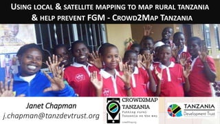
- 1. USING LOCAL & SATELLITE MAPPING TO MAP RURAL TANZANIA & HELP PREVENT FGM - CROWD2MAP TANZANIA Janet Chapman j.chapman@tanzdevtrust.org
- 2. WE’RE MAPPING RURAL TANZANIA. WHY? • The remote villages where TDT works are EXTREMELY poorly mapped. • Local officials lack maps of their area. • This makes navigation and planning difficult. • We are mapping onto Openstreetmap that is accessible to everyone online and on phones.
- 3. WE’RE MAPPING RURAL TANZANIA. WHY? • Much of rural Tanzania is blank in Google Maps and Openstreetmap. MOST RURAL TANZANIA LOOKED LIKE THIS WHEN WE STARTED - AND MUCH OF IT STILL DOES.. Zeze village, Kigoma, population 8200, 2015
- 4. WE’RE MAPPING RURAL TANZANIA. WHY? LOCAL MAPPERS ADDED POINTS OF INTEREST, CHURCHES, SHOPS, SCHOOLS, WATER POINTS USING MAPS.ME ON PHONES… REMOTE MAPPERS ADDED ROADS AND BUILDINGS (TASK 1069 – THANKS PETE!)…
- 5. INITIAL FOCUS: FIGHTING FEMALE GENITAL MUTILATION IN MUGUMU, SERENGETI Tanzania Development Trust’s largest project is a Safe House for girls refusing Female Genital Mutilation, run by FGM survivor Rhobi Samwelly. She visits the villages around Mugumu to tell girls about the Safe House and the dangers of FGM. This work was hampered by the lack of maps showing the location of the villages.
- 6. MAPPING ON MAPS.ME When Maps.Me released version that allowed users to add points directly to OSM we started training local
- 7. MAPPING ON MAPS.ME Ilya Zverev is producing a cut down English/Swahili version
- 9. MAPPING COMPETITION! Sharing the leader board on What’s App groups was good at increasing motivation
- 10. COMMUNICATION: WHATSAPP Posting of updates about monthly competition increased motivation.
- 11. REMOTE VILLAGES ARE STILL MISSING FROM MAPS … Set up Facebook group to post questions to local mappers
- 12. SATELLITE MAPPING VIA HOT TASK MANAGER /project/1788 http://tasks.hotosm.org/ project/1788# Now 99% mapped, 91% validated – (thanks Sophie!) https://vimeo.com/199314736
- 13. SATELLITE MAPPING VIA HOT TASK MANAGER /project/1788 Online volunteers trace roads and villages from satellite images. Recent release of Digital Globe imagery very helpful.
- 14. SATELLITE MAPPING EVENTS BY VOLUNTEERS Launched Crowd2Map with triple mapping party in London, Vilnius and Dar es Salaam: Ramani Huria volunteers mapping Mugumu on May 7th 2016 in Dar es Salaam.
- 15. MUGUMU SAFE HOUSE GIRLS ENGAGING IN MAPPING THEMSELVES Rhobi and some of the girls at the Safe House mapping in OSM on May 7th after initial training when I visited.
- 16. TRANSFERRING GOV OPEN DATA TO OSM data from http://opendata.go.tz/
- 17. TRANSFERRING GOV OPEN DATA TO OSM Over 600 online volunteers manually added schools and clinics.
- 18. BUILDING COMMUNITY - SLACK CHANNEL Slack channel is good for generating a community, and for volunteers to ask questions etc. – if anyone would like to join please let me know!
- 19. BUILDING COMMUNITY – MAILCHIMP EMAILS Monthly emails to volunteers to tell them about progress, events etc.
- 20. WINS • Mugumu Safe House able to reach more girls in Mara via Discovery of remote villages Reaching remote villages (limited roads, bridges, issues in rainy season) Fuel planning Better maps will eventually help girls reach the Safe House on their own “We’re reaching places that we’ve never reached before”
- 21. WHAT WE’VE ACHIEVED.. • We’ve now recruited over 1500 online volunteers and 199 local mappers. • mapped an area of over 16,248 square kilometres, added 5 towns and 175 villages and hamlets. • added over 62,128 km of roads and tracks and over a million buildings.. • Countrywide we have added 12,294 schools and 162 clinics to Openstreetmap from government open data.
- 23. EFFECT ON FGM Having better maps helped • prevent 2257 girls from being cut this year. However change is a slow process. • 1076 girls were still cut in Mara, down from 3700 the previous year, • and 4 girls died, down from 12 last year.
- 24. PEACE CORPS Trained 50 Peace Corps Volunteers on using Maps.Me to map their villages via Skype, May 12th and 13th
- 25. AWARDED HUMANITARIAN OPENSTREETMAP MICROGRANT Grant of $5000 to • buy 48 smartphones, • train village level community change agents in 4 areas of Tanzania, and • generate village and ward level maps and data, particularly around access to water, health facilities and land rights. Any advice appreciated!
- 26. COMMUNITY MAPPING PLANNING DASHBOARD Dashboard set up by Gabor Bakos http://www.fragosus.pe.hu/J anet/dashboard.htm
- 27. MAPSWIPE – PHONE APP TO IDENTIFY AREAS WITH BUILDINGS Using Mapswipe phone app to identify areas that had buildings and so needed mapping before putting task on Tasking Manager reduced the time taken. http://tasks.hotosm.org/project/2578
- 28. ORIGINAL MAPPING PLAN Use Maps.Me to map: • Village Office • Schools • Dispensaries/health centres/hospitals • Water points • Mpesa shops • Legal office • Churches • Police stations • Shops • FGM Activist Houses
- 29. AFTER DISCUSSIONS WITH LEGAL OFFICERS IN MASWA YESTERDAY They also want to collect data on: • Child labour positions • Girls hostels • Number of children in village with disabilities • Whether they are in school • What support they get • School infrastructure • toilets, • water supply, • teachers’ houses
- 30. CODING HELP REQUEST 1. Clustering buildings into residential areas / villages. 2. Import of high quality / high accuracy curated datasets, e.g. from academic institutions. 3. Android apps to support mapping in the field for users who are unfamiliar with smart phones, eg to monitor GPS accuracy Whatever we do, and whatever we find, will be shared with the community, through blog posts, documentation on the OSM wiki, etc. We’ll take care of that, but would like to find volunteers who can help with the technical aspects. Please contact Bjoern Hassler bjohas (at) gmail.com if interested
- 31. STATE OF THE MAP - JAPAN Egle will present on impact of mapping on fighting FGM * qualitative study - interviews and narratives from the affected communities (edited) * qualitative interpretation of the GIS visualizations generated during the Summer of Maps * quantitative study of multisource data sources concerning FGM
- 32. ACCESS TO WATER Overlaying population density to water point locations to assess relative need of applications.
- 33. SUMMER OF MAPS INTERN JIANTING ZHAO Past work: • Analyzed and presented crime incidence likelihood in Chicago, USA using logistic regression and ArcGIS • Measured healthy food accessibility in Philadelphia, USA using ArcGIS • Predicted historic buildings demolition probability in Philadelphia Will be looking at impact of mapping on FGM Contact Info: zhao.jianting912@gmail.com what’sApp: 608-609-3512
- 34. HOW YOU CAN HELP.. • Access to smartphones is the limiting factor, so if you have any unwanted phones we can make very good use of them.. • And/or ideas about funding sources! • Any comments, questions or suggestions always welcome. • Thank you! • Janet j.chapman@tanzdevtrust.org @crowd2map • Egle emramanauskaite@gmail.com crowd2map.org
Hinweis der Redaktion
- Sometime hand drawn map on wall, often not. Getting lost driving through rivers in the rain. Asked local reps to draw map of where village was, they couldn’t
- Points added in OSM and Maps.Me
- Rhobi at a roadshow against FGM in a village near Mugumu. Challenge in outreach in villages, no maps
- Moved to maps.me Tried OSMAND, but difficult for novice users
- Maps me brilliant now you can add points, but list not that suitable for rural Africa..
- Maps me brilliant now you can add points, but list not that suitable for rural Africa..
- say more on Mapping competition how much are people contributing EMR: how many people? How well are they engaging? Are the points accurate? Reliable ?
- Via Facebook, Whats app
- Set up project on HOT for area around Mugumu,
- Set up project on HOT for area around Mugumu,
- EMR: prepare for Qs about open data. Where did you get it from? Was it government-collected? Are you sure it is usable? Did you consider importing it straight to OSM (not manual)? Is that all the data you got? How recent is it? Are you still accessing other open data from elshwere ?
- Over 900 volunteers largely through UN online volunteers, regular contact via email.
- It is possible to automatically cluster buildings into residential areas / villages according to some rule set. So you might say if there are “more than 10 buildings no more than 50m from each other" then create an outline - more technically a convex hull, and mark that as residential area. Such a rule set would give you some "definites" - but we need to get the software in place, and need to determine the rule set. There will be cases that would need to be checked manually / referred to crowd sourcing. So how do we extract those cases, and what crowd sourcing tools can we use to fix those? With Bjoern Hassler from Cambridge University, I’ve been talking to Chris Grundy at LSHTM about academic (high accuracy) datasets they have available, that are CC / public domain and thus available for OSM. We’d like to develop an automated process that imports these data sets. The challenge is to check for existing data points, and the algorithm would need to check whether a village already exists nearby the new data point, and take action on that basis. Again, there'll be some definites, but also some cases that would need to be checked manually. Again, we'd love to work with a volunteer.