
Empfohlen
Empfohlen
Weitere ähnliche Inhalte
Andere mochten auch
Andere mochten auch (15)
Ähnlich wie 9 - GMRC-DREWBERRY - WB_WR_Management_meeting-Sep-16
Ähnlich wie 9 - GMRC-DREWBERRY - WB_WR_Management_meeting-Sep-16 (20)
Mehr von indiawrm
Mehr von indiawrm (20)
Kürzlich hochgeladen
Kürzlich hochgeladen (20)
9 - GMRC-DREWBERRY - WB_WR_Management_meeting-Sep-16
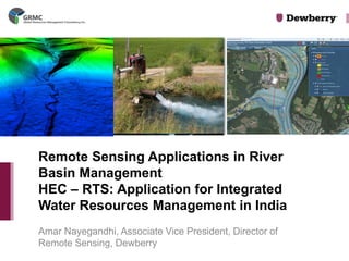
- 1. Amar Nayegandhi, Associate Vice President, Director of Remote Sensing, Dewberry Remote Sensing Applications in River Basin Management HEC – RTS: Application for Integrated Water Resources Management in India
- 2. GRMC is a new Infrastructure and Facilities Management services company providing practical, innovative solutions to alleviate simple to complex long term problems related to Water Resources, Transportation, Mass Transit, Logistics, Facilities and Urban Development and Planning EXECUTIVE SUMMARY Who We Are Our Focused Approach Our Management Team Initial focus is to enhance technical consulting services specifically towards marketing and distribution of advanced technological offerings. As, GRMC continues to grows we will continue our Global expansion. GRMC founders have rich expertise in engineering services. GRMC has two affiliate engineering companies – Ewell W. Finley and SCI Engineering. Together they have completed over 100 projects in New York in the last 5 years, with a client list including Port Authority of New York and New Jersey, Metro Transit Authority and New York State Department of Transportation. © 2014 GRMC, Inc.
- 3. Ewell W. Finley, P.C. – Local Land Surveying & Engineering Partner Dewberry - Geospatial Mapping & Water Resource Consulting Geo Digital International– Airborne and Mobile LiDAR Scanning Partner Pelydryn, LLC – Bathymetric Surveying Partner (LiDAR & Sonar) Innovation Technology Partners, Inc– Static LiDAR Scanning Partner EnTech Engineering, Inc– Utility & Underground Mapping Partner Briem Engineering – Materials Testing AeroPower – Live Line Maintenance & Inspection (Transmission Lines) EcoDomus – Asset Management Partner Mandli Communications Inc – Data Collection Products & Services for Transportation Sure Waters – Water Resource Management GLOBAL RESOURCES MANAGEMENT CONSULTANCY INC. (GRMC) 3 LIST OF PARTNERS (EXCLUSIVELY REPRESENTED BY GRMC) © 2014 GRMC, Inc.
- 4. Dewberry •Established in 1956 by Sidney O. Dewberry, PE, LS. Chairmanship to his son Barry K. Dewberry. •Dewberry is headquartered in Fairfax, VA and has more than 40 locations in 20 states •Multi-disciplined Architecture, Engineering and Consulting Firm •2000+ employees
- 5. •Full service geospatial consulting and development firm •Over 250 geospatial professionals •150+ surveyors, 50 software developers, 30 business analysts •Program Management (Consulting, Training, Quality Assurance, On Site Support) •GIS/IT Services (Application Development, Data Collection & Development, Data & Systems Integration, Analysis) •Remote Sensing Services (Imagery, LiDAR, IFSAR, Environmental & Asset Mapping ) •Cloud Services (Consulting, On Boarding, Systems & Data Migration, 24X7 Customer Support) Dewberry’s Geospatial and Technology Services High resolution seamless topobathymetric LiDAR of riverine channels.
- 6. Dewberry literally “wrote the books” on Elevation Technology and Flood Hazards Mapping FEMA NDEP DEM 1st Edition, DEM 2nd Edition, DEM ASPRS LiDAR Guidelines Guidelines Users Manual Users Manual Guidelines Amar Nayegandhi and Dave Maune are currently working on USACE Manual and DEM Users 3rd Edition
- 7. Dewberry has written the engineering manual for USACE.
- 9. Risk Mapping, Assessment, and Planning (Risk Map), Nationwide •Client: FEMA •Contract: $600-million over five years Water Resources for US Federal Emergency Management Agency (FEMA)
- 10. Sea, Lake, and Overland Surges from Hurricanes (SLOSH) Models •Client: Florida Department of Emergency Management •Updated nine of 11 SLOSH models in Florida •Models adopted by National Hurricane Center and currently used for hurricane evacuation studies and real-time storm surge forecasting Water Resources
- 11. North Carolina Sea Level Rise Risk Management Study •Funded by $5-M grant from FEMA Climate Change
- 13. •Guiding our clients through the entire project lifecycle •Up-front strategic planning for 3-D elevation development •We also provide training, web data dissemination (cloud services), customized analysis tools, and derivative products Program Management for 3-D Data
- 14. Alaska’s Mapping Problem (1.7 million sq km) Note: Existing elevation maps when overlaid with hydrography data show rivers not flowing through valleys because of mapping errors
- 15. Dewberry is providing Alaska’s Mapping Solution using IFSAR - $80 M project Dewberry has the experience in working on very large remote sensing projects. Together, the GRMC team has all the resources needed to conduct remote sensing activities in India.
- 16. LiDAR and Image Mapping Solutions for Water Resources Management Mr. Dave Lewis, Vice President, Geodigital International
- 17. What is LiDAR? First reflection (first pulse) Last reflection (last pulse) Airborne LiDAR – Light Detection and Ranging essentially a 3D scanning laser rangefinder LiDAR turns 2D maps into accurate 3D maps
- 19. Industry Experience & Capacity: GeoDigital Industry Expertise & Capacity •Over 400,000 miles of corridors mapped •Over 100,000 miles of engineering grade LiDAR •Hundreds of thousands of sq. kms wide area mapping •LiDAR/Ortho/Oblique/Hyper-Spectral •Single pass GeoDigital Brings Nearly 2 Decades of Wide Area Mapping Experience using fixed wing aircraft GeoDigital has largest acquisition and processing capability for corridor mapping in North America using helicopter and mobile platforms • Demonstrated ability to acquire over 7,000 miles per month. • Capacity to process 1000s of miles per month •Over 400,000 miles of corridors mapped/Over 100,000 miles of engineering grade LiDAR
- 20. Projects completed in: India, Australia, Phillipines, England, Brazil, Costa Rica, Honduras, Guatamala, Mexico, El Salvador, Colombia, Chile, Italy, Monserrat, Canada, France, Panama, Nicaragua, Zambia, Puerto Rico, Antigua, Afghanistan, Suriname and more Experience in obtaining necessary permits and approvals to fly in foreign countries Experience with different weather systems/patterns Dedicated international aviation manager (former Microsoft) Have been through the process in India (MOD, DGCA, Local authorities) Current 15,000 km project for Power Grid Corporation Vast International experience
- 22. An engineering grade three dimensional LiDAR and Imagery Area wide model which will allow enterprise- wide access for planning, management and development of vast areas of land •Infrastructure •Utilities •Coastal Management •Storm Surge modeling •Water Resources management •Emergency management •Evacuation route planning •Security management and more What we deliver:
- 23. GeoDigital has provided flood mapping throughout the United States to Federal Emergency Management Agency (FEMA) specifications In many of these projects we have worked with Dewberry, the leading flood mapping specialist in the US, having developed the FEMA flood mapping specifications Extensive wide area/flood mapping experience
- 24. Modern Tools & Technologies on Water Resources Assessment and Management 16th and 17th September, 2014 Aerial Lidar Bathymetry and Topography
- 25. Horizon & Pelydryn •Operates Topo/Bathy LiDAR •Formed in 2008 •Workforce of 17 •UK based, also office in USA •2 x Hawkeye IIb LiDAR systems •1 x Chiroptera IIb and •to meet the growing global demand for coastal & shallow-water survey •Offers comprehensive Survey, Geotechnical & Environmental Services to the marine industry •Established 2004 •workforce over 430 •Own 51% stake in Pelydryn •UAE based, offices in India and the UK •Registered offices/representation in: •Middle East (Head Office) •India (Mumbai) •Europe •North Africa •West Africa •Caspian Sea •South East Asia
- 26. •Hydrographic Survey •4 x ships •Numerous smaller survey boats, all conducting Hydrographic survey •Environmental Dept: •Water Quality Sampling: •Analysis of Biological and sediment makeup •Mapping of Species & Habitat •Data Processing & Analysis •Seabed/Riverbed core sampling •Environmental Impact Assessments and Baseline Surveys
- 27. Pollution: River Bed River Bed & Core samples can be taken at regular intervals and tested for Heavy Metals and other pollutants In House Shear testing undertaken in house to analyze river bed/seabed stability
- 28. Capability of Bathymetric LiDAR Bathymetric LiDAR (Green) allows the collection of depths from the seabed over a wide area from a low flying aircraft. When used simultaneously with Topographic LiDAR (Red) - depths can be taken of the seabed seamlessly up on to the land
- 29. River profile Wales(UK) May 2014 River Cross Section Profile River Valley Flood Mapping Tool
- 30. Source: Ministry of Water Resources, River Development & Ganga Rejuvination OUR VISION •Optimal sustainable development, maintenance of quality and efficient use of water resources to match with the growing demands on this precious natural resource of the country. OUR MISSION •India is endowed with a rich and vast diversity of natural resources, water being one of them. Its development and management plays a vital role in agriculture production. Integrated water management is vital for poverty reduction, environmental sustenance and sustainable economic development. National Water Policy envisages that the water resources of the country should be developed and managed in an integrated manner. Integrated Water Resources Management
- 31. Water resource is a vulnerable resource and its quality changes because of the following factors: •Deforestation and poor land use practices in the catchment area, which disturb topsoil and vegetative cover resulting in decreased infiltration rates, increased runoff, sediment transport and deposition in rivers and storage reservoirs. •Over abstraction of surface water sources at the upstream reduces the minimum flow required in the downstream sections for the sustenance of ecosystems and mangroves. •Over pumping of groundwater induces saline water intrusion into fresh water aquifer resulting changes in groundwater quality with increased TDS. •Water pollution due to discharge of untreated/partially treated industrial and municipal wastewater into water sources deplete dissolved oxygen and affects fish and other aquatic life. Agricultural drainage, which is carrying residues of chemical fertilizers and pesticides, affects the water quality, promoted weed growth and renders the water resources unfit for other uses. •Encroachment of agricultural land and watersheds for urbanization and industrial development has impact on wetlands and important watershed areas and affects recharging areas and reservoir capacities. Source: Dr. Angappapillai and Dr. Muthukumaran (Asia Pacific Journal of Marketing and Management Review, Nov 2012) Water resource issues
- 32. www.dewberry.com “We shall know the value of water when the well runs dry.” Integrated Water Resources Management
- 33. www.dewberry.com •Goal: Integrate water planning and land use planning as early as possible •Goal: Integrate surface water, groundwater, wastewater, and storm water planning with floodplain management •Goal: Maximize stakeholder participation •Goal: Provide sustainable use of water resources Integrated Water Resources Management
- 34. Which H&H Modeling software should I use? Dewberry-GRMC team proposes the HEC-RTS software. Real-Time Simulation (RTS) programs are designed to seamlessly integrate meteorological data; and reservoir operation simulation, hydrologic, and hydraulic models into a calibrated, comprehensive, and standardized program. Developed by the Hydrologic Engineering Center (HEC) of the United States Army Corps of Engineers (USACE)
- 35. www.dewberry.com HEC-HMS Model ResSim Model HEC-RAS Model RTS Program GEOGRAPHICAL DATA INPUTS Chlolavarm Red Hills Poondi Chembarambakkam METEOROLOGICAL DATA INPUTS (Updated hourly) Program Overview
- 36. •Accurate and Capable •User Friendly •Sustainable – Ongoing Support and Training •Flexible and Customizable •Publically Available (FREE!) Why HEC-RTS?
- 37. www.dewberry.com •Meteorologic Data •Hydro-Meteorologic Model (i.e., MFP) •Hydrologic Model (i.e., HEC-HMS) •Geo-hydrologic Model (i.e. MODFLOW) •Hydraulic Model (i.e., HEC-RAS) •Storage Simulation (i.e., HEC-ResSim) •Integrated Program (i.e. HEC-RTS) Integrated Water Resources Management – Dewberry’s Experience Sample IRWM Planning Tools
- 38. www.dewberry.com THE 72 HOURS PRECIPITATION FORCAST DATA RECEIVED FROM REGIONAL INTEGRATED MULTIHAZARD EARLY WARNING SYSTEMS FOR ASIA AND AFRICA (RIMES) BHAKRA BEAS MANAGEMENT BOARD
- 39. www.dewberry.com TRMM SATELITE PRECIPITATION DATA IS USED FOR SPATIAL AND TEMPORAL VARIATION OF RAINFALL AND THE CATCHMENT AREA IN TIBET(CHINA) BHAKRA BEAS MANAGEMENT BOARD
- 40. www.dewberry.com BBMB Data Acquisition and Validation
- 41. www.dewberry.com Compare simulated hydrographs with observed hydrographs Determine area-weighted average hyetographs for each subbasin to create gridded data Integrated Water Resources Planning using HEC-HMS Hydro-Meteorological Modeling Hydrologic Model Input Hydro-meteorologic Model Output
- 42. www.dewberry.com Integrated Water Resources Planning Hydraulic Model Input Hydrologic Model Output Hydrologic Modeling
- 43. www.dewberry.com Geo-Hydrologic Model Input Hydraulic Model Output Integrated Water Resources Planning Operator Inputs Hydraulic Modeling
- 44. www.dewberry.com Integrated Water Resources Management - MODFLOW Geo-Hydrologic Modeling
- 45. www.dewberry.com Integrated Water Resources Planning using MODFLOW Geo-Hydrologic Modeling
- 46. www.dewberry.com Integrated Water Resources Planning - RESSIM Reservoir Simulation/ Storage Modeling
- 47. www.dewberry.com Reservoir Simulation (ResSim) Model ResSim Inputs – • Rating curves for low level outlets, gated and ungated spillways • Outlet prioritization • Multiple guide curves to define dead storage, conservation pool, and flood control storage that vary by season • Separate rating and efficiency curves for each power generator • Scheduled releases • Diversions • Parallel and Tandem Reservoir System • Pump back storage operations and pump curves • User Scripted Rules and State Variable. • PRIORITIZATION OF RULES! • User-Scripted Rules – If you can write it, ResSim will do it.
- 48. www.dewberry.com Reservoir Simulation (ResSim) Model Release Decision Report – ResSim generates a report that tells you why each release was made. Why do I have this spike in flows at 2 am?
- 49. www.dewberry.com Dewberry-GRMC team can help with customizing HEC-RTS, such as: •Create grids using ArcTools instead of the GageInterp program •Automate the RTS program to run on a six-hour interval •Create an unsteady RAS model for critical locations •Develop new solutions to limitations found in the RTS program, i.e. read temperature and precipitation forecast grids •Create daily grids for 10-, 25-, 50-, 75-, and 90- percentile years •Create a 12-hour time-step planning model for seasonal projections •Integrate weather data from Custom Weather •Provide support during implementation and operating the software Services we can offer
- 50. www.dewberry.com Additional Tasks •Scripts written that allows our client to change diversions and outage schedule without having to open the RTS model. •Custom report are generated and sent to the Managers and Operators as an email attachment. •Flood Warning triggers
- 51. www.dewberry.com Why HEC-RTS? •States and Private Entities need a software package that is –Accurate and Capable –User Friendly –Sustainable – Ongoing Support and Training –Flexible and Customizable –Publically Available (FREE!)
- 52. www.dewberry.com Meeting the needs using HEC-RTS •ACCURACY –No software is more accurate than HEC Products. –Most trusted H&H program in the US –Most Used by Federal, State and Private Industry Clients •USER FRIENDLY –Most Users require 1-3 days training per package –BBMB modeled their complex system with HEC using NATIVE employees only. –Most HEC Users are Self Taught or Tutored by Experienced fellow employees –Training is Available thru HEC classes or Private Firms –GRMC - Dewberry team will offer training and full support
- 53. www.dewberry.com Meeting the Needs •SUSTAINABILITY –HEC has been maintaining and improved its software for over 40 years –HEC and Private Firms provide training materials and workshops –Dewberry can create training materials using Indian examples and set up training in India –Dewberry can support Online Help Line • FLEXIBILITY and CUSTOMIZATION –Dewberry-GRMC team has software developers for HEC –Dewberry created custom functionality and reports for the Upper San Joaquin RTS system –Interface and Output are completely customizable – only the calculation are protected
- 54. www.dewberry.com Meeting the Needs using HEC-RTS •PUBLICALLY AVAILABLE –HEC products are FREE –GRMC – Dewberry team will assist in setting up and calibrating models –HEC programs should be run by EMPLOYEES OF THE CLIENT. No Life Time, forever commitment by CLIENT! –Dewberry will set up On Demand Training and Trouble Shooting
- 55. www.dewberry.com •Dewberry is the ONLY Private Entity to Implement an RTS model •Dewberry worked with HEC to Improve to HEC-RTS –Automation –Gridded Forecast Data –Snowmelt –Customized Model Interface –Custom Reports –Warnings – 12-hour time-step planning model for seasonal projections •Over 40 years experience working with USACE •Primary Software Development Contractors for HEC since 1997 •Contributed to over 20 of HEC’s core applications and software libraries including HEC-HMS, HEC-ResSim, HEC-RAS, HEC-FIA, HEC-WAT, CWMS and RTS •Full software life cycle support with version control, continuous build integration, testing, and issue tracking •Actively managing over 4 million lines of USACE source code Summary of GRMC-Dewberry Team’s Qualifications
- 56. www.dewberry.com “HEC-RTS is a calibrated, real-time simulation program that takes of advantage of formatted data and integrates H&H and ResSim models to provide users with the ability to maximize integrated operation of their water supply and flood protection systems.” Summary Integrated Water Resources Management
- 57. www.dewberry.com Amar Nayegandhi Associate Vice President Dewberry anayegandhi@dewberry.com Ph: +1 813 421 8642 Thank you! Questions? Lincoln (Raj) T. Satkunarajah President & CEO Global Resources Management Consultancy Inc. (GRMC) lincoln@grmcinc.com Ph: +1 917 608 3570 GRMC India: +91 11 262 6353