SlideShare ist ein Scribd-Unternehmen logo
1 von 37
Living with the floods
                             Initiation of a warning system
                                in the inlands of Surinam


Project team Surinam
Ir. Glenn Weisz Jr.
Raheena Doekhie
Priscilla Miranda
Ton Knol
Marloes van Ginkel
Marjolein van der Kraan
Ivo Miltenburg


                                                              1
Sponsor


                                   Duinwaterbedrijf Zuid-Holland


Living with the floods                                             2
Project team Surinam
Introduction
Cause
Project team Surinam
                            Introduction
‘Living with the floods’
Organization
                             Cause
Inlands of Surinam
Project locations
Participation               Flooding inlands of Surinam
Drinking water
                            May 2006
Introduction
Mercury issues
Drinking water sources
Drinking water systems
                                                          Flooded area
Warning system
Introduction
Awareness
Data allocation
Simple Warning system
Communication

Evacuation plan
Introduction
Progressive scheme
    safe area
Safe areas

Conclusion                     Flooded villages
Recommendations


   Living with the floods                                                3
   Project team Surinam
Introduction
Cause
Project team Surinam
                            Introduction
‘Living with the floods’
Organization
                             Cause
Inlands of Surinam
Project locations
Participation               Flooding inlands of Surinam
Drinking water
                            May 2006
Introduction
Mercury issues
Drinking water sources
Drinking water systems
                                                          Eroded riverbanks
                                                          Eroded riverbanks
Warning system
Introduction
Awareness
Data allocation
Simple Warning system
Communication

Evacuation plan
Introduction                             Uprooted trees
                                         Uprooted trees
Progressive scheme
    safe area
Safe areas
                            • 22,000 victims
Conclusion
Recommendations
                            • major damage to
                            buildings/arable land          Flooded schools
                                                           Flooded schools


   Living with the floods                                                4
   Project team Surinam
Introduction
Cause
Project team Surinam
                            Introduction
‘Living with the floods’
Organization
                            Project team Surinam
Inlands of Surinam
Project locations
Participation

Drinking water
Introduction                 Team
Mercury issues
Drinking water sources       members
Drinking water systems

Warning system
Introduction                                      Ton
                                                  Ton   Raheena
                                                        Raheena   Marjolein
                                                                  Marjolein
Awareness
Data allocation
Simple Warning system
Communication

Evacuation plan
Introduction
Progressive scheme
    safe area
Safe areas

Conclusion
Recommendations                  Glenn
                                 Glenn      Priscilla
                                            Priscilla   Marloes
                                                        Marloes         Ivo
                                                                        Ivo


   Living with the floods                                                5
   Project team Surinam
Introduction
Cause
Project team Surinam
                            Introduction
‘Living with the floods’
Organization
                              ‘Living with the floods’
Inlands of Surinam
Project locations
Participation               Project goals:
Drinking water
Introduction                • Drinking water
Mercury issues
Drinking water sources      • Warning system
Drinking water systems
                            • Evacuation plan
Warning system
Introduction
Awareness
Data allocation
Simple Warning system
Communication

Evacuation plan
Introduction
Progressive scheme
    safe area
Safe areas

Conclusion
Recommendations


   Living with the floods                                6
   Project team Surinam
Introduction
Cause
Project team Surinam
                            Introduction
‘Living with the floods’
Organization
                             Organization
Inlands of Surinam
Project locations
Participation               • group 1: evacuation, drinking water, communication
Drinking water
                            • group 2: warning system, communication
Introduction
Mercury issues
Drinking water sources
Drinking water systems

Warning system
Introduction
Awareness
Data allocation
Simple Warning system
Communication

Evacuation plan
Introduction
Progressive scheme
    safe area                               Group 1
                                            Group 1          Group 2
                                                             Group 2
Safe areas

Conclusion
Recommendations


   Living with the floods                                                          7
   Project team Surinam
Introduction
Cause
Project team Surinam
                            Introduction
‘Living with the floods’
Organization
                             Organization
Inlands of Surinam
Project locations
Participation               Making contact and setting up cooperation
Drinking water
Introduction
Mercury issues
Drinking water sources      • BIO – cooperating NGO’s in Surinam
Drinking water systems

Warning system              • ADEK – University of Paramaribo
Introduction
Awareness
Data allocation
Simple Warning system       • Participation of Surinam students
Communication

Evacuation plan
Introduction
Progressive scheme
    safe area
Safe areas

Conclusion
Recommendations


   Living with the floods                                               8
   Project team Surinam
Introduction
Cause
Project team Surinam
                            Inlands of Surinam
‘Living with the floods’
Organization
                                Project locations
Inlands of Surinam
Project locations
Participation               Four village-clusters at          PARAMARIBO
                            Boven-Suriname river       Paramaribo
Drinking water
Introduction
Mercury issues
Drinking water sources      •   Kayana
Drinking water systems
                            •   Djoemoe
Warning system              •   Botopasi
Introduction                                                        Laduani
Awareness                   •   Laduani                Botopasi
Data allocation                                                     Djoemoe
Simple Warning system                                   Kayana
Communication

Evacuation plan
Introduction
Progressive scheme
    safe area
Safe areas

Conclusion
Recommendations


   Living with the floods                                                     9
   Project team Surinam
Introduction
Cause
Project team Surinam
                            Inlands of Surinam
‘Living with the floods’
Organization
                             Participation
Inlands of Surinam
Project locations
Participation               Social hierarchy is very important
Drinking water              • Granman
Introduction
Mercury issues
                            • Village board (captain and basja’s)
Drinking water sources      • Krutu (village meeting)
Drinking water systems

Warning system              Contact with villagers
Introduction
Awareness                   • Acceptance of the project
Data allocation
Simple Warning system       • Sharing knowledge
Communication
                            • Working together
Evacuation plan             • Discussing solutions
Introduction
Progressive scheme          • Involving schoolchildren
    safe area
Safe areas

Conclusion
Recommendations


   Living with the floods                                           10
   Project team Surinam
Introduction
Cause
Project team Surinam
                             Drinking water
‘Living with the floods’
Organization
                              Introduction
Inlands of Surinam
Project locations
Participation

Drinking water
Introduction                Goals:
Mercury issues
Drinking water sources
Drinking water systems      • Analyzing drinking water sources
Warning system              • Introducing small-scale, simple and robust drinking water
Introduction
Awareness
                            systems
Data allocation
Simple Warning system
                            • Assessment of central drinking water system (Djoemoe)
Communication

Evacuation plan
Introduction
Progressive scheme
    safe area
Safe areas

Conclusion
Recommendations


   Living with the floods                                                                 11
   Project team Surinam
Introduction
Cause
Project team Surinam
                            Drinking water
‘Living with the floods’
Organization
                             Mercury issues
Inlands of Surinam
Project locations
Participation

Drinking water
                            • Maximum mercury concentration of 0.29 ug/l meets WHO
Introduction                standard for drinking water of < 1.0 ug/l.
Mercury issues
Drinking water sources
Drinking water systems
                            • Exceeds the target value for eco systems of 0.03 ug/l.
Warning system
Introduction
Awareness
Data allocation
Simple Warning system
Communication

Evacuation plan
Introduction
Progressive scheme
    safe area
Safe areas

Conclusion
Recommendations


   Living with the floods                                                              12
   Project team Surinam
Introduction
Cause
Project team Surinam
                            Drinking water
‘Living with the floods’
Organization
                            Drinking water sources
Inlands of Surinam
Project locations
Participation

Drinking water               River water     Creek water   Rain water (storage)
Introduction
Mercury issues
Drinking water sources
Drinking water systems

Warning system
Introduction
Awareness
Data allocation
Simple Warning system
Communication

Evacuation plan
Introduction
Progressive scheme
    safe area
Safe areas

Conclusion
Recommendations


   Living with the floods                                                 13
   Project team Surinam
Introduction
Cause
Project team Surinam
                              Drinking water
‘Living with the floods’
Organization
                               Drinking water sources
Inlands of Surinam          Water quality
Project locations
Participation
                            • E.Coli
Drinking water
Introduction                • Total coli form
Mercury issues
Drinking water sources
Drinking water systems
                                River water     Creek water   Rain water (storage)
Warning system
Introduction
Awareness
Data allocation
Simple Warning system
Communication

Evacuation plan
Introduction
Progressive scheme
    safe area
Safe areas

Conclusion
Recommendations


   Living with the floods                                                    14
   Project team Surinam
Introduction
Cause
Project team Surinam
                            Drinking water
‘Living with the floods’
Organization
                            Drinking water systems
Inlands of Surinam
Project locations
Participation
                            • Removal of pathogene
Drinking water              organisms
Introduction
Mercury issues
Drinking water sources
Drinking water systems      • Ease in use                         SODIS system
Warning system
Introduction
Awareness
Data allocation
Simple Warning system
Communication

Evacuation plan
Introduction
Progressive scheme
    safe area
Safe areas

Conclusion                                       Katadyn Pocket
Recommendations
                                                                    Clay pot
                              Katadyn Combi


   Living with the floods                                                        15
   Project team Surinam
Introduction
Cause
Project team Surinam
                            Drinking water
‘Living with the floods’
Organization
                            Drinking water systems
Inlands of Surinam
Project locations
Participation
                              Removal of (most) of pathogene organisms

Drinking water                • confirmed with all systems
Introduction
Mercury issues
Drinking water sources
Drinking water systems


Warning system
Introduction
Awareness
Data allocation
Simple Warning system
Communication

Evacuation plan
Introduction
Progressive scheme
    safe area
Safe areas

Conclusion                    SODIS exposure time of 24 hours on a sink roof:
Recommendations               • most effective method


   Living with the floods                                                       16
   Project team Surinam
Introduction
Cause
Project team Surinam
                            Drinking water
‘Living with the floods’
Organization
                            Drinking water systems
Inlands of Surinam
Project locations
Participation
                              Ease in use

Drinking water                Feedback villagers:
Introduction
Mercury issues
Drinking water sources
Drinking water systems

Warning system
Introduction
Awareness
Data allocation
Simple Warning system
Communication

Evacuation plan
Introduction
Progressive scheme
    safe area
Safe areas

Conclusion
Recommendations                Katadyn Combi


   Living with the floods                            17
   Project team Surinam
Introduction
Cause
Project team Surinam
                            Drinking water
‘Living with the floods’
Organization
                            Drinking water systems
Inlands of Surinam
Project locations
Participation                    Advise : SODIS system
Drinking water
Introduction
Mercury issues
Drinking water sources
Drinking water systems

Warning system
Introduction
Awareness
Data allocation
Simple Warning system
Communication

Evacuation plan
Introduction
Progressive scheme
    safe area
Safe areas
                              until all inhabitants have access to central drinking
Conclusion                    water systems or rain water storages………..
Recommendations


   Living with the floods                                                             18
   Project team Surinam
Introduction
Cause
Project team Surinam
                            Warning system
‘Living with the floods’
Organization
                             Introduction
Inlands of Surinam
Project locations
Participation               Challenges:
Drinking water
                            • Isolated area
Introduction                • Lack of warning system
Mercury issues
Drinking water sources      • No flood protection possible
Drinking water systems
                            • Limited data available
Warning system              • Expecting more floods in future
Introduction
Awareness
Data allocation
Simple Warning system       Goals:
Communication
                            • Raising awareness
Evacuation plan             • Start data allocation
Introduction
Progressive scheme          • Initiation of a warning system
    safe area
Safe areas
                            • Communication
Conclusion
Recommendations


   Living with the floods                                       19
   Project team Surinam
Introduction
Cause
Project team Surinam
                            Warning system
‘Living with the floods’
Organization
                             Awareness
Inlands of Surinam
Project locations
Participation               Important for future
Drinking water
                            safety and continuity
Introduction
Mercury issues
Drinking water sources
Drinking water systems

Warning system
Introduction
Awareness
Data allocation
Simple Warning system
Communication

Evacuation plan
Introduction
Progressive scheme
    safe area
Safe areas
                            • Providing information
                            • Working with villagers
Conclusion
Recommendations


   Living with the floods                              20
   Project team Surinam
Introduction
Cause
Project team Surinam
                            Warning system
‘Living with the floods’
Organization
                             Awareness
Inlands of Surinam
Project locations
Participation               Building a monument at the
Drinking water
                            floodline on a central location
Introduction
Mercury issues
Drinking water sources
Drinking water systems

Warning system
Introduction
Awareness
Data allocation
Simple Warning system
Communication

Evacuation plan
Introduction
Progressive scheme
    safe area
Safe areas

Conclusion
Recommendations


   Living with the floods                                     21
   Project team Surinam
Introduction
Cause
Project team Surinam
                            Warning system
‘Living with the floods’
Organization
                             Data allocation
Inlands of Surinam
Project locations
Participation               Waterlevel gauges - preparation
Drinking water
Introduction
Mercury issues
Drinking water sources
Drinking water systems

Warning system
Introduction
Awareness
Data allocation
Simple Warning system
Communication

Evacuation plan
Introduction
Progressive scheme
    safe area
Safe areas

Conclusion
Recommendations


   Living with the floods                                     22
   Project team Surinam
Introduction
Cause
Project team Surinam
                            Warning system
‘Living with the floods’
Organization
                             Data allocation
Inlands of Surinam
Project locations
Participation               Waterlevel gauges - result
Drinking water
Introduction
Mercury issues
Drinking water sources
Drinking water systems

Warning system
Introduction
Awareness
Data allocation
Simple Warning system
Communication

Evacuation plan
Introduction
Progressive scheme
    safe area
Safe areas

Conclusion
Recommendations


   Living with the floods                                23
   Project team Surinam
Introduction
Cause
Project team Surinam
                            Warning system
‘Living with the floods’
Organization
                             Data allocation
Inlands of Surinam
Project locations
Participation               Rain gauges – placed by hydrologist S. Naipal
Drinking water
Introduction
Mercury issues
Drinking water sources
Drinking water systems

Warning system
Introduction
Awareness
Data allocation
Simple Warning system
Communication

Evacuation plan
Introduction
Progressive scheme
    safe area
Safe areas

Conclusion
Recommendations


   Living with the floods                                                   24
   Project team Surinam
Introduction
Cause
Project team Surinam
                            Warning system
‘Living with the floods’
Organization
                             Simple warning system
Inlands of Surinam
Project locations
Participation               Goal:
Drinking water
                            • h-h relations between inland villages
Introduction
Mercury issues
Drinking water sources
Drinking water systems                Waterlevel Kayana

Warning system
Introduction
Awareness
Data allocation
Simple Warning system
Communication
                                                                      Forecast
Evacuation plan                                                       waterlevel
Introduction                                                          Djoemoe
Progressive scheme                     Working of the
    safe area
Safe areas                             warning system

Conclusion
Recommendations


   Living with the floods                                                          25
   Project team Surinam
Introduction
Cause
Project team Surinam
                            Warning system
‘Living with the floods’
Organization
                             Simple warning system
Inlands of Surinam
Project locations
Participation               Measuring river and land profile
Drinking water
Introduction
Mercury issues
Drinking water sources
Drinking water systems

Warning system              Using a Diver
                            Using a Diver
Introduction
Awareness
Data allocation                                                                                      30
                                                                                                          30
Simple Warning system
Communication                                                                    Profile Kayana
                                                                                 Profile Kayana      25
                                                                                                          25


Evacuation plan                                                                                      20
                                                                                                          20

Introduction                                                                                         15
Progressive scheme                                                                                        15

    safe area                                                                                        10
                                                                                                          10
Safe areas
                                                                                                      5
                                                                                                           5
Conclusion                                                                                            0
Recommendations                                                -800
                                                                 -800
                                                                        -600
                                                                          -600
                                                                                   -400
                                                                                     -400
                                                                                            -200
                                                                                              -200
                                                                                                          0
                                                                                                          0
                                                                                                               0
                                                                                                                   200
                                                                                                                     200


   Living with the floods                                                                                                  26
   Project team Surinam
Introduction
Cause
Project team Surinam
                            Warning system
‘Living with the floods’
Organization
                              Simple warning system
Inlands of Surinam
Project locations
Participation               Determining Q-h relations using Strickler’s Formula
Drinking water
Introduction
                            Q = kAR 2 / 3 s1/ 2
Mercury issues
Drinking water sources
Drinking water systems
                            Estimation of slope (s) and roughness (k)
Warning system
Introduction                      3000
Awareness
Data allocation                   2500
Simple Warning system
Communication                     2000

                                  1500
                                                                                • No kalibration possible
                              Q


Evacuation plan
                                  1000
                                                                                due to lack of historical
Introduction
Progressive scheme
                                  500
                                                                                data
    safe area
Safe areas                          0
                                         0   2   4   6       8   10   12   14
                                                                                • Not able to produce
Conclusion                                               h                      accurate h-h relations
Recommendations                   Q-h relation Djoemoe


   Living with the floods                                                                                27
   Project team Surinam
Introduction
Cause
Project team Surinam
                                   Warning system
‘Living with the floods’
Organization
                                       Simple warning system
Inlands of Surinam
Project locations
Participation                     Final warning system product:
Drinking water
Introduction                      Profile-sheet
Mercury issues
Drinking water sources            • river and land profile linked with the gauge in the village
Drinking water systems
                                  • critical depth
                                                                                                                                                         Waarschuwingssysteem Djoemoe
Warning system                                                                                                                                           In de figuur hieronder ziet u het rivierprofiel van Djoemoe bij de peilschalen.


Introduction                                                                                                                                           Goddo                               op peillat
                                                                                                                                                                                                        450
                                                                                                                                                                                           Waterhoogte 400
                                                                                                                                                                                                        350
                                                                                                                                                                                                        300
                                                                                                                                                                                                                                 Djoemoe -
                                                                                                                                                                                                                                 Medische post
Awareness
                                                                                                                                                                                                        250
                                                                                                                                                                                                        200
                                                                                                          850                                                                                           150
                                                                                                                                                                                                        100
                                                                                           Waterhoogte    800
Data allocation                    Vliegveld                                               op peillat     750                Kajana             -130                -80                     -30
                                                                                                                                                                                                         50
                                                                                                                                                                                                          0
                                                                                                                                                                                                        -50
                                                                                                                                                                                                       -100
                                                                                                                                                                                                                 20              70                   120   Afstand

                                                                                                          700                                                                                          -150
                                                                                                                                                                                                       -200


Simple Warning system                                                                                     650
                                                                                                          600
                                                                                                                                                                                                       -250
                                                                                                                                                                                                       -300
                                                                                                                                                                                                       -350
                                                                                                                                                                                                       -400
                                                                                                                                                                                                                                        -100


                                                                                                                                                                                                       -450

Communication                                                                                             550
                                                                                                          500
                                                                                                                                                                                                       -500
                                                                                                                                                                                                       -550
                                                                                                                                                                                                       -600
                                                                                                                                                                                                       -650
                                                                                                                                                                                                                                                  Kritieke waterhoogte

                                                                                                          450                                                                                          -700
                                                                                                                                                                                                       -750
                                                                                                          400                                                                                          -800
                                                                                                                                                                                                       -850
                                                                                                          350                                                                                          -900


Evacuation plan
                                                                                                                                                                                                       -950
                                                                                                          300                                                                                         -1000
                                                                                                                                                                                                      -1050
                                                                                                                                                                                                      -1100
                                                                                                          250
                                             Kritieke waterhoogte                                                                                                                                     -1150
                                                                                                                                                                                                      -1200
                                                                                                          200                                                                                         -1250

Introduction                                                                  300
                                                                                                          150
                                                                                                          100
                                                                                                                                                                           Rivierprofiel            Waterhoogte mei 2006   Kritieke waterhoogte


Progressive scheme                                                                                         50
                                                                                                            0
                                                                                                                                                         In dit rivierprofiel is met de blauwe lijn de hoogste waterstand tijdens de
                                                                                                                                                         overstroming van mei 2006 aangegeven. De waterhoogte in mei 2006 kwam tot de
    safe area              -300       -250        -200              -150            -100     -50          -50 0
                                                                                                         -100
                                                                                                                    50      100   Afstand 150            stand +75 centimeter op de peilschalen.
                                                                                                                                                         Het monument bij de medische post in Djoemoe geeft deze hoogte aan. Deze
                                                                                                         -150                                            waterstand kan bij een volgende overstroming worden overschreden en geeft dus
Safe areas                                                                                               -200
                                                                                                                                                         geen veilige hoogte aan.

                                                                                                         -250
                                                                                                         -300                                            Met de rode lijn is de kritieke hoogte aangegeven. De kritieke hoogte is de
                                                                                                         -350                                            waterstand waarbij rekening moet worden gehouden met overstromingen. De kritieke


Conclusion
                                                                                                                                                         waterhoogte is bij een stand van - 125 centimeter op de peilschalen.
                                                                                                         -400
                                                                                                                                                         Gevaar dreigt als het hard regent en de waterhoogte snel stijgt. Bij de stand van
                                                                                                         -450                                            - 125 centimeter moet de stijgsnelheid van het water goed in de gaten worden
                                                                                                         -500                                            gehouden, zodat de bewoners van Djoemoe snel gewaarschuwd kunnen worden

Recommendations                                                            -1250
                                                                                                         -550
                                                                                                         -600
                                                                                                                                                         wanneer het water van de rivier nog verder stijgt.

                                                                                                                                                         Als de waterhoogte de kritieke waterhoogte passeert moet Botopasi gewaarschuwd
                                                                                                                                                         worden dat er hoog water op komst is.


                                  Rivierprofiel                     Waterhoogte mei 2006                          Kritieke waterhoogte


   Living with the floods                                                                                                                                                                                                                                             28
   Project team Surinam
Introduction
Cause
Project team Surinam
                            Warning system
‘Living with the floods’
Organization
                             Communication
Inlands of Surinam
Project locations
Participation               Communication necessary
Drinking water
Introduction                Stable situation
Mercury issues
Drinking water sources      • uniform messages
Drinking water systems
                            • radio contact
Warning system               villages-Paramaribo
Introduction
Awareness
Data allocation
Simple Warning system       Critical / emergency
Communication
                            situation
Evacuation plan             • radio contact
Introduction
Progressive scheme           villages-villages
    safe area
Safe areas
                            • emergency communication
                             in villages (hierarchical
Conclusion
Recommendations
                             network)


   Living with the floods                                29
   Project team Surinam
Introduction
Cause
Project team Surinam
                            Evacuation plan
‘Living with the floods’
Organization
                             Introduction
Inlands of Surinam
Project locations
Participation               Evacuation plan important in case of
Drinking water
                            future floodings
Introduction
Mercury issues
Drinking water sources      Challenges:
Drinking water systems
                            • No evacuation plan available
Warning system              • Many houses in risk areas close to
Introduction
Awareness                   the river
Data allocation
Simple Warning system       • No notion inhabitants of safe areas
Communication

Evacuation plan
Introduction
Progressive scheme          Goals:
    safe area
Safe areas
                            • Developing a progressive scheme to
                            determine safe areas
Conclusion
Recommendations
                            • Identification safe areas in Kayana,
                            Godo and Botopasi


   Living with the floods                                            30
   Project team Surinam
Introduction
Cause
Project team Surinam
                            Evacuation plan
‘Living with the floods’
Organization
                             Progressive scheme safe area
Inlands of Surinam
Project locations
Participation               A progressive scheme to determine safe areas:
Drinking water
Introduction
Mercury issues
                                   1.
                                    1.   Geography – location of the village
                                          Geography – location of the village
Drinking water sources             2.
                                    2.   Identification inhabited areas
                                          Identification inhabited areas
Drinking water systems
                                   3.
                                    3.   Measuring water level May 2006
                                          Measuring water level May 2006
Warning system                     4.    Mapping topography villages
Introduction                        4.    Mapping topography villages
Awareness                          5.
                                    5.   Identification safe areas
                                          Identification safe areas
Data allocation
Simple Warning system              6.
                                    6.   Mapping walking paths
                                          Mapping walking paths
Communication
                                   7.
                                    7.   Conclusion about availability and
                                          Conclusion about availability and
Evacuation plan                           accessibility safe areas
                                           accessibility safe areas
Introduction
Progressive scheme
    safe area
Safe areas

Conclusion
Recommendations


   Living with the floods                                                       31
   Project team Surinam
Introduction
Cause
Project team Surinam
                              Evacuation plan
‘Living with the floods’
Organization
                               Safe areas
Inlands of Surinam
Project locations
Participation                Case study: Kayana
Drinking water
Introduction
Mercury issues
Drinking water sources
Drinking water systems

Warning system
Introduction
Awareness
Data allocation
                            2. Inhabited area
                            2. Inhabited area     3. Flooded area
                                                  3. Flooded area
Simple Warning system
Communication

Evacuation plan
Introduction
Progressive scheme
    safe area
Safe areas

Conclusion
Recommendations
                                 5. Safe area
                                 5. Safe area       7. Conclusion
                                                    7. Conclusion


   Living with the floods                                           32
   Project team Surinam
Introduction
Cause
Project team Surinam
                            Evacuation plan
‘Living with the floods’
Organization
                             Safe areas
Inlands of Surinam
Project locations
Participation               Case study: Godo
Drinking water
Introduction
Mercury issues
Drinking water sources
Drinking water systems

Warning system
Introduction
Awareness
Data allocation               2. Inhabited area   3. Flooded area
Simple Warning system
                              2. Inhabited area   3. Flooded area
Communication

Evacuation plan
Introduction
Progressive scheme
    safe area
Safe areas

Conclusion
Recommendations               5. Safe area        7. Conclusion
                              5. Safe area        7. Conclusion


   Living with the floods                                           33
   Project team Surinam
Introduction
Cause
Project team Surinam
                            Conclusion
‘Living with the floods’
Organization

Inlands of Surinam
Project locations
Participation               • Mercury concentrations sufficiently low in the water
Drinking water
                             phase
Introduction                • SODIS system is advised to use in case of calamities
Mercury issues
Drinking water sources
Drinking water systems
                            • Awareness through monument and participation
Warning system              • Data allocation is started
Introduction
Awareness                   • Simple warning system usable
Data allocation
Simple Warning system       • Communication between villages and between the inlands
Communication
                             of Surinam and Paramaribo is tested and functioning
Evacuation plan
Introduction
Progressive scheme          • Safe areas in the villages can be determined
    safe area
Safe areas

Conclusion
Recommendations


   Living with the floods                                                              34
   Project team Surinam
Introduction
Cause
Project team Surinam
                            Recommendations
‘Living with the floods’
Organization

Inlands of Surinam
Project locations
Participation               • Education of the concept : ‘safe drinking water’
Drinking water              • Introduction of the SODIS to all inhabitants of the villages
Introduction
Mercury issues
Drinking water sources
Drinking water systems
                            • Complete hydrological warning system
                            • Continuity: responsibility and maintenance
Warning system
Introduction
                            • Test emergency communication
Awareness
Data allocation
Simple Warning system       • Topographical research in other villages to determine
Communication
                            more safe areas
Evacuation plan             • Work out evacuation plan
Introduction
Progressive scheme
    safe area
Safe areas

Conclusion
Recommendations


   Living with the floods                                                                    35
   Project team Surinam
Living with the floods   36
Project team Surinam
Sponsor


                                   Duinwaterbedrijf Zuid-Holland


Living with the floods                                             37
Project team Surinam

Weitere ähnliche Inhalte

Empfohlen

Social Media Marketing Trends 2024 // The Global Indie Insights
Social Media Marketing Trends 2024 // The Global Indie InsightsSocial Media Marketing Trends 2024 // The Global Indie Insights
Social Media Marketing Trends 2024 // The Global Indie Insights
Kurio // The Social Media Age(ncy)
 

Empfohlen (20)

AI Trends in Creative Operations 2024 by Artwork Flow.pdf
AI Trends in Creative Operations 2024 by Artwork Flow.pdfAI Trends in Creative Operations 2024 by Artwork Flow.pdf
AI Trends in Creative Operations 2024 by Artwork Flow.pdf
 
Skeleton Culture Code
Skeleton Culture CodeSkeleton Culture Code
Skeleton Culture Code
 
PEPSICO Presentation to CAGNY Conference Feb 2024
PEPSICO Presentation to CAGNY Conference Feb 2024PEPSICO Presentation to CAGNY Conference Feb 2024
PEPSICO Presentation to CAGNY Conference Feb 2024
 
Content Methodology: A Best Practices Report (Webinar)
Content Methodology: A Best Practices Report (Webinar)Content Methodology: A Best Practices Report (Webinar)
Content Methodology: A Best Practices Report (Webinar)
 
How to Prepare For a Successful Job Search for 2024
How to Prepare For a Successful Job Search for 2024How to Prepare For a Successful Job Search for 2024
How to Prepare For a Successful Job Search for 2024
 
Social Media Marketing Trends 2024 // The Global Indie Insights
Social Media Marketing Trends 2024 // The Global Indie InsightsSocial Media Marketing Trends 2024 // The Global Indie Insights
Social Media Marketing Trends 2024 // The Global Indie Insights
 
Trends In Paid Search: Navigating The Digital Landscape In 2024
Trends In Paid Search: Navigating The Digital Landscape In 2024Trends In Paid Search: Navigating The Digital Landscape In 2024
Trends In Paid Search: Navigating The Digital Landscape In 2024
 
5 Public speaking tips from TED - Visualized summary
5 Public speaking tips from TED - Visualized summary5 Public speaking tips from TED - Visualized summary
5 Public speaking tips from TED - Visualized summary
 
ChatGPT and the Future of Work - Clark Boyd
ChatGPT and the Future of Work - Clark Boyd ChatGPT and the Future of Work - Clark Boyd
ChatGPT and the Future of Work - Clark Boyd
 
Getting into the tech field. what next
Getting into the tech field. what next Getting into the tech field. what next
Getting into the tech field. what next
 
Google's Just Not That Into You: Understanding Core Updates & Search Intent
Google's Just Not That Into You: Understanding Core Updates & Search IntentGoogle's Just Not That Into You: Understanding Core Updates & Search Intent
Google's Just Not That Into You: Understanding Core Updates & Search Intent
 
How to have difficult conversations
How to have difficult conversations How to have difficult conversations
How to have difficult conversations
 
Introduction to Data Science
Introduction to Data ScienceIntroduction to Data Science
Introduction to Data Science
 
Time Management & Productivity - Best Practices
Time Management & Productivity -  Best PracticesTime Management & Productivity -  Best Practices
Time Management & Productivity - Best Practices
 
The six step guide to practical project management
The six step guide to practical project managementThe six step guide to practical project management
The six step guide to practical project management
 
Beginners Guide to TikTok for Search - Rachel Pearson - We are Tilt __ Bright...
Beginners Guide to TikTok for Search - Rachel Pearson - We are Tilt __ Bright...Beginners Guide to TikTok for Search - Rachel Pearson - We are Tilt __ Bright...
Beginners Guide to TikTok for Search - Rachel Pearson - We are Tilt __ Bright...
 
Unlocking the Power of ChatGPT and AI in Testing - A Real-World Look, present...
Unlocking the Power of ChatGPT and AI in Testing - A Real-World Look, present...Unlocking the Power of ChatGPT and AI in Testing - A Real-World Look, present...
Unlocking the Power of ChatGPT and AI in Testing - A Real-World Look, present...
 
12 Ways to Increase Your Influence at Work
12 Ways to Increase Your Influence at Work12 Ways to Increase Your Influence at Work
12 Ways to Increase Your Influence at Work
 
ChatGPT webinar slides
ChatGPT webinar slidesChatGPT webinar slides
ChatGPT webinar slides
 
More than Just Lines on a Map: Best Practices for U.S Bike Routes
More than Just Lines on a Map: Best Practices for U.S Bike RoutesMore than Just Lines on a Map: Best Practices for U.S Bike Routes
More than Just Lines on a Map: Best Practices for U.S Bike Routes
 

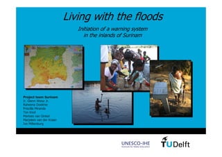
Suriname - Living with the floods

  • 1. Living with the floods Initiation of a warning system in the inlands of Surinam Project team Surinam Ir. Glenn Weisz Jr. Raheena Doekhie Priscilla Miranda Ton Knol Marloes van Ginkel Marjolein van der Kraan Ivo Miltenburg 1
  • 2. Sponsor Duinwaterbedrijf Zuid-Holland Living with the floods 2 Project team Surinam
  • 3. Introduction Cause Project team Surinam Introduction ‘Living with the floods’ Organization Cause Inlands of Surinam Project locations Participation Flooding inlands of Surinam Drinking water May 2006 Introduction Mercury issues Drinking water sources Drinking water systems Flooded area Warning system Introduction Awareness Data allocation Simple Warning system Communication Evacuation plan Introduction Progressive scheme safe area Safe areas Conclusion Flooded villages Recommendations Living with the floods 3 Project team Surinam
  • 4. Introduction Cause Project team Surinam Introduction ‘Living with the floods’ Organization Cause Inlands of Surinam Project locations Participation Flooding inlands of Surinam Drinking water May 2006 Introduction Mercury issues Drinking water sources Drinking water systems Eroded riverbanks Eroded riverbanks Warning system Introduction Awareness Data allocation Simple Warning system Communication Evacuation plan Introduction Uprooted trees Uprooted trees Progressive scheme safe area Safe areas • 22,000 victims Conclusion Recommendations • major damage to buildings/arable land Flooded schools Flooded schools Living with the floods 4 Project team Surinam
  • 5. Introduction Cause Project team Surinam Introduction ‘Living with the floods’ Organization Project team Surinam Inlands of Surinam Project locations Participation Drinking water Introduction Team Mercury issues Drinking water sources members Drinking water systems Warning system Introduction Ton Ton Raheena Raheena Marjolein Marjolein Awareness Data allocation Simple Warning system Communication Evacuation plan Introduction Progressive scheme safe area Safe areas Conclusion Recommendations Glenn Glenn Priscilla Priscilla Marloes Marloes Ivo Ivo Living with the floods 5 Project team Surinam
  • 6. Introduction Cause Project team Surinam Introduction ‘Living with the floods’ Organization ‘Living with the floods’ Inlands of Surinam Project locations Participation Project goals: Drinking water Introduction • Drinking water Mercury issues Drinking water sources • Warning system Drinking water systems • Evacuation plan Warning system Introduction Awareness Data allocation Simple Warning system Communication Evacuation plan Introduction Progressive scheme safe area Safe areas Conclusion Recommendations Living with the floods 6 Project team Surinam
  • 7. Introduction Cause Project team Surinam Introduction ‘Living with the floods’ Organization Organization Inlands of Surinam Project locations Participation • group 1: evacuation, drinking water, communication Drinking water • group 2: warning system, communication Introduction Mercury issues Drinking water sources Drinking water systems Warning system Introduction Awareness Data allocation Simple Warning system Communication Evacuation plan Introduction Progressive scheme safe area Group 1 Group 1 Group 2 Group 2 Safe areas Conclusion Recommendations Living with the floods 7 Project team Surinam
  • 8. Introduction Cause Project team Surinam Introduction ‘Living with the floods’ Organization Organization Inlands of Surinam Project locations Participation Making contact and setting up cooperation Drinking water Introduction Mercury issues Drinking water sources • BIO – cooperating NGO’s in Surinam Drinking water systems Warning system • ADEK – University of Paramaribo Introduction Awareness Data allocation Simple Warning system • Participation of Surinam students Communication Evacuation plan Introduction Progressive scheme safe area Safe areas Conclusion Recommendations Living with the floods 8 Project team Surinam
  • 9. Introduction Cause Project team Surinam Inlands of Surinam ‘Living with the floods’ Organization Project locations Inlands of Surinam Project locations Participation Four village-clusters at PARAMARIBO Boven-Suriname river Paramaribo Drinking water Introduction Mercury issues Drinking water sources • Kayana Drinking water systems • Djoemoe Warning system • Botopasi Introduction Laduani Awareness • Laduani Botopasi Data allocation Djoemoe Simple Warning system Kayana Communication Evacuation plan Introduction Progressive scheme safe area Safe areas Conclusion Recommendations Living with the floods 9 Project team Surinam
  • 10. Introduction Cause Project team Surinam Inlands of Surinam ‘Living with the floods’ Organization Participation Inlands of Surinam Project locations Participation Social hierarchy is very important Drinking water • Granman Introduction Mercury issues • Village board (captain and basja’s) Drinking water sources • Krutu (village meeting) Drinking water systems Warning system Contact with villagers Introduction Awareness • Acceptance of the project Data allocation Simple Warning system • Sharing knowledge Communication • Working together Evacuation plan • Discussing solutions Introduction Progressive scheme • Involving schoolchildren safe area Safe areas Conclusion Recommendations Living with the floods 10 Project team Surinam
  • 11. Introduction Cause Project team Surinam Drinking water ‘Living with the floods’ Organization Introduction Inlands of Surinam Project locations Participation Drinking water Introduction Goals: Mercury issues Drinking water sources Drinking water systems • Analyzing drinking water sources Warning system • Introducing small-scale, simple and robust drinking water Introduction Awareness systems Data allocation Simple Warning system • Assessment of central drinking water system (Djoemoe) Communication Evacuation plan Introduction Progressive scheme safe area Safe areas Conclusion Recommendations Living with the floods 11 Project team Surinam
  • 12. Introduction Cause Project team Surinam Drinking water ‘Living with the floods’ Organization Mercury issues Inlands of Surinam Project locations Participation Drinking water • Maximum mercury concentration of 0.29 ug/l meets WHO Introduction standard for drinking water of < 1.0 ug/l. Mercury issues Drinking water sources Drinking water systems • Exceeds the target value for eco systems of 0.03 ug/l. Warning system Introduction Awareness Data allocation Simple Warning system Communication Evacuation plan Introduction Progressive scheme safe area Safe areas Conclusion Recommendations Living with the floods 12 Project team Surinam
  • 13. Introduction Cause Project team Surinam Drinking water ‘Living with the floods’ Organization Drinking water sources Inlands of Surinam Project locations Participation Drinking water River water Creek water Rain water (storage) Introduction Mercury issues Drinking water sources Drinking water systems Warning system Introduction Awareness Data allocation Simple Warning system Communication Evacuation plan Introduction Progressive scheme safe area Safe areas Conclusion Recommendations Living with the floods 13 Project team Surinam
  • 14. Introduction Cause Project team Surinam Drinking water ‘Living with the floods’ Organization Drinking water sources Inlands of Surinam Water quality Project locations Participation • E.Coli Drinking water Introduction • Total coli form Mercury issues Drinking water sources Drinking water systems River water Creek water Rain water (storage) Warning system Introduction Awareness Data allocation Simple Warning system Communication Evacuation plan Introduction Progressive scheme safe area Safe areas Conclusion Recommendations Living with the floods 14 Project team Surinam
  • 15. Introduction Cause Project team Surinam Drinking water ‘Living with the floods’ Organization Drinking water systems Inlands of Surinam Project locations Participation • Removal of pathogene Drinking water organisms Introduction Mercury issues Drinking water sources Drinking water systems • Ease in use SODIS system Warning system Introduction Awareness Data allocation Simple Warning system Communication Evacuation plan Introduction Progressive scheme safe area Safe areas Conclusion Katadyn Pocket Recommendations Clay pot Katadyn Combi Living with the floods 15 Project team Surinam
  • 16. Introduction Cause Project team Surinam Drinking water ‘Living with the floods’ Organization Drinking water systems Inlands of Surinam Project locations Participation Removal of (most) of pathogene organisms Drinking water • confirmed with all systems Introduction Mercury issues Drinking water sources Drinking water systems Warning system Introduction Awareness Data allocation Simple Warning system Communication Evacuation plan Introduction Progressive scheme safe area Safe areas Conclusion SODIS exposure time of 24 hours on a sink roof: Recommendations • most effective method Living with the floods 16 Project team Surinam
  • 17. Introduction Cause Project team Surinam Drinking water ‘Living with the floods’ Organization Drinking water systems Inlands of Surinam Project locations Participation Ease in use Drinking water Feedback villagers: Introduction Mercury issues Drinking water sources Drinking water systems Warning system Introduction Awareness Data allocation Simple Warning system Communication Evacuation plan Introduction Progressive scheme safe area Safe areas Conclusion Recommendations Katadyn Combi Living with the floods 17 Project team Surinam
  • 18. Introduction Cause Project team Surinam Drinking water ‘Living with the floods’ Organization Drinking water systems Inlands of Surinam Project locations Participation Advise : SODIS system Drinking water Introduction Mercury issues Drinking water sources Drinking water systems Warning system Introduction Awareness Data allocation Simple Warning system Communication Evacuation plan Introduction Progressive scheme safe area Safe areas until all inhabitants have access to central drinking Conclusion water systems or rain water storages……….. Recommendations Living with the floods 18 Project team Surinam
  • 19. Introduction Cause Project team Surinam Warning system ‘Living with the floods’ Organization Introduction Inlands of Surinam Project locations Participation Challenges: Drinking water • Isolated area Introduction • Lack of warning system Mercury issues Drinking water sources • No flood protection possible Drinking water systems • Limited data available Warning system • Expecting more floods in future Introduction Awareness Data allocation Simple Warning system Goals: Communication • Raising awareness Evacuation plan • Start data allocation Introduction Progressive scheme • Initiation of a warning system safe area Safe areas • Communication Conclusion Recommendations Living with the floods 19 Project team Surinam
  • 20. Introduction Cause Project team Surinam Warning system ‘Living with the floods’ Organization Awareness Inlands of Surinam Project locations Participation Important for future Drinking water safety and continuity Introduction Mercury issues Drinking water sources Drinking water systems Warning system Introduction Awareness Data allocation Simple Warning system Communication Evacuation plan Introduction Progressive scheme safe area Safe areas • Providing information • Working with villagers Conclusion Recommendations Living with the floods 20 Project team Surinam
  • 21. Introduction Cause Project team Surinam Warning system ‘Living with the floods’ Organization Awareness Inlands of Surinam Project locations Participation Building a monument at the Drinking water floodline on a central location Introduction Mercury issues Drinking water sources Drinking water systems Warning system Introduction Awareness Data allocation Simple Warning system Communication Evacuation plan Introduction Progressive scheme safe area Safe areas Conclusion Recommendations Living with the floods 21 Project team Surinam
  • 22. Introduction Cause Project team Surinam Warning system ‘Living with the floods’ Organization Data allocation Inlands of Surinam Project locations Participation Waterlevel gauges - preparation Drinking water Introduction Mercury issues Drinking water sources Drinking water systems Warning system Introduction Awareness Data allocation Simple Warning system Communication Evacuation plan Introduction Progressive scheme safe area Safe areas Conclusion Recommendations Living with the floods 22 Project team Surinam
  • 23. Introduction Cause Project team Surinam Warning system ‘Living with the floods’ Organization Data allocation Inlands of Surinam Project locations Participation Waterlevel gauges - result Drinking water Introduction Mercury issues Drinking water sources Drinking water systems Warning system Introduction Awareness Data allocation Simple Warning system Communication Evacuation plan Introduction Progressive scheme safe area Safe areas Conclusion Recommendations Living with the floods 23 Project team Surinam
  • 24. Introduction Cause Project team Surinam Warning system ‘Living with the floods’ Organization Data allocation Inlands of Surinam Project locations Participation Rain gauges – placed by hydrologist S. Naipal Drinking water Introduction Mercury issues Drinking water sources Drinking water systems Warning system Introduction Awareness Data allocation Simple Warning system Communication Evacuation plan Introduction Progressive scheme safe area Safe areas Conclusion Recommendations Living with the floods 24 Project team Surinam
  • 25. Introduction Cause Project team Surinam Warning system ‘Living with the floods’ Organization Simple warning system Inlands of Surinam Project locations Participation Goal: Drinking water • h-h relations between inland villages Introduction Mercury issues Drinking water sources Drinking water systems Waterlevel Kayana Warning system Introduction Awareness Data allocation Simple Warning system Communication Forecast Evacuation plan waterlevel Introduction Djoemoe Progressive scheme Working of the safe area Safe areas warning system Conclusion Recommendations Living with the floods 25 Project team Surinam
  • 26. Introduction Cause Project team Surinam Warning system ‘Living with the floods’ Organization Simple warning system Inlands of Surinam Project locations Participation Measuring river and land profile Drinking water Introduction Mercury issues Drinking water sources Drinking water systems Warning system Using a Diver Using a Diver Introduction Awareness Data allocation 30 30 Simple Warning system Communication Profile Kayana Profile Kayana 25 25 Evacuation plan 20 20 Introduction 15 Progressive scheme 15 safe area 10 10 Safe areas 5 5 Conclusion 0 Recommendations -800 -800 -600 -600 -400 -400 -200 -200 0 0 0 200 200 Living with the floods 26 Project team Surinam
  • 27. Introduction Cause Project team Surinam Warning system ‘Living with the floods’ Organization Simple warning system Inlands of Surinam Project locations Participation Determining Q-h relations using Strickler’s Formula Drinking water Introduction Q = kAR 2 / 3 s1/ 2 Mercury issues Drinking water sources Drinking water systems Estimation of slope (s) and roughness (k) Warning system Introduction 3000 Awareness Data allocation 2500 Simple Warning system Communication 2000 1500 • No kalibration possible Q Evacuation plan 1000 due to lack of historical Introduction Progressive scheme 500 data safe area Safe areas 0 0 2 4 6 8 10 12 14 • Not able to produce Conclusion h accurate h-h relations Recommendations Q-h relation Djoemoe Living with the floods 27 Project team Surinam
  • 28. Introduction Cause Project team Surinam Warning system ‘Living with the floods’ Organization Simple warning system Inlands of Surinam Project locations Participation Final warning system product: Drinking water Introduction Profile-sheet Mercury issues Drinking water sources • river and land profile linked with the gauge in the village Drinking water systems • critical depth Waarschuwingssysteem Djoemoe Warning system In de figuur hieronder ziet u het rivierprofiel van Djoemoe bij de peilschalen. Introduction Goddo op peillat 450 Waterhoogte 400 350 300 Djoemoe - Medische post Awareness 250 200 850 150 100 Waterhoogte 800 Data allocation Vliegveld op peillat 750 Kajana -130 -80 -30 50 0 -50 -100 20 70 120 Afstand 700 -150 -200 Simple Warning system 650 600 -250 -300 -350 -400 -100 -450 Communication 550 500 -500 -550 -600 -650 Kritieke waterhoogte 450 -700 -750 400 -800 -850 350 -900 Evacuation plan -950 300 -1000 -1050 -1100 250 Kritieke waterhoogte -1150 -1200 200 -1250 Introduction 300 150 100 Rivierprofiel Waterhoogte mei 2006 Kritieke waterhoogte Progressive scheme 50 0 In dit rivierprofiel is met de blauwe lijn de hoogste waterstand tijdens de overstroming van mei 2006 aangegeven. De waterhoogte in mei 2006 kwam tot de safe area -300 -250 -200 -150 -100 -50 -50 0 -100 50 100 Afstand 150 stand +75 centimeter op de peilschalen. Het monument bij de medische post in Djoemoe geeft deze hoogte aan. Deze -150 waterstand kan bij een volgende overstroming worden overschreden en geeft dus Safe areas -200 geen veilige hoogte aan. -250 -300 Met de rode lijn is de kritieke hoogte aangegeven. De kritieke hoogte is de -350 waterstand waarbij rekening moet worden gehouden met overstromingen. De kritieke Conclusion waterhoogte is bij een stand van - 125 centimeter op de peilschalen. -400 Gevaar dreigt als het hard regent en de waterhoogte snel stijgt. Bij de stand van -450 - 125 centimeter moet de stijgsnelheid van het water goed in de gaten worden -500 gehouden, zodat de bewoners van Djoemoe snel gewaarschuwd kunnen worden Recommendations -1250 -550 -600 wanneer het water van de rivier nog verder stijgt. Als de waterhoogte de kritieke waterhoogte passeert moet Botopasi gewaarschuwd worden dat er hoog water op komst is. Rivierprofiel Waterhoogte mei 2006 Kritieke waterhoogte Living with the floods 28 Project team Surinam
  • 29. Introduction Cause Project team Surinam Warning system ‘Living with the floods’ Organization Communication Inlands of Surinam Project locations Participation Communication necessary Drinking water Introduction Stable situation Mercury issues Drinking water sources • uniform messages Drinking water systems • radio contact Warning system villages-Paramaribo Introduction Awareness Data allocation Simple Warning system Critical / emergency Communication situation Evacuation plan • radio contact Introduction Progressive scheme villages-villages safe area Safe areas • emergency communication in villages (hierarchical Conclusion Recommendations network) Living with the floods 29 Project team Surinam
  • 30. Introduction Cause Project team Surinam Evacuation plan ‘Living with the floods’ Organization Introduction Inlands of Surinam Project locations Participation Evacuation plan important in case of Drinking water future floodings Introduction Mercury issues Drinking water sources Challenges: Drinking water systems • No evacuation plan available Warning system • Many houses in risk areas close to Introduction Awareness the river Data allocation Simple Warning system • No notion inhabitants of safe areas Communication Evacuation plan Introduction Progressive scheme Goals: safe area Safe areas • Developing a progressive scheme to determine safe areas Conclusion Recommendations • Identification safe areas in Kayana, Godo and Botopasi Living with the floods 30 Project team Surinam
  • 31. Introduction Cause Project team Surinam Evacuation plan ‘Living with the floods’ Organization Progressive scheme safe area Inlands of Surinam Project locations Participation A progressive scheme to determine safe areas: Drinking water Introduction Mercury issues 1. 1. Geography – location of the village Geography – location of the village Drinking water sources 2. 2. Identification inhabited areas Identification inhabited areas Drinking water systems 3. 3. Measuring water level May 2006 Measuring water level May 2006 Warning system 4. Mapping topography villages Introduction 4. Mapping topography villages Awareness 5. 5. Identification safe areas Identification safe areas Data allocation Simple Warning system 6. 6. Mapping walking paths Mapping walking paths Communication 7. 7. Conclusion about availability and Conclusion about availability and Evacuation plan accessibility safe areas accessibility safe areas Introduction Progressive scheme safe area Safe areas Conclusion Recommendations Living with the floods 31 Project team Surinam
  • 32. Introduction Cause Project team Surinam Evacuation plan ‘Living with the floods’ Organization Safe areas Inlands of Surinam Project locations Participation Case study: Kayana Drinking water Introduction Mercury issues Drinking water sources Drinking water systems Warning system Introduction Awareness Data allocation 2. Inhabited area 2. Inhabited area 3. Flooded area 3. Flooded area Simple Warning system Communication Evacuation plan Introduction Progressive scheme safe area Safe areas Conclusion Recommendations 5. Safe area 5. Safe area 7. Conclusion 7. Conclusion Living with the floods 32 Project team Surinam
  • 33. Introduction Cause Project team Surinam Evacuation plan ‘Living with the floods’ Organization Safe areas Inlands of Surinam Project locations Participation Case study: Godo Drinking water Introduction Mercury issues Drinking water sources Drinking water systems Warning system Introduction Awareness Data allocation 2. Inhabited area 3. Flooded area Simple Warning system 2. Inhabited area 3. Flooded area Communication Evacuation plan Introduction Progressive scheme safe area Safe areas Conclusion Recommendations 5. Safe area 7. Conclusion 5. Safe area 7. Conclusion Living with the floods 33 Project team Surinam
  • 34. Introduction Cause Project team Surinam Conclusion ‘Living with the floods’ Organization Inlands of Surinam Project locations Participation • Mercury concentrations sufficiently low in the water Drinking water phase Introduction • SODIS system is advised to use in case of calamities Mercury issues Drinking water sources Drinking water systems • Awareness through monument and participation Warning system • Data allocation is started Introduction Awareness • Simple warning system usable Data allocation Simple Warning system • Communication between villages and between the inlands Communication of Surinam and Paramaribo is tested and functioning Evacuation plan Introduction Progressive scheme • Safe areas in the villages can be determined safe area Safe areas Conclusion Recommendations Living with the floods 34 Project team Surinam
  • 35. Introduction Cause Project team Surinam Recommendations ‘Living with the floods’ Organization Inlands of Surinam Project locations Participation • Education of the concept : ‘safe drinking water’ Drinking water • Introduction of the SODIS to all inhabitants of the villages Introduction Mercury issues Drinking water sources Drinking water systems • Complete hydrological warning system • Continuity: responsibility and maintenance Warning system Introduction • Test emergency communication Awareness Data allocation Simple Warning system • Topographical research in other villages to determine Communication more safe areas Evacuation plan • Work out evacuation plan Introduction Progressive scheme safe area Safe areas Conclusion Recommendations Living with the floods 35 Project team Surinam
  • 36. Living with the floods 36 Project team Surinam
  • 37. Sponsor Duinwaterbedrijf Zuid-Holland Living with the floods 37 Project team Surinam