SlideShare ist ein Scribd-Unternehmen logo
1 von 2
Downloaden Sie, um offline zu lesen
APPLICATION DATA SHEET
THROW AWAY MAPS
PUT YOUR BUSINESS DATA ON A MAP
Capturing, analysing and presenting information on maps (Geospatial Intelligence) 
is extremely useful to accurately associate customers, assets and activities with 
geographic locations. Encanvas Maps™ is a versatile mapping application that 
everyone can use. It integrates closely with most data sources and digital map 
resources including Openstreetmap.org and other popular mapping services.
Enterprise geo­spatial mapping just as you 
imagined it should be
Geospatial	mapping	applications	have	always	
required	specialist	software	and	tools.	Why	are	
these	applications	so	complicated	that	they	demand	
specialist	skills	in	IT	teams	to	use	them? As	the	
business	value	of	location	data	has	been	realised	‐
achieving	productivity	gains,	removing	
inefficiencies,	improving	coordination	etc.	– the	
number	of	processes	requiring	geospatial	
technology	has	grown	substantially.	No	longer	is	it	
affordable	or	sensible	to	purchase dedicated	and	
prescriptive	geospatial	solutions	for	each	specific	
process	across	an	organization	that	could	benefit	
from	it.
View your business world on one map
Encanvas	Maps makes	geospatial	mapping	
technology	available	to	everyone	in	the	enterprise.	
It	employs	a	point‐and‐click	environment	to	create	
new	views	of	data.	Acquire	data	from	back‐office	
systems	and	legacy	GIS	platforms	to	build	modern	
portal	and	mobile	mapping	solutions. Encanvas	
Maps is	built	on	the	Encanvas	platform	and	includes	
integration	tools	that	mean	different	sources	of	data	
can	be	mashed	together	to	form	new	federated	
views.
Coherent data architecture
Encanvas	Maps treats	every	plotted	data	item	as	a	
pin	associated	with	data	held	in	a	database	record.	
This	means	collections	of	‘pins’	can	be	filtered	in	a	
flexible	way	to	make	it	easy	to	present	users	with	
only	the	information	they’re	interested	in.	It	also	
means	that	Encanvas can	store	geospatial	data	
assets	in	any	form	of	relational	database.
Unrivalled performance
Whether	you’re	using	Encanvas	Maps™ on a	web‐
browser	or	a	mobile	device,	you’ll	be	surprised	how	
quickly	maps	are	presented.	This	is	due	to	the	clever	
way	that	maps	are	presented	in	tiles	(so	the	entire	
image	doesn’t	need	to	build	all	at	once)	and	the	
underlying	data	architecture	that	means	data	
queries	can	be	rapidly	composed.
Scalability that knows no bounds
Encanvas	Maps is	used	for	some	of	the	most	
demanding	geo‐coding	applications.	Use	it to	
support	millions	of	data	items	and	still	experience	
blistering	response	speeds.	
Business intelligence
Encanvas	Maps benefits	from	its	role	as	a	
component	of	the	Encanvas	information	
management	architecture	which	means	rich	
features	such	as	dynamic	forms,	email	notifications,	
table	views,	charting	and	traffic	lights	and	dials	may
be	customized	to	service	mapping	applications.
Unparalleled usability
Encanvas	Maps	is	really	easy	to	use.	Interfaces	are	
clean	and	designed	to	work	in	a	coherent	way	with	
common	desktop	applications	to	minimize	user‐
training	overheads.	
Why Use Encanvas for MAPS?
Add
Web browser‐based mapping 
engine
Maps to existing applications
Mobile mapping applications
Simple integration with existing 
applications
24x7 access to maps via pc, 
tablet or mobile
Support for legacy mapping 
resources including shape‐files
Grow
Use and access to mapping 
applications across the 
enterprise.
Input data directly onto maps
Mapping options with the choice 
of simple web 2.0 styled pop‐up 
mapping details or mass‐data 
views
Reduce
Time to market on map‐based 
applications developments
Remove
Inflated GIS software license and 
support costs
Feature Benefit
Build geospatial mapping 
applications without code
Create geospatial mapping applications for capture, 
analysis and presentation of information without 
programming, scripting or GIS expertise
Democratizes mapping Remove the complexity and high costs of GIS 
technology and its associated IT resources from the 
enterprise
Security over conference and 
materials
Give users across the enterprise the ability to capture 
and present geospatial information how they want to
‘Data mashup’ capabilities 
come as standard
Blend data from disparate systems across the 
enterprise with powerful data mashup capabilities to 
create federated map views
Ultra­responsive mapping Improve the speed and performance of mapping 
application presented on websites with Encanvas 
Vector Map Format – the better way to manage GIS 
data
Extend legacy IT systems Integrate mapping functionality into legacy business 
systems
Available on­premises Optional on‐premises install is completely automated
An integrated component of 
the Encanvas DX platform
For class‐leading user identity management, group 
creation, website administration, business analytics,
data governance/security, data entry and applications 
customization capabilities.
For more information
For	further	details	about	Encanvas visit	www.encanvas.com.
©	2017	Encanvas.	All	rights	reserved.	
Encanvas® is	a	registered	trademark.	All	other	trademarks	and	trade	names	are	acknowledged	as	belonging	to	their	
respective	owners.	Encanvas® reserves	the	right	to	modify	specifications	of	applications	without	notice.
www.encanvas.com
Supporting a mix of referencing systems
Some	geospatial	applications	require	longitude	and	
latitude	references while	others	use	eastings	and	
northings.	Encanvas supports	both.
Improve display performance with Encanvas 
Vector Map Format (VMF)
Encanvas	VMF	is	a	binary	code	format	data	file	that	
can	be	saved	in	any	form	of	ODBC	database	and	
provides	ultra‐fast	browser	presentation	without	
requiring	plug‐ins	or	downloads!
Tried and tested, and tested again!
Encanvas	has	been	tested	on	a	range	of	browsers	
including	Internet	Explorer	6,	7	and	8,	Google	
Chrome	3,	Mozilla	Firefox,	Apple	Safari	4 and	
Opera to	provide	trusted	technology	for	engaging	
with	colleagues,	partners	and	customers.
Use examples
Common	applications	include	customer	
management,	transport	and	street‐works,	urban	
regeneration,	civil	defence	and	contingency	
planning,	asset	management,	risk	management	and	
customer	service.
Simple deployment
Encanvas	is	a	cloud‐deployed	platform. All	that	
users	need	to	access	it	is	a	web	browser.	No	client	
install	is	required.	
How we compare...
You’ll	be	surprised	how	Encanvas	outperforms	even	
the	big	names	in	geo‐spatial	software	through:
Affordability
Advanced	data	mashup	connectivity
Code‐free	authoring	of	geo‐spatial	applications
Built‐in	business	intelligence	and	dashboarding
Data	capture	forms
Enterprise	scalability
Encanvas is a cloud­deployed 
application fabric. No client 
installation is required. Private 
cloud and host platform options are 
available for in­house deployments
Host platform
Microsoft® Windows Small Business 
Server 2003 through to Windows 
Server 2016. Requires Microsoft® SQL 
Server or Microsoft® SQL Server 
Express (not supplied).
Supported formats
Encanvas acquires and presents data 
sourced from front‐office files (like 
.CSV and .XLS), back‐office systems 
(like relational databases) and 
Shapefiles (composite ESRI® format), 
TAB, MIF (composites used by 
MapInfo®), GML files (composite used 
by MasterMap™)
Other applications
Live Wire‐Frame
Dashboards
Robotic Process Automation
IoT & Big Data
Digital Transformation
Digital City 
Business Intelligence
Life‐Cycle Dashboards

Weitere ähnliche Inhalte

Was ist angesagt?

3D Results 3DRCube
3D Results 3DRCube3D Results 3DRCube
3D Results 3DRCube
Steve Jensen
 
CWT-AnalytIQs---Online-Press-Kit
CWT-AnalytIQs---Online-Press-KitCWT-AnalytIQs---Online-Press-Kit
CWT-AnalytIQs---Online-Press-Kit
Robert Cole
 
Unleashing the Power of Collective Insight :: Analytics solutions from Glintt...
Unleashing the Power of Collective Insight :: Analytics solutions from Glintt...Unleashing the Power of Collective Insight :: Analytics solutions from Glintt...
Unleashing the Power of Collective Insight :: Analytics solutions from Glintt...
Rui Valente
 

Was ist angesagt? (11)

Vejen til digital transformation
Vejen til digital transformationVejen til digital transformation
Vejen til digital transformation
 
3D Results 3DRCube
3D Results 3DRCube3D Results 3DRCube
3D Results 3DRCube
 
Who Is Data Transformed
Who Is Data TransformedWho Is Data Transformed
Who Is Data Transformed
 
Big Data in Cloud: Seize your Insight Like a Golden Snitch (Margaret Ostapchu...
Big Data in Cloud: Seize your Insight Like a Golden Snitch (Margaret Ostapchu...Big Data in Cloud: Seize your Insight Like a Golden Snitch (Margaret Ostapchu...
Big Data in Cloud: Seize your Insight Like a Golden Snitch (Margaret Ostapchu...
 
Real-Time Analytics: The Future of Big Data in the Agency
Real-Time Analytics: The Future of Big Data in the AgencyReal-Time Analytics: The Future of Big Data in the Agency
Real-Time Analytics: The Future of Big Data in the Agency
 
Big Data Services
Big Data ServicesBig Data Services
Big Data Services
 
Digital transformation - Hvor er vi lige nu?
Digital transformation -  Hvor er vi lige nu?Digital transformation -  Hvor er vi lige nu?
Digital transformation - Hvor er vi lige nu?
 
CWT-AnalytIQs---Online-Press-Kit
CWT-AnalytIQs---Online-Press-KitCWT-AnalytIQs---Online-Press-Kit
CWT-AnalytIQs---Online-Press-Kit
 
Anastasiya Kochepasova's program manager
Anastasiya Kochepasova's program managerAnastasiya Kochepasova's program manager
Anastasiya Kochepasova's program manager
 
Unleashing the Power of Collective Insight :: Analytics solutions from Glintt...
Unleashing the Power of Collective Insight :: Analytics solutions from Glintt...Unleashing the Power of Collective Insight :: Analytics solutions from Glintt...
Unleashing the Power of Collective Insight :: Analytics solutions from Glintt...
 
'Location, Location, Location' - Location Matters Seminar 29 Mar 2012
'Location, Location, Location' - Location Matters Seminar 29 Mar 2012'Location, Location, Location' - Location Matters Seminar 29 Mar 2012
'Location, Location, Location' - Location Matters Seminar 29 Mar 2012
 

Ähnlich wie Encanvas maps data sheet

Alteryx (Tri Fild) Brochure V2 Low Res
Alteryx (Tri Fild) Brochure V2 Low ResAlteryx (Tri Fild) Brochure V2 Low Res
Alteryx (Tri Fild) Brochure V2 Low Res
lduane
 
MCS GEOTECH (P) LTD gis solutions
MCS GEOTECH (P) LTD gis solutionsMCS GEOTECH (P) LTD gis solutions
MCS GEOTECH (P) LTD gis solutions
MCS GEOTECH (P) LTD
 
Visually enabled business processes to enrich the user experience
Visually enabled business processes to enrich the user experienceVisually enabled business processes to enrich the user experience
Visually enabled business processes to enrich the user experience
robgirvan
 
Mapping GIS to Enterprise Architecture and Analytics
Mapping GIS to Enterprise Architecture and AnalyticsMapping GIS to Enterprise Architecture and Analytics
Mapping GIS to Enterprise Architecture and Analytics
Dennis Crow
 

Ähnlich wie Encanvas maps data sheet (20)

Esri Maps for SAP BusinessObjects
Esri Maps for SAP BusinessObjectsEsri Maps for SAP BusinessObjects
Esri Maps for SAP BusinessObjects
 
JA SERVICES PROFILE
JA SERVICES PROFILEJA SERVICES PROFILE
JA SERVICES PROFILE
 
Encanvas Dashboards
Encanvas DashboardsEncanvas Dashboards
Encanvas Dashboards
 
Alteryx (Tri Fild) Brochure V2 Low Res
Alteryx (Tri Fild) Brochure V2 Low ResAlteryx (Tri Fild) Brochure V2 Low Res
Alteryx (Tri Fild) Brochure V2 Low Res
 
MCS GEOTECH (P) LTD gis solutions
MCS GEOTECH (P) LTD gis solutionsMCS GEOTECH (P) LTD gis solutions
MCS GEOTECH (P) LTD gis solutions
 
Mapping application
Mapping applicationMapping application
Mapping application
 
Ibisa platform EN
Ibisa platform ENIbisa platform EN
Ibisa platform EN
 
Esri Maps for MicroStrategy
Esri Maps for MicroStrategyEsri Maps for MicroStrategy
Esri Maps for MicroStrategy
 
Geo Everything White Paper on Collaborating Web 2.0 Mapping
Geo Everything White Paper on Collaborating Web 2.0 MappingGeo Everything White Paper on Collaborating Web 2.0 Mapping
Geo Everything White Paper on Collaborating Web 2.0 Mapping
 
Collateral Copywriting
Collateral CopywritingCollateral Copywriting
Collateral Copywriting
 
SQL Anywhere- Solution Brief- Embed Data Management in Your Mobile &Remote Ap...
SQL Anywhere- Solution Brief- Embed Data Management in Your Mobile &Remote Ap...SQL Anywhere- Solution Brief- Embed Data Management in Your Mobile &Remote Ap...
SQL Anywhere- Solution Brief- Embed Data Management in Your Mobile &Remote Ap...
 
Esri Location Analytics
Esri Location AnalyticsEsri Location Analytics
Esri Location Analytics
 
Visually enabled business processes to enrich the user experience
Visually enabled business processes to enrich the user experienceVisually enabled business processes to enrich the user experience
Visually enabled business processes to enrich the user experience
 
Geosuiteonline EN
Geosuiteonline ENGeosuiteonline EN
Geosuiteonline EN
 
Mapping GIS to Enterprise Architecture and Analytics
Mapping GIS to Enterprise Architecture and AnalyticsMapping GIS to Enterprise Architecture and Analytics
Mapping GIS to Enterprise Architecture and Analytics
 
Location Intelligence - The where factor
Location Intelligence - The where factorLocation Intelligence - The where factor
Location Intelligence - The where factor
 
Web Based GIS
Web Based GISWeb Based GIS
Web Based GIS
 
Esri Maps for Dynamics CRM
Esri Maps for Dynamics CRMEsri Maps for Dynamics CRM
Esri Maps for Dynamics CRM
 
freeDatamap presentation - data visualization BI & GIS -
freeDatamap presentation - data visualization BI & GIS -freeDatamap presentation - data visualization BI & GIS -
freeDatamap presentation - data visualization BI & GIS -
 
ArcGIS for Desktop
ArcGIS for DesktopArcGIS for Desktop
ArcGIS for Desktop
 

Mehr von Newton Day Uploads

Mehr von Newton Day Uploads (20)

Guide to Conversational Paths
Guide to Conversational PathsGuide to Conversational Paths
Guide to Conversational Paths
 
Encanvas introduction brochure 2017
Encanvas introduction brochure 2017Encanvas introduction brochure 2017
Encanvas introduction brochure 2017
 
Case story regional transport authority
Case story regional transport authorityCase story regional transport authority
Case story regional transport authority
 
Case story local government streetworks compliance
Case story local government streetworks complianceCase story local government streetworks compliance
Case story local government streetworks compliance
 
Case story electronics research
Case story electronics researchCase story electronics research
Case story electronics research
 
Case story local government performance
Case story local government performanceCase story local government performance
Case story local government performance
 
Case story office equipment competitive intelligence
Case story office equipment competitive intelligenceCase story office equipment competitive intelligence
Case story office equipment competitive intelligence
 
Case story office equipment_compliance reporting
Case story office equipment_compliance reportingCase story office equipment_compliance reporting
Case story office equipment_compliance reporting
 
Case story professional services horizon scanning
Case story professional services horizon scanningCase story professional services horizon scanning
Case story professional services horizon scanning
 
Case story regional transport authority platform modernization
Case story regional transport authority platform modernizationCase story regional transport authority platform modernization
Case story regional transport authority platform modernization
 
Live wireframe data mashups overview brochure
Live wireframe data mashups overview brochureLive wireframe data mashups overview brochure
Live wireframe data mashups overview brochure
 
Encanvas IFD Data Sheet
Encanvas IFD Data Sheet Encanvas IFD Data Sheet
Encanvas IFD Data Sheet
 
Encanvas Remote(Spaces) Data Sheet
Encanvas Remote(Spaces) Data SheetEncanvas Remote(Spaces) Data Sheet
Encanvas Remote(Spaces) Data Sheet
 
Encanvas for Big Data_ Brochure
Encanvas for Big Data_ BrochureEncanvas for Big Data_ Brochure
Encanvas for Big Data_ Brochure
 
Encanvas for IoT brochure
Encanvas for IoT brochureEncanvas for IoT brochure
Encanvas for IoT brochure
 
Encanvas introduction 2017
Encanvas introduction 2017Encanvas introduction 2017
Encanvas introduction 2017
 
Extensibility Briefing 2017
Extensibility Briefing 2017Extensibility Briefing 2017
Extensibility Briefing 2017
 
Live-Wireframing Versus Programming
Live-Wireframing Versus ProgrammingLive-Wireframing Versus Programming
Live-Wireframing Versus Programming
 
Encanvas digital transformation data sheet
Encanvas digital transformation data sheetEncanvas digital transformation data sheet
Encanvas digital transformation data sheet
 
Encanvas iot and big data data sheet
Encanvas iot and big data data sheetEncanvas iot and big data data sheet
Encanvas iot and big data data sheet
 

Kürzlich hochgeladen

Abortion Pills In Pretoria ](+27832195400*)[ 🏥 Women's Abortion Clinic In Pre...
Abortion Pills In Pretoria ](+27832195400*)[ 🏥 Women's Abortion Clinic In Pre...Abortion Pills In Pretoria ](+27832195400*)[ 🏥 Women's Abortion Clinic In Pre...
Abortion Pills In Pretoria ](+27832195400*)[ 🏥 Women's Abortion Clinic In Pre...
Medical / Health Care (+971588192166) Mifepristone and Misoprostol tablets 200mg
 
Love witchcraft +27768521739 Binding love spell in Sandy Springs, GA |psychic...
Love witchcraft +27768521739 Binding love spell in Sandy Springs, GA |psychic...Love witchcraft +27768521739 Binding love spell in Sandy Springs, GA |psychic...
Love witchcraft +27768521739 Binding love spell in Sandy Springs, GA |psychic...
chiefasafspells
 
%+27788225528 love spells in Boston Psychic Readings, Attraction spells,Bring...
%+27788225528 love spells in Boston Psychic Readings, Attraction spells,Bring...%+27788225528 love spells in Boston Psychic Readings, Attraction spells,Bring...
%+27788225528 love spells in Boston Psychic Readings, Attraction spells,Bring...
masabamasaba
 

Kürzlich hochgeladen (20)

WSO2CON 2024 Slides - Open Source to SaaS
WSO2CON 2024 Slides - Open Source to SaaSWSO2CON 2024 Slides - Open Source to SaaS
WSO2CON 2024 Slides - Open Source to SaaS
 
%in Soweto+277-882-255-28 abortion pills for sale in soweto
%in Soweto+277-882-255-28 abortion pills for sale in soweto%in Soweto+277-882-255-28 abortion pills for sale in soweto
%in Soweto+277-882-255-28 abortion pills for sale in soweto
 
%in Benoni+277-882-255-28 abortion pills for sale in Benoni
%in Benoni+277-882-255-28 abortion pills for sale in Benoni%in Benoni+277-882-255-28 abortion pills for sale in Benoni
%in Benoni+277-882-255-28 abortion pills for sale in Benoni
 
Architecture decision records - How not to get lost in the past
Architecture decision records - How not to get lost in the pastArchitecture decision records - How not to get lost in the past
Architecture decision records - How not to get lost in the past
 
Abortion Pills In Pretoria ](+27832195400*)[ 🏥 Women's Abortion Clinic In Pre...
Abortion Pills In Pretoria ](+27832195400*)[ 🏥 Women's Abortion Clinic In Pre...Abortion Pills In Pretoria ](+27832195400*)[ 🏥 Women's Abortion Clinic In Pre...
Abortion Pills In Pretoria ](+27832195400*)[ 🏥 Women's Abortion Clinic In Pre...
 
Announcing Codolex 2.0 from GDK Software
Announcing Codolex 2.0 from GDK SoftwareAnnouncing Codolex 2.0 from GDK Software
Announcing Codolex 2.0 from GDK Software
 
Love witchcraft +27768521739 Binding love spell in Sandy Springs, GA |psychic...
Love witchcraft +27768521739 Binding love spell in Sandy Springs, GA |psychic...Love witchcraft +27768521739 Binding love spell in Sandy Springs, GA |psychic...
Love witchcraft +27768521739 Binding love spell in Sandy Springs, GA |psychic...
 
WSO2Con2024 - Enabling Transactional System's Exponential Growth With Simplicity
WSO2Con2024 - Enabling Transactional System's Exponential Growth With SimplicityWSO2Con2024 - Enabling Transactional System's Exponential Growth With Simplicity
WSO2Con2024 - Enabling Transactional System's Exponential Growth With Simplicity
 
%in kempton park+277-882-255-28 abortion pills for sale in kempton park
%in kempton park+277-882-255-28 abortion pills for sale in kempton park %in kempton park+277-882-255-28 abortion pills for sale in kempton park
%in kempton park+277-882-255-28 abortion pills for sale in kempton park
 
WSO2CON2024 - It's time to go Platformless
WSO2CON2024 - It's time to go PlatformlessWSO2CON2024 - It's time to go Platformless
WSO2CON2024 - It's time to go Platformless
 
%+27788225528 love spells in Boston Psychic Readings, Attraction spells,Bring...
%+27788225528 love spells in Boston Psychic Readings, Attraction spells,Bring...%+27788225528 love spells in Boston Psychic Readings, Attraction spells,Bring...
%+27788225528 love spells in Boston Psychic Readings, Attraction spells,Bring...
 
AI & Machine Learning Presentation Template
AI & Machine Learning Presentation TemplateAI & Machine Learning Presentation Template
AI & Machine Learning Presentation Template
 
%in Rustenburg+277-882-255-28 abortion pills for sale in Rustenburg
%in Rustenburg+277-882-255-28 abortion pills for sale in Rustenburg%in Rustenburg+277-882-255-28 abortion pills for sale in Rustenburg
%in Rustenburg+277-882-255-28 abortion pills for sale in Rustenburg
 
WSO2CON 2024 - Does Open Source Still Matter?
WSO2CON 2024 - Does Open Source Still Matter?WSO2CON 2024 - Does Open Source Still Matter?
WSO2CON 2024 - Does Open Source Still Matter?
 
tonesoftg
tonesoftgtonesoftg
tonesoftg
 
Direct Style Effect Systems - The Print[A] Example - A Comprehension Aid
Direct Style Effect Systems -The Print[A] Example- A Comprehension AidDirect Style Effect Systems -The Print[A] Example- A Comprehension Aid
Direct Style Effect Systems - The Print[A] Example - A Comprehension Aid
 
WSO2CON 2024 - Navigating API Complexity: REST, GraphQL, gRPC, Websocket, Web...
WSO2CON 2024 - Navigating API Complexity: REST, GraphQL, gRPC, Websocket, Web...WSO2CON 2024 - Navigating API Complexity: REST, GraphQL, gRPC, Websocket, Web...
WSO2CON 2024 - Navigating API Complexity: REST, GraphQL, gRPC, Websocket, Web...
 
%in Hazyview+277-882-255-28 abortion pills for sale in Hazyview
%in Hazyview+277-882-255-28 abortion pills for sale in Hazyview%in Hazyview+277-882-255-28 abortion pills for sale in Hazyview
%in Hazyview+277-882-255-28 abortion pills for sale in Hazyview
 
%in tembisa+277-882-255-28 abortion pills for sale in tembisa
%in tembisa+277-882-255-28 abortion pills for sale in tembisa%in tembisa+277-882-255-28 abortion pills for sale in tembisa
%in tembisa+277-882-255-28 abortion pills for sale in tembisa
 
WSO2CON 2024 - WSO2's Digital Transformation Journey with Choreo: A Platforml...
WSO2CON 2024 - WSO2's Digital Transformation Journey with Choreo: A Platforml...WSO2CON 2024 - WSO2's Digital Transformation Journey with Choreo: A Platforml...
WSO2CON 2024 - WSO2's Digital Transformation Journey with Choreo: A Platforml...
 

Encanvas maps data sheet

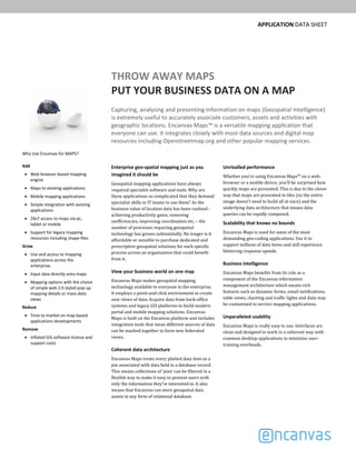
  • 1. APPLICATION DATA SHEET THROW AWAY MAPS PUT YOUR BUSINESS DATA ON A MAP Capturing, analysing and presenting information on maps (Geospatial Intelligence)  is extremely useful to accurately associate customers, assets and activities with  geographic locations. Encanvas Maps™ is a versatile mapping application that  everyone can use. It integrates closely with most data sources and digital map  resources including Openstreetmap.org and other popular mapping services. Enterprise geo­spatial mapping just as you  imagined it should be Geospatial mapping applications have always required specialist software and tools. Why are these applications so complicated that they demand specialist skills in IT teams to use them? As the business value of location data has been realised ‐ achieving productivity gains, removing inefficiencies, improving coordination etc. – the number of processes requiring geospatial technology has grown substantially. No longer is it affordable or sensible to purchase dedicated and prescriptive geospatial solutions for each specific process across an organization that could benefit from it. View your business world on one map Encanvas Maps makes geospatial mapping technology available to everyone in the enterprise. It employs a point‐and‐click environment to create new views of data. Acquire data from back‐office systems and legacy GIS platforms to build modern portal and mobile mapping solutions. Encanvas Maps is built on the Encanvas platform and includes integration tools that mean different sources of data can be mashed together to form new federated views. Coherent data architecture Encanvas Maps treats every plotted data item as a pin associated with data held in a database record. This means collections of ‘pins’ can be filtered in a flexible way to make it easy to present users with only the information they’re interested in. It also means that Encanvas can store geospatial data assets in any form of relational database. Unrivalled performance Whether you’re using Encanvas Maps™ on a web‐ browser or a mobile device, you’ll be surprised how quickly maps are presented. This is due to the clever way that maps are presented in tiles (so the entire image doesn’t need to build all at once) and the underlying data architecture that means data queries can be rapidly composed. Scalability that knows no bounds Encanvas Maps is used for some of the most demanding geo‐coding applications. Use it to support millions of data items and still experience blistering response speeds. Business intelligence Encanvas Maps benefits from its role as a component of the Encanvas information management architecture which means rich features such as dynamic forms, email notifications, table views, charting and traffic lights and dials may be customized to service mapping applications. Unparalleled usability Encanvas Maps is really easy to use. Interfaces are clean and designed to work in a coherent way with common desktop applications to minimize user‐ training overheads. Why Use Encanvas for MAPS? Add Web browser‐based mapping  engine Maps to existing applications Mobile mapping applications Simple integration with existing  applications 24x7 access to maps via pc,  tablet or mobile Support for legacy mapping  resources including shape‐files Grow Use and access to mapping  applications across the  enterprise. Input data directly onto maps Mapping options with the choice  of simple web 2.0 styled pop‐up  mapping details or mass‐data  views Reduce Time to market on map‐based  applications developments Remove Inflated GIS software license and  support costs
  • 2. Feature Benefit Build geospatial mapping  applications without code Create geospatial mapping applications for capture,  analysis and presentation of information without  programming, scripting or GIS expertise Democratizes mapping Remove the complexity and high costs of GIS  technology and its associated IT resources from the  enterprise Security over conference and  materials Give users across the enterprise the ability to capture  and present geospatial information how they want to ‘Data mashup’ capabilities  come as standard Blend data from disparate systems across the  enterprise with powerful data mashup capabilities to  create federated map views Ultra­responsive mapping Improve the speed and performance of mapping  application presented on websites with Encanvas  Vector Map Format – the better way to manage GIS  data Extend legacy IT systems Integrate mapping functionality into legacy business  systems Available on­premises Optional on‐premises install is completely automated An integrated component of  the Encanvas DX platform For class‐leading user identity management, group  creation, website administration, business analytics, data governance/security, data entry and applications  customization capabilities. For more information For further details about Encanvas visit www.encanvas.com. © 2017 Encanvas. All rights reserved. Encanvas® is a registered trademark. All other trademarks and trade names are acknowledged as belonging to their respective owners. Encanvas® reserves the right to modify specifications of applications without notice. www.encanvas.com Supporting a mix of referencing systems Some geospatial applications require longitude and latitude references while others use eastings and northings. Encanvas supports both. Improve display performance with Encanvas  Vector Map Format (VMF) Encanvas VMF is a binary code format data file that can be saved in any form of ODBC database and provides ultra‐fast browser presentation without requiring plug‐ins or downloads! Tried and tested, and tested again! Encanvas has been tested on a range of browsers including Internet Explorer 6, 7 and 8, Google Chrome 3, Mozilla Firefox, Apple Safari 4 and Opera to provide trusted technology for engaging with colleagues, partners and customers. Use examples Common applications include customer management, transport and street‐works, urban regeneration, civil defence and contingency planning, asset management, risk management and customer service. Simple deployment Encanvas is a cloud‐deployed platform. All that users need to access it is a web browser. No client install is required. How we compare... You’ll be surprised how Encanvas outperforms even the big names in geo‐spatial software through: Affordability Advanced data mashup connectivity Code‐free authoring of geo‐spatial applications Built‐in business intelligence and dashboarding Data capture forms Enterprise scalability Encanvas is a cloud­deployed  application fabric. No client  installation is required. Private  cloud and host platform options are  available for in­house deployments Host platform Microsoft® Windows Small Business  Server 2003 through to Windows  Server 2016. Requires Microsoft® SQL  Server or Microsoft® SQL Server  Express (not supplied). Supported formats Encanvas acquires and presents data  sourced from front‐office files (like  .CSV and .XLS), back‐office systems  (like relational databases) and  Shapefiles (composite ESRI® format),  TAB, MIF (composites used by  MapInfo®), GML files (composite used  by MasterMap™) Other applications Live Wire‐Frame Dashboards Robotic Process Automation IoT & Big Data Digital Transformation Digital City  Business Intelligence Life‐Cycle Dashboards