This document discusses an ancient city called Mohenjo-daro as research for a student project to design a new future city. It provides background on Mohenjo-daro, including its history as a major city from the Indus Valley Civilization around 2600 BCE, and details of its advanced urban planning with a organized street grid layout and public buildings. The document analyzes what made Mohenjo-daro a significant ancient city and concludes that the student can draw on its well-planned grid structure for their new proposed future city design.
Abortion pill for sale in Muscat (+918761049707)) Get Cytotec Cash on deliver...
X- City Report
1. ENBE | Final Project | Part A – Report | The Better Town Of The Future Representation
HIRENDRAN | 0319894 | MS. IDA | FNBE AUG 2014 | Taylor’s University
1
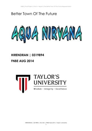
Better Town Of The Future
HIRENDRAN | 0319894
FNBE AUG 2014
2. ENBE | Final Project | Part A – Report | The Better Town Of The Future Representation
HIRENDRAN | 0319894 | MS. IDA | FNBE AUG 2014 | Taylor’s University
2
Content:
1. Introduction
2. A Town Investigation on Better Township or Town or City
Guidelines and Issues
3. Investigation & Data Collection: Ancient and old cities/town
4. Investigation & Data Collection: The present towns/cities
5. Investigation & Data Collection: The future and better
township
6. The New “X” Town / Aqua Nirvana
7. The Conclusion
8. References list
3. ENBE | Final Project | Part A – Report | The Better Town Of The Future Representation
HIRENDRAN | 0319894 | MS. IDA | FNBE AUG 2014 | Taylor’s University
3
1.Introduction
In this final project for Elements of Natural Built and Environment, each
Student had to pretend that they are the mayor of the “X” City, in which is no
longer liveable. As the mayor of their own city, each student had to come up
with a new layout for their new “X” City.
Each student was instructed to investigate about a past, present and future
city. With the information collected, students were required to propose a new
“X” City based on their choice of different concepts of cities which were;
Underwater City, Underground City, a City Floating on Water, or a City In The
Air.
4. ENBE | Final Project | Part A – Report | The Better Town Of The Future Representation
HIRENDRAN | 0319894 | MS. IDA | FNBE AUG 2014 | Taylor’s University
4
2.The City
2.1 The City Definition
A city is a relatively large and permanent human settlement. Although there is no
agreement on how a city is distinguished from a town within general English
language meanings, many cities have a particular administrative, legal, or historical
status based on local law.
Cities generally have complex systems for sanitation, utilities, land usage, housing,
and transportation. The concentration of development greatly facilitates interaction
between people and businesses, benefiting both parties in the process, but it also
presents challenges to managing urban growth. A big city or metropolis usually has
associated suburbs and exurbs. Such cities are usually associated with metropolitan
areas and urban areas, creating numerous business commuters traveling to urban
centers for employment. Once a city expands far enough to reach another city, this
region can be deemed a conurbation or megalopolis. In terms of population, the
largest city proper is Shanghai, while the fastest growing is Dubai.
5. ENBE | Final Project | Part A – Report | The Better Town Of The Future Representation
HIRENDRAN | 0319894 | MS. IDA | FNBE AUG 2014 | Taylor’s University
5
2.2 What is the brief history
Early humans led a nomadic existence, relying on hunting and gathering for
sustenance. Between 8,000 and 10,000 years ago, systematic cultivation of
plants and the domestication of animals allowed for more permanent
settlements. During the fourth millennium B.C., the requirements for the "urban
revolution" were finally met: the production of a surplus of storable food, a
system of writing, a more complex social organization, and technological
advances such as the plough, potter's wheel, loom, and metallurgy.
Cities exist for many reasons, and the diversity of urban forms can be traced
to the complex functions that cities perform. Cities serve as centers of storage,
trade, and manufacture. The agricultural surplus from the surrounding
countryside is processed and distributed in cities. Cities also grew up around
marketplaces, where goods from distant places could be exchanged for
local products. Throughout history, cities have been founded at the
intersections of transportation routes, or at points where goods must shift from
one mode of transportation to another, as at river and ocean ports.
Religious elements have been crucial throughout urban history. Ancient
peoples had sacred places, often associated with cemeteries or shrines,
around which cities grew. Ancient cities usually had large temple precincts
with monumental religious buildings. Many medieval cities were built near
monasteries and cathedrals.
Cities often provide protection in a precarious world. During attacks, the rural
populace could flee behind city walls, where defence forces assembled to
repel the enemy. The wall served this purpose for millennia, until the invention
of heavy artillery rendered walls useless in warfare. With the advent of modern
aerial warfare, cities have become prime targets for destruction rather than
safe havens.
Cities serve as centers of government. In particular, the emergence of the
great nation-states of Europe between 1400 and 1800 led to the creation of
new capital cities or the investing of existing cities with expanded
governmental functions.
Washington, D.C., for example, displays the monumental buildings, radial
street pattern, and large public spaces typical of capital cities.
Cities, with their concentration of talent, mixture of peoples, and economic
surplus, have provided a fertile ground for the evolution of human culture: the
arts, scientific research, and technical innovation. They serve as centers of
communication, where new ideas and information are spread to the
surrounding territory and to foreign land.
6. ENBE | Final Project | Part A – Report | The Better Town Of The Future Representation
HIRENDRAN | 0319894 | MS. IDA | FNBE AUG 2014 | Taylor’s University
6
2.3 What makes a city / town
In 1950 Gordon Childe attempted to define a historic city with 10 general
metrics. These are:
-Size and density of the population should be above normal.
-Differentiation of the population. Not all residents grow their own food,
leading to specialists.
-Payment of taxes to a deity or king.
-Monumental public buildings.
-Those not producing their own food are supported by the king.
-Systems of recording and practical science.
-A system of writing.
-Development of symbolic art.
-Trade and import of raw materials.
-Specialist craftsmen from outside the kin-group.
2.4 What makes a good City
-GREEN ENVIRONMENT
Build environmentally sound and carbon efficient cities. Buildings alone
account for 30% of greenhouse gas emissions, and the way we plan and
design our cities now will have significant implications for how resilient,
resource efficient and environmentally sound they are in the future. A green
city means promoting sustainable development through a carbon efficient
built environment.
-WELL PLANNED
As long as cities offer better opportunities for livelihoods, rural-urban migration
cannot be stopped. Therefore, plan the cities of tomorrow for sustainable
decision-making processes.
Sustainable urbanization and development requires planning processes and
political frameworks that harness the city’s assets and potential. Sustainable
planning entails participatory decision making processes and particular
attention to development that balances social, environmental and
economic needs. Of equal importance, sustainable planning and a planned
city are fundamental to achieving all the other characteristics of a good city.
-RESELIENT
Cities and communities are empowered to plan for and effectively manage
adversity, as it is fundamental to the urban agenda. Urbanization and
development can only be sustainable if it is adaptable to future demands
and risks, and is resilient to the consequences of climate change or natural
disasters.
7. ENBE | Final Project | Part A – Report | The Better Town Of The Future Representation
HIRENDRAN | 0319894 | MS. IDA | FNBE AUG 2014 | Taylor’s University
7
-SAFE AND HEALTHY
Good cities are safe and healthy. Cities hold the answers to challenges posed
by urbanization, which are in turn inextricably linked to issues of and agendas
concerning the economy, climate change, resource consumption, food
security and more. Cities need to be highly livable environments in order to
capitalize on their tremendous potential as the drivers of sustainable solutions
to our current and future challenges.
Health is determined by many factors outside the biomedical domain, even
with the restricted definition of health as the absence of disease. This point is
reinforced when the definition is expanded to the WHO vision of health as a
“state of complete physical, mental and social wellbeing – not merely the
absence of disease or infirmity.
To build a healthy city is to establish people’s multi-consciousness of health
and a new public health policy of ecological balance (effects of
environment on health) and social justice (effects of poverty on health), by
integrating the professional cross-filed groups, promoting community
participation, health capacity building, and self-empowerment of inhabitants.
-PRODUCTIVITY
Good cities are efficient and better places to ensure decent work.
Economically equitable development is also one of the three pillars of
sustainability, and a requisite component of any healthy, livable and
sustainable city. Pursuing a sustainable development agenda means
planning cities that promote and foster livelihoods for all citizens through
economic opportunities.
8. ENBE | Final Project | Part A – Report | The Better Town Of The Future Representation
HIRENDRAN | 0319894 | MS. IDA | FNBE AUG 2014 | Taylor’s University
8
3.Investigation & Data Collection:
Ancient City, City Of Mohenjo-Daro
3.1 History Of Mohenjo-Daro
Mohenjo-daro, the modern name for the site, simply means Mound of the
Dead in Sindhi. The city's original name is unknown, but analysis of a Mohenjo-daro
seal suggests a possible ancient Dravidian name, Kukkutarma ("the city [-rma] of the
cockerel [kukkuta]"). Cock-fighting may have had ritual and religious significance for
the city, with domesticated chickens bred there for sacred purposes, rather than as
a food source. Mohenjo-daro may have been a point of diffusion for the eventual
worldwide domestication of chickens.
Mohenjo-daro was built in the 26th century BCE. It was one of the largest cities of the
ancient Indus Valley Civilization, also known as the Harappan Civilization, which
developed around 3000 BCE from the prehistoric Indus culture. At its height, the
Indus Civilization spanned much of what is now Pakistan and North India, extending
westwards to the Iranian border, south to Gujarat in India and northwards to an
outpost in Bactria, with major urban centers at Harappa, Mohenjo-daro, Lothal,
Kalibangan, Dholavira and Rakhigarhi. Mohenjo-daro was the most advanced city
of its time, with remarkably sophisticated civil engineering and urban planning.
When the Indus civilization went into sudden decline around 1900 BCE, Mohenjo-
daro was abandoned.
9. ENBE | Final Project | Part A – Report | The Better Town Of The Future Representation
HIRENDRAN | 0319894 | MS. IDA | FNBE AUG 2014 | Taylor’s University
9
3.2 What ancient city are you concentrating on?
Location of Mohenjo-daro in the Indus Valley and extent of Indus Valley
Civilization (green). Mohenjo-daro is located in the Larkana District of Sindh,
Pakistan, on a Pleistocene ridge in the middle of the flood plain of the Indus
River Valley, around 28 kilometres (17 mi) from the town of Larkana. The ridge
was prominent during the time of the Indus Valley Civilization, allowing the
city to stand above the surrounding plain, but the flooding of the river has
since buried most of the ridge in deposited silt. The site occupies a central
position between the Indus River and the Ghaggar-Hakra River. The Indus still
flows to the east of the site, but the riverbed of the Ghaggar-Hakra on the
western side is now dry.
3.3 What makes is a significant city and what are the details?
Mohenjo-daro has a planned layout based on a street grid of rectilinear
buildings. Most were built of fired and mortared brick; some incorporated sun-
dried mud-brick and wooden superstructures. The area covered by the city is
estimated at 300 hectares. A "weak" estimate of peak population is at around
40,000.
The sheer size of the city, and its provision of public buildings and facilities,
suggests a high level of social organization. The city is divided into two parts,
the so-called Citadel and the Lower City. The Citadel – a mud-brick mound
around 12 metres (39 ft) high – is known to have supported public baths, a
large residential structure designed to house about 5,000 citizens, and two
large assembly halls. The city had a central marketplace, with a large central
well. Individual households or groups of households obtained their water from
smaller wells. Waste water was channeled to covered drains that lined the
major streets. Some houses, presumably those of wealthier inhabitants,
include rooms that appear to have been set aside for bathing, and one
building had an underground furnace (known as a hypocaust), possibly for
heated bathing. Most houses had inner courtyards, with doors that opened
onto side-lanes. Some buildings had two stories.
10. ENBE | Final Project | Part A – Report | The Better Town Of The Future Representation
HIRENDRAN | 0319894 | MS. IDA | FNBE AUG 2014 | Taylor’s University
10
In 1950, Sir Mortimer Wheeler identified one large building in Mohenjo-daro as
a "Great Granary". Certain wall-divisions in its massive wooden superstructure
appeared to be grain storage-bays, complete with air-ducts to dry the grain.
According to Wheeler, carts would have brought grain from the countryside
and unloaded them directly into the bays. However, Jonathan Mark Kenoyer
noted the complete lack of evidence for grain at the "granary", which, he
argued, might therefore be better termed a "Great Hall" of uncertain function.
Close to the "Great Granary" is a large and elaborate public bath, sometimes
called the Great Bath. From a colonnaded courtyard, steps lead down to the
brick-built pool, which was waterproofed by a lining of bitumen. The pool
measures 12 metres long, 7 metres wide and 2.4 metres deep. It may have
been used for religious purification. Other large buildings include a "Pillared
Hall", thought to be an assembly hall of some kind, and the so-called "College
Hall", a complex of buildings comprising 78 rooms, thought to have been a
priestly residence.
Mohenjo-daro had no series of city walls, but was fortified with guard towers
to the west of the main settlement, and defensive fortifications to the south.
Considering these fortifications and the structure of other major Indus valley
cities like Harappa, it is postulated that Mohenjo-daro was an administrative
center. Both Harappa and Mohenjo-daro share relatively the same
architectural layout, and were generally not heavily fortified like other Indus
Valley sites. It is obvious from the identical city layouts of all Indus sites that
there was some kind of political or administrative centrality, but the extent
and functioning of an administrative center remains unclear. Mohenjo-daro
was successively destroyed and rebuilt at least seven times. Each time, the
new cities were built directly on top of the old ones. Flooding by the Indus is
thought to have been the cause of destruction.
11. ENBE | Final Project | Part A – Report | The Better Town Of The Future Representation
HIRENDRAN | 0319894 | MS. IDA | FNBE AUG 2014 | Taylor’s University
11
3.4 Conclusion about the cities
The ruins of the city remained undocumented for over 3,700 years, until their
discovery in 1922 by Rakhaldas Bandyopadhyay, an officer of the
Archaeological Survey of India. He was led to the mound by a Buddhist monk,
who reportedly believed it to be a stupa. In the 1930s, major excavations
were conducted at the site under the leadership of John Marshall, D. K.
Dikshitar and Ernest Mackay. Further excavations were carried out in 1945 by
Ahmad Hasan Dani and Mortimer Wheeler. The last major series of
excavations were conducted in 1964 and 1965 by Dr. George F. Dales. After
1965 excavations were banned due to weathering damage to the exposed
structures, and the only projects allowed at the site since have been salvage
excavations, surface surveys, and conservation projects. However, in the
1980s, German and Italian survey groups led by Dr. Michael Jansen and Dr.
Maurizio Tosi used less invasive archeological techniques, such as
architectural documentation, surface surveys, and localized probing, to
gather further information about Mohenjo-daro.
3.5 What information or element that you can use to your new future city
Mohenjo-daro has a planned layout based on a street grid of rectilinear
buildings. The City is layed out very systematically. I plan to use this for my ‘X’
City. The defensive fortifications of Mohenjo Daro is also useful for my city.
Considering these fortifications and the structure of Mohenjo Daro, My ‘X’ City
can be protected well just like the Mohenjo Daro City.
12. ENBE | Final Project | Part A – Report | The Better Town Of The Future Representation
HIRENDRAN | 0319894 | MS. IDA | FNBE AUG 2014 | Taylor’s University
12
4.Investigation & Data Collection:
Present City, Dubai
4.1 History of Dubai.
Dubai is located on the southeast coast of the Persian Gulf and is one of the
seven emirates that make up the country. Although stone tools have been
found at many archaeological sites, little is known about the UAE's early
inhabitants as only a few settlements have been found. Many ancient towns
in the area were trading centers between the Eastern and Western worlds.
The remnants of an ancient mangrove swamp, dated at 7000 BC, were
discovered during the construction of sewer lines near Dubai Internet City. The
area was covered with sand about 5,000 years ago as the coast retreated
inland, becoming part of the city's present coastline. Pre-Islamic ceramics
have been found from the 3rd and 4th centuries. Prior to the introduction of
Islam to the area, the people in this region worshiped Bajir (or Bajar). After the
spread of Islam in the region, the Umayyad Caliph of the eastern Islamic
world invaded south-east Arabia and drove out the Sassanians. Excavations
by the Dubai Museum in the region of Al-Jumayra (Jumeirah) found several
artifacts from the Umayyad period.
The earliest recorded mention of Dubai is in 1095 in the Book of Geography by
the Andalusian-Arab geographer Abu Abdullah al-Bakri. The Venetian pearl
merchant Gaspero Balbi visited the area in 1580 and mentioned Dubai (Dibei)
for its pearling industry.
Dubai is thought to have been established as a fishing village in the early 18th
century and was, by 1822, a town of some 7-800 members of the Baniyas tribe
and subject to the rule of Sheikh Tahnoon of Abu Dhabi.
In 1833, following tribal feuding, members of the Al Bu Falasa tribe seceded
from Abu Dhabi and established themselves in Dubai. The exodus from Abu
Dhabi was led by Ubaid bin Saeed and Maktum bin Butti who became joint
leaders of Dubai until Ubaid died in 1836, leaving Maktum to establish the
Maktoum dynasty.
Dubai signed the treaty of 'Perpetual Maritime Truce' of 1853 along with other
Trucial States and also - like its neighbours on the Trucial Coast - entered into
an exclusivity agreement in which Great Britain took responsibility for the
emirate's security in 1892.
Two catastrophes struck the town during the 1800s. First, in 1841, a smallpox
epidemic broke out in the Bur Dubai locality, forcing residents to relocate east
13. ENBE | Final Project | Part A – Report | The Better Town Of The Future Representation
HIRENDRAN | 0319894 | MS. IDA | FNBE AUG 2014 | Taylor’s University
13
to Deira. Then, in 1894, fire swept through Deira, burning down most homes.
However, the town's geographical location continued to attract traders and
merchants from around the region. The emir of Dubai was keen to attract
foreign traders and lowered trade tax brackets, which lured traders away
from Sharjah and Bandar Lengeh, the region's main trade hubs at the time.
Persian merchants naturally looked across to the Arab shore of the Persian
Gulf finally making their homes in Dubai. They continued to trade with Lingah,
however, as do many of the dhows in Dubai Creek today, and they named
their district Bastakiya, after the Bastak region in southern Persia.
4.2 What town are you concentrating on?
Dubai is situated on the Persian Gulf coast of the United Arab Emirates and is
roughly at sea level (16 m or 52 ft above). The emirate of Dubai shares borders with
Abu Dhabi in the south, Sharjah in the northeast, and the Sultanate of Oman in the
southeast. Hatta, a minor exclave of the emirate, is surrounded on three sides by
Oman and by the emirates of Ajman (in the west) and Ras Al Khaimah (in the north).
The Persian Gulf borders the western coast of the emirate. Dubai is positioned at
25.2697°N 55.3095°E and covers an area of 1,588 sq mi (4,110 km2), which represents
a significant expansion beyond its initial 1,500 sq mi (3,900 km2) designation due to
land reclamation from the sea.
Dubai lies directly within the Arabian Desert. However, the topography of
Dubai is significantly different from that of the southern portion of the UAE in
that much of Dubai's landscape is highlighted by sandy desert patterns, while
gravel deserts dominate much of the southern region of the country. The sand
consists mostly of crushed shell and coral and is fine, clean and white. East of
the city, the salt-crusted coastal plains, known as sabkha, give way to a north-
south running line of dunes. Farther east, the dunes grow larger and are
tinged red with iron oxide.
The flat sandy desert gives way to the Western Hajar Mountains, which run
alongside Dubai's border with Oman at Hatta. The Western Hajar chain has
an arid, jagged and shattered landscape, whose mountains rise to about
1,300 metres (4,265 feet) in some places. Dubai has no natural river bodies or
oases; however, Dubai does have a natural inlet, Dubai Creek, which has
been dredged to make it deep enough for large vessels to pass through.
Dubai also has multiple gorges and waterholes, which dot the base of the
Western Al Hajar mountains. A vast sea of sand dunes covers much of
southern Dubai and eventually leads into the desert known as The Empty
Quarter. Seismically, Dubai is in a very stable zone—the nearest seismic fault
line, the Zagros Fault, is 200 kilometres (124 miles) from the UAE and is unlikely
to have any seismic impact on Dubai. Experts also predict that the possibility
of a tsunami in the region is minimal because the Persian Gulf waters are not
deep enough to trigger a tsunami.
14. ENBE | Final Project | Part A – Report | The Better Town Of The Future Representation
HIRENDRAN | 0319894 | MS. IDA | FNBE AUG 2014 | Taylor’s University
14
The sandy desert surrounding the city supports wild grasses and occasional
date palms. Desert hyacinths grow in the sabkha plains east of the city, while
acacia and ghaf trees grow in the flat plains within the proximity of the
Western Al Hajar mountains. Several indigenous trees such as the date palm
and neem as well as imported trees such as the eucalypts grow in Dubai's
natural parks. The houbara bustard, striped hyena, caracal, desert fox, falcon
and Arabian oryx are common in Dubai's desert. Dubai is on the migration
path between Europe, Asia and Africa, and more than 320 migratory bird
species pass through the emirate in spring and autumn. The waters of Dubai
are home to more than 300 species of fish, including the hammour. The
typical marine life off the Dubai coast includes tropical fish, jellyfish, coral,
dugong, dolphins, whales and sharks. Various types of turtles can also be
found in the area including the Hawksbill turtle and Green Turtle, which are
listed as endangered species.
Dubai Creek runs northeast-southwest through the city. The eastern section of
the city forms the locality of Deira and is flanked by the emirate of Sharjah in
the east and the town of Al Aweer in the south. The Dubai International
Airport is located south of Deira, while the Palm Deira is located north of Deira
in the Persian Gulf. Much of Dubai's real-estate boom is concentrated to the
west of Dubai Creek, on the Jumeirah coastal belt. Port Rashid, Jebel Ali, Burj
Al Arab, the Palm Jumeirah and theme-based free-zone clusters such as
Business Bay are all located in this section
15. ENBE | Final Project | Part A – Report | The Better Town Of The Future Representation
HIRENDRAN | 0319894 | MS. IDA | FNBE AUG 2014 | Taylor’s University
15
4.3 What makes is a significant town and what are the details?
Dubai has a rich collection of buildings and structures of various architectural
styles. Many modern interpretations of Islamic architecture can be found here,
due to a boom in construction and architectural innovation in the Arab World
in general, and in Dubai in particular, supported not only by top Arab or
international architectural and engineering design firms such as Al Hashemi
and Aedas, but also by top firms of New York and Chicago. As a result of this
boom, modern Islamic – and world – architecture has literally been taken to
new levels in skyscraper building design and technology. Dubai now has
more completed or topped-out skyscrapers higher than 2/3 km, 1/3 km, or 1/4
km than any other city. A culmination point was reached in 2010 with the
completion of the Burj Khalifa (Khalifa Tower), now by far the world's tallest
building at 829.8 m (2,722 ft). The Burj Khalifa's design is derived from the
patterning systems embodied in Islamic architecture, with the triple-lobed
footprint of the building based on an abstracted version of the desert flower
hymenocallis which is native to the Dubai region. The completion of the
Khalifa Tower, following the construction boom that began in the 1980s,
accelerated in the 1990s, and took on a rapid pace of construction
unparalled in modern human history during the decade of the 2000s, leaves
Dubai with the world's tallest skyline as of 4 January 2010. At the Top, Burj
Khalifa, the world’s highest observatory deck with an outdoor terrace is one
of Dubai’s most popular tourist attractions, with over 1.87 million visitors in 2013.
16. ENBE | Final Project | Part A – Report | The Better Town Of The Future Representation
HIRENDRAN | 0319894 | MS. IDA | FNBE AUG 2014 | Taylor’s University
16
Burj Al Arab
The Burj Al Arab (Arabic: رج ب عرب ,ال Tower of the Arabs) is a 7 star luxury hotel.
Although the hotel is frequently described as "the world's only seven-Star
hotel", the hotel management claims to never have done that themselves.
The Burj al Arab's management company, Jumeira Group, describes the hotel
as simply a "seven-star deluxe" property. A Jumeirah Group spokesperson is
quoted as saying: "There's not a lot we can do to stop it. We're not
encouraging the use of the term. We've never used it in our advertising."
Transport
Transport in Dubai is controlled by the Roads and Transport Authority (RTA), an
agency of the government of Dubai, formed by royal decree in 2005. The
public transport network has in the past faced congestion and reliability issues
which a large investment programme has addressed, including over AED 70
billion of improvements planned for completion by 2020, when the population
of the city is projected to exceed 3.5 million. In 2009, according to Dubai
Municipality statistics, there were an estimated 1,021,880 cars in Dubai. In
January 2010, the number of Dubai residents who use public transport stood
at 6%.
17. ENBE | Final Project | Part A – Report | The Better Town Of The Future Representation
HIRENDRAN | 0319894 | MS. IDA | FNBE AUG 2014 | Taylor’s University
17
Road
Five main routes – E 11 (Sheikh Zayed Road), E 311 (Sheikh Mohammed Bin
Zayed Road), E 44 (Dubai-Hatta Highway), E 77 (Dubai-Al Habab Road) and E
66 (Oud Metha Road) – run through Dubai, connecting the city to other
towns and emirates. Additionally, several important intra-city routes, such as D
89 (Al Maktoum Road/Airport Road), D 85 (Baniyas Road), D 75 (Sheikh Rashid
Road), D 73 (Al Dhiyafa Road now named as 2 December street), D 94
(Jumeirah Road) and D 92 (Al Khaleej/Al Wasl Road) connect the various
localities in the city. The eastern and western sections of the city are
connected by Al Maktoum Bridge, Al Garhoud Bridge, Al Shindagha Tunnel,
Business Bay Crossing and Floating Bridge.
The Public Bus Transport system in Dubai is run by the RTA. The bus system
services 140 routes and transported over 109 million people in 2008. By the
end of 2010, there will be 2,100 buses in service across the city. In 2006, the
Transport authority announced the construction of 500 air-conditioned (A/C)
Passenger Bus Shelters, and planned for 1,000 more across the emirates in a
move to encourage the use of public buses.
All taxi services are licenced by the RTA. Dubai licensed taxis are easily
identifiable by their cream bodywork colour and varied roof colours
identifying the operator. Dubai Taxi Corporation, a division of the RTA, is the
largest operator and has taxis with red roofs. There are four private operators:
Metro Taxis (orange roofs); Network Taxis (yellow roofs); Cars Taxis (blue roofs);
and Arabia Taxis (green roofs). In addition, Dubai Taxi Corporation has a
Ladies Taxi service, with pink roofs, which caters exclusively for female
passengers, using female drivers. The Dubai International Airport taxi
concession is operated by Dubai Taxi Corporation. There are more than 3000
taxis operating within the emirate making an average of 192,000 trips every
day, carrying about 385,000 persons. In 2009 taxi trips exceeded 70 million trips
serving around 140.45 million passengers.
18. ENBE | Final Project | Part A – Report | The Better Town Of The Future Representation
HIRENDRAN | 0319894 | MS. IDA | FNBE AUG 2014 | Taylor’s University
18
Air
Dubai International Airport (IATA: DXB), the hub for the Emirates Airline, serves
the city of Dubai and other emirates in the country. The airport was the 15th
busiest airport in the world by passenger traffic handling 40.9 million
passengers in 2009. The airport is also the busiest airport in the world by
international passenger traffic. In addition to being an important passenger
traffic hub, the airport is the 7th busiest cargo airport in world, handling 1.927
million tonnes of cargo in 2009, a 5.6% increase compared to 2008 and was
also the 4th busiest International freight traffic airport in world. Emirates Airline
is the national airline of Dubai. As of 2009, it operated internationally serving
101 destinations in 61 countries across six continents.
The development of Al Maktoum International Airport (IATA: DWC) was
announced in 2004. The first phase of the airport, featuring one A380 capable
runway, 64 remote stands, one cargo terminal with annual capacity for
250,000 tonnes of cargo and a passenger terminal building designed to
accommodate five million passengers per year, has been opened. When
completed, Dubai World Central-Al Maktoum International will be the largest
airport in the world with five runways, four terminal buildings and capacity for
160 million passengers and 12 million tons of cargo.
In 2014, it emerged that an American contractor, ARINC (now owned by
Rockwell Collins) claims that it has not been paid for work performed at
Terminal 3, and that it is owed some US $70 million stemming from a 2007 debt.
Ahmed Bin Jassim, personal assistant to Sheikh Ahmed Bin Saeed Al Maktoum,
Chairman of Dubai Airports, told an American journalist he had not heard of
ARINC.
19. ENBE | Final Project | Part A – Report | The Better Town Of The Future Representation
HIRENDRAN | 0319894 | MS. IDA | FNBE AUG 2014 | Taylor’s University
19
Metro rail
A $3.89 billion Dubai Metro project is currently operational. It currently consists
of two lines (Red line and Green line) which run through the major financial
and residential areas of the city. The Metro system was partially opened on
September 2009. UK-based international service company Serco Group is
responsible for operating the metro. The metro comprises the Green Line
which runs from the Etisalat Station to the Creek Station (though Creek Station
is still not operational and stops at Dubai Healthcare City Station, just before
Creek Station) and the Red Line, the major back bone line, which runs from
Rashidiya Station to Jebel Ali Station Jebel Ali. A Blue and a Purple Line have
also been planned. The Dubai Metro (Green and Blue Lines) will have 70 km
(43.5 mi) of track and 43 stations, 37 above ground and ten underground. The
Dubai Metro is the first urban train network in the Arabian Peninsula. All the
trains run without a driver and are based on automatic navigation.
Palm Jumeirah Monorail
The Palm Jumeirah Monorail is a monorail line on the Palm Jumeirah. It
connects the Palm Jumeirah to the mainland, with a planned further
extension to the Red Line of the Dubai Metro. The line opened on 30 April
2009. Two trams systems are expected to be built in Dubai by 2011. The first is
the Downtown Burj Khalifa Tram System and the second is the Al Sufouh Tram.
The Downtown Burj Khalifa Tram System is a 4.6 km (2.9 mi) tram service that is
planned to service the area around the Burj Khalifa, and the second tram will
run 14.5 km (9.0 mi) along Al Sufouh Road from Dubai Marina to the Burj Al
Arab and the Mall of the Emirates.
Dubai has announced it will complete a link of the UAE high-speed rail system
which will eventually hook up with the whole GCC (Gulf Cooperation Council,
also known as Cooperation Council for the Arab States of the Gulf) and then
possibly Europe. The High Speed Rail will serve passengers and cargo.
20. ENBE | Final Project | Part A – Report | The Better Town Of The Future Representation
HIRENDRAN | 0319894 | MS. IDA | FNBE AUG 2014 | Taylor’s University
20
Waterways
There are two major commercial ports in Dubai, Port Rashid and Port Jebel Ali.
Port Jebel Ali is the world's largest man-made harbour, the biggest port in the
Middle East, and the 7th-busiest port in the world. One of the more traditional
methods of getting across Bur Dubai to Deira is by abras, small boats that ferry
passengers across the Dubai Creek, between abra stations in Bastakiya and
Baniyas Road. The Marine Transport Agency has also implemented the Dubai
Water Bus System. Water bus is a fully air conditioned boat service across
selected destinations across the creek. One can also avail oneself of the
tourist water bus facility in Dubai. Latest addition to the water transport system
is the Water Taxi.
4.4 Conclusion about the towns
The City of Dubai represents an enormous collaboration and coordination
effort of many individuals across all sectors of the building profession.
Conventional and cutting-edge technologies and building systems were
utilized, developed, and further advanced to create this unprecedented
structure, taking this building and the profession to literally new heights
4.5 What information or element that you can use to your new town
I was inspired by the layout of the city and the means of easy public
transportation across the city. I would include the transportation system of
Dubai into my city as it is highly functional and very efficient. I would also
incorporate the layout of the city and the structures of the buildings located
in the City of Dubai.
21. ENBE | Final Project | Part A – Report | The Better Town Of The Future Representation
HIRENDRAN | 0319894 | MS. IDA | FNBE AUG 2014 | Taylor’s University
21
5.Investigation & Data Collection:
The Future City, Case Study.
Floating City Concept.
Cities that float on water could offer an alternative to destroying the earth's valuable
countryside according to architecture studio AT Design Office, who has developed
a concept for an ocean metropolis.
AT Design Office, who has offices in England and China, was commissioned by
Chinese construction firm CCCC-FHDI to design a floating island with an area of four
square miles – utilising the same technologies that CCCC-FHDI is using to build a 31-
mile bridge between the cities of Hong Kong, Macau and Zhuhai.
22. ENBE | Final Project | Part A – Report | The Better Town Of The Future Representation
HIRENDRAN | 0319894 | MS. IDA | FNBE AUG 2014 | Taylor’s University
22
Part of that bridge is an underwater tunnel, which is joined by a 150-metre-long
precast concrete box. The mega box is cast on a nearby island and floated to site
before being connected. We were appointed to work with the engineer to come
up with a masterplan for a 10-square-kilometre floating island that can be built with
the same technology.
Entitled Floating City, the team's proposal involves a series of prefabricated
hexagonal modules that tesselate to create all the infrastructure needed for a city
on water – from a transport network of yachts and submarines, to a floating hotel
and entertainment complex.
Recreational green spaces would be located both above and below the water's
surface, while farms, hatcheries and rubbish collection facilities would allow the
community to produce its own food and sustainably dispose of waste.
23. ENBE | Final Project | Part A – Report | The Better Town Of The Future Representation
HIRENDRAN | 0319894 | MS. IDA | FNBE AUG 2014 | Taylor’s University
23
The project offered an opportunity to develop a new urban nucleus of world-class
residential, commercial and cultural facilities, as well as to promote a zero-carbon,
energy-efficient and self-sufficient city.
The modules used to construct the island would be prefabricated in a factory then
floated out to a site. A cruise dock would be an integral feature of the city, allowing
these new deliveries to be easily received.
A system of underground tunnels would also be included, creating a network of
roads and walkways between buildings and islands.
24. ENBE | Final Project | Part A – Report | The Better Town Of The Future Representation
HIRENDRAN | 0319894 | MS. IDA | FNBE AUG 2014 | Taylor’s University
24
The proposal is now being reviewed by one of China's largest property investors.
China Transport Investment Co is reviewing the proposal and is likely to start to test
this ambitious project from a smaller scale next year.
Design for the Floating City
Our existing landmass on earth has been built up so extensively that the remaining
free land is under extreme pressure and needs to be preserved as much as possible.
New settlements should be planned in such a manner that important social and
environmental conditions are improved and can provide for better 21st century
living. Environmental impact and the improvements of health and social conditions
for human habitat should be the main concerns of new urban design and
development. Environmentally adaptive measures, higher densities, mixed uses and
efficient, smart design and infrastructure strategies need to be considered.
The basic construction unit is a prefabricated block – 150 metres length and and 30
metres in section. On plan, the grid can be an equilateral triangle and a pentagon.
The prefabricated parts can be overlapped vertically. During construction, the
modular parts are floated to the site after pre-fabrication in the factory.
The floating city has a perfect internal and external traffic system, linking it within but
also with the outside world. A cruise dock serves giant ships, a yacht dock serves
private vessels and civilian submarine traffic. Submarines and electric vehicles are
the main means of transport on the island – keeping the island free from air pollution
and congestion caused by automobiles. The main traffic flows are facilitated via the
25. ENBE | Final Project | Part A – Report | The Better Town Of The Future Representation
HIRENDRAN | 0319894 | MS. IDA | FNBE AUG 2014 | Taylor’s University
25
water canals above and below the water surface. The peri-urban area house farm,
hatchery and garbage recycling centre.
There are two public green belts ‐ one on the water surface and one under water.
The upper one can provide public space usable for sports and recreation in a fresh
air environment. The underwater green can be used for recreational tours.
Vertical gardens are interconnected with the public greenery system above and
below the water. A chimney in the centre of the vertical garden provides natural
ventilation and lighting to the underwater city. Meanwhile the vertical garden is also
a public traffic hub, which provides a traffic platform for submarines and inter-block
passages.
The harbour centre is used for parking submarines and also has a vibrant floating
entertainment area at its centre. The amusement city has a hotel at its bottom and
an open stage on its top. The large commercial and entertainment centre is located
under the stage. The entertainment city can be connected underwater with
adjacent buildings through an Archimedes buoyancy bridge, enabling people to
reach the entertainment city conveniently. Tourists can experience the fabulous
underwater world whilst passing through the underwater hotel and coming up to the
harbour city.
All living spaces in the floating city have ocean scenery in all directions, and with
convenient traffic connections within its 150-metre radius, enjoying proximity to local
facilities, services, public transport and gardens. A club located at the top of each
block and an equipment room and gravity regulation system located at the bottom.
Underwater tunnels with walkways and roads permit horizontal communication and
access between the islands and buildings that comprise the floating city.
26. ENBE | Final Project | Part A – Report | The Better Town Of The Future Representation
HIRENDRAN | 0319894 | MS. IDA | FNBE AUG 2014 | Taylor’s University
26
The peripheral area houses farms and hatcheries as well as a modern garbage
collection and waste conversion centre. A production base and manufacturing
factory is located in the upper part of the triangle plot, whilst a tidal power
generation device is located in the lower part. These facilities are the basis of a
sustainable food and energy supply chain.
The Floating City will provide world class facilities, as well as additional supplies of
new areas to satisfy the long-term demand for human habitable land. Noise, waste
and other environmental impacts will be managed via innovative strategies. Our
proposed development and the associated infrastructure will bring positive change
to the community and its economy. The design will meet long‐term infrastructure
and sustainable development needs but also bringing new opportunities to
education, recreation, employment and business activities. Such opportunities will
create a vibrant, diverse and sustainable social and economic platform.
Architect: CCCC-FHDI & AT Design Office
Design Team: Zhu lixiang, Anthony Phan, Wang Rukai, Feng Yinhui, Liu Kun, Siska
Slavomir, Anna Kowal
Co Designer: CCCC‐ EHDI engineering Co. Ltd
27. ENBE | Final Project | Part A – Report | The Better Town Of The Future Representation
HIRENDRAN | 0319894 | MS. IDA | FNBE AUG 2014 | Taylor’s University
27
6.The New “X” City / AQUA NIRVANA
6.1 How did you come up with the solution to create this new town
I came up with the solution to create this city after being inspired by a few
concept ideas of a floating city by AT Design Office. The name “AQUA
NIRVANA” was inspired by water and happiness.
6.2 What is the important characteristic and elements
My new City is about 40km2 and it is floating on the ocean. It’s surrounded by a thick
transparent glass in the shape of an ‘X’ for protection. The city will mostly run on
hydroelectric energy and solar powered energy. The city is stationery and floats on
water based on the ‘Lily Pad’ concept.
The bottom of the floating “ecopolis” would be made of polyester fibers covered by
a layer of titanium dioxide (TiO2), which would react with ultraviolet rays and absorb
atmospheric pollution via a photocatalytic effect in the same way as the air-
purifying concrete and paving stones.
The floating city would also include the full complement of renewable energy
technologies, including solar, thermal, wind, tidal, and biomass to produce more
energy than it consumes. Aqua Nirvana could be located close to land or set free to
follow the ocean currents wherever they may lead.
28. ENBE | Final Project | Part A – Report | The Better Town Of The Future Representation
HIRENDRAN | 0319894 | MS. IDA | FNBE AUG 2014 | Taylor’s University
28
The glass used to cover my city is made up of 3 layers. Each layer is
protective layer can be removed based on the climate/situation which can
make the glass either transparent, translucent or opaque.
The motive behind the glass covered city is to protect the city from the
harmful effect of the sun in the future. It is also to protect the citizens from
natural disasters like tsunamis and earthquake. The glass also will protect the
citizens from the highly polluted area outside the city. It can act as a defence
system against enemies when needed. The top of the glass can be opened
for citizens that intend to travel out of the city. There are also solar panels on
the glass to collect solar energy from the Sun for the city.
Transparent
Opaque
Translucent
29. ENBE | Final Project | Part A – Report | The Better Town Of The Future Representation
HIRENDRAN | 0319894 | MS. IDA | FNBE AUG 2014 | Taylor’s University
29
ZONING OF AQUA NIRVANA CITY
Residential Area
Commercial Area
Recreational Area/ Park
Green Landscape/Forest
Police Station / Fire Station
Hospital
Education (Primary, Secondary, University)
Agriculture
Industrial Area
Religious/ Culture Area
Energy Source Plant
Tourism and Hospitality Area
Government
30. ENBE | Final Project | Part A – Report | The Better Town Of The Future Representation
HIRENDRAN | 0319894 | MS. IDA | FNBE AUG 2014 | Taylor’s University
30
Zoning
The residential areas are located near the commercial area for easy access
for the citizens. It is also located near the education area. Each residential
area has a park nearby for citizen to carry out recreational activities.
Religious area for church, mosques, and temples are also located around the
residential areas for the citizens of diverse ethnicities.
A Police Station, Fire Station and a Hospital is located nearby the residential
areas and education areas in case of any emergencies. Two large areas of
my city is used for agriculture to sustain the city by itself.
Industrial Area is located away from residential areas, recreational areas and
agriculture areas to avoid disturbance and pollution of the area.
Two energy source plants are located at both ends of the city so that the city
can sustain on its own by producing natural and renewable energy. This
include the full complement of renewable energy technologies, including
solar, thermal, wind, tidal, and biomass to produce more energy than it
consumes.
31. ENBE | Final Project | Part A – Report | The Better Town Of The Future Representation
HIRENDRAN | 0319894 | MS. IDA | FNBE AUG 2014 | Taylor’s University
31
TRANSPORTATION
Pod Cars
The Pod Cars will be Aqua Nirvana City’s main source of public transport.
These systems, also known as pod cars, will be the new type of public
transportation designed to provide swift travel in congested areas of the city.
Pod cars are arranged in a ‘network topology’ and placed on elevated or
underground shuttle networks. With this system, travelers can make nonstop,
point-to-point trips bypassing all intermediate stations. To form a mental
image, pod cars can be though as individual and small scale trains. They offer
an efficient and clean energy alternative for city transportation.
32. ENBE | Final Project | Part A – Report | The Better Town Of The Future Representation
HIRENDRAN | 0319894 | MS. IDA | FNBE AUG 2014 | Taylor’s University
32
7.Conclusion
From this project, I learnt how to describe the different characteristics of natural
built and environment by exploring the basic elements such as natural
topography, landscape, space, building and infrastructure. I also learnt to
differentiate and compare the different development of built and environment
by looking at the natural topography, landscape, space, building and
infrastructure. Besides that I also learnt to analyse and evaluate the different
development of built and environment by looking at the natural topography,
landscape, space, building and infrastructure. I also managed to understand
how to communicate ideas through observation and different media
tools/technique to present information of the study of different cities.
33. ENBE | Final Project | Part A – Report | The Better Town Of The Future Representation
HIRENDRAN | 0319894 | MS. IDA | FNBE AUG 2014 | Taylor’s University
33
8.Reference Links
- http://en.wikipedia.org/wiki/Dubai
- http://www.art.net/~hopkins/Don/simcity/manual/history.html
- http://alexandria.tue.nl/extra2/redes/lynch1980.pdf
- http://www.dezeen.com/2014/05/13/floating-city-at-design-office/
- http://www.gizmag.com/lilypad-floating-city-concept/17697/
- http://vincent.callebaut.org/page1-img-lilypad.html
- http://cenews.com/article/7709/design_and_construction_of_the_world_a
cute_s_tallest_building__the_burj_dubai
- http://en.wikipedia.org/wiki/Mohenjo-
daro#Architecture_and_urban_infrastructure
- https://www.premiumtimesng.com/business/111213-features-of-good-
cities-by-mayowa-afolabi.html
- http://www.renewableenergymexico.com/?p=429