SlideShare ist ein Scribd-Unternehmen logo
1 von 15
Downloaden Sie, um offline zu lesen
Cyberinfrastructure “…the coordinated aggregate of computer
hardware / software and other technologies designed to change
 data systems into knowledge systems” (Synthesis for Earth, Life, &
      Linda Koch, JenniferstHo, Cory 2003) and Mike Kido
              Society in the 21 Century NSF Yap


             Center for Conservation Research and Training
                        Pacific Biosciences Research Center
                              University of Hawaii at Manoa
Real-Time Monitoring
                        Wireless Sensor Networks


                             Sensor Data                    High Performance
                                                               Computing


                                                     Data Modeling

                                           Research Cyberinfrastructure
                                             Core (RCC) Cluster – UHM
                                            (Data Processing / Storage)


Portal User Interface
                                                   Mapping - ArcGIS®
Research Cyberinfrastructure Core
             (RCC)
                            Remote
                            sensor
 Database/Spreadsheet
        upload

                                          ArcGIS Desktop

                         DATA SERVER

             Upload
           from portal                  Map API

                           Smartphone
                            and GPS
Research Cyberinfrastructure Core
             (RCC)
Internet access


           Web
        Frontends

                     Data/Application
                      Server


                       Data Storage
                         Library         Backup
                                         Server
Real-Time Monitoring
                        Wireless Sensor Networks


                             Sensor Data                    High Performance
                                                               Computing


                                                     Data Modeling

                                           Research Cyberinfrastructure
                                             Core (RCC) Cluster – UHM
                                            (Data Processing / Storage)


Portal User Interface
                                                   Mapping - ArcGIS®
Secure Portal Development
Real-Time Monitoring
                        Wireless Sensor Networks


                             Sensor Data                    High Performance
                                                               Computing


                                                     Data Modeling

                                           Research Cyberinfrastructure
                                             Core (RCC) Cluster – UHM
                                            (Data Processing / Storage)


Portal User Interface
                                                   Mapping - ArcGIS®
Hawaiian Island Sensor Network (SDSS)
North Kauai Sensor Network (IVJ)
Waipa Valley and Waipa Foundation
Waipa Weather and Water Quality
Real-Time Monitoring
                        Wireless Sensor Networks


                             Sensor Data                    High Performance
                                                               Computing


                                                     Data Modeling

                                           Research Cyberinfrastructure
                                             Core (RCC) Cluster – UHM
                                            (Data Processing / Storage)


Portal User Interface
                                                   Mapping - ArcGIS®
Contact information
Hawaii Biodiversity and Mapping Program
Center for Conservation Research and Training
University of Hawaii at Manoa

Jennifer Ho – jhho@hawaii.edu
Cory Yap – coryy@hawaii.edu
Linda Koch – lkoch@hawaii.edu
Mike Kido – mkido@hawaii.edu

                   Mahalo nui loa!

Weitere ähnliche Inhalte

Andere mochten auch

GIS application in Natural Resource Management
GIS application in Natural Resource ManagementGIS application in Natural Resource Management
GIS application in Natural Resource Management
Achal Gupta
 
Gis Applications Presentation
Gis Applications PresentationGis Applications Presentation
Gis Applications Presentation
Idua Olunwa
 
APPLICATIONS OF REMOTE SENSING AND GIS IN WATERSHED MANAGEMENT
APPLICATIONS OF REMOTE SENSING AND GIS IN WATERSHED MANAGEMENTAPPLICATIONS OF REMOTE SENSING AND GIS IN WATERSHED MANAGEMENT
APPLICATIONS OF REMOTE SENSING AND GIS IN WATERSHED MANAGEMENT
Sriram Chakravarthy
 
Application of gis & rs in urban planning
Application of gis & rs in urban planning Application of gis & rs in urban planning
Application of gis & rs in urban planning
sathish1446
 

Andere mochten auch (20)

Presentation for community GIS workshops
Presentation for community GIS workshopsPresentation for community GIS workshops
Presentation for community GIS workshops
 
Environmental Resources Inventory Using GIS, City of Englewood, NJ
Environmental Resources Inventory Using GIS,  City of Englewood, NJ Environmental Resources Inventory Using GIS,  City of Englewood, NJ
Environmental Resources Inventory Using GIS, City of Englewood, NJ
 
Web Based Gis For Land Administration 20090629
Web Based Gis For Land Administration 20090629Web Based Gis For Land Administration 20090629
Web Based Gis For Land Administration 20090629
 
GIS as a Land Planning Resource
GIS as a Land Planning ResourceGIS as a Land Planning Resource
GIS as a Land Planning Resource
 
Application of GIS in decentralised planning – A free software approach
Application of GIS in decentralised planning – A free software approachApplication of GIS in decentralised planning – A free software approach
Application of GIS in decentralised planning – A free software approach
 
5 tuul
5   tuul5   tuul
5 tuul
 
Chapter1 is344(intro-to-gis)
Chapter1 is344(intro-to-gis)Chapter1 is344(intro-to-gis)
Chapter1 is344(intro-to-gis)
 
3 introduction gis
3   introduction gis3   introduction gis
3 introduction gis
 
Application of GIS and Remote Sensing in the analysis of Landuse/Landcover ch...
Application of GIS and Remote Sensing in the analysis of Landuse/Landcover ch...Application of GIS and Remote Sensing in the analysis of Landuse/Landcover ch...
Application of GIS and Remote Sensing in the analysis of Landuse/Landcover ch...
 
Land planning: What is it?
Land planning: What is it?Land planning: What is it?
Land planning: What is it?
 
Urban Landuse/ Landcover change analysis using Remote Sensing and GIS
Urban Landuse/ Landcover change analysis using Remote Sensing and GISUrban Landuse/ Landcover change analysis using Remote Sensing and GIS
Urban Landuse/ Landcover change analysis using Remote Sensing and GIS
 
Application of gis in natural disaster management
Application of gis in natural disaster managementApplication of gis in natural disaster management
Application of gis in natural disaster management
 
Gis powerpoint
Gis powerpointGis powerpoint
Gis powerpoint
 
GIS application in Natural Resource Management
GIS application in Natural Resource ManagementGIS application in Natural Resource Management
GIS application in Natural Resource Management
 
Land use land cover mapping for smart village using gis
Land use land cover mapping for smart village using gisLand use land cover mapping for smart village using gis
Land use land cover mapping for smart village using gis
 
Gis Applications Presentation
Gis Applications PresentationGis Applications Presentation
Gis Applications Presentation
 
GIS Application in Water Resource Management by Engr. Ehtisham Habib
GIS Application in Water Resource Management by Engr. Ehtisham HabibGIS Application in Water Resource Management by Engr. Ehtisham Habib
GIS Application in Water Resource Management by Engr. Ehtisham Habib
 
Remote sensing & Gis
Remote sensing & GisRemote sensing & Gis
Remote sensing & Gis
 
APPLICATIONS OF REMOTE SENSING AND GIS IN WATERSHED MANAGEMENT
APPLICATIONS OF REMOTE SENSING AND GIS IN WATERSHED MANAGEMENTAPPLICATIONS OF REMOTE SENSING AND GIS IN WATERSHED MANAGEMENT
APPLICATIONS OF REMOTE SENSING AND GIS IN WATERSHED MANAGEMENT
 
Application of gis & rs in urban planning
Application of gis & rs in urban planning Application of gis & rs in urban planning
Application of gis & rs in urban planning
 

Ähnlich wie Hawaii Pacific GIS Conference 2012: Natural Resource Management - Coupling Cyberinfrastructure and GIS for Natural Resource Management Applications in Hawaii

Java & dotnet titles
Java & dotnet titlesJava & dotnet titles
Java & dotnet titles
ingenioustech
 
KAIST 전산학과 iDBLab 소개 20130319-발표용
KAIST 전산학과 iDBLab 소개 20130319-발표용KAIST 전산학과 iDBLab 소개 20130319-발표용
KAIST 전산학과 iDBLab 소개 20130319-발표용
Taehun Kim, Ph.D
 
How a Cloud Computing Provider Reached the Holy Grail of Visibility
How a Cloud Computing Provider Reached the Holy Grail of VisibilityHow a Cloud Computing Provider Reached the Holy Grail of Visibility
How a Cloud Computing Provider Reached the Holy Grail of Visibility
eladgotfrid
 
OSS Presentation Keynote by Hal Stern
OSS Presentation Keynote by Hal SternOSS Presentation Keynote by Hal Stern
OSS Presentation Keynote by Hal Stern
OpenStorageSummit
 
InfoSphere streams_technical_overview_infospherusergroup
InfoSphere streams_technical_overview_infospherusergroupInfoSphere streams_technical_overview_infospherusergroup
InfoSphere streams_technical_overview_infospherusergroup
IBMInfoSphereUGFR
 
Internet data mining 2006
Internet data mining   2006Internet data mining   2006
Internet data mining 2006
raj_vij
 

Ähnlich wie Hawaii Pacific GIS Conference 2012: Natural Resource Management - Coupling Cyberinfrastructure and GIS for Natural Resource Management Applications in Hawaii (20)

Java & dotnet titles
Java & dotnet titlesJava & dotnet titles
Java & dotnet titles
 
Sensor Data Management
Sensor Data ManagementSensor Data Management
Sensor Data Management
 
KAIST 전산학과 iDBLab 소개 20130319-발표용
KAIST 전산학과 iDBLab 소개 20130319-발표용KAIST 전산학과 iDBLab 소개 20130319-발표용
KAIST 전산학과 iDBLab 소개 20130319-발표용
 
Enterprise GIS
Enterprise GIS Enterprise GIS
Enterprise GIS
 
Introducing Splunk – The Big Data Engine
Introducing Splunk – The Big Data EngineIntroducing Splunk – The Big Data Engine
Introducing Splunk – The Big Data Engine
 
How a Cloud Computing Provider Reached the Holy Grail of Visibility
How a Cloud Computing Provider Reached the Holy Grail of VisibilityHow a Cloud Computing Provider Reached the Holy Grail of Visibility
How a Cloud Computing Provider Reached the Holy Grail of Visibility
 
Scalable Computing Labs (SCL).
Scalable Computing Labs (SCL).Scalable Computing Labs (SCL).
Scalable Computing Labs (SCL).
 
OSS Presentation Keynote by Hal Stern
OSS Presentation Keynote by Hal SternOSS Presentation Keynote by Hal Stern
OSS Presentation Keynote by Hal Stern
 
Introduction to Gruter and Gruter's BigData Platform
Introduction to Gruter and Gruter's BigData PlatformIntroduction to Gruter and Gruter's BigData Platform
Introduction to Gruter and Gruter's BigData Platform
 
InfoSphere streams_technical_overview_infospherusergroup
InfoSphere streams_technical_overview_infospherusergroupInfoSphere streams_technical_overview_infospherusergroup
InfoSphere streams_technical_overview_infospherusergroup
 
Gef 2012 InduSoft Presentation
Gef 2012  InduSoft PresentationGef 2012  InduSoft Presentation
Gef 2012 InduSoft Presentation
 
High Performance Cloud Computing
High Performance Cloud ComputingHigh Performance Cloud Computing
High Performance Cloud Computing
 
Big Data, Big Content, and Aligning Your Storage Strategy
Big Data, Big Content, and Aligning Your Storage StrategyBig Data, Big Content, and Aligning Your Storage Strategy
Big Data, Big Content, and Aligning Your Storage Strategy
 
Solving Compliance for Big Data
Solving Compliance for Big DataSolving Compliance for Big Data
Solving Compliance for Big Data
 
Internet data mining 2006
Internet data mining   2006Internet data mining   2006
Internet data mining 2006
 
Big Data Beyond Hadoop*: Research Directions for the Future
Big Data Beyond Hadoop*: Research Directions for the FutureBig Data Beyond Hadoop*: Research Directions for the Future
Big Data Beyond Hadoop*: Research Directions for the Future
 
Software Architecture and Design for Electric Mobility Battery Charging and S...
Software Architecture and Design for Electric Mobility Battery Charging and S...Software Architecture and Design for Electric Mobility Battery Charging and S...
Software Architecture and Design for Electric Mobility Battery Charging and S...
 
Sensor Network
Sensor NetworkSensor Network
Sensor Network
 
Building a Data Discovery Network for Sustainability Science
Building a Data Discovery Network for Sustainability ScienceBuilding a Data Discovery Network for Sustainability Science
Building a Data Discovery Network for Sustainability Science
 
Application architecture for cloud
Application architecture for cloudApplication architecture for cloud
Application architecture for cloud
 

Mehr von Hawaii Geographic Information Coordinating Council

Mehr von Hawaii Geographic Information Coordinating Council (20)

Taking 3D to the next Level with 3D Streaming Maps
Taking 3D to the next Level with 3D Streaming MapsTaking 3D to the next Level with 3D Streaming Maps
Taking 3D to the next Level with 3D Streaming Maps
 
US Army Real Estate Holdings in Hawaii
US Army Real Estate Holdings in HawaiiUS Army Real Estate Holdings in Hawaii
US Army Real Estate Holdings in Hawaii
 
NOAA's Coastal Change Analysis Program
NOAA's Coastal Change Analysis ProgramNOAA's Coastal Change Analysis Program
NOAA's Coastal Change Analysis Program
 
Hawaii and US Pacific Basin Orthoimagery Update
Hawaii and US Pacific Basin Orthoimagery UpdateHawaii and US Pacific Basin Orthoimagery Update
Hawaii and US Pacific Basin Orthoimagery Update
 
The ArcGIS Platform: Appyling Geography Everywhere
The ArcGIS Platform: Appyling Geography EverywhereThe ArcGIS Platform: Appyling Geography Everywhere
The ArcGIS Platform: Appyling Geography Everywhere
 
Web based Data and Tools for Coastal Management
Web based Data and Tools for Coastal ManagementWeb based Data and Tools for Coastal Management
Web based Data and Tools for Coastal Management
 
Ecosystem Vulnerability and Cumulative Impacts on th eOceans of hawaii
Ecosystem Vulnerability and Cumulative Impacts on th eOceans of hawaiiEcosystem Vulnerability and Cumulative Impacts on th eOceans of hawaii
Ecosystem Vulnerability and Cumulative Impacts on th eOceans of hawaii
 
Using GIS to Connect Communities
Using GIS to Connect CommunitiesUsing GIS to Connect Communities
Using GIS to Connect Communities
 
Assessing Reef Health Using a Low Altitude Sensing Platform
Assessing Reef Health Using a Low Altitude Sensing PlatformAssessing Reef Health Using a Low Altitude Sensing Platform
Assessing Reef Health Using a Low Altitude Sensing Platform
 
Hawaii DOT Monitoring Stations Versus National Performance Measurement Resear...
Hawaii DOT Monitoring Stations Versus National Performance Measurement Resear...Hawaii DOT Monitoring Stations Versus National Performance Measurement Resear...
Hawaii DOT Monitoring Stations Versus National Performance Measurement Resear...
 
Use of GIS Technology to Inform Planning Efforts Through Visualization of Com...
Use of GIS Technology to Inform Planning Efforts Through Visualization of Com...Use of GIS Technology to Inform Planning Efforts Through Visualization of Com...
Use of GIS Technology to Inform Planning Efforts Through Visualization of Com...
 
Expanding GIS Access to Technical and Non-Technical Users to Enhance Project ...
Expanding GIS Access to Technical and Non-Technical Users to Enhance Project ...Expanding GIS Access to Technical and Non-Technical Users to Enhance Project ...
Expanding GIS Access to Technical and Non-Technical Users to Enhance Project ...
 
STEMworks: K12 Education in Hawaii in Science Technology Engineering and Math
STEMworks: K12 Education in Hawaii in Science Technology Engineering and MathSTEMworks: K12 Education in Hawaii in Science Technology Engineering and Math
STEMworks: K12 Education in Hawaii in Science Technology Engineering and Math
 
Planning for Technological Change
Planning for Technological ChangePlanning for Technological Change
Planning for Technological Change
 
Now & the Future of geodesy in Hawaii for the GIS Users
Now & the Future of geodesy in Hawaii for the GIS UsersNow & the Future of geodesy in Hawaii for the GIS Users
Now & the Future of geodesy in Hawaii for the GIS Users
 
314 woods- uav mapping history
314   woods- uav mapping history314   woods- uav mapping history
314 woods- uav mapping history
 
314 smith 2015 higicc-final
314  smith 2015 higicc-final314  smith 2015 higicc-final
314 smith 2015 higicc-final
 
Real Time Corrections for GNSS Receivers
Real Time Corrections for GNSS ReceiversReal Time Corrections for GNSS Receivers
Real Time Corrections for GNSS Receivers
 
Honolulu Board of Water Supply: Enterprise GIS
Honolulu Board of Water Supply: Enterprise GISHonolulu Board of Water Supply: Enterprise GIS
Honolulu Board of Water Supply: Enterprise GIS
 
State of Hawaii Digital Leveling Project
State of Hawaii Digital Leveling ProjectState of Hawaii Digital Leveling Project
State of Hawaii Digital Leveling Project
 

Kürzlich hochgeladen

Architecting Cloud Native Applications
Architecting Cloud Native ApplicationsArchitecting Cloud Native Applications
Architecting Cloud Native Applications
WSO2
 
Cloud Frontiers: A Deep Dive into Serverless Spatial Data and FME
Cloud Frontiers:  A Deep Dive into Serverless Spatial Data and FMECloud Frontiers:  A Deep Dive into Serverless Spatial Data and FME
Cloud Frontiers: A Deep Dive into Serverless Spatial Data and FME
Safe Software
 
Why Teams call analytics are critical to your entire business
Why Teams call analytics are critical to your entire businessWhy Teams call analytics are critical to your entire business
Why Teams call analytics are critical to your entire business
panagenda
 
Cloud Frontiers: A Deep Dive into Serverless Spatial Data and FME
Cloud Frontiers:  A Deep Dive into Serverless Spatial Data and FMECloud Frontiers:  A Deep Dive into Serverless Spatial Data and FME
Cloud Frontiers: A Deep Dive into Serverless Spatial Data and FME
Safe Software
 

Kürzlich hochgeladen (20)

How to Troubleshoot Apps for the Modern Connected Worker
How to Troubleshoot Apps for the Modern Connected WorkerHow to Troubleshoot Apps for the Modern Connected Worker
How to Troubleshoot Apps for the Modern Connected Worker
 
Polkadot JAM Slides - Token2049 - By Dr. Gavin Wood
Polkadot JAM Slides - Token2049 - By Dr. Gavin WoodPolkadot JAM Slides - Token2049 - By Dr. Gavin Wood
Polkadot JAM Slides - Token2049 - By Dr. Gavin Wood
 
Architecting Cloud Native Applications
Architecting Cloud Native ApplicationsArchitecting Cloud Native Applications
Architecting Cloud Native Applications
 
Corporate and higher education May webinar.pptx
Corporate and higher education May webinar.pptxCorporate and higher education May webinar.pptx
Corporate and higher education May webinar.pptx
 
Emergent Methods: Multi-lingual narrative tracking in the news - real-time ex...
Emergent Methods: Multi-lingual narrative tracking in the news - real-time ex...Emergent Methods: Multi-lingual narrative tracking in the news - real-time ex...
Emergent Methods: Multi-lingual narrative tracking in the news - real-time ex...
 
ICT role in 21st century education and its challenges
ICT role in 21st century education and its challengesICT role in 21st century education and its challenges
ICT role in 21st century education and its challenges
 
MINDCTI Revenue Release Quarter One 2024
MINDCTI Revenue Release Quarter One 2024MINDCTI Revenue Release Quarter One 2024
MINDCTI Revenue Release Quarter One 2024
 
CNIC Information System with Pakdata Cf In Pakistan
CNIC Information System with Pakdata Cf In PakistanCNIC Information System with Pakdata Cf In Pakistan
CNIC Information System with Pakdata Cf In Pakistan
 
presentation ICT roal in 21st century education
presentation ICT roal in 21st century educationpresentation ICT roal in 21st century education
presentation ICT roal in 21st century education
 
Cloud Frontiers: A Deep Dive into Serverless Spatial Data and FME
Cloud Frontiers:  A Deep Dive into Serverless Spatial Data and FMECloud Frontiers:  A Deep Dive into Serverless Spatial Data and FME
Cloud Frontiers: A Deep Dive into Serverless Spatial Data and FME
 
Why Teams call analytics are critical to your entire business
Why Teams call analytics are critical to your entire businessWhy Teams call analytics are critical to your entire business
Why Teams call analytics are critical to your entire business
 
2024: Domino Containers - The Next Step. News from the Domino Container commu...
2024: Domino Containers - The Next Step. News from the Domino Container commu...2024: Domino Containers - The Next Step. News from the Domino Container commu...
2024: Domino Containers - The Next Step. News from the Domino Container commu...
 
Apidays New York 2024 - The value of a flexible API Management solution for O...
Apidays New York 2024 - The value of a flexible API Management solution for O...Apidays New York 2024 - The value of a flexible API Management solution for O...
Apidays New York 2024 - The value of a flexible API Management solution for O...
 
AXA XL - Insurer Innovation Award Americas 2024
AXA XL - Insurer Innovation Award Americas 2024AXA XL - Insurer Innovation Award Americas 2024
AXA XL - Insurer Innovation Award Americas 2024
 
[BuildWithAI] Introduction to Gemini.pdf
[BuildWithAI] Introduction to Gemini.pdf[BuildWithAI] Introduction to Gemini.pdf
[BuildWithAI] Introduction to Gemini.pdf
 
Cloud Frontiers: A Deep Dive into Serverless Spatial Data and FME
Cloud Frontiers:  A Deep Dive into Serverless Spatial Data and FMECloud Frontiers:  A Deep Dive into Serverless Spatial Data and FME
Cloud Frontiers: A Deep Dive into Serverless Spatial Data and FME
 
Strategies for Landing an Oracle DBA Job as a Fresher
Strategies for Landing an Oracle DBA Job as a FresherStrategies for Landing an Oracle DBA Job as a Fresher
Strategies for Landing an Oracle DBA Job as a Fresher
 
Artificial Intelligence Chap.5 : Uncertainty
Artificial Intelligence Chap.5 : UncertaintyArtificial Intelligence Chap.5 : Uncertainty
Artificial Intelligence Chap.5 : Uncertainty
 
Spring Boot vs Quarkus the ultimate battle - DevoxxUK
Spring Boot vs Quarkus the ultimate battle - DevoxxUKSpring Boot vs Quarkus the ultimate battle - DevoxxUK
Spring Boot vs Quarkus the ultimate battle - DevoxxUK
 
Navigating the Deluge_ Dubai Floods and the Resilience of Dubai International...
Navigating the Deluge_ Dubai Floods and the Resilience of Dubai International...Navigating the Deluge_ Dubai Floods and the Resilience of Dubai International...
Navigating the Deluge_ Dubai Floods and the Resilience of Dubai International...
 

Hawaii Pacific GIS Conference 2012: Natural Resource Management - Coupling Cyberinfrastructure and GIS for Natural Resource Management Applications in Hawaii

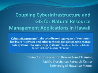
  • 1. Cyberinfrastructure “…the coordinated aggregate of computer hardware / software and other technologies designed to change data systems into knowledge systems” (Synthesis for Earth, Life, & Linda Koch, JenniferstHo, Cory 2003) and Mike Kido Society in the 21 Century NSF Yap Center for Conservation Research and Training Pacific Biosciences Research Center University of Hawaii at Manoa
  • 2. Real-Time Monitoring Wireless Sensor Networks Sensor Data High Performance Computing Data Modeling Research Cyberinfrastructure Core (RCC) Cluster – UHM (Data Processing / Storage) Portal User Interface Mapping - ArcGIS®
  • 3. Research Cyberinfrastructure Core (RCC) Remote sensor Database/Spreadsheet upload ArcGIS Desktop DATA SERVER Upload from portal Map API Smartphone and GPS
  • 4. Research Cyberinfrastructure Core (RCC) Internet access Web Frontends  Data/Application Server Data Storage Library Backup Server
  • 5. Real-Time Monitoring Wireless Sensor Networks Sensor Data High Performance Computing Data Modeling Research Cyberinfrastructure Core (RCC) Cluster – UHM (Data Processing / Storage) Portal User Interface Mapping - ArcGIS®
  • 7. Real-Time Monitoring Wireless Sensor Networks Sensor Data High Performance Computing Data Modeling Research Cyberinfrastructure Core (RCC) Cluster – UHM (Data Processing / Storage) Portal User Interface Mapping - ArcGIS®
  • 8. Hawaiian Island Sensor Network (SDSS)
  • 9. North Kauai Sensor Network (IVJ)
  • 10. Waipa Valley and Waipa Foundation
  • 11. Waipa Weather and Water Quality
  • 12. Real-Time Monitoring Wireless Sensor Networks Sensor Data High Performance Computing Data Modeling Research Cyberinfrastructure Core (RCC) Cluster – UHM (Data Processing / Storage) Portal User Interface Mapping - ArcGIS®
  • 13.
  • 14. Real-Time Monitoring Wireless Sensor Networks Sensor Data High Performance Computing Data Modeling Research Cyberinfrastructure Core (RCC) Cluster – UHM (Data Processing / Storage) Portal User Interface Mapping - ArcGIS®
  • 15. Contact information Hawaii Biodiversity and Mapping Program Center for Conservation Research and Training University of Hawaii at Manoa Jennifer Ho – jhho@hawaii.edu Cory Yap – coryy@hawaii.edu Linda Koch – lkoch@hawaii.edu Mike Kido – mkido@hawaii.edu Mahalo nui loa!