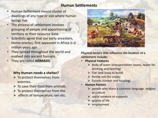
1. Human Settlements
• Human Settlement means cluster of
dwellings of any type or size where human
beings live.
• The process of settlement involves
grouping of people and apportioning of
territory as their resource base.
• Scientists agree that our early ancestors,
Homo erectus, first appeared in Africa 1–2
million years ago.
• They spread throughout the world and
evolved into ancient humans.
• They are called NOMADS.
Why Human needs a shelter?
To protect themselves from
enemies.
To save their food from animals.
To protect themselves from the
effects of temperature,rain etc.
Physical factors that influence the location of a
settlement include;
• Physical Features
Body of water (transportation routes, water for
drinking and farming)
Flat land (easy to build)
Fertile soil (for crops)
Forests (timber and housing)
• Human Factors
people who share a common language, religion
or culture
social network or supports
quality of life
employment
3. The human were settled near the Nile
River.
Physical Features of Egypt
Nile created a long, fertile valley that
ended in a marshy delta where the
river emptied into the Mediterranean
Sea.
On the north, Egypt was bordered by
the Mediterranean Sea. Settlers could
not drink its sparkling salt water, but
the sea was rich in fish and other kinds
of seafood.
Environmental Factors and Human Settlement in
Egypt
• the Nile River valley, the river provided natural
irrigation and fertilization.
• Every summer, the river overflowed its
banks. The floodwaters soaked the dry ground
for several weeks. As the water level
decreased, a thin layer of silt (very fine
particles of rock) was left behind. This soil was
perfect for farming.
• In the south, parts of the Nile ran through narrow
valleys between steep hills.
• But there were also wide, flat areas of land
around deep bends in the river.
• These flat areas were good for farming.
• In the north, wide plains were watered by the
Nile’s annual flooding.
Sea and Desert surrounds the Land
Human Settlement in Egypt
4. The outlay of the city itself was rectangular with an orthogonal street
grid, covering an area of 350 by 400 metres.
It was surrounded by a brick wall and divided into two parts.
streets in the residential districts which were sometimes as narrow as 1½
metres.
The streets had shallow stone channels running down the middle for
drainage.
Amarna(Akhetaten)
There the planners included public open spaces where trees were
planted and inhabitants often had their own private garden plots.
Most of the city was built along an eight kilometer north-south main
street, referred to today as the “Royal Road”. the city, protected by a
fortified wall which enclosed a complex of royal service buildings.
Important Cities
1.Amarna(Akhetaten) 2.Maadi
3.Memphis 3.Thebes
The layout is divided into 3 areas:
1. Main Temple
2. Royal Place in the Middle
3. Three city quarters laid out for development
• The orientation of the houses were towards the Nile River.
Nubian village on the banks of
river Nile, Egypt
5. Human Settlement in Mesopotamia
• the region in south-western Asia where the
world’s earliest civilization developed.
• The region was the centre of a culture whose
influence extended throughout the Middle
East and as far as the Indus valley, Egypt and
the Mediterranean.
• People were permanent Settled.
Due to the fertile soil in Mesopotamia, farming
was very successful. In fact, people were able to
create surpluses of food.
This meant that some people could stop farming
and begin doing other things, like building a city.
Sumerian City
Sumerian city streets were so narrow that you
could hardly get a cart through them.
Sumerian houses faced away from crowded
streets. Instead, they faced onto courtyards
where children played.
6. Uruk
• It is considered the first true city in the world.
• the first example of architectural work in
stone and the building of great stone
structures, the origin of the ziggurat, and the
first city to develop the cylinder seal.
Uruk - Ur - The Great Ziggurat
Cylinder Seals
• The Uruk Period is divided into 8 phases
• The city was most influential between 4100-c.3000
BCE when Uruk was the largest urban center and the
hub of trade and administration.
• A characteristic form of decoration involves the use of
clay cones with painted tops pressed into the mud
plaster facing the buildings - a technique known as
clay cone mosaic.
Reconstructed layout of the city of Uruk.
7. Human Settlement in Greek
The invention of formal city planning was
attributed to Hippodamus of Miletus(c. 498- c.
408 BC).
During his first five years in power Alexander captured five
major cities and many smaller ones.
straight streets intersecting to form quadrilateral city
blocks, had just been popularized in Greece by the
architect Hippodamus.
Hippodamus arranged the buildings and the streets such
that the winds from the mountains and the sea close to
Miletus could flow optimal through the city and provide
a cooling during the hot summer.
The Greeks were the first to use solar architecture They
oriented their houses to make use of the sun during
winter.
Based on street the city were of two types:
1. Old city-irregular street planning(Athens).
2. New city- Grid iron street plan
Hippodamus
Acropolis
8. the city was divided into 3 parts:
1. Acropolis
2. Agora
3. Town
The acropolis in Athens is a religious
place located on the Hill of the city.
It is a perfect composition of doric and
ionic orders in four buildings.
1. Acropolis
2. Agora
It is a gathering place or maket place.
3..Town
In the initial the were in irregular pattern
After the planning the street were in a grid iron
pattern and the houses surrounding it.
9. Messene city
Under he Hellennistic period they created new
cities(urban centers).
Cities were followed a Hippodamian structure.
Its was an urban planning concept that followed
orthogonal grid system.
Hippodamian resulted in creation of public spaces of
human scale.
Strong fortification walls with
towers and gates are
preserved along a course of
9.5 km.
UNESCO has declared it world
heritage monument because
of many reasons.
10. Human Settlement in Ancient Rome
The ancient rome was founded near the river TIBER.
They employed orthogonal structures inspired by Greek
And Hellenic examples.
Followed a square grid
Al roads were
Timgad
It served as a Roman military colony and its plan,
laid out with great precision, illustrates Roman
urban planning at its height.
Buildings, constructed entirely of stone,
Arch of Trajan
The arch reaches a height of 12 metres, with a
central arch of 6 metres in height
Timgad was destroyed at the end of
the 5th century by montagnards of the
Aurès.
Timgad was inscribed as a World
Heritage Site by UNESCO in 1982.