
Empfohlen
Empfohlen
Weitere ähnliche Inhalte
Kürzlich hochgeladen
Kürzlich hochgeladen (20)
Empfohlen
Empfohlen (20)
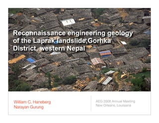
Reconnaissance engineering geology of the Laprak landslide,Gorhka District, western Nepal
- 1. Reconnaissance engineering geology of the Laprak landslide,Gorhka District, western Nepal William C. Haneberg AEG 2008 Annual Meeting New Orleans, Louisiana Narayan Gurung
- 2. Acknowledgements • AEG Foundation Research Fund • Kadoorie Agricultural Aid Assocation • Dr. G.V. Ramana, Department of Civil Engineering, IIT-Delhi • The people of Laprak
- 3. Geologic setting China Laprak Nepal India Source: Geological Map of Nepal (1994) 0 50 km
- 5. View to the east
- 6. ? View to the southwest across the Raizo Khola valley
- 7. Damage to an occupied home
- 8. More damage to another occupied home
- 9. Shaded Relief Illumination from 30°/315°
- 10. Slope Angle with Shaded Relief (30°/360°)
- 11. Slope Aspect with Shaded Relief (30°/360°)
- 12. Foliation (335°-355°) Shears? (300°-320°) Joints (130°-140°) Dip Direction (Aspect) of Known Planar Structures with Shaded Relief (30°/360°)
- 13. Bedrock structural controls Elevation Easting Northing
- 14. Bedrock structural controls Metamorphic foliation Elevation Easting Northing
- 15. Bedrock structural controls Metamorphic foliation Foliation-perpendicular joints Elevation Easting Northing
- 16. Bedrock structural controls Metamorphic foliation Foliation-perpendicular joints Low angle shears? Elevation Easting Northing
- 17. Bedrock structural controls Metamorphic foliation Foliation-perpendicular joints Low angle shears? Easting Northing Colluvium wedges controlled by intersecting bedrock structures (upslope view)
- 18. Rainfall and landslide movement 1 life 10 homes 6 homes 5 homes 3 homes 12 hectares 5 hectares 4 hectares 2 hectares 5500 4125 Annual 2750 (mm) 1375 0 1500 Maximum 1125 monthly 750 (mm) 375 0 350.0 262.5 Maximum daily 175.0 (mm) 87.5 0 1999 2000 2001 2002 2003 2004 2005 2006 2007
- 19. Laprak 1999 and 2007 extreme rainfall events Gabet et al Himalayan rainfall threshold • Compared peak sediment loads in streams with daily rainfall and annual accumulated monsoon rainfall in the Annapurna region of Nepal • Concluded that 850 mm accumulated monsoon rainfall was necessary for sediment- generating landslides to occur each year • Gabet et al, 2004, Geomorphology 63: 131-143
- 20. Remedial options • Structural, grading, or drainage • Hand labor, limited budget, difficult access • Resettlement • No suitable nearby locations • Resistance to distant resettlement • Warning system(s) • Rainfall threshold • Movement monitoring • Temporary evacuation • Safer buildings • Lightweight materials • Hand-buildable and affordable design? • Resistant to landslides and earthquakes • Easy to repair