SlideShare ist ein Scribd-Unternehmen logo
1 von 23
HafezAhmad
1 Hafez Ahmad
Marine Geophysics
Introduction to Marine Geophysics:
1. Define geophysics? What is marine geophysics?
Geophysics is a branch of earth science concerned with the physical processes and physical properties
of the Earth and its surrounding space environment, and the use of quantitative methods for their
analysis.
Marine geophysics is a partof geophysics which usesthe quantitative observation of physical properties
to understand the seafloor and sub-seafloor geology. Both active and passive sensors are used to
measure the shape and hardness of the seafloor as well as to define and map sub-seafloor structures.
2. Howwould you differentiate between solid earth geophysics & marine geophysics?
Solid earth geophysics is concerned with solid layers of the earth but marine geophysics is a specified
section of geophysics that is being applied in the marine environment. On the other hand, solid
geophysics is applied to both land and seafloor in different activities such as oil gas exploration.
How an oceanographer can be a geophysicist at same time?
Oceanography is the scientific study of the ocean and Geophysics is the science of the physical
processes in the Earth. Nowadays, geophysics embraces the study of the internal constitution of the
Earth, of the oceans, the atmosphere and the outer space beyond. Oceanography covers four different
sections, for example, physical, biological, chemical and geological. All sections are related to the earth.
Especially, physical oceanography is the total physics of the ocean. The ocean covers about 71% of the
earth's surface. Geoscientists do exploration and research to gain knowledge of the earth's structure,
composition, and processes. They locate, identify and extract hydrocarbon, mineral and groundwater
resources to find out how development and waste disposal projects affect the environment and to lessen
the effects. They also examine earth's surface processes—for example, stream flow and bank erosion.
Oceanographers do exploration and research on:
1. Oceanic processes and phenomena
2. Biological, chemical and physical characteristics of oceans
3. Interactions with atmospheric and geological environments
4. Impacts of human activity on oceans and marine ecosystems
So, this is the reason why oceanographers can be geophysics at the same time.
3. Differentiate between geology and geophysics?
Geology is the study of the solid Earth and involves both qualitative and quantitative descriptions of
the solid Earth. Geologist use the methods of applied geophysics to try and measure remotely parts of
the Earth that are not available to direct investigation. The study of geology and geophysics intersect in
for example in the study of the composition of the deep interior of the Earth and the driving mechanism
behind plate tectonics.
Geophysics is the study of the entire planet and its thermal evolution. This means the atmosphere (low,
middle and high), ionosphere, oceans, cryosphere (glaciers) as well as the solid Earth (crust, mantle,
outer and inner core). Geophysics is also concerned with Earth’s interactions with the moon and sun.
Broadly speaking the study of geophysics include:
1. Physical oceanography
2. Atmospheric Physics (meteorology, climatology etc.)
HafezAhmad
2 Hafez Ahmad
3. Aeronomy and ionospheric physics
4. Geodesy
5. Geodynamics (Shared with geology)
6. Tectonophysics (also shared with geology)
4. Discuss the scopes, importance and limitations ofmarine geophysics?
Scope and importance geological research
1. Resources exploration (oil and gas exploration, mineral prospecting , geothermal and
groundwater exploration)
2. Benthic habitat research
3. Marine boundary delineation
4. Safety of navigation
5. Defence.
6. Naturalhazard studies (earthquake,volcanoes and landslide)
7. Engineering (underground utility locating, concrete inspection, rebar locating, pavement evaluation,
underground void locating, and ground strength testing)
8. Environmental application (underground storage tank locating, contamination delineation
, landfill delineation and bedrock depth mapping)
Geophysical testing offers some notable advantages and some disadvantages that should be
considered before the technique is recommended for a specific application. The advantages are
summarized as follows:
1. Many geophysical tests are non-invasive and thus offer significant benefits in cases where
conventional drilling, testing, and sampling are difficult (e.g., deposits of gravel, talus deposits) or
where potentially contaminated soils may occur in the subsurface.
2. In general, geophysical testing covers a relatively large area,thus providing the opportunity to
characterize large areas with few tests. It is particularly well-suited to projects that have large
longitudinal extent compared to lateral extent (such as for new highway construction).
3. Geophysical measurement assesses the characteristics of soil and rock at very small strains,
typically on the order of 0.001 percent thus providing information on truly elastic properties.
4. For the purpose of obtaining information on the subsurface,geophysical methods are
relatively inexpensive when considering cost relative to the relatively large areas over which
information can be obtained.
limitation of marine geophysics
1. Most methods work best for situations in which there is a large difference in stiffness between
adjacent subsurface units.
2. It is difficult to develop good stratigraphic profiling if the general stratigraphy consists of
hard material over soft material
3. Results are generally interpreted qualitatively and therefore useful results can only be
obtained by an experienced engineer or geologist familiar with the particular testing method.
HafezAhmad
3 Hafez Ahmad
4. Specialized equipment is required (compared to more conventional subsurface exploration
tools.
5. Historical development ofmarine geophysics?
Marine geology and geophysics as a field dates back at least to the HMS Challenger expedition in
1872-1876.
During the 1960s and early 1970s, the three major institutions conducting research in marine geology
and geophysics (Lamont, Scripps, and Woods Hole)
Some important geophysical methods with their applications
Geophysical methods provide indirect quantitative measurements of physical properties of sediment
and rocks and are subject to varying degrees of ambiguity in their interpretation.
There are three basic methods of Geophysical methods
a. Potential fields methods: Potential field methods include gravity and magnetic surveys. these
methods rely on Earth's gravitational and magnetic field and are used to image the subsurface.
They are an indirect (above ground) means of sensing the density and magnetization (physical
properties) of subsurface materials for the purpose of locating faults and other lithology.
Potential-field surveys can cover large areas of ground quickly and inexpensively and are,
therefore, often used to identify smaller target areas for further investigation.
1. Gravity : The gravity method involves measuring the earth’s gravitational field at specific
locations on the earth’s surface to determine the location of subsurface density variations. The
basic on which gravity methods depends is encapsulated in two laws derived by newton’s
universal law of gravitation and his second law of motion.
2. Magnetics : Magnetic geophysical surveys measure small, localized variations in the Earth's
magnetic field. The magnetic properties of naturally occurring materials such as magnetic ore
bodies and basic igneous rocks allows them to be identified and mapped by magnetic surveys.
b. Wave propagation methods
1. Seismic (sound wave): Seismic reflection technique consists of generating seismic waves
and measuring the time taken for the wavesto travelfrom the source,reflect off an interface
and be detected by an array of receivers (or geophones) at the surface.
2. Radar (EM wave)
c. Diffusive fields methods
1. Electrical : This Method detects the surface effects produced by electric current flow in
the ground. Using electrical methods, one may measure potentials, currents, and
electromagnetic fields that occur naturally or are introduced artificially in the ground.
2. Heat flow : Heat is constantly being dissipated through the ocean bottom generated from
the decay of radioactive elements within the earth. For example high rates of heat dissipation would be
expected over metallic ore bodies of high conductivity than over salt domes of relatively low
conductivity.
Electromagnetic method:
1. Briefly describe the electromagnetic method?
Electromagnetic (EM) methods. In applied geophysics, the term is usually used to refer to
methods that use a low frequency time-varying magnetic field as a source to excite electrical
currents in the ground through the principle of electromagnetic induction. These methods are
sensitive to the electrical conductivity of the subsurface. Electromagnetic survey methods are
HafezAhmad
4 Hafez Ahmad
based on two fundamental principles: Faraday’s law of electromagnetic induction and the fact
that electric currents generate magnetic fields, expressed in Ampère’s law. In its simplest form
Faraday’s law states that the electromotive force (EMF) in a closed circuit is proportional to
the rate of change of magnetic flux through the circuit, or in even simpler terms: a changing
magnetic field will induce an EMF.
The magnetic flux 𝜙 𝐵 which crosses a closed loop is given by
𝜙 𝐵 = ∫ 𝐵⃗
{ 𝑎𝑟𝑒𝑎}
⋅ 𝑛̂ 𝑑𝑎
Where 𝑛̂ the outward pointing normal is vector for the loop and 𝐵⃗ is the magnetic flux density,
which is proportional to the magnetic field in free space.
2. Write down the uses of electromagnetic method?
Electrical and electromagnetic methods are powerful tools in environmental and geotechnical
investigations. Techniques developed for deeper applications, such as mining, geothermal and crustal
studies, are scaled for shallow targets by moving to higher frequencies, earlier decay times and/or
smaller array configurations.
1. Hydrological investigations ( To estimate volume extend and internal structure of aquifers, to
mapping the infiltration of the vadose zone, and contamination of the groundwater)
2. Landfill investigation
3. Unexploded ordnance detection
3. What control electromagnetic induction?
Electromagnetic induction
Electromagnetic or magnetic induction is the production of an electromotive force across an electrical
conductor in a changing magnetic field. Electromagnetic Induction was first discovered way back in
the 1830’s by Michael Faraday. Faraday noticed that when he moved a permanent magnet in and out
of a coil or a single loop of wire it induced an Electro Motive Force in other words a Voltage, and
therefore a current was produced.
The direction of the induced potential difference or induced current depends on the direction of
movement. The current is reversed when:
1. the magnet is moved out of the coil
2. the other pole of the magnet is moved into the coil
4. What is geomagnetism?
HafezAhmad
5 Hafez Ahmad
Geomagnetism is the study of the dynamics of the Earth'smagnetic field, which is produced in the inner
core. The Earth's magnetic field is predominantly a geo-axial dipole, with north and south magnetic
poles located near the geographic poles that undergo periodic reversals and excursions.
5. What do you understand by magnetic anomaly? Why does it vary from place to place?
A magnetic anomaly is a local variation in the Earth's magnetic field resulting from variations in the
chemistry or magnetism of the rocks. Anomalies in the earth’s magnetic field are caused by the induced
or remanent magnetism. This anomaly created when the earth’s magnetic field is disturbed by an object
that can be magnetized. Induced magnetic anomalies are the result of secondary magnetization induced
in a ferrous body by the earth’s magnetic field. Common causes of magnetic anomalies include dykes,
faults and lava flow. Where the rocks have magnetic susceptibility, the local magnetic field will be
strong, where they have low magnetic susceptibility, it will be weaker. Magnetic gradient anomalies
generally give a better definition of shallow buried features such as buried tanks and drum but are less
useful for investigating large geological features.
Radioactivity:
1.What is radioactivity? What gives rise to natural radioactivity in earth materials?
the property possessed by some elements (such as uranium) or isotopes (such as carbon 14) of
spontaneously emitting energetic particles (such as electrons or alpha particles) by the disintegration of
their atomic nuclei.
4. What is radioactive decay? What is half life?
Radioactive decay is the process by which an unstable atomic nucleus loses energy by radiation. A
material containing unstable nuclei is considered radioactive. Three of the most common types of decay
are alpha decay, beta decay, and gamma decay,all of which involve emitting one or more particles or
photons.
The half-life of a radioactive substance is a characteristic constant. It measures the time it takes for a
given amount of the substance to become reduced by half as a consequence of decay,and therefore,the
emission of radiation.
5. Describe some common types of particles in earths radioactivity?
The emissions of the most common forms of spontaneous radioactive decay are the alpha
(α) particle, the beta (β) particle, the gamma (γ) ray, and the neutrino. The alpha particle is actually
the nucleus of a helium-4 atom, with two positive charges 4
2He.
Common Sources ofRadiation
Sources can be natural and artificial. The natural gamma radiation that is measured, emanates from
many rock types, those containing uranium and potassium being most active including granites, shales
and clays, and from radon gas in the atmosphere as a by-product of uranium. Also, cosmic radiation
forms a ‘background’ level.
Artificial sources include detecting leakage from reactors and isotopes used as tracers. The latter have
generally much higher energy levels than natural sources.
4. What is the principle ofradiometric method?
The radiometric instrument measures the level of gamma radiation by recording the flashes of light, or
‘scintillations’ that occur when a gamma ray impinges on a special crystalcalled, a “phosphor”. The
brilliance of the flash is proportional to the gamma ray’s energy and each scintillation is detected by a
photomultiplier tube that converts the light into a voltage pulse. Since the value of voltage is directly
HafezAhmad
6 Hafez Ahmad
related to the energy, a “spectrum’ of energy levels can be developed and particular elements
distinguished.
5. Write down the Applications ofradiometric method?
The radiometric method has a number of applications.
1. Obviously it is most applicable to the direct search for uranium.
2. Since many rocks are naturally radioactive to characteristic degrees, the method is suitable to map
geology by way of distinguishing different rock types. Indeed the method works more on the chemical
response than the physical properties of the rock. In this way different rock types and different phases
may be distinguishable when they are not visually.
3. Since gamma rays cannot penetrate more than ~½ metre of rock, the natural response from rocks is
however, limited to this order of depth. The method is therefore able to map only the very near surface.
In this way, it is useful in agriculture in mapping different soil types.
4. It can detect faults that act as conduits for radiation in the form of radon gas to escape to the surface.
5. Another important application of the method is its ability to determine the actualconcentration of the
radioactive elements and so ‘assay’ quantitatively rocks or drill-core, in situ, if necessary. This can be
quicker than having assays done in a geochemical laboratory and may be sufficient.
6. The progress of radioactive tracers used to define rate of flow of liquids can be monitored using
radiometric instruments.
7. Contamination in soil from leakage from nuclear reactors.
8. The presence of radioactive radon gas can be a precursor to earthquakes.
Gravity:
1.What is gravity? Write down the Newtons lawof gravity?
Gravity is a force of attraction that exists betweenany two masses,any two bodies, and any two particles
everywhere in the universe.
Newton's law of universal gravitation is usually stated that every particle attracts every other particle in
the universe with a force which is directly proportional to the product of their masses and inversely
proportional to the square of the distance between their centers.
𝐹 =
𝐺(𝑚1 𝑚2)
𝑟2
2. Briefly describe the applications ofgravity surveying?
Gravity and magnetic surveys play an important role in mapping geological structures at micro (oil
concession) and macro (continental) scales,as these surveys allow rapid spatial coverage at modest
cost compared to seismic reflection methods. Application of gravity method
1. Determine shape of the earth
2. Hydrocarbon exploration
3. Regional geological studies
4. iso-static compensation determination
5. Detection of sub-surface cavities
HafezAhmad
7 Hafez Ahmad
6. Location of buried rock valleys
7. Determination glacier thickness
8. Tidal oscillations
9. Basin geometry
3. What is gravity survey? What is Gravimeter? Describe a simple astatic gravity meter.
The gravity method involves measuring the earth’s gravitational field at specific locations on the
earth’s surface to determine the location of subsurface density variations. The basic on which
gravity methods depends is encapsulated in two laws derived by newton’s universal law of
gravitation and his second law of motion.
1. 𝐹 =
𝐺( 𝑚1 𝑚2)
𝑟2
𝐹 = 𝑚𝑔, 𝑡ℎ𝑒𝑟𝑒𝑓𝑜𝑟𝑒 , 𝑔 =
𝐺𝑀
𝑅2
Gravimeter
A gravimeter is an instrument used to measure gravitational acceleration. Every mass has an
associated gravitational potential. The gradient of this potential is a force. A gravimeter measures
this gravitational force
How does a gravimeter work?
Gravimeters are basically spring balances carrying a constant mass. The instrument works on the
principle of measuring constant downward acceleration of gravity. It measures only relative gravity
by analyzing the response of a spring to an attached mass acting in a gravitational field.
Variations in the weight of the mass caused by variations in gravity cause the length of the spring
to vary and give a measure of the change in gravity.
Gravity method (Equipment) • There are two types of gravimeters:
1. Relative : Relative gravimeters compare the value of gravity at one point with another
HafezAhmad
8 Hafez Ahmad
2. Absolute. Absolute gravimeters measure the local gravity in absolute units, gals
They must be calibrated at a location where the gravity is known accurately,and then transported to the
location where the gravity is to be measured. They measure the ratio of the gravity at the two points.
Some applications of gravimeters include:
 Geodesy
 Metrology
 Seismology
 Petroleum and mineral prospecting
 Geophysical surveys and other geophysical research
 Precision inertial navigation
3. Describes the method ofgravity surveying with different types ofcorrections.
Gravity method is non-destructive geophysical technique that measures differences in the earth’s
gravitational field at specific locations. It is a relatively cheap,non-invasive and non-destructive
remote sensing method.in gravity survey, subsurface geology is investigated on the basis of variations
in the earth’s gravitational field arising from differences of density between subsurface rocks. The
higher the gravity values, the denser the rock beneath.
HafezAhmad
9 Hafez Ahmad
5. What is gravity anomaly? What is rock density?
A gravity anomaly is the difference between the observed acceleration of free fall, or gravity, on a
planet's surface,and the corresponding value predicted from a model of the planet's gravity field. These
anomalies are thus of substantial geophysical and geological interest. Gravity anomalies are often due
to unusual concentrations of massin a region. For example, the presence ofmountain rangeswill usually
cause the gravitational force to be more than it would be on a featureless planet — positive gravity
anomaly. Conversely, the presence of ocean trenches or even the depression of the landmass that was
caused by the presence of glaciers millennia ago can cause negative gravity anomalies.
These techniques provide critical input to many scientific models used in oceanography, hydrology,
geology, and related disciplines, and will be used for a variety of applications including:
1. measuring the changing mass of polar ice caps;
2. measuring changes in water resources on land
3. understanding shallow and deep ocean current transport;
HafezAhmad
10 Hafez Ahmad
4. understanding sea level change resulting from ocean temperature and water mass changes;
5. understanding atmosphere-ocean mass exchange;
6. understanding the forces that generate Earth’s geomagnetic field; and
7. Understanding internal Earth forces that move tectonic plates and result in earthquakes and
volcanic eruptions.
Rock densityis a physicalcharacteristic that is governed by the chemical composition (in situ minerals)
and pore spaces of a specific rock or rock type.
Properties
1. Bulk density
2. Elasticity
3. Porosity, pore size and shape
4. Texture
5. Fracture and creak
How does gravity affected by rock density AND what is the relation between rock density and
gravity ?
Many geodynamic processes are either directly or indirectly driven by the force of gravity due to the
spatial variation of rock density inside the Earth. Density is a measure of how much mass is
concentrated in a given space. Sir Isaac Newton discovered that as an object's mass increases,
the gravitational attraction of that object increases Thus, the gravitational attraction on the Moon is
much less than it is here on Earth. Densities of rocks near the surface of the Earth range from about 800
kgm-3
-3000 kgm−3
, and depend on factors like composition, crystallinity, void fraction and water
saturation.
If the densities of the substance of interest and the reference substance are known in the same units
(e.g.,both in g/cm 3
or lb/ft 3
), then the specific gravity of the substance is equal to its density divided
by that of the reference substance. Similarly, if the specific gravity of a substance is known and the
density of the reference substance is known in some particular units, then the density of the substance
of interest, in those units, is equal to the product of its specific gravity and the density of the reference
substance. Because the densities of all substances vary with temperature and pressure,the temperature
and (particularly for gases) the pressure for both the reference substance and the substance of interest
are often included when precise values of specific gravities are given.
HafezAhmad
11 Hafez Ahmad
Resistivity:
1.What is resistivity method? What is apparent resistivity?
Electric resistivity methods are a form of geophysical surveying that aids in imaging the subsurface.
These methods utilize differences in electric potential to identify subsurface material.
Apparent resistivity is defined as the resistivity of an electrically homogeneous and isotropic half-space
that would yield the measured relationship between the applied current and the potential difference for
a particular arrangement and spacing of electrodes.
3. Write down the application of resistivity surveying? Limitation ofresistivity
surveying?
Electrical resistivity imaging is a widely used tool in near surface geophysical surveys for investigation
of various geological, environmental and engineering problems including landslide. In addition, a 2-D
synthetic resistivity modelling study wascarriedout to understand the response of the resistivity method
to a landslide problem before the field surveys.
1. Used for many decades in hydrogeological, mining and geotechnical investigations.
2. Use to quantify mineral and fluid content, porosity and degree of water saturation in the rock.
3. Quantitative modelling is possible either computer software or published master curves
4. The resulting models can provide accurate estimate ofdepth , thickness and electrical resistivity
of subsurface layers
5. Used to estimate total concentration of dissolved solids in the fluids.
Limitations
1. Limitations of using the electrical resistivity method in ground water pollution investigations
are largely due to site characteristics, rather than in any inherent limitations of the method.
2. Typically, sites are located in industrial areas that contain an abundance of broad-spectrum
electrical noise.
3. In conducting an electrical resistivity survey, the voltages are relayed to the receiver over long
wires that are grounded at each end.
4. These wires act as an antenna receiving the radiated electrical noise that in turn degrades the
quality of the measured voltages.
5. Another consideration in the electrical resistivity method is that the fieldwork tends to be more
labour intensive than some other geophysical techniques.
6. A minimum of three crewmembers is required for the fieldwork.
Advantages and disadvantages of wenner and schlumber Arrays.
HafezAhmad
12 Hafez Ahmad
6. Ohms law and Archies law.
Ohm's law states that the current through a conductor between two points is directly proportional to
the voltage across the two points. V = IR (V=voltage, I=current , R=resistance)
The electrical resistivity of a rock depends mainly on quantity of water in a unit volume of rock and
on the quality of this water. These factors are taken into account in the Archie law which link the
resistivity of the electrolyte.
𝜌𝑡 = α𝜌 𝑤ϕ−𝑤 𝑆 𝑤
−𝑛
ϕ = porosity,α,m,n = constants,ρ = resistivity of water,S = water saturation,C
= cementation
5. Why highest resistivity for igneous rock?
6. Methods for resistivity surveying (Soundind and Profiling).
The three most common modes of electrical resistivity surveying are profiling, sounding, and profiling-
sounding, each having its own specific purpose. If the purpose of the survey is to map the depths and
thickness of stratigraphic units, then the electrical resistivity data should be collected in the sounding
mode . In the depth sounding mode, all four electrodes are initially placed in the ground with a very
short spacing between adjacent electrodes. A reading is taken, and then the array is reset with an
incremental increase in spacing. Another reading is taken, and the array is, in turn, progressively
expanded in this manner until the maximum depth to be investigated is reached. The current and
potential sense progressively deeper layer as the array is expanded.
In the profiling mode, a constant electrode spacing is selected that senses the subsurface geology to the
depth of interest, and this constant array is "leap frogged" along a profile line to measure lateral
variations along the profile that have geologic meaning.
7. The wenner Arrays and schlumber Arrays.
The Schlumberger arrayis an arraywhere four electrodes are placed in line around a common midpoint.
The two outer electrodes, A and B, are current electrodes, and the two inner electrodes, M and N, are
potential electrodes placed close together. the Schlumberger array is commonly used for vertical
electrical sounding (VES) for groundwater and aggregate minerals. Vertical electrical sounding (VES)
using the Schlumberger array provides better resolution, and take less time to deploy than the Wenner
array (source).
The Schlumberger arrayis an arraywhere four electrodes are placed in line around a common midpoint.
The two outer electrodes, A and B, are current electrodes, and the two inner electrodes, M and N, are
potential electrodes placed close together.
HafezAhmad
13 Hafez Ahmad
Seismic Survey:
1.Briefly describe the seismic survey?
Seismic surveys consist of a means of generating sound waves that are transmitted into the earth and a
means of recording the energy that is returned back from changes in rock layers. A seismic survey is a
low impact, non-invasive method of gathering information about the location and characteristics of
geological structuresbeneath the Earth'ssurface.This information is used to produce maps of structures
identifying areas where gas deposits may be found.
The seismic testing is carried out by a specially configured truck (called a vibroseis truck) that lowers
a plate onto the surface. This plate generatesanacoustic sound signal that is transmitted into the earth’s
surface which then reflects off the various geological layers. The returning sounds waves are recorded
by small microphones (geophones) strung together that are laid along a predetermined and prepared
path called a seismic line.
Seismic air gun
Seismic airguns produce loud, repetitive sounds that can travel underwater up to 2,500 miles.it is a
practice commonly used by the oil and gas industries to locate deposits deep beneath the seafloor. It is
also used for research applications to map buried sediments.
Difference between hydrophone and geophone
Hydrophone Geophone
A hydrophone is an underwater device that
detects and records ocean sounds from all
directions.
A geophone is a ground motion transducer that
has beenused by geophysicists and seismologists
to convert ground movement into voltage
hydrophone detects sounds in the water and
converts the acoustic energy into electrical
energy
to convert ground movement into voltage
HafezAhmad
14 Hafez Ahmad
Used in water a device that is placed on or in the ground and
used to detect seismic waves
How seismic energy is attenuated and attenuation factors
Seismic attenuation describes the energy loss experienced by seismic waves as they propagate. It is
controlled by the temperature, composition, melt content, and volatile content of the rocks through
which the waves travel. It results in the decay of amplitude of the seismic waves. Attenuation is related
to velocity dispersion. The energy of seismic wave is conserved if it travels through a perfectly elastic
medium. Propagating seismic waves loose energy due to
1. Geometrical spreading
2. Absorption (anelastic attenuation)
3. Scattering (elastic attenuation)
Geometrical spreading: Seismic wave amplitudes vary as they travel across the Earth. As the
wavefront moves out from the source, the initial energy released in the seismic wave is spread over an
increasing area and therefore the intensity of the wave decreases with distance. The decrease of the
kinetic energy of seismic waves is also due to the energy absorption caused the imperfections in the
earth.
Anelastic attenuation:There is another factor that affects seismic amplitudes. This is the energy loss
due to anelastic processes or internal friction during wave propagation. This is called intrinsic or
anelastic attenuation. Intrinsic attenuation occurs mostly during shear wave motion associated with
lateral movements of lattice and grain boundaries. When traveling through subsurface,an elastic wave's
mechanical energy is converted to heat energy due to friction and changes in viscosity.As the wave
spreads, attenuation removes the high frequency component of the pulse.
Scattering: Attenuation is frequency-dependent and is strongly affected by scattering. Scattering is an
important factor caused by the heterogeneity of the Earth's crust and mantle and availability of
hydrocarbon reservoirs. Scattering theory states that rocks containing oil and gas can cause energy
attenuation in seismic waves,particularly the high frequency waves,passing through them. Frequency-
dependent attenuation can be used to detect hydrocarbons.
Geological significant of seismic attenuation
Seismic attenuation is in rocks is proportional to frequency, thehigher-frequencycomponents of propagating
seismic waves are more attenuated than the lower-frequency components. Q (quality factor) is sensitive to
clay volume, pressure, saturation, and fracture, therefore seismic attenuation can be used for lithology
discrimination. The effect of saturation and pore pressure on attenuation is greater on the order of magnitude
than the effect of saturation on velocity. Seismic attenuation is a powerful attribute that is sensitive to
hydrocarbon accumulation, fluid-saturated fractures, and rugosity. Thus attenuation is extremely useful for
reservoir characterization. Theratio of compressionaltoshear attenuations is applied as hydrocarbonindictor
in well logs.Qp /Qs < 1 indicates presence of gas or condensate, while Qp /Qs - 1 indicates 'full water' or 'oil
+ water' saturation. The upper mantle demonstrates a prevailing shear attenuation not bulk attenuation so
Qp / Qs ratios are usually small in partially molten materials. At the same time, rocks near their melting point
have large Vp/Vs ratios (Vp/Vs > 2). Estimates of seismic attenuation combined with Vp and Vs variations
provide information of the physical state of the upper mantle and explain the impact of temperature,
composition and melt friction.
Seismic data interpretation and categories
Seismic interpretation conveys the geologic meaning of seismic data by extracting subsurface
information from it and can be of different kinds, such as structural, stratigraphic and seismic
stratigraphy. It depends on the geologic objectives .The interpretation work flows may be categorized
as below and each considered in some detail in subsequent sections:
HafezAhmad
15 Hafez Ahmad
1. Category I: Structural Interpretation (on 2D data) – first level regional interpretation, mainly
structural in nature, and attempted in the early stage of exploration.
2. Category II: Stratigraphic Interpretation (on 2D/3D/4D data) – higher-level synergistic
interpretation that provides stratigraphic information including rock and fluid properties during
exploration/delineation and production stage.
3. Category III:Seismic Stratigraphy Interpretation (on 2Ddata) – regional geologic interpretation
of depositional systems and tectonic styles for basin evolution and evaluation, and is carried
out mostly in initial stage of exploration.
4. Category IV: Seismic Sequence Stratigraphy Interpretation (2D/3D) – integrated detailed
stratigraphic interpretation of log and core data with seismic, in exploration / delineation/
development stage.
5. Write down the applications ofseismic survey?
a. The seismic survey can explain subsurface discontinuities, layering, and probable
rocks/structures.
b. It is suitable for the investigation of coal, oil and gas, groundwater, and massive metallic
deposits.
c. 3D seismic surveys are a powerful tool to monitor spatial distribution of injected CO2
Magnetic surveys are a geophysical method to image
anomalies in the earth's magnetic field caused by source
bodies within the sub-surface. Oil and gas exploration use
magnetic anomalies to detect faults and igneous intrusions.
Instruments
1: magnetometer is a more complex instruments which
measuresboth the orientation and strength of a magnetic field.
Magnetometer surveys measure small, localized variations in
the earth’smagnetic field. Magnetometersare highly accurate
instruments allowing the measurement with accuracy about
0.002%.
Common instruments: gradiometer, magnetometer systems,
fluxgate, caesium vapor and proton precession. Marine: rubidium-vapor magnetometers, Towed
Magnetometers.
What is a Fluxgate magnetometer?
The fluxgate magnetometer is a magnetic field sensor for vector magnetic field. Its normal range is
suitable for measuring earth's field and it is capable of resolving well below one 10,000th of that. The
fluxgate magnetometer was originally designed and developed during World War II. It was built for
use from low-flying aircraft as a submarine detection device. Today it is used for making borehole
measurements, and the transducers are found in electronic compasses and in laboratory devices for
measuring remanent magnetization.
HafezAhmad
16 Hafez Ahmad
How it works?
Two parallel bars of a ferromagnetic material are placed closely together. Each bar is coiled with a
primary coil, but the direction in which the coil is wrapped around the bars is reversed. An alternating
current (AC) is passed through the primary coils causing a large, artificial, and varying magnetic
field in each coil. This produces induced magnetic fields in the two cores that have the same strengths
but opposite orientations, at any given time during the current cycle.
If the cores are in an external magnetic field, one component of the external field will be parallel to the
core axes. As the current in the primary coil increases,the magnetic field in one core will be parallel to
the external field and so reinforced by it.
The secondary coil surrounds the two ferromagnetic cores and the primary coil. In the absence of an
external field the voltage detected in the secondary coil would be zero because the magnetic
generated in the two cores have the same strength but are in opposite directions. In the presence of an
external field component, the behavior in the two cores differs. Thus, the fluxgate magnetometer is
capable of measuring the strength of any component of the Earth's magnetic field by simply
reorienting the instrument.
Modes of magnetic survey ?
1. Airborne: fluxgate and proton magnetometer can be mounted within or tower behind aircraft
including helicopters.
2. Ship borne: can be completed over water by towing a magnetometer behind a ship.
3. Ground based : conducted on foot or with a vehicle.
Mapping of variation over an area is valuable in detecting structures obscured by overlying material.
As the earth rotates, the outer layers of the ionosphere interact with the solar wind to cause minor
fluctuations in the magnetic field. Thus why the earth’s magnetic field varies with time.
HafezAhmad
17 Hafez Ahmad
Difference between passive and active
Passive methods (Natural Sources): Incorporate measurements of natural occurring fields or properties
of the earth. Ex. SP, Magnetotelluric (MT), Telluric, Gravity, Magnetic.
Active Methods (Induced Sources) : A signal is injected into the earth and then measure how the earth
respond to the signal. Ex. DC. Resistivity, Seismic Refraction, IP, EM, Mise-A-LA-Masse, GPR.
Application of gravity survey
A Gravity survey is an indirect (surface) means of calculating the density property. Gravity survey is to
investigate variation (gravity anomalies) in the Earth's gravitational field generated by differences of
density between subsurface rocks.
The primary goal of studying detailed gravity data is to provide a better understanding of the subsurface
geology. The gravity method is a relatively cheap,non-invasive, non-destructive remote sensing method
that has already been tested on the lunar surface. It is also passive – that is, no energy need be put into
the ground in order to acquire data.
Seismic method in geophysics and sources of energy in this method
Seismic methods are based on the study of elastic wave propagation inside the earth. These waves are
generated by explosions on the earth’s surface (in seismic exploration), or by seismic sources in the
earth’s crust. The seismic receiver geophones record on the surface of the earth the “echo” signal
reflected from deep geological structures.
Seismic surveys consist of a means of generating sound waves that are transmitted into the earth and a
means of recording the energy that is returned back from changes in rock layers. They may be one of
two types.
1. The commonest is a reflection survey where the energy travels largely vertically and is reflected
back from the interfaces between different rock types. The less common type is the refraction
survey where the energy travels along the boundary of two layers (as a head wave) before
returning to the surface .
2. Refraction surveys are used to image deep structures where reflection data can be poor and to
determine near surface velocity models that are used to correct the processing of reflection data
in land applications
HafezAhmad
18 Hafez Ahmad
Temporal variation
Consider the following three temporal variations:
1. Secular Variations - These are long-term variations in the main magnetic field that are presumably
caused by fluid motion in the Earth's Outer Core. Because these variations occur slowly with respect
to the time of completion of a typical exploration magnetic survey, these variations will not
complicate data reduction efforts.
2. Diurnal Variations - These are variations in the magnetic field that occur over the course of a day
and are related to variations in the Earth's external magnetic field. This variation can be on the order
of 20 to 30 nT per day and should be accounted for when conducting exploration magnetic surveys.
3. Magnetic Storms - Occasionally, magnetic activity in the ionosphere will abruptly increase. The
occurrence of such storms correlates with enhanced sunspot activity. The magnetic field observed
during such times is highly irregular and unpredictable, having amplitude changes as large as 1000 nt.
Exploration magnetic surveys should not be conducted during magnetic storms.
Application of seismic survey:
1. The seismic survey can explain subsurface discontinuities, layering, and probable
rocks/structures.
2. It is suitable for the investigation of coal, oil and gas, groundwater, and massive metallic
deposits.
3. Seismic survey data used to identify deepwater geohazard occurrences
4. Seismic surveys are carried out on land and at sea
5. Seismic surveys are used to locate and estimate the size of offshore oil and gas reserves.
6. To carryout such surveys, ships towmultiple air gun arraysthat emit thousands of high-decibel
explosive impulses to map the seafloor.
7. The auditory assault from seismic surveys hasbeenfound to damage or kill fish eggs and larvae
and to impair the hearing and health of fish and marine mammals.
Application of magnetic method survey
1. Locating buried Pipes, cables, tank and drums
2. Fault studies
3. Ore exploration identification of metalliferous deposits, for example massive sulphides
4. Geothermal exploration
HafezAhmad
19 Hafez Ahmad
5. Mapping buried utilities
6. Exploration of fossil fuels (oil and gas)
7. Exploration of ore deposit
8. Regional and global tectonics
9. Large scale of geological structures ,volcanology
10. Engineering construction site investigation
11. Burried foundation ,fine pits for archeology
12. Mineral exploration
Application electrical resistance survey method
1. The presence of certain metallic ore
2. The temperature of sub surface
3. Geothermal energy
4.
Different seismic methods used in submarine geological explorations
Seismic reflection and refraction methods are routinely used to illuminate sub-seafloor geological
relationships.
Seismic reflection is the primary geophysical method used in oil and gas exploration and operated on
density and elastic module of subsurface materials.
The refraction method has been used in mineral investigations to map low-velocity alluvial deposits
such as those that may contain gold, tin or sand and gravel
Heat Flow:
1.What is heat? Sources ofheat?
Heat is the form of energy that is transferred between two substances at different temperatures. The
direction of energy flow is from the substance of higher temperature to the substance of lower
temperature. Heat is measured in units of energy, usually calories or joules.
Sources of heat at the interior of earth
There are three main sources of heat in the deep earth:
(1) heat from when the planet formed and accreted, which has not yet been lost;
(2) frictional heating, caused by denser core material sinking to the center of the planet; and
(3) heat from the decay of radioactive elements.
Illustrate heat transport in the earth. Describe heat flux and its measurement on land and in the ocean
HafezAhmad
20 Hafez Ahmad
Figure: heat transport in the earth
The flow of heat from Earth's interior to the surface is estimated at 47±2 terawatts (TW) and comes
from two main sources in roughly equal amounts: the radiogenic heat produced by the radioactive
decay of isotopes in the mantle and crust, and the primordial heat left over from the formation of
the Earth. Earth heat transport occurs by conduction, mantle convection, hydrothermal convection,
and volcanic advection. Earth's internal heat flow to the surface is thought to be 80% due to mantle
convection, with the remaining heat mostly originating in the Earth's crust, with about 1% due to
volcanic activity, earthquakes, and mountain building. Thus, about 99% of Earth's internal heat loss at
the surface is by conduction through the crust, and mantle convection is the dominant control on heat
transport from deep within the Earth. Most of the heat flow from the thicker continental crust is
attributed to internal radiogenic sources, in contrast the thinner oceanic crust has only 2% internal
radiogenic heat. The remaining heat flow at the surface would be due to basalheating of the crust from
mantle convection. Heat fluxes are negatively correlated with rock age, with the highest heat fluxes
from the youngest rock at mid-ocean ridge spreading centers (zones of mantle upwelling), as observed
in the global map of Earth heat flow.
6. What is geothermal and thermal energy?
Geothermal energy is thermal energy generated and stored in the Earth. Thermal energy is the energy
that determines the temperature of matter. The geothermal energy of the Earth's crust originates from
the original formation of the planet and from radioactive decay of materials.
4. What are the roles of geophysics in heat flow of the earth?
The role of geophysics in the heat flow of the earth is huge because with the help of the geophysics
knowledge, we have understood how it occurs inner earth.
4. What is temperature anomalies? Howit can be detected?
A temperature anomaly is the difference from an average, or baseline, temperature. A positive anomaly
indicates the observed temperature was warmer than the baseline, while a negative anomaly indicates
the observed temperature was cooler than the baseline.
To do so, let's take each value for each month and subtract the average value for that same time of year
(i.e. for the same month). This will give us anomaly values. Positive values indicate temperatures hotter
than the average (for that month), negative values are colder than average.
HafezAhmad
21 Hafez Ahmad
Short Notes:
1.Sonar
Sonar (originally an acronym for sound navigation ranging) is a technique that uses sound propagation
(usually underwater,as in submarine navigation) to navigate, communicate with or detect objects on or
under the surface of the water, such as other vessels.
2. Echo-sounder
Echo sounding is a type of sonar used to determine the depth of water by transmitting sound waves into
water. The time interval between emission and return of a pulse is recorded, which is used to determine
the depth of water along with the speed of sound in water at the time.
1. Single beam echo sounder
2. Multi beam echo sounder
3. Side scan sonar
Single beam echo sounder and main
components
Side scan sonar and how it is different from other echo sounding instrument
HafezAhmad
22 Hafez Ahmad
Side Scan Sonar is a marine geophysical technique that is used to image the ocean floor. The method
uses pulses of sound (sonar) shot sub-horizontally across the sea bottom from a towed transducer or
towfish.
Side-scan uses a sonar device that emits conical or fan-shaped pulses down toward the seafloor across
a wide angle perpendicular to the path of the sensor through the water, which may be towed from a
surface vesselor submarine, or mounted on the ship's hull. The intensity of the acoustic reflections from
the seafloor of this fan-shaped beam is recorded in a series of cross-track slices. When stitched together
along the direction of motion, these slices form an image of the sea bottom within the swath (coverage
width) of the beam. The sound frequencies used in side-scan sonar usually range from 100 to 500 kHz;
higher frequencies yield better resolution but less range.
4. Ground Surveying
Ground surveys are a preliminary first step in gathering critical information that can be used in
developing a pipeline proposal. Generally, each property will be visited by various specialists in land,
engineering, archaeological and environmental sciences.Ground surveys are performed in areas where
new pipeline facilities are being considered. There are three types of ground surveys: civil,
environmental and cultural resource surveys.
Civil Survey: Civil engineering surveys are a means to take relatively large-scale, accurate
measurements of the earth’s surface for the purpose of mapping and the establishment of marks to
control construction and to indicate land boundaries. This process normally doesn’t take longer than
two days, and usually involves crews of two to three people using light-weight, GPS-enabled
mechanical instruments to capture measurements related to terrain and topography. Other tools
traditionally needed by the surveyor include stakes,hammers and small brush cutting and clearing tools
to ensure a clean line-of-sight to the surveying instruments. The only evidence that a civil survey has
taken place are the small wooden stakes placed in the ground to identify specific geographical survey
points, such as wetland or property boundaries.
Environmental Survey: Environmental surveys are performed to map and catalogue existing
environmental conditions. They are critical to provide a comprehensive view of natural resources and
sensitive areas so that the project developers can fully understand potential environmental issues within
the study area. These field surveys are conducted by qualified scientists and environmental experts
(ecologists, botanists, biologists) who have detailed knowledge of the plant and animal species and
natural communities expected to be present on the site.
HafezAhmad
23 Hafez Ahmad
Cultural resources surveys are a means to Identify and gather information on a property’s architectural,
historical, and archaeological resources. Cultural resources are evidence of past human activity. These
may include pioneer homes, buildings or old roads; structures with unique architecture; prehistoric
village sites; historic or prehistoric artifacts or objects; rock engravings called petroglyphs; human
burial sites; and earthworks, such as battlefield entrenchments, historic canals, or prehistoric mounds.
4. Active vs Passive geophysical methods
5. Radar
6. Laser

Weitere ähnliche Inhalte

Was ist angesagt?

Introduction to Seismic Method
Introduction to Seismic MethodIntroduction to Seismic Method
Introduction to Seismic MethodŞarlatan Avcısı
 
Similarities between gravity and magnetics and application of different geoph...
Similarities between gravity and magnetics and application of different geoph...Similarities between gravity and magnetics and application of different geoph...
Similarities between gravity and magnetics and application of different geoph...Jyoti Khatiwada
 
Well loggining. Gamma Ray log
Well loggining. Gamma Ray logWell loggining. Gamma Ray log
Well loggining. Gamma Ray logAmir I. Abdelaziz
 
Lecture 13-electrical method -field procedure
Lecture 13-electrical method -field procedureLecture 13-electrical method -field procedure
Lecture 13-electrical method -field procedureKosygin Leishangthem
 
Borehole geophysics presentation linked in-031317
Borehole geophysics presentation linked in-031317Borehole geophysics presentation linked in-031317
Borehole geophysics presentation linked in-031317JamesPetersonLSRP
 
Reservoir Geophysics
Reservoir GeophysicsReservoir Geophysics
Reservoir GeophysicsJacob13012
 
Gravity and magmetic method
Gravity and magmetic methodGravity and magmetic method
Gravity and magmetic methodShah Naseer
 
Applications Gravity survey Magnetic survey Electrical resistivity survey Sei...
Applications Gravity survey Magnetic survey Electrical resistivity survey Sei...Applications Gravity survey Magnetic survey Electrical resistivity survey Sei...
Applications Gravity survey Magnetic survey Electrical resistivity survey Sei...University of Azad Jammu & Kashmir
 
Seismic Refraction Surveying
Seismic Refraction SurveyingSeismic Refraction Surveying
Seismic Refraction SurveyingAli Osman Öncel
 
Geophysics-Gravity Method
Geophysics-Gravity Method Geophysics-Gravity Method
Geophysics-Gravity Method Shimul Al-razi
 
386465179-Magnetotelluric-Mt-Method.pdf
386465179-Magnetotelluric-Mt-Method.pdf386465179-Magnetotelluric-Mt-Method.pdf
386465179-Magnetotelluric-Mt-Method.pdfDarwinHude
 
Magnetic prospecting
Magnetic prospectingMagnetic prospecting
Magnetic prospectingPramoda Raj
 

Was ist angesagt? (20)

Introduction to Seismic Method
Introduction to Seismic MethodIntroduction to Seismic Method
Introduction to Seismic Method
 
Similarities between gravity and magnetics and application of different geoph...
Similarities between gravity and magnetics and application of different geoph...Similarities between gravity and magnetics and application of different geoph...
Similarities between gravity and magnetics and application of different geoph...
 
Well loggining. Gamma Ray log
Well loggining. Gamma Ray logWell loggining. Gamma Ray log
Well loggining. Gamma Ray log
 
Introduction to Seismic Method
Introduction to Seismic Method Introduction to Seismic Method
Introduction to Seismic Method
 
Resistivity log
Resistivity logResistivity log
Resistivity log
 
SEISMIC METHOD
SEISMIC METHODSEISMIC METHOD
SEISMIC METHOD
 
Lecture 13-electrical method -field procedure
Lecture 13-electrical method -field procedureLecture 13-electrical method -field procedure
Lecture 13-electrical method -field procedure
 
Borehole geophysics presentation linked in-031317
Borehole geophysics presentation linked in-031317Borehole geophysics presentation linked in-031317
Borehole geophysics presentation linked in-031317
 
Gravity method report
Gravity method reportGravity method report
Gravity method report
 
Reservoir Geophysics
Reservoir GeophysicsReservoir Geophysics
Reservoir Geophysics
 
Gravity and magmetic method
Gravity and magmetic methodGravity and magmetic method
Gravity and magmetic method
 
Applications Gravity survey Magnetic survey Electrical resistivity survey Sei...
Applications Gravity survey Magnetic survey Electrical resistivity survey Sei...Applications Gravity survey Magnetic survey Electrical resistivity survey Sei...
Applications Gravity survey Magnetic survey Electrical resistivity survey Sei...
 
Interpreting geophysical well logs
Interpreting geophysical well logsInterpreting geophysical well logs
Interpreting geophysical well logs
 
Seismic Refraction Surveying
Seismic Refraction SurveyingSeismic Refraction Surveying
Seismic Refraction Surveying
 
Geophysical exploration
Geophysical exploration Geophysical exploration
Geophysical exploration
 
Geophysics-Gravity Method
Geophysics-Gravity Method Geophysics-Gravity Method
Geophysics-Gravity Method
 
386465179-Magnetotelluric-Mt-Method.pdf
386465179-Magnetotelluric-Mt-Method.pdf386465179-Magnetotelluric-Mt-Method.pdf
386465179-Magnetotelluric-Mt-Method.pdf
 
Magnetic prospecting
Magnetic prospectingMagnetic prospecting
Magnetic prospecting
 
Sidescan sonar (nio)
Sidescan sonar (nio)Sidescan sonar (nio)
Sidescan sonar (nio)
 
Well logging notes
Well logging notesWell logging notes
Well logging notes
 

Ähnlich wie Marine Geophysics

lect 4- petroleum exploration- part1.pdf
lect 4- petroleum exploration- part1.pdflect 4- petroleum exploration- part1.pdf
lect 4- petroleum exploration- part1.pdftahahaider8
 
Geophysical Exploration
Geophysical ExplorationGeophysical Exploration
Geophysical ExplorationSohail Nawab
 
Geophysical methods in Hydrocarbon Exploration
Geophysical methods in Hydrocarbon ExplorationGeophysical methods in Hydrocarbon Exploration
Geophysical methods in Hydrocarbon ExplorationRaboon Redar
 
Geophysical studies
Geophysical studiesGeophysical studies
Geophysical studiesDr. M Prasad
 
Petroleum Geology/Engineering
Petroleum Geology/EngineeringPetroleum Geology/Engineering
Petroleum Geology/EngineeringArshad Ayub
 
The integration of space born and ground remotely sensed data
The integration of space born and ground remotely sensed dataThe integration of space born and ground remotely sensed data
The integration of space born and ground remotely sensed dataoilandgas24
 
Exploration and Exploitation Groundwater From Journal and Materials
Exploration and Exploitation Groundwater From Journal and MaterialsExploration and Exploitation Groundwater From Journal and Materials
Exploration and Exploitation Groundwater From Journal and MaterialsMartheana Kencanawati
 
Geophysical Methods of Hydrocarbon Exploration
Geophysical Methods of Hydrocarbon ExplorationGeophysical Methods of Hydrocarbon Exploration
Geophysical Methods of Hydrocarbon ExplorationM.T.H Group
 
Geophysical and Geochemical Methods.pptx
Geophysical and Geochemical Methods.pptxGeophysical and Geochemical Methods.pptx
Geophysical and Geochemical Methods.pptxFisicasemSegredoscom
 
reflectingmethodofseismicprospecting-170911184242.pdf
reflectingmethodofseismicprospecting-170911184242.pdfreflectingmethodofseismicprospecting-170911184242.pdf
reflectingmethodofseismicprospecting-170911184242.pdf3flatun1111
 
Topic1-PetroleumExplorationMethods.cleaned.pdf
Topic1-PetroleumExplorationMethods.cleaned.pdfTopic1-PetroleumExplorationMethods.cleaned.pdf
Topic1-PetroleumExplorationMethods.cleaned.pdfDenisTrevorAWAS
 
PetroleumExplorationMethods.pdf
PetroleumExplorationMethods.pdfPetroleumExplorationMethods.pdf
PetroleumExplorationMethods.pdfShivamVerma90443
 
Geomorophology presentation
Geomorophology presentationGeomorophology presentation
Geomorophology presentationNigatu G-medhin
 
A new look to the yemeni geology based on new solutions to the most chaotic y...
A new look to the yemeni geology based on new solutions to the most chaotic y...A new look to the yemeni geology based on new solutions to the most chaotic y...
A new look to the yemeni geology based on new solutions to the most chaotic y...Dr. Eng. Mohammed Darsi Abdulrahman Nedham
 
A NEW LOOK TO THE YEMENI GEOLOGY BASED ON NEW SOLUTIONS TO THE MOST CHAOTIC Y...
A NEW LOOK TO THE YEMENI GEOLOGY BASED ON NEW SOLUTIONS TO THE MOST CHAOTIC Y...A NEW LOOK TO THE YEMENI GEOLOGY BASED ON NEW SOLUTIONS TO THE MOST CHAOTIC Y...
A NEW LOOK TO THE YEMENI GEOLOGY BASED ON NEW SOLUTIONS TO THE MOST CHAOTIC Y...Dr. Eng. Mohammed Darsi Abdulrahman Nedham
 
Subsurface Mapping
Subsurface MappingSubsurface Mapping
Subsurface MappingMaliha Mehr
 
geotechnical investigation in civil engineering
geotechnical investigation in civil engineeringgeotechnical investigation in civil engineering
geotechnical investigation in civil engineeringJayakrishnan Jk
 
Recognizing Geomagnetic Storms
Recognizing Geomagnetic StormsRecognizing Geomagnetic Storms
Recognizing Geomagnetic StormsBrandi M. Carrier
 
ÖNCEL AKADEMİ: INTRODUCTION TO GEOPHYSICS
ÖNCEL AKADEMİ: INTRODUCTION TO GEOPHYSICSÖNCEL AKADEMİ: INTRODUCTION TO GEOPHYSICS
ÖNCEL AKADEMİ: INTRODUCTION TO GEOPHYSICSAli Osman Öncel
 

Ähnlich wie Marine Geophysics (20)

lect 4- petroleum exploration- part1.pdf
lect 4- petroleum exploration- part1.pdflect 4- petroleum exploration- part1.pdf
lect 4- petroleum exploration- part1.pdf
 
Geophysical Exploration
Geophysical ExplorationGeophysical Exploration
Geophysical Exploration
 
Geophysical methods in Hydrocarbon Exploration
Geophysical methods in Hydrocarbon ExplorationGeophysical methods in Hydrocarbon Exploration
Geophysical methods in Hydrocarbon Exploration
 
Unit 5
Unit 5Unit 5
Unit 5
 
Geophysical studies
Geophysical studiesGeophysical studies
Geophysical studies
 
Petroleum Geology/Engineering
Petroleum Geology/EngineeringPetroleum Geology/Engineering
Petroleum Geology/Engineering
 
The integration of space born and ground remotely sensed data
The integration of space born and ground remotely sensed dataThe integration of space born and ground remotely sensed data
The integration of space born and ground remotely sensed data
 
Exploration and Exploitation Groundwater From Journal and Materials
Exploration and Exploitation Groundwater From Journal and MaterialsExploration and Exploitation Groundwater From Journal and Materials
Exploration and Exploitation Groundwater From Journal and Materials
 
Geophysical Methods of Hydrocarbon Exploration
Geophysical Methods of Hydrocarbon ExplorationGeophysical Methods of Hydrocarbon Exploration
Geophysical Methods of Hydrocarbon Exploration
 
Geophysical and Geochemical Methods.pptx
Geophysical and Geochemical Methods.pptxGeophysical and Geochemical Methods.pptx
Geophysical and Geochemical Methods.pptx
 
reflectingmethodofseismicprospecting-170911184242.pdf
reflectingmethodofseismicprospecting-170911184242.pdfreflectingmethodofseismicprospecting-170911184242.pdf
reflectingmethodofseismicprospecting-170911184242.pdf
 
Topic1-PetroleumExplorationMethods.cleaned.pdf
Topic1-PetroleumExplorationMethods.cleaned.pdfTopic1-PetroleumExplorationMethods.cleaned.pdf
Topic1-PetroleumExplorationMethods.cleaned.pdf
 
PetroleumExplorationMethods.pdf
PetroleumExplorationMethods.pdfPetroleumExplorationMethods.pdf
PetroleumExplorationMethods.pdf
 
Geomorophology presentation
Geomorophology presentationGeomorophology presentation
Geomorophology presentation
 
A new look to the yemeni geology based on new solutions to the most chaotic y...
A new look to the yemeni geology based on new solutions to the most chaotic y...A new look to the yemeni geology based on new solutions to the most chaotic y...
A new look to the yemeni geology based on new solutions to the most chaotic y...
 
A NEW LOOK TO THE YEMENI GEOLOGY BASED ON NEW SOLUTIONS TO THE MOST CHAOTIC Y...
A NEW LOOK TO THE YEMENI GEOLOGY BASED ON NEW SOLUTIONS TO THE MOST CHAOTIC Y...A NEW LOOK TO THE YEMENI GEOLOGY BASED ON NEW SOLUTIONS TO THE MOST CHAOTIC Y...
A NEW LOOK TO THE YEMENI GEOLOGY BASED ON NEW SOLUTIONS TO THE MOST CHAOTIC Y...
 
Subsurface Mapping
Subsurface MappingSubsurface Mapping
Subsurface Mapping
 
geotechnical investigation in civil engineering
geotechnical investigation in civil engineeringgeotechnical investigation in civil engineering
geotechnical investigation in civil engineering
 
Recognizing Geomagnetic Storms
Recognizing Geomagnetic StormsRecognizing Geomagnetic Storms
Recognizing Geomagnetic Storms
 
ÖNCEL AKADEMİ: INTRODUCTION TO GEOPHYSICS
ÖNCEL AKADEMİ: INTRODUCTION TO GEOPHYSICSÖNCEL AKADEMİ: INTRODUCTION TO GEOPHYSICS
ÖNCEL AKADEMİ: INTRODUCTION TO GEOPHYSICS
 

Mehr von Hafez Ahmad

Unclos Law of the sea
Unclos Law of the seaUnclos Law of the sea
Unclos Law of the seaHafez Ahmad
 
Python programming for Oceanography
Python programming for OceanographyPython programming for Oceanography
Python programming for OceanographyHafez Ahmad
 
Implementation of a high-resolution regional ocean modeling system (ROMS) for...
Implementation of a high-resolution regional ocean modeling system (ROMS) for...Implementation of a high-resolution regional ocean modeling system (ROMS) for...
Implementation of a high-resolution regional ocean modeling system (ROMS) for...Hafez Ahmad
 
Introduction to ecology
Introduction to ecologyIntroduction to ecology
Introduction to ecologyHafez Ahmad
 
Biodiversity data analysis and visualization
Biodiversity data analysis and visualizationBiodiversity data analysis and visualization
Biodiversity data analysis and visualizationHafez Ahmad
 
Predicted Seagrass habitat across the shallow ocean
Predicted Seagrass habitat across the shallow ocean Predicted Seagrass habitat across the shallow ocean
Predicted Seagrass habitat across the shallow ocean Hafez Ahmad
 
Renewable energy and non-renewable energy
Renewable energy and non-renewable energy Renewable energy and non-renewable energy
Renewable energy and non-renewable energy Hafez Ahmad
 
Research Methodology
Research MethodologyResearch Methodology
Research MethodologyHafez Ahmad
 
Biogeochemistry 303
Biogeochemistry 303Biogeochemistry 303
Biogeochemistry 303Hafez Ahmad
 
Geological oceanography 301
Geological oceanography 301Geological oceanography 301
Geological oceanography 301Hafez Ahmad
 
Hydrocarbon and seismology 307
Hydrocarbon and seismology 307Hydrocarbon and seismology 307
Hydrocarbon and seismology 307Hafez Ahmad
 
Marine environmental management 305b
Marine environmental management 305bMarine environmental management 305b
Marine environmental management 305bHafez Ahmad
 
Remote sensing 311
Remote sensing 311Remote sensing 311
Remote sensing 311Hafez Ahmad
 
Research tools in oceanography 313
Research tools in oceanography 313Research tools in oceanography 313
Research tools in oceanography 313Hafez Ahmad
 
Fluid and sediment 309
Fluid and sediment  309Fluid and sediment  309
Fluid and sediment 309Hafez Ahmad
 

Mehr von Hafez Ahmad (20)

Unclos Law of the sea
Unclos Law of the seaUnclos Law of the sea
Unclos Law of the sea
 
Python programming for Oceanography
Python programming for OceanographyPython programming for Oceanography
Python programming for Oceanography
 
Blue economy
Blue economyBlue economy
Blue economy
 
Implementation of a high-resolution regional ocean modeling system (ROMS) for...
Implementation of a high-resolution regional ocean modeling system (ROMS) for...Implementation of a high-resolution regional ocean modeling system (ROMS) for...
Implementation of a high-resolution regional ocean modeling system (ROMS) for...
 
Introduction to ecology
Introduction to ecologyIntroduction to ecology
Introduction to ecology
 
Seamanship v2
Seamanship v2Seamanship v2
Seamanship v2
 
Port managment
Port managmentPort managment
Port managment
 
Biodiversity data analysis and visualization
Biodiversity data analysis and visualizationBiodiversity data analysis and visualization
Biodiversity data analysis and visualization
 
Predicted Seagrass habitat across the shallow ocean
Predicted Seagrass habitat across the shallow ocean Predicted Seagrass habitat across the shallow ocean
Predicted Seagrass habitat across the shallow ocean
 
Ocean Modelling
Ocean ModellingOcean Modelling
Ocean Modelling
 
Renewable energy and non-renewable energy
Renewable energy and non-renewable energy Renewable energy and non-renewable energy
Renewable energy and non-renewable energy
 
Research Methodology
Research MethodologyResearch Methodology
Research Methodology
 
Biogeochemistry 303
Biogeochemistry 303Biogeochemistry 303
Biogeochemistry 303
 
Geological oceanography 301
Geological oceanography 301Geological oceanography 301
Geological oceanography 301
 
Hydrocarbon and seismology 307
Hydrocarbon and seismology 307Hydrocarbon and seismology 307
Hydrocarbon and seismology 307
 
Marine environmental management 305b
Marine environmental management 305bMarine environmental management 305b
Marine environmental management 305b
 
Remote sensing 311
Remote sensing 311Remote sensing 311
Remote sensing 311
 
Research tools in oceanography 313
Research tools in oceanography 313Research tools in oceanography 313
Research tools in oceanography 313
 
Fluid and sediment 309
Fluid and sediment  309Fluid and sediment  309
Fluid and sediment 309
 
Statistics 315
Statistics 315Statistics 315
Statistics 315
 

Kürzlich hochgeladen

Full Stack Web Development Course for Beginners
Full Stack Web Development Course  for BeginnersFull Stack Web Development Course  for Beginners
Full Stack Web Development Course for BeginnersSabitha Banu
 
What is Model Inheritance in Odoo 17 ERP
What is Model Inheritance in Odoo 17 ERPWhat is Model Inheritance in Odoo 17 ERP
What is Model Inheritance in Odoo 17 ERPCeline George
 
Keynote by Prof. Wurzer at Nordex about IP-design
Keynote by Prof. Wurzer at Nordex about IP-designKeynote by Prof. Wurzer at Nordex about IP-design
Keynote by Prof. Wurzer at Nordex about IP-designMIPLM
 
USPS® Forced Meter Migration - How to Know if Your Postage Meter Will Soon be...
USPS® Forced Meter Migration - How to Know if Your Postage Meter Will Soon be...USPS® Forced Meter Migration - How to Know if Your Postage Meter Will Soon be...
USPS® Forced Meter Migration - How to Know if Your Postage Meter Will Soon be...Postal Advocate Inc.
 
Grade 9 Q4-MELC1-Active and Passive Voice.pptx
Grade 9 Q4-MELC1-Active and Passive Voice.pptxGrade 9 Q4-MELC1-Active and Passive Voice.pptx
Grade 9 Q4-MELC1-Active and Passive Voice.pptxChelloAnnAsuncion2
 
INTRODUCTION TO CATHOLIC CHRISTOLOGY.pptx
INTRODUCTION TO CATHOLIC CHRISTOLOGY.pptxINTRODUCTION TO CATHOLIC CHRISTOLOGY.pptx
INTRODUCTION TO CATHOLIC CHRISTOLOGY.pptxHumphrey A Beña
 
MULTIDISCIPLINRY NATURE OF THE ENVIRONMENTAL STUDIES.pptx
MULTIDISCIPLINRY NATURE OF THE ENVIRONMENTAL STUDIES.pptxMULTIDISCIPLINRY NATURE OF THE ENVIRONMENTAL STUDIES.pptx
MULTIDISCIPLINRY NATURE OF THE ENVIRONMENTAL STUDIES.pptxAnupkumar Sharma
 
ENGLISH6-Q4-W3.pptxqurter our high choom
ENGLISH6-Q4-W3.pptxqurter our high choomENGLISH6-Q4-W3.pptxqurter our high choom
ENGLISH6-Q4-W3.pptxqurter our high choomnelietumpap1
 
Proudly South Africa powerpoint Thorisha.pptx
Proudly South Africa powerpoint Thorisha.pptxProudly South Africa powerpoint Thorisha.pptx
Proudly South Africa powerpoint Thorisha.pptxthorishapillay1
 
THEORIES OF ORGANIZATION-PUBLIC ADMINISTRATION
THEORIES OF ORGANIZATION-PUBLIC ADMINISTRATIONTHEORIES OF ORGANIZATION-PUBLIC ADMINISTRATION
THEORIES OF ORGANIZATION-PUBLIC ADMINISTRATIONHumphrey A Beña
 
Science 7 Quarter 4 Module 2: Natural Resources.pptx
Science 7 Quarter 4 Module 2: Natural Resources.pptxScience 7 Quarter 4 Module 2: Natural Resources.pptx
Science 7 Quarter 4 Module 2: Natural Resources.pptxMaryGraceBautista27
 
Barangay Council for the Protection of Children (BCPC) Orientation.pptx
Barangay Council for the Protection of Children (BCPC) Orientation.pptxBarangay Council for the Protection of Children (BCPC) Orientation.pptx
Barangay Council for the Protection of Children (BCPC) Orientation.pptxCarlos105
 
call girls in Kamla Market (DELHI) 🔝 >༒9953330565🔝 genuine Escort Service 🔝✔️✔️
call girls in Kamla Market (DELHI) 🔝 >༒9953330565🔝 genuine Escort Service 🔝✔️✔️call girls in Kamla Market (DELHI) 🔝 >༒9953330565🔝 genuine Escort Service 🔝✔️✔️
call girls in Kamla Market (DELHI) 🔝 >༒9953330565🔝 genuine Escort Service 🔝✔️✔️9953056974 Low Rate Call Girls In Saket, Delhi NCR
 
Roles & Responsibilities in Pharmacovigilance
Roles & Responsibilities in PharmacovigilanceRoles & Responsibilities in Pharmacovigilance
Roles & Responsibilities in PharmacovigilanceSamikshaHamane
 
DATA STRUCTURE AND ALGORITHM for beginners
DATA STRUCTURE AND ALGORITHM for beginnersDATA STRUCTURE AND ALGORITHM for beginners
DATA STRUCTURE AND ALGORITHM for beginnersSabitha Banu
 
Inclusivity Essentials_ Creating Accessible Websites for Nonprofits .pdf
Inclusivity Essentials_ Creating Accessible Websites for Nonprofits .pdfInclusivity Essentials_ Creating Accessible Websites for Nonprofits .pdf
Inclusivity Essentials_ Creating Accessible Websites for Nonprofits .pdfTechSoup
 
Gas measurement O2,Co2,& ph) 04/2024.pptx
Gas measurement O2,Co2,& ph) 04/2024.pptxGas measurement O2,Co2,& ph) 04/2024.pptx
Gas measurement O2,Co2,& ph) 04/2024.pptxDr.Ibrahim Hassaan
 
Earth Day Presentation wow hello nice great
Earth Day Presentation wow hello nice greatEarth Day Presentation wow hello nice great
Earth Day Presentation wow hello nice greatYousafMalik24
 

Kürzlich hochgeladen (20)

Full Stack Web Development Course for Beginners
Full Stack Web Development Course  for BeginnersFull Stack Web Development Course  for Beginners
Full Stack Web Development Course for Beginners
 
What is Model Inheritance in Odoo 17 ERP
What is Model Inheritance in Odoo 17 ERPWhat is Model Inheritance in Odoo 17 ERP
What is Model Inheritance in Odoo 17 ERP
 
Keynote by Prof. Wurzer at Nordex about IP-design
Keynote by Prof. Wurzer at Nordex about IP-designKeynote by Prof. Wurzer at Nordex about IP-design
Keynote by Prof. Wurzer at Nordex about IP-design
 
USPS® Forced Meter Migration - How to Know if Your Postage Meter Will Soon be...
USPS® Forced Meter Migration - How to Know if Your Postage Meter Will Soon be...USPS® Forced Meter Migration - How to Know if Your Postage Meter Will Soon be...
USPS® Forced Meter Migration - How to Know if Your Postage Meter Will Soon be...
 
Grade 9 Q4-MELC1-Active and Passive Voice.pptx
Grade 9 Q4-MELC1-Active and Passive Voice.pptxGrade 9 Q4-MELC1-Active and Passive Voice.pptx
Grade 9 Q4-MELC1-Active and Passive Voice.pptx
 
INTRODUCTION TO CATHOLIC CHRISTOLOGY.pptx
INTRODUCTION TO CATHOLIC CHRISTOLOGY.pptxINTRODUCTION TO CATHOLIC CHRISTOLOGY.pptx
INTRODUCTION TO CATHOLIC CHRISTOLOGY.pptx
 
MULTIDISCIPLINRY NATURE OF THE ENVIRONMENTAL STUDIES.pptx
MULTIDISCIPLINRY NATURE OF THE ENVIRONMENTAL STUDIES.pptxMULTIDISCIPLINRY NATURE OF THE ENVIRONMENTAL STUDIES.pptx
MULTIDISCIPLINRY NATURE OF THE ENVIRONMENTAL STUDIES.pptx
 
ENGLISH6-Q4-W3.pptxqurter our high choom
ENGLISH6-Q4-W3.pptxqurter our high choomENGLISH6-Q4-W3.pptxqurter our high choom
ENGLISH6-Q4-W3.pptxqurter our high choom
 
Proudly South Africa powerpoint Thorisha.pptx
Proudly South Africa powerpoint Thorisha.pptxProudly South Africa powerpoint Thorisha.pptx
Proudly South Africa powerpoint Thorisha.pptx
 
THEORIES OF ORGANIZATION-PUBLIC ADMINISTRATION
THEORIES OF ORGANIZATION-PUBLIC ADMINISTRATIONTHEORIES OF ORGANIZATION-PUBLIC ADMINISTRATION
THEORIES OF ORGANIZATION-PUBLIC ADMINISTRATION
 
LEFT_ON_C'N_ PRELIMS_EL_DORADO_2024.pptx
LEFT_ON_C'N_ PRELIMS_EL_DORADO_2024.pptxLEFT_ON_C'N_ PRELIMS_EL_DORADO_2024.pptx
LEFT_ON_C'N_ PRELIMS_EL_DORADO_2024.pptx
 
Science 7 Quarter 4 Module 2: Natural Resources.pptx
Science 7 Quarter 4 Module 2: Natural Resources.pptxScience 7 Quarter 4 Module 2: Natural Resources.pptx
Science 7 Quarter 4 Module 2: Natural Resources.pptx
 
Barangay Council for the Protection of Children (BCPC) Orientation.pptx
Barangay Council for the Protection of Children (BCPC) Orientation.pptxBarangay Council for the Protection of Children (BCPC) Orientation.pptx
Barangay Council for the Protection of Children (BCPC) Orientation.pptx
 
call girls in Kamla Market (DELHI) 🔝 >༒9953330565🔝 genuine Escort Service 🔝✔️✔️
call girls in Kamla Market (DELHI) 🔝 >༒9953330565🔝 genuine Escort Service 🔝✔️✔️call girls in Kamla Market (DELHI) 🔝 >༒9953330565🔝 genuine Escort Service 🔝✔️✔️
call girls in Kamla Market (DELHI) 🔝 >༒9953330565🔝 genuine Escort Service 🔝✔️✔️
 
Roles & Responsibilities in Pharmacovigilance
Roles & Responsibilities in PharmacovigilanceRoles & Responsibilities in Pharmacovigilance
Roles & Responsibilities in Pharmacovigilance
 
DATA STRUCTURE AND ALGORITHM for beginners
DATA STRUCTURE AND ALGORITHM for beginnersDATA STRUCTURE AND ALGORITHM for beginners
DATA STRUCTURE AND ALGORITHM for beginners
 
Inclusivity Essentials_ Creating Accessible Websites for Nonprofits .pdf
Inclusivity Essentials_ Creating Accessible Websites for Nonprofits .pdfInclusivity Essentials_ Creating Accessible Websites for Nonprofits .pdf
Inclusivity Essentials_ Creating Accessible Websites for Nonprofits .pdf
 
Gas measurement O2,Co2,& ph) 04/2024.pptx
Gas measurement O2,Co2,& ph) 04/2024.pptxGas measurement O2,Co2,& ph) 04/2024.pptx
Gas measurement O2,Co2,& ph) 04/2024.pptx
 
Model Call Girl in Tilak Nagar Delhi reach out to us at 🔝9953056974🔝
Model Call Girl in Tilak Nagar Delhi reach out to us at 🔝9953056974🔝Model Call Girl in Tilak Nagar Delhi reach out to us at 🔝9953056974🔝
Model Call Girl in Tilak Nagar Delhi reach out to us at 🔝9953056974🔝
 
Earth Day Presentation wow hello nice great
Earth Day Presentation wow hello nice greatEarth Day Presentation wow hello nice great
Earth Day Presentation wow hello nice great
 

Marine Geophysics

  • 1. HafezAhmad 1 Hafez Ahmad Marine Geophysics Introduction to Marine Geophysics: 1. Define geophysics? What is marine geophysics? Geophysics is a branch of earth science concerned with the physical processes and physical properties of the Earth and its surrounding space environment, and the use of quantitative methods for their analysis. Marine geophysics is a partof geophysics which usesthe quantitative observation of physical properties to understand the seafloor and sub-seafloor geology. Both active and passive sensors are used to measure the shape and hardness of the seafloor as well as to define and map sub-seafloor structures. 2. Howwould you differentiate between solid earth geophysics & marine geophysics? Solid earth geophysics is concerned with solid layers of the earth but marine geophysics is a specified section of geophysics that is being applied in the marine environment. On the other hand, solid geophysics is applied to both land and seafloor in different activities such as oil gas exploration. How an oceanographer can be a geophysicist at same time? Oceanography is the scientific study of the ocean and Geophysics is the science of the physical processes in the Earth. Nowadays, geophysics embraces the study of the internal constitution of the Earth, of the oceans, the atmosphere and the outer space beyond. Oceanography covers four different sections, for example, physical, biological, chemical and geological. All sections are related to the earth. Especially, physical oceanography is the total physics of the ocean. The ocean covers about 71% of the earth's surface. Geoscientists do exploration and research to gain knowledge of the earth's structure, composition, and processes. They locate, identify and extract hydrocarbon, mineral and groundwater resources to find out how development and waste disposal projects affect the environment and to lessen the effects. They also examine earth's surface processes—for example, stream flow and bank erosion. Oceanographers do exploration and research on: 1. Oceanic processes and phenomena 2. Biological, chemical and physical characteristics of oceans 3. Interactions with atmospheric and geological environments 4. Impacts of human activity on oceans and marine ecosystems So, this is the reason why oceanographers can be geophysics at the same time. 3. Differentiate between geology and geophysics? Geology is the study of the solid Earth and involves both qualitative and quantitative descriptions of the solid Earth. Geologist use the methods of applied geophysics to try and measure remotely parts of the Earth that are not available to direct investigation. The study of geology and geophysics intersect in for example in the study of the composition of the deep interior of the Earth and the driving mechanism behind plate tectonics. Geophysics is the study of the entire planet and its thermal evolution. This means the atmosphere (low, middle and high), ionosphere, oceans, cryosphere (glaciers) as well as the solid Earth (crust, mantle, outer and inner core). Geophysics is also concerned with Earth’s interactions with the moon and sun. Broadly speaking the study of geophysics include: 1. Physical oceanography 2. Atmospheric Physics (meteorology, climatology etc.)
  • 2. HafezAhmad 2 Hafez Ahmad 3. Aeronomy and ionospheric physics 4. Geodesy 5. Geodynamics (Shared with geology) 6. Tectonophysics (also shared with geology) 4. Discuss the scopes, importance and limitations ofmarine geophysics? Scope and importance geological research 1. Resources exploration (oil and gas exploration, mineral prospecting , geothermal and groundwater exploration) 2. Benthic habitat research 3. Marine boundary delineation 4. Safety of navigation 5. Defence. 6. Naturalhazard studies (earthquake,volcanoes and landslide) 7. Engineering (underground utility locating, concrete inspection, rebar locating, pavement evaluation, underground void locating, and ground strength testing) 8. Environmental application (underground storage tank locating, contamination delineation , landfill delineation and bedrock depth mapping) Geophysical testing offers some notable advantages and some disadvantages that should be considered before the technique is recommended for a specific application. The advantages are summarized as follows: 1. Many geophysical tests are non-invasive and thus offer significant benefits in cases where conventional drilling, testing, and sampling are difficult (e.g., deposits of gravel, talus deposits) or where potentially contaminated soils may occur in the subsurface. 2. In general, geophysical testing covers a relatively large area,thus providing the opportunity to characterize large areas with few tests. It is particularly well-suited to projects that have large longitudinal extent compared to lateral extent (such as for new highway construction). 3. Geophysical measurement assesses the characteristics of soil and rock at very small strains, typically on the order of 0.001 percent thus providing information on truly elastic properties. 4. For the purpose of obtaining information on the subsurface,geophysical methods are relatively inexpensive when considering cost relative to the relatively large areas over which information can be obtained. limitation of marine geophysics 1. Most methods work best for situations in which there is a large difference in stiffness between adjacent subsurface units. 2. It is difficult to develop good stratigraphic profiling if the general stratigraphy consists of hard material over soft material 3. Results are generally interpreted qualitatively and therefore useful results can only be obtained by an experienced engineer or geologist familiar with the particular testing method.
  • 3. HafezAhmad 3 Hafez Ahmad 4. Specialized equipment is required (compared to more conventional subsurface exploration tools. 5. Historical development ofmarine geophysics? Marine geology and geophysics as a field dates back at least to the HMS Challenger expedition in 1872-1876. During the 1960s and early 1970s, the three major institutions conducting research in marine geology and geophysics (Lamont, Scripps, and Woods Hole) Some important geophysical methods with their applications Geophysical methods provide indirect quantitative measurements of physical properties of sediment and rocks and are subject to varying degrees of ambiguity in their interpretation. There are three basic methods of Geophysical methods a. Potential fields methods: Potential field methods include gravity and magnetic surveys. these methods rely on Earth's gravitational and magnetic field and are used to image the subsurface. They are an indirect (above ground) means of sensing the density and magnetization (physical properties) of subsurface materials for the purpose of locating faults and other lithology. Potential-field surveys can cover large areas of ground quickly and inexpensively and are, therefore, often used to identify smaller target areas for further investigation. 1. Gravity : The gravity method involves measuring the earth’s gravitational field at specific locations on the earth’s surface to determine the location of subsurface density variations. The basic on which gravity methods depends is encapsulated in two laws derived by newton’s universal law of gravitation and his second law of motion. 2. Magnetics : Magnetic geophysical surveys measure small, localized variations in the Earth's magnetic field. The magnetic properties of naturally occurring materials such as magnetic ore bodies and basic igneous rocks allows them to be identified and mapped by magnetic surveys. b. Wave propagation methods 1. Seismic (sound wave): Seismic reflection technique consists of generating seismic waves and measuring the time taken for the wavesto travelfrom the source,reflect off an interface and be detected by an array of receivers (or geophones) at the surface. 2. Radar (EM wave) c. Diffusive fields methods 1. Electrical : This Method detects the surface effects produced by electric current flow in the ground. Using electrical methods, one may measure potentials, currents, and electromagnetic fields that occur naturally or are introduced artificially in the ground. 2. Heat flow : Heat is constantly being dissipated through the ocean bottom generated from the decay of radioactive elements within the earth. For example high rates of heat dissipation would be expected over metallic ore bodies of high conductivity than over salt domes of relatively low conductivity. Electromagnetic method: 1. Briefly describe the electromagnetic method? Electromagnetic (EM) methods. In applied geophysics, the term is usually used to refer to methods that use a low frequency time-varying magnetic field as a source to excite electrical currents in the ground through the principle of electromagnetic induction. These methods are sensitive to the electrical conductivity of the subsurface. Electromagnetic survey methods are
  • 4. HafezAhmad 4 Hafez Ahmad based on two fundamental principles: Faraday’s law of electromagnetic induction and the fact that electric currents generate magnetic fields, expressed in Ampère’s law. In its simplest form Faraday’s law states that the electromotive force (EMF) in a closed circuit is proportional to the rate of change of magnetic flux through the circuit, or in even simpler terms: a changing magnetic field will induce an EMF. The magnetic flux 𝜙 𝐵 which crosses a closed loop is given by 𝜙 𝐵 = ∫ 𝐵⃗ { 𝑎𝑟𝑒𝑎} ⋅ 𝑛̂ 𝑑𝑎 Where 𝑛̂ the outward pointing normal is vector for the loop and 𝐵⃗ is the magnetic flux density, which is proportional to the magnetic field in free space. 2. Write down the uses of electromagnetic method? Electrical and electromagnetic methods are powerful tools in environmental and geotechnical investigations. Techniques developed for deeper applications, such as mining, geothermal and crustal studies, are scaled for shallow targets by moving to higher frequencies, earlier decay times and/or smaller array configurations. 1. Hydrological investigations ( To estimate volume extend and internal structure of aquifers, to mapping the infiltration of the vadose zone, and contamination of the groundwater) 2. Landfill investigation 3. Unexploded ordnance detection 3. What control electromagnetic induction? Electromagnetic induction Electromagnetic or magnetic induction is the production of an electromotive force across an electrical conductor in a changing magnetic field. Electromagnetic Induction was first discovered way back in the 1830’s by Michael Faraday. Faraday noticed that when he moved a permanent magnet in and out of a coil or a single loop of wire it induced an Electro Motive Force in other words a Voltage, and therefore a current was produced. The direction of the induced potential difference or induced current depends on the direction of movement. The current is reversed when: 1. the magnet is moved out of the coil 2. the other pole of the magnet is moved into the coil 4. What is geomagnetism?
  • 5. HafezAhmad 5 Hafez Ahmad Geomagnetism is the study of the dynamics of the Earth'smagnetic field, which is produced in the inner core. The Earth's magnetic field is predominantly a geo-axial dipole, with north and south magnetic poles located near the geographic poles that undergo periodic reversals and excursions. 5. What do you understand by magnetic anomaly? Why does it vary from place to place? A magnetic anomaly is a local variation in the Earth's magnetic field resulting from variations in the chemistry or magnetism of the rocks. Anomalies in the earth’s magnetic field are caused by the induced or remanent magnetism. This anomaly created when the earth’s magnetic field is disturbed by an object that can be magnetized. Induced magnetic anomalies are the result of secondary magnetization induced in a ferrous body by the earth’s magnetic field. Common causes of magnetic anomalies include dykes, faults and lava flow. Where the rocks have magnetic susceptibility, the local magnetic field will be strong, where they have low magnetic susceptibility, it will be weaker. Magnetic gradient anomalies generally give a better definition of shallow buried features such as buried tanks and drum but are less useful for investigating large geological features. Radioactivity: 1.What is radioactivity? What gives rise to natural radioactivity in earth materials? the property possessed by some elements (such as uranium) or isotopes (such as carbon 14) of spontaneously emitting energetic particles (such as electrons or alpha particles) by the disintegration of their atomic nuclei. 4. What is radioactive decay? What is half life? Radioactive decay is the process by which an unstable atomic nucleus loses energy by radiation. A material containing unstable nuclei is considered radioactive. Three of the most common types of decay are alpha decay, beta decay, and gamma decay,all of which involve emitting one or more particles or photons. The half-life of a radioactive substance is a characteristic constant. It measures the time it takes for a given amount of the substance to become reduced by half as a consequence of decay,and therefore,the emission of radiation. 5. Describe some common types of particles in earths radioactivity? The emissions of the most common forms of spontaneous radioactive decay are the alpha (α) particle, the beta (β) particle, the gamma (γ) ray, and the neutrino. The alpha particle is actually the nucleus of a helium-4 atom, with two positive charges 4 2He. Common Sources ofRadiation Sources can be natural and artificial. The natural gamma radiation that is measured, emanates from many rock types, those containing uranium and potassium being most active including granites, shales and clays, and from radon gas in the atmosphere as a by-product of uranium. Also, cosmic radiation forms a ‘background’ level. Artificial sources include detecting leakage from reactors and isotopes used as tracers. The latter have generally much higher energy levels than natural sources. 4. What is the principle ofradiometric method? The radiometric instrument measures the level of gamma radiation by recording the flashes of light, or ‘scintillations’ that occur when a gamma ray impinges on a special crystalcalled, a “phosphor”. The brilliance of the flash is proportional to the gamma ray’s energy and each scintillation is detected by a photomultiplier tube that converts the light into a voltage pulse. Since the value of voltage is directly
  • 6. HafezAhmad 6 Hafez Ahmad related to the energy, a “spectrum’ of energy levels can be developed and particular elements distinguished. 5. Write down the Applications ofradiometric method? The radiometric method has a number of applications. 1. Obviously it is most applicable to the direct search for uranium. 2. Since many rocks are naturally radioactive to characteristic degrees, the method is suitable to map geology by way of distinguishing different rock types. Indeed the method works more on the chemical response than the physical properties of the rock. In this way different rock types and different phases may be distinguishable when they are not visually. 3. Since gamma rays cannot penetrate more than ~½ metre of rock, the natural response from rocks is however, limited to this order of depth. The method is therefore able to map only the very near surface. In this way, it is useful in agriculture in mapping different soil types. 4. It can detect faults that act as conduits for radiation in the form of radon gas to escape to the surface. 5. Another important application of the method is its ability to determine the actualconcentration of the radioactive elements and so ‘assay’ quantitatively rocks or drill-core, in situ, if necessary. This can be quicker than having assays done in a geochemical laboratory and may be sufficient. 6. The progress of radioactive tracers used to define rate of flow of liquids can be monitored using radiometric instruments. 7. Contamination in soil from leakage from nuclear reactors. 8. The presence of radioactive radon gas can be a precursor to earthquakes. Gravity: 1.What is gravity? Write down the Newtons lawof gravity? Gravity is a force of attraction that exists betweenany two masses,any two bodies, and any two particles everywhere in the universe. Newton's law of universal gravitation is usually stated that every particle attracts every other particle in the universe with a force which is directly proportional to the product of their masses and inversely proportional to the square of the distance between their centers. 𝐹 = 𝐺(𝑚1 𝑚2) 𝑟2 2. Briefly describe the applications ofgravity surveying? Gravity and magnetic surveys play an important role in mapping geological structures at micro (oil concession) and macro (continental) scales,as these surveys allow rapid spatial coverage at modest cost compared to seismic reflection methods. Application of gravity method 1. Determine shape of the earth 2. Hydrocarbon exploration 3. Regional geological studies 4. iso-static compensation determination 5. Detection of sub-surface cavities
  • 7. HafezAhmad 7 Hafez Ahmad 6. Location of buried rock valleys 7. Determination glacier thickness 8. Tidal oscillations 9. Basin geometry 3. What is gravity survey? What is Gravimeter? Describe a simple astatic gravity meter. The gravity method involves measuring the earth’s gravitational field at specific locations on the earth’s surface to determine the location of subsurface density variations. The basic on which gravity methods depends is encapsulated in two laws derived by newton’s universal law of gravitation and his second law of motion. 1. 𝐹 = 𝐺( 𝑚1 𝑚2) 𝑟2 𝐹 = 𝑚𝑔, 𝑡ℎ𝑒𝑟𝑒𝑓𝑜𝑟𝑒 , 𝑔 = 𝐺𝑀 𝑅2 Gravimeter A gravimeter is an instrument used to measure gravitational acceleration. Every mass has an associated gravitational potential. The gradient of this potential is a force. A gravimeter measures this gravitational force How does a gravimeter work? Gravimeters are basically spring balances carrying a constant mass. The instrument works on the principle of measuring constant downward acceleration of gravity. It measures only relative gravity by analyzing the response of a spring to an attached mass acting in a gravitational field. Variations in the weight of the mass caused by variations in gravity cause the length of the spring to vary and give a measure of the change in gravity. Gravity method (Equipment) • There are two types of gravimeters: 1. Relative : Relative gravimeters compare the value of gravity at one point with another
  • 8. HafezAhmad 8 Hafez Ahmad 2. Absolute. Absolute gravimeters measure the local gravity in absolute units, gals They must be calibrated at a location where the gravity is known accurately,and then transported to the location where the gravity is to be measured. They measure the ratio of the gravity at the two points. Some applications of gravimeters include:  Geodesy  Metrology  Seismology  Petroleum and mineral prospecting  Geophysical surveys and other geophysical research  Precision inertial navigation 3. Describes the method ofgravity surveying with different types ofcorrections. Gravity method is non-destructive geophysical technique that measures differences in the earth’s gravitational field at specific locations. It is a relatively cheap,non-invasive and non-destructive remote sensing method.in gravity survey, subsurface geology is investigated on the basis of variations in the earth’s gravitational field arising from differences of density between subsurface rocks. The higher the gravity values, the denser the rock beneath.
  • 9. HafezAhmad 9 Hafez Ahmad 5. What is gravity anomaly? What is rock density? A gravity anomaly is the difference between the observed acceleration of free fall, or gravity, on a planet's surface,and the corresponding value predicted from a model of the planet's gravity field. These anomalies are thus of substantial geophysical and geological interest. Gravity anomalies are often due to unusual concentrations of massin a region. For example, the presence ofmountain rangeswill usually cause the gravitational force to be more than it would be on a featureless planet — positive gravity anomaly. Conversely, the presence of ocean trenches or even the depression of the landmass that was caused by the presence of glaciers millennia ago can cause negative gravity anomalies. These techniques provide critical input to many scientific models used in oceanography, hydrology, geology, and related disciplines, and will be used for a variety of applications including: 1. measuring the changing mass of polar ice caps; 2. measuring changes in water resources on land 3. understanding shallow and deep ocean current transport;
  • 10. HafezAhmad 10 Hafez Ahmad 4. understanding sea level change resulting from ocean temperature and water mass changes; 5. understanding atmosphere-ocean mass exchange; 6. understanding the forces that generate Earth’s geomagnetic field; and 7. Understanding internal Earth forces that move tectonic plates and result in earthquakes and volcanic eruptions. Rock densityis a physicalcharacteristic that is governed by the chemical composition (in situ minerals) and pore spaces of a specific rock or rock type. Properties 1. Bulk density 2. Elasticity 3. Porosity, pore size and shape 4. Texture 5. Fracture and creak How does gravity affected by rock density AND what is the relation between rock density and gravity ? Many geodynamic processes are either directly or indirectly driven by the force of gravity due to the spatial variation of rock density inside the Earth. Density is a measure of how much mass is concentrated in a given space. Sir Isaac Newton discovered that as an object's mass increases, the gravitational attraction of that object increases Thus, the gravitational attraction on the Moon is much less than it is here on Earth. Densities of rocks near the surface of the Earth range from about 800 kgm-3 -3000 kgm−3 , and depend on factors like composition, crystallinity, void fraction and water saturation. If the densities of the substance of interest and the reference substance are known in the same units (e.g.,both in g/cm 3 or lb/ft 3 ), then the specific gravity of the substance is equal to its density divided by that of the reference substance. Similarly, if the specific gravity of a substance is known and the density of the reference substance is known in some particular units, then the density of the substance of interest, in those units, is equal to the product of its specific gravity and the density of the reference substance. Because the densities of all substances vary with temperature and pressure,the temperature and (particularly for gases) the pressure for both the reference substance and the substance of interest are often included when precise values of specific gravities are given.
  • 11. HafezAhmad 11 Hafez Ahmad Resistivity: 1.What is resistivity method? What is apparent resistivity? Electric resistivity methods are a form of geophysical surveying that aids in imaging the subsurface. These methods utilize differences in electric potential to identify subsurface material. Apparent resistivity is defined as the resistivity of an electrically homogeneous and isotropic half-space that would yield the measured relationship between the applied current and the potential difference for a particular arrangement and spacing of electrodes. 3. Write down the application of resistivity surveying? Limitation ofresistivity surveying? Electrical resistivity imaging is a widely used tool in near surface geophysical surveys for investigation of various geological, environmental and engineering problems including landslide. In addition, a 2-D synthetic resistivity modelling study wascarriedout to understand the response of the resistivity method to a landslide problem before the field surveys. 1. Used for many decades in hydrogeological, mining and geotechnical investigations. 2. Use to quantify mineral and fluid content, porosity and degree of water saturation in the rock. 3. Quantitative modelling is possible either computer software or published master curves 4. The resulting models can provide accurate estimate ofdepth , thickness and electrical resistivity of subsurface layers 5. Used to estimate total concentration of dissolved solids in the fluids. Limitations 1. Limitations of using the electrical resistivity method in ground water pollution investigations are largely due to site characteristics, rather than in any inherent limitations of the method. 2. Typically, sites are located in industrial areas that contain an abundance of broad-spectrum electrical noise. 3. In conducting an electrical resistivity survey, the voltages are relayed to the receiver over long wires that are grounded at each end. 4. These wires act as an antenna receiving the radiated electrical noise that in turn degrades the quality of the measured voltages. 5. Another consideration in the electrical resistivity method is that the fieldwork tends to be more labour intensive than some other geophysical techniques. 6. A minimum of three crewmembers is required for the fieldwork. Advantages and disadvantages of wenner and schlumber Arrays.
  • 12. HafezAhmad 12 Hafez Ahmad 6. Ohms law and Archies law. Ohm's law states that the current through a conductor between two points is directly proportional to the voltage across the two points. V = IR (V=voltage, I=current , R=resistance) The electrical resistivity of a rock depends mainly on quantity of water in a unit volume of rock and on the quality of this water. These factors are taken into account in the Archie law which link the resistivity of the electrolyte. 𝜌𝑡 = α𝜌 𝑤ϕ−𝑤 𝑆 𝑤 −𝑛 ϕ = porosity,α,m,n = constants,ρ = resistivity of water,S = water saturation,C = cementation 5. Why highest resistivity for igneous rock? 6. Methods for resistivity surveying (Soundind and Profiling). The three most common modes of electrical resistivity surveying are profiling, sounding, and profiling- sounding, each having its own specific purpose. If the purpose of the survey is to map the depths and thickness of stratigraphic units, then the electrical resistivity data should be collected in the sounding mode . In the depth sounding mode, all four electrodes are initially placed in the ground with a very short spacing between adjacent electrodes. A reading is taken, and then the array is reset with an incremental increase in spacing. Another reading is taken, and the array is, in turn, progressively expanded in this manner until the maximum depth to be investigated is reached. The current and potential sense progressively deeper layer as the array is expanded. In the profiling mode, a constant electrode spacing is selected that senses the subsurface geology to the depth of interest, and this constant array is "leap frogged" along a profile line to measure lateral variations along the profile that have geologic meaning. 7. The wenner Arrays and schlumber Arrays. The Schlumberger arrayis an arraywhere four electrodes are placed in line around a common midpoint. The two outer electrodes, A and B, are current electrodes, and the two inner electrodes, M and N, are potential electrodes placed close together. the Schlumberger array is commonly used for vertical electrical sounding (VES) for groundwater and aggregate minerals. Vertical electrical sounding (VES) using the Schlumberger array provides better resolution, and take less time to deploy than the Wenner array (source). The Schlumberger arrayis an arraywhere four electrodes are placed in line around a common midpoint. The two outer electrodes, A and B, are current electrodes, and the two inner electrodes, M and N, are potential electrodes placed close together.
  • 13. HafezAhmad 13 Hafez Ahmad Seismic Survey: 1.Briefly describe the seismic survey? Seismic surveys consist of a means of generating sound waves that are transmitted into the earth and a means of recording the energy that is returned back from changes in rock layers. A seismic survey is a low impact, non-invasive method of gathering information about the location and characteristics of geological structuresbeneath the Earth'ssurface.This information is used to produce maps of structures identifying areas where gas deposits may be found. The seismic testing is carried out by a specially configured truck (called a vibroseis truck) that lowers a plate onto the surface. This plate generatesanacoustic sound signal that is transmitted into the earth’s surface which then reflects off the various geological layers. The returning sounds waves are recorded by small microphones (geophones) strung together that are laid along a predetermined and prepared path called a seismic line. Seismic air gun Seismic airguns produce loud, repetitive sounds that can travel underwater up to 2,500 miles.it is a practice commonly used by the oil and gas industries to locate deposits deep beneath the seafloor. It is also used for research applications to map buried sediments. Difference between hydrophone and geophone Hydrophone Geophone A hydrophone is an underwater device that detects and records ocean sounds from all directions. A geophone is a ground motion transducer that has beenused by geophysicists and seismologists to convert ground movement into voltage hydrophone detects sounds in the water and converts the acoustic energy into electrical energy to convert ground movement into voltage
  • 14. HafezAhmad 14 Hafez Ahmad Used in water a device that is placed on or in the ground and used to detect seismic waves How seismic energy is attenuated and attenuation factors Seismic attenuation describes the energy loss experienced by seismic waves as they propagate. It is controlled by the temperature, composition, melt content, and volatile content of the rocks through which the waves travel. It results in the decay of amplitude of the seismic waves. Attenuation is related to velocity dispersion. The energy of seismic wave is conserved if it travels through a perfectly elastic medium. Propagating seismic waves loose energy due to 1. Geometrical spreading 2. Absorption (anelastic attenuation) 3. Scattering (elastic attenuation) Geometrical spreading: Seismic wave amplitudes vary as they travel across the Earth. As the wavefront moves out from the source, the initial energy released in the seismic wave is spread over an increasing area and therefore the intensity of the wave decreases with distance. The decrease of the kinetic energy of seismic waves is also due to the energy absorption caused the imperfections in the earth. Anelastic attenuation:There is another factor that affects seismic amplitudes. This is the energy loss due to anelastic processes or internal friction during wave propagation. This is called intrinsic or anelastic attenuation. Intrinsic attenuation occurs mostly during shear wave motion associated with lateral movements of lattice and grain boundaries. When traveling through subsurface,an elastic wave's mechanical energy is converted to heat energy due to friction and changes in viscosity.As the wave spreads, attenuation removes the high frequency component of the pulse. Scattering: Attenuation is frequency-dependent and is strongly affected by scattering. Scattering is an important factor caused by the heterogeneity of the Earth's crust and mantle and availability of hydrocarbon reservoirs. Scattering theory states that rocks containing oil and gas can cause energy attenuation in seismic waves,particularly the high frequency waves,passing through them. Frequency- dependent attenuation can be used to detect hydrocarbons. Geological significant of seismic attenuation Seismic attenuation is in rocks is proportional to frequency, thehigher-frequencycomponents of propagating seismic waves are more attenuated than the lower-frequency components. Q (quality factor) is sensitive to clay volume, pressure, saturation, and fracture, therefore seismic attenuation can be used for lithology discrimination. The effect of saturation and pore pressure on attenuation is greater on the order of magnitude than the effect of saturation on velocity. Seismic attenuation is a powerful attribute that is sensitive to hydrocarbon accumulation, fluid-saturated fractures, and rugosity. Thus attenuation is extremely useful for reservoir characterization. Theratio of compressionaltoshear attenuations is applied as hydrocarbonindictor in well logs.Qp /Qs < 1 indicates presence of gas or condensate, while Qp /Qs - 1 indicates 'full water' or 'oil + water' saturation. The upper mantle demonstrates a prevailing shear attenuation not bulk attenuation so Qp / Qs ratios are usually small in partially molten materials. At the same time, rocks near their melting point have large Vp/Vs ratios (Vp/Vs > 2). Estimates of seismic attenuation combined with Vp and Vs variations provide information of the physical state of the upper mantle and explain the impact of temperature, composition and melt friction. Seismic data interpretation and categories Seismic interpretation conveys the geologic meaning of seismic data by extracting subsurface information from it and can be of different kinds, such as structural, stratigraphic and seismic stratigraphy. It depends on the geologic objectives .The interpretation work flows may be categorized as below and each considered in some detail in subsequent sections:
  • 15. HafezAhmad 15 Hafez Ahmad 1. Category I: Structural Interpretation (on 2D data) – first level regional interpretation, mainly structural in nature, and attempted in the early stage of exploration. 2. Category II: Stratigraphic Interpretation (on 2D/3D/4D data) – higher-level synergistic interpretation that provides stratigraphic information including rock and fluid properties during exploration/delineation and production stage. 3. Category III:Seismic Stratigraphy Interpretation (on 2Ddata) – regional geologic interpretation of depositional systems and tectonic styles for basin evolution and evaluation, and is carried out mostly in initial stage of exploration. 4. Category IV: Seismic Sequence Stratigraphy Interpretation (2D/3D) – integrated detailed stratigraphic interpretation of log and core data with seismic, in exploration / delineation/ development stage. 5. Write down the applications ofseismic survey? a. The seismic survey can explain subsurface discontinuities, layering, and probable rocks/structures. b. It is suitable for the investigation of coal, oil and gas, groundwater, and massive metallic deposits. c. 3D seismic surveys are a powerful tool to monitor spatial distribution of injected CO2 Magnetic surveys are a geophysical method to image anomalies in the earth's magnetic field caused by source bodies within the sub-surface. Oil and gas exploration use magnetic anomalies to detect faults and igneous intrusions. Instruments 1: magnetometer is a more complex instruments which measuresboth the orientation and strength of a magnetic field. Magnetometer surveys measure small, localized variations in the earth’smagnetic field. Magnetometersare highly accurate instruments allowing the measurement with accuracy about 0.002%. Common instruments: gradiometer, magnetometer systems, fluxgate, caesium vapor and proton precession. Marine: rubidium-vapor magnetometers, Towed Magnetometers. What is a Fluxgate magnetometer? The fluxgate magnetometer is a magnetic field sensor for vector magnetic field. Its normal range is suitable for measuring earth's field and it is capable of resolving well below one 10,000th of that. The fluxgate magnetometer was originally designed and developed during World War II. It was built for use from low-flying aircraft as a submarine detection device. Today it is used for making borehole measurements, and the transducers are found in electronic compasses and in laboratory devices for measuring remanent magnetization.
  • 16. HafezAhmad 16 Hafez Ahmad How it works? Two parallel bars of a ferromagnetic material are placed closely together. Each bar is coiled with a primary coil, but the direction in which the coil is wrapped around the bars is reversed. An alternating current (AC) is passed through the primary coils causing a large, artificial, and varying magnetic field in each coil. This produces induced magnetic fields in the two cores that have the same strengths but opposite orientations, at any given time during the current cycle. If the cores are in an external magnetic field, one component of the external field will be parallel to the core axes. As the current in the primary coil increases,the magnetic field in one core will be parallel to the external field and so reinforced by it. The secondary coil surrounds the two ferromagnetic cores and the primary coil. In the absence of an external field the voltage detected in the secondary coil would be zero because the magnetic generated in the two cores have the same strength but are in opposite directions. In the presence of an external field component, the behavior in the two cores differs. Thus, the fluxgate magnetometer is capable of measuring the strength of any component of the Earth's magnetic field by simply reorienting the instrument. Modes of magnetic survey ? 1. Airborne: fluxgate and proton magnetometer can be mounted within or tower behind aircraft including helicopters. 2. Ship borne: can be completed over water by towing a magnetometer behind a ship. 3. Ground based : conducted on foot or with a vehicle. Mapping of variation over an area is valuable in detecting structures obscured by overlying material. As the earth rotates, the outer layers of the ionosphere interact with the solar wind to cause minor fluctuations in the magnetic field. Thus why the earth’s magnetic field varies with time.
  • 17. HafezAhmad 17 Hafez Ahmad Difference between passive and active Passive methods (Natural Sources): Incorporate measurements of natural occurring fields or properties of the earth. Ex. SP, Magnetotelluric (MT), Telluric, Gravity, Magnetic. Active Methods (Induced Sources) : A signal is injected into the earth and then measure how the earth respond to the signal. Ex. DC. Resistivity, Seismic Refraction, IP, EM, Mise-A-LA-Masse, GPR. Application of gravity survey A Gravity survey is an indirect (surface) means of calculating the density property. Gravity survey is to investigate variation (gravity anomalies) in the Earth's gravitational field generated by differences of density between subsurface rocks. The primary goal of studying detailed gravity data is to provide a better understanding of the subsurface geology. The gravity method is a relatively cheap,non-invasive, non-destructive remote sensing method that has already been tested on the lunar surface. It is also passive – that is, no energy need be put into the ground in order to acquire data. Seismic method in geophysics and sources of energy in this method Seismic methods are based on the study of elastic wave propagation inside the earth. These waves are generated by explosions on the earth’s surface (in seismic exploration), or by seismic sources in the earth’s crust. The seismic receiver geophones record on the surface of the earth the “echo” signal reflected from deep geological structures. Seismic surveys consist of a means of generating sound waves that are transmitted into the earth and a means of recording the energy that is returned back from changes in rock layers. They may be one of two types. 1. The commonest is a reflection survey where the energy travels largely vertically and is reflected back from the interfaces between different rock types. The less common type is the refraction survey where the energy travels along the boundary of two layers (as a head wave) before returning to the surface . 2. Refraction surveys are used to image deep structures where reflection data can be poor and to determine near surface velocity models that are used to correct the processing of reflection data in land applications
  • 18. HafezAhmad 18 Hafez Ahmad Temporal variation Consider the following three temporal variations: 1. Secular Variations - These are long-term variations in the main magnetic field that are presumably caused by fluid motion in the Earth's Outer Core. Because these variations occur slowly with respect to the time of completion of a typical exploration magnetic survey, these variations will not complicate data reduction efforts. 2. Diurnal Variations - These are variations in the magnetic field that occur over the course of a day and are related to variations in the Earth's external magnetic field. This variation can be on the order of 20 to 30 nT per day and should be accounted for when conducting exploration magnetic surveys. 3. Magnetic Storms - Occasionally, magnetic activity in the ionosphere will abruptly increase. The occurrence of such storms correlates with enhanced sunspot activity. The magnetic field observed during such times is highly irregular and unpredictable, having amplitude changes as large as 1000 nt. Exploration magnetic surveys should not be conducted during magnetic storms. Application of seismic survey: 1. The seismic survey can explain subsurface discontinuities, layering, and probable rocks/structures. 2. It is suitable for the investigation of coal, oil and gas, groundwater, and massive metallic deposits. 3. Seismic survey data used to identify deepwater geohazard occurrences 4. Seismic surveys are carried out on land and at sea 5. Seismic surveys are used to locate and estimate the size of offshore oil and gas reserves. 6. To carryout such surveys, ships towmultiple air gun arraysthat emit thousands of high-decibel explosive impulses to map the seafloor. 7. The auditory assault from seismic surveys hasbeenfound to damage or kill fish eggs and larvae and to impair the hearing and health of fish and marine mammals. Application of magnetic method survey 1. Locating buried Pipes, cables, tank and drums 2. Fault studies 3. Ore exploration identification of metalliferous deposits, for example massive sulphides 4. Geothermal exploration
  • 19. HafezAhmad 19 Hafez Ahmad 5. Mapping buried utilities 6. Exploration of fossil fuels (oil and gas) 7. Exploration of ore deposit 8. Regional and global tectonics 9. Large scale of geological structures ,volcanology 10. Engineering construction site investigation 11. Burried foundation ,fine pits for archeology 12. Mineral exploration Application electrical resistance survey method 1. The presence of certain metallic ore 2. The temperature of sub surface 3. Geothermal energy 4. Different seismic methods used in submarine geological explorations Seismic reflection and refraction methods are routinely used to illuminate sub-seafloor geological relationships. Seismic reflection is the primary geophysical method used in oil and gas exploration and operated on density and elastic module of subsurface materials. The refraction method has been used in mineral investigations to map low-velocity alluvial deposits such as those that may contain gold, tin or sand and gravel Heat Flow: 1.What is heat? Sources ofheat? Heat is the form of energy that is transferred between two substances at different temperatures. The direction of energy flow is from the substance of higher temperature to the substance of lower temperature. Heat is measured in units of energy, usually calories or joules. Sources of heat at the interior of earth There are three main sources of heat in the deep earth: (1) heat from when the planet formed and accreted, which has not yet been lost; (2) frictional heating, caused by denser core material sinking to the center of the planet; and (3) heat from the decay of radioactive elements. Illustrate heat transport in the earth. Describe heat flux and its measurement on land and in the ocean
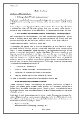
  • 20. HafezAhmad 20 Hafez Ahmad Figure: heat transport in the earth The flow of heat from Earth's interior to the surface is estimated at 47±2 terawatts (TW) and comes from two main sources in roughly equal amounts: the radiogenic heat produced by the radioactive decay of isotopes in the mantle and crust, and the primordial heat left over from the formation of the Earth. Earth heat transport occurs by conduction, mantle convection, hydrothermal convection, and volcanic advection. Earth's internal heat flow to the surface is thought to be 80% due to mantle convection, with the remaining heat mostly originating in the Earth's crust, with about 1% due to volcanic activity, earthquakes, and mountain building. Thus, about 99% of Earth's internal heat loss at the surface is by conduction through the crust, and mantle convection is the dominant control on heat transport from deep within the Earth. Most of the heat flow from the thicker continental crust is attributed to internal radiogenic sources, in contrast the thinner oceanic crust has only 2% internal radiogenic heat. The remaining heat flow at the surface would be due to basalheating of the crust from mantle convection. Heat fluxes are negatively correlated with rock age, with the highest heat fluxes from the youngest rock at mid-ocean ridge spreading centers (zones of mantle upwelling), as observed in the global map of Earth heat flow. 6. What is geothermal and thermal energy? Geothermal energy is thermal energy generated and stored in the Earth. Thermal energy is the energy that determines the temperature of matter. The geothermal energy of the Earth's crust originates from the original formation of the planet and from radioactive decay of materials. 4. What are the roles of geophysics in heat flow of the earth? The role of geophysics in the heat flow of the earth is huge because with the help of the geophysics knowledge, we have understood how it occurs inner earth. 4. What is temperature anomalies? Howit can be detected? A temperature anomaly is the difference from an average, or baseline, temperature. A positive anomaly indicates the observed temperature was warmer than the baseline, while a negative anomaly indicates the observed temperature was cooler than the baseline. To do so, let's take each value for each month and subtract the average value for that same time of year (i.e. for the same month). This will give us anomaly values. Positive values indicate temperatures hotter than the average (for that month), negative values are colder than average.
  • 21. HafezAhmad 21 Hafez Ahmad Short Notes: 1.Sonar Sonar (originally an acronym for sound navigation ranging) is a technique that uses sound propagation (usually underwater,as in submarine navigation) to navigate, communicate with or detect objects on or under the surface of the water, such as other vessels. 2. Echo-sounder Echo sounding is a type of sonar used to determine the depth of water by transmitting sound waves into water. The time interval between emission and return of a pulse is recorded, which is used to determine the depth of water along with the speed of sound in water at the time. 1. Single beam echo sounder 2. Multi beam echo sounder 3. Side scan sonar Single beam echo sounder and main components Side scan sonar and how it is different from other echo sounding instrument
  • 22. HafezAhmad 22 Hafez Ahmad Side Scan Sonar is a marine geophysical technique that is used to image the ocean floor. The method uses pulses of sound (sonar) shot sub-horizontally across the sea bottom from a towed transducer or towfish. Side-scan uses a sonar device that emits conical or fan-shaped pulses down toward the seafloor across a wide angle perpendicular to the path of the sensor through the water, which may be towed from a surface vesselor submarine, or mounted on the ship's hull. The intensity of the acoustic reflections from the seafloor of this fan-shaped beam is recorded in a series of cross-track slices. When stitched together along the direction of motion, these slices form an image of the sea bottom within the swath (coverage width) of the beam. The sound frequencies used in side-scan sonar usually range from 100 to 500 kHz; higher frequencies yield better resolution but less range. 4. Ground Surveying Ground surveys are a preliminary first step in gathering critical information that can be used in developing a pipeline proposal. Generally, each property will be visited by various specialists in land, engineering, archaeological and environmental sciences.Ground surveys are performed in areas where new pipeline facilities are being considered. There are three types of ground surveys: civil, environmental and cultural resource surveys. Civil Survey: Civil engineering surveys are a means to take relatively large-scale, accurate measurements of the earth’s surface for the purpose of mapping and the establishment of marks to control construction and to indicate land boundaries. This process normally doesn’t take longer than two days, and usually involves crews of two to three people using light-weight, GPS-enabled mechanical instruments to capture measurements related to terrain and topography. Other tools traditionally needed by the surveyor include stakes,hammers and small brush cutting and clearing tools to ensure a clean line-of-sight to the surveying instruments. The only evidence that a civil survey has taken place are the small wooden stakes placed in the ground to identify specific geographical survey points, such as wetland or property boundaries. Environmental Survey: Environmental surveys are performed to map and catalogue existing environmental conditions. They are critical to provide a comprehensive view of natural resources and sensitive areas so that the project developers can fully understand potential environmental issues within the study area. These field surveys are conducted by qualified scientists and environmental experts (ecologists, botanists, biologists) who have detailed knowledge of the plant and animal species and natural communities expected to be present on the site.
  • 23. HafezAhmad 23 Hafez Ahmad Cultural resources surveys are a means to Identify and gather information on a property’s architectural, historical, and archaeological resources. Cultural resources are evidence of past human activity. These may include pioneer homes, buildings or old roads; structures with unique architecture; prehistoric village sites; historic or prehistoric artifacts or objects; rock engravings called petroglyphs; human burial sites; and earthworks, such as battlefield entrenchments, historic canals, or prehistoric mounds. 4. Active vs Passive geophysical methods 5. Radar 6. Laser