
Empfohlen
Empfohlen
Weitere ähnliche Inhalte
Was ist angesagt?
Was ist angesagt? (20)
Ähnlich wie TU2.L10.1 - THE THERMAL INFRARED SENSOR ON THE LANDSAT DATA CONTINUITY MISSION
Ähnlich wie TU2.L10.1 - THE THERMAL INFRARED SENSOR ON THE LANDSAT DATA CONTINUITY MISSION (20)
Mehr von grssieee
Mehr von grssieee (20)
TU2.L10.1 - THE THERMAL INFRARED SENSOR ON THE LANDSAT DATA CONTINUITY MISSION
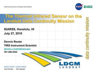
- 1. The Thermal Infrared Sensor on the Landsat Data Continuity Mission IGARSS, Honolulu, HI July 27, 2010 Dennis Reuter TIRS Instrument Scientist dennis.c.reuter@nasa.gov 301-286-2042
- 2. Landsat Mission History Landsat was first program proposed to monitor land surface data from space Stimulated by recognition of successful atmospheric programs Landsat 1 launched July 23, 1972 Originally called Earth Resources Technology Satellite (ERTS) Visible/Near IR multispectral mapper. Landsat 3, launched March 5, 1978, included one thermal band (10-12 mm) Following missions also included thermal band 2
- 3. 3 Landsat Data Continuity Mission (LDCM) LDCM is the follow-on to Landsat 7 with launch in Dec., 2012 LDCM provides data continuity with previous Landsats Operational Land Imager (OLI) Thermal Infrared Sensor (TIRS) OLI is visible /NIR multispectral imager Supplied by Ball Aerospace and Technology Corporation Two new channels compared to previous Landsats Based on pushbroom imaging system LDCM originally did not include TIRS Added to manifest, Dec 2009.
- 4. 4 TIRS High-level Overview TIRS is a two channel thermal imager providing data continuity for the Landsat thermal band. Pushbroom imager developed by NASA/Goddard Space Flight Center TIRS operates in concert with, but independently of, OLI. TIRS will produce radiometrically calibrated, geo-located thermal image data TIRS will deliver algorithms and parameters necessary to evaluate data and produce required outputs Final scene data generated as part of the Data Processing and Archive Segmentat the United States Geological Survey/ Earth Resources Observation and Science (EROS) facility in Sioux Falls, South Dakota. USGS responsible for operational algorithms OLI and TIRS data will be merged into a single data stream. TIRS Delivery date is December 2011. The TIRS delivery schedule is a significant driver of the overall TIRS development.
- 6. Landsat 3 (1978 -1983 ) afforded 240 m spatial resolution in the thermal band
- 7. Landsat 4 (1982 - 1989) and Landsat 5 (1984 -present) afford 120 m resolution
- 8. Landsat 7 (1999 - present) affords 60 m resolution
- 9. Landsat thermal data are now used operationally to monitor water consumption on a field-by-field basis in the U.S. West and internationally
- 10. Evapotranspiration cools vegetation (plants “sweat”)
- 11. 120 meter resolution (or better) sufficient
- 12. Allowed by development of operational energy balanced-based evapotranspiration models
- 13. SEBAL, METRICUsing 120 m Landsat 5 Thermal Data Courtesy of Richard Allen, Kimberly Research and Extension Center, University of Idaho
- 14. 6 Additional TIRS Science Landsat thermal data are used for: • Mapping urban heat fluxes for air quality modeling (urban heat island) • Volcanic hazard assessment, monitoring, and recovery • Cloud detection and screening • Mapping lake thermal plumes from power plants • Burnt area mapping / Wildfire risk assessment • Tracking material transport in lakes and coastal regions • Identifying mosquito breeding areas and vector-borne illness potential TIRS 2-Channel split window improves fidelity of surface temperatures Allows correction for atmospheric effects (Images from D. Quattrochi)
- 16. OLI required to calculate the SWup (short wave albedo)
- 18. 9 2 channel (10.8 and 12 um) thermal imaging instrument Quantum Well Infrared Photometer (QWIP) detector/FPA built at GSFC <120 m Ground Sample Distance (100 m nominal) 185 km ground swath (15º field of view) Operating cadence: 70 frames per second Pushbroom design with a precision scene select mirror to select between two full aperture calibration sources Onboard variable temp black body and space view Passively cooled telescope assembly operating at 185K (nominal) Actively cooled (crycooler) FPA operating at ≤43K Thermal stability key to radiometric stability (NEDT < 0.4 K @ 300 K) TIRS Instrument Overview
- 19. TIRS Overview TIRS (Earthshield Deployed) TIRS (Earthshield Stowed) Cryocooler Radiator Blackbody Cal Radiator Telescope Radiator Scene Select Mechanism Nadir (Earth) View Captive Earthshield Latch Hinge/Hinge Dampers External Alignment Cube Focal Plane Electronics Spacecraft Interface Flexures (2 of 3) Interconnecting Harness Bracket 10
- 20. 11 TIRS FOVs and Telescope Detail Deployed Earthshield Cryocooler Radiator Telescope Radiator Scene Select Mechanism Nadir View Spaceview FPE Flexures (1 of 3) Telescope Assembly Cryocooler
- 22. Scene Select Mirror & Baffles (≤293K)
- 23. Stability ±1K (35 sec)
- 25. Blackbody Calibrator (270 to 320K)
- 27. Stability ±0.1K (35 sec)
- 29. Warm Stage: FPA Shroud (<100K)
- 30. Cold Stage: FPA (<43K)
- 31. Stability ±0.01K (35 sec)
- 33. TIRS Focal Plane Picture of the FPA with the filters attached. Note that there are two filters over each array with a thin dark strip between them. Picture of the FPA without the filters attached showing the 3 QWIPs in the center. 14
- 34. TIRS on LDCM Spacecraft OLI Deployable Earth Shield (Stowed) Sensor Unit Connector Bulkhead Cryocooler Electronics MEB X Y Z 15
- 35. 16 Top Level Operations Concept Imaging Requirements 400 WRS-2 scenes/24 hour period Image up to 15 degrees off-nadir Acquire up to 77 contiguous sun-lit scenes per orbit Acquire up to 38 contiguous night scenes per orbit Calibration Operations Requirements Onboard calibration capability Spaceview and onboard NIST Traceable Black Body No calibration maneuvers required No planned vicarious calibration sources Orbit Requirements 705 km altitude 98.2 ± 0.015 degrees inclination 10:00 AM equatorial crossing descending node
- 36. Pre-Launch Calibration Performed at GSFC Calibration tests are designed to understand the sensor behavior Requirement verification is necessary but not sufficient for sensor characterization L 4 requirements Special Characterization Test Requirements (SCTR) Verify vendor-supplied test data Calibration GSE requirements defined to satisfy calibration tests. Calibration GSE is NIST traceable. Performance measured at component, subsystem and system level. 17
- 37. In Chamber Calibration Equipment 16” Diameter Flood source Target Source Module Blackbody 16 position motorized target wheel 8 position motorized filter Wheel 13” square steering mirror system Linear stage expands effective yaw range Pitch & yaw Folded, all reflective, off-axis parabola collimator Linear stages to move sources Cooled enclosure over entire system 18
- 38. Phase 1 Calibration Equipment- Acceptance at ATK – 10/2009 Phase 1 cal equipment includes 102 cm focal length OAP, blackbody, aperture wheel, filter wheel chopper, wiring and liquid N2 plumbing. 19
- 39. Significant TIRS Hardware on Hand Calibration GSE EM Cryocooler FPM Telescope FPM FPA EM FPE BB SSM 20
- 40. TIRS Status and Upcoming work Design Finalized for all Systems All Major Contracts in Place Successful CDR April 27 - 30, 2010 Schedule, While Aggressive, is Being Met Challenges Remain Very active management and scrutiny Active Testing/ Measurement Campaign in Progress. TIRS is benefitting greatly from active support of all partners Includes NASA GSFC, LDCM, USGS, NASA HQ, Orbital Systems (Spacecraft Provider)
Hinweis der Redaktion
- Update with testing, procurements, design, fully staffed.
- New Mexico is another state obligated to deliver water to Texas under the Rio Grande and Pecos River Compacts. Other available remote sensing tools do not now provide the level of detail needed to be useful.
- Telescope qual level vibed prior to test, FPA shells cyro cycled, FPA qualvibed and cryo cycled