
Empfohlen
Empfohlen
Weitere ähnliche Inhalte
Was ist angesagt?
Was ist angesagt? (16)
Andere mochten auch
Andere mochten auch (16)
Ähnlich wie FR3T10-3-IGARSS2011_Geolocation_20110720.pptx
Ähnlich wie FR3T10-3-IGARSS2011_Geolocation_20110720.pptx (20)
Mehr von grssieee
Mehr von grssieee (20)
Kürzlich hochgeladen
Kürzlich hochgeladen (20)
FR3T10-3-IGARSS2011_Geolocation_20110720.pptx
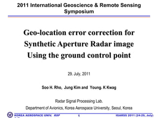
- 1. 1 2011 International Geoscience & Remote Sensing Symposium Geo-location error correction for Synthetic Aperture Radar image Using the ground control point 29. July, 2011 Soo H. Rho, Jung Kim and Young. K Kwag Radar Signal Processing Lab. Department of Avionics, Korea Aerospace University, Seoul, Korea
- 2. To be Presented Introduction Spaceborne SAR Geometry SAR Geo-location Error Multiple Target Distortion Overview Simulation Proposed Algorithm Simulation Results Conclusions 2
- 3. Introduction SAR Geometric Calibration Geometric Correction Processing step where the image is re-sampled from its natural distorted projection into an actual image in a real coordinate system Geocoding for standard map projection such as UTM, WGS Geolocation Accurate target location decided by SAR sensor parameter and the Earth model Geometric Calibration Process of measuring the various error sources such as sensor payload platform ephemeris errors, relative target height error, and SAR signal processing errors. Necessity In the real operating environment, the SAR estimation errors always exist Accuracy of slant range measurement, Doppler centroid estimation performance, SAR operation characteristics (Side-looking) are to be analyzed and corrected in the process of the SAR image utilization. 3
- 5. Comparison of E/O & SAR Image 5 [EO Image] [SAR Image]
- 11. Incidence Angle
- 12. Doppler Centroid
- 14. Yaw Angle
- 16. Geo-location Error Correction Method
- 17. Effect of ErrorEffect of Error - Range Location - Range Scale - Azimuth Scale SAR sensor - Electronic Time Delay - Slant Range Error - Incidence Angle Estimation - PRF Fluctuation - Internal Calibration - Geometric Calibration - Deskew - Ground Projection - Image Rotation - Terrain Correction Ground Control Point DEM, DSM Earth - Earth Rotation - Side-looking - Target Height Earth - Azimuth Skew - Range Non-Linearity - Foreshortening, Layover, Shadowing Platform - Image Orientation Error - Squint Angle - Doppler Centroid Platform - Inclination Angle - Yaw Angel Error - Pitch Angle Error
- 18. Multiple Target Distortion Multiple Target Distortion 8
- 19. 9 Selection of GCP SAR images contain speckle noise. Thus, the GCPs that are used in EO (Electro Optical) images is no longer effective. As a result, distinctive physical features on the ground that are readily identifiable from SAR image should be regarded as GCPs. Examples: Runway, Intersection, Huge Building, cultivated land Procedure The first step is the selection and extraction of GCP from SAR and reference (EO) image. For the GCP extraction from satellite radar image, easily seen objects such as intersections and artificial structures with large RCS are chosen as reference points. Since the GCP(Ground Control Point) which is often used in EO images cannot be used for SAR Images due to speckle noise. The second step is image transformation for GCP matching using the each extracted points of SAR and EO image. In the last step, RMSE values are calculated comparing the geo-location error corrected image and EO image. 9 Overview of Simulation
- 20. Proposed Algorithm Reference Image SAR Image : Input the Same Region Image Extract GCP Extract Check Point Extract GCP, Check Point : Extract the GCP, Check Point : Extract GCP Coordinates Extract GCP Coordinates Extract GCP Coordinates Image Transform : Image Transform (Projective Transform) Extract Check Point Coordinates Extract Check Point Coordinates Comparison : Image Matching, Calculation of RMSE Geo-located SAR Image 10
- 21. Simulation Image RADARSAT-1 11 25 16 24 15 23 17 19 22 21 18 20 1 Seoul, Korea Resolution : 10m x 10m Error Corrected SAR Image (Using SAR General Information) 2 14 4 13 12 3 11 7 5 6 8 9 10 [Error CorrectedSAR Image]
- 22. Before Error Correction Before Using GCP 12 16 25 25 16 24 15 24 17 23 15 19 23 17 22 18 19 21 22 20 21 18 1 20 + : EO Point (red) 1 14 2 4 + : SAR Point (yellow) 2 14 4 13 12 13 12 3 3 11 11 7 7 5 5 6 6 8 8 9 9 10 [Before Using GCP] 10
- 23. After Error Correction (Using GCP) After Error correction Image (Using GCP) EO point(red)/SAR point(yellow) 13 16 25 24 15 17 23 19 22 18 20 21 1 2 14 4 13 12 3 11 7 5 6 8 9 [After Error Correction] 10
- 24. Comparison of RMSE 14 Northing : 454.05m Easting : 1212.20m Overall : 1294.45m Northing : 2.49m Easting : 5.87m Overall : 6.38m
- 25. Simulation Results 15 [Reference Image] [Using SAR General Information] [Using GCP]
- 26. Conclusions Geolocation error correction method is essential for SAR image utilization New geo-location error correction method is proposed using GCP. The performance of the proposed algorithm has been evaluated in terms of the RMSE distance by correcting foreshortening and layover and shadowing using the SAR image. The proposed algorithm shows good performance in correcting a geo-location error with aid of GCP data compared to the case of the general SAR parameter information without GCP. Performance of the proposed method is improved especially in mountain area. 16
- 27. Thank you for your attention ! Contact author: Prof. Young K. Kwag ykwag@kau.ac.kr 17