Busty Desi⚡Call Girls in Sector 62 Noida Escorts >༒8448380779 Escort Service
Draft report Grandview District Plan, Jan. 31, 2012
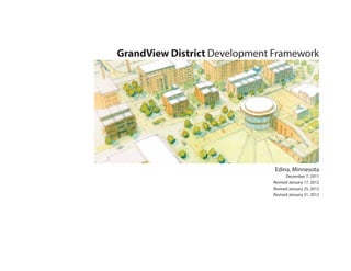
1. GrandView District Development Framework
Edina, Minnesota
December 7, 2011
Revised January 17, 2012
Revised January 25, 2012
Revised January 31, 2012
2. Table of Contents Steering Committee
Executive Summary 3 Ken Potts Peter Sussman
Kim Melin Lisa Diehl
1. Hope for Change 5 Randy Halvorson Bob Kojetin
Chris Rofidal David Davison
2. Thoughts and Interactions 6 Steve Buss Bernie Beaver
Gene Persha Mike Platteter
3. Patterns for a Neighborhood Center 9 Richard Borland Peyton Robb
Larry Chestler Dan Gieseke
4. Moving Forward with a Purpose 45 Laura Giertsen Diane Reinhart
Ellen Jones James Justice
5. Appendix 57 Terry Ahlstrum Darcy Winter
Dick Ward Paul Nelson
Bill Neuendorf David Novak
Tim McIlwain Linda Urban
Bright Dornblaser Tom Mattison
Andy Brown Ken and Adele Floren
Suzanne Davison Michael Schroeder
Greg Domke Jim Smith
Sandy Fox Kevin Staunton, Chair
Dick Crockett Michael Fischer
Arne Cook Brett Johnson
Tom Bonneville Collin Bredeson
Kim Montgomery Deron Lindquist
Tim Murphy Eric Bredesen
Thomas Raeuchle Jim Baisch
Tom Ruppert
Consultant Team
Cuningham Group Architecture, PA
Close Landscape Architecture
HR Green
Community Design Group
Springsted Inc.
1/31/12 2
3. Executive Summary
The Development Framework presented here is part of a small area planning 2. Completely rethink and reorganize the District’s transportation
process required by Edina’s Comprehensive Plan for those parts of our infrastructure to:
community (like the GrandView District) designated as Potential Areas of • Make the District accessible and inviting to pedestrians and cyclists;
Change. It follows the 2010 GrandView District Small Area Guide Plan • Create connections between the different parts of the District;
process. That process – led by a group of community residents and business • Maintain automobile-friendly access to convenience retail;
and property owners – resulted in adoption by the Edina City Council of seven • Create separate pathways for “pass-through” and “destination” automobile
Guiding Principles for the redevelopment of the GrandView District. traffic; and
• Preserve future transit opportunities provided by the rail corridor in a
The process of crafting this Development Framework has been led by a way that ensures that the kinds of opportunities pursued in the future are
52-member Steering Committee made up of residents of the community and consistent with the character we envision for the District and provide benefit
owners of area businesses and properties. The 52 members of the Steering to the surrounding neighborhood.
Committee have dedicated countless hours since April of 2011 listening to
community members, considering options, and debating alternatives for the
3. Leverage public resources to make incremental value-creating changes
future of the District. Thanks to a grant from the Metropolitan Council, we
that enhance the public realm and encourage private redevelopment
have had the good fortune to be supported in our efforts by a talented group of
consistent with the vision that improves the quality of the neighborhood for
consulting experts. We have also been fortunate to have the patient support of
residents, businesses, and property owners.
City staff throughout the process.
This Development Framework makes substantial progress in charting the path
Our objective in creating this Development Framework is to build upon the
to be followed in redeveloping the GrandView District. By creating a vision
seven Guiding Principles adopted by the City Council. In the pages that
that meets the seven Guiding Principles, it provides guidance to city officials,
follow, we share a vision of how to bring those Guiding Principles to life.
residents, business and property owners, and developers as opportunities for
While there are many details essential to fulfilling that vision, our goals can be
change emerge in the District. To ensure that the future redevelopment of
summarized as efforts to:
the District is consistent with the vision articulated in this Framework, we
recommend that it become part of the City’s Comprehensive Plan.
1. Create a place with a unique identity announced by signature elements
like:
We want to be clear, however, that we recognize that the Framework (like
• A central commons on the Public Works site with indoor and outdoor public
space that connects the civic cornerstones of the District and serves the the Comprehensive Plan) provides broad direction rather than detailed
neighborhood and community needs; requirements. This Framework is intended to be a vision of the future rather
than a blueprint. Achieving the vision will require, among other things:
• A “gateway” at Highway 100 that announces the District as a special
place, using elements like an iconic pedestrian and bicycle bridge spanning
Highway 100; and • A feasibility study that examines the costs and resources available to bear
those costs;
• An innovative, cutting-edge approach to 21st-century sustainability.
1/31/12 3
4. • An examination of the height and density necessary to make the vision
financially feasible while ensuring that it results in the human scale and
neighborhood character that is the essential to the Framework;
• Developing a strategy to allow for a vibrant business and residential
community by managing the mix of retail, office, residential, and public uses
of land while maintaining the currently successful neighborhood service and
convenience character;
• A determination of a range of possible housing choices that support the
character and experience of the District.
• A community building/public green programming group should work to
determine appropriate program and uses.
We discuss these and other “next steps” in the Implementation section.
Consistent with the “community-led” spirit of the initial stages of this
process, we recommend that these “next steps” include active participation by
community members, support of staff, and leadership from the City Council.
Study Area Location
1/31/12 4
6. 1. Hope for Change
Introduction
Hope for Change has been the driving vision since
the very beginning of this process that is now well
into its second year of perspiration, participation,
and planning. Thousands of volunteer hours,
countless meetings, and hundreds of discussions
(large and small) have demonstrated that a
committed group of citizen stakeholders, business
leaders and owners, and elected and appointed
officials believe that hope for change must be
proactive, progressive, and promoted. The result
will be not just be change for the sake of change,
but directed energy, policy, and investment that will
deliver a place for people to live, work, shop, and
play in sustainable, memorable ways.
Concept Diagram from the Small Area Guide Plan Process, December 2010
1/31/12 6
7. 1. Hope for Change
Guiding Principles
The Seven Guiding Principles
1. Leverage publicly-owned parcels and civic presence to create a vibrant and
connected District that serves as a catalyst for high quality, integrated public
and private development.
2. Enhance the District’s economic viability as a neighborhood center with 2
regional connections, recognizing that meeting the needs of both businesses 6 3 7
and residents will make the District a good place to do business.
5 7
3. Turn perceived barriers into opportunities. Consider layering development 2
over supporting infrastructure and taking advantage of the natural topography 6 1
of the area.
1
4. Design for the present and the future by pursuing logical increments of 4
change using key parcels as stepping stones to a more vibrant, walkable,
functional, attractive, and life-filled place. 4
5. Organize parking as an effective resource for the District by linking
community parking to public and private destinations while also providing
parking that is convenient for businesses and customers.
6. Improve movement within and access to the District for people of all ages
by facilitating multiple modes of transportation, and preserve future transit Principles Related to the Concept Diagram
opportunities provided by the rail corridor.
1. Leverage publicly owned parcels
7. Create an identity and unique sense of place that incorporates natural spaces 2. Meet the needs of businesses and residents
into a high quality and sustainable development reflecting Edina’s innovative 3. Turn barriers into opportunities
development heritage. 4. Pursue logical increments; make vibrant walkable and attractive
5. Organize parking; provide convenience
6. Improve movement for all ages; facilitate multiple modes of movement
7. Identity and unique sense of place; be sustainable and innovative
1/31/12 7
8. 1. Hope for Change
History
Before Edina became a village almost 125 years ago, a country market road crossed
Minnehaha Creek at Edina Mills. Headed westward to the high ground, it branched
out as Eden Prairie Road and Hopkins Road.
In 1869, the Yancey family moved from Ohio and purchased 127 acres of land
including that high ground and most of the present GrandView District. Civil
War veteran Beverly C., his wife Ellen and their seven children were to become
the most prominent pioneer black family of Edina over several decades and left a
legacy of civic involvement. An observer described early Edina as an agricultural
village, “where there is a post office, a mill, and a store, and proudly aspires to the
dignity of a trading town. The numerous farms are well-cultivated, and are occupied
by intelligent people who appreciate education, and surround themselves with the
accessories of a refined society.”
A center of the early community was Minnehaha Grange No. 398, organized in
1873. The Grange Hall originated in a meeting at the Yancey family home in 1879
with a “considerable number of persons desirous to form an association to build and
own a hall building near Edina Mills.” In 1888, the name Edina was voted upon
in that building, which also served as the village hall until 1942. When moved for
construction of St. Stephen’s Church in 1935, a member of the Yancey family donated
the new site. In 1970, the Grange Hall was moved to the present Frank Tupa Park
in the GrandView District, later joined by the historic Cahill School. Historic GrandView Heights Plat
and garden supply store. In 1947, Jerry Paulsen opened a meat counter in one of
Changes in the district have been ongoing including transportation and services.
the local groceries, a modest beginning to Jerry’s Enterprises, a longtime prominent
Members of the Yancey family platted Grand View Heights in 1910 and Tingdale
presence in the District.
Brother’s Brookside in 1916. In 1913, the Dan Patch Line was cut through the high
ground east of Brookside Avenue, providing passenger service to Minneapolis from
It is encouraged to look to the history of the District in naming the proposed public
1915 to 1942.
amenities and new streets. The Yancey family in particular, due to their early
ownership of the District and legacy of civic engagement, merits that honor at a
In 1927, new highway 169/212 (current Vernon Avenue) was cut through the
prominent location such as the commons.
District. Grading and paving businesses such as J. A. Danens and Son located to
serve the growth, joined by motels and restaurants. Sources:
1. R. J. Baldwin, in Isaac Atwater, History of Minneapolis and Hennepin County (Munsell,
1895), p. 1263 as quoted in Paul D. Hesterman, From Settlement to Suburb: The History of
The District expanded rapidly with western Edina following World War II. The Edina, Minnesota (Burgess Publishing,1998) Edina Historical Society, p. 29.
Edina directory of 1953 listed six of ten businesses in the District as including 2. Meeting minutes dated March 7, 1879. Copy in the Edina Historical Society files.
“Grandview” in their names: a cafe, market, two service station, hardware, and seed
1/31/12 8
10. 2. Thoughts and Interactions
Project Schedule and Process
Part I: Discussion and Discovery
Sept Oct Nov Dec
Part I is about learning from and listening to the Steering Committee, Work Part I
Groups, and other stakeholders; analyzing the study area and understanding Discussion and Discovery
Community Workshop #1
the work done to-date; appreciating the larger dynamics of the area; and
Part II
clearly defining the opportunities. An initial Community Workshop is held to Ideas and Options
conduct work group discussions/downloads, and a public meeting/presentation Community Workshop #2
is hosted by the Steering Committee and the Consulting Team. Part III
Decide and Deliver
Part II: Ideas and Options Community Workshop #3
Deliverables
Part II focuses on developing ideas and options that address the specific issues Project/Community Meetings Sept Oct Nov Dec
raised by the Steering Committee, stakeholders, and the public process. The Steering Committee
Staff Coordination
Consulting Team conducts a three-day Community Workshop (to be held in
Executive Team Meeting
the study area) that will include Steering Committee meetings, focus group Community Workshop #1 #2 #3
meetings, stakeholder interviews, team work sessions, and conclude with a Work Group Meetings
Plan Commission/Council
public meeting/presentation.
Project Update
Part III: Decide and Deliver Project Schedule: The project schedule was organized around three
community workshops.
Part III consolidates all the comments, ideas, and options into a preferred
direction. This part includes a third Community Workshop and public meeting.
The Consulting Team prepares a summary document that may be widely
distributed via a variety of sources (i.e., print, web, etc.) and a Sketch-up 3D
model of the area with preferred options.
1/31/12 10
11. 2. Thoughts and Interactions
Summary of Participation Process
The Steering Committee and Executive
Committee have worked closely with the
Consulting Team to facilitate a process that focused
on key issues, opportunities, and recommendations.
The process worked with the Steering Committee
that met on a regular basis to guide the Consulting
Team. A sub-committee of Work Groups
addressed Land Use/Community Design,
Community Needs/Public Realm, Transportation/
Infrastructure and Real Estate/Finance. These
groups put an incredible amount of effort into
initial background information and research,
definition of issues, and discussion about ideas and
options.
A key component of the project was a series
of Community Workshops held in September,
October and November, 2011, that hosted a range
of community stakeholders either in interviews,
focus groups, program meetings and at public
meetings.
The community participation process included
these primary groups of participants: Steering The Public Participation Process: The public participation process included Steering
Committee, Executive Committee, work Committee meetings, work group meetings, public meetings, focus groups meetings,
and program groups meetings throughout the fall of 2011.
groups, City staff, focus groups (land owners,
neighborhoods, public officials, school
district, institutions, city departments, business
operators, and others as identified during the
process), Plan Commission members, City Council
members and the Mayor.
1/31/12 11
13. 3. Patterns for a Neighborhood Center
Introduction
Neighborhood Center Concept Diagrams
Principle #2 in the GrandView District Small Area
Guide Plan is about “enhanc(ing) the District’s
economic viability as a neighborhood center with
regional connections.”
The Guide Plan also suggests that “The District
serves primarily as a neighborhood (rather than
regional) center.” Based on Steering Committee
and Public input, this idea has broad appeal. But
what do we mean by neighborhood center and
how does that fit with specific expectations and
outcomes for the GrandView District?
“Neighborhood feel,” “pedestrian friendly,” and
“safe and connected” describe the desired character Create “go to” and “stay at” uses Connect throughout
for the District. But the basis for these words lies
in a clear vision for the key elements, or systems,
that define place...and further set the framework
for future and ongoing development at GrandView.
These elements include Land Use, Transportation
and Movement, the Public Realm and
Sustainability, and will be described and illustrated
in more detail in this chapter.
Easy to get to; easy to get around
1/31/12 13
14. 3. Patterns for a Neighborhood Center
Land Use
Land use in the District is currently focused on Highway 100 and the rail corridor. Arcadia is seen • Emphasize the connection to Minnehaha Creek.
convenience retail and service uses that are visible as a more residential street with a range of condo, • Create a recognized, visible arts identity and
from Vernon Avenue. The majority of these apartments, and multi-level townhouse types. provide space/place for greater community arts
uses are auto-oriented and are accessible from Mixed-use and office buildings are anticipated and users and producers.
Vernon and Gus Young Lane. The exception is the may be oriented to Vernon and/or south toward • Address needs of underserved populations (teens,
GrandView Square development that includes Eden and the Our Lady of Grace (OLG) fields, a singles, seniors, etc.).
residential, office, and civic uses organized around significant open space that is a visual amenity to • Establish a community commons as a multi-
a central green space. The Comprehensive Plan the greater district. purpose facility for a wide audience (e.g., whole
identifies the GrandView Heights District as a body, whole life, health and wellness) and as
mixed-use center character area, a potential “area Vernon is assumed to remain more convenience- a focal point and central gathering place that
of change” and guides future land as a mixed-use and service-oriented with improved pedestrian connects City Hall to the east with the Library
center. The Comprehensive Plan also says that sidewalks/connections, safer street crossings to the southwest.
“the District is in the process of evolving from (especially to the adjacent neighborhood), bike • Celebrate the “Birthplace” of Edina, the Mill, and
a somewhat scattered auto-oriented district to a lanes, and better organized/managed traffic record the oral history of GrandView Heights;
more integrated mixed of uses.” flow and parking. Both Eden and Vernon are tell the stories.
anticipated to employ Complete/Living Street • Emphasize a pedestrian-oriented sense of place
The over-arching concept is to support the “go- principles that emphasize the place-qualities of that produces an appropriate scale and function,
to” uses (auto-oriented) while anticipating more streets. and preserves surrounding views.
“stay-at” uses (pedestrian-oriented), and to improve • Support economic growth and community
future use and built form around three key civic Across Highway 100 to the east, the Vernon/50th/ stability by providing accessible and efficient
“centers”: Eden alignment culminates with City Hall; long connections between home, school, work,
term uses are assumed to accommodate a greater recreation, and business destinations through
• City Hall civic/community presence when/if the Highway improved pedestrian and vehicular environments
throughout the area.
• Library 100 interchange is reconfigured as a split-diamond
• Community Commons (civic building and green facility.
space)
Goals
• Develop and improve the district as three smaller
The future land use plan proposes a broader mix “villages” that are connected physically and by a
of uses arranged around a new central green space signature character and identity.
(GrandView Green) located on the public works • Recognize the need for a range of housing types
site and fronting Arcadia. The plan emphasizes and choices and address those markets that also
a mixed-use sub-area between Vernon/Eden/ reinforce the District vision.
1/31/12 14
15. 3. Patterns for a Neighborhood Center
Land Use
Public
Neighborhood Commercial
Mixed-use Center
Office
Medium/High Density Residential
Hwy 100
Arcadia Ave
e
n Av
o
Vern
ve
nA
Ede
Land Use Plan
1/31/12 15
16. 3. Patterns for a Neighborhood Center
Land Use
Hwy 100
e
n Av
o
Vern
Arcadia Ave
ve
nA
Ede
Existing Buildings
Potential Development
Proposed Civic Community Buildings
Illustrative Master Plan
1/31/12 16
17. 3. Patterns for a Neighborhood Center
Land Use
Vernon Ave
Library
ve
aA
adi
Arc
Ede
n Av
e
0
y 10
Hw
City Hall
Potential Build-Out
1/31/12 17
18. 3. Patterns for a Neighborhood Center
Land Use
Arcadia Avenue Looking North
1/31/12 18
19. 3. Patterns for a Neighborhood Center
Land Use
Public Works Site
The public works site is located in a central point of
the District and is seen as the “commons” for how
the District vision will be realized. Uses proposed
include the community green space located on top Public Green
Public Green
of a parking garage that supports area businesses, Community Center
civic uses, and serves as a Metro Transit park Condominiums
and ride structure; a community/civic building
Apartments
anchoring the green; and a variety of residential
Arcadia Ave
uses including condominiums, apartments, and
townhouse building types. Townhouse units are Townhouses
ve
envisioned to front Arcadia as a building type that aA
di
ca
can incrementally “step-up” the hill, providing a Eden Ave Ar
Community Center
character unique to the District.
Development
3.6 acres Site
28,000 SF Public Green
Condominiums
Townhouses
24 units Condominium
42 units Apartments
50,000 SF Community/Civic
16 units Townhouses
Apartments
Parking
A form-based code can guide desired building use
200 spaces Park and Ride and frontage.
200 spaces Community Use
158 spaces Multi-family
es
nh ous
Tow
e
Av
en
Ed
Public Works Site
1/31/12 19
20. 3. Patterns for a Neighborhood Center
Land Use
100
Hw y
Eden A
ve
ve
dia A
Arca
Gr
an
dV
ie
w
Cr
os
sin
g
Public Works Site Looking Southeast
1/31/12 20
21. 3. Patterns for a Neighborhood Center
Land Use
Public Works Site
GrandView Green Space
Townhouses Condominiums Community on top of Parking Structure
Center GrandView
Crossing
Eden Ave
Parking
Proposed North-South Section
Hwy 100 OLG
Jerry’s
New frontage road on Arcadia GrandView Green on top Rail ROW Existing
west side of Hwy 100 of Parking Structure City Ramp
Proposed East -West Section
1/31/12 21
22. 3. Patterns for a Neighborhood Center
Land Use
Bus Garage Site
Due to the elevation change, this site lends itself
to supporting a number of commercial and retail
uses by adding a small, one level parking structure Parking
contiguous to and south of Jerry’s. This structure
would work with the existing topography to allow
Parking
better access to the Jerry’s loading area and to
provide additional parking to support the grocery Office/
Retail
and needed parking at grade. This site could also
accommodate a drive-thru use such as a small
community bank, cleaners, or coffee shop. Retail
Office
5,000 SF Retail
42,000 SF Office
175 spaces Parking
ve
nA
Ede
Jerry’s
e
Av
en
Ed
1/31/12 22
23. 3. Patterns for a Neighborhood Center
Land Use
Jerry’s
e
Av
en
Ed
Bus Garage Site Looking Northeast
1/31/12 23
24. 3. Patterns for a Neighborhood Center
Land Use
Phase 1 early, and will demonstrate the leverage identified
From a land use perspective, a number of in the Guiding Principles to support a variety of
immediate steps can be taken to set the stage for next steps. This could include a Metro Transit
new investment in the District. These include: park and ride facility as a way to provide a parking
structure that would also serve as the GrandView
• Policy changes to the Comprehensive Plan Commons (community/civic building/public
(the Small Area Plan is intended to update the green). 3
Comprehensive Plan).
• Potential zoning revisions that could include a In similar fashion, the bus garage can be a major 1
form-based code to regulate desired public realm, pivot point for how a number of land use decisions
6
building frontages, and building height. may play out and will act as a land use “connector”
• Identification of Eden and Vernon as early along Eden. This site may need to be readied for
7
candidates for application of Living Streets development sooner than the public works site
principles. in order to accommodate a series of land use
• Policy direction that guides overall sustainability transitions that will help the larger District vision 5
of the District, including consolidated reuse/ implementation. A third component of an early 2
recycling, stormwater management, etc. phase would be the development of the Wanner
• Policy direction that guides how new public site currently owned by Our Lady of Grace as
and private investment may be supported with a potential residential, office, or retail uses.
variety of financing tools. 4
In support of these anticipated land use changes,
The public works site (public green space and a new street configurations/alignments, circulation
community/civic building) and the bus garage site patterns, and streetscape/pedestrian improvements
are the two key parcels that can “jump-start” the along Eden will complete a bike and pedestrian
redevelopment process. In particular, the ability network and support the anticipated land use
of the public works site to provide a fee simple, changes with improved automobile circulation and
unencumbered asset will allow civic/community management.
and private and public realm uses to be realized
1. Public Works
2. School Bus Garage
3. New Bridge/Street
4. Wanner Site
5. Jerry’s Site
6. Jerry’s Site
7. City Ramp Access
1/31/12 24
25. 3. Patterns for a Neighborhood Center
Land Use
The following chapter on Implementation is included as one example of
anticipating an initial, or Phase 1, increment and associated preliminary range
of costs. These numbers are not detailed costs but represent one possible
range of expenditures that are included here to illustrate levels of funding
(and investment) of various components. The Phase 1 diagram and following
spreadsheets for the public works site, the bus garage site, and local street
improvements will vary depending on actual funding sources, timing, program,
and other factors (e.g., cost of materials and labor) that cannot be determined
e
at this time. See Appendix.
n Av
Community
Green Space on
o
Vern
top of Parking
Structure
Arcadia Ave
Hwy 100
Phase 1
A. Public Works Site C. Wanner Site A
• Community Commons: • Townhouses fronting OLG
GrandView Crossing (street) open space Housing
GrandView Green
Community/Civic building D. Eden Avenue Streetscape ve
nA
E Ede
• Arcadia steps • Bus stop integrated
• Community/Civic building • Boulevard organizes intersection
alignments D
• Variety of residential building types
• Structured parking
E. Jerry’s Streetscape B
• Park and ride structure • Pedestrian enhancements
• Streetscape
B. Bus Garage Site
• Multi-level parking • Stormwater treatment
• Retail/service/office use
C
Wanner/OLG
Property
Phase 1 Diagram
1/31/12 25
26. 3. Patterns for a Neighborhood Center
Public Realm
Public realm refers to all land and area under the Goals
ownership of the city. This includes city streets • Acknowledge “no net loss,” yet aggressively seek
and rights-of-way (ROW), parks and open space, new public space.
and parcels of land or other assets that are used • Improve the bike and pedestrian environment:
to provide individual and collective benefit and make it safe and friendly, and include adequate
amenity to all residents and the general public. parking area for bikes.
• Create a community/civic building connected
The greater value and power of the public realm is to GrandView Green (an outdoor public green
its ability to connect neighborhoods, businesses, space) that connects east and west and serves as
schools, and parks and open space into a larger an indoor/outdoor gathering space.
whole greater than the sum of the individual • Create a prominent public realm of connected
elements. Streets and ROW make up a major parks, green space, paths, plazas, and private open
(and connected) portion of the public realm and space – a legible green framework as the primary
represent a significant opportunity to enhance and form giver.
connect the community. It is critical to view streets, • Provide views within the District and maintain
then, not as just conveyors for automobiles but also important viewsheds (such as the “grand view”)
as multi-modal facilities that provide democratic for public use.
accessibility for all and as form-givers and green • Plan for a safe, comfortable pedestrian
space that increase the livability of the community. environment that links public and private
The result should be a greater sense of green destinations north-south (neighborhoods, library,
businesses) and east-west (neighborhoods,
throughout the District.
businesses, commons, City Hall).
Images (top to bottom): Osaka, Japan;
Montreal, Canada; and New York, New York.
1/31/12 26
27. 3. Patterns for a Neighborhood Center
Public Realm
Sunnyslope
Summit
Dale Dr
Hwy 100
G
E
Hankerson
Arcadia Ave
51st St H
e
C
n Av
o
Vern
A
D
ve
B nA
Ede
Brookside
52nd St
F H
Rd
tage
Public Realm / Open Space Diagram
n
E. Fro
A. GrandView Commons
B. GrandView Steps
C. GrandView Crossing
D. Arcadia Streetscape
W Frontage Rd
E. Gus Young Streetscape
F. Arcade Connection
G. Vernon Streetscape
Sherwood
H. Eden Streetscape
1/31/12 27
28. 3. Patterns for a Neighborhood Center
Public Realm
GrandView Commons
For GrandView, the public works site provides a
unique and singular opportunity to create a major
new public realm amenity that will add interest to
the area for all stakeholders, value to real estate,
and provide a signature gathering place in the
heart of the District. Beyond that, an even greater
opportunity exists then to continuously link the
businesses and destinations within the District to
the surrounding neighborhoods and the city in
general.
This can begin immediately by simply investing
in a safe and connected public sidewalk network,
increment by increment. The larger vision of the
public realm includes a community/civic building
and GrandView Green, a connected network of
public parks, public and private plazas, a new street
(GrandView Crossing), sidewalk and streetscape
improvements, and bike and pedestrian facilities.
This should include bridge enhancements on Eden Montreal public green: This public green suggests the appropriate scale and
character of GrandView Green.
over Highway 100, a pedestrian and bike bridge
connecting the Commons with City Hall, and the
potential to connect Eden and Brookside with local
a bike path within the Canada Pacific Rail ROW.
1/31/12 28
29. 3. Patterns for a Neighborhood Center
Public Realm
GrandView Community Commons Diagram
What / Who Populates the Commons?
GrandView Crossing Pedestrian Bridge
GrandView Green
Social Interaction
Hwy 100
Exercise and Fitness
Civic Building
Arcadia Ave
Classroom
Teen Activity
GrandView Commons: GrandView Commons includes GrandView Crossing,
GrandView Green, and a new community/civic building.
Banquet and Reception
Food Prep / Community Oven
Retail / Incubator
History / Interpretive
Performing and Visual Arts
Meetings
1/31/12 29
30. 3. Patterns for a Neighborhood Center
Public Realm
Vernon , Eden, Sherwood, Library
The plan here is to focus on improving pedestrian 52nd St
3
Brookside
connections between the Library/Senior Center
and Jerry’s, via a more street-like character that
extends north from GrandView Square Street,
including a well-defined pedestrian crossing at
Eden. Sherwood is shown as a conversion for
additional parking and may still allow movement
through the area, though at a very reduced rate of 4
3 ve
speed. This conversion allows a small green space to nA
Ede
connect the Library to Vernon.
1. Conversion of Sherwood would provide 50
additional parking spaces.
2. A small green space connects the Library to
Vernon giving the civic building an “address” on 1
Vernon. 2
3. Pedestrian crossings are created or enhanced to
provide safe and visible locations (51st, 52nd, and
53rd Streets) on Vernon and to the west of the bus 1 Library
garage site on Eden to cross the street.
4. The GrandView Square area is connected to
Jerry’s and beyond through the use of a streetscape 53rd St
that provides a well-defined pedestrian system as 3
well as a more organized parking and circulation
e
pattern. GrandView
Av
Square
on
rn
Ve
Sherwood
1/31/12 30
31. 3. Patterns for a Neighborhood Center
Public Realm
GrandView
Square
Library
e
Av
en
Ed
Ve
rno
nA
ve
Library Site Looking East
1/31/12 31
32. 3. Patterns for a Neighborhood Center
Public Realm
Vernon, Gus Young, Interlachen
The plan recommends a number of street and
traffic improvements that will provide greater
Int
er
predictability for the management of traffic,
lac
he
thereby creating a safer environment for bikes and
n
pedestrians. This is made possible by building a Ave
new street (GrandView Crossing) and bridge (over Vernon
Summit
the CP Rail corridor) that will connect Vernon
east to Arcadia and then paired with Gus Young 4
5
to create a one-way street pattern. Anchoring
the public realm is the GrandView Green, an
approximately one-half + acre public space located
on the north end of the public works site. Gus Young Ln
Arcadia Ave
6 3
1. New street and bridge connection (GrandView
Crossing).
2. GrandView Green public space and outdoor
gathering area.
3. Gus Young (westbound)and GrandView
5
Crossing (eastbound) are combined to create a 3 1 GrandView Crossing 7
one-way street pair.
4. Left turns from southbound Vernon to Gus 2
Young are removed.
5. Improved pedestrian crossings on Vernon.
6. Complete Streets principles application would City Parking
Ramp
transfer Vernon into a 3-lane section with bike Community /
lanes and pedestrian improvements. Civic Building
7. Pedestrian plaza/bridgehead and future bike/
pedestrian bridge connection over Highway 100.
8
8. Public steps of Arcadia.
Jerry’s
1/31/12 32
33. 3. Patterns for a Neighborhood Center
Public Realm
City Hall
With the future addition of the split-diamond
Sunnyslope Rd
interchange for Highway 100, the east side could
see some significant changes with the public
realm, land use, and improved pedestrian/bike
Dale Dr
environments.
1. Frontage road associated with the split-diamond
interchange.
2. Excess land from Minnesota Department of
Vern
Transportation (MnDOT) could be used for on Av
4 e
underground parking (with a green roof deck) and
Hwy 100
future community/civic use.
2
3. Strategy would provide an improved/expanded 1
Frank Tupa Park and setting for the historic Cahill
School and Grange Hall. City Hall
4. Grange Road alignment is “rationalized” to 5
provide a more efficient parking layout and allow
for a small civic green (5) in front of City Hall.
5. Pedestrian/bike bridge connects to west side of 3 6
Highway 100.
6. Eden is shown as a “parking” street to provide
Eden Ave 4
additional supply for City Hall.
1/31/12 33
34. 3. Patterns for a Neighborhood Center
Transportation
The GrandView area street and movement circulation pattern. It would operate as one-way in • Create a more bike and pedestrian friendly
network is primarily composed of Vernon/50th (eastbound) from Vernon on the new GrandView environment by applying Complete Streets and
Street (reliever/augmenter arterial), Eden (local Crossing, and one-way out (westbound) to Vernon/ Living Streets principles to Vernon, Eden, and
street, state-aid facility) and the multiple ingress/ Interlachen on Gus Young Lane. This pattern the local street network.
egress ramp system of Highway 100 (designated would eliminate the left hand turn from Vernon • Create an improved circulation and access
a principal arterial). There are other local streets, (southbound) to Gus Young Lane. network between public streets/parcels and
but most provide limited service (such as Summit private development/destinations.
Avenue) or access that dead ends (such as Bike improvements would focus on more lane
• Create an enhanced parking environment that,
Brookside off Eden). area and identification along Vernon and Eden,
in part, depends on shared, centrally-located
consistent with Living and Complete Streets
District parking supplies.
The highway interchange has several on and off principles. Over the long term, east-west bike and
ramps that, according to MnDOT, are redundant pedestrian access would be improved by adding a • Partner with Metro Transit to implement
and/or unsafe. Vernon is a county facility that, new bridge over Highway 100 that would connect a community-scale Park and Ride and bus
south of Interlachen, has seen a reduction of the GrandView Commons to Tupa Park, City Hall, turnaround loop in the area.
average daily traffic over the past 10 years. Eden and the Minnehaha Creek mill area. In addition • Complete the historical transition of Vernon
provides a secondary connection within the to more bike parking facilities in the District, the from old Highway 169 to a local District street.
District east and west over Highway 100. Eden plan recommends an off-road option within the • Identify and implement a demonstration project
is designated the primary bike route through the District: an at-grade bike path alongside the CP for “Complete/Living” streets principles.
District; Vernon and Interlachen are designated as Rail ROW from Eden connecting to Brookside.
secondary routes. • Provide additional auto, bike, and pedestrian
connections east and west in the District.
Functional Class
There are two major recommendations that support • Highway 100: Principal Arterial. • Maintain and improve parking, access, and
the overall movement and transportation goals of circulation in the short term for convenience,
• 50th Street: A Minor Augmenter.
the plan. First, the Framework proposes that the retail, and service uses.
Highway 100 interchange be reconfigured into • Vernon Avenue: B Minor Connector.
• Complete the pedestrian and bike system. Make
a split-diamond interchange to better manage • Interlachen Boulevard: Major Collector. bikes and pedestrians a priority and allow for a
through-traffic and to provide improved local • Eden Avenue: Local Street. safe crossing over Highway 100.
access/circulation via frontage roads east and west • Take a leadership role related to the Highway
of the highway. Over time, this would provide 100 interchange. Build the “reason platform” for
a more connected local system (i.e., more local Traffic Volume
• 13,000-23,000 AADT along West 50th Street/ multi-modal access and gateways.
streets) with direct access to Highway 100 via the
frontage roads. Vernon Avenue. • Preserve the CP Rail corridor for future, possible
• 4000-8000 AADT along Eden Avenue. public transit, and non-motorized movement/
Second, the Framework proposes a new east-west connection in the District.
street along the north half of the public works Goals • Reduce congestion by providing safe travel
site (spanning the CP Rail corridor) connecting • Support a more efficient, compact, and safe choices that encourage non-motorized
to Arcadia from Vernon, that would be paired interchange access to Highway 100 from Vernon transportation options, increasing the overall
with Gus Young Lane to provide a one-way and Eden. capacity of the transportation network.
1/31/12 34
35. 3. Patterns for a Neighborhood Center
Transportation
District Street Framework
The movement framework for the District begins
with addressing policy issues like the adoption
of the Living Streets principles and applying
Hennepin County’s Complete Streets policy,
as well as considering larger and more long
term ideas like reconstructing the Highway 100
Hwy 100
interchange using a “split diamond” configuration.
This approach accomplishes a number of objectives
that meet the District Principles and provides an
Arcadia Ave
incremental approach to addressing change over
e
n Av
time.
o
Vern
The existing slip ramp location off the southbound
ingress ramp would be retained but would be
combined with an additional connection to Gus ve
nA
Young as part of the one way frontage road system. Ede
Traffic would be controlled at four signalized
intersections.
In the short term, there is an opportunity to
begin implementing streetscape, bike, and
pedestrian improvements. Another important
recommendation is to implement the GrandView
Crossing/Gus Young one-way street pair that will
help manage traffic access and circulation in the
upper core of the District. Complete/Living Streets improvements
Private streetscapes
Split diamond interchange
New / improved bridges
1/31/12 35
36. 3. Patterns for a Neighborhood Center
Transportation
District Street Framework
Existing Proposed
1/31/12 36
37. 3. Patterns for a Neighborhood Center
Transportation
Vern
on Av
e
0
Hw y 10
Ede
nA
ve
Highway 100 and West Frontage Road Looking West
1/31/12 37
38. 3. Patterns for a Neighborhood Center
Transportation
Parking
• Consider the use of the current city parking
ramp (located behind Jerry’s) to accommodate
future park and ride patrons and general parking
district supply; increase the capacity of this
structure in the future if economically possible/
practical.
• The public works site should be considered
Hwy 100
as a location for a Metro Transit park and
e
ride facility as a way to provide parking to
n Av
weekly commuters and to provide parking
o
Vern
Arcadia Ave
for a community/civic building, public green,
P
residences and other uses. In addition, the top
level (deck) of this structure is intended to serve
as the GrandView Green, the major public realm
amenity in the district.
• Additional parking (structure) is proposed to the
south and contiguous to Jerry’s grocery store to ve
nA
provide better service access to the loading area Ede
and provide additional parking supply.
Parking beneath buildings
New access to existing
Surface lots
P Existing ramp
Direction of traffic
1/31/12 38
39. 3. Patterns for a Neighborhood Center
Transportation
Park and Ride Options
Metro Transit operates the #587 Express route
through the GrandView District before turning
north on Highway 100 to downtown. They have
a well documented market that they serve in
southwest Edina, and board riders on a daily basis
who are parking in front of the library, in the city
ramp, and in front of a number of businesses. They
Hwy 100
are highly motivated to locate a “community” scale
C
park and ride facility that would accommodate
no more than 200 cars. At least two sites have the
Arcadia Ave
potential to serve this need: the existing city ramp A B
and a potential structure on the public works site.
The existing city ramp is currently undergoing a
construction project (new water treatment plant
on the ground floor) and according to the city, this
would make adding additional levels problematic. ve
nA
Access will also be an issue as well when the new Ede
GrandView Crossing is built. The city does think
e
n Av
additional parking could be located over Brookside
o
behind and east of Jerry’s.
Vern
Under the right conditions and with some minor
improvements, the public works site could be
converted into a park and ride lot tomorrow. This
would be an interim solution (a similar scenario
involving the site as an interim use for the Edina Location Spaces Notes
bus garage could also be considered). The advantage
A Use existing ramp 244 Access issues
of locating a park and ride on the public works site
is that it is a fee simple site that could be used with C New ramp in “cloverleaf” n/a Long term
little change to existing conditions. In general, a B New ramp on public works site 200 Fee simple
park and ride could provide a surplus of parking 587 Express Route
during nights and weekends, and serve overflow Existing bus stops
parking in the District as well.
1/31/12 39
40. 3. Patterns for a Neighborhood Center
Transportation
Vernon Avenue Right-Sizing
South of the Interlachen intersection, Vernon
Avenue would be reconfigured into a three lane,
divided section that would better accommodate
local traffic movement, provide a dedicated bike
lane, and capture some of the ROW for pedestrian
improvements and street crossings.
bike bike
sidewalk boulevard lane drive lane median drive lane lane boulevard sidewalk
8’ 6’ 6’ 12’ varies 12’ 6’ 6’ 8’
Proposed Section for Vernon Avenue
Existing Section for Vernon Avenue
drive lane drive lane drive lane drive lane
12’ 12’ 12’ 12’
Vernon Avenue Looking South: A new three lane section
would allow additional space for bikes and pedestrians, and
provide controlled left turn lanes.
1/31/12 40
41. 3. Patterns for a Neighborhood Center
Transportation
Highway 100 Improvements
A major proposal involves the short term and
long term configuration of the Highway 100
interchange. The plan proposes a “split-diamond”
arrangement that would manage access on and
off the highway at signalized intersections. These
intersections would be at Vernon and Eden, and
would connect with parallel, one-way frontage
roads.
This configuration would allow regional traffic to
clearly and safely access the highway and still move
into the District with predictability and safety.
Long term prospects might include the transfer of
unused MnDOT ROW for local and community
uses such as civic building sites, future bus rapid
transit support, parking, and open space.
Short Term Improvements Long Term Improvements
New ramps
Eliminated ramps
Signal
1/31/12 41
42. 3. Patterns for a Neighborhood Center
Transportation
Bicycle Improvements
Bike lanes are shown for Vernon, a secondary bike
route, and Eden, a primary bike route, through
the District. The lanes are shown with enhanced
paint and striping as well as additional lane area. A
potential bike facility using the CP Rail right-of-
way or adjacent land could connect Eden, at grade,
to Brookside, thereby providing an off-road option
to move through the District.
e
n Av
Arcadia Ave
o
Vern
Hwy 100
ve
nA
Ede
Primary bike routes
Secondary bike routes
Trail (on CP ROW)
1/31/12 42
43. 3. Patterns for a Neighborhood Center
Transportation
Bicycle Improvements
Eden Avenue Vernon between Eden and Interlachen Vernon south of Eden
Existing Existing Existing
Proposed Proposed Proposed
Precedent Precedent
1/31/12 43