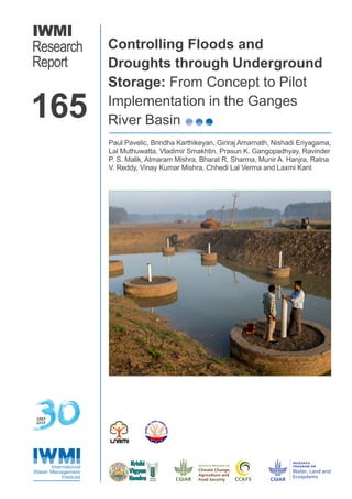
SlideShare ist ein Scribd-Unternehmen logo
1 von 38
Downloaden Sie, um offline zu lesen
IWMI
Research
Report
Controlling Floods and
Droughts through Underground
Storage: From Concept to Pilot
Implementation in the Ganges
River Basin
Paul Pavelic, Brindha Karthikeyan, Giriraj Amarnath, Nishadi Eriyagama,
Lal Muthuwatta, Vladimir Smakhtin, Prasun K. Gangopadhyay, Ravinder
P. S. Malik, Atmaram Mishra, Bharat R. Sharma, Munir A. Hanjra, Ratna
V. Reddy, Vinay Kumar Mishra, Chhedi Lal Verma and Laxmi Kant
165
1985
2015
Research Reports
The publications in this series cover a wide range of subjects—from computer
modeling to experience with water user associations—and vary in content from
directly applicable research to more basic studies, on which applied work ultimately
depends. Some research reports are narrowly focused, analytical and detailed
empirical studies; others are wide-ranging and synthetic overviews of generic
problems.
Although most of the reports are published by IWMI staff and their
collaborators, we welcome contributions from others. Each report is reviewed
internally by IWMI staff, and by external reviewers. The reports are published and
distributed both in hard copy and electronically (www.iwmi.org) and where possible
all data and analyses will be available as separate downloadable files. Reports
may be copied freely and cited with due acknowledgment.
About IWMI
IWMI’s mission is to provide evidence-based solutions to sustainably manage water
and land resources for food security, people’s livelihoods and the environment.
IWMI works in partnership with governments, civil society and the private sector
to develop scalable agricultural water management solutions that have a tangible
impact on poverty reduction, food security and ecosystem health.
i
International Water Management Institute (IWMI)
P O Box 2075, Colombo, Sri Lanka
IWMI Research Report 165
Controlling Floods and Droughts through
Underground Storage: From Concept to Pilot
Implementation in the Ganges River Basin
Paul Pavelic, Brindha Karthikeyan, Giriraj Amarnath, Nishadi
Eriyagama, Lal Muthuwatta, Vladimir Smakhtin, Prasun K.
Gangopadhyay, Ravinder P. S. Malik, Atmaram Mishra, Bharat
R. Sharma, Munir A. Hanjra, Ratna V. Reddy, Vinay Kumar
Mishra, Chhedi Lal Verma and Laxmi Kant
The authors: Dr. Paul Pavelic is Principal Researcher – Hydrogeology at the Southeast Asia Office of
the International Water Management Institute (IWMI), Vientiane, Lao PDR; Dr. Brindha Karthikeyan is a
Postdoctoral Fellow – Integrated Surface Water/Groundwater Modeler at IWMI, Vientiane, Lao PDR; Dr.
Giriraj Amarnath is Senior Researcher – Remote Sensing and Water Resources at IWMI, Colombo, Sri
Lanka; Nishadi Eriyagama is Water Resources Engineer at IWMI, Colombo, Sri Lanka; Dr. Lal Muthuwatta
is Regional Researcher – Hydrological Modeling and Remote Sensing at IWMI, Colombo, Sri Lanka; Dr.
Vladimir Smakhtin is Theme Leader – Water Availability, Risk and Resilience at IWMI, Colombo, Sri Lanka;
Dr. Prasun K. Gangopadhyay is based at IWMI, New Delhi, India; Dr. Ravinder P. S. Malik is a Consultant,
Water Resources, New Delhi, India; Dr. Atmaram Mishra is a Principal Scientist at the Indian Institute
of Water Management, Indian Council of Agricultural Research (ICAR), Odisha, India. Both Ravinder
Malik and Atmaram Mishra were at IWMI at the time this research study was conducted; Dr. Bharat R.
Sharma is Scientist Emeritus at IWMI, New Delhi, India; Dr. Munir A. Hanjra is Economist – Agricultural
Water Management at the Southern Africa Office of IWMI, Pretoria, South Africa; Dr. Ratna V. Reddy is
the Director of the Livelihoods and Natural Resources Management Institute (LNRMI), Hyderabad, India;
Dr. Vinay Kumar Mishra is Head of the Central Soil Salinity Research Institute (CSSRI), Indian Council
of Agricultural Research (ICAR), Regional Research Station, Lucknow, India; Dr. Chhedi Lal Verma is a
Senior Scientist, Soil and Water Conservation, at CSSRI, ICAR, Lucknow, India; and Dr. Laxmi Kant is
Programme Coordinator at Krishi Vigyan Kendra, Rampur, India.
Pavelic, P.; Brindha, K.; Amarnath, G.; Eriyagama, N.; Muthuwatta, L.; Smakhtin, V.; Gangopadhyay,
P. K.; Malik, R. P. S.; Mishra, A.; Sharma, B. R.; Hanjra, M. A.; Reddy, R. V.; Mishra, V. K.; Verma,
C. L.; Kant, L. 2015. Controlling floods and droughts through underground storage: from concept to
pilot implementation in the Ganges River Basin. Colombo, Sri Lanka: International Water Management
Institute (IWMI). 34p. (IWMI Research Report 165). doi: 10.5337/2016.200
/ climate change / flood control / flood irrigation / floodplains / drought / river basins / economic aspects
/ cost benefit analysis / corporate culture / groundwater depletion / groundwater recharge / groundwater
irrigation / water storage / water resources / underground storage / subsurface runoff / flow discharge /
disaster risk reduction / impact assessment / case studies / South East Asia / India / Nepal / Bangladesh
/ Tibet /
ISSN 1026-0862
ISBN 978-92-9090-831-9
Copyright © 2015, by IWMI. All rights reserved. IWMI encourages the use of its material provided that the
organization is acknowledged and kept informed in all such instances.
Front cover photograph shows a scientist measuring the water collected in a pond created under the
Underground Taming of Floods for irrigation (UTFI) approach in Jiwai Jadid village, Rampur District, Uttar
Pradesh, India (photo: Prashanth Vishwanathan/IWMI).
Please send inquiries and comments to IWMI-Publications@cgiar.org
A free copy of this publication can be downloaded at
www.iwmi.org/Publications/IWMI_Research_Reports/index.aspx
Acknowledgements
Flood-related information for Moradabad District was provided by the Disaster Management Division,
Government of Uttar Pradesh, India.
Collaborators
This research study is a collaboration of the following organizations:
	 International Water Management Institute (IWMI)
	 Livelihoods and Natural Resources Management Institute 	
	 (LNRMI), Hyderabad, India
	 Central Soil Salinity Research Institute (CSSRI), Lucknow, 	
	India
	 Krishi Vigyan Kendra, Rampur, India
Donors
This research study was funded by the following:
	 This work was undertaken as part of the CGIAR Research 	
	 Program on Climate Change, Agriculture and Food Security 	
	 (CCAFS), which is a strategic partnership of CGIAR and 	
	 Future Earth.
		 CGIAR is a global research partnership for a food-	
	 secure future. The views expressed in this document cannot 	
	 be taken to reflect the official opinions of CGIAR or Future 	
	Earth.
	 This work has been undertaken as part of the CGIAR Research
	 Program on Water, Land and Ecosystems (WLE). IWMI is a
	 member of the CGIAR Consortium and leads this program.
v
v
Contents
Acronyms	vi
Summary	vii
Introduction	1
The Concept	 3
	 Description and Biophysical Dimensions	 3
	 Financial and Economic Dimensions	 7
	 Institutional and Policy Dimensions	 7
From Concept to Mainstream Practice	 9
	 Broad-scale Opportunity Assessments	 9
	 Pilot-scale Testing and Evaluation	 9
	 Scaling Up	 10
Potential for Utfi in the Ganges River Basin	 10
	 Basin-scale Opportunity Assessment	 10
	 Sub-basin Assessment	 12
	 Cost-benefit Analysis at District Level	 16
	 Planning and Establishment of Pilot Trial	 18
Conclusions	23
References	24
vi
Acronyms
EVI		 Enhanced Vegetation Index
GIS		 Geographic Information System
INR 		 Indian Rupee
IRR 		 Internal Rate of Return
MAR		 Managed Aquifer Recharge
MODIS 		 Moderate Resolution Imaging Spectroradiometer
NPV 		 Net Present Value
PES 		 Payments for Environmental Services
SI 		 Suitability Index
SWAT 		 Soil and Water Assessment Tool
USD 		 United States Dollar
UTFI 		 Underground Taming of Floods for Irrigation
vii
Summary
Floods and droughts, along with over-exploitation
of groundwater, are major issues of concern
across much of the developed and developing
world. This report presents an approach –
referred to as ‘Underground Taming of Floods for
Irrigation’ (UTFI) – for tackling these challenges
in a novel and integrated manner. This approach
involves interventions at the river basin scale to
strategically recharge aquifers upstream during
periods of high flow, thereby preventing local and
downstream flooding and simultaneously providing
additional groundwater for irrigation during the dry
season for livelihood improvement. The three key
stages and risks to be addressed in moving from
the concept stage to mainstream implementation
of UTFI are explained. An analysis of the Ganges
River Basin indicates that the prospects for
UTFI are high, with 68% of the inner region of
the basin having high or very high suitability.
Based on a hydrologic analysis of the Ramganga
sub-basin, along with tentative estimates of
recharge performance based on surface and
subsurface recharge methods, the anticipated
land area required to store and capture excess
floodwater and reduce peak flows are defined.
The economic benefits to local agriculture and
the wider public benefits from flood reduction are
substantial, and warrant the upfront investments
and maintenance. After a detailed site selection
and consultation process, a suitable site was
selected in western Uttar Pradesh where a
village pond was retrofitted with recharge wells
and associated infrastructure to draw monsoon
flows from a nearby flood-prone river. This
pilot trial serves as both a scientific experiment
and practical demonstration. If the trial and the
UTFI approach, in general, can be technically,
economically, socially and institutionally verified
then there is enormous potential to apply the
approach to help decision makers when planning
investments in climate change adaption/mitigation
and disaster risk reduction.
1
Controlling Floods and Droughts through
Underground Storage: From Concept to Pilot
Implementation in the Ganges River Basin
Paul Pavelic, Brindha Karthikeyan, Giriraj Amarnath, Nishadi Eriyagama,
Lal Muthuwatta, Vladimir Smakhtin, Prasun K. Gangopadhyay, Ravinder
P. S. Malik, Atmaram Mishra, Bharat R. Sharma, Munir A. Hanjra, Ratna V.
Reddy, Vinay Kumar Mishra, Chhedi Lal Verma and Laxmi Kant
Introduction
Water-related disasters have significant social,
environmental and economic impacts at the global
level, and there is mounting scientific evidence
to suggest that their frequency and severity will
continue to increase (IPCC 2012). This will place
increasing pressure on developing countries
already overwhelmed with efforts to boost their
economies, enhance living standards and forge
pathways for sustainable development (Agrawala
and Fankhauser 2008; Patt et al. 2010; World
Bank 2010). Floods and droughts account for
90% of the people affected by so-called ‘natural’
disasters. On average, over the period from
1980 to 2013, floods killed around 5,000 people,
affected the lives of 52 million and cost USD 16
billion in damages each year (CRED 2014). The
corresponding figures for droughts were 17,000
killed, 76 million people affected and USD 3.5
billion in damages each year. In geographic terms,
Asia eclipses all other regions and accounts for
about 95% of all people affected by both floods
and droughts. Negative impacts of extreme
climatic events are most severe for the poorest
people within developing countries, who are the
most vulnerable and suffer the most in terms of
loss of lives and livelihoods (ADPC-UNDP 2005).
Approaches to flood and drought mitigation
typically look at one or more structural measures
to store and divert/transfer water, along with
non-structural measures that seek to provide
information-enhanced capacity to warn and
respond to such events, and also building
institutions and greater participation at the
grassroots level (Jha et al. 2012). In recent
years, greater emphasis has been given to
integrated flood management, which combines
both the hard and soft approaches. In the case
of flooding, structural measures such as building
dams, levees, dikes and diversions can also
have negative effects, including the shifting of
flood problems downstream, adverse ecological
impacts, and high capital and maintenance costs.
It is worthwhile noting that, in some instances,
positive impacts on livelihoods can emerge from
flooding that is periodic and at a manageable
scale, through nutrient-laden silt deposition
onto floodplains, salt flushing and biodiversity
enhancement (Nguyen et al. 2007).
Enhancing water storage, both above and
below ground, mitigates both types of hydrologic
extremes: droughts and floods. Big dams are
beneficial, but are also expensive and highly
controversial from a variety of perspectives. Large
dams create economic growth, but this growth
may be highly inequitable and not necessarily
trickle down to the poorest communities (Ansar
et al. 2014). The flooding of valleys causes
translocation of affected human settlements, and
the modification of river flows can lead to negative
impacts on river ecology. There is little doubt that
dams can have a positive ameliorating effect on
both floods and droughts. Juggling the multiple
2
purposes that dams are expected to serve by
prescribing suitable operating rules to achieve
multiple sets of objectives is highly challenging.
For example, dams constructed specifically for
hydropower generation and/or irrigation tend to
be operated from those perspectives and can
perform poorly from the viewpoint of flood control
(Goldsmith and Hildyard 1984).
One fact that is often overlooked is that the
largest reservoirs lie below the ground in the
form of aquifers, where the active aquifer storage
potential is usually vast (Tuinhof et al. 2005). In
times of drought, groundwater reserves, which
are more highly buffered to rainfall variability
than surface water, can provide emergency
relief and ongoing water supplies for critical
purposes (McCartney and Smakhtin 2010). Global
groundwater use has intensified significantly,
creating enormous socioeconomic benefits
for public health, sanitation and food security
(Giordano 2009). Undesirable impacts have
also resulted from intensive pumping, notably
groundwater depletion, water quality degradation,
reduced inflows to streams and wetlands, and
land subsidence. Many of these changes are
irreversible over the short and medium term, and
restoration of regional aquifer systems may take
decades or centuries even if sustainable practices
were implemented immediately.
The advantage of intensified groundwater use
is that the capacity for aquifers to store surface
water through infiltration and other recharge
methods has increased, and so has the need
for this to take place to offset unsustainable
groundwater use in many areas. Thus, solutions
to flooding issues can, if chosen wisely, create
new opportunities during drier periods that can
yield significant benefits for drought protection,
agricultural production and ecosystem functioning.
Enhancing water storage, particularly below the
ground, offers an effective means of mitigating
both flood and drought hazards.
River basins provide an ideal scale to
address water resource problems. River
basin management is universally faced with
challenges associated with the mismatch
between supply and demand brought about by
variability in rainfall (Krysanova et al. 2008). In
most river basins, situations of water shortage
and abundance co-exist, although separated
by time and/or space. Water scarcity in the dry
season can emerge just a few months after
heavy monsoonal flooding and, on occasion,
flooding can emerge soon after a prolonged
drought. While downstream locations experience
flooding, upstream locations can face water
shortages.
One of the major challenges for research
on climate change adaptation is to provide
the solutions needed by decision makers and
practitioners that are affordable, implementable
and sustainable (Moss et al. 2013). Ideally,
solutions must work on a variety of levels.
They must serve not only their most immediate
goals, but also the poorest and most vulnerable
members of the community who typically carry an
unduly high burden.
We begin here with the premise that the
existing portfolio of technologies and practices
to address current and future problems
associated with water-related disasters are
inadequate and that alternatives are needed.
This report describes the overarching idea for a
new approach, and the generic steps required
for its implementation and prospective areas
for future research. The framework that has
been developed is applied within the Ganges
River Basin through a detailed program of
analyses and engagements. This has enabled
narrowing down from the broad scale prospects
across the basin, through detailed analysis in a
representative sub-basin, and finally selecting
and setting up a pilot trial for implementation
and testing.
3
The Concept
Description and Biophysical Dimensions
For river basins that have a frequent occurrence
of negatively-impacting floods during the wet
season and water deficits in the dry season
brought about by groundwater depletion or
drought, the main question is how to intercept
surplus surface water flows to minimize these
impacts without unduly compromising existing
downstream water users and environmental
flow requirements in the dry season. A novel
form of conjunctive water use management
referred to herein as ‘Underground Taming of
Floods for Irrigation’ (UTFI) (pronounced ‘utify’)
has been devised to address this issue. The
concept is best reflected visually as illustrated
in Figure 1. Capture and storage of high wet-
season flows that potentially pose a flood
risk take place through groundwater recharge
structures (interventions) installed in upstream
areas for the protection of highly valued assets
(urban, industrial, cultural, etc.) locally and in
downstream areas. This would then enable
the recovery of water stored underground for
productive use and livelihood enhancement.
Therefore, in a sense, the impacts that would be
felt across one part of the system could be offset
to create opportunities in another part.
UTFI is a specific and unique application of
managed aquifer recharge (MAR) (Table 1). UTFI
adds new value to often ad hoc MAR efforts and
puts it into a larger-scale perspective that offers
a wider range of benefits to both upstream and
downstream areas. Central to UTFI is distributing
FIGURE 1. Schematic illustrating the UTFI concept for harvesting, recharging and recovering floodwater in upstream
areas to protect downstream communities.
4
recharge-enhancing interventions across strategic
parts of the basin to provide supplies to meet
additional demand during the dry season, and for
this water to be recovered via agricultural wells
rather than allowing surface water to concentrate
and be problematic in the floodplain areas. The
use of surface structures such as infiltration
basins is preferable as they are simplest to
construct and maintain. In some hydrogeological
settings with low permeability surficial layers or
poor surficial aquifers, deep infiltration systems
such as recharge wells may be needed instead.
All recharge systems are more prone to clogging
impacts, and thus require higher levels of pre-
treatment of recharge water and careful ongoing
maintenance. Aquifers targeted for storage would
typically be the upper unconfined or semi-confined
formations with latent storage capacity and
adequate aquifer productivity. Given the types
of operational characteristics outlined, flooding
events that are of a larger scale and longer
duration in nature are more suited to UTFI than
those that are localized or rapid.
Storing surface water from various sources
(rooftops, drains, canals, rivers, lakes, wastewater
treatment plants, etc.) in underground formations
through different types of MAR has been
implemented for decades (Dillon 2005). However,
to our knowledge, the UTFI approach has not yet
been put into practice and evaluated at scale.
Some case study examples that have relevance
to UTFI are presented in Table 2. They illustrate
the diversity of settings and problems to which
MAR has been applied. It demonstrates the
clear preference towards surface-based recharge
methods in alluvial settings and addresses
issues related to water scarcity. Case studies 2
and 3 provide the closest comparison to UTFI,
although the differences remain large. Case
study 2 considers downstream capture of storm
water runoff from a local peri-urban watershed in
southern Australia and then pumping the water
into a confined aquifer for irrigation of a park.
Case study 3 is for an arid region in rural Iran,
where infrequent runoff is collected and recharged
for irrigation.
The origins of the UTFI approach emerged as
a spin-off from a pilot-scale MAR trial conducted
in a sub-basin of the Chao Phraya River Basin,
Thailand (Pavelic et al. 2012). Water resources
in the basin are heavily relied upon to support
economic development, but severe problems
associated with water surpluses and shortfalls
are experienced on a regular basis. On average,
28% of the wet-season discharge into the Gulf
of Thailand from the basin (3,370 million cubic
meters [Mm
3
] yr
-1
) could be harvested without
significantly impacting on water use associated
with existing large to medium storages or the
riverine ecosystem, in terms of preventing
seawater ingress and pollution of marine
ecosystems by maintaining nutrient and sediment
loads to levels comparable to the period
prior to major economic development.
TABLE 1. Generalized characteristics of UTFI.
Rationale	 Mitigate seasonal flooding and improve groundwater storage.
Scale	 Watershed through to river basin.
Target aquifer	 Primarily medium-shallow, unconfined or semi-confined.
Site selection	 Regular flood occurrence and impact, hydrogeological suitability, groundwater depletion.
Design	 Targets simple, low-cost technologies that can be managed by local communities.
Frequency of 	 Intended to capture only excess flows, not necessarily in equal amounts in all the years.
operation	
Operation and 	 Local communities operating collectively in partnership with local authorities.
maintenance	
Benefits	 Upstream and downstream benefits in terms of improved groundwater availability, flood mitigation and
	 improved livelihoods.
5
TABLE2.CasestudiesofMARreliantonharvestingsurfacewaterrunoff.
				Casestudies
	
Parameter	1	2	3	4	5	6	7
Region	NorthernAustralia	SouthernAustralia	SouthwestIran	LowerNorthern	WesternIndia	Uzbekistan	EasternIndia
				Thailand	
Recharge	Riverwater	Stormwaterrunoff	Floodwater	Canalwater	Catchmentrunoff	Riverwater	Runofffromfields
watertype							
Recharge	Pondsandtrenches	Injectionwell	Floodwater	Basins	Ponds,check	Infiltrationbasin	Aquiferstorage
technology			spreadingsystem		dams		andrecovery	
							(ASR)well
Volume	100x10
6
m
3
/year	0.25x10
6
m
3
over	<1to>20x10
6
	5,000m
3
in	374x10
3
	58,000m
3
	220mm/year
recharged		4years	m
3
/year	30days	m
3
/year	over1.5months
						(potentially
						100Mm
3
/yearat
						scale)	
Aquifer	Alluvial,unconfined	Limestone,confined	Alluvial,unconfined	Alluvial,unconfined	Fracturedbasalts	Coarsealluvium	Alluvial,
							semi-confined
Setting	Riverdelta	Peri-urban	Aridplain	Alluvialplains,	Semi-arid	Semi-aridvalley	Hillytogentle
				humidtropics			plainsandcoastal	
							area
MARobjective	Schemetoreduce	Pilottotestcreating	Harvestfloodwater	Pilotaimedto	Evaluationofrecharge	Pilottoenhance	Utilizeexcess
	groundwateroveruse/	newfreshwaterfor	tooffset	reverse	frommicro-watersheds	groundwateruse	monsoonrunoff
	seawaterintrusionto	landscapeirrigation	groundwater	groundwater	overseveralyears	sustainablyfor	tomeetirrigation
	sustainsugar	andreducecoastal	overuse	depletion		irrigationto	demands
	production	dischargeofrunoff				overcomedry
						seasonwater
						shortfalls
						downstream	
(Continued)
6
TABLE2.CasestudiesofMARreliantonharvestingsurfacewaterrunoff.(Continued)
				Casesdtudies
	
Parameter	1	2	3	4	5	6	7
Problems	Unlicensed	Wellclogging	Declinein	Largeareaofland	Nonereported	Nonereported	Cloggingof	
experienced	groundwater		groundwater	usedaswetlandfor			injectionwells
	abstraction		persistsdueto	pre-treatment;
			hugedemand,	long-termperformance
			sediment	isunclear				
			depositionand		
			flooddamage
			tosystem
Implementing	Waterboards	Stategovernment		Centralgovernment
agency	(regionalgovernment
	organization)				
Source	Charlesworthetal.	Pavelicetal.2006	Hashemietal.2015	Pavelicetal.2012	Shardaetal.2006	Karimovetal.	Holländeretal.
	2002					2013	2009
7
These volumes, which create an enormous
hazard when concentrated downstream in built-
up floodplains, could be easily accommodated to
refill the vast alluvial aquifers in the central plains
which are extensively utilized for irrigation of rice
and sugarcane. Results from pilot recharge trials
reveal that this water could be readily recharged
and accommodated within the vast shallow alluvial
aquifers situated within and upstream of the
flood-prone areas. Capturing peak flows would
take place in wet years and requires dedicating
around 200 km
2
of land for groundwater recharge
within the basin. This would not only reduce
the magnitude and costs of flooding, but also
generate USD 140 million per year to boost the
livelihoods of thousands of farming households,
and thereby allow capital investments to be
recouped over reasonably short time frames.
Financial and Economic Dimensions
The ‘value proposition’ for UTFI revolves around
transferring investments from traditional watershed
management approaches in downstream areas
into alternative interventions upstream. UTFI
requires upfront and ongoing costs that in turn
provide benefits both in terms of flood mitigation
and improved agricultural productivity, and
generally increases socioeconomic well-being in
addition to existing benefits.
It may be argued that UTFI is not a
straightforward case of cost-benefit analysis, as
the costs and benefits take place in different
locations involving private as well as public
goods and services. The public benefits as
a result of UTFI are environmental services
that go beyond flood mitigation, and include
increased groundwater availability during the
dry season and continuity of groundwater
baseflows into surface water bodies, thereby
enhancing environmental assets. Indirect
services include sustainable drinking water
provision, improved livelihood activities and
enhanced economic well-being, including
health and education. The distribution of these
additional benefits horizontally (across space)
and vertically (across socioeconomic groups)
could potentially result in increased prosperity
and more equitable societies, resilient
communities, improved natural resource
governance and protected ecosystems. UTFI
places importance on the ecosystem services
from watershed-level interventions. It is
anticipated that the economic valuation of
ecosystems will lead to their optimal use and
preservation of their services.
Institutional and Policy Dimensions
UTFI cannot be undertaken by any single party
alone. Close partnerships are required between
different stakeholder groups in upstream and
downstream areas, through institutional and
broader governance arrangements that are
inclusive and effective.
Farmers are a key beneficiary as well as
strategic partners, and thus their participation
and ownership is central to the operational
success and sustainability of UTFI. Targeted
operation of recharge structures to intercept
excess flows, and flows in normal or dry years
are perhaps permitted to bypass for use in
downstream areas when and where necessary,
is a crucial consideration. As important and
perhaps more challenging, there is a high
level of interdependence created between
stakeholders situated in lowland flood-affected
areas and runoff generating in upstream
areas. How will upstream stakeholders be
co-opted and encouraged to use land for
dedicated recharge purposes, and manage
this infrastructure on an ongoing basis for
the benefit of downstream communities? In
areas with intensive land use, this may require
conversion of land use for recharge purposes.
How will the number of stakeholders required
to achieve positive impacts participate in
this collective action? How will downstream
stakeholders mobilize resources to support
upstream actions? How to operationalize rules
for when and how to harvest floodwater, and
the minimum quantity of groundwater that
needs to be withdrawn to achieve effective
storage capacity?
8
The governance challenge is to identify
institutional mechanisms for equitable distribution
of the cost and benefit sharing necessary for
ensuring the sustainability of these interventions
and the follow-on benefits to farmers, urban areas
and ecosystems. Financial or other incentives on
a continuous basis are necessary to enable the
effective and ongoing functioning of infrastructure
over the long term. Since such incentives would
need to be linked to flood events, there is also
uncertainty in their use because such events can
be irregular and difficult to forecast.
In terms of implementing UTFI, a number of
models are possible:
● 	 Linkages to existing government programs
that address flood, groundwater and irrigation
management.
● 	 Market-based approaches such as Payment
for Environmental Services (PES).
● 	 Non-market-based (participatory) approaches.
Government agencies and programs with
synergies to UTFI cut across numerous sectors
that encompass the management of surface
water resources, groundwater, irrigation, land-
use planning, urban/agricultural development
and others. This complex institutional
environment can be simplified, if UTFI can be
integrated into existing government development
programs or strategies. In some cases, the
integration needed exists in the form of river
basin organizations, watershed improvement
programs and others. To fully understand the
context and entry points for UTFI in urban
and rural planning, detailed multi-level/sector
stakeholder engagement is vital from the
very beginning.
PES is an institutional approach linking
environmental service providers and users
(i.e., beneficiaries) based on the principle that
those who benefit from environmental services
should pay, and those who provide these
services should be compensated (Pagiola and
Platais 2007). PES has been found to be a
cost-effective means for a range of natural
resource management issues. However, although
attractive in theory, putting it into practice is
far from being simple in most cases (Dillaha
et al. 2007). PES can give rise to collective
action dilemmas at the local level from political
corruption, unequal power relationships and other
processes. Given the nature and scale of UTFI,
this needs to be managed within both upstream
(seller) and downstream (buyer) locations by the
community, private sector or the government
itself acting in the public interest, or using a
combination of these where parties work together
covering the interests of both buyers and sellers.
Non-market (participatory) instruments are
based on decentralized governance principles
and are from a natural resource management
perspective, which include approaches such
as community participation and contribution,
participatory learning and social regulation. Non-
market approaches have been globally applied
to various aspects, including groundwater,
watersheds, irrigation systems, flood/drought
risks, wetlands and others (Villarroya and
Aldwell 1998; Shah 2009). Such approaches are
applicable in arriving at agreements between
communities that may have highly contrasting
socioeconomic conditions and natural resource
issues, especially when considered at a scale
that is sufficiently large or rather complex. The
success of informal participatory approaches is
often attributable to strong local leadership or
support from nongovernmental organizations
(NGOs). Therefore, the sustainability and
scalability of these initiatives is of major
concern. It has generally been observed that,
in the absence of regulatory controls, formal
or informal, farmers have little incentive to
follow specified practices in the given policy
environment (Reddy 2012). Levels of trust
between farmers and the public or government
service delivery mechanisms are a key
determinant. While continuity and up-scaling of
these successful small-scale initiatives is not
easy, the learnings that are derived could be
integrated into formal institutions. A number
of participatory institutions would need to be
integrated in the context of UTFI. The feasibility
of social regulation at scale and achieving equity
in the UTFI context appear to be plausible in
theory but needs to be investigated further.
9
Ultimately, it is difficult, if not impossible, to
be prescriptive in advance of field testing, and
operational experience of the actual merits and
potential of these approaches.
From Concept to Mainstream Practice
New water management approaches will entail
risks that must be identified and addressed. In
this particular case, the following risks can be
partitioned into four main types - technical (T),
social and institutional (S&I), economic (EC) and
environmental (EN):
● 	 Poor site selection (T).
● 	 Inappropriate system design leading to low
performance (T, EN).
● 	 Poorly targeted governance model (S&I).
● 	 Lack of operating rules leading to ineffective
flood mitigation (S&I).
● 	 Large capital or operating costs relative to
other approaches (EC).
● 	 Waterlogging due to over-filling of aquifer (T,
EN, S&I).
● 	 Contamination of aquifer due to pollutants in
recharge water (T, EN, S&I).
● 	 Interception of downstream environmental
flows (EN, S&I)
To address these risks, a staged and adaptive
management approach is proposed to maximize
the benefits of investments and to avert major
failures. This is consistent with the messages
reported by experienced practitioners of MAR
(Bouwer 2002; Dillon 2005). It is also recognized
that unless careful planning takes place, technical
failures can occur which are rarely reported but
can significantly set back advancements.
It is envisaged that the advancement of UTFI
from inception to widespread implementation will
involve a series of steps or stages that would
collectively lead to advanced progress. For
convenience, three main stages are defined here:
i) broad-scale opportunity assessments, ii) pilot-
scale testing and evaluation, and iii) scaling up.
Broad-scale Opportunity Assessments
The goal here is to develop an understanding of
the likely scope for UTFI implementation within a
broad region, such as a country or river basin. A
disaggregated analysis across the region would
serve to pinpoint the localities that are most
favorable for its implementation; envisaged to be
areas where suitable biophysical, socioeconomic
and institutional characteristics converge.
Broad-scale assessments to examine the
potential of MAR have been carried out in various
regions (Smith and Pollock 2012; Alraggad
and Jasem 2010; Chusanathas et al. 2010).
The focus of these studies is twofold: i) nature
of the subsurface, and its capacity to accept,
store and recover water; and 2) availability of
sufficient water to meet the project objectives.
These are useful starting points, but do not
necessarily include all the key elements needed
for a UTFI opportunity assessment. A generalized
methodology has been developed for UTFI,
and applied to Sri Lanka, Myanmar and the
Ganges River Basin. The results of the Ganges
River Basin assessment is presented in the
following section.
Pilot-scale Testing and Evaluation
The areas with the highest potential for UTFI
implementation were identified from the opportunity
assessment. A detailed proof of concept by field
implementation on a pilot scale would follow.
10
The key biophysical measures of performance
would be in terms of flood attenuation and risk
reduction, along with enhanced groundwater
storage and irrigation intensities. There is a need
for demonstrated performance on a sustained
basis that extends across multiple years to capture
variability in rainfall and flood characteristics.
Sustainable operations of groundwater recharge
interventions are underpinned by effective
participation from the relevant actors derived from
local communities and local government. Research
activities would cover site selection, biophysical
and socioeconomic site characterization, pilot-
scale design and implementation or storage/
recharge interventions, baseline data, performance
monitoring and testing, hydrologic modelling
and forecasting, training and capacity building,
social/institutional policy arrangements, and cost-
benefit analyses. Pilots would need to be on a
sufficiently representative yet achievable scale, and
operational testing and evaluation should be carried
out over extended periods to fine-tune operational
systems and protocols.
Site selection is arguably the most critical
step, since it provides the foundation for a
successful pilot study. Cases of MAR failures
being reported are rare. However, of the
few exceptions that are reported, poor site
characteristics have been a key attributing factor
(Pavelic et al. 2010).
Scaling Up
It is expected that the direct benefits that can
emerge from any individual pilot trial will be
modest. How to best bring UTFI up to scale and
the benefits of the approach are reliant on the
use of decision support tools, such as hydrologic
models, which offer predictions based on one
or more implementation scenarios. Such tools/
models also have value in designing the pilot trials
in the second stage.
The evidence base generated, when
disseminated in well-targeted ways, can lead
to policy acceptance and the guidance needed
to enable larger-scale rollout by governments
and other investors, which may be linked to
ongoing government programs that address flood/
groundwater/irrigation management or crosscutting
areas such as climate change adaptation and
mitigation. Bringing on board key stakeholders
from the development sector, including private
enterprise and international financial institutions,
can also help facilitate uptake of UTFI.
Finally, it is also recognized that development
pathways are rarely as simple or straightforward
as presented in the three-stage process defined
here. Also, within and between each stage may
lie a myriad of sub-steps and interactions that
are highly case specific and difficult to identify
a priori.
Potential for UTFI in the Ganges River Basin
This section is multi-faceted and describes
assessments made at the basin, sub-basin, district
and village scales. It applies a variety of methods
and approaches to assess the feasibility of UTFI
at these different scales. This finally leads to on-
the-ground implementation of a UTFI pilot trial in
one prospective village.
Basin-scale Opportunity Assessment
The Ganges River Basin in South Asia,
where problems related to seasonal flooding,
groundwater depletion and food security are
particularly acute, was selected for development
of the opportunity assessment. The basin is
11
one of the world’s largest (1.2 million km
2
) and
most heavily populated (655 million people)
transboundary river basins that extends over four
countries - Bangladesh (4%), China (3%), India
(79%) and Nepal (14%) (JRCB 2011). Floods
are an annual occurrence and the basin has a
well-known history of devastating flooding events,
and low-lying parts of the basin are regularly
inundated by floodwaters. In fact, some of South
Asia’s largest and fastest-growing cities (e.g.,
Delhi, Kolkata, Lucknow, Dhaka) sit on low-lying
floodplain and deltaic settings that are highly
susceptible to natural disasters such as floods
and sea-level rise. The economies of the major
riparian countries of the basin are highly driven
by agriculture, and many areas remain steeped
in poverty (World Bank 2014). Rapid increases in
population and economic growth have increased
food demand in recent decades. The gross
irrigated area in the Indian part of the basin is
estimated at 23 million hectares (Mha). Pumping
of groundwater to support irrigated agriculture is a
major water source across the basin. This heavy
reliance on groundwater has led to depletion
across the northwestern Gangetic Plains, which
includes much of Haryana, Delhi and western
Uttar Pradesh.
Identifying locations with characteristics suited
for UTFI implementation using scientifically-based
methods and tools is a necessary first step. UTFI
interventions require an area-based approach,
and must be implemented at a sufficient scale
to be effective in dampening flooding impacts.
While tools that indicate MAR site selection or
climate vulnerability exist in different regions,
the methodologies used for this purpose are not
directly transferable to UTFI and hence a specific
approach was developed. Only an overview of the
assessment protocols and results are provided
here, and more detailed information can be found
in Brindha and Pavelic (Forthcoming).
Factors influencing the occurrence and
impacts of floods in the Ganges were identified
based on literature which focused on flood-risk
mapping, groundwater development and mapping
of groundwater potential zones. Nine surface
characteristics of the basin (drainage density,
population density, geology, flood frequency,
flood mortality and distribution, extreme rainfall
events in a year, land use, slope and soil type),
two subsurface characteristics (groundwater level
and transmissivity of the aquifer) and economic
losses due to floods were included. Data related
to these surface and subsurface characteristics
of the area were collected from different sources.
Processing of the layers was carried out through
a multi-layer geographic information system (GIS)
analysis, whereby a suitability index (SI) was
determined. Each of the layers was sorted under
three distinct groups representing different parts
of the cycle of water flows: (i) flood occurrence
and impacts; (ii) capture and recharge; and (iii)
groundwater storage, use and demand. Only
43% of the basin encompassing the ‘inner zone’
was analyzed, because it was found that UTFI is
not feasible in the ‘outer zone’ due to the risk of
flooding, drought and human/economic losses.
Data were available at a diverse range of scales,
which were then aggregated and analyzed at the
watershed level. Ranks were assigned for features
within the thematic layers, and a weight given for
each layer was then merged to arrive at a final
SI map organized into four suitability classes:
low, moderate, high and very high (Brindha and
Pavelic Forthcoming).
Flood occurrence was drawn directly from
the work of Amarnath et al. (2012), which
established the maximum area inundated by
flooding revealed from Moderate Resolution
Imaging Spectroradiometer (MODIS) satellite
data. These data consisted of 500-m resolution
images of ground spectral reflectance at 8-day
intervals over the period from 2000 to 2011, and
was interpreted using flood detection mapping
algorithms. Across the Ganges River Basin, the
maximum inundation was highly variable with
an area varying from 6,000 km
2
to 11,000 km
2
.
The longest inundation periods were in 2007
and 2010 (although not immediately evident from
Figure 2).
Results show that 24% of the inner basin had
very high suitability and a further 44% had high
suitability for UTFI (Figure 3). The SI distribution
reveals differentiation in suitability across the
landscape – not all areas have the same
potential to support UTFI implementation.
12
There was a tendency for the watersheds at the
periphery to have a low SI, a natural transition
considering that the adjacent areas could be
excluded from the analysis. These upland areas
with low SI contribute runoff that can lead to
flood inundation downstream (Sharma and de
Condappa 2013). This highlights the scalar
nature of the problem, and the dilemma in trying
to find a balance between considering scales
that are either too small or too large. A scale
that is too small may disconnect the problem
areas downstream from the areas where there
are opportunities upstream. A scale that is too
large creates excess aggregation and separation
between the upstream and downstream areas.
Sub-basin Assessment
According to Figure 3, one of the areas with
generally high potential for UTFI implementation
is the Ramganga sub-basin. The Ramganga
originates from the high altitude zone of 750-
2,300 m before descending upon the Upper
Gangetic plains. Its drainage area is 18,665 km
2
with an average annual discharge of about 200
m
3
s
-1
(ignoring the drainage area of a tributary
in the East, which flows separately into the
Ganges but is commonly included in the sub-basin
analysis of other studies). The largest storage,
the Ramganga reservoir located near Kalagarh,
provides for irrigation and hydroelectric generation.
FIGURE 2.Annual maximum inundation maps of the Ganges River Basin showing the maximum area of flood inundation
for each year between 2000 and 2011. Flood pixels have Enhanced Vegetation Indices (EVI) of ≤ 0.1; Mixture pixels
include water, vegetation and soil coverage with EVI > 0.1 and ≤ 0.3; Long-term water body pixels have inundation
periods > 120 days. The boundary of the Ramganga sub-basin is indicated by the red line.
Source: After Amarnath et al. 2012.
13
This sub-basin is the first major river joining the
Ganges River, and the length of the river from
the source to the confluence with the Ganges
is 596 km. The sub-basin extends over two
administrative states: Uttaranchal and Uttar
Pradesh. The important tributaries that flow into
the Ramganga River are the Kho, Gangan, Aril,
Koshi and Gorra. There are about 20 million
people living in the sub-basin. As in other parts
of the Ganges River Basin, the most challenging
water resources management issue in this sub-
basin is the difference between water demand and
seasonal availability. Average annual precipitation
in the basin is about 900 mm, and ranges from
550 mm to 1,340 mm. The monsoon period
is from June to September and about 85% of
the precipitation occurs during these monsoon
months. Also, more than 80% of the annual
flow in the Ramganga River occurs during these
months, resulting in widespread flooding. During
the rest of the year, surface water flows are
limited, and this has an impact on domestic
and agricultural supplies, and ecosystems.
Groundwater levels are dropping across the
basin, especially in non-command areas where
groundwater pumping is not being countered by
seepage from canals and surface water return
flows (CWC 2012).
Flow-flood Relationships
The Ramganga sub-basin has a high flood frequency
with major flooding estimated for 2003, 2005, 2008
and 2010, with an average inundation extent of
approximately 800 km
2
to 1,000 km
2
(Figure 4). In
sub-basins of the Upper Ganges River Basin, such
as Ramganga, flood events are most apparent in the
period between late August and early October.
FIGURE 3. Suitability index (SI) rankings across the inner Ganges River Basin determined at the watershed level.
Source: Adapted from Brindha and Pavelic Forthcoming.
14
A flow analysis of the Ramganga sub-
basin was carried out using the Soil and Water
Assessment Tool (SWAT) model, calibrated with
hydrograph records from several river monitoring
stations over a 15-year period from 1996 to 2010,
to better understand the volumes of problematic
water flows and to design interventions
accordingly. Due to the flow monitoring stations
being located in the upper and middle parts of
the basin, the model had to be used to simulate
the total outflow from the sub-basin. It also served
to better understand the hydrology of a basin,
which will be useful for other facets of the study
as described later.
The annual peak monthly flow simulated
at the outlet station is strongly correlated (R
2
=
0.62) to the maximum area inundated by floods
as revealed by the MODIS data. It verifies
that reducing peak monthly flows will have
a commensurate impact on reducing flood
inundation. In theory, reducing peak monthly
flows to around 500 m
3
s
-1
or less is needed
to eliminate major negative flooding, although
smaller, more manageable floods would likely not
be eliminated (Figure 5).
Interventions to Reduce Flows
The average runoff volumes for 100% flow, and
the associated volumes that need to be recharged
to achieve 25% and 50% reductions in flow are
shown in Table 3. A 50% reduction would reduce
flow of the highest magnitude in 2010 with a
recurrence interval of 16 years down to 2 years.
For the 50% target, across the entire sub-basin,
about 1,741 m
3
ha
-1
would need to be intercepted,
stored and recharged, on average, or this could
be up to 2,377 m
3
ha
-1
, if the variability in flows
are taken into account.
On the heterogeneous alluvial soils
characteristic of the Ramganga floodplain,
we consider two methods of recharge: (i)
surface infiltration to account for areas where
the unsaturated zones are permeable, and
(ii) subsurface recharge for less permeable
zones. The 50% reduction target is used here for
demonstration purposes.
For the first method, it is assumed that
a minimum infiltration rate of 10 m per wet
season may be achieved in any area targeted for
recharge (Bouwer 2002), which is a conservative
FIGURE 4. Temporal changes in the extent of estimated flood pixels within the Ramganga sub-basin.
Source: After Amarnath et al. 2012.
0
200
400
600
800
1,000
1,200
1,400
2001 2001 2002 2003 2004 2005 2006 2007 2007 2008 2009 2010 2011
Inundatedarea(km2)
15
FIGURE 5. Relationship between annual maximum area inundated by floods determined from MODIS data and the
maximum monthly flow simulated with SWAT over a 10-year period (2001-2010).
estimate based on international experience in
similar settings. In this case, where the recharge
target is 1,741 m
3
ha
-1
, less than 2% of the land
area would need to be dedicated to recharge
interventions across the entire Ramganga sub-
basin. If areas with most permeable surface
and subsurface strata are targeted then higher
infiltration rates may be achieved and the
dedicated area will reduce proportionately. For
example, achieving 100 m of recharge per
season would reduce the land area to around
less than 0.2%, whereas if only 1 meter of
recharge was achieved due to poor site selection
or performance, the area required would be up
to 20%.
For the second method, it is assumed that
recharge wells are used. With high transmissivities
in Uttar Pradesh in the order of 3,000 m
2
/day
(MacDonald et al. 2015), it is conservatively
assumed that each well can recharge 100 m
3
day
-1
(1.2 liters s
-1
) and that recharge takes
place during a 100-day period of the wet season.
y = 0.0009x2
- 0.834x + 423.3
R² = 0.623
0
200
400
600
800
1,000
1,200
1,400
1,600
0 200 400 600 800 1,000 1,200 1,400 1,600
Maximuminundatedarea(km2
)
Maximum monthly flow (m3
/sec)
TABLE 3. Annual and standard deviation outflow volumes for 100, 75 and 50% flows and flow reductions, and the
captured water needed to achieve each scenario.
Percentage 	 Mean annual	 Mean annual	 Mean captured
of flows	 outflow ± 	 flow reduction	 water yield ±
	 Standard 	 (Mm
3
)	Standard
	 deviation (Mm
3
)		 deviation (m
3
ha
-1
)
100	 6,498± 2,375	 0	 0±1,272
75	 4,873±1,782	 1,624	 870±955
50	 3,249±1,188	 3,249	 1,741±636
16
Recharging floodwater to achieve the 50%
reduction target can be reached with a well
density of 0.17 wells per hectare. If 10 wells were
installed in the base of a typical village pond then
one pond installation would provide sufficient flood
proofing for an area of 58 ha.
The values presented here for both methods
provide preliminary estimates of what the
possible performance could be in practice,
accounting for some degree of uncertainty.
Further data would be needed to establish
actual recharge rates, supported by a more
rigorous analysis that links the river flows to the
recharge dynamics. Further, the high silt load
of the Ganges floodwaters makes the recharge
design challenging and necessitates the need
to consider pre-treatment of source water.
The implications are that periodic desilting of
recharge structures would be needed to achieve
effective ongoing performance.
Cost-benefit Analysis at District Level
Ex-ante costs and benefits from UTFI
interventions are assessed for Moradabad
District, which is situated within the middle
reaches of the Ramganga sub-basin. The
average population density is 745 persons per
km
2
, with 68% of the people living in rural areas.
The district is intensively used for agriculture,
with 83% of the area under irrigation, high
cropping intensities and three major cropping
seasons. Over 95% of irrigation draws on
groundwater from open wells or tube wells.
According to the district profile of the Central
Ground Water Board (CGWB), over half of the
assessment units have groundwater resources
that are classified as ‘unsafe’ (i.e., semi-critically
over-exploited) and, on average, groundwater
draft has reached 95% of the recharge. Major
crops include rice in the wet season, wheat in
the winter season, and maize and menthol are
sown during the summer. Sugarcane, grown
year-round, is another major crop.
During the past 5 to 10 years, there were no
declared droughts, although water stress due to
increasing groundwater depletion is on the rise
and causing productivity losses in some seasons.
Moradabad District experiences frequent floods,
with three flood events in the past 5 years, i.e.,
September 2010, August 2012 and July 2014.
Both the 2010 and 2014 floods were severe
and resulted in the loss of lives, and caused
extensive damage to crops and property in rural
as well as urban areas. A number of villages
were submerged in Moradabad District, such that
state flood relief agencies were overwhelmed
and rescue operations through the military
were needed.
Here we use the example of the extent and
cost of damage caused by the floods in 2010.
As per the official estimates in 2010, there were
28 lives lost and 412,000 people in 216 villages
were affected, with flood damage totalling about
INR 1,000 million (USD 17 million). This damage/
cost estimate does not include the loss of human
life, losses due to transport delays, losses due to
school days or workdays lost, and losses due to
disease- and health-related problems.
The various cash flow measures using
the data on flood damage, costs of UTFI
investments and gains to farmers are estimated
based on a set of assumptions, in order to
arrive at a cost-benefit assessment over a 20-
year time frame using 3% and 8% discount
rates (Table 4). We assume that about 25%
of the cultivable wasteland and fallow lands,
and just 2% of the irrigated land need to be
dedicated for capturing floodwaters under
UTFI interventions. The captured water yield
is sufficient to enable at least one additional
irrigation application to support cropping during
water-short periods. The assumed capital cost
of establishing UTFI interventions (INR 36,000/
USD 600 per hectare) is set at three times the
allocation made towards watershed management
programs at the national level, due to the huge
volume of floodwaters that would need to be
arrested in the area. Rental value of irrigated
land is used to estimate the opportunity cost
of using this land for UTFI interventions. The
additional cost of groundwater recovery for
irrigation is assumed to be equivalent to the
cost of renting pump sets (including diesel) by
the farmers. Governance costs are assumed
17
according to the annual salary of staff needed
for the supervision of UTFI interventions. Gains
in earnings to farmers through greater cropping
intensity and crop diversification are estimated
using prevailing market prices. The farm-gate
prices are assumed to be 80% of the wholesale
market prices.
Farmers use additional groundwater
harnessed by the UTFI interventions to bring
more land area under food security crops
(rice is taken as the model crop), close the
yield gap (model crop is sugarcane) and then
diversify the cropping pattern (more potatoes,
less sugarcane) to enhance revenues. Cropping
intensity increases to 195% (up from 188%)
with just one additional irrigation application,
and could reach 250% with wider adoption
and broad-scale implementation of UTFI.
Preliminary estimates show that farmers benefit
from gains in farm earnings through greater
cropping intensity (INR 42/USD 0.7 million
per year, on average), closing the yield gap
and crop diversification (INR 812/USD 13.5
million per year, on average). Benefits from
the flood damage prevented and savings to the
government on emergency flood relief operations
are substantial to justify the investments in
UTFI interventions. The returns are quite high,
even if only the benefits to farmers and the
local agricultural economy are considered. It is
also apparent that high NPV and IRR could be
achieved, yet the numbers are indicative only
and detailed field data are required for a more
robust economic analysis of UTFI. Further, this
analysis provides guidance on the viability of
UTFI in Moradabad District in the absence of
any comparative interventions such as medium-
or large-sized dams.
TABLE 4. Cost-benefit analysis of UTFI implementation in Moradabad District, Uttar Pradesh, India.
Item	 INR 	 USD
1
	 (millions)	(millions)
Costs
Total investment, establishing floodwater harvesting interventions	 286.9 		 4.78
Total operation and maintenance (O&M) costs:	 237.3 		 3.96
a. Average annual O&M cost for maintaining UTFI structures	 28.7 		 0.48
b. Opportunity cost of land acquisition	 91.2 		 1.52
c. Groundwater recovery for irrigation	 117.3 		 1.96
d. Governance of UTFI (supervision)	 0.2 		 0.003
Benefits
Benefit of the damage prevented (per flood event)	 953.0 		 15.9
Savings to the government in terms of flood rescue and relief operations (per flood event)	 136.6 		 2.28
Gains in farm earnings, greater cropping intensity	 42.3 		 0.71
Gains in farm earnings, closing the yield gap and crop diversification	 812.2 		 13.5
Net present value (NPV) @3%	 13,660.9 		 227.7
NPV @8%	 7,930.3 		 132.2
Internal rate of return (IRR)		 77%
IRR with agricultural benefits only		 42%
Note:
1
It is assumed that USD 1 = INR 60.
18
Planning and Establishment of Pilot Trial
Site Selection Processes
The first major step for piloting involved selection
of the most suitable site by narrowing down the
area from the Ramganga sub-basin to the village
scale. Two adjacent meso-scale watersheds,
248 and 295 km
2
in size, were selected in an
area with a high SI according to the opportunity
assessment map, where canals or rivers and
ponds are present, and in close proximity to the
administrative capital of the district (Rampur)
(Figure 6).
Using the sub-basin-level datasets
supplemented by available district-level
information, such as the groundwater reports
of CGWB and the agriculture contingency plan
of the Uttar Pradesh Department of Agriculture
and Cooperation (AGRICOOP), a set of local
indicators were identified to assist in the process
of selecting a suitable pilot site. These indicators
included the following:
●	 Occurrence of flooding.
●	 Depth to the water table and long-term
trends in groundwater levels (stable,
rising, falling).
●	 Distance of proposed recharge structure
(ponds) to nearest river or canal.
●	 Size and number of ponds in each village.
●	 Type of ownership of ponds (government/
community or privately owned).
FIGURE 6. Satellite map of the two focal watersheds and four short-listed villages in Rampur District. The village
ultimately selected for piloting (Jiwai Jadid) is amongst those indicated in the map.
19
Maps for each indicator were prepared and
villages within the watersheds were ranked
against those indicators. Over the period
from February to May 2015, visits were made
to the ten highest ranking villages, which
were ranked again after the visits. Of these,
the top four villages were revisited and a
detailed questionnaire was administered under
several themes: general information, floods,
groundwater, agriculture, socioeconomic and
institutions. Team members from the Central
Soil Salinity Research Institute (CSSRI),
Krishi Vigyan Kendra and the International
Water Management Institute (IWMI), with
collective knowledge on biophysical as well as
socioeconomic aspects, contributed to preparing
and carrying out the questionnaire survey.
In the intensively cultivated plains of the
lower Ramganga sub-basin, availability of land to
implement UTFI is a major constraint. The ponds
within the villages situated in local depressions,
where there is scope to propose conversion
of land for floodwater recharge, became the
obvious focal point. There are two types of
village ponds: (i) community ponds owned
by the local government (Gram Panchayat),
and (ii) private ponds owned by one or more
community members. Community ponds, which
were once heavily relied upon for domestic
and agricultural water supplies, and for other
purposes, have been replaced by private wells
tapping groundwater, and these ponds now serve
as repositories for domestic sewage within the
villages. As national sanitation programs, such as
the Clean India Mission, have been implemented,
households have constructed toilets to replace
open defecation practices. Due to this, pollutant
loading has become most concentrated within
the built-up village environment, and ultimately
ends up in the community ponds. Most of these
ponds are choked with water hyacinth due to high
nutrient inputs. On the other hand, private ponds,
which tend to lie in the fringes and rural parts
of a village, collect runoff from local catchments
and is sometimes supplemented by groundwater
pumping rather than wastewater, and are thus
visibly less polluted. Private ponds are typically
used for growing water chestnut, raising ducks,
fish farming and livestock watering/bathing. Thus,
private and community owned ponds each have
specific characteristics. The cleaner environment
of private ponds must be weighed up against
the need to fully understand the motivations and
interests of their owners. Community ponds,
which lie on common land as a public asset,
offer long-term security and may be eligible to
attract funding through government development
schemes to support livelihood-related activities.
For the purpose of site selection, neither option
was explicitly ruled out, but rather left to the
merits of each individual site and the views of the
selection team members.
On the basis of the final ranking, site visits
and detailed consultations (described in a later
sub-section), Jiwai Jadid village, situated in Milak
block, Rampur District, was selected for piloting.
In particular, a community pond situated adjacent
to a sealed road and a canal transporting water
from the Pilakhar River (Pilakhar minor canal)
were selected (Table 5). The site is conveniently
accessed and prominently located on a transport
corridor linking Milak with Bilaspur via Kemri.
Considering multiple watersheds provided
benefits beyond simply site selection, namely: i)
a greater understanding of the factors affecting
site suitability at the local level, and ii) identifying
multiple sites that could be setup during a
subsequent expansion phase.
Pilot Trial: Design and Construction
When retrofitting village ponds for recharge
purposes, surface infiltration methods are
generally preferred as they are cheap, simple
and easy to manage compared to other methods
(CGWB 2007). However, as the top few meters of
the soil profile in Jiwai Jadid village is composed
of heavy clay topsoil, percolation rates can be
expected to be negligible. A viable alternative is to
use deep infiltration methods, which bypass upper
layers that are resistive to flow, to transfer water
directly under gravity to deeper more permeable
layers. In this case, groundwater recharge was
achieved through recharge wells that transfer
excess canal water (filtered) under gravity
through the well to subsurface permeable zones.
20
This approach has been practiced widely across
the Ganges River Basin and considerable
operational experience has emerged (e.g.,
Kaledhonkar et al. 2003; Kumari et al. 2014).
In an effort to establish the pilot site swiftly to
maximize the opportunities presented by the 2015
monsoon season, the private sector was solicited
to submit bids. Water Solutions, a company based
in Delhi with extensive experience in MAR in the
region, was selected to undertake the work. The
pond was dewatered and excavated to a depth of
2 m, and the soil recovered was used for raising
and strengthening the banks (Figure 7). A set of
10 gravity-fed recharge wells with six-inch inner
diameter PVC pipes slotted at the base were sunk
into the bottom of the pond. Around each pipe
of the recharge well is a brick masonry chamber
filled with pea gravels to filter out suspended
silts and ensure higher rates of groundwater
recharge. The wells are coupled to a recharge
filter consisting of gravel in a small brick masonry
chamber. Wastewater which previously flowed
into the pond from around 12 households was
diverted away from the pond. Water flows from
the canal enters a stilling chamber within the pond
via a pipe and recharge operates when water
levels within the pond are from 1 to 2 m, thereby
ensuring around 1 m of permanent water within
the pond to serve other community purposes.
Three monitoring wells were installed within close
proximity of the pond to evaluate the impacts of
recharge, and groundwater levels and quality.
The anticipated recharge rates could be as
high as 432 m
3
day
-1
well
-1
based on initial testing
of the performance of the recharge well. The total
volume of water to be recharged at the site each
season will be dependent on the acceptance rate
of the wells, taking into account the degree of
filtering and well clogging experienced, and the
duration of water availability in the canal. These
characteristics will be revealed over the course
of the monitoring process. Community members
will be provided with training by the research
team to desilt the filter chambers and wells, and
to generally maintain the functionality of the site
while also raising awareness of the direct benefits
of doing so.
Consultative Processes
Over the course of site selection and
establishment, meetings were held with
government officials from the local level through
to the national level in Delhi, Lucknow, Moradabad
and Rampur, as well as in numerous villages within
the targeted watersheds. These meetings served
to inform people about the project, solicit their
views and seek their support. The local knowledge
provided at these meetings helped immensely
to improve the site establishment process.
TABLE 5. Comparison of villages visited in May 2015 to identify suitability to implement UTFI.
Parameter
1
	 Jiwai Jadid	 Aanga	 Kesharpur	 Bansipur 	 Bansipur
				 Baknowri	Baknowri
				 (site 1)	 (site 2)
Flooding
2
	 X	 X	X	-	X
Water table in decline 	 X	 X	 X	 X	 XX
Proximity to canal/river	 XXX	 XXX	 XXX	 X	 XXX
Number of ponds	 2	 1	 1	 2	 2
Ease of access
3
	 XXX	 XXX	XXX	XXX	XXX
Type of pond
4
	 GP	 P	 GP	GP	 P
Ranking 	 1
5
	 2	3	5	4
1
X = Low rating; XX = Medium rating; XXX = High rating.
2
No loss of human lives reported.
3
Distance from the nearest highway.
4
Owned by the local government, i.e., gram panchayat (GP), or privately owned (P) by one or more community members.
5
Aanga village was initially ranked ahead of Jiwai Jadid. However, as Aanga has a privately owned pond, the latter was most preferred by the team.
21
FIGURE 7. Schematic illustrations and photographs of the UTFI pilot site at Jiwai Jadid village. (a) Basin-scale, and
(b) local-scale representations; (c) design of recharge wells; and (d) photograph of the retrofitted village pond.
22
The key stakeholders that the research team
interacted with included the following:
●	 Department of Irrigation, including the
Engineer of Rampur Canal Division.
●	 District Magistrate of Rampur District.
●	 Commissioner of Moradabad Division
(covering Moradabad, Bijnor, Rampur,
Amroha and Sambhal districts).
The acceptance of any UTFI trial by the local
community emerged as an important issue. Prior
to visiting each site, courtesy visits were made
to the village head (Pradhan) and other village
officials to appraise them of the concept and the
planned trial, and to seek their views and support
for the project. A brochure about the project in
English and Hindi to cater for the local people was
prepared. It is worthwhile to add that the ultimate
selection of Jiwai Jadid village had a lot to do with
community acceptance of the trial, as well as the
biophysical suitability.
The project is harnessing the goodwill and
support of the Jiwai Jadid community, and
providing the capacity and linkages to broader
institutions needed. This will enable the local
community to ultimately manage the system over
the longer term, with links to the government to
provide the necessary support and services.
Prior to commencement of the field activities,
a community meeting was held in the village
on June 23, 2015, and a resolution prepared
(in Hindi) was passed by the head and other
members of the village committee (Panchayat
Samiti) for implementation of the project. The
resolution confirmed that the village head and its
residents were pleased to welcome the research
team, other development agencies and the district
administration of Rampur to carry out the project,
and agreed to extend their full cooperation to the
project team members during the construction
and evaluation phases, and in all other project-
related activities. The project team were, in
turn, committed to keeping the Gram Pradhan
and other key members informed about their
activities, and to work together in harmony and
cooperation. A letter of notification was also
prepared and provided to the Commissioner of
Moradabad Division, District Magistrate (Rampur),
Chief Development Officer (Rampur) and the
Subdivisional Magistrate (Milak). The site was also
visited by the Lekhpal (Administrative Clerk: Land
Records), and checks were carried out on the site
ownership and boundaries.
Next Steps
The pilot site in western Uttar Pradesh has been
prepared and the trial is under way. The pilot
site is intended to serve the dual purposes of a
practical demonstration of UFTI at a local level
as well as a scientific experiment. The major
activities that are being conducted include the
following:
● 	 Performance monitoring and evaluation
from biophysical, socioeconomic and
institutional standpoints.
● 	 Training and capacity building of the local
institutions on UTFI operations.
● 	 Baseline surveys of the biophysical and
socioeconomic conditions in the focal
village and wider watershed.
● 	 Broad-scale and local hydro-dynamic
modelling of surface water and
groundwater systems to assess UTFI
impacts and develop scaling-up scenarios.
● 	 Social/institutional/policy arrangements
and cost/benefit-sharing mechanisms that
facilitate successful participation.
● 	 Gender/equity impacts in upstream and
downstream contexts.
● 	 Costs and benefits of UTFI, and
comparative analyses with traditional
and contemporary water management
technologies.
The analysis emerging from these data
will reveal the degree of success of the
demonstration/trial from technical, economic,
social and institutional standpoints when
considered over successive years.
23
Conclusions
UTFI has been presented here as a new
approach for conjunctively managing water
resource problems in a way that offers the dual
advantages of enhancing irrigation potential and
livelihoods in the upstream, and moderating the
negative impacts of floods in the downstream.
The approach uses components that are generally
tested well individually, but in a combined manner
and in settings that are novel, and are distinct
from other modes of MAR. Opportunities for UTFI
implementation are gradually becoming realized.
A research and development framework is offered
for piloting and upscaling UTFI, and for better
understanding the risks involved and how they
can be addressed and managed to achieve wider
acceptance and implementation.
The Ganges River Basin case study
demonstrates that the characteristics conducive
to implementing UTFI are present over large
tracts (68%) of the inner region of the basin. An
analysis presented for the Ramganga sub-basin
suggests that diverting and recharging around
1,741 m
3
ha
-1
would reduce peak floods by 50%,
and significantly diminish flood return periods.
This is achieved through surface or subsurface
recharge interventions, by dedicating a proportion
of the land in low-lying areas that is hydraulically
connected to rivers or canals.
A cost-benefit analysis for one midstream
district (Moradabad) suggests that the economics
are favorable for implementation, with agricultural
production gains and public benefits greatly
exceeding investments and ongoing costs. The
hydrological and economic analyses reported
here are largely indicative, and detailed field data
are required for a more robust hydro-economic
analysis of UTFI.
A detailed process has been followed
to identify and set up a pilot trial in Rampur
District in western Uttar Pradesh. The recharge
interventions are low-tech, robust, make the
best use of existing infrastructure, and aim to be
managed by farmers. Performance evaluation
is under way to determine the impact of UTFI
interventions on surface water and groundwater
hydrology, agricultural production and food/
nutritional security, household incomes and
gender/equity dimensions.
The piloting seeks to generate a sufficiently
strong body of scientific evidence on the
technical and non-technical performance to
verify sustainable implementation, and to find
workable policy instruments and institutional
arrangements for UTFI to be implemented on a
scale that achieves significant positive impacts.
With flood and drought events still regularly
inflicting enormous socioeconomic costs across
South Asia, government agencies and other
decision makers should consider UTFI amongst
the portfolio of options when making investments
in climate change adaptation/mitigation and
disaster risk reduction. Scope also exists to
consider UTFI beyond the areas where the idea
emerged and where efforts are currently being
focused to include other regions, and potentially
in developed countries as well.
24
References
ADPC (Asian Disaster Preparedness Center); UNDP (United Nations Development Programme). 2005. Integrated
flood risk management in Asia: A primer. Bangkok, Thailand: Asian Disaster Preparedness Center. 332p.
Agrawala, S.; Fankhauser, S. (Eds.) 2008. Economic aspects of adaptation to climate change: Costs, benefits and
policy instruments. Paris, France: Organization for Economic Co-operation and Development (OECD). 133p.
Alraggad, M.; Jasem, H. 2010. Managed Aquifer Recharge (MAR) through surface infiltration in the Azraq Basin/
Jordan. Journal of Water Resource and Protection 2(12): 1057-1070.
Amarnath, G.; Ameer, M.; Aggarwal, P.; Smakhtin, V. 2012. Detecting spatio-temporal changes in the extent
of seasonal and annual flooding in South Asia using multi-resolution satellite data. In: Earth resources and
environmental remote sensing/GIS applications III: Proceedings of the International Society for Optics and
Photonics (SPIE), Vol. 8538, Amsterdam, Netherlands, July 1-6, 2012, eds., Civco, D.L.; Ehlers, M.; Habib, S.;
Maltese, A.; Messinger, D.; Michel, U.; Nikolakopoulos, K.G.; Schulz, K. Bellingham, WA, USA: International
Society for Optics and Photonics (SPIE), 11p.
Ansar, A.; Flyvbjerg, B.; Budzier, A.; Lunn, D. 2014. Should we build more large dams? The actual costs of
hydropower megaproject development. Energy Policy 69: 43-56.
Bouwer, H. 2002. Artificial recharge of groundwater: Hydrogeology and engineering. Hydrogeology Journal 10(1):
121-142.
Brindha, K.; Pavelic, P. Forthcoming. Identifying priority watersheds to mitigate flood and drought impacts by novel
conjunctive water use management strategies. Environmental Earth Sciences. In press.
CGWB (Central Ground Water Board). 2007. Manual on artificial recharge of ground water. New Delhi, India: Central
Ground Water Board (CGWB), Ministry of Water Resources, Government of India. Available at http://cgwb.gov.
in/NEW/Documents/Manual-Artificial-Recharge.pdf (accessed on August 3, 2015).
Charlesworth, P.B.; Narayan, K.A.; Bristow, K.L.; Lowis, B.; Laidlow, G.; McGowan, R. 2002. The Burdekin Delta –
Australia’s oldest artificial recharge scheme. In: Management of Aquifer Recharge for Sustainability: Proceedings
of the 4
th
International Symposium on Artificial Recharge of Groundwater (ISAR4), Adelaide, September 22-26,
2002, ed., Dillon, P.J. Lisse: Swets & Zeitlinger. Pp. 347-352.
Chusanathas, S.; Uppasit, S.; Munyou, S.; Intarasut, T.; Pholkern, K.; Srisuk, K. 2010. Application of GIS techniques
for determining suitable areas for managed aquifer recharge in the Lower Ping-Yom River Basin, Thailand. In:
Proceedings of the 38
th
IAH Congress on Groundwater Quality Sustainability, Krakow, September 12-17, 2010,
eds., Zuber, A.; Kania, J.; Kmiecik, E. Extended Abstract No. 302. Katowice, Poland: University of Silesia Press.
Pp. 1961-1972.
CRED (Centre for Research on the Epidemiology of Disasters). 2014. EM-DAT: The international disaster database.
Available at http://www.emdat.be/database (accessed on November 30, 2015).
CWC (Central Water Commission). 2012. Environmental evaluation study of Ramganga major irrigation project.
Volume 1 (main report), February 2012. Central Water Commission (CWC), Environmental Impact Assessment
Directorate.
Dillaha, T.; Ferraro, P.; Huang, M.; Southgate, D.; Upadhyaya, S.; Wunder, S. 2007. Payments for watershed
services regional syntheses. USAID PES Brief No. 7. Blacksburg, Virginia, Office of International Research,
Education, and Development (OIRED). 18p.
Dillon, P.J. 2005. Future management of aquifer recharge. Hydrogeology Journal 13(1): 313-316.
Giordano, M. 2009. Global groundwater? Issues and solutions. Annual Review of Environment and Resources 34:
153-178.
Goldsmith, E.; Hildyard, N. 1984. The myth of flood control. In: The social and environmental effects of large dams:
Volume 1. Overview. Chapter 10. Cornwall, UK: Wadebridge Ecological Centre.
25
Hashemi, H.; Berndtsson, R.; Persson, M. 2015. Artificial recharge by floodwater spreading estimated by water
balances and groundwater modelling in arid Iran. Hydrological Sciences Journal 60(2): 336-350.
Holländer, H.M.; Mull, R.; Panda, S.N. 2009. A concept for managed aquifer recharge using ASR-wells for
sustainable use of groundwater resources in an alluvial coastal aquifer in Eastern India. Physics and Chemistry
of the Earth 34: 270-278.
IPCC (Intergovernmental Panel on Climate Change). 2012. Summary for policymakers. In: Managing the risks
of extreme events and disasters to advance climate change adaptation, eds., Field, C.B.; Barros, V.; Stocker,
T.F.; Qin, D.; Dokken, D.J.; Ebi, K.L.; Mastrandrea, M.D.; Mach, K.J.; Plattner, G.-K.; Allen, S.K.; Tignor, M.;
Midgley, P.M. A Special Report of Working Groups I and II of the Intergovernmental Panel on Climate Change.
Cambridge, UK, and New York, NY, USA: Cambridge University Press. Pp. 3-21.
Jha, A.K.; Bloch, R.; Lamond, J. 2012. Cities and flooding: A guide to integrated urban flood risk management for
the 21
st
century. Washington, DC: The World Bank. 631p.
JRCB (Joint Rivers Commission Bangladesh). 2011. Basin map of the Ganges, the Brahmaputra and the Meghna
River. Dhaka, Bangladesh: Joint Rivers Commission, Bangladesh, Ministry of Water Resources. Available at
http://www.jrcb.gov.bd/basin_map.html (accessed on November 30, 2015).
Kaledhonkar, M.J.; Singh, O.P.; Ambast, S.K.; Tyagi, N.K.; Tyagi, K.C. 2003. Artificial groundwater recharge through
recharge tube wells: A case study. IE (I) Journal–AG 84: 28-32.
Karimov, A.; Smakhtin, V.; Mavlonov, A.; Borisov, V.; Gracheva, I.; Miryusupov, F.; Djumanov, J.; Khamzina, T.;
Ibragimov, R.; Abdurahmanov, B. 2013. Managed aquifer recharge: The solution for water shortages in the
Fergana Valley. Colombo, Sri Lanka: International Water Management Institute (IWMI). 51p. (IWMI Research
Report 151).
Krysanova, V.; Buiteveld, H.; Haase, D.; Hattermann, F.F.; van Niekerk, K.; Roest, K.; Martinez-Santos, P.; Schlüter,
M. 2008. Practices and lessons learned in coping with climatic hazards at the river-basin scale: Floods and
droughts. Ecology and Society 13(2): 32.
Kumari, R.; Sharma, B.; Singh, R.; Singh, R.M.; Tewari, R.K. 2014. Estimation of groundwater recharge using well
recharging unit in Parasai- Sindh watershed of SAT region of India. lndian Journal of Ecology 41(2): 252-256.
MacDonald, A.M.; Bonsor, H.C.; Taylor, R.; Shamsudduha, M.; Burgess, W.G.; Ahmed, K.M.; Mukherjee, A.; Zahid,
A.; Lapworth, D.; Gopal, K.; Rao, M.S.; Moench, M.; Bricker, S.H.; Yadav, S.K.; Satyal, Y.; Smith, L.; Dixit, A.;
Bell, R.; van Steenbergen, F.; Basharat, M.; Gohar, M.S.; Tucker, J.; Calow, R.C.; Maurice, L. 2015. Groundwater
resources in the Indo-Gangetic Basin: Resilience to climate change and abstraction. Nottingham, UK: British
Geological Survey. Open Report OR/15/047. 63p.
McCartney, M.; Smakhtin, V. 2010. Water storage in an era of climate change: Addressing the challenge of
increasing rainfall variability. Blue Paper. Colombo, Sri Lanka: International Water Management Institute (IWMI).
14p. Available at http://www.iwmi.cgiar.org/Publications/Blue_Papers/PDF/Blue_Paper_2010-final.pdf
Moss, R.H.; Meehl, G.A.; Lemos, M.C.; Smith, J.B.; Arnold, J.R.; Arnott, J.C.; Behar, D.; Brasseur, G.P.; Broomell,
S.B.; Busalacchi, A.J.; Dessai, S.; Ebi, K.L.; Edmonds, J.A.; Furlow, J.; Goddard, L.; Hartmann, H.C.; Hurrell,
J.W.; Katzenberger, J.W.; Liverman, D.M.; Mote, P.W.; Moser, S.C.; Kumar, A.; Pulwarty, R.S.; Seyller, E.A.;
Turner II, B.L.; Washington, W.M.; Wilbanks, T.J. 2013. Hell and high water: Practice-relevant adaptation science.
Science 342: 696-698.
Nguyen, H.N.; Vu, K.T.; Nguyen, X.N. 2007. Flooding in Mekong River Delta, Viet Nam. UNDP Human Development
Report Office, Occasional Paper 2007/53.
Pagiola, S.; Platais, G. 2007. Payments for environmental services: From theory to practice. Washington, DC: World
Bank.
Patt, A.G.; Tadross, M.; Nussbaumer, P.; Asante, K.; Metzger, M.; Rafael, J.; Goujon, A.; Brundrit, G. 2010.
Estimating least-developed countries’ vulnerability to climate-related extreme events over the next 50 years.
Proceedings of the National Academy of Sciences of the United States of America 107(4): 1333-1337.
26
Pavelic, P.; Dillon, P.J.; Barry, K.E.; Gerges, N.Z. 2006. Hydraulic evaluation of aquifer storage and recovery (ASR)
with urban stormwater in a brackish limestone aquifer. Hydrogeology Journal 14: 1544-1555.
Pavelic, P.; Dillon P.J.; Chusanathas, S.; Barry, K.E. 2010. Capturing the lessons of ASR failure from trials in
unconsolidated aquifers. Paper presented at ISMAR7, Theme - Integrated Water Management, Abu Dhabi, UAE,
October 9-13, 2010. 5p.
Pavelic, P.; Srisuk, K.; Saraphirom, P.; Nadee, S.; Pholkern, K.; Chusanathas, S.; Munyou, S.; Tangsutthinon, T.;
Intarasut, T.; Smakhtin, V. 2012. Balancing-out floods and droughts: Opportunities to utilize floodwater harvesting
and groundwater storage for agricultural development in Thailand. Journal of Hydrology 470-471: 55–64.
Reddy, V.R. 2012. Hydrological externalities and livelihoods impacts: Informed communities for better resource
management. Journal of Hydrology 412-413: 279-290.
Shah, T. 2009. Taming the anarchy: Groundwater governance in South Asia. Washington, DC: Resources for the
Future; Colombo, Sri Lanka: International Water Management Institute (IWMI). 310p.
Sharda, V.N.; Kurothe, R.S.; Sena, D.R.; Pande, V.C.; Tiwari, S.P. 2006. Estimation of groundwater recharge from
water storage structures in a semi-arid climate of India. Journal of Hydrology 329: 224-243.
Sharma, B.R.; de Condappa, D. 2013. Opportunities for harnessing the increased contribution of glacier and
snowmelt flows in the Ganges basin. Water Policy 15: 9-25.
Smith, A.J.; Pollock, D.W. 2012. Assessment of managed aquifer recharge potential using ensembles of local
models. Groundwater 50: 133-143.
Tuinhof, A.; Olsthoorn, T.; Heederik, J.P.; de Vries, J. 2005. Groundwater storage and water security: Making better
use of our largest reservoir. Water Science and Technology 51(5): 141-148.
Villarroya, F.; Aldwell, C.R. 1998. Sustainable development and groundwater resources exploitation. Environmental
Geology 34(2-3): 111-115.
World Bank. 2010. Economics of adaptation to climate change: Synthesis report. Washington, DC, USA: The
International Bank for Reconstruction and Development/The World Bank.
World Bank. 2014. Ganges strategic basin assessment: A discussion of regional opportunities and risks. World Bank
South Asia Regional Report. Washington, DC, USA: The International Bank for Reconstruction and Development/
The World Bank.
Electronic copies of IWMI's publications are available for free.
Visit
www.iwmi.org/publications/index.aspx
IWMI Research Reports
165	 Controlling Floods and Droughts through Underground Storage: From Concept
to Pilot Implementation in the Ganges River Basin. Paul Pavelic, Brindha
Karthikeyan, Giriraj Amarnath, Nishadi Eriyagama, Lal Muthuwatta, Vladimir
Smakhtin, Prasun K. Gangopadhyay, Ravinder P. S. Malik, Atmaram Mishra,
Bharat R. Sharma, Munir A. Hanjra, Ratna V. Reddy, Vinay Kumar Mishra,
Chhedi Lal Verma and Laxmi Kant. 2016.
164	 Integrated Assessment of Groundwater Use for Improving Livelihoods in the Dry
Zone of Myanmar. Paul Pavelic, Sonali Senaratna Sellamuttu, Robyn Johnston,
Matthew McCartney, Touleelor Sotoukee, Soumya Balasubramanya, Diana
Suhardiman, Guillaume Lacombe, Somphasith Douangsavanh, Olivier Joffre,
Khin Latt, Aung Kyaw Zan, Kyaw Thein, Aye Myint, Cho Cho and Ye Thaung
Htut. 2015.
163	 Demonstrating Complexity with a Role-playing Simulation: Investing in Water
in the Indrawati Subbasin, Nepal. John Janmaat, Suzan Lapp, Ted Wannop,
Luna Bharati and Fraser Sugden. 2015.
162	 Landlordism, Tenants and the Groundwater Sector: Lessons from Tarai-
Madhesh, Nepal. Fraser Sugden. 2014.
161	 Is ‘Social Cooperation’ for Traditional Irrigation, while ‘Technology’ is for Motor
Pump Irrigation? Mengistu Dessalegn and Douglas J. Merrey. 2014.
160	 Understanding Farmers’ Adaptation to Water Scarcity: A Case Study from the
Western Nile Delta, Egypt. Wafa Ghazouani, François Molle, Atef Swelam,
Edwin Rap and Ahmad Abdo. 2014.
159	 Climate Change, Out-migration and Agrarian Stress: The Potential for Upscaling
Small-scale Water Storage in Nepal. Fraser Sugden, Lata Shrestha, Luna
Bharati, Pabitra Gurung, Laxmi Maharjan, John Janmaat, James I. Price, Tashi
Yang Chung Sherpa, Utsav Bhattarai, Shishir Koirala and Basu Timilsina. 2014.
158	 Water for Food in Bangladesh: Outlook to 2030. Upali A. Amarasinghe, Bharat
R. Sharma, Lal Muthuwatta and Zahirul Haque Khan. 2014.
157	 Land Reforms and Feminization of Agricultural Labor in Sughd Province,
Tajikistan. Nozilakhon Mukhamedova and Kai Wegerich. 2014.
156	 Global Water Demand Projections: Past, Present and Future. Upali A.
Amarasinghe and Vladimir Smakhtin. 2014.
ISSN: 1026-0862
ISBN: 978-92-9090-831-9
Postal Address
P O Box 2075
Colombo
Sri Lanka
Location
127 Sunil Mawatha
Pelawatta
Battaramulla
Sri Lanka
Telephone
+94-11-2880000
Fax
+94-11-2786854
E-mail
iwmi@cgiar.org
Website
www.iwmi.org

Weitere ähnliche Inhalte

Ähnlich wie RR165-UTFI

Irrigation Projects Cost Ha
Irrigation  Projects  Cost  HaIrrigation  Projects  Cost  Ha
Irrigation Projects Cost Haneiracar
 
Irrigation Projects Cost Ha
Irrigation  Projects  Cost  HaIrrigation  Projects  Cost  Ha
Irrigation Projects Cost Haneiracar
 
Detailed Report-E-Flows_May2012
Detailed Report-E-Flows_May2012Detailed Report-E-Flows_May2012
Detailed Report-E-Flows_May2012Nitin Kaushal
 
WB_CAP_Watershed Management Summary Report_ES_03-09-15
WB_CAP_Watershed Management Summary Report_ES_03-09-15WB_CAP_Watershed Management Summary Report_ES_03-09-15
WB_CAP_Watershed Management Summary Report_ES_03-09-15David Gandhi
 
Disaster Risk Research, Science and Innovation for Sustainability - Asian Cas...
Disaster Risk Research, Science and Innovation for Sustainability - Asian Cas...Disaster Risk Research, Science and Innovation for Sustainability - Asian Cas...
Disaster Risk Research, Science and Innovation for Sustainability - Asian Cas...ESD UNU-IAS
 
Participatory Dialogue on Co-creating Water Positive Communities
Participatory Dialogue on Co-creating Water Positive CommunitiesParticipatory Dialogue on Co-creating Water Positive Communities
Participatory Dialogue on Co-creating Water Positive Communities4th Wheel Social Impact
 
1E-Flows Report_low res_New Logo_250113
1E-Flows Report_low res_New Logo_2501131E-Flows Report_low res_New Logo_250113
1E-Flows Report_low res_New Logo_250113Nitin Kaushal
 
Decision Support Tools for Integrated Water Resources Management
Decision Support Tools for Integrated Water Resources ManagementDecision Support Tools for Integrated Water Resources Management
Decision Support Tools for Integrated Water Resources ManagementVitor Vieira Vasconcelos
 
WB_CAP_Watershed Management Report_Annexure Report_03-09-15
WB_CAP_Watershed Management Report_Annexure Report_03-09-15WB_CAP_Watershed Management Report_Annexure Report_03-09-15
WB_CAP_Watershed Management Report_Annexure Report_03-09-15David Gandhi
 
Market research and feasibility of water treatment in durgapur
Market research and feasibility of water treatment in durgapurMarket research and feasibility of water treatment in durgapur
Market research and feasibility of water treatment in durgapurSaral Chatterjee
 
Urama k et_al_2016_options_for_decouplin (1)
Urama k et_al_2016_options_for_decouplin (1)Urama k et_al_2016_options_for_decouplin (1)
Urama k et_al_2016_options_for_decouplin (1)Jan Kamer
 
DGIS: Increasing Effectiveness and Efficiency through Probabilistic Decision ...
DGIS: Increasing Effectiveness and Efficiency through Probabilistic Decision ...DGIS: Increasing Effectiveness and Efficiency through Probabilistic Decision ...
DGIS: Increasing Effectiveness and Efficiency through Probabilistic Decision ...Land Health Decisions (SD4) ICRAF
 
Journal of Geographical Research | Vol.3, Iss.2 April 2020
Journal of Geographical Research | Vol.3, Iss.2 April 2020Journal of Geographical Research | Vol.3, Iss.2 April 2020
Journal of Geographical Research | Vol.3, Iss.2 April 2020Bilingual Publishing Group
 
GWP on the Ground - the Myanmar Case_21 March 2014 Tokyo
GWP on the Ground - the Myanmar Case_21 March 2014 TokyoGWP on the Ground - the Myanmar Case_21 March 2014 Tokyo
GWP on the Ground - the Myanmar Case_21 March 2014 TokyoGlobal Water Partnership
 
Adoption of Kelo Watershed Project in Raigarh District of Chhattisgarh
Adoption of Kelo Watershed Project in Raigarh District of ChhattisgarhAdoption of Kelo Watershed Project in Raigarh District of Chhattisgarh
Adoption of Kelo Watershed Project in Raigarh District of Chhattisgarhinventionjournals
 
Singapore world water day
Singapore world water daySingapore world water day
Singapore world water dayGeesuals
 

Ähnlich wie RR165-UTFI (20)

Irrigation Projects Cost Ha
Irrigation  Projects  Cost  HaIrrigation  Projects  Cost  Ha
Irrigation Projects Cost Ha
 
Irrigation Projects Cost Ha
Irrigation  Projects  Cost  HaIrrigation  Projects  Cost  Ha
Irrigation Projects Cost Ha
 
Detailed Report-E-Flows_May2012
Detailed Report-E-Flows_May2012Detailed Report-E-Flows_May2012
Detailed Report-E-Flows_May2012
 
Stakeholders’ Involvement for Mainstreaming UTFI in Programs and Policies of ...
Stakeholders’ Involvement for Mainstreaming UTFI in Programs and Policies of ...Stakeholders’ Involvement for Mainstreaming UTFI in Programs and Policies of ...
Stakeholders’ Involvement for Mainstreaming UTFI in Programs and Policies of ...
 
WB_CAP_Watershed Management Summary Report_ES_03-09-15
WB_CAP_Watershed Management Summary Report_ES_03-09-15WB_CAP_Watershed Management Summary Report_ES_03-09-15
WB_CAP_Watershed Management Summary Report_ES_03-09-15
 
Disaster Risk Research, Science and Innovation for Sustainability - Asian Cas...
Disaster Risk Research, Science and Innovation for Sustainability - Asian Cas...Disaster Risk Research, Science and Innovation for Sustainability - Asian Cas...
Disaster Risk Research, Science and Innovation for Sustainability - Asian Cas...
 
Participatory Dialogue on Co-creating Water Positive Communities
Participatory Dialogue on Co-creating Water Positive CommunitiesParticipatory Dialogue on Co-creating Water Positive Communities
Participatory Dialogue on Co-creating Water Positive Communities
 
1E-Flows Report_low res_New Logo_250113
1E-Flows Report_low res_New Logo_2501131E-Flows Report_low res_New Logo_250113
1E-Flows Report_low res_New Logo_250113
 
Research insights on climate change
Research insights on climate changeResearch insights on climate change
Research insights on climate change
 
Decision Support Tools for Integrated Water Resources Management
Decision Support Tools for Integrated Water Resources ManagementDecision Support Tools for Integrated Water Resources Management
Decision Support Tools for Integrated Water Resources Management
 
WB_CAP_Watershed Management Report_Annexure Report_03-09-15
WB_CAP_Watershed Management Report_Annexure Report_03-09-15WB_CAP_Watershed Management Report_Annexure Report_03-09-15
WB_CAP_Watershed Management Report_Annexure Report_03-09-15
 
Market research and feasibility of water treatment in durgapur
Market research and feasibility of water treatment in durgapurMarket research and feasibility of water treatment in durgapur
Market research and feasibility of water treatment in durgapur
 
Rr85
Rr85Rr85
Rr85
 
Urama k et_al_2016_options_for_decouplin (1)
Urama k et_al_2016_options_for_decouplin (1)Urama k et_al_2016_options_for_decouplin (1)
Urama k et_al_2016_options_for_decouplin (1)
 
call for papers, research paper publishing, where to publish research paper, ...
call for papers, research paper publishing, where to publish research paper, ...call for papers, research paper publishing, where to publish research paper, ...
call for papers, research paper publishing, where to publish research paper, ...
 
DGIS: Increasing Effectiveness and Efficiency through Probabilistic Decision ...
DGIS: Increasing Effectiveness and Efficiency through Probabilistic Decision ...DGIS: Increasing Effectiveness and Efficiency through Probabilistic Decision ...
DGIS: Increasing Effectiveness and Efficiency through Probabilistic Decision ...
 
Journal of Geographical Research | Vol.3, Iss.2 April 2020
Journal of Geographical Research | Vol.3, Iss.2 April 2020Journal of Geographical Research | Vol.3, Iss.2 April 2020
Journal of Geographical Research | Vol.3, Iss.2 April 2020
 
GWP on the Ground - the Myanmar Case_21 March 2014 Tokyo
GWP on the Ground - the Myanmar Case_21 March 2014 TokyoGWP on the Ground - the Myanmar Case_21 March 2014 Tokyo
GWP on the Ground - the Myanmar Case_21 March 2014 Tokyo
 
Adoption of Kelo Watershed Project in Raigarh District of Chhattisgarh
Adoption of Kelo Watershed Project in Raigarh District of ChhattisgarhAdoption of Kelo Watershed Project in Raigarh District of Chhattisgarh
Adoption of Kelo Watershed Project in Raigarh District of Chhattisgarh
 
Singapore world water day
Singapore world water daySingapore world water day
Singapore world water day
 

RR165-UTFI

  • 1. IWMI Research Report Controlling Floods and Droughts through Underground Storage: From Concept to Pilot Implementation in the Ganges River Basin Paul Pavelic, Brindha Karthikeyan, Giriraj Amarnath, Nishadi Eriyagama, Lal Muthuwatta, Vladimir Smakhtin, Prasun K. Gangopadhyay, Ravinder P. S. Malik, Atmaram Mishra, Bharat R. Sharma, Munir A. Hanjra, Ratna V. Reddy, Vinay Kumar Mishra, Chhedi Lal Verma and Laxmi Kant 165 1985 2015
  • 2. Research Reports The publications in this series cover a wide range of subjects—from computer modeling to experience with water user associations—and vary in content from directly applicable research to more basic studies, on which applied work ultimately depends. Some research reports are narrowly focused, analytical and detailed empirical studies; others are wide-ranging and synthetic overviews of generic problems. Although most of the reports are published by IWMI staff and their collaborators, we welcome contributions from others. Each report is reviewed internally by IWMI staff, and by external reviewers. The reports are published and distributed both in hard copy and electronically (www.iwmi.org) and where possible all data and analyses will be available as separate downloadable files. Reports may be copied freely and cited with due acknowledgment. About IWMI IWMI’s mission is to provide evidence-based solutions to sustainably manage water and land resources for food security, people’s livelihoods and the environment. IWMI works in partnership with governments, civil society and the private sector to develop scalable agricultural water management solutions that have a tangible impact on poverty reduction, food security and ecosystem health.
  • 3. i International Water Management Institute (IWMI) P O Box 2075, Colombo, Sri Lanka IWMI Research Report 165 Controlling Floods and Droughts through Underground Storage: From Concept to Pilot Implementation in the Ganges River Basin Paul Pavelic, Brindha Karthikeyan, Giriraj Amarnath, Nishadi Eriyagama, Lal Muthuwatta, Vladimir Smakhtin, Prasun K. Gangopadhyay, Ravinder P. S. Malik, Atmaram Mishra, Bharat R. Sharma, Munir A. Hanjra, Ratna V. Reddy, Vinay Kumar Mishra, Chhedi Lal Verma and Laxmi Kant
  • 4. The authors: Dr. Paul Pavelic is Principal Researcher – Hydrogeology at the Southeast Asia Office of the International Water Management Institute (IWMI), Vientiane, Lao PDR; Dr. Brindha Karthikeyan is a Postdoctoral Fellow – Integrated Surface Water/Groundwater Modeler at IWMI, Vientiane, Lao PDR; Dr. Giriraj Amarnath is Senior Researcher – Remote Sensing and Water Resources at IWMI, Colombo, Sri Lanka; Nishadi Eriyagama is Water Resources Engineer at IWMI, Colombo, Sri Lanka; Dr. Lal Muthuwatta is Regional Researcher – Hydrological Modeling and Remote Sensing at IWMI, Colombo, Sri Lanka; Dr. Vladimir Smakhtin is Theme Leader – Water Availability, Risk and Resilience at IWMI, Colombo, Sri Lanka; Dr. Prasun K. Gangopadhyay is based at IWMI, New Delhi, India; Dr. Ravinder P. S. Malik is a Consultant, Water Resources, New Delhi, India; Dr. Atmaram Mishra is a Principal Scientist at the Indian Institute of Water Management, Indian Council of Agricultural Research (ICAR), Odisha, India. Both Ravinder Malik and Atmaram Mishra were at IWMI at the time this research study was conducted; Dr. Bharat R. Sharma is Scientist Emeritus at IWMI, New Delhi, India; Dr. Munir A. Hanjra is Economist – Agricultural Water Management at the Southern Africa Office of IWMI, Pretoria, South Africa; Dr. Ratna V. Reddy is the Director of the Livelihoods and Natural Resources Management Institute (LNRMI), Hyderabad, India; Dr. Vinay Kumar Mishra is Head of the Central Soil Salinity Research Institute (CSSRI), Indian Council of Agricultural Research (ICAR), Regional Research Station, Lucknow, India; Dr. Chhedi Lal Verma is a Senior Scientist, Soil and Water Conservation, at CSSRI, ICAR, Lucknow, India; and Dr. Laxmi Kant is Programme Coordinator at Krishi Vigyan Kendra, Rampur, India. Pavelic, P.; Brindha, K.; Amarnath, G.; Eriyagama, N.; Muthuwatta, L.; Smakhtin, V.; Gangopadhyay, P. K.; Malik, R. P. S.; Mishra, A.; Sharma, B. R.; Hanjra, M. A.; Reddy, R. V.; Mishra, V. K.; Verma, C. L.; Kant, L. 2015. Controlling floods and droughts through underground storage: from concept to pilot implementation in the Ganges River Basin. Colombo, Sri Lanka: International Water Management Institute (IWMI). 34p. (IWMI Research Report 165). doi: 10.5337/2016.200 / climate change / flood control / flood irrigation / floodplains / drought / river basins / economic aspects / cost benefit analysis / corporate culture / groundwater depletion / groundwater recharge / groundwater irrigation / water storage / water resources / underground storage / subsurface runoff / flow discharge / disaster risk reduction / impact assessment / case studies / South East Asia / India / Nepal / Bangladesh / Tibet / ISSN 1026-0862 ISBN 978-92-9090-831-9 Copyright © 2015, by IWMI. All rights reserved. IWMI encourages the use of its material provided that the organization is acknowledged and kept informed in all such instances. Front cover photograph shows a scientist measuring the water collected in a pond created under the Underground Taming of Floods for irrigation (UTFI) approach in Jiwai Jadid village, Rampur District, Uttar Pradesh, India (photo: Prashanth Vishwanathan/IWMI). Please send inquiries and comments to IWMI-Publications@cgiar.org A free copy of this publication can be downloaded at www.iwmi.org/Publications/IWMI_Research_Reports/index.aspx
  • 5. Acknowledgements Flood-related information for Moradabad District was provided by the Disaster Management Division, Government of Uttar Pradesh, India. Collaborators This research study is a collaboration of the following organizations: International Water Management Institute (IWMI) Livelihoods and Natural Resources Management Institute (LNRMI), Hyderabad, India Central Soil Salinity Research Institute (CSSRI), Lucknow, India Krishi Vigyan Kendra, Rampur, India Donors This research study was funded by the following: This work was undertaken as part of the CGIAR Research Program on Climate Change, Agriculture and Food Security (CCAFS), which is a strategic partnership of CGIAR and Future Earth. CGIAR is a global research partnership for a food- secure future. The views expressed in this document cannot be taken to reflect the official opinions of CGIAR or Future Earth. This work has been undertaken as part of the CGIAR Research Program on Water, Land and Ecosystems (WLE). IWMI is a member of the CGIAR Consortium and leads this program.
  • 6.
  • 7. v v Contents Acronyms vi Summary vii Introduction 1 The Concept 3 Description and Biophysical Dimensions 3 Financial and Economic Dimensions 7 Institutional and Policy Dimensions 7 From Concept to Mainstream Practice 9 Broad-scale Opportunity Assessments 9 Pilot-scale Testing and Evaluation 9 Scaling Up 10 Potential for Utfi in the Ganges River Basin 10 Basin-scale Opportunity Assessment 10 Sub-basin Assessment 12 Cost-benefit Analysis at District Level 16 Planning and Establishment of Pilot Trial 18 Conclusions 23 References 24
  • 8. vi Acronyms EVI Enhanced Vegetation Index GIS Geographic Information System INR Indian Rupee IRR Internal Rate of Return MAR Managed Aquifer Recharge MODIS Moderate Resolution Imaging Spectroradiometer NPV Net Present Value PES Payments for Environmental Services SI Suitability Index SWAT Soil and Water Assessment Tool USD United States Dollar UTFI Underground Taming of Floods for Irrigation
  • 9. vii Summary Floods and droughts, along with over-exploitation of groundwater, are major issues of concern across much of the developed and developing world. This report presents an approach – referred to as ‘Underground Taming of Floods for Irrigation’ (UTFI) – for tackling these challenges in a novel and integrated manner. This approach involves interventions at the river basin scale to strategically recharge aquifers upstream during periods of high flow, thereby preventing local and downstream flooding and simultaneously providing additional groundwater for irrigation during the dry season for livelihood improvement. The three key stages and risks to be addressed in moving from the concept stage to mainstream implementation of UTFI are explained. An analysis of the Ganges River Basin indicates that the prospects for UTFI are high, with 68% of the inner region of the basin having high or very high suitability. Based on a hydrologic analysis of the Ramganga sub-basin, along with tentative estimates of recharge performance based on surface and subsurface recharge methods, the anticipated land area required to store and capture excess floodwater and reduce peak flows are defined. The economic benefits to local agriculture and the wider public benefits from flood reduction are substantial, and warrant the upfront investments and maintenance. After a detailed site selection and consultation process, a suitable site was selected in western Uttar Pradesh where a village pond was retrofitted with recharge wells and associated infrastructure to draw monsoon flows from a nearby flood-prone river. This pilot trial serves as both a scientific experiment and practical demonstration. If the trial and the UTFI approach, in general, can be technically, economically, socially and institutionally verified then there is enormous potential to apply the approach to help decision makers when planning investments in climate change adaption/mitigation and disaster risk reduction.
  • 10.
  • 11. 1 Controlling Floods and Droughts through Underground Storage: From Concept to Pilot Implementation in the Ganges River Basin Paul Pavelic, Brindha Karthikeyan, Giriraj Amarnath, Nishadi Eriyagama, Lal Muthuwatta, Vladimir Smakhtin, Prasun K. Gangopadhyay, Ravinder P. S. Malik, Atmaram Mishra, Bharat R. Sharma, Munir A. Hanjra, Ratna V. Reddy, Vinay Kumar Mishra, Chhedi Lal Verma and Laxmi Kant Introduction Water-related disasters have significant social, environmental and economic impacts at the global level, and there is mounting scientific evidence to suggest that their frequency and severity will continue to increase (IPCC 2012). This will place increasing pressure on developing countries already overwhelmed with efforts to boost their economies, enhance living standards and forge pathways for sustainable development (Agrawala and Fankhauser 2008; Patt et al. 2010; World Bank 2010). Floods and droughts account for 90% of the people affected by so-called ‘natural’ disasters. On average, over the period from 1980 to 2013, floods killed around 5,000 people, affected the lives of 52 million and cost USD 16 billion in damages each year (CRED 2014). The corresponding figures for droughts were 17,000 killed, 76 million people affected and USD 3.5 billion in damages each year. In geographic terms, Asia eclipses all other regions and accounts for about 95% of all people affected by both floods and droughts. Negative impacts of extreme climatic events are most severe for the poorest people within developing countries, who are the most vulnerable and suffer the most in terms of loss of lives and livelihoods (ADPC-UNDP 2005). Approaches to flood and drought mitigation typically look at one or more structural measures to store and divert/transfer water, along with non-structural measures that seek to provide information-enhanced capacity to warn and respond to such events, and also building institutions and greater participation at the grassroots level (Jha et al. 2012). In recent years, greater emphasis has been given to integrated flood management, which combines both the hard and soft approaches. In the case of flooding, structural measures such as building dams, levees, dikes and diversions can also have negative effects, including the shifting of flood problems downstream, adverse ecological impacts, and high capital and maintenance costs. It is worthwhile noting that, in some instances, positive impacts on livelihoods can emerge from flooding that is periodic and at a manageable scale, through nutrient-laden silt deposition onto floodplains, salt flushing and biodiversity enhancement (Nguyen et al. 2007). Enhancing water storage, both above and below ground, mitigates both types of hydrologic extremes: droughts and floods. Big dams are beneficial, but are also expensive and highly controversial from a variety of perspectives. Large dams create economic growth, but this growth may be highly inequitable and not necessarily trickle down to the poorest communities (Ansar et al. 2014). The flooding of valleys causes translocation of affected human settlements, and the modification of river flows can lead to negative impacts on river ecology. There is little doubt that dams can have a positive ameliorating effect on both floods and droughts. Juggling the multiple
  • 12. 2 purposes that dams are expected to serve by prescribing suitable operating rules to achieve multiple sets of objectives is highly challenging. For example, dams constructed specifically for hydropower generation and/or irrigation tend to be operated from those perspectives and can perform poorly from the viewpoint of flood control (Goldsmith and Hildyard 1984). One fact that is often overlooked is that the largest reservoirs lie below the ground in the form of aquifers, where the active aquifer storage potential is usually vast (Tuinhof et al. 2005). In times of drought, groundwater reserves, which are more highly buffered to rainfall variability than surface water, can provide emergency relief and ongoing water supplies for critical purposes (McCartney and Smakhtin 2010). Global groundwater use has intensified significantly, creating enormous socioeconomic benefits for public health, sanitation and food security (Giordano 2009). Undesirable impacts have also resulted from intensive pumping, notably groundwater depletion, water quality degradation, reduced inflows to streams and wetlands, and land subsidence. Many of these changes are irreversible over the short and medium term, and restoration of regional aquifer systems may take decades or centuries even if sustainable practices were implemented immediately. The advantage of intensified groundwater use is that the capacity for aquifers to store surface water through infiltration and other recharge methods has increased, and so has the need for this to take place to offset unsustainable groundwater use in many areas. Thus, solutions to flooding issues can, if chosen wisely, create new opportunities during drier periods that can yield significant benefits for drought protection, agricultural production and ecosystem functioning. Enhancing water storage, particularly below the ground, offers an effective means of mitigating both flood and drought hazards. River basins provide an ideal scale to address water resource problems. River basin management is universally faced with challenges associated with the mismatch between supply and demand brought about by variability in rainfall (Krysanova et al. 2008). In most river basins, situations of water shortage and abundance co-exist, although separated by time and/or space. Water scarcity in the dry season can emerge just a few months after heavy monsoonal flooding and, on occasion, flooding can emerge soon after a prolonged drought. While downstream locations experience flooding, upstream locations can face water shortages. One of the major challenges for research on climate change adaptation is to provide the solutions needed by decision makers and practitioners that are affordable, implementable and sustainable (Moss et al. 2013). Ideally, solutions must work on a variety of levels. They must serve not only their most immediate goals, but also the poorest and most vulnerable members of the community who typically carry an unduly high burden. We begin here with the premise that the existing portfolio of technologies and practices to address current and future problems associated with water-related disasters are inadequate and that alternatives are needed. This report describes the overarching idea for a new approach, and the generic steps required for its implementation and prospective areas for future research. The framework that has been developed is applied within the Ganges River Basin through a detailed program of analyses and engagements. This has enabled narrowing down from the broad scale prospects across the basin, through detailed analysis in a representative sub-basin, and finally selecting and setting up a pilot trial for implementation and testing.
  • 13. 3 The Concept Description and Biophysical Dimensions For river basins that have a frequent occurrence of negatively-impacting floods during the wet season and water deficits in the dry season brought about by groundwater depletion or drought, the main question is how to intercept surplus surface water flows to minimize these impacts without unduly compromising existing downstream water users and environmental flow requirements in the dry season. A novel form of conjunctive water use management referred to herein as ‘Underground Taming of Floods for Irrigation’ (UTFI) (pronounced ‘utify’) has been devised to address this issue. The concept is best reflected visually as illustrated in Figure 1. Capture and storage of high wet- season flows that potentially pose a flood risk take place through groundwater recharge structures (interventions) installed in upstream areas for the protection of highly valued assets (urban, industrial, cultural, etc.) locally and in downstream areas. This would then enable the recovery of water stored underground for productive use and livelihood enhancement. Therefore, in a sense, the impacts that would be felt across one part of the system could be offset to create opportunities in another part. UTFI is a specific and unique application of managed aquifer recharge (MAR) (Table 1). UTFI adds new value to often ad hoc MAR efforts and puts it into a larger-scale perspective that offers a wider range of benefits to both upstream and downstream areas. Central to UTFI is distributing FIGURE 1. Schematic illustrating the UTFI concept for harvesting, recharging and recovering floodwater in upstream areas to protect downstream communities.
  • 14. 4 recharge-enhancing interventions across strategic parts of the basin to provide supplies to meet additional demand during the dry season, and for this water to be recovered via agricultural wells rather than allowing surface water to concentrate and be problematic in the floodplain areas. The use of surface structures such as infiltration basins is preferable as they are simplest to construct and maintain. In some hydrogeological settings with low permeability surficial layers or poor surficial aquifers, deep infiltration systems such as recharge wells may be needed instead. All recharge systems are more prone to clogging impacts, and thus require higher levels of pre- treatment of recharge water and careful ongoing maintenance. Aquifers targeted for storage would typically be the upper unconfined or semi-confined formations with latent storage capacity and adequate aquifer productivity. Given the types of operational characteristics outlined, flooding events that are of a larger scale and longer duration in nature are more suited to UTFI than those that are localized or rapid. Storing surface water from various sources (rooftops, drains, canals, rivers, lakes, wastewater treatment plants, etc.) in underground formations through different types of MAR has been implemented for decades (Dillon 2005). However, to our knowledge, the UTFI approach has not yet been put into practice and evaluated at scale. Some case study examples that have relevance to UTFI are presented in Table 2. They illustrate the diversity of settings and problems to which MAR has been applied. It demonstrates the clear preference towards surface-based recharge methods in alluvial settings and addresses issues related to water scarcity. Case studies 2 and 3 provide the closest comparison to UTFI, although the differences remain large. Case study 2 considers downstream capture of storm water runoff from a local peri-urban watershed in southern Australia and then pumping the water into a confined aquifer for irrigation of a park. Case study 3 is for an arid region in rural Iran, where infrequent runoff is collected and recharged for irrigation. The origins of the UTFI approach emerged as a spin-off from a pilot-scale MAR trial conducted in a sub-basin of the Chao Phraya River Basin, Thailand (Pavelic et al. 2012). Water resources in the basin are heavily relied upon to support economic development, but severe problems associated with water surpluses and shortfalls are experienced on a regular basis. On average, 28% of the wet-season discharge into the Gulf of Thailand from the basin (3,370 million cubic meters [Mm 3 ] yr -1 ) could be harvested without significantly impacting on water use associated with existing large to medium storages or the riverine ecosystem, in terms of preventing seawater ingress and pollution of marine ecosystems by maintaining nutrient and sediment loads to levels comparable to the period prior to major economic development. TABLE 1. Generalized characteristics of UTFI. Rationale Mitigate seasonal flooding and improve groundwater storage. Scale Watershed through to river basin. Target aquifer Primarily medium-shallow, unconfined or semi-confined. Site selection Regular flood occurrence and impact, hydrogeological suitability, groundwater depletion. Design Targets simple, low-cost technologies that can be managed by local communities. Frequency of Intended to capture only excess flows, not necessarily in equal amounts in all the years. operation Operation and Local communities operating collectively in partnership with local authorities. maintenance Benefits Upstream and downstream benefits in terms of improved groundwater availability, flood mitigation and improved livelihoods.
  • 15. 5 TABLE2.CasestudiesofMARreliantonharvestingsurfacewaterrunoff. Casestudies Parameter 1 2 3 4 5 6 7 Region NorthernAustralia SouthernAustralia SouthwestIran LowerNorthern WesternIndia Uzbekistan EasternIndia Thailand Recharge Riverwater Stormwaterrunoff Floodwater Canalwater Catchmentrunoff Riverwater Runofffromfields watertype Recharge Pondsandtrenches Injectionwell Floodwater Basins Ponds,check Infiltrationbasin Aquiferstorage technology spreadingsystem dams andrecovery (ASR)well Volume 100x10 6 m 3 /year 0.25x10 6 m 3 over <1to>20x10 6 5,000m 3 in 374x10 3 58,000m 3 220mm/year recharged 4years m 3 /year 30days m 3 /year over1.5months (potentially 100Mm 3 /yearat scale) Aquifer Alluvial,unconfined Limestone,confined Alluvial,unconfined Alluvial,unconfined Fracturedbasalts Coarsealluvium Alluvial, semi-confined Setting Riverdelta Peri-urban Aridplain Alluvialplains, Semi-arid Semi-aridvalley Hillytogentle humidtropics plainsandcoastal area MARobjective Schemetoreduce Pilottotestcreating Harvestfloodwater Pilotaimedto Evaluationofrecharge Pilottoenhance Utilizeexcess groundwateroveruse/ newfreshwaterfor tooffset reverse frommicro-watersheds groundwateruse monsoonrunoff seawaterintrusionto landscapeirrigation groundwater groundwater overseveralyears sustainablyfor tomeetirrigation sustainsugar andreducecoastal overuse depletion irrigationto demands production dischargeofrunoff overcomedry seasonwater shortfalls downstream (Continued)
  • 17. 7 These volumes, which create an enormous hazard when concentrated downstream in built- up floodplains, could be easily accommodated to refill the vast alluvial aquifers in the central plains which are extensively utilized for irrigation of rice and sugarcane. Results from pilot recharge trials reveal that this water could be readily recharged and accommodated within the vast shallow alluvial aquifers situated within and upstream of the flood-prone areas. Capturing peak flows would take place in wet years and requires dedicating around 200 km 2 of land for groundwater recharge within the basin. This would not only reduce the magnitude and costs of flooding, but also generate USD 140 million per year to boost the livelihoods of thousands of farming households, and thereby allow capital investments to be recouped over reasonably short time frames. Financial and Economic Dimensions The ‘value proposition’ for UTFI revolves around transferring investments from traditional watershed management approaches in downstream areas into alternative interventions upstream. UTFI requires upfront and ongoing costs that in turn provide benefits both in terms of flood mitigation and improved agricultural productivity, and generally increases socioeconomic well-being in addition to existing benefits. It may be argued that UTFI is not a straightforward case of cost-benefit analysis, as the costs and benefits take place in different locations involving private as well as public goods and services. The public benefits as a result of UTFI are environmental services that go beyond flood mitigation, and include increased groundwater availability during the dry season and continuity of groundwater baseflows into surface water bodies, thereby enhancing environmental assets. Indirect services include sustainable drinking water provision, improved livelihood activities and enhanced economic well-being, including health and education. The distribution of these additional benefits horizontally (across space) and vertically (across socioeconomic groups) could potentially result in increased prosperity and more equitable societies, resilient communities, improved natural resource governance and protected ecosystems. UTFI places importance on the ecosystem services from watershed-level interventions. It is anticipated that the economic valuation of ecosystems will lead to their optimal use and preservation of their services. Institutional and Policy Dimensions UTFI cannot be undertaken by any single party alone. Close partnerships are required between different stakeholder groups in upstream and downstream areas, through institutional and broader governance arrangements that are inclusive and effective. Farmers are a key beneficiary as well as strategic partners, and thus their participation and ownership is central to the operational success and sustainability of UTFI. Targeted operation of recharge structures to intercept excess flows, and flows in normal or dry years are perhaps permitted to bypass for use in downstream areas when and where necessary, is a crucial consideration. As important and perhaps more challenging, there is a high level of interdependence created between stakeholders situated in lowland flood-affected areas and runoff generating in upstream areas. How will upstream stakeholders be co-opted and encouraged to use land for dedicated recharge purposes, and manage this infrastructure on an ongoing basis for the benefit of downstream communities? In areas with intensive land use, this may require conversion of land use for recharge purposes. How will the number of stakeholders required to achieve positive impacts participate in this collective action? How will downstream stakeholders mobilize resources to support upstream actions? How to operationalize rules for when and how to harvest floodwater, and the minimum quantity of groundwater that needs to be withdrawn to achieve effective storage capacity?
  • 18. 8 The governance challenge is to identify institutional mechanisms for equitable distribution of the cost and benefit sharing necessary for ensuring the sustainability of these interventions and the follow-on benefits to farmers, urban areas and ecosystems. Financial or other incentives on a continuous basis are necessary to enable the effective and ongoing functioning of infrastructure over the long term. Since such incentives would need to be linked to flood events, there is also uncertainty in their use because such events can be irregular and difficult to forecast. In terms of implementing UTFI, a number of models are possible: ● Linkages to existing government programs that address flood, groundwater and irrigation management. ● Market-based approaches such as Payment for Environmental Services (PES). ● Non-market-based (participatory) approaches. Government agencies and programs with synergies to UTFI cut across numerous sectors that encompass the management of surface water resources, groundwater, irrigation, land- use planning, urban/agricultural development and others. This complex institutional environment can be simplified, if UTFI can be integrated into existing government development programs or strategies. In some cases, the integration needed exists in the form of river basin organizations, watershed improvement programs and others. To fully understand the context and entry points for UTFI in urban and rural planning, detailed multi-level/sector stakeholder engagement is vital from the very beginning. PES is an institutional approach linking environmental service providers and users (i.e., beneficiaries) based on the principle that those who benefit from environmental services should pay, and those who provide these services should be compensated (Pagiola and Platais 2007). PES has been found to be a cost-effective means for a range of natural resource management issues. However, although attractive in theory, putting it into practice is far from being simple in most cases (Dillaha et al. 2007). PES can give rise to collective action dilemmas at the local level from political corruption, unequal power relationships and other processes. Given the nature and scale of UTFI, this needs to be managed within both upstream (seller) and downstream (buyer) locations by the community, private sector or the government itself acting in the public interest, or using a combination of these where parties work together covering the interests of both buyers and sellers. Non-market (participatory) instruments are based on decentralized governance principles and are from a natural resource management perspective, which include approaches such as community participation and contribution, participatory learning and social regulation. Non- market approaches have been globally applied to various aspects, including groundwater, watersheds, irrigation systems, flood/drought risks, wetlands and others (Villarroya and Aldwell 1998; Shah 2009). Such approaches are applicable in arriving at agreements between communities that may have highly contrasting socioeconomic conditions and natural resource issues, especially when considered at a scale that is sufficiently large or rather complex. The success of informal participatory approaches is often attributable to strong local leadership or support from nongovernmental organizations (NGOs). Therefore, the sustainability and scalability of these initiatives is of major concern. It has generally been observed that, in the absence of regulatory controls, formal or informal, farmers have little incentive to follow specified practices in the given policy environment (Reddy 2012). Levels of trust between farmers and the public or government service delivery mechanisms are a key determinant. While continuity and up-scaling of these successful small-scale initiatives is not easy, the learnings that are derived could be integrated into formal institutions. A number of participatory institutions would need to be integrated in the context of UTFI. The feasibility of social regulation at scale and achieving equity in the UTFI context appear to be plausible in theory but needs to be investigated further.
  • 19. 9 Ultimately, it is difficult, if not impossible, to be prescriptive in advance of field testing, and operational experience of the actual merits and potential of these approaches. From Concept to Mainstream Practice New water management approaches will entail risks that must be identified and addressed. In this particular case, the following risks can be partitioned into four main types - technical (T), social and institutional (S&I), economic (EC) and environmental (EN): ● Poor site selection (T). ● Inappropriate system design leading to low performance (T, EN). ● Poorly targeted governance model (S&I). ● Lack of operating rules leading to ineffective flood mitigation (S&I). ● Large capital or operating costs relative to other approaches (EC). ● Waterlogging due to over-filling of aquifer (T, EN, S&I). ● Contamination of aquifer due to pollutants in recharge water (T, EN, S&I). ● Interception of downstream environmental flows (EN, S&I) To address these risks, a staged and adaptive management approach is proposed to maximize the benefits of investments and to avert major failures. This is consistent with the messages reported by experienced practitioners of MAR (Bouwer 2002; Dillon 2005). It is also recognized that unless careful planning takes place, technical failures can occur which are rarely reported but can significantly set back advancements. It is envisaged that the advancement of UTFI from inception to widespread implementation will involve a series of steps or stages that would collectively lead to advanced progress. For convenience, three main stages are defined here: i) broad-scale opportunity assessments, ii) pilot- scale testing and evaluation, and iii) scaling up. Broad-scale Opportunity Assessments The goal here is to develop an understanding of the likely scope for UTFI implementation within a broad region, such as a country or river basin. A disaggregated analysis across the region would serve to pinpoint the localities that are most favorable for its implementation; envisaged to be areas where suitable biophysical, socioeconomic and institutional characteristics converge. Broad-scale assessments to examine the potential of MAR have been carried out in various regions (Smith and Pollock 2012; Alraggad and Jasem 2010; Chusanathas et al. 2010). The focus of these studies is twofold: i) nature of the subsurface, and its capacity to accept, store and recover water; and 2) availability of sufficient water to meet the project objectives. These are useful starting points, but do not necessarily include all the key elements needed for a UTFI opportunity assessment. A generalized methodology has been developed for UTFI, and applied to Sri Lanka, Myanmar and the Ganges River Basin. The results of the Ganges River Basin assessment is presented in the following section. Pilot-scale Testing and Evaluation The areas with the highest potential for UTFI implementation were identified from the opportunity assessment. A detailed proof of concept by field implementation on a pilot scale would follow.
  • 20. 10 The key biophysical measures of performance would be in terms of flood attenuation and risk reduction, along with enhanced groundwater storage and irrigation intensities. There is a need for demonstrated performance on a sustained basis that extends across multiple years to capture variability in rainfall and flood characteristics. Sustainable operations of groundwater recharge interventions are underpinned by effective participation from the relevant actors derived from local communities and local government. Research activities would cover site selection, biophysical and socioeconomic site characterization, pilot- scale design and implementation or storage/ recharge interventions, baseline data, performance monitoring and testing, hydrologic modelling and forecasting, training and capacity building, social/institutional policy arrangements, and cost- benefit analyses. Pilots would need to be on a sufficiently representative yet achievable scale, and operational testing and evaluation should be carried out over extended periods to fine-tune operational systems and protocols. Site selection is arguably the most critical step, since it provides the foundation for a successful pilot study. Cases of MAR failures being reported are rare. However, of the few exceptions that are reported, poor site characteristics have been a key attributing factor (Pavelic et al. 2010). Scaling Up It is expected that the direct benefits that can emerge from any individual pilot trial will be modest. How to best bring UTFI up to scale and the benefits of the approach are reliant on the use of decision support tools, such as hydrologic models, which offer predictions based on one or more implementation scenarios. Such tools/ models also have value in designing the pilot trials in the second stage. The evidence base generated, when disseminated in well-targeted ways, can lead to policy acceptance and the guidance needed to enable larger-scale rollout by governments and other investors, which may be linked to ongoing government programs that address flood/ groundwater/irrigation management or crosscutting areas such as climate change adaptation and mitigation. Bringing on board key stakeholders from the development sector, including private enterprise and international financial institutions, can also help facilitate uptake of UTFI. Finally, it is also recognized that development pathways are rarely as simple or straightforward as presented in the three-stage process defined here. Also, within and between each stage may lie a myriad of sub-steps and interactions that are highly case specific and difficult to identify a priori. Potential for UTFI in the Ganges River Basin This section is multi-faceted and describes assessments made at the basin, sub-basin, district and village scales. It applies a variety of methods and approaches to assess the feasibility of UTFI at these different scales. This finally leads to on- the-ground implementation of a UTFI pilot trial in one prospective village. Basin-scale Opportunity Assessment The Ganges River Basin in South Asia, where problems related to seasonal flooding, groundwater depletion and food security are particularly acute, was selected for development of the opportunity assessment. The basin is
  • 21. 11 one of the world’s largest (1.2 million km 2 ) and most heavily populated (655 million people) transboundary river basins that extends over four countries - Bangladesh (4%), China (3%), India (79%) and Nepal (14%) (JRCB 2011). Floods are an annual occurrence and the basin has a well-known history of devastating flooding events, and low-lying parts of the basin are regularly inundated by floodwaters. In fact, some of South Asia’s largest and fastest-growing cities (e.g., Delhi, Kolkata, Lucknow, Dhaka) sit on low-lying floodplain and deltaic settings that are highly susceptible to natural disasters such as floods and sea-level rise. The economies of the major riparian countries of the basin are highly driven by agriculture, and many areas remain steeped in poverty (World Bank 2014). Rapid increases in population and economic growth have increased food demand in recent decades. The gross irrigated area in the Indian part of the basin is estimated at 23 million hectares (Mha). Pumping of groundwater to support irrigated agriculture is a major water source across the basin. This heavy reliance on groundwater has led to depletion across the northwestern Gangetic Plains, which includes much of Haryana, Delhi and western Uttar Pradesh. Identifying locations with characteristics suited for UTFI implementation using scientifically-based methods and tools is a necessary first step. UTFI interventions require an area-based approach, and must be implemented at a sufficient scale to be effective in dampening flooding impacts. While tools that indicate MAR site selection or climate vulnerability exist in different regions, the methodologies used for this purpose are not directly transferable to UTFI and hence a specific approach was developed. Only an overview of the assessment protocols and results are provided here, and more detailed information can be found in Brindha and Pavelic (Forthcoming). Factors influencing the occurrence and impacts of floods in the Ganges were identified based on literature which focused on flood-risk mapping, groundwater development and mapping of groundwater potential zones. Nine surface characteristics of the basin (drainage density, population density, geology, flood frequency, flood mortality and distribution, extreme rainfall events in a year, land use, slope and soil type), two subsurface characteristics (groundwater level and transmissivity of the aquifer) and economic losses due to floods were included. Data related to these surface and subsurface characteristics of the area were collected from different sources. Processing of the layers was carried out through a multi-layer geographic information system (GIS) analysis, whereby a suitability index (SI) was determined. Each of the layers was sorted under three distinct groups representing different parts of the cycle of water flows: (i) flood occurrence and impacts; (ii) capture and recharge; and (iii) groundwater storage, use and demand. Only 43% of the basin encompassing the ‘inner zone’ was analyzed, because it was found that UTFI is not feasible in the ‘outer zone’ due to the risk of flooding, drought and human/economic losses. Data were available at a diverse range of scales, which were then aggregated and analyzed at the watershed level. Ranks were assigned for features within the thematic layers, and a weight given for each layer was then merged to arrive at a final SI map organized into four suitability classes: low, moderate, high and very high (Brindha and Pavelic Forthcoming). Flood occurrence was drawn directly from the work of Amarnath et al. (2012), which established the maximum area inundated by flooding revealed from Moderate Resolution Imaging Spectroradiometer (MODIS) satellite data. These data consisted of 500-m resolution images of ground spectral reflectance at 8-day intervals over the period from 2000 to 2011, and was interpreted using flood detection mapping algorithms. Across the Ganges River Basin, the maximum inundation was highly variable with an area varying from 6,000 km 2 to 11,000 km 2 . The longest inundation periods were in 2007 and 2010 (although not immediately evident from Figure 2). Results show that 24% of the inner basin had very high suitability and a further 44% had high suitability for UTFI (Figure 3). The SI distribution reveals differentiation in suitability across the landscape – not all areas have the same potential to support UTFI implementation.
  • 22. 12 There was a tendency for the watersheds at the periphery to have a low SI, a natural transition considering that the adjacent areas could be excluded from the analysis. These upland areas with low SI contribute runoff that can lead to flood inundation downstream (Sharma and de Condappa 2013). This highlights the scalar nature of the problem, and the dilemma in trying to find a balance between considering scales that are either too small or too large. A scale that is too small may disconnect the problem areas downstream from the areas where there are opportunities upstream. A scale that is too large creates excess aggregation and separation between the upstream and downstream areas. Sub-basin Assessment According to Figure 3, one of the areas with generally high potential for UTFI implementation is the Ramganga sub-basin. The Ramganga originates from the high altitude zone of 750- 2,300 m before descending upon the Upper Gangetic plains. Its drainage area is 18,665 km 2 with an average annual discharge of about 200 m 3 s -1 (ignoring the drainage area of a tributary in the East, which flows separately into the Ganges but is commonly included in the sub-basin analysis of other studies). The largest storage, the Ramganga reservoir located near Kalagarh, provides for irrigation and hydroelectric generation. FIGURE 2.Annual maximum inundation maps of the Ganges River Basin showing the maximum area of flood inundation for each year between 2000 and 2011. Flood pixels have Enhanced Vegetation Indices (EVI) of ≤ 0.1; Mixture pixels include water, vegetation and soil coverage with EVI > 0.1 and ≤ 0.3; Long-term water body pixels have inundation periods > 120 days. The boundary of the Ramganga sub-basin is indicated by the red line. Source: After Amarnath et al. 2012.
  • 23. 13 This sub-basin is the first major river joining the Ganges River, and the length of the river from the source to the confluence with the Ganges is 596 km. The sub-basin extends over two administrative states: Uttaranchal and Uttar Pradesh. The important tributaries that flow into the Ramganga River are the Kho, Gangan, Aril, Koshi and Gorra. There are about 20 million people living in the sub-basin. As in other parts of the Ganges River Basin, the most challenging water resources management issue in this sub- basin is the difference between water demand and seasonal availability. Average annual precipitation in the basin is about 900 mm, and ranges from 550 mm to 1,340 mm. The monsoon period is from June to September and about 85% of the precipitation occurs during these monsoon months. Also, more than 80% of the annual flow in the Ramganga River occurs during these months, resulting in widespread flooding. During the rest of the year, surface water flows are limited, and this has an impact on domestic and agricultural supplies, and ecosystems. Groundwater levels are dropping across the basin, especially in non-command areas where groundwater pumping is not being countered by seepage from canals and surface water return flows (CWC 2012). Flow-flood Relationships The Ramganga sub-basin has a high flood frequency with major flooding estimated for 2003, 2005, 2008 and 2010, with an average inundation extent of approximately 800 km 2 to 1,000 km 2 (Figure 4). In sub-basins of the Upper Ganges River Basin, such as Ramganga, flood events are most apparent in the period between late August and early October. FIGURE 3. Suitability index (SI) rankings across the inner Ganges River Basin determined at the watershed level. Source: Adapted from Brindha and Pavelic Forthcoming.
  • 24. 14 A flow analysis of the Ramganga sub- basin was carried out using the Soil and Water Assessment Tool (SWAT) model, calibrated with hydrograph records from several river monitoring stations over a 15-year period from 1996 to 2010, to better understand the volumes of problematic water flows and to design interventions accordingly. Due to the flow monitoring stations being located in the upper and middle parts of the basin, the model had to be used to simulate the total outflow from the sub-basin. It also served to better understand the hydrology of a basin, which will be useful for other facets of the study as described later. The annual peak monthly flow simulated at the outlet station is strongly correlated (R 2 = 0.62) to the maximum area inundated by floods as revealed by the MODIS data. It verifies that reducing peak monthly flows will have a commensurate impact on reducing flood inundation. In theory, reducing peak monthly flows to around 500 m 3 s -1 or less is needed to eliminate major negative flooding, although smaller, more manageable floods would likely not be eliminated (Figure 5). Interventions to Reduce Flows The average runoff volumes for 100% flow, and the associated volumes that need to be recharged to achieve 25% and 50% reductions in flow are shown in Table 3. A 50% reduction would reduce flow of the highest magnitude in 2010 with a recurrence interval of 16 years down to 2 years. For the 50% target, across the entire sub-basin, about 1,741 m 3 ha -1 would need to be intercepted, stored and recharged, on average, or this could be up to 2,377 m 3 ha -1 , if the variability in flows are taken into account. On the heterogeneous alluvial soils characteristic of the Ramganga floodplain, we consider two methods of recharge: (i) surface infiltration to account for areas where the unsaturated zones are permeable, and (ii) subsurface recharge for less permeable zones. The 50% reduction target is used here for demonstration purposes. For the first method, it is assumed that a minimum infiltration rate of 10 m per wet season may be achieved in any area targeted for recharge (Bouwer 2002), which is a conservative FIGURE 4. Temporal changes in the extent of estimated flood pixels within the Ramganga sub-basin. Source: After Amarnath et al. 2012. 0 200 400 600 800 1,000 1,200 1,400 2001 2001 2002 2003 2004 2005 2006 2007 2007 2008 2009 2010 2011 Inundatedarea(km2)
  • 25. 15 FIGURE 5. Relationship between annual maximum area inundated by floods determined from MODIS data and the maximum monthly flow simulated with SWAT over a 10-year period (2001-2010). estimate based on international experience in similar settings. In this case, where the recharge target is 1,741 m 3 ha -1 , less than 2% of the land area would need to be dedicated to recharge interventions across the entire Ramganga sub- basin. If areas with most permeable surface and subsurface strata are targeted then higher infiltration rates may be achieved and the dedicated area will reduce proportionately. For example, achieving 100 m of recharge per season would reduce the land area to around less than 0.2%, whereas if only 1 meter of recharge was achieved due to poor site selection or performance, the area required would be up to 20%. For the second method, it is assumed that recharge wells are used. With high transmissivities in Uttar Pradesh in the order of 3,000 m 2 /day (MacDonald et al. 2015), it is conservatively assumed that each well can recharge 100 m 3 day -1 (1.2 liters s -1 ) and that recharge takes place during a 100-day period of the wet season. y = 0.0009x2 - 0.834x + 423.3 R² = 0.623 0 200 400 600 800 1,000 1,200 1,400 1,600 0 200 400 600 800 1,000 1,200 1,400 1,600 Maximuminundatedarea(km2 ) Maximum monthly flow (m3 /sec) TABLE 3. Annual and standard deviation outflow volumes for 100, 75 and 50% flows and flow reductions, and the captured water needed to achieve each scenario. Percentage Mean annual Mean annual Mean captured of flows outflow ± flow reduction water yield ± Standard (Mm 3 ) Standard deviation (Mm 3 ) deviation (m 3 ha -1 ) 100 6,498± 2,375 0 0±1,272 75 4,873±1,782 1,624 870±955 50 3,249±1,188 3,249 1,741±636
  • 26. 16 Recharging floodwater to achieve the 50% reduction target can be reached with a well density of 0.17 wells per hectare. If 10 wells were installed in the base of a typical village pond then one pond installation would provide sufficient flood proofing for an area of 58 ha. The values presented here for both methods provide preliminary estimates of what the possible performance could be in practice, accounting for some degree of uncertainty. Further data would be needed to establish actual recharge rates, supported by a more rigorous analysis that links the river flows to the recharge dynamics. Further, the high silt load of the Ganges floodwaters makes the recharge design challenging and necessitates the need to consider pre-treatment of source water. The implications are that periodic desilting of recharge structures would be needed to achieve effective ongoing performance. Cost-benefit Analysis at District Level Ex-ante costs and benefits from UTFI interventions are assessed for Moradabad District, which is situated within the middle reaches of the Ramganga sub-basin. The average population density is 745 persons per km 2 , with 68% of the people living in rural areas. The district is intensively used for agriculture, with 83% of the area under irrigation, high cropping intensities and three major cropping seasons. Over 95% of irrigation draws on groundwater from open wells or tube wells. According to the district profile of the Central Ground Water Board (CGWB), over half of the assessment units have groundwater resources that are classified as ‘unsafe’ (i.e., semi-critically over-exploited) and, on average, groundwater draft has reached 95% of the recharge. Major crops include rice in the wet season, wheat in the winter season, and maize and menthol are sown during the summer. Sugarcane, grown year-round, is another major crop. During the past 5 to 10 years, there were no declared droughts, although water stress due to increasing groundwater depletion is on the rise and causing productivity losses in some seasons. Moradabad District experiences frequent floods, with three flood events in the past 5 years, i.e., September 2010, August 2012 and July 2014. Both the 2010 and 2014 floods were severe and resulted in the loss of lives, and caused extensive damage to crops and property in rural as well as urban areas. A number of villages were submerged in Moradabad District, such that state flood relief agencies were overwhelmed and rescue operations through the military were needed. Here we use the example of the extent and cost of damage caused by the floods in 2010. As per the official estimates in 2010, there were 28 lives lost and 412,000 people in 216 villages were affected, with flood damage totalling about INR 1,000 million (USD 17 million). This damage/ cost estimate does not include the loss of human life, losses due to transport delays, losses due to school days or workdays lost, and losses due to disease- and health-related problems. The various cash flow measures using the data on flood damage, costs of UTFI investments and gains to farmers are estimated based on a set of assumptions, in order to arrive at a cost-benefit assessment over a 20- year time frame using 3% and 8% discount rates (Table 4). We assume that about 25% of the cultivable wasteland and fallow lands, and just 2% of the irrigated land need to be dedicated for capturing floodwaters under UTFI interventions. The captured water yield is sufficient to enable at least one additional irrigation application to support cropping during water-short periods. The assumed capital cost of establishing UTFI interventions (INR 36,000/ USD 600 per hectare) is set at three times the allocation made towards watershed management programs at the national level, due to the huge volume of floodwaters that would need to be arrested in the area. Rental value of irrigated land is used to estimate the opportunity cost of using this land for UTFI interventions. The additional cost of groundwater recovery for irrigation is assumed to be equivalent to the cost of renting pump sets (including diesel) by the farmers. Governance costs are assumed
  • 27. 17 according to the annual salary of staff needed for the supervision of UTFI interventions. Gains in earnings to farmers through greater cropping intensity and crop diversification are estimated using prevailing market prices. The farm-gate prices are assumed to be 80% of the wholesale market prices. Farmers use additional groundwater harnessed by the UTFI interventions to bring more land area under food security crops (rice is taken as the model crop), close the yield gap (model crop is sugarcane) and then diversify the cropping pattern (more potatoes, less sugarcane) to enhance revenues. Cropping intensity increases to 195% (up from 188%) with just one additional irrigation application, and could reach 250% with wider adoption and broad-scale implementation of UTFI. Preliminary estimates show that farmers benefit from gains in farm earnings through greater cropping intensity (INR 42/USD 0.7 million per year, on average), closing the yield gap and crop diversification (INR 812/USD 13.5 million per year, on average). Benefits from the flood damage prevented and savings to the government on emergency flood relief operations are substantial to justify the investments in UTFI interventions. The returns are quite high, even if only the benefits to farmers and the local agricultural economy are considered. It is also apparent that high NPV and IRR could be achieved, yet the numbers are indicative only and detailed field data are required for a more robust economic analysis of UTFI. Further, this analysis provides guidance on the viability of UTFI in Moradabad District in the absence of any comparative interventions such as medium- or large-sized dams. TABLE 4. Cost-benefit analysis of UTFI implementation in Moradabad District, Uttar Pradesh, India. Item INR USD 1 (millions) (millions) Costs Total investment, establishing floodwater harvesting interventions 286.9 4.78 Total operation and maintenance (O&M) costs: 237.3 3.96 a. Average annual O&M cost for maintaining UTFI structures 28.7 0.48 b. Opportunity cost of land acquisition 91.2 1.52 c. Groundwater recovery for irrigation 117.3 1.96 d. Governance of UTFI (supervision) 0.2 0.003 Benefits Benefit of the damage prevented (per flood event) 953.0 15.9 Savings to the government in terms of flood rescue and relief operations (per flood event) 136.6 2.28 Gains in farm earnings, greater cropping intensity 42.3 0.71 Gains in farm earnings, closing the yield gap and crop diversification 812.2 13.5 Net present value (NPV) @3% 13,660.9 227.7 NPV @8% 7,930.3 132.2 Internal rate of return (IRR) 77% IRR with agricultural benefits only 42% Note: 1 It is assumed that USD 1 = INR 60.
  • 28. 18 Planning and Establishment of Pilot Trial Site Selection Processes The first major step for piloting involved selection of the most suitable site by narrowing down the area from the Ramganga sub-basin to the village scale. Two adjacent meso-scale watersheds, 248 and 295 km 2 in size, were selected in an area with a high SI according to the opportunity assessment map, where canals or rivers and ponds are present, and in close proximity to the administrative capital of the district (Rampur) (Figure 6). Using the sub-basin-level datasets supplemented by available district-level information, such as the groundwater reports of CGWB and the agriculture contingency plan of the Uttar Pradesh Department of Agriculture and Cooperation (AGRICOOP), a set of local indicators were identified to assist in the process of selecting a suitable pilot site. These indicators included the following: ● Occurrence of flooding. ● Depth to the water table and long-term trends in groundwater levels (stable, rising, falling). ● Distance of proposed recharge structure (ponds) to nearest river or canal. ● Size and number of ponds in each village. ● Type of ownership of ponds (government/ community or privately owned). FIGURE 6. Satellite map of the two focal watersheds and four short-listed villages in Rampur District. The village ultimately selected for piloting (Jiwai Jadid) is amongst those indicated in the map.
  • 29. 19 Maps for each indicator were prepared and villages within the watersheds were ranked against those indicators. Over the period from February to May 2015, visits were made to the ten highest ranking villages, which were ranked again after the visits. Of these, the top four villages were revisited and a detailed questionnaire was administered under several themes: general information, floods, groundwater, agriculture, socioeconomic and institutions. Team members from the Central Soil Salinity Research Institute (CSSRI), Krishi Vigyan Kendra and the International Water Management Institute (IWMI), with collective knowledge on biophysical as well as socioeconomic aspects, contributed to preparing and carrying out the questionnaire survey. In the intensively cultivated plains of the lower Ramganga sub-basin, availability of land to implement UTFI is a major constraint. The ponds within the villages situated in local depressions, where there is scope to propose conversion of land for floodwater recharge, became the obvious focal point. There are two types of village ponds: (i) community ponds owned by the local government (Gram Panchayat), and (ii) private ponds owned by one or more community members. Community ponds, which were once heavily relied upon for domestic and agricultural water supplies, and for other purposes, have been replaced by private wells tapping groundwater, and these ponds now serve as repositories for domestic sewage within the villages. As national sanitation programs, such as the Clean India Mission, have been implemented, households have constructed toilets to replace open defecation practices. Due to this, pollutant loading has become most concentrated within the built-up village environment, and ultimately ends up in the community ponds. Most of these ponds are choked with water hyacinth due to high nutrient inputs. On the other hand, private ponds, which tend to lie in the fringes and rural parts of a village, collect runoff from local catchments and is sometimes supplemented by groundwater pumping rather than wastewater, and are thus visibly less polluted. Private ponds are typically used for growing water chestnut, raising ducks, fish farming and livestock watering/bathing. Thus, private and community owned ponds each have specific characteristics. The cleaner environment of private ponds must be weighed up against the need to fully understand the motivations and interests of their owners. Community ponds, which lie on common land as a public asset, offer long-term security and may be eligible to attract funding through government development schemes to support livelihood-related activities. For the purpose of site selection, neither option was explicitly ruled out, but rather left to the merits of each individual site and the views of the selection team members. On the basis of the final ranking, site visits and detailed consultations (described in a later sub-section), Jiwai Jadid village, situated in Milak block, Rampur District, was selected for piloting. In particular, a community pond situated adjacent to a sealed road and a canal transporting water from the Pilakhar River (Pilakhar minor canal) were selected (Table 5). The site is conveniently accessed and prominently located on a transport corridor linking Milak with Bilaspur via Kemri. Considering multiple watersheds provided benefits beyond simply site selection, namely: i) a greater understanding of the factors affecting site suitability at the local level, and ii) identifying multiple sites that could be setup during a subsequent expansion phase. Pilot Trial: Design and Construction When retrofitting village ponds for recharge purposes, surface infiltration methods are generally preferred as they are cheap, simple and easy to manage compared to other methods (CGWB 2007). However, as the top few meters of the soil profile in Jiwai Jadid village is composed of heavy clay topsoil, percolation rates can be expected to be negligible. A viable alternative is to use deep infiltration methods, which bypass upper layers that are resistive to flow, to transfer water directly under gravity to deeper more permeable layers. In this case, groundwater recharge was achieved through recharge wells that transfer excess canal water (filtered) under gravity through the well to subsurface permeable zones.
  • 30. 20 This approach has been practiced widely across the Ganges River Basin and considerable operational experience has emerged (e.g., Kaledhonkar et al. 2003; Kumari et al. 2014). In an effort to establish the pilot site swiftly to maximize the opportunities presented by the 2015 monsoon season, the private sector was solicited to submit bids. Water Solutions, a company based in Delhi with extensive experience in MAR in the region, was selected to undertake the work. The pond was dewatered and excavated to a depth of 2 m, and the soil recovered was used for raising and strengthening the banks (Figure 7). A set of 10 gravity-fed recharge wells with six-inch inner diameter PVC pipes slotted at the base were sunk into the bottom of the pond. Around each pipe of the recharge well is a brick masonry chamber filled with pea gravels to filter out suspended silts and ensure higher rates of groundwater recharge. The wells are coupled to a recharge filter consisting of gravel in a small brick masonry chamber. Wastewater which previously flowed into the pond from around 12 households was diverted away from the pond. Water flows from the canal enters a stilling chamber within the pond via a pipe and recharge operates when water levels within the pond are from 1 to 2 m, thereby ensuring around 1 m of permanent water within the pond to serve other community purposes. Three monitoring wells were installed within close proximity of the pond to evaluate the impacts of recharge, and groundwater levels and quality. The anticipated recharge rates could be as high as 432 m 3 day -1 well -1 based on initial testing of the performance of the recharge well. The total volume of water to be recharged at the site each season will be dependent on the acceptance rate of the wells, taking into account the degree of filtering and well clogging experienced, and the duration of water availability in the canal. These characteristics will be revealed over the course of the monitoring process. Community members will be provided with training by the research team to desilt the filter chambers and wells, and to generally maintain the functionality of the site while also raising awareness of the direct benefits of doing so. Consultative Processes Over the course of site selection and establishment, meetings were held with government officials from the local level through to the national level in Delhi, Lucknow, Moradabad and Rampur, as well as in numerous villages within the targeted watersheds. These meetings served to inform people about the project, solicit their views and seek their support. The local knowledge provided at these meetings helped immensely to improve the site establishment process. TABLE 5. Comparison of villages visited in May 2015 to identify suitability to implement UTFI. Parameter 1 Jiwai Jadid Aanga Kesharpur Bansipur Bansipur Baknowri Baknowri (site 1) (site 2) Flooding 2 X X X - X Water table in decline X X X X XX Proximity to canal/river XXX XXX XXX X XXX Number of ponds 2 1 1 2 2 Ease of access 3 XXX XXX XXX XXX XXX Type of pond 4 GP P GP GP P Ranking 1 5 2 3 5 4 1 X = Low rating; XX = Medium rating; XXX = High rating. 2 No loss of human lives reported. 3 Distance from the nearest highway. 4 Owned by the local government, i.e., gram panchayat (GP), or privately owned (P) by one or more community members. 5 Aanga village was initially ranked ahead of Jiwai Jadid. However, as Aanga has a privately owned pond, the latter was most preferred by the team.
  • 31. 21 FIGURE 7. Schematic illustrations and photographs of the UTFI pilot site at Jiwai Jadid village. (a) Basin-scale, and (b) local-scale representations; (c) design of recharge wells; and (d) photograph of the retrofitted village pond.
  • 32. 22 The key stakeholders that the research team interacted with included the following: ● Department of Irrigation, including the Engineer of Rampur Canal Division. ● District Magistrate of Rampur District. ● Commissioner of Moradabad Division (covering Moradabad, Bijnor, Rampur, Amroha and Sambhal districts). The acceptance of any UTFI trial by the local community emerged as an important issue. Prior to visiting each site, courtesy visits were made to the village head (Pradhan) and other village officials to appraise them of the concept and the planned trial, and to seek their views and support for the project. A brochure about the project in English and Hindi to cater for the local people was prepared. It is worthwhile to add that the ultimate selection of Jiwai Jadid village had a lot to do with community acceptance of the trial, as well as the biophysical suitability. The project is harnessing the goodwill and support of the Jiwai Jadid community, and providing the capacity and linkages to broader institutions needed. This will enable the local community to ultimately manage the system over the longer term, with links to the government to provide the necessary support and services. Prior to commencement of the field activities, a community meeting was held in the village on June 23, 2015, and a resolution prepared (in Hindi) was passed by the head and other members of the village committee (Panchayat Samiti) for implementation of the project. The resolution confirmed that the village head and its residents were pleased to welcome the research team, other development agencies and the district administration of Rampur to carry out the project, and agreed to extend their full cooperation to the project team members during the construction and evaluation phases, and in all other project- related activities. The project team were, in turn, committed to keeping the Gram Pradhan and other key members informed about their activities, and to work together in harmony and cooperation. A letter of notification was also prepared and provided to the Commissioner of Moradabad Division, District Magistrate (Rampur), Chief Development Officer (Rampur) and the Subdivisional Magistrate (Milak). The site was also visited by the Lekhpal (Administrative Clerk: Land Records), and checks were carried out on the site ownership and boundaries. Next Steps The pilot site in western Uttar Pradesh has been prepared and the trial is under way. The pilot site is intended to serve the dual purposes of a practical demonstration of UFTI at a local level as well as a scientific experiment. The major activities that are being conducted include the following: ● Performance monitoring and evaluation from biophysical, socioeconomic and institutional standpoints. ● Training and capacity building of the local institutions on UTFI operations. ● Baseline surveys of the biophysical and socioeconomic conditions in the focal village and wider watershed. ● Broad-scale and local hydro-dynamic modelling of surface water and groundwater systems to assess UTFI impacts and develop scaling-up scenarios. ● Social/institutional/policy arrangements and cost/benefit-sharing mechanisms that facilitate successful participation. ● Gender/equity impacts in upstream and downstream contexts. ● Costs and benefits of UTFI, and comparative analyses with traditional and contemporary water management technologies. The analysis emerging from these data will reveal the degree of success of the demonstration/trial from technical, economic, social and institutional standpoints when considered over successive years.
  • 33. 23 Conclusions UTFI has been presented here as a new approach for conjunctively managing water resource problems in a way that offers the dual advantages of enhancing irrigation potential and livelihoods in the upstream, and moderating the negative impacts of floods in the downstream. The approach uses components that are generally tested well individually, but in a combined manner and in settings that are novel, and are distinct from other modes of MAR. Opportunities for UTFI implementation are gradually becoming realized. A research and development framework is offered for piloting and upscaling UTFI, and for better understanding the risks involved and how they can be addressed and managed to achieve wider acceptance and implementation. The Ganges River Basin case study demonstrates that the characteristics conducive to implementing UTFI are present over large tracts (68%) of the inner region of the basin. An analysis presented for the Ramganga sub-basin suggests that diverting and recharging around 1,741 m 3 ha -1 would reduce peak floods by 50%, and significantly diminish flood return periods. This is achieved through surface or subsurface recharge interventions, by dedicating a proportion of the land in low-lying areas that is hydraulically connected to rivers or canals. A cost-benefit analysis for one midstream district (Moradabad) suggests that the economics are favorable for implementation, with agricultural production gains and public benefits greatly exceeding investments and ongoing costs. The hydrological and economic analyses reported here are largely indicative, and detailed field data are required for a more robust hydro-economic analysis of UTFI. A detailed process has been followed to identify and set up a pilot trial in Rampur District in western Uttar Pradesh. The recharge interventions are low-tech, robust, make the best use of existing infrastructure, and aim to be managed by farmers. Performance evaluation is under way to determine the impact of UTFI interventions on surface water and groundwater hydrology, agricultural production and food/ nutritional security, household incomes and gender/equity dimensions. The piloting seeks to generate a sufficiently strong body of scientific evidence on the technical and non-technical performance to verify sustainable implementation, and to find workable policy instruments and institutional arrangements for UTFI to be implemented on a scale that achieves significant positive impacts. With flood and drought events still regularly inflicting enormous socioeconomic costs across South Asia, government agencies and other decision makers should consider UTFI amongst the portfolio of options when making investments in climate change adaptation/mitigation and disaster risk reduction. Scope also exists to consider UTFI beyond the areas where the idea emerged and where efforts are currently being focused to include other regions, and potentially in developed countries as well.
  • 34. 24 References ADPC (Asian Disaster Preparedness Center); UNDP (United Nations Development Programme). 2005. Integrated flood risk management in Asia: A primer. Bangkok, Thailand: Asian Disaster Preparedness Center. 332p. Agrawala, S.; Fankhauser, S. (Eds.) 2008. Economic aspects of adaptation to climate change: Costs, benefits and policy instruments. Paris, France: Organization for Economic Co-operation and Development (OECD). 133p. Alraggad, M.; Jasem, H. 2010. Managed Aquifer Recharge (MAR) through surface infiltration in the Azraq Basin/ Jordan. Journal of Water Resource and Protection 2(12): 1057-1070. Amarnath, G.; Ameer, M.; Aggarwal, P.; Smakhtin, V. 2012. Detecting spatio-temporal changes in the extent of seasonal and annual flooding in South Asia using multi-resolution satellite data. In: Earth resources and environmental remote sensing/GIS applications III: Proceedings of the International Society for Optics and Photonics (SPIE), Vol. 8538, Amsterdam, Netherlands, July 1-6, 2012, eds., Civco, D.L.; Ehlers, M.; Habib, S.; Maltese, A.; Messinger, D.; Michel, U.; Nikolakopoulos, K.G.; Schulz, K. Bellingham, WA, USA: International Society for Optics and Photonics (SPIE), 11p. Ansar, A.; Flyvbjerg, B.; Budzier, A.; Lunn, D. 2014. Should we build more large dams? The actual costs of hydropower megaproject development. Energy Policy 69: 43-56. Bouwer, H. 2002. Artificial recharge of groundwater: Hydrogeology and engineering. Hydrogeology Journal 10(1): 121-142. Brindha, K.; Pavelic, P. Forthcoming. Identifying priority watersheds to mitigate flood and drought impacts by novel conjunctive water use management strategies. Environmental Earth Sciences. In press. CGWB (Central Ground Water Board). 2007. Manual on artificial recharge of ground water. New Delhi, India: Central Ground Water Board (CGWB), Ministry of Water Resources, Government of India. Available at http://cgwb.gov. in/NEW/Documents/Manual-Artificial-Recharge.pdf (accessed on August 3, 2015). Charlesworth, P.B.; Narayan, K.A.; Bristow, K.L.; Lowis, B.; Laidlow, G.; McGowan, R. 2002. The Burdekin Delta – Australia’s oldest artificial recharge scheme. In: Management of Aquifer Recharge for Sustainability: Proceedings of the 4 th International Symposium on Artificial Recharge of Groundwater (ISAR4), Adelaide, September 22-26, 2002, ed., Dillon, P.J. Lisse: Swets & Zeitlinger. Pp. 347-352. Chusanathas, S.; Uppasit, S.; Munyou, S.; Intarasut, T.; Pholkern, K.; Srisuk, K. 2010. Application of GIS techniques for determining suitable areas for managed aquifer recharge in the Lower Ping-Yom River Basin, Thailand. In: Proceedings of the 38 th IAH Congress on Groundwater Quality Sustainability, Krakow, September 12-17, 2010, eds., Zuber, A.; Kania, J.; Kmiecik, E. Extended Abstract No. 302. Katowice, Poland: University of Silesia Press. Pp. 1961-1972. CRED (Centre for Research on the Epidemiology of Disasters). 2014. EM-DAT: The international disaster database. Available at http://www.emdat.be/database (accessed on November 30, 2015). CWC (Central Water Commission). 2012. Environmental evaluation study of Ramganga major irrigation project. Volume 1 (main report), February 2012. Central Water Commission (CWC), Environmental Impact Assessment Directorate. Dillaha, T.; Ferraro, P.; Huang, M.; Southgate, D.; Upadhyaya, S.; Wunder, S. 2007. Payments for watershed services regional syntheses. USAID PES Brief No. 7. Blacksburg, Virginia, Office of International Research, Education, and Development (OIRED). 18p. Dillon, P.J. 2005. Future management of aquifer recharge. Hydrogeology Journal 13(1): 313-316. Giordano, M. 2009. Global groundwater? Issues and solutions. Annual Review of Environment and Resources 34: 153-178. Goldsmith, E.; Hildyard, N. 1984. The myth of flood control. In: The social and environmental effects of large dams: Volume 1. Overview. Chapter 10. Cornwall, UK: Wadebridge Ecological Centre.
  • 35. 25 Hashemi, H.; Berndtsson, R.; Persson, M. 2015. Artificial recharge by floodwater spreading estimated by water balances and groundwater modelling in arid Iran. Hydrological Sciences Journal 60(2): 336-350. Holländer, H.M.; Mull, R.; Panda, S.N. 2009. A concept for managed aquifer recharge using ASR-wells for sustainable use of groundwater resources in an alluvial coastal aquifer in Eastern India. Physics and Chemistry of the Earth 34: 270-278. IPCC (Intergovernmental Panel on Climate Change). 2012. Summary for policymakers. In: Managing the risks of extreme events and disasters to advance climate change adaptation, eds., Field, C.B.; Barros, V.; Stocker, T.F.; Qin, D.; Dokken, D.J.; Ebi, K.L.; Mastrandrea, M.D.; Mach, K.J.; Plattner, G.-K.; Allen, S.K.; Tignor, M.; Midgley, P.M. A Special Report of Working Groups I and II of the Intergovernmental Panel on Climate Change. Cambridge, UK, and New York, NY, USA: Cambridge University Press. Pp. 3-21. Jha, A.K.; Bloch, R.; Lamond, J. 2012. Cities and flooding: A guide to integrated urban flood risk management for the 21 st century. Washington, DC: The World Bank. 631p. JRCB (Joint Rivers Commission Bangladesh). 2011. Basin map of the Ganges, the Brahmaputra and the Meghna River. Dhaka, Bangladesh: Joint Rivers Commission, Bangladesh, Ministry of Water Resources. Available at http://www.jrcb.gov.bd/basin_map.html (accessed on November 30, 2015). Kaledhonkar, M.J.; Singh, O.P.; Ambast, S.K.; Tyagi, N.K.; Tyagi, K.C. 2003. Artificial groundwater recharge through recharge tube wells: A case study. IE (I) Journal–AG 84: 28-32. Karimov, A.; Smakhtin, V.; Mavlonov, A.; Borisov, V.; Gracheva, I.; Miryusupov, F.; Djumanov, J.; Khamzina, T.; Ibragimov, R.; Abdurahmanov, B. 2013. Managed aquifer recharge: The solution for water shortages in the Fergana Valley. Colombo, Sri Lanka: International Water Management Institute (IWMI). 51p. (IWMI Research Report 151). Krysanova, V.; Buiteveld, H.; Haase, D.; Hattermann, F.F.; van Niekerk, K.; Roest, K.; Martinez-Santos, P.; Schlüter, M. 2008. Practices and lessons learned in coping with climatic hazards at the river-basin scale: Floods and droughts. Ecology and Society 13(2): 32. Kumari, R.; Sharma, B.; Singh, R.; Singh, R.M.; Tewari, R.K. 2014. Estimation of groundwater recharge using well recharging unit in Parasai- Sindh watershed of SAT region of India. lndian Journal of Ecology 41(2): 252-256. MacDonald, A.M.; Bonsor, H.C.; Taylor, R.; Shamsudduha, M.; Burgess, W.G.; Ahmed, K.M.; Mukherjee, A.; Zahid, A.; Lapworth, D.; Gopal, K.; Rao, M.S.; Moench, M.; Bricker, S.H.; Yadav, S.K.; Satyal, Y.; Smith, L.; Dixit, A.; Bell, R.; van Steenbergen, F.; Basharat, M.; Gohar, M.S.; Tucker, J.; Calow, R.C.; Maurice, L. 2015. Groundwater resources in the Indo-Gangetic Basin: Resilience to climate change and abstraction. Nottingham, UK: British Geological Survey. Open Report OR/15/047. 63p. McCartney, M.; Smakhtin, V. 2010. Water storage in an era of climate change: Addressing the challenge of increasing rainfall variability. Blue Paper. Colombo, Sri Lanka: International Water Management Institute (IWMI). 14p. Available at http://www.iwmi.cgiar.org/Publications/Blue_Papers/PDF/Blue_Paper_2010-final.pdf Moss, R.H.; Meehl, G.A.; Lemos, M.C.; Smith, J.B.; Arnold, J.R.; Arnott, J.C.; Behar, D.; Brasseur, G.P.; Broomell, S.B.; Busalacchi, A.J.; Dessai, S.; Ebi, K.L.; Edmonds, J.A.; Furlow, J.; Goddard, L.; Hartmann, H.C.; Hurrell, J.W.; Katzenberger, J.W.; Liverman, D.M.; Mote, P.W.; Moser, S.C.; Kumar, A.; Pulwarty, R.S.; Seyller, E.A.; Turner II, B.L.; Washington, W.M.; Wilbanks, T.J. 2013. Hell and high water: Practice-relevant adaptation science. Science 342: 696-698. Nguyen, H.N.; Vu, K.T.; Nguyen, X.N. 2007. Flooding in Mekong River Delta, Viet Nam. UNDP Human Development Report Office, Occasional Paper 2007/53. Pagiola, S.; Platais, G. 2007. Payments for environmental services: From theory to practice. Washington, DC: World Bank. Patt, A.G.; Tadross, M.; Nussbaumer, P.; Asante, K.; Metzger, M.; Rafael, J.; Goujon, A.; Brundrit, G. 2010. Estimating least-developed countries’ vulnerability to climate-related extreme events over the next 50 years. Proceedings of the National Academy of Sciences of the United States of America 107(4): 1333-1337.
  • 36. 26 Pavelic, P.; Dillon, P.J.; Barry, K.E.; Gerges, N.Z. 2006. Hydraulic evaluation of aquifer storage and recovery (ASR) with urban stormwater in a brackish limestone aquifer. Hydrogeology Journal 14: 1544-1555. Pavelic, P.; Dillon P.J.; Chusanathas, S.; Barry, K.E. 2010. Capturing the lessons of ASR failure from trials in unconsolidated aquifers. Paper presented at ISMAR7, Theme - Integrated Water Management, Abu Dhabi, UAE, October 9-13, 2010. 5p. Pavelic, P.; Srisuk, K.; Saraphirom, P.; Nadee, S.; Pholkern, K.; Chusanathas, S.; Munyou, S.; Tangsutthinon, T.; Intarasut, T.; Smakhtin, V. 2012. Balancing-out floods and droughts: Opportunities to utilize floodwater harvesting and groundwater storage for agricultural development in Thailand. Journal of Hydrology 470-471: 55–64. Reddy, V.R. 2012. Hydrological externalities and livelihoods impacts: Informed communities for better resource management. Journal of Hydrology 412-413: 279-290. Shah, T. 2009. Taming the anarchy: Groundwater governance in South Asia. Washington, DC: Resources for the Future; Colombo, Sri Lanka: International Water Management Institute (IWMI). 310p. Sharda, V.N.; Kurothe, R.S.; Sena, D.R.; Pande, V.C.; Tiwari, S.P. 2006. Estimation of groundwater recharge from water storage structures in a semi-arid climate of India. Journal of Hydrology 329: 224-243. Sharma, B.R.; de Condappa, D. 2013. Opportunities for harnessing the increased contribution of glacier and snowmelt flows in the Ganges basin. Water Policy 15: 9-25. Smith, A.J.; Pollock, D.W. 2012. Assessment of managed aquifer recharge potential using ensembles of local models. Groundwater 50: 133-143. Tuinhof, A.; Olsthoorn, T.; Heederik, J.P.; de Vries, J. 2005. Groundwater storage and water security: Making better use of our largest reservoir. Water Science and Technology 51(5): 141-148. Villarroya, F.; Aldwell, C.R. 1998. Sustainable development and groundwater resources exploitation. Environmental Geology 34(2-3): 111-115. World Bank. 2010. Economics of adaptation to climate change: Synthesis report. Washington, DC, USA: The International Bank for Reconstruction and Development/The World Bank. World Bank. 2014. Ganges strategic basin assessment: A discussion of regional opportunities and risks. World Bank South Asia Regional Report. Washington, DC, USA: The International Bank for Reconstruction and Development/ The World Bank.
  • 37. Electronic copies of IWMI's publications are available for free. Visit www.iwmi.org/publications/index.aspx IWMI Research Reports 165 Controlling Floods and Droughts through Underground Storage: From Concept to Pilot Implementation in the Ganges River Basin. Paul Pavelic, Brindha Karthikeyan, Giriraj Amarnath, Nishadi Eriyagama, Lal Muthuwatta, Vladimir Smakhtin, Prasun K. Gangopadhyay, Ravinder P. S. Malik, Atmaram Mishra, Bharat R. Sharma, Munir A. Hanjra, Ratna V. Reddy, Vinay Kumar Mishra, Chhedi Lal Verma and Laxmi Kant. 2016. 164 Integrated Assessment of Groundwater Use for Improving Livelihoods in the Dry Zone of Myanmar. Paul Pavelic, Sonali Senaratna Sellamuttu, Robyn Johnston, Matthew McCartney, Touleelor Sotoukee, Soumya Balasubramanya, Diana Suhardiman, Guillaume Lacombe, Somphasith Douangsavanh, Olivier Joffre, Khin Latt, Aung Kyaw Zan, Kyaw Thein, Aye Myint, Cho Cho and Ye Thaung Htut. 2015. 163 Demonstrating Complexity with a Role-playing Simulation: Investing in Water in the Indrawati Subbasin, Nepal. John Janmaat, Suzan Lapp, Ted Wannop, Luna Bharati and Fraser Sugden. 2015. 162 Landlordism, Tenants and the Groundwater Sector: Lessons from Tarai- Madhesh, Nepal. Fraser Sugden. 2014. 161 Is ‘Social Cooperation’ for Traditional Irrigation, while ‘Technology’ is for Motor Pump Irrigation? Mengistu Dessalegn and Douglas J. Merrey. 2014. 160 Understanding Farmers’ Adaptation to Water Scarcity: A Case Study from the Western Nile Delta, Egypt. Wafa Ghazouani, François Molle, Atef Swelam, Edwin Rap and Ahmad Abdo. 2014. 159 Climate Change, Out-migration and Agrarian Stress: The Potential for Upscaling Small-scale Water Storage in Nepal. Fraser Sugden, Lata Shrestha, Luna Bharati, Pabitra Gurung, Laxmi Maharjan, John Janmaat, James I. Price, Tashi Yang Chung Sherpa, Utsav Bhattarai, Shishir Koirala and Basu Timilsina. 2014. 158 Water for Food in Bangladesh: Outlook to 2030. Upali A. Amarasinghe, Bharat R. Sharma, Lal Muthuwatta and Zahirul Haque Khan. 2014. 157 Land Reforms and Feminization of Agricultural Labor in Sughd Province, Tajikistan. Nozilakhon Mukhamedova and Kai Wegerich. 2014. 156 Global Water Demand Projections: Past, Present and Future. Upali A. Amarasinghe and Vladimir Smakhtin. 2014.
  • 38. ISSN: 1026-0862 ISBN: 978-92-9090-831-9 Postal Address P O Box 2075 Colombo Sri Lanka Location 127 Sunil Mawatha Pelawatta Battaramulla Sri Lanka Telephone +94-11-2880000 Fax +94-11-2786854 E-mail iwmi@cgiar.org Website www.iwmi.org