SlideShare ist ein Scribd-Unternehmen logo
1 von 37
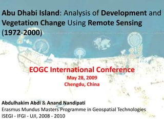
Abu Dhabi Island: Analysis of Development and
Vegetation Change Using Remote Sensing
(1972-2000)


           EOGC International Conference
                          May 28, 2009
                         Chengdu, China


Abdulhakim Abdi & Anand Nandipati
Erasmus Mundus Masters Programme in Geospatial Technologies
ISEGI - IFGI - UJI, 2008 - 2010
2


 Contents
‱ Introduction
‱ Data
‱ Methodology
‱ Analysis & Visualization
‱ Conclusion `


                             2
Objective
Use of remote sensing methods and
GIS tools to study the change in the
landscape of Abu Dhabi Island and
surrounding areas brought on by
development.

                                       3
Introduction
The United Arab Emirates’ GDP in 1972 was $1.6 billion
and swelled to $   103 in 2004 (UAE-NMC, 2008).
The country had undergone tremendous change over since
it got independence in 1971.


Several programs have been implemented to “beautify”
the desert landscape and included heavy afforestation and
agricultural projects.

                                                            4
Study Area


                      United Arab Emirates

Source: Google Maps


                                             5
Study Area
 1960


             6
Study Area
 1970


             7
Study Area
Present


             8
Data
                                                                    Landsat 7
                                                             WRS-2, Path 160, Row 043
                                                                   2000-08-23
                                                            2000 Landsat ETM+


 1972 Landsat MSS
        Landsat 1
 WRS-1, Path 172, Row 043
       1972-11-29
                   Source: Global Land Cover Facility, UMD, Maryland, USA               9
Data


Landsat ETM+ Imagery from November 1, 2008 with Scan Line Corrector-OFF
                                                                          10
Methodology
                   Image
                Classification

Definition of      Feature
                                                      Post-         Accuracy
 Mapping        Identification   Classification
                                                  Classification   Assessment
 Approach       and Selection


                                                                                11
Image
          Classification

Definition of      Feature
                                                      Post-         Accuracy
 Mapping        Identification   Classification
                                                  Classification   Assessment
 Approach       and Selection


                                                                                12
Mapping Approach

 Minimum Mapping Unit (MMU) : Pixel
                                                                       Pixel
Satellite        Sensor           Spectral Range      Bands Used
                                                                     Resolution
  L1        MSS multi-spectral      0.5 - 1.1 ”m       1, 2, 3, 4    60 meter
               ETM+ multi-         0.450 – 1.175
  L7                                                 1, 2, 3, 4, 5   30 meter
                 spectral               ”m
                   Satellites and sensors used for the study


We selected set of contiguous pixels for our classification

Softwares used: ENVI, IDRISI Andes & ArcGIS

                                                                                  13
Image
                Classification

Definition of        Feature
                                                          Post-         Accuracy
 Mapping        Identification and   Classification
                                                      Classification   Assessment
 Approach           Selection


                                                                                    14
NDVI


Map showing NDVI based on 2000 Landsat 7 ETM+
                                                       15
Sample Selection


           Land
           Vegetation
           Shallow
           Water
           Deep
           Water


                     16
Image
                Classification

Definition of      Feature
                                                      Post-         Accuracy
 Mapping        Identification   Classification   Classification   Assessment
 Approach       and Selection


                                                                                17
“when sufficient training samples are
  available and the feature of land
    covers in a dataset is normally
  distributed, Maximum likelyhood
classification (MLC) may yield an
   accurate classification result”
          (Lu,D and Weng, Q, 2007)


                                        18
Maximum Likelihood


             Land
             Vegetation
             Shallow
             Water
             Deep
             Water


                       19
Image
                Classification

Definition of      Feature                            Post-         Accuracy
 Mapping        Identification   Classification
                                                  Classification   Assessment
 Approach       and Selection


                                                                                20
Sieve


        Majority
        Analysis


                   21
MLC   Sieve   Majority Analysis   Output
                                           22
Image
                Classification

Definition of      Feature
                                                      Post-
                                                                    Accuracy
 Mapping        Identification   Classification                    Assessment
                                                  Classification
 Approach       and Selection


                                                                                23
The Overall Accuracy of the 1972 image was 99.04% with a
                 Kappa Coefficient of 0.98.


The 2000 image produced an Overall Accuracy of 99.47% and
               a Kappa Coefficient of 0.99.


                                                            24
Analysis

     &
 Visualization

                 25
26
27
Land Cover


1972   2000

                           28
What's the change ?
  1972 to 2000


                      29
Vegetation increased by   3700%


17% of existing land was created from
     shallow and deep water


                                        30
31
32
1972 Land Cover   2000 Land Cover Area (sq km)     Percentage based on
                                                   2000 Land Cover Area
     land              Land            405                83%

Shallow water          Land             61               13%
 Deep water            Land             17                 4%
       Land cover changes from 1972 to 2000
                                                   Percentage based on
1972 Land Cover   2000 Land Cover   Area (sq km)   2000 Land Cover Area
 Vegetation        Vegetation            3                 2%

    Land           Vegetation           76               59%
Shallow water      Vegetation           48               38%
 Deep water        Vegetation            1                 1%
                                                                          33
Land Cover 1972
                                                                            Graphs
       29.9%
                                  43.5%
                                                             Land Cover     Area (Sq Km)

                                            Land
                                                            Land                  500
                                            Vegetation
                                            Shallow water   Vegetation            3
        26.3%              0.3%
                                            Deep water
                                                            Shallow water         302
                                                            Deep water            344


                                                      Land Cover 2000
                                          30.2%
                                                                          42.0%
 Land Cover      Area (Sq Km)
Land                 483
Vegetation           128                                                       Land
                                          16.7%                                Vegetation
Shallow water        192                                     11.1%             Shallow water
                                                                               Deep water
Deep water           347
                                                                                               34
Conclusion
‱ The results clearly indicate the permanent   alteration
  of landscape in Abu      Dhabi island and surrounding
  areas.


‱ It is the combination of new
                             technologies and
  techniques, such as remote sensing methods and
  GIS tools provides the greatest value to study land
  cover changes.

                                                            35
This work was supported by the European Commission,
                Erasmus Mundus Programme,
       M.Sc. in Geospatial Technologies, project no.2007-0064

This work could not have been completed without the assistance of Vanessa Joy
Anacta and Ashwin Dhakal. We would also like to thank Dr. Mario Caetano,
Instituto GeogrĂĄfico PortuguĂȘs and Instituto   Superior de EstatĂ­stica e
Gestão de Informação, Universidade Nova de Lisboa for their invaluable
support and advice in carrying out this study. Also special thanks to Institute
fĂŒr Geoinformatik, WestfĂ€lische Wilhelms-UniversitĂ€t MĂŒnster.


                                                                                  36
Compare with reclamation in Dubai
                Graphs n tables in same page
                Kappa


èŹèŹ
Thank you for your attention


                                                    37

Weitere Àhnliche Inhalte

Andere mochten auch

Brasil Deadly Landslide 0111
Brasil Deadly Landslide 0111Brasil Deadly Landslide 0111
Brasil Deadly Landslide 0111Dirval Chareti
 
SMiB09 Joanne Jacobs
SMiB09 Joanne JacobsSMiB09 Joanne Jacobs
SMiB09 Joanne Jacobssmibevents
 
Reinforcement 3
Reinforcement 3Reinforcement 3
Reinforcement 3Sonia
 
myStratex Strategy Board Game
myStratex Strategy Board GamemyStratex Strategy Board Game
myStratex Strategy Board GameFabStart
 
Grammar Tenses.pptx
Grammar Tenses.pptxGrammar Tenses.pptx
Grammar Tenses.pptxwendyvinueza
 
JBS Power Point Presentatie
JBS Power Point PresentatieJBS Power Point Presentatie
JBS Power Point Presentatiebreepoel
 
Two ancestors of today's america
Two ancestors of today's americaTwo ancestors of today's america
Two ancestors of today's americaPedro Morales
 
Taking Flight: from Aspiration to Transformational Action
Taking Flight: from Aspiration to Transformational ActionTaking Flight: from Aspiration to Transformational Action
Taking Flight: from Aspiration to Transformational ActionPaul Boos
 
What is eTwinning
What is eTwinningWhat is eTwinning
What is eTwinningivanabrabcova
 
E twinning contact_seminar
E twinning contact_seminarE twinning contact_seminar
E twinning contact_seminarivanabrabcova
 
Opd Govt & Not For Profit Overview V12.2
Opd Govt & Not For Profit Overview V12.2Opd Govt & Not For Profit Overview V12.2
Opd Govt & Not For Profit Overview V12.2naitchison
 
Blogging and How It Complements Your Marketing Strategy
Blogging and How It Complements Your Marketing StrategyBlogging and How It Complements Your Marketing Strategy
Blogging and How It Complements Your Marketing StrategyKayak Online Marketing
 
HOT NÂŽCOLD
HOT NÂŽCOLD HOT NÂŽCOLD
HOT NÂŽCOLD Sonia
 
Reconstructionpp
ReconstructionppReconstructionpp
Reconstructionppcpatton
 
12 flood social media
12 flood social media12 flood social media
12 flood social mediaweatherhead
 
Reading Summary Turkle
Reading Summary TurkleReading Summary Turkle
Reading Summary Turklemichelemcfarlane
 
Vid Presentatie
Vid PresentatieVid Presentatie
Vid Presentatieguest4dd8b91
 

Andere mochten auch (20)

Brasil Deadly Landslide 0111
Brasil Deadly Landslide 0111Brasil Deadly Landslide 0111
Brasil Deadly Landslide 0111
 
SMiB09 Joanne Jacobs
SMiB09 Joanne JacobsSMiB09 Joanne Jacobs
SMiB09 Joanne Jacobs
 
Reinforcement 3
Reinforcement 3Reinforcement 3
Reinforcement 3
 
myStratex Strategy Board Game
myStratex Strategy Board GamemyStratex Strategy Board Game
myStratex Strategy Board Game
 
Grammar Tenses.pptx
Grammar Tenses.pptxGrammar Tenses.pptx
Grammar Tenses.pptx
 
JBS Power Point Presentatie
JBS Power Point PresentatieJBS Power Point Presentatie
JBS Power Point Presentatie
 
Two ancestors of today's america
Two ancestors of today's americaTwo ancestors of today's america
Two ancestors of today's america
 
Taking Flight: from Aspiration to Transformational Action
Taking Flight: from Aspiration to Transformational ActionTaking Flight: from Aspiration to Transformational Action
Taking Flight: from Aspiration to Transformational Action
 
What is eTwinning
What is eTwinningWhat is eTwinning
What is eTwinning
 
The Beaches Of Timor
The Beaches Of TimorThe Beaches Of Timor
The Beaches Of Timor
 
E twinning contact_seminar
E twinning contact_seminarE twinning contact_seminar
E twinning contact_seminar
 
Opd Govt & Not For Profit Overview V12.2
Opd Govt & Not For Profit Overview V12.2Opd Govt & Not For Profit Overview V12.2
Opd Govt & Not For Profit Overview V12.2
 
Blogging and How It Complements Your Marketing Strategy
Blogging and How It Complements Your Marketing StrategyBlogging and How It Complements Your Marketing Strategy
Blogging and How It Complements Your Marketing Strategy
 
Shadows
ShadowsShadows
Shadows
 
HOT NÂŽCOLD
HOT NÂŽCOLD HOT NÂŽCOLD
HOT NÂŽCOLD
 
Wta may2012 fnpw
Wta may2012 fnpwWta may2012 fnpw
Wta may2012 fnpw
 
Reconstructionpp
ReconstructionppReconstructionpp
Reconstructionpp
 
12 flood social media
12 flood social media12 flood social media
12 flood social media
 
Reading Summary Turkle
Reading Summary TurkleReading Summary Turkle
Reading Summary Turkle
 
Vid Presentatie
Vid PresentatieVid Presentatie
Vid Presentatie
 

Ähnlich wie Abu Dhabi Island: Analysis of Development and Vegetation Change Using Remote Sensing (1972-2000)

final_year_project
final_year_projectfinal_year_project
final_year_projectMALLIKA H.M
 
PCI Geomatics Synthetic Aperture Radar Processing Capabilities
PCI Geomatics Synthetic Aperture Radar Processing CapabilitiesPCI Geomatics Synthetic Aperture Radar Processing Capabilities
PCI Geomatics Synthetic Aperture Radar Processing CapabilitiesPci Geomatics
 
19MCN19-ADVANCED DIGITAL IMAGE PROCESSING.pdf
19MCN19-ADVANCED DIGITAL IMAGE PROCESSING.pdf19MCN19-ADVANCED DIGITAL IMAGE PROCESSING.pdf
19MCN19-ADVANCED DIGITAL IMAGE PROCESSING.pdfMrKAMALANATHANE
 
Digital image classification
Digital image classificationDigital image classification
Digital image classificationAleemuddin Abbasi
 
Vegetation Mapping and Measurement using LiDAR - an Industry Survey by Toby C...
Vegetation Mapping and Measurement using LiDAR - an Industry Survey by Toby C...Vegetation Mapping and Measurement using LiDAR - an Industry Survey by Toby C...
Vegetation Mapping and Measurement using LiDAR - an Industry Survey by Toby C...Toby Clewett
 
Vegetation mapping and measurement using li dar an industry survey by toby ...
Vegetation mapping and measurement using li dar   an industry survey by toby ...Vegetation mapping and measurement using li dar   an industry survey by toby ...
Vegetation mapping and measurement using li dar an industry survey by toby ...Fungis Queensland
 
Feature Based Underwater Fish Recognition Using SVM Classifier
Feature Based Underwater Fish Recognition Using SVM ClassifierFeature Based Underwater Fish Recognition Using SVM Classifier
Feature Based Underwater Fish Recognition Using SVM ClassifierIIRindia
 
A Review of Edge Detection Techniques for Image Segmentation
A Review of Edge Detection Techniques for Image SegmentationA Review of Edge Detection Techniques for Image Segmentation
A Review of Edge Detection Techniques for Image SegmentationIIRindia
 
satellite image processing
satellite image processingsatellite image processing
satellite image processingavhadlaxmikant
 
satllite image processing
satllite image processingsatllite image processing
satllite image processingavhadlaxmikant
 
Classification of Satellite broadcasting Image and Validation Exhausting Geom...
Classification of Satellite broadcasting Image and Validation Exhausting Geom...Classification of Satellite broadcasting Image and Validation Exhausting Geom...
Classification of Satellite broadcasting Image and Validation Exhausting Geom...IJSRD
 
Satellite Image Classification and Analysis using Machine Learning with ISRO ...
Satellite Image Classification and Analysis using Machine Learning with ISRO ...Satellite Image Classification and Analysis using Machine Learning with ISRO ...
Satellite Image Classification and Analysis using Machine Learning with ISRO ...IRJET Journal
 
Land scene classification from remote sensing images using improved artificia...
Land scene classification from remote sensing images using improved artificia...Land scene classification from remote sensing images using improved artificia...
Land scene classification from remote sensing images using improved artificia...IJECEIAES
 
Elettronica: Multimedia Information Processing in Smart Environments by Aless...
Elettronica: Multimedia Information Processing in Smart Environments by Aless...Elettronica: Multimedia Information Processing in Smart Environments by Aless...
Elettronica: Multimedia Information Processing in Smart Environments by Aless...Codemotion
 

Ähnlich wie Abu Dhabi Island: Analysis of Development and Vegetation Change Using Remote Sensing (1972-2000) (19)

final_year_project
final_year_projectfinal_year_project
final_year_project
 
PCI Geomatics Synthetic Aperture Radar Processing Capabilities
PCI Geomatics Synthetic Aperture Radar Processing CapabilitiesPCI Geomatics Synthetic Aperture Radar Processing Capabilities
PCI Geomatics Synthetic Aperture Radar Processing Capabilities
 
19MCN19-ADVANCED DIGITAL IMAGE PROCESSING.pdf
19MCN19-ADVANCED DIGITAL IMAGE PROCESSING.pdf19MCN19-ADVANCED DIGITAL IMAGE PROCESSING.pdf
19MCN19-ADVANCED DIGITAL IMAGE PROCESSING.pdf
 
Digital image classification
Digital image classificationDigital image classification
Digital image classification
 
Vegetation Mapping and Measurement using LiDAR - an Industry Survey by Toby C...
Vegetation Mapping and Measurement using LiDAR - an Industry Survey by Toby C...Vegetation Mapping and Measurement using LiDAR - an Industry Survey by Toby C...
Vegetation Mapping and Measurement using LiDAR - an Industry Survey by Toby C...
 
Vegetation mapping and measurement using li dar an industry survey by toby ...
Vegetation mapping and measurement using li dar   an industry survey by toby ...Vegetation mapping and measurement using li dar   an industry survey by toby ...
Vegetation mapping and measurement using li dar an industry survey by toby ...
 
Feature Based Underwater Fish Recognition Using SVM Classifier
Feature Based Underwater Fish Recognition Using SVM ClassifierFeature Based Underwater Fish Recognition Using SVM Classifier
Feature Based Underwater Fish Recognition Using SVM Classifier
 
Fd36957962
Fd36957962Fd36957962
Fd36957962
 
A Review of Edge Detection Techniques for Image Segmentation
A Review of Edge Detection Techniques for Image SegmentationA Review of Edge Detection Techniques for Image Segmentation
A Review of Edge Detection Techniques for Image Segmentation
 
satellite image processing
satellite image processingsatellite image processing
satellite image processing
 
satllite image processing
satllite image processingsatllite image processing
satllite image processing
 
Classification of Satellite broadcasting Image and Validation Exhausting Geom...
Classification of Satellite broadcasting Image and Validation Exhausting Geom...Classification of Satellite broadcasting Image and Validation Exhausting Geom...
Classification of Satellite broadcasting Image and Validation Exhausting Geom...
 
L12 GIS (a).pdf
L12 GIS (a).pdfL12 GIS (a).pdf
L12 GIS (a).pdf
 
J25043046
J25043046J25043046
J25043046
 
J25043046
J25043046J25043046
J25043046
 
Satellite Image Classification and Analysis using Machine Learning with ISRO ...
Satellite Image Classification and Analysis using Machine Learning with ISRO ...Satellite Image Classification and Analysis using Machine Learning with ISRO ...
Satellite Image Classification and Analysis using Machine Learning with ISRO ...
 
An Image-Based Bone fracture Detection Using AForge Library
An Image-Based Bone fracture Detection Using AForge LibraryAn Image-Based Bone fracture Detection Using AForge Library
An Image-Based Bone fracture Detection Using AForge Library
 
Land scene classification from remote sensing images using improved artificia...
Land scene classification from remote sensing images using improved artificia...Land scene classification from remote sensing images using improved artificia...
Land scene classification from remote sensing images using improved artificia...
 
Elettronica: Multimedia Information Processing in Smart Environments by Aless...
Elettronica: Multimedia Information Processing in Smart Environments by Aless...Elettronica: Multimedia Information Processing in Smart Environments by Aless...
Elettronica: Multimedia Information Processing in Smart Environments by Aless...
 

KĂŒrzlich hochgeladen

The Role of Taxonomy and Ontology in Semantic Layers - Heather Hedden.pdf
The Role of Taxonomy and Ontology in Semantic Layers - Heather Hedden.pdfThe Role of Taxonomy and Ontology in Semantic Layers - Heather Hedden.pdf
The Role of Taxonomy and Ontology in Semantic Layers - Heather Hedden.pdfEnterprise Knowledge
 
FULL ENJOY 🔝 8264348440 🔝 Call Girls in Diplomatic Enclave | Delhi
FULL ENJOY 🔝 8264348440 🔝 Call Girls in Diplomatic Enclave | DelhiFULL ENJOY 🔝 8264348440 🔝 Call Girls in Diplomatic Enclave | Delhi
FULL ENJOY 🔝 8264348440 🔝 Call Girls in Diplomatic Enclave | Delhisoniya singh
 
From Event to Action: Accelerate Your Decision Making with Real-Time Automation
From Event to Action: Accelerate Your Decision Making with Real-Time AutomationFrom Event to Action: Accelerate Your Decision Making with Real-Time Automation
From Event to Action: Accelerate Your Decision Making with Real-Time AutomationSafe Software
 
A Domino Admins Adventures (Engage 2024)
A Domino Admins Adventures (Engage 2024)A Domino Admins Adventures (Engage 2024)
A Domino Admins Adventures (Engage 2024)Gabriella Davis
 
The Codex of Business Writing Software for Real-World Solutions 2.pptx
The Codex of Business Writing Software for Real-World Solutions 2.pptxThe Codex of Business Writing Software for Real-World Solutions 2.pptx
The Codex of Business Writing Software for Real-World Solutions 2.pptxMalak Abu Hammad
 
08448380779 Call Girls In Diplomatic Enclave Women Seeking Men
08448380779 Call Girls In Diplomatic Enclave Women Seeking Men08448380779 Call Girls In Diplomatic Enclave Women Seeking Men
08448380779 Call Girls In Diplomatic Enclave Women Seeking MenDelhi Call girls
 
Transcript: #StandardsGoals for 2024: What’s new for BISAC - Tech Forum 2024
Transcript: #StandardsGoals for 2024: What’s new for BISAC - Tech Forum 2024Transcript: #StandardsGoals for 2024: What’s new for BISAC - Tech Forum 2024
Transcript: #StandardsGoals for 2024: What’s new for BISAC - Tech Forum 2024BookNet Canada
 
[2024]Digital Global Overview Report 2024 Meltwater.pdf
[2024]Digital Global Overview Report 2024 Meltwater.pdf[2024]Digital Global Overview Report 2024 Meltwater.pdf
[2024]Digital Global Overview Report 2024 Meltwater.pdfhans926745
 
Boost PC performance: How more available memory can improve productivity
Boost PC performance: How more available memory can improve productivityBoost PC performance: How more available memory can improve productivity
Boost PC performance: How more available memory can improve productivityPrincipled Technologies
 
Raspberry Pi 5: Challenges and Solutions in Bringing up an OpenGL/Vulkan Driv...
Raspberry Pi 5: Challenges and Solutions in Bringing up an OpenGL/Vulkan Driv...Raspberry Pi 5: Challenges and Solutions in Bringing up an OpenGL/Vulkan Driv...
Raspberry Pi 5: Challenges and Solutions in Bringing up an OpenGL/Vulkan Driv...Igalia
 
GenCyber Cyber Security Day Presentation
GenCyber Cyber Security Day PresentationGenCyber Cyber Security Day Presentation
GenCyber Cyber Security Day PresentationMichael W. Hawkins
 
How to Troubleshoot Apps for the Modern Connected Worker
How to Troubleshoot Apps for the Modern Connected WorkerHow to Troubleshoot Apps for the Modern Connected Worker
How to Troubleshoot Apps for the Modern Connected WorkerThousandEyes
 
Strategies for Unlocking Knowledge Management in Microsoft 365 in the Copilot...
Strategies for Unlocking Knowledge Management in Microsoft 365 in the Copilot...Strategies for Unlocking Knowledge Management in Microsoft 365 in the Copilot...
Strategies for Unlocking Knowledge Management in Microsoft 365 in the Copilot...Drew Madelung
 
Scaling API-first – The story of a global engineering organization
Scaling API-first – The story of a global engineering organizationScaling API-first – The story of a global engineering organization
Scaling API-first – The story of a global engineering organizationRadu Cotescu
 
🐬 The future of MySQL is Postgres 🐘
🐬  The future of MySQL is Postgres   🐘🐬  The future of MySQL is Postgres   🐘
🐬 The future of MySQL is Postgres 🐘RTylerCroy
 
Google AI Hackathon: LLM based Evaluator for RAG
Google AI Hackathon: LLM based Evaluator for RAGGoogle AI Hackathon: LLM based Evaluator for RAG
Google AI Hackathon: LLM based Evaluator for RAGSujit Pal
 
Breaking the Kubernetes Kill Chain: Host Path Mount
Breaking the Kubernetes Kill Chain: Host Path MountBreaking the Kubernetes Kill Chain: Host Path Mount
Breaking the Kubernetes Kill Chain: Host Path MountPuma Security, LLC
 
CNv6 Instructor Chapter 6 Quality of Service
CNv6 Instructor Chapter 6 Quality of ServiceCNv6 Instructor Chapter 6 Quality of Service
CNv6 Instructor Chapter 6 Quality of Servicegiselly40
 
04-2024-HHUG-Sales-and-Marketing-Alignment.pptx
04-2024-HHUG-Sales-and-Marketing-Alignment.pptx04-2024-HHUG-Sales-and-Marketing-Alignment.pptx
04-2024-HHUG-Sales-and-Marketing-Alignment.pptxHampshireHUG
 
Slack Application Development 101 Slides
Slack Application Development 101 SlidesSlack Application Development 101 Slides
Slack Application Development 101 Slidespraypatel2
 

KĂŒrzlich hochgeladen (20)

The Role of Taxonomy and Ontology in Semantic Layers - Heather Hedden.pdf
The Role of Taxonomy and Ontology in Semantic Layers - Heather Hedden.pdfThe Role of Taxonomy and Ontology in Semantic Layers - Heather Hedden.pdf
The Role of Taxonomy and Ontology in Semantic Layers - Heather Hedden.pdf
 
FULL ENJOY 🔝 8264348440 🔝 Call Girls in Diplomatic Enclave | Delhi
FULL ENJOY 🔝 8264348440 🔝 Call Girls in Diplomatic Enclave | DelhiFULL ENJOY 🔝 8264348440 🔝 Call Girls in Diplomatic Enclave | Delhi
FULL ENJOY 🔝 8264348440 🔝 Call Girls in Diplomatic Enclave | Delhi
 
From Event to Action: Accelerate Your Decision Making with Real-Time Automation
From Event to Action: Accelerate Your Decision Making with Real-Time AutomationFrom Event to Action: Accelerate Your Decision Making with Real-Time Automation
From Event to Action: Accelerate Your Decision Making with Real-Time Automation
 
A Domino Admins Adventures (Engage 2024)
A Domino Admins Adventures (Engage 2024)A Domino Admins Adventures (Engage 2024)
A Domino Admins Adventures (Engage 2024)
 
The Codex of Business Writing Software for Real-World Solutions 2.pptx
The Codex of Business Writing Software for Real-World Solutions 2.pptxThe Codex of Business Writing Software for Real-World Solutions 2.pptx
The Codex of Business Writing Software for Real-World Solutions 2.pptx
 
08448380779 Call Girls In Diplomatic Enclave Women Seeking Men
08448380779 Call Girls In Diplomatic Enclave Women Seeking Men08448380779 Call Girls In Diplomatic Enclave Women Seeking Men
08448380779 Call Girls In Diplomatic Enclave Women Seeking Men
 
Transcript: #StandardsGoals for 2024: What’s new for BISAC - Tech Forum 2024
Transcript: #StandardsGoals for 2024: What’s new for BISAC - Tech Forum 2024Transcript: #StandardsGoals for 2024: What’s new for BISAC - Tech Forum 2024
Transcript: #StandardsGoals for 2024: What’s new for BISAC - Tech Forum 2024
 
[2024]Digital Global Overview Report 2024 Meltwater.pdf
[2024]Digital Global Overview Report 2024 Meltwater.pdf[2024]Digital Global Overview Report 2024 Meltwater.pdf
[2024]Digital Global Overview Report 2024 Meltwater.pdf
 
Boost PC performance: How more available memory can improve productivity
Boost PC performance: How more available memory can improve productivityBoost PC performance: How more available memory can improve productivity
Boost PC performance: How more available memory can improve productivity
 
Raspberry Pi 5: Challenges and Solutions in Bringing up an OpenGL/Vulkan Driv...
Raspberry Pi 5: Challenges and Solutions in Bringing up an OpenGL/Vulkan Driv...Raspberry Pi 5: Challenges and Solutions in Bringing up an OpenGL/Vulkan Driv...
Raspberry Pi 5: Challenges and Solutions in Bringing up an OpenGL/Vulkan Driv...
 
GenCyber Cyber Security Day Presentation
GenCyber Cyber Security Day PresentationGenCyber Cyber Security Day Presentation
GenCyber Cyber Security Day Presentation
 
How to Troubleshoot Apps for the Modern Connected Worker
How to Troubleshoot Apps for the Modern Connected WorkerHow to Troubleshoot Apps for the Modern Connected Worker
How to Troubleshoot Apps for the Modern Connected Worker
 
Strategies for Unlocking Knowledge Management in Microsoft 365 in the Copilot...
Strategies for Unlocking Knowledge Management in Microsoft 365 in the Copilot...Strategies for Unlocking Knowledge Management in Microsoft 365 in the Copilot...
Strategies for Unlocking Knowledge Management in Microsoft 365 in the Copilot...
 
Scaling API-first – The story of a global engineering organization
Scaling API-first – The story of a global engineering organizationScaling API-first – The story of a global engineering organization
Scaling API-first – The story of a global engineering organization
 
🐬 The future of MySQL is Postgres 🐘
🐬  The future of MySQL is Postgres   🐘🐬  The future of MySQL is Postgres   🐘
🐬 The future of MySQL is Postgres 🐘
 
Google AI Hackathon: LLM based Evaluator for RAG
Google AI Hackathon: LLM based Evaluator for RAGGoogle AI Hackathon: LLM based Evaluator for RAG
Google AI Hackathon: LLM based Evaluator for RAG
 
Breaking the Kubernetes Kill Chain: Host Path Mount
Breaking the Kubernetes Kill Chain: Host Path MountBreaking the Kubernetes Kill Chain: Host Path Mount
Breaking the Kubernetes Kill Chain: Host Path Mount
 
CNv6 Instructor Chapter 6 Quality of Service
CNv6 Instructor Chapter 6 Quality of ServiceCNv6 Instructor Chapter 6 Quality of Service
CNv6 Instructor Chapter 6 Quality of Service
 
04-2024-HHUG-Sales-and-Marketing-Alignment.pptx
04-2024-HHUG-Sales-and-Marketing-Alignment.pptx04-2024-HHUG-Sales-and-Marketing-Alignment.pptx
04-2024-HHUG-Sales-and-Marketing-Alignment.pptx
 
Slack Application Development 101 Slides
Slack Application Development 101 SlidesSlack Application Development 101 Slides
Slack Application Development 101 Slides
 

Abu Dhabi Island: Analysis of Development and Vegetation Change Using Remote Sensing (1972-2000)

  • 1. Abu Dhabi Island: Analysis of Development and Vegetation Change Using Remote Sensing (1972-2000) EOGC International Conference May 28, 2009 Chengdu, China Abdulhakim Abdi & Anand Nandipati Erasmus Mundus Masters Programme in Geospatial Technologies ISEGI - IFGI - UJI, 2008 - 2010
  • 2. 2 Contents ‱ Introduction ‱ Data ‱ Methodology ‱ Analysis & Visualization ‱ Conclusion ` 2
  • 3. Objective Use of remote sensing methods and GIS tools to study the change in the landscape of Abu Dhabi Island and surrounding areas brought on by development. 3
  • 4. Introduction The United Arab Emirates’ GDP in 1972 was $1.6 billion and swelled to $ 103 in 2004 (UAE-NMC, 2008). The country had undergone tremendous change over since it got independence in 1971. Several programs have been implemented to “beautify” the desert landscape and included heavy afforestation and agricultural projects. 4
  • 5. Study Area United Arab Emirates Source: Google Maps 5
  • 9. Data Landsat 7 WRS-2, Path 160, Row 043 2000-08-23 2000 Landsat ETM+ 1972 Landsat MSS Landsat 1 WRS-1, Path 172, Row 043 1972-11-29 Source: Global Land Cover Facility, UMD, Maryland, USA 9
  • 10. Data Landsat ETM+ Imagery from November 1, 2008 with Scan Line Corrector-OFF 10
  • 11. Methodology Image Classification Definition of Feature Post- Accuracy Mapping Identification Classification Classification Assessment Approach and Selection 11
  • 12. Image Classification Definition of Feature Post- Accuracy Mapping Identification Classification Classification Assessment Approach and Selection 12
  • 13. Mapping Approach Minimum Mapping Unit (MMU) : Pixel Pixel Satellite Sensor Spectral Range Bands Used Resolution L1 MSS multi-spectral 0.5 - 1.1 ”m 1, 2, 3, 4 60 meter ETM+ multi- 0.450 – 1.175 L7 1, 2, 3, 4, 5 30 meter spectral ”m Satellites and sensors used for the study We selected set of contiguous pixels for our classification Softwares used: ENVI, IDRISI Andes & ArcGIS 13
  • 14. Image Classification Definition of Feature Post- Accuracy Mapping Identification and Classification Classification Assessment Approach Selection 14
  • 15. NDVI Map showing NDVI based on 2000 Landsat 7 ETM+ 15
  • 16. Sample Selection Land Vegetation Shallow Water Deep Water 16
  • 17. Image Classification Definition of Feature Post- Accuracy Mapping Identification Classification Classification Assessment Approach and Selection 17
  • 18. “when sufficient training samples are available and the feature of land covers in a dataset is normally distributed, Maximum likelyhood classification (MLC) may yield an accurate classification result” (Lu,D and Weng, Q, 2007) 18
  • 19. Maximum Likelihood Land Vegetation Shallow Water Deep Water 19
  • 20. Image Classification Definition of Feature Post- Accuracy Mapping Identification Classification Classification Assessment Approach and Selection 20
  • 21. Sieve Majority Analysis 21
  • 22. MLC Sieve Majority Analysis Output 22
  • 23. Image Classification Definition of Feature Post- Accuracy Mapping Identification Classification Assessment Classification Approach and Selection 23
  • 24. The Overall Accuracy of the 1972 image was 99.04% with a Kappa Coefficient of 0.98. The 2000 image produced an Overall Accuracy of 99.47% and a Kappa Coefficient of 0.99. 24
  • 25. Analysis & Visualization 25
  • 26. 26
  • 27. 27
  • 28. Land Cover 1972 2000 28
  • 29. What's the change ? 1972 to 2000 29
  • 30. Vegetation increased by 3700% 17% of existing land was created from shallow and deep water 30
  • 31. 31
  • 32. 32
  • 33. 1972 Land Cover 2000 Land Cover Area (sq km) Percentage based on 2000 Land Cover Area land Land 405 83% Shallow water Land 61 13% Deep water Land 17 4% Land cover changes from 1972 to 2000 Percentage based on 1972 Land Cover 2000 Land Cover Area (sq km) 2000 Land Cover Area Vegetation Vegetation 3 2% Land Vegetation 76 59% Shallow water Vegetation 48 38% Deep water Vegetation 1 1% 33
  • 34. Land Cover 1972 Graphs 29.9% 43.5% Land Cover Area (Sq Km) Land Land 500 Vegetation Shallow water Vegetation 3 26.3% 0.3% Deep water Shallow water 302 Deep water 344 Land Cover 2000 30.2% 42.0% Land Cover Area (Sq Km) Land 483 Vegetation 128 Land 16.7% Vegetation Shallow water 192 11.1% Shallow water Deep water Deep water 347 34
  • 35. Conclusion ‱ The results clearly indicate the permanent alteration of landscape in Abu Dhabi island and surrounding areas. ‱ It is the combination of new technologies and techniques, such as remote sensing methods and GIS tools provides the greatest value to study land cover changes. 35
  • 36. This work was supported by the European Commission, Erasmus Mundus Programme, M.Sc. in Geospatial Technologies, project no.2007-0064 This work could not have been completed without the assistance of Vanessa Joy Anacta and Ashwin Dhakal. We would also like to thank Dr. Mario Caetano, Instituto GeogrĂĄfico PortuguĂȘs and Instituto Superior de EstatĂ­stica e GestĂŁo de Informação, Universidade Nova de Lisboa for their invaluable support and advice in carrying out this study. Also special thanks to Institute fĂŒr Geoinformatik, WestfĂ€lische Wilhelms-UniversitĂ€t MĂŒnster. 36
  • 37. Compare with reclamation in Dubai Graphs n tables in same page Kappa èŹèŹ Thank you for your attention 37