SlideShare ist ein Scribd-Unternehmen logo
1 von 18
Downloaden Sie, um offline zu lesen
Remote sensing e-course
28-29 December, 2013
Fatwa Ramdani
Geoenvironment, Earth Science, Grad. School of Science
Outline
• The first day of this course will focus in vegetation cover analysis
based on remotely-sensed data, Landsat OLI 8. The methods how to
analyze and exploit the multispectral information for vegetation
mapping will be illustrated. This lesson also provide the concept of
color composite, basic algorithm theoretical of atmospheric
correction, how to using formula in open source software.
• The second day will guide the students to the next level of analysis
using Thermal Infrared Sensor, compare with the vegetation indices
and different land use land cover class.
• In every section will be follow with the exercise and questions to allow
student expand their understanding.
Course Goal and Objectives
• Understand the concept of false composite color
• Understand the basic algorithm theoretical of atmospheric
correction
• Understand formula module function in open source software
• Understand the benefit of vegetation indices
• Understand basic cartography design and classification
technique
• Understand the utility of TIRS bands
Intended Audience
• University student with basic level of
knowledge in Remote Sensing studies
• Course Requirements:
–
–
–
–

Internet access
GRASS software (http://grass.osgeo.org/grass64/binary/mswindows/native/)
QuantumGIS software (http://www.qgis.org/en/site/forusers/download.html)
Download data here ()
1. Using remotely-sensed image to
highlighted vegetation
• This lesson will focus in vegetation cover analysis based on remotelysensed data, Landsat 5 TM, Landsat 7 ETM+, and OLI 8. The methods how
to analyze and exploit the multispectral information for vegetation
mapping will be illustrated. This lesson also provide the concept of color
composite.
Resources:
• http://fatwaramdani.wordpress.com/2013/05/31/landsat-8-of-westsulawesi/
• http://landsat.usgs.gov/L8_band_combos.php
2. Radiance and Reflectance
• The section will be discuss the basic concept of radiance and reflectance
Resource
•

http://www.exelisvis.com/Company/PressRoom/TabId/190/ArtMID/786/ArticleID/3377/3377.aspx
To understand more about how Satellite sensors work, it helps to remember
that – As sunlight strikes Earth’s surface, some of it is
absorbed, and some of it is reflected back into space.
Sunlight has visible light and infrared light, as well light of other
wavelengths. Sunlight interacts with the objects it hits. Some of
it is absorbed and some of it is reflected by those objects.

We see the light that’s reflected from objects.
Photo: Diptarama
Red, green, blue, and infrared light from the sun hit
the tree and its leaves.
Infrared and green light are reflected from the tree.
Red and blue light are absorbed by the tree.

In this picture,
IR is Infrared light
R is red light
G is green light
B is blue light
Activities!
•
•
•
•
•

Import file using GRASS
Explore basic statistics
Rescale satellite images
Apply greyscale and RGB composite
Apply image enhancement (IHS)
3. Generating vegetation indices and
produce thematic map
• This lecture will introduce the student to basic algorithm theoretical of
Digital Numbers (DNs) conversions, atmospheric correction, how to using
formula in open source software, variant of vegetation indices algorithm,
and will be follow with the exercise and questions to allow student expand
their understanding.
ACTIVITIES
• Converting DNs into Reflectance, calculate NDVI & WDRVI, assign colour.

Resource
•
•

https://landsat.usgs.gov/Landsat8_Using_Product.php
http://fatwaramdani.wordpress.com/2010/12/02/optimizing-spectral-information-for-sensing-vegetationproperties/
Quiz?
• Why do we assign band to certain color?
• How is the spatial distribution of vegetation density in
the study area? Which area has sparse, moderate, and
dense vegetation cover? Could you distinguish it from
false composite color?
• What is d2 value associated with 28 Dec 2013?
• Why do we need to perform TOA radiance and TOA
reflectance?
• Why the histogram and transect of WDRVI image and
NDVI image are different?
• What impression do you get from the scatter chart of
the WDRVI against NDVI values?
End of first day
Questions?
6. Comparing near-natural colour composite
to LST (Land Surface Temperature)
•

The students will guide to comparing their land surface temperature map with
near-natural colour composite using GRASS. Also they will guider more to explore
command console in GRASS
Resources
• http://fatwaramdani.wordpress.com/2012/04/04/comparing-near-natural-colourcomposite-to-lst-land-surface-temperature-using-grass/
4. Exploring Digital Numbers (DNs)
of TIRS bands
• This lecture will introduce students how to explore the DNs of TIRS band
using transect and histogram
ACTIVITIES!
• Converting DNs into Radiance
Resources
http://atmcorr.gsfc.nasa.gov/
http://atmcorr.gsfc.nasa.gov/Barsi_AtmCorr_SPIE05.pdf
https://landsat.usgs.gov/calibration_notices.php
5. Deriving surface temperature
from TIRS band using GRASS
• This part will guide students how to derive surface temperature from TIRS
band using GRASS
ACTIVITIES!
• Converting Radiance into Absolut temperature (Kelvin)
• Converting Absolut temperature into Celsius
• Save file and produce map using QuantumGIS
Resources
•

http://fatwaramdani.wordpress.com/2012/04/04/how-to-derive-surface-temperature-from-thermalband-using-grass/
Activities& Quiz!
• Read the LST values using transect line on the different land
use land cover, record the coordinates, and create the tables.
Record at least for 5 different land use land cover
• Read the vegetation indices value & LST values using transect
line on the different land use land cover, and create the
scatterplot
• Based on the above activites, analyse the result! Which class
of land use land cover related to high land surface
temperature, and which class related to the lower values?
Thank you!
Questions?

Weitere ähnliche Inhalte

Andere mochten auch

Western crop science society of america conference oregon, 2013 - greensee...
Western crop science society of america conference    oregon, 2013 - greensee...Western crop science society of america conference    oregon, 2013 - greensee...
Western crop science society of america conference oregon, 2013 - greensee...Wtarc Conrad Montana
 
Band Combination of Landsat 8 Earth-observing Satellite Images
Band Combination of Landsat 8 Earth-observing Satellite ImagesBand Combination of Landsat 8 Earth-observing Satellite Images
Band Combination of Landsat 8 Earth-observing Satellite ImagesKabir Uddin
 
Lorenzo Martelletti Pix4D
Lorenzo Martelletti   Pix4DLorenzo Martelletti   Pix4D
Lorenzo Martelletti Pix4DsUAS News
 
Evaluating satellite remote sensing as a method for measuring yield variabili...
Evaluating satellite remote sensing as a method for measuring yield variabili...Evaluating satellite remote sensing as a method for measuring yield variabili...
Evaluating satellite remote sensing as a method for measuring yield variabili...Amanda Woods
 
Iirs Remote sensing and GIS application in Agricultur- Indian Experience
Iirs Remote sensing and GIS application in Agricultur- Indian ExperienceIirs Remote sensing and GIS application in Agricultur- Indian Experience
Iirs Remote sensing and GIS application in Agricultur- Indian ExperienceTushar Dholakia
 
Indices for Precision Agriculture
Indices for Precision AgricultureIndices for Precision Agriculture
Indices for Precision AgricultureAlex Charles, E.I.T
 
Introduce variable/ Indices using landsat image
Introduce variable/ Indices using landsat imageIntroduce variable/ Indices using landsat image
Introduce variable/ Indices using landsat imageKabir Uddin
 
DSM Generation Using High Resolution UAV Images
DSM Generation Using High Resolution UAV ImagesDSM Generation Using High Resolution UAV Images
DSM Generation Using High Resolution UAV ImagesBiplov Bhandari
 
Luke Monette, OSMRE, “Drones and their use in Environmental Monitoring”
Luke Monette, OSMRE, “Drones and their use in Environmental Monitoring”Luke Monette, OSMRE, “Drones and their use in Environmental Monitoring”
Luke Monette, OSMRE, “Drones and their use in Environmental Monitoring”Michael Hewitt, GISP
 
NDVI Presentation-by Steve Caldwell-PROMO - Copy
NDVI Presentation-by Steve Caldwell-PROMO - CopyNDVI Presentation-by Steve Caldwell-PROMO - Copy
NDVI Presentation-by Steve Caldwell-PROMO - CopySteve Caldwell
 
#29 SUSB Expo 2014 PIX4D
#29 SUSB Expo 2014 PIX4D#29 SUSB Expo 2014 PIX4D
#29 SUSB Expo 2014 PIX4DsUAS News
 
Generation of high resolution DSM using UAV Images
Generation of high resolution DSM using UAV Images  Generation of high resolution DSM using UAV Images
Generation of high resolution DSM using UAV Images Nepal Flying Labs
 
GeoVantage Agriculture Imagery
GeoVantage Agriculture ImageryGeoVantage Agriculture Imagery
GeoVantage Agriculture ImageryMatthew Herring
 
Will climate change result in more pest and disease problems for agriculture?...
Will climate change result in more pest and disease problems for agriculture?...Will climate change result in more pest and disease problems for agriculture?...
Will climate change result in more pest and disease problems for agriculture?...Farming Futures
 
Application of remote sensing
Application of remote sensingApplication of remote sensing
Application of remote sensingAnurag Kumar
 
Application of remote sensing in agriculture
Application of remote sensing in agricultureApplication of remote sensing in agriculture
Application of remote sensing in agriculturevajinder kalra
 
Steps for Principal Component Analysis (pca) using ERDAS software
Steps for Principal Component Analysis (pca) using ERDAS softwareSteps for Principal Component Analysis (pca) using ERDAS software
Steps for Principal Component Analysis (pca) using ERDAS softwareSwetha A
 

Andere mochten auch (20)

Sensor nutrient management swcs williams
Sensor nutrient management swcs   williamsSensor nutrient management swcs   williams
Sensor nutrient management swcs williams
 
Pest risk analysis
Pest risk analysisPest risk analysis
Pest risk analysis
 
Western crop science society of america conference oregon, 2013 - greensee...
Western crop science society of america conference    oregon, 2013 - greensee...Western crop science society of america conference    oregon, 2013 - greensee...
Western crop science society of america conference oregon, 2013 - greensee...
 
Band Combination of Landsat 8 Earth-observing Satellite Images
Band Combination of Landsat 8 Earth-observing Satellite ImagesBand Combination of Landsat 8 Earth-observing Satellite Images
Band Combination of Landsat 8 Earth-observing Satellite Images
 
Lorenzo Martelletti Pix4D
Lorenzo Martelletti   Pix4DLorenzo Martelletti   Pix4D
Lorenzo Martelletti Pix4D
 
Evaluating satellite remote sensing as a method for measuring yield variabili...
Evaluating satellite remote sensing as a method for measuring yield variabili...Evaluating satellite remote sensing as a method for measuring yield variabili...
Evaluating satellite remote sensing as a method for measuring yield variabili...
 
Iirs Remote sensing and GIS application in Agricultur- Indian Experience
Iirs Remote sensing and GIS application in Agricultur- Indian ExperienceIirs Remote sensing and GIS application in Agricultur- Indian Experience
Iirs Remote sensing and GIS application in Agricultur- Indian Experience
 
PEST RISK ANALYSIS
PEST RISK ANALYSISPEST RISK ANALYSIS
PEST RISK ANALYSIS
 
Indices for Precision Agriculture
Indices for Precision AgricultureIndices for Precision Agriculture
Indices for Precision Agriculture
 
Introduce variable/ Indices using landsat image
Introduce variable/ Indices using landsat imageIntroduce variable/ Indices using landsat image
Introduce variable/ Indices using landsat image
 
DSM Generation Using High Resolution UAV Images
DSM Generation Using High Resolution UAV ImagesDSM Generation Using High Resolution UAV Images
DSM Generation Using High Resolution UAV Images
 
Luke Monette, OSMRE, “Drones and their use in Environmental Monitoring”
Luke Monette, OSMRE, “Drones and their use in Environmental Monitoring”Luke Monette, OSMRE, “Drones and their use in Environmental Monitoring”
Luke Monette, OSMRE, “Drones and their use in Environmental Monitoring”
 
NDVI Presentation-by Steve Caldwell-PROMO - Copy
NDVI Presentation-by Steve Caldwell-PROMO - CopyNDVI Presentation-by Steve Caldwell-PROMO - Copy
NDVI Presentation-by Steve Caldwell-PROMO - Copy
 
#29 SUSB Expo 2014 PIX4D
#29 SUSB Expo 2014 PIX4D#29 SUSB Expo 2014 PIX4D
#29 SUSB Expo 2014 PIX4D
 
Generation of high resolution DSM using UAV Images
Generation of high resolution DSM using UAV Images  Generation of high resolution DSM using UAV Images
Generation of high resolution DSM using UAV Images
 
GeoVantage Agriculture Imagery
GeoVantage Agriculture ImageryGeoVantage Agriculture Imagery
GeoVantage Agriculture Imagery
 
Will climate change result in more pest and disease problems for agriculture?...
Will climate change result in more pest and disease problems for agriculture?...Will climate change result in more pest and disease problems for agriculture?...
Will climate change result in more pest and disease problems for agriculture?...
 
Application of remote sensing
Application of remote sensingApplication of remote sensing
Application of remote sensing
 
Application of remote sensing in agriculture
Application of remote sensing in agricultureApplication of remote sensing in agriculture
Application of remote sensing in agriculture
 
Steps for Principal Component Analysis (pca) using ERDAS software
Steps for Principal Component Analysis (pca) using ERDAS softwareSteps for Principal Component Analysis (pca) using ERDAS software
Steps for Principal Component Analysis (pca) using ERDAS software
 

Mehr von Fatwa Ramdani

Semi-Automatic Classification Algorithm: The differences between Minimum Dist...
Semi-Automatic Classification Algorithm: The differences between Minimum Dist...Semi-Automatic Classification Algorithm: The differences between Minimum Dist...
Semi-Automatic Classification Algorithm: The differences between Minimum Dist...Fatwa Ramdani
 
PCA and Classification
PCA and ClassificationPCA and Classification
PCA and ClassificationFatwa Ramdani
 
Remote sensing e course (Geohydrology)
Remote sensing e course (Geohydrology)Remote sensing e course (Geohydrology)
Remote sensing e course (Geohydrology)Fatwa Ramdani
 
Pelatihan menulis blog dan website
Pelatihan menulis blog dan websitePelatihan menulis blog dan website
Pelatihan menulis blog dan websiteFatwa Ramdani
 
Field excursion – the changes of old sendai
Field excursion – the changes of old sendaiField excursion – the changes of old sendai
Field excursion – the changes of old sendaiFatwa Ramdani
 
Could mount fuji erupt
Could mount fuji eruptCould mount fuji erupt
Could mount fuji eruptFatwa Ramdani
 
Disaster management and recovery in northeast japan
Disaster management and recovery in northeast japanDisaster management and recovery in northeast japan
Disaster management and recovery in northeast japanFatwa Ramdani
 

Mehr von Fatwa Ramdani (9)

Semi-Automatic Classification Algorithm: The differences between Minimum Dist...
Semi-Automatic Classification Algorithm: The differences between Minimum Dist...Semi-Automatic Classification Algorithm: The differences between Minimum Dist...
Semi-Automatic Classification Algorithm: The differences between Minimum Dist...
 
PCA and Classification
PCA and ClassificationPCA and Classification
PCA and Classification
 
Remote sensing e course (Geohydrology)
Remote sensing e course (Geohydrology)Remote sensing e course (Geohydrology)
Remote sensing e course (Geohydrology)
 
Management bencana
Management bencanaManagement bencana
Management bencana
 
Yuk menulis
Yuk menulisYuk menulis
Yuk menulis
 
Pelatihan menulis blog dan website
Pelatihan menulis blog dan websitePelatihan menulis blog dan website
Pelatihan menulis blog dan website
 
Field excursion – the changes of old sendai
Field excursion – the changes of old sendaiField excursion – the changes of old sendai
Field excursion – the changes of old sendai
 
Could mount fuji erupt
Could mount fuji eruptCould mount fuji erupt
Could mount fuji erupt
 
Disaster management and recovery in northeast japan
Disaster management and recovery in northeast japanDisaster management and recovery in northeast japan
Disaster management and recovery in northeast japan
 

Kürzlich hochgeladen

SOCIAL AND HISTORICAL CONTEXT - LFTVD.pptx
SOCIAL AND HISTORICAL CONTEXT - LFTVD.pptxSOCIAL AND HISTORICAL CONTEXT - LFTVD.pptx
SOCIAL AND HISTORICAL CONTEXT - LFTVD.pptxiammrhaywood
 
Application orientated numerical on hev.ppt
Application orientated numerical on hev.pptApplication orientated numerical on hev.ppt
Application orientated numerical on hev.pptRamjanShidvankar
 
Class 11th Physics NEET formula sheet pdf
Class 11th Physics NEET formula sheet pdfClass 11th Physics NEET formula sheet pdf
Class 11th Physics NEET formula sheet pdfAyushMahapatra5
 
Sports & Fitness Value Added Course FY..
Sports & Fitness Value Added Course FY..Sports & Fitness Value Added Course FY..
Sports & Fitness Value Added Course FY..Disha Kariya
 
APM Welcome, APM North West Network Conference, Synergies Across Sectors
APM Welcome, APM North West Network Conference, Synergies Across SectorsAPM Welcome, APM North West Network Conference, Synergies Across Sectors
APM Welcome, APM North West Network Conference, Synergies Across SectorsAssociation for Project Management
 
ICT Role in 21st Century Education & its Challenges.pptx
ICT Role in 21st Century Education & its Challenges.pptxICT Role in 21st Century Education & its Challenges.pptx
ICT Role in 21st Century Education & its Challenges.pptxAreebaZafar22
 
Web & Social Media Analytics Previous Year Question Paper.pdf
Web & Social Media Analytics Previous Year Question Paper.pdfWeb & Social Media Analytics Previous Year Question Paper.pdf
Web & Social Media Analytics Previous Year Question Paper.pdfJayanti Pande
 
psychiatric nursing HISTORY COLLECTION .docx
psychiatric  nursing HISTORY  COLLECTION  .docxpsychiatric  nursing HISTORY  COLLECTION  .docx
psychiatric nursing HISTORY COLLECTION .docxPoojaSen20
 
Gardella_PRCampaignConclusion Pitch Letter
Gardella_PRCampaignConclusion Pitch LetterGardella_PRCampaignConclusion Pitch Letter
Gardella_PRCampaignConclusion Pitch LetterMateoGardella
 
Z Score,T Score, Percential Rank and Box Plot Graph
Z Score,T Score, Percential Rank and Box Plot GraphZ Score,T Score, Percential Rank and Box Plot Graph
Z Score,T Score, Percential Rank and Box Plot GraphThiyagu K
 
Measures of Dispersion and Variability: Range, QD, AD and SD
Measures of Dispersion and Variability: Range, QD, AD and SDMeasures of Dispersion and Variability: Range, QD, AD and SD
Measures of Dispersion and Variability: Range, QD, AD and SDThiyagu K
 
microwave assisted reaction. General introduction
microwave assisted reaction. General introductionmicrowave assisted reaction. General introduction
microwave assisted reaction. General introductionMaksud Ahmed
 
Gardella_Mateo_IntellectualProperty.pdf.
Gardella_Mateo_IntellectualProperty.pdf.Gardella_Mateo_IntellectualProperty.pdf.
Gardella_Mateo_IntellectualProperty.pdf.MateoGardella
 
An Overview of Mutual Funds Bcom Project.pdf
An Overview of Mutual Funds Bcom Project.pdfAn Overview of Mutual Funds Bcom Project.pdf
An Overview of Mutual Funds Bcom Project.pdfSanaAli374401
 
Advanced Views - Calendar View in Odoo 17
Advanced Views - Calendar View in Odoo 17Advanced Views - Calendar View in Odoo 17
Advanced Views - Calendar View in Odoo 17Celine George
 

Kürzlich hochgeladen (20)

SOCIAL AND HISTORICAL CONTEXT - LFTVD.pptx
SOCIAL AND HISTORICAL CONTEXT - LFTVD.pptxSOCIAL AND HISTORICAL CONTEXT - LFTVD.pptx
SOCIAL AND HISTORICAL CONTEXT - LFTVD.pptx
 
Application orientated numerical on hev.ppt
Application orientated numerical on hev.pptApplication orientated numerical on hev.ppt
Application orientated numerical on hev.ppt
 
Mehran University Newsletter Vol-X, Issue-I, 2024
Mehran University Newsletter Vol-X, Issue-I, 2024Mehran University Newsletter Vol-X, Issue-I, 2024
Mehran University Newsletter Vol-X, Issue-I, 2024
 
Class 11th Physics NEET formula sheet pdf
Class 11th Physics NEET formula sheet pdfClass 11th Physics NEET formula sheet pdf
Class 11th Physics NEET formula sheet pdf
 
Sports & Fitness Value Added Course FY..
Sports & Fitness Value Added Course FY..Sports & Fitness Value Added Course FY..
Sports & Fitness Value Added Course FY..
 
APM Welcome, APM North West Network Conference, Synergies Across Sectors
APM Welcome, APM North West Network Conference, Synergies Across SectorsAPM Welcome, APM North West Network Conference, Synergies Across Sectors
APM Welcome, APM North West Network Conference, Synergies Across Sectors
 
ICT Role in 21st Century Education & its Challenges.pptx
ICT Role in 21st Century Education & its Challenges.pptxICT Role in 21st Century Education & its Challenges.pptx
ICT Role in 21st Century Education & its Challenges.pptx
 
Web & Social Media Analytics Previous Year Question Paper.pdf
Web & Social Media Analytics Previous Year Question Paper.pdfWeb & Social Media Analytics Previous Year Question Paper.pdf
Web & Social Media Analytics Previous Year Question Paper.pdf
 
psychiatric nursing HISTORY COLLECTION .docx
psychiatric  nursing HISTORY  COLLECTION  .docxpsychiatric  nursing HISTORY  COLLECTION  .docx
psychiatric nursing HISTORY COLLECTION .docx
 
Gardella_PRCampaignConclusion Pitch Letter
Gardella_PRCampaignConclusion Pitch LetterGardella_PRCampaignConclusion Pitch Letter
Gardella_PRCampaignConclusion Pitch Letter
 
INDIA QUIZ 2024 RLAC DELHI UNIVERSITY.pptx
INDIA QUIZ 2024 RLAC DELHI UNIVERSITY.pptxINDIA QUIZ 2024 RLAC DELHI UNIVERSITY.pptx
INDIA QUIZ 2024 RLAC DELHI UNIVERSITY.pptx
 
Z Score,T Score, Percential Rank and Box Plot Graph
Z Score,T Score, Percential Rank and Box Plot GraphZ Score,T Score, Percential Rank and Box Plot Graph
Z Score,T Score, Percential Rank and Box Plot Graph
 
Measures of Dispersion and Variability: Range, QD, AD and SD
Measures of Dispersion and Variability: Range, QD, AD and SDMeasures of Dispersion and Variability: Range, QD, AD and SD
Measures of Dispersion and Variability: Range, QD, AD and SD
 
microwave assisted reaction. General introduction
microwave assisted reaction. General introductionmicrowave assisted reaction. General introduction
microwave assisted reaction. General introduction
 
Mattingly "AI & Prompt Design: Structured Data, Assistants, & RAG"
Mattingly "AI & Prompt Design: Structured Data, Assistants, & RAG"Mattingly "AI & Prompt Design: Structured Data, Assistants, & RAG"
Mattingly "AI & Prompt Design: Structured Data, Assistants, & RAG"
 
Código Creativo y Arte de Software | Unidad 1
Código Creativo y Arte de Software | Unidad 1Código Creativo y Arte de Software | Unidad 1
Código Creativo y Arte de Software | Unidad 1
 
Gardella_Mateo_IntellectualProperty.pdf.
Gardella_Mateo_IntellectualProperty.pdf.Gardella_Mateo_IntellectualProperty.pdf.
Gardella_Mateo_IntellectualProperty.pdf.
 
An Overview of Mutual Funds Bcom Project.pdf
An Overview of Mutual Funds Bcom Project.pdfAn Overview of Mutual Funds Bcom Project.pdf
An Overview of Mutual Funds Bcom Project.pdf
 
Advance Mobile Application Development class 07
Advance Mobile Application Development class 07Advance Mobile Application Development class 07
Advance Mobile Application Development class 07
 
Advanced Views - Calendar View in Odoo 17
Advanced Views - Calendar View in Odoo 17Advanced Views - Calendar View in Odoo 17
Advanced Views - Calendar View in Odoo 17
 

Remote sensing e course (Surface Temperature and Vegetation Undex)

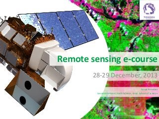
  • 1. Remote sensing e-course 28-29 December, 2013 Fatwa Ramdani Geoenvironment, Earth Science, Grad. School of Science
  • 2. Outline • The first day of this course will focus in vegetation cover analysis based on remotely-sensed data, Landsat OLI 8. The methods how to analyze and exploit the multispectral information for vegetation mapping will be illustrated. This lesson also provide the concept of color composite, basic algorithm theoretical of atmospheric correction, how to using formula in open source software. • The second day will guide the students to the next level of analysis using Thermal Infrared Sensor, compare with the vegetation indices and different land use land cover class. • In every section will be follow with the exercise and questions to allow student expand their understanding.
  • 3. Course Goal and Objectives • Understand the concept of false composite color • Understand the basic algorithm theoretical of atmospheric correction • Understand formula module function in open source software • Understand the benefit of vegetation indices • Understand basic cartography design and classification technique • Understand the utility of TIRS bands
  • 4. Intended Audience • University student with basic level of knowledge in Remote Sensing studies • Course Requirements: – – – – Internet access GRASS software (http://grass.osgeo.org/grass64/binary/mswindows/native/) QuantumGIS software (http://www.qgis.org/en/site/forusers/download.html) Download data here ()
  • 5. 1. Using remotely-sensed image to highlighted vegetation • This lesson will focus in vegetation cover analysis based on remotelysensed data, Landsat 5 TM, Landsat 7 ETM+, and OLI 8. The methods how to analyze and exploit the multispectral information for vegetation mapping will be illustrated. This lesson also provide the concept of color composite. Resources: • http://fatwaramdani.wordpress.com/2013/05/31/landsat-8-of-westsulawesi/ • http://landsat.usgs.gov/L8_band_combos.php
  • 6. 2. Radiance and Reflectance • The section will be discuss the basic concept of radiance and reflectance Resource • http://www.exelisvis.com/Company/PressRoom/TabId/190/ArtMID/786/ArticleID/3377/3377.aspx
  • 7. To understand more about how Satellite sensors work, it helps to remember that – As sunlight strikes Earth’s surface, some of it is absorbed, and some of it is reflected back into space.
  • 8. Sunlight has visible light and infrared light, as well light of other wavelengths. Sunlight interacts with the objects it hits. Some of it is absorbed and some of it is reflected by those objects. We see the light that’s reflected from objects. Photo: Diptarama
  • 9. Red, green, blue, and infrared light from the sun hit the tree and its leaves. Infrared and green light are reflected from the tree. Red and blue light are absorbed by the tree. In this picture, IR is Infrared light R is red light G is green light B is blue light
  • 10. Activities! • • • • • Import file using GRASS Explore basic statistics Rescale satellite images Apply greyscale and RGB composite Apply image enhancement (IHS)
  • 11. 3. Generating vegetation indices and produce thematic map • This lecture will introduce the student to basic algorithm theoretical of Digital Numbers (DNs) conversions, atmospheric correction, how to using formula in open source software, variant of vegetation indices algorithm, and will be follow with the exercise and questions to allow student expand their understanding. ACTIVITIES • Converting DNs into Reflectance, calculate NDVI & WDRVI, assign colour. Resource • • https://landsat.usgs.gov/Landsat8_Using_Product.php http://fatwaramdani.wordpress.com/2010/12/02/optimizing-spectral-information-for-sensing-vegetationproperties/
  • 12. Quiz? • Why do we assign band to certain color? • How is the spatial distribution of vegetation density in the study area? Which area has sparse, moderate, and dense vegetation cover? Could you distinguish it from false composite color? • What is d2 value associated with 28 Dec 2013? • Why do we need to perform TOA radiance and TOA reflectance? • Why the histogram and transect of WDRVI image and NDVI image are different? • What impression do you get from the scatter chart of the WDRVI against NDVI values?
  • 13. End of first day Questions?
  • 14. 6. Comparing near-natural colour composite to LST (Land Surface Temperature) • The students will guide to comparing their land surface temperature map with near-natural colour composite using GRASS. Also they will guider more to explore command console in GRASS Resources • http://fatwaramdani.wordpress.com/2012/04/04/comparing-near-natural-colourcomposite-to-lst-land-surface-temperature-using-grass/
  • 15. 4. Exploring Digital Numbers (DNs) of TIRS bands • This lecture will introduce students how to explore the DNs of TIRS band using transect and histogram ACTIVITIES! • Converting DNs into Radiance Resources http://atmcorr.gsfc.nasa.gov/ http://atmcorr.gsfc.nasa.gov/Barsi_AtmCorr_SPIE05.pdf https://landsat.usgs.gov/calibration_notices.php
  • 16. 5. Deriving surface temperature from TIRS band using GRASS • This part will guide students how to derive surface temperature from TIRS band using GRASS ACTIVITIES! • Converting Radiance into Absolut temperature (Kelvin) • Converting Absolut temperature into Celsius • Save file and produce map using QuantumGIS Resources • http://fatwaramdani.wordpress.com/2012/04/04/how-to-derive-surface-temperature-from-thermalband-using-grass/
  • 17. Activities& Quiz! • Read the LST values using transect line on the different land use land cover, record the coordinates, and create the tables. Record at least for 5 different land use land cover • Read the vegetation indices value & LST values using transect line on the different land use land cover, and create the scatterplot • Based on the above activites, analyse the result! Which class of land use land cover related to high land surface temperature, and which class related to the lower values?