Lake Accotink Dredging Alternatives Analysis
•Als PPTX, PDF herunterladen•
0 gefällt mir•569 views

This document provides information about alternatives being considered for dredging Lake Accotink in Fairfax County, VA. It summarizes the project background, including previous dredging events and sediment deposition rates. It then discusses the development and screening of various dredging, dewatering, disposal location, and pipeline route alternatives. Key factors like impacts to the community, environment, and costs were considered. The document retains several processing area, dewatering location, and pipeline route alternatives for further analysis to identify a preferred alternative for dredging Lake Accotink.

Empfohlen
Empfohlen
Weitere ähnliche Inhalte
Was ist angesagt?
Was ist angesagt? (20)
Ähnlich wie Lake Accotink Dredging Alternatives Analysis
Ähnlich wie Lake Accotink Dredging Alternatives Analysis (20)
Mehr von Fairfax County
Mehr von Fairfax County (20)
Kürzlich hochgeladen
Kürzlich hochgeladen (20)
Lake Accotink Dredging Alternatives Analysis
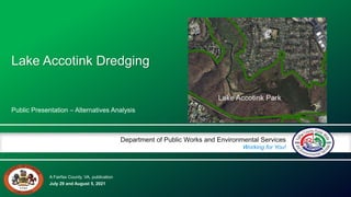
- 1. A Fairfax County, VA, publication Department of Public Works and Environmental Services Working for You! July 29 and August 5, 2021 Public Presentation – Alternatives Analysis Lake Accotink Dredging
- 2. DPWES Stormwater Planning Division Project Background 2 Lake Accotink Dredging Lake Siltation Lake Accotink has been dredged three times over the past 40 years. The most recent dredging was completed in May 2008. An average of 20,000 CY of sediment is deposited in the lake per year. The estimated average depth of the lake is less than 4 feet. Park Master Plan Process • Master Plan began Spring 2016. • 5 Public Meetings/Workshops held with Community. • 6 Lake Management Options were shared with the public. • 90% of public comments favored having the lake. Board of Supervisors Approval of Funding • BOS approved request to seek funding for up to $30.5 million to proceed with Lake Accotink Dredging in October 2019 .
- 3. DPWES Stormwater Planning Division Project Overview 3 Lake Accotink Dredging Description • Dredge estimated 500,000 cubic yards of sediment to restore lake to average 8 ft depth. • Pump sediment to location within Wakefield or Lake Accotink Park for dewatering and disposal. • Establish maintenance dredging program to sustain the lake. • Retain aesthetic and recreation value of the lake.
- 4. DPWES Stormwater Planning Division Project Team 4 Lake Accotink Dredging Department of Public Works & Environmental Services Charles Smith Project Manager – Stormwater Justin Pistore Project Manager - Stormwater Aaron George Lake Management – Stormwater Jay Horstman Construction Management – Capital Facilities Tom Richardson Sanitary Sewer Coordination – Wastewater Fairfax County Park Authority Valerie Maislin Project Manager – Planning and Development Adam Wynn Lake Accotink Park Master Plan Project Manager – Planning and Development Dan Grulke Lake Accotink Manager – Park Services Chris Goldbecker Lake Front Park Manager – Park Services Amber Stramel Area 2 Manager – Park Operations Braddock District Supervisor Marcia Pape Supervisor’s Aide Arcadis Team Mike Wooden Project Manager Fernando Pasquel Project Director Akshay Kumar Assistant Project Manager Liz Hover Materials Management Amanda Kohler Conveyance & Dewatering System Shannon Dunn Sediment Characterization & Water Quality Susan Larcher Public Outreach Frank Graziano (WSSI) Survey & Permitting ECS Geotechnical Analysis Key Stakeholder Groups Friends of Lake Accotink Park Friends of Accotink Creek Save Lake Accotink Homeowner & Civic Associations Mid-Atlantic Off-Road Enthusiasts Lake Accotink Dredging Critical Players
- 5. DPWES Stormwater Planning Division Project Schedule 5 Lake Accotink Dredging Data collection and survey – April 2021 Alternatives Analysis – July 12, 2021 Public Comment July 22 to August 22 Public Meeting July 29 & August 5 Concept Design and Value Engineering Study – May 2022 Final Design and Permitting – May 2023 Begin Dredging – Fall 2023 Complete Dredging – 2026 Post Construction Monitoring – 2026 to 2031 Lake Accotink dredging operations June 21, 2006 – Photo by Fairfax County DPWES
- 6. © Arcadis 2021 Photo courtesy of Tom Kinder Alternatives Analysis July 29 and August 5, 2021 Lake Accotink Dredging
- 7. Alternatives Analysis Report Full Report Available on Project Website: https://www.fairfaxcounty.gov/publicworks/lake-accotink-dredging 1. Introduction 2. Summary of Existing Data 3. Evaluation Criteria 4. Development and Screening of Methods 5. Environmental and Cultural Resource Evaluation 6. Development and Screening of Alternatives 7. Analysis of Retained Alternatives 29 July 2021 © Arcadis 2021
- 8. Lake Accotink Information Watershed Area 19,600 acres Lake Area 55 acres Average Sedimentation Rate 23,000 cubic yards per year Previous Dredging Events 1960s, 1985, 2008 Nearby Land Use Parks, Residential, Light Industrial Surrounding Habitat Forests, marshes, and ephemeral wetlands All values are approximate • Project to include dredging, sediment transport, and disposal by truck • Increase lake depth and overall volume of the lake • Facilitate retention of the aesthetic and recreational value of the lake • Provide a dredging maintenance plan that allows the lake to remain a valuable asset to the community Objective and Scope 29 July 2021 Lake Accotink Existing Conditions Alternatives Analysis Report Figure 1-2 Introduction © Arcadis 2021
- 9. 29 July 2021 © Arcadis 2021 Summary of Existing Data
- 10. © Arcadis 2021 Category Criteria Park Management Long-Term Park Vision Community Recreational Use Restrictions During Construction Community Considerations During Construction Environment Environmental Considerations Floodplain Impacts Sustainability Construction and Dredging Program Operation Available Area and Accessibility Site Preparation Requirements Flexibility/Compatibility with Various Equipment Efficient Water Return Constructability Long-Term Operation and Maintenance Schedule Costs Evaluation Criteria Sub-Criteria Developed for Each of the Components Evaluated 29 July 2021
- 11. © Arcadis 2021 Assumptions 29 July 2021 • Target Final Water Depth – 8 feet • Dredge Volume – 450,000 to 500,00 cubic yards • Construction Schedule – 3 years • Dredging Schedule – 2 years • Average Dredging Rate – 950 cubic yards per day
- 12. Development and Screening of Methods
- 13. Dredging
- 14. © Arcadis 2021 Dredging Methods 29 July 2021 Mechanical Amphibious (Hybrid) Hydraulic 8 cubic yard bucket 16 cubic yard bucket 8-inch dredge 14-inch dredge
- 15. © Arcadis 2021 29 July 2021 Dredging Method Evaluation Table 8-cubic-yard bucket 16-cubic-yard bucket 8-inch dredge 14-inch dredge Lost Use Days Minimizes days lost Reduced Use Minimizes reduced use of lake Existing Infrastructure Impacts Minimizes impacts to existing infrastructure Lake Use Minimizes impacts to lake use due to dredging activities (including aesthetic considerations) Facilities Availability Avoids closures of park facilities (e.g., marina, parking) Minimizes Noise Comparison of relative proximity of potential receptors Minimizes Odors/Dust Comparison of relative proximity of potential receptors Impacts to Aquatic Wildlife Minimizes impacts to aquatic wildlife Wetland Impacts Minimizes impacts to wetlands Impacts to Terrestrial Wildlife Minimizes impacts to terrestrial wildlife Minimize Floodplain Impacts -- Minimizes Sediment Resuspension -- Greenhouse Emissions Minimizes greenhouse gas emissions Preserving wetlands Minimizes impacts to wetlands Minimizes Clearing/Grading -- Requires Updated Infrastructure Minimizes required updates to existing infrastructure Sediment Processing Considerations Adaptability to pipeline transport Maneuverability Around Dock/Dam -- Dredge Equipment Accuracy -- Separate debris removal step required Convertible for debris removal Availability -- Seasonal Restrictions Seasonal impacts on dredge use Production Average sustained production rate Relative Costs -- Criteria Sub-Criteria Mechanical Hydraulic Amphibious Debris Compatibility Low Compatibility Medium Compatibility High Compatibility
- 16. © Arcadis 2021 29 July 2021 Key Takeaways • All options are feasible • Main challenges (red ratings) – Hydraulic – debris handling – Amphibious – production rate – Mechanical – community and floodplain impacts Dredging Method Evaluation Detailed Evaluation in Exhibit 1 of Alternatives Analysis Report
- 17. Dewatering
- 18. © Arcadis 2021 3.5 – 4.9 acres PASSIVE (GEOTEXTILE TUBE) Dewatering Methods 29 July 2021 PASSIVE WITH DESANDING 5.2 – 7.4 acres MECHANICAL 3.2 – 5.8 acres DRYING AGENT Island Options Only
- 19. © Arcadis 2021 Dewatering Method Evaluations 29 July 2021 Key Takeaways • Passive is simple and relatively low-cost but needs large, flat area • Mechanical can accommodate higher throughput and creates drier material but is higher cost • Identify location to provide most flexibility for contractor’s approach Detailed Evaluation in Exhibit 2 of Alternatives Analysis Report
- 21. © Arcadis 2021 Disposal Locations 29 July 2021 Island Expansion Bank Restoration County Use Offsite Reuse Offsite Landfill
- 22. © Arcadis 2021 Disposal Location Evaluation 29 July 2021 Key Takeaways • All disposal locations can be paired with any of the dredging and dewatering options • Offsite landfill and offsite reuse have no public impacts but have higher costs • Onsite reuse has lower costs but has public impacts Detailed Evaluation in Exhibit 3 of Alternatives Analysis Report
- 23. Environmental and Cultural Resource Evaluation
- 24. Details in Table 5-1 and Appendix C of Alternative Analysis Report • Provided impacts likely a "Worst Case Scenario" • No distinction between "temporary" vs "permanent" wetland impacts • Permit will require avoidance and minimization, reducing noted impacts • Largest dewatering site "impacts" are associated with use of the island or settling basin • Largest pipeline "impacts" are for alignments in stream valleys • Largest tree "impacts" in stream valleys, maintenance area, settling basin Potential Wetland and Vegetative Impacts 29 July 2021 © Arcadis 2021
- 25. Potential Cultural Resource Impacts Details in Appendix D of Alternative Analysis Report • Based on Virginia Department of Historic Resources (VDHR) database review of previously recorded cultural resources within or adjacent to potential alignments and dewatering sites • Seven sites were identified, consisting of prehistoric lithic scatter, civil war era features, and/or portions of the Orange & Alexandria rail bed • No sites have been evaluated for listing in the National Register of Historic Places (NRHP) • Sites could also meet Fairfax County criteria for local significance 29 July 2021 © Arcadis 2021
- 26. Development and Screening of Alternatives
- 27. Alternative Components Detailed Evaluation in Exhibit 4 of Alternatives Analysis Report North of Braddock Road 1. Howrey Field 2. Wakefield Park Maintenance Facility 3. Wakefield Ball Fields 4. Dominion Energy (Dominion) Right-of-Way (ROW) Lake Accotink Park 5. Lake Accotink Upper Settling Basin 6. Lake Accotink Island – Current Footprint 7. Lake Accotink Island – Expanded Footprint Concrete Plant 8. Concrete Plant Dewatering Locations North of Braddock Road 1. Cross-County Trail 2. Queensberry Avenue 3. Flag Run / Port Royal Road 4. Flag Run / Interstate 495 Lake Accotink Park 5. Lake Accotink Trail Concrete Plant 6. Amtrak ROW 7. Residential Route Pipeline Alignments 29 July 2021 Detailed Evaluation in Exhibit 5 of Alternatives Analysis Report © Arcadis 2021
- 28. © Arcadis 2021 List of Potential Alternatives 29 July 2021 # ID Description 1 HF1 Howrey Field via Cross-County trail 2 HF2 Howrey Field via Queensberry Ave 3 HF3 Howrey Field via Flag Run/Port Royal Road 4 HF4 Howrey Field via Flag Run/I-495 5 WMF1 Wakefield Park Maintenance Facility via Cross-County Trail 6 WMF2 Wakefield Park Maintenance Facility via Queensberry Ave 7 WMF3 Wakefield Park Maintenance Facility via Flag Run/Port Royal Road 8 WMF4 Wakefield Park Maintenance Facility via Flag Run/I-495 9 WB1 Wakefield Ball Fields via Cross-County Trail 10 WB2 Wakefield Ball Fields via Queensberry Ave 11 WB3 Wakefield Ball Fields via Flag Run/Port Royal Road 12 WB4 Wakefield Ball Fields via Flag Run/I-495 13 DOM1 Dominion Right-of-Way (ROW) via Cross-County Trail 14 DOM2 Dominion ROW via Queensberry Ave 15 DOM3 Dominion ROW via Flag Run/Port Royal Road 16 DOM4 Dominion ROW via Flag Run/I-495 17 USB Lake Accotink Upper Settling Basin 18 ICF Lake Accotink Island - Current Footprint 19 IXF Lake Accotink Island - Expanded Footprint 20 VCP1 Concrete Plant via Residential 21 VCP2 Concrete Plant via Amtrak ROW HF WB I Legend Processing Area HF = Howrey Field WMF = Maintenance Area WB = Ballfields DOM = Dominion ROW USB = Settling Basin I = Island (IXF, ICF) VPC = Concrete Plant Main Pipeline Route HF USB WMF VCP DOM
- 29. © Arcadis 2021 HF WB I Legend Processing Area HF = Howrey Field WMF = Maintenance Area WB = Ballfields DOM = Dominion ROW USB = Settling Basin I = Island (IXF, ICF) VPC = Concrete Plant Main Pipeline Route HF USB WMF VCP DOM Removed & Retained Alternatives in Report 29 July 2021 # ID Description 1 HF1 Howrey Field via Cross-County trail 2 HF2 Howrey Field via Queensberry Ave 1 3 HF3 Howrey Field via Flag Run/Port Royal Road 4 HF4 Howrey Field via Flag Run/I-495 5 WMF1 Wakefield Park Maintenance Facility via Cross-County Trail 6 WMF2 Wakefield Park Maintenance Facility via Queensberry Ave 1 7 WMF3 Wakefield Park Maintenance Facility via Flag Run/Port Royal Road 8 WMF4 Wakefield Park Maintenance Facility via Flag Run/I-495 9 WB1 Wakefield Ball Fields via Cross-County Trail 2 10 WB2 Wakefield Ball Fields via Queensberry Ave 1, 2 11 WB3 Wakefield Ball Fields via Flag Run/Port Royal Road 2 12 WB4 Wakefield Ball Fields via Flag Run/I-495 2 13 DOM1 Dominion Right-of-Way (ROW) via Cross-County Trail 14 DOM2 Dominion ROW via Queensberry Ave 1 15 DOM3 Dominion ROW via Flag Run/Port Royal Road 16 DOM4 Dominion ROW via Flag Run/I-495 17 USB Lake Accotink Upper Settling Basin 18 ICF Lake Accotink Island - Current Footprint 19 IXF Lake Accotink Island - Expanded Footprint 20 VCP1 Concrete Plant via Residential 3 21 VCP2 Concrete Plant via Amtrak ROW 3 Rationale for alternatives removed from consideration: 1. Queensberry Ave removed from consideration due to impacts to community and cost 2. Wakefield Ball Fields removed from consideration due to legal impacts and inability to replace facility that meets Title IX obligations 3. Concrete Plant removed from consideration as property owner is unable to accommodate dewatering operations X X X X X
- 30. Analysis of Retained Alternatives
- 31. © Arcadis 2021 Retained Alternatives Evaluation 29 July 2021 ID Alt # Description HF1 1 Howrey Field via Cross-County trail HF3 3 Howrey Field via Flag Run/Port Royal Road HF4 4 Howrey Field via Flag Run/I-495 WMF1 5 Wakefield Park Maintenance Facility via Cross-County Trail WMF3 7 Wakefield Park Maintenance Facility via Flag Run/Port Royal Road WMF4 8 Wakefield Park Maintenance Facility via Flag Run/I-495 DOM1 13 Dominion Right-of-Way (ROW) via Cross-County Trail DOM3 15 Dominion ROW via Flag Run/Port Royal Road DOM4 16 Dominion ROW via Flag Run/I-495 USB 17 Lake Accotink Upper Settling Basin ICF 18 Lake Accotink Island - Current Footprint IXF 19 Lake Accotink Island - Expanded Footprint County Staff Recommend Removal from Consideration
- 32. Dewatering Location Evaluation See Exhibit 4 of Alternatives Analysis for Detailed Evaluation County Staff Recommend Removal from Consideration 29 July 2021
- 33. Limits Park & Community Impacts; Long-Term Use; Restoration & Remobilization; Extent of Clearing, Floodplain 33 Wakefield Park Maintenance Facility Areas Type Acreages Maximum Limits of Disturbance 7.7 Wetlands 0 Floodplain 2.6 Resource Protection Area 4.0 Method Compatibility* Production (cy/day) Slurry Solids 950 7% 950 15% 1250 7% 1250 15% Passive Yes Yes No No Passive w/ Desanding No No No No Mechanical Maybe Yes No Maybe Drying Agent No No Rating Summary *Based on current assumptions From Alternative Analysis Report Figure 6-3 Unknown • Extent of Braddock Rd Improvements
- 34. © Arcadis 2021 Wakefield Park Maintenance Facility Slurry Transport Alignments WMF1 - Cross-County Trail WMF3 - Flag Run/Port Royal Road WMF4 - Flag Run/I-495 Alignment Length, mi. 1.3 1.9 1.9 Pipe Diameter, inches 12 to 14 16 to 18 16 to 18 Difference in Elevation1, ft. 17 110 110 No. of Utility Crossings2, ea. 17 55 19 No. of Water Features/ Trail Crossings 7 29 27 Notes: 1. Difference in elevation between highest and lowest point along the alignment. 2. Sewer, Stormwater, Electrical & Water. 29 July 2021 Detailed Evaluation in Exhibit 5 of Alternatives Analysis Report
- 35. 10 August 2021 35 Dominion ROW Areas Type Acreages Maximum Limits of Disturbance 10 Wetlands 0.2 Floodplain 6.2 Resource Protection Area 9.7 Method Compatibility* Production (cy/day) Slurry Solids 950 7% 950 15% 1250 7% 1250 15% Passive Maybe Maybe No No Passive w/ Desanding No No No No Mechanical Maybe Maybe No Maybe Drying Agent No No *Based on current assumptions Rating Summary Clearing/Wetland Impacts; Restoration & Remobilization Floodplain; Truck Access From Alternative Analysis Report Figure 6-5 Unknown • Dominion requirements / use restrictions
- 36. © Arcadis 2021 DOM1 - Cross-County Trail DOM3 - Flag Run/Port Royal Road DOM4 - Flag Run/I-495 Alignment Length, mi. 2.1 2.5 2.2 Pipe Diameter, inches 16 to 18 16 to 18 16 to 18 Difference in Elevation1, ft. 25 110 105 No. of Utility Crossings2, ea. 26 66 23 No. of Water Feature/Trail Crossings 18 41 35 Note: 1. Difference in elevation between highest and lowest point along the alignment. 2. Sewer, Stormwater, Electrical & Water. 29 July 2021 Detailed Evaluation in Exhibit 5 of Alternatives Analysis Report Dominion ROW Slurry Transport Alignments
- 37. 10 August 2021 37 Upper Settling Basin Areas Type Acreages Maximum Limits of Disturbance 6.7 Wetlands 4.1 Floodplain 0 Resource Protection Area 6.7 Method Compatibility* Production (cy/day) Slurry Solids 950 7% 950 15% 1250 7% 1250 15% Passive Maybe Maybe No No Passive w/ Desanding No No No No Mechanical Maybe Maybe No Maybe Drying Agent No No *Based on current assumptions Rating Summary Improve Infrastructure; Outside Floodplain; Water Return; Restoration & Remobilization Trail & Wetland Impacts, Grading; Soil Condition, Community Impacts, Site Preparation; Accessibility From Alternative Analysis Report Figure 6-6 Unknown • Surface/Subsurface Conditions • Embankment Stability
- 38. © Arcadis 2021 Upper Settling Basin – Trail Alignment Alignment Length, mi. 0.7 Pipe Diameter, inches 14 to 16 Difference in Elevation1, ft. 70 No. of Utility Crossings2, ea. 9 No. of Water Feature/Trail Crossings 15 Notes: 1. Difference in elevation between highest and lowest point along the alignment. 2. Sewer, Stormwater, Electrical & Water. 29 July 2021 High Compatibility Medlium Low Compatibility Detailed Evaluation in Exhibit 5 of Alternatives Analysis Report Upper Settling Basin Slurry Transport Alignment
- 39. 10 August 2021 39 Howrey Field Areas Type Acreages Maximum Limits of Disturbance 7.5 Wetlands 0 Floodplain 4.5 Resource Protection Area 3.7 Method Compatibility* Production (cy/day) Slurry Solids 950 7% 950 15% 1250 7% 1250 15% Passive Maybe Maybe No No Passive w/ Desanding No No No No Mechanical Maybe Maybe No Maybe Drying Agent No No *Based on current assumptions Rating Summary Accessibility; Truck Traffic Park Use; Memorial; Restoration & Remobilization; Floodplain; Return Water From Alternative Analysis Report Figure 6-2 Howrey Field Unknown • Extent of Braddock Rd Improvements
- 40. Howrey Field Slurry Transport Alignments Type HF1 - Cross-County Trail HF3 - Flag Run/Port Royal Road HF4 - Flag Run/I-495 Alignment Length, mi. 1.3 2.2 2.2 Pipe Diameter, inches 12 to 14 16 to 18 16 to 18 Difference in Elevation1, ft. 15 105 110 No. of Utility Crossings2, ea. 27 59 37 No. of Water Feature/Trail Crossings 8 32 29 Note: 1. Difference in elevation between highest and lowest point along the alignment. 2. Sewer, Stormwater, Electrical & Water. 29 July 2021 Detailed Evaluation in Exhibit 5 of Alternatives Analysis Report
- 41. 10 August 2021 41 Lake Accotink Island (Current Footprint) Areas Type Acreages Maximum Limits of Disturbance 3.3 Wetlands 3.0 Floodplain 3.3 Resource Protection Area 3.3 Method Compatibility* Production (cy/day) Slurry Solids 950 7% 950 15% 1250 7% 1250 15% Passive No No No No Passive w/ Desanding No No No No Mechanical No No No No Drying Agent Yes – if barge transport Yes – if barge transport *Based on current assumptions Rating Summary No Pipeline; Water Return Park and Environmental Impacts, Accessibility, Truck Traffic, Floodplain From Alternative Analysis Report Figure 6-7 Unknown • Surface/subsurface conditions of island
- 42. 10 August 2021 42 Lake Accotink Island (Expanded Footprint) Areas Type Acreages Maximum Limits of Disturbance 10 Wetlands 4.4 Floodplain 9.6 Resource Protection Area 10 Method Compatibility* Production (cy/day) Slurry Solids 950 7% 950 15% 1250 7% 1250 15% Passive Yes Yes Yes Yes Passive w/ Desanding Maybe Maybe Maybe Maybe Mechanical No No No No Drying Agent Yes – if barge transport Yes – if barge transport *Based on current assumptions Rating Summary No Pipeline, Water Return, Method Compatibility Park and Environmental Impacts, Site Preparation, Accessibility, Truck Traffic, Floodplain, Cost From Alternative Analysis Report Figure 6-8 Unknown • Surface/subsurface condition of island and land bridge area
- 43. ID Alt # Description HF1 1 Howrey Field via Cross-County trail HF3 3 Howrey Field via Flag Run/Port Royal Road HF4 4 Howrey Park via Flag Run/I-495 WMF1 5 Wakefield Park Maintenance Facility via Cross-County Trail WMF3 7 Wakefield Park Maintenance Facility via Flag Run/Port Royal Road WMF4 8 Wakefield Park Maintenance Facility via Flag Run/I-495 DOM1 13 Dominion Right-of-Way (ROW) via Cross-County Trail DOM3 15 Dominion ROW via Flag Run/Port Royal Road DOM4 16 Dominion ROW via Flag Run/I-495 USB 17 Lake Accotink Upper Settling Basin ICF 18 Lake Accotink Island - Current Footprint IXF 19 Lake Accotink Island - Expanded Footprint Retained Alternatives Evaluation 29 July 2021 County Staff Recommend Removal from Consideration © Arcadis 2021
- 44. © Arcadis 2021 Arcadis. Improving quality of life. Thank You For Your Time!
- 45. DPWES Stormwater Planning Division Staff Recommendations 45 Lake Accotink Dredging Dredging: Pursue hydraulic dredging with mechanical debris removal. Pipeline: Pursue lowest impact/cost pipeline alternative: along CCT, lake perimeter trail or Flag Run/Port Royal Road or Beltway. Retain flexibility during design for permanent and temporary pipeline options. Dewatering: Retain consideration for four potential locations during design for maximum flexibility, impact minimization, cost efficiency: Dominion Energy ROW – Wakefield Park Settling Basin – Lake Accotink Park Maintenance Area – Wakefield Park Lake Island – Lake Accotink Park
- 46. DPWES Stormwater Planning Division Staff Recommendations 46 Lake Accotink Dredging
- 47. DPWES Stormwater Planning Division Staff Recommendations 47 Lake Accotink Dredging
- 48. DPWES Stormwater Planning Division Discussion Discussion & Questions 48 Native mussels below Lake Accotink dam – Photo by Friends of Accotink Creek Lake Accotink Dredging Community stewardship – Photo by Friends of Lake Accotink Park Cardboard boat regatta – Photo by Friends of Lake Accotink Park Mallard ducks – Photo by Fairfax County Park Authority
- 49. DPWES Stormwater Planning Division 49 Lake Accotink Dredging Thanks for Attending!! The window for comments will be open until Sunday, August 22, 2021. Public Input Webpage: https://publicinput.com/R018 For Additional Information, to Comment or Sign up for Email Updates, Please Visit the Project Web Page: https://www.fairfaxcounty.gov/publicworks/lake-accotink- dredging
Hinweis der Redaktion
- Construction: FY2018 = July 2018
- Construction: FY2018 = July 2018
- Construction: FY2018 = July 2018
- Construction: FY2018 = July 2018
- Construction: FY2018 = July 2018
- Construction: FY2018 = July 2018
- Construction: FY2018 = July 2018
- Construction: FY2018 = July 2018
- Construction: FY2018 = July 2018