![Table of Contents Table of Contents ,[object Object],A quick overview of positioning systems ,[object Object],Positioning with GPS ,[object Object],GSM and Wireless LAN based positioning techniques ,[object Object],Infrared, Radio, Ultrasound, and Video based techniques ,[object Object],1 2 3 4 5 2](data:image/gif;base64,R0lGODlhAQABAIAAAAAAAP///yH5BAEAAAAALAAAAAABAAEAAAIBRAA7)
Empfohlen
Weitere ähnliche Inhalte
Was ist angesagt?
Was ist angesagt? (20)
Andere mochten auch
Andere mochten auch (18)
Ähnlich wie Positioning in Location Based Services
Ähnlich wie Positioning in Location Based Services (20)
Kürzlich hochgeladen
Kürzlich hochgeladen (20)
Positioning in Location Based Services
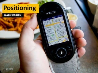
- 1. Positioning MARK ESSIEN 11.11.2009 1
- 4. What are positioning systems? These are systems that allow us detect the location of a person or object. 4 There are lots of different such systems in different areas. Here we will talk about the systems we need for Location Based Services.
- 5. 5 Such as: Indoor Positioning Systems Network Based Positioning Systems Satellite Positioning Systems
- 6. How do we do get locations? 6 Sensor Network tracks the device Device discovers its own position
- 7. Basic techniques to discover locations 7 Cell of Origin
- 8. Basic techniques to discover locations 8 Time of Arrival
- 9. Basic techniques to discover locations 9 Angle of Arrival
- 10. Basic techniques to discover locations 10 Measuring Strength
- 11. Basic techniques to discover locations 11 Processing Video Data
- 12. 12 Satellite Positioning 2
- 14. Not disturbed by enviromental conditions
- 17. Basic Mechanism of Satellite Navigation 15 By looking at the intersection of the coverage radius of at least 3 satellites, he can discover his exact position
- 18. How does the device know the position of the satellite? Satellites are on fixed, known orbits. Additionally, the position of all satellites is updated by sending a so-called almanac with currrent position information to the device. (By the way, if you don’t use your GPS device for a long time, it needs to download this almanac, which is why it takes much longer to start) 16
- 19. What about the distance r from the satellite? 17 r = c * t r = Distance from Satellite c = Speed of Light t = Time it took signal to reach device
- 20. Problems The speedoflightisveryhigh. An errorof1 μs leadsto a 300m inaccuracy Satelliteshaveatomicclocks, and so theirtimesareveryaccurate, but thedevices do not. The clocksarehence not synchronised. Tocorrecttheunknownfactor, a fourthsatellitesignalisdrawn in, andequationsthatfactor in the time offsetbuilt These non-linear equationscanbecalculatedusing Kalman filtersor Taylor series 18
- 22. Full operational capability in July, 1995
- 24. Energy supplied by solar cells
- 25. Central computer is a 16 Mhz CPU
- 26. Expected lifetime of 7.5 years
- 27. 12 hours for an orbit
- 28. 60 days to launch after failure
- 30. About 25.000 lines of code. In comparison,Microsoft Office has 30 million lines of code.-
- 31. User Segment / The GPS receiver 21
- 32. Control Segment /GPS Master Control Station 22 Schriever Air Force Base, near Colorado Springs, U.S.A
- 33. GPS Properties SPS (Standard Positioning Service): Available for civilian users – Less Accurate (100m horizontal) PPS (Precise Positioning Service): 22m horizontal. For military use Data channel with 50bps 23
- 34. GPS Accuracy Accuracy affected by clock errors, fluctuation in satellite orbit, disturbances of the atmosphere/ionosphere and multipath errors 24
- 35. Improving GPS accuracy with DGPS 25 DGPS involves a system of base stations with fixed, known positions that broadcast correctional information to the devices directly.
- 36. Correction Stations in Australia 26 AMSA's Differential Global Positioning System provides a network of radio beacons that improve the accuracy and integrity of the Global Positioning System (GPS) around selected areas of Australia's coast.
- 37. Improving GPS accuracy with WAAS Base stations calculate correction data, then transmit it to geostationary satellites, who then pass it on to the devices 27
- 38. Selective Availability Artificial Distortion of GPS signal by U.S government Switched off in 2000 New Satellites being launched 2009 do not have this capability any more 28
- 40. Slated for operation start by 2013
- 41. Bases in Germany and Italy
- 42. Partners include China, Israel, Ukraine, Morroco, South Korea
- 43. GLONASS – Russian alternative to GPS
- 44. Launched in 1996
- 45. Financial problems, only 10 satellites by 2000
- 47. Network Based Positioning Using existing networks for positioning 31 Wireless LAN networks The GSM network
- 48. Already covers a wide area User knows his position already, based off the cell he is in However, cell accuracy from 1km to 35km, so very inaccurate 32 Overview
- 49. Sony Ericsson developed the MPS (Mobile Positioning System) that improves the accuracy. It does so using multiple methods. Detect Cell Detect the segment antennae user is, allowing an angle of antennae to user Use Timing Advance to determine distance. Accuracy is circa 555m Signal runtimes to 4 base stations 33 Improving Accuracy
- 50. Position can be detected by measuring signal strength of all wireless LAN access points Requires a training phase where the locations are mapped to signal strengths Realized as prototype by Microsoft, as well as with the Nibble system Outdoor variant in use in the iPhone 2G, using a service by the company SkyHook 34 WLAN: Overview
- 53. Company drives around in metroareas and maps available wirelessLAN devices and signal strengthsto the GPS location
- 55. 37 Indoor Positioning 4
- 56. Indoor Positioning Indoor positioning does not work with satellites because the radio signals do not penetrate the walls. So other systems are required. The indoor positioning devices can be split up into categories based on the technology in use: 38 Infrared Radio Ultrasound Video
- 57. 1. Infrared Beacons Infrared devices are cheap and easy to get, and so are often used for indoor positioning. Two sample system are the Active Badge System and the Wireless Indoor Positioning System (WIPS). 39
- 58. The Active Badge System Every user carries a transmitter in the shape of a card Infrared signal with pulse length 0.1s is sent every 15 seconds Signal identifies user with unique code Low cost with a long battery life 40
- 60. Signals flood room, so positioning is accurate to room level
- 61. Long battery life because the pulse duration very short compared to idle time
- 63. The SpotON System Uses the strength of the signals at the spot from where the measurement occurs The signal strength is assumed to decrease with the square of the distance. This is not always the case, however, as there may be obstacles. Accuracy of 3m can be achieved with this 43
- 64. RFID Small systems with processor, memory, antennae, but without power supply Use the energy from the radio waves Distance of 1 meter Often used to track objects – can be used to find out if an object has passed a certain point 44
- 65. 3. Ultrasound 45 Ultrasound devices use ultra sound transmitters to transmit the position of a user. Sensors are placed in the building, and the transmitter sends ultra sound signals on request.
- 67. The bat replies with an ultra-sonic impulse
- 68. Receivers on the ceiling, which are spread out at 1.2m intervals, receive the signal
- 69. The receivers pass the signals on to a location server via a wired network
- 72. The tags can store information, for example by the position of squares to each other
- 74. 50 Conclusions & Perspectives 5
- 75. Conclusion In conclusion, positioning is an important technology that is of critical importance in location based systems. We have gone through the most important methods in this presentation, and imparted an understanding of how modern positioning works. 51
- 76. Future of positioning There are still a lot of problems left in the positioning area. In particular: The speed of position detection can be improved Power consumption issues should be solved Accuracy should get better, independent of the location Ideal positioning systems should combine the different methods available 52
- 78. References Data CollectionJörg RothIn Jochen Schiller, AgnèsVoisard (eds), Location-Based Services, Morgan Kaufmann Publishers, May 2004 Positioning Systems Jörg RothChapter 3 of the thesis "A Decentralized Location Service Providing Semantic Locations“ (habilitation), 2005 Fact Sheet: Differential Global Positioning System (DGPS) Australian Maritime Safety Authority Canberra, ACT Australia August 2007 Website: How it Works – Skyhook Wireless: http://www.skyhookwireless.com/howitworks/Accessed 11.11.2009 Website: Glonass Official page: http://www.glonass-ianc.rsa.ru. Accessed 11.11.2009 Website: Galileo: http://ec.europa.eu/transport/galileo/index_en.htmAccessed 11.11.2009 54