
Empfohlen
Empfohlen
Weitere ähnliche Inhalte
Was ist angesagt?
Was ist angesagt? (18)
Ähnlich wie ProjetoUrucuia_W1_JasperFanning_english
Ähnlich wie ProjetoUrucuia_W1_JasperFanning_english (20)
Mehr von equipeagroplus
Mehr von equipeagroplus (20)
Kürzlich hochgeladen
Kürzlich hochgeladen (20)
ProjetoUrucuia_W1_JasperFanning_english
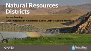
- 1. Natural Resources Districts Jasper Fanning Upper Republican Natural Resources District General Manager Nebraska’s Natural Resources Districts: How they came about and their objectives
- 2. Nebraska Uniqueness • Natural Resources Districts (NRDs) were formed in 1972 to deal with issues like flood control, soil erosion, irrigation run-off, and groundwater quantity and quality. • The Nebraska Legislature created NRDs by combining 154 pre- existing special purpose entities. • The NRD system is unique to Nebraska. • 23 Districts with boundaries based upon river basin boundaries. • Locally elected Boards govern the Districts, allowing for issues to be solved locally.
- 3. The Upper Republican NRD
- 4. Irrigation Wells in URNRD
- 5. Irrigated Acres in URNRD
- 6. Authorized Purposes of Natural Resources Districts 1. Development, management, use and conservation of groundwater and surface water 2. Soil conservation 3. Erosion prevention and control 4. Flood prevention and control 5. Pollution control 6. Water supply for any beneficial uses 7. Prevention of damages from flood water and sediment 8. Development and management of recreational and park facilities 9. Forestry and range management 10. Development and management of fish and wildlife habitat 11. Drainage improvement 12. Solid waste disposal
- 7. Issues Faced During Development • Many producers and water users throughout the state were hesitant due to potential regulation. • Local control was preferred to state level control and rule making. Local water conservation district officials were intimately involved in lobbying for creation of NRDs and local control. • Water levels in the Ogallala Aquifer were declining due to existing development in the area of the Upper Republican NRD.
- 8. Upper Republican NRD Timeline • 1972 – NRDs Created • 1976 – Groundwater Management Act passed by Legislature with encouragement from the URNRD. The Act gives NRDs the authority to regulate groundwater use. • 1977 – Groundwater declines and interest in sustainability of water resources prompt URNRD to request designation as Groundwater Management Area. Request is granted by the state and the NRD becomes the first Management Area in the state with limitations on groundwater irrigation. • 1978-1979 –URNRD the first in the state to require metering and reporting of groundwater use. Irrigation allocation of 20 inches per acre per year. Since reduced to 13 inches per acre. • 1997 – Moratorium on new wells approved becoming the first well-drilling moratorium in the state. • 2005 – Developed first integrated management plan to manage ground and surface water conjunctively. Started work to develop conjunctive management projects.
- 9. URNRD Timeline, Continued • 2012 – Rock Creek Augmentation Project constructed significantly enhancing the state’s and NRD’s ability to maintain compact compliance. • 2013 – Nebraska Cooperative Republican Platte Enhancement Project (NCORPE) constructed.
- 10. Groundwater Monitoring • More than 400 irrigation well static water levels are measured twice annually. • All irrigation wells in the District are required to be equipped with flow meters that track water use. • The URNRD monitors the quality of water by testing wells throughout the District; the Water Quality Testing Program began in 1974. • There are two separate sampling events: a sample of domestic and irrigation wells are sampled annually, focusing on human health as well as aquifer health.
- 11. Management Based on Information • Geological Survey of Geology and groundwater hydrology of Republican and Frenchman Rivers, 1957 • Groundwater geology and pump irrigation in Frenchman Creek Basin above Palisade, Nebraska, Cardwell and Jenkins, 1963 • Changes in the water supply in the Upper Republican Natural Resources District, Southwest Nebraska, from 1952-1975, Lappala, 1976 • Quantitative hydrogeology of the Upper Republican Natural Resources District, southwest Nebraska, Lappala, 1978 • Simulated Response of the High Plains Aquifer to Groundwater withdrawals in the Upper Republican Natural Resources District, Peckenpaugh, Kern, Dugan, Kilpatrick, 1995
- 12. Future Study and Modeling • Continued Data Collection • Cooperation with UNL Conservation and Survey • Periodically update models with new information to refine predictive capability and decision making capability.
- 13. Funding District Operations • Property tax authority • All property owners pay • Occupation tax authority • Fee per irrigated acre • Only eligible to fund water management projects • Irrigators paying for the projects that benefit them the most
- 14. Recent Challenges and Authorities • Originally focused on management of groundwater only • More recently expanded to conjunctive or integrated management of groundwater and surface water. • Integrated management plans are required to be sufficient to comply with interstate compacts and agreements. • Allowing for growth and changes in use in a fully appropriated system. • Nebraska law gives power to the NRDs to manage water in their districts and that responsibility continues to grow and the NRDs continue to have success and continue to be a model for other states to follow.