Drones
•Als PPTX, PDF herunterladen•
8 gefällt mir•10,208 views

A presentation on the application of drones for conservation efforts.

Empfohlen
Weitere ähnliche Inhalte
Was ist angesagt?
Was ist angesagt? (20)
Andere mochten auch
Ähnlich wie Drones
Ähnlich wie Drones (20)
Kürzlich hochgeladen
Kürzlich hochgeladen (20)
Drones
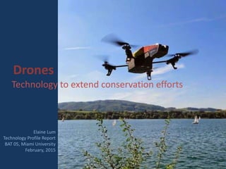
- 1. Drones Technology to extend conservation efforts Elaine Lum Technology Profile Report BAT 05, Miami University February, 2015
- 2. What are drones? • Also known as unmanned aerial vehicles • Remotely controlled from the ground • Uses a camera or spectral imaging device mounted on the vehicle • Used for gathering images in its flight path See one in action in the next slide
- 3. Conservation applications of drones • Map land changes due to deforestation • Monitor illegal poaching
- 4. • Track movements of large animals • Survey edge effects along wildlife corridors (Koh & Wich, 2012) Watch a TEDtalk about conservation drones in the next slide
- 5. Advantages of drones • Does not require specialized knowledge or complex algorithms like traditional remote sensing techniques (Flynn & Chapra, 2014)
- 6. • Much more affordable than using proprietary satellite products Advantages of drones (Flynn & Chapra, 2014; Koh & Wich, 2012)
- 7. • Able to gather information at low altitudes, therefore not affected by cloud cover Advantages of drones
- 8. • Provides real-time data that can be accessed through mobile devices (Saleem, Rehmani, & Zeadally, 2015) Advantages of drones
- 9. • Unmanned sampling of remote areas cuts down on required manpower and manhours Advantages of drones (Flynn & Chapra, 2014; Koh & Wich, 2012)
- 10. Disadvantages of drones • Having to share bandwidth with other wireless devices means insufficient spectrum bands (Saleem, Rehmani, & Zeadally, 2015)
- 11. • Light reflection over water surface can interfere with images in aquatic sampling (Flynn & Chapra, 2014; Kwon, Yoder, Baek, Gruber, & Pack, 2014) Disadvantages of drones (Flynn & Chapra, 2014; Koh & Wich, 2012)
- 12. • Collisions with overhanging branches or other flying objects may occur and cause injury (Tadjdeh, 2012) Disadvantages of drones
- 13. • Noise of drone’s motor may disturb wildlife (Flynn & Chapra, 2014) Disadvantages of drones
- 14. • Possible privacy issues if used inappropriately (Tadjdeh, 2012) Disadvantages of drones
- 15. • Parameters of sampling must comply with FAA regulations (Flynn & Chapra, 2014; Tadjdeh, 2012) Disadvantages of drones
- 16. FAA regulations for drones • Operator must maintain visual contact with the drone • Flight path must avoid noise-sensitive areas • Drones must fly under 122 m. altitude • Flight control personnel must be notified if drones are within 4.8 km of an airport (Flynn & Chapra, 2014)
- 17. A specific application of drones in conservation Problem: Invasive algal blooms negatively impact biodiversity How can drones help scientists study this issue?
- 18. Cladophora: an ecological issue • Cladophora is a green filamentous alga that is an invasive species in many aquatic systems • Thick mats of Cladophora impact fauna and flora by blocking out light and competing for resources (Flynn & Chapra, 2014)
- 19. • Cladophora provides shelter and nutrients to pathogens such as E. coli and Salmonella in the water, causing human disease • Avian botulism is associated with algal blooms of Cladophora Cladophora: an ecological issue (Lan Chun et al., 2015; Verhougstraete, Rose, Byappanahalli, & Whitman, 2010)
- 20. Drone monitoring of Cladophora • Multi-spectral sensors mounted on drones flew repeated missions to gather data on Cladophora
- 21. • Data collected on growth cycle and biomass distribution of Cladophora will help scientists predict and control its spread • Historical changes of biomass patterns can be chronicled over time by building an image data base for future research Drone monitoring of Cladophora (Flynn & Chapra, 2014)
- 22. Comparing satellite and drone generated maps of Cladophora biomass Satellite generated map (Brooks, Grimm, Shuchman, Sayers, & Jessee, 2015) Drone generated map (Flynn & Chapra, 2014) Which do you think provides more useful information? Share your thoughts in the Slideshare comments section.
- 23. References Brooks, C., Grimm, A., Shuchman, R., Sayers, M., & Jessee, N. (2015). A satellite-based multi- temporal assessment of the extent of nuisance Cladophora and related submerged aquatic vegetation for the Laurentian Great Lakes. Remote Sensing of Environment, 157, 58-71. doi: 10.1016/j.rse.2014.04.032 Flynn, K. F., & Chapra, S. C. (2014). Remote Sensing of Submerged Aquatic Vegetation in a Shallow Non-Turbid River Using an Unmanned Aerial Vehicle. Remote Sensing, 6(12), 12815-12836. doi: 10.3390/rs61212815 Koh, L. P., & Wich, S. A. (2012). Dawn of drone ecology: low-cost autonomous aerial vehicles for conservation. Tropical Conservation Science, 5(2), 121-132. Kwon, H., Yoder, J., Baek, S., Gruber, S., & Pack, D. (2014). Maximizing Water Surface Target Localization Accuracy Under Sunlight Reflection with an Autonomous Unmanned Aerial Vehicle. Journal of Intelligent & Robotic Systems, 74(1-2), 395-411. Lan Chun, C., Kahn, C. I., Borchert, A. J., Byappanahalli, M. N., Whitman, R. L., Peller, J., . . . Sadowsky, M. J. (2015). Prevalence of toxin-producing Clostridium botulinum associated with the macroalga Cladophora in three Great Lakes: Growth and management. Science of the Total Environment, 511, 523-529. doi: 10.1016/j.scitotenv.2014.12.080 Saleem, Y., Rehmani, M. H., & Zeadally, S. (2015). Review: Integration of Cognitive Radio Technology with unmanned aerial vehicles: Issues, opportunities, and future research challenges. Journal of Network and Computer Applications, 50, 15-31. doi: 10.1016/j.jnca.2014.12.002 Verhougstraete, M. P., Rose, J. B., Byappanahalli, M. N., & Whitman, R. L. (2010). Cladophora in the Great Lakes: impacts on beach water quality and human health. Water Science & Technology, 62(1), 68-76. doi: 10.2166/wst.2010.230