Geospatial Tech in Teaching
•Als PPT, PDF herunterladen•
0 gefällt mir•913 views

Presented by Addy Pope at the Higher Education Network - New to teaching workshop, Edinburgh, 14 June 2012

Empfohlen
Empfohlen
Weitere ähnliche Inhalte
Was ist angesagt?
Was ist angesagt? (10)
Andere mochten auch
Andere mochten auch (20)
Ähnlich wie Geospatial Tech in Teaching
Ähnlich wie Geospatial Tech in Teaching (20)
Mehr von EDINA, University of Edinburgh
Mehr von EDINA, University of Edinburgh (20)
Kürzlich hochgeladen
Kürzlich hochgeladen (20)
Geospatial Tech in Teaching
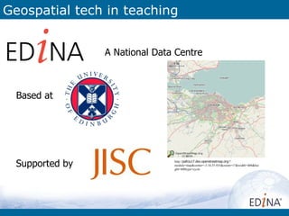
- 1. Geospatial tech in teaching A National Data Centre Based at Supported by http://pafciu17.dev.openstreetmap.org/? module=map¢er=-3.18,55.935&zoom=17&width=400&hei ght=400type=cycle
- 2. What? EDINA seeks to enhance the productivity, quality and cost- effectiveness of research and education in the UK and beyond. EDINA innovates, generating knowledge, expertise and trust, through a focus on ease and continuity of access to scholarly resources and tools. Enhance Preserve Research Innovate Continuity Community Expertise Support Infrastructure http://www.flickr.com/photos/santos/23006059 5/sizes/z/in/photostream/
- 3. Need maps? Images of front pages here……
- 4. Annotate maps Annotate maps to guide visitors to events Images of front pages here……
- 5. Use of Digimap Breakdown of Digimap services by discipline Images of front pages here…… Digimap ROAM Screen maps
- 6. Maps on YOUR website? Stream OS Opendata directly into: • Web apps • Google Earth • Desktop GIS Over 1000 registered users Non-academic use http://openstream.edina.ac.uk/
- 7. Thematic Mapper showing proportion of households within English local authorities defined as being in fuel poverty. Data grabbed from http://www.decc.gov.uk & uploaded to Thematic Mapper application to create map. Images of front pages here…… http://edina.ac.uk/ukborders/
- 8. Why are we teaching geospatial tech? Geospatial awareness is a core skill in many environment sector job descriptions. Students need to be aware of geospatial tech and need to know what it’s potential is. Geospatial tech is a key tool of the public and private sectors for locating and capturing asset data. Most asset management systems are now digital so it makes sense to capture data digitally. Images of front pages here……
- 9. So what does this tell us? Location is necessary but it is not sufficient Smartphone's are booming, GPS is seen as a standard bit of kit on phones, but they carry a host of other sensors. Making use of the sensor web in teaching and learning has huge potential
- 10. CMOS light sensor OK, it is commonly called a camera but the sensor is capable of much more than just taking pictures: Image recognition (face, labels, buildings) Distance ranging Change Detection Improve Positional Accuracy The interesting things happen when the CMOS sensor integrates with other sensors. e.g. get a rough fix with the GPS, then use the CMOS to improve this through image matching and then track your position with the gyroscope and accelerometer.
- 11. CMOS – Indoor Navigation Image recognition is another way that indoor navigation / locating can be achieved. Images might be barcodes, QR codes or even image triggers. Junaio have created an app that allows users to build their own custom apps for navigating indoor spaces http://www.youtube.com/watch?feature=player_embedded&v=jRcSFXvoPkU
- 12. Augmented Reality AR relies on: • Cameras and Displays • GPS, Positional, and Locative Technologies • Image Recognition Online / Offline / Caching Images of front pages here……
- 13. AR – Enhance Fieldtrips Enhance field course learning by revealing details that cannot be seen. Eh, this is obviously not on a mobile but you get the idea and it is something we would like to offer. Images of front pages here…… We have the data, but would it be useful?
- 14. AR – Pedestrian Navigation Navigation can work better when you use landmarks. “come out the station steps and follow the pavement round to the left onto the North bridge. Keep straight ahead till the Blockbuster, turn right, go down one block, turn left, straight ahead, passing the 1930’s Art Deco wine shop and just before the BP garage on your right, the pub is on the left” You can navigate from Waverly to The Old Bell Images of front pages here……
- 15. AR - Pico Projectors AR needn’t be a 1to1 activity. Pico Projectors are starting to appear that would allow the AR experience to be shared between a small group. Images of front pages here…… http://ar-ux.com/tag/modes
- 16. So what’s stopping us? There are a number of issues that need to be thought about before the potential of this technology can be fully realised for teaching and learning. Off-line caching Authentication Licences Devices Speed Usability Images of front pages here…… http://www.flickr.com/photos/hryckowian/2029393648/sizes/l/in/photostream/ Network coverage
- 17. CMOS AR
- 18. CMOS Virtual Reality
- 19. CMOS AR
- 20. Digimap Mobile Work in progress on a mobile mapping client that will allow users to collect data in the field and then retrieve that data or integrate it with other EDINA services Images of front pages here…… What would you find useful?
- 21. Addressing History App to explore the historic postal gazetteers of Edinburgh. Images of front pages here…… Still in development http://addressinghistory.edina.ac.uk/
- 22. Saviour or Slideshow? Location is necessary but it is not sufficient. “Smartphones will eat the web” Bruce Sterling ARE2011 Keynote
- 23. JISC “But, for more researchers to make full and effective use of the potential of sites, services and tools like this, the geospatial skills gap needs to be bridged. JISC is planning work to help do just that.” Matthew Dovey - programme director for the digital infrastructure at JISC Images of front pages here…… http://www.researchinformation.info/news/news_story.php?news_id=876
- 24. Addy Pope Email: addy.pope@ed.ac.uk Twitter: @go_geo http://www.gogeo.ac.uk EDINA website: http://edina.ac.uk http://mobilegeo.wordpress.com/ Open Data & Open Source Software at EDINA
- 25. Links http://people.csail.mit.edu/kapu/papers/mobile_visual_computing_pulli_isuvr09.pdf Indoor Nav http://radar.oreilly.com/2011/10/indoor-navigation.html http://dailyiphoneblog.com/2010/06/23/augmented-reality-indoor-usage-of-junaio-iphone-app/ AR http://ar-ux.com/tag/modes http://shareable.net/blog/five-ways-augmented-reality-is-making-your-life-more-shareable Pico http://gadgetmania.com/2011/01/mili-power-pico-projector/ http://www.youtube.com/watch?v=HUAVZhF43r8 (2010) http://www.youtube.com/watch?v=qU_bTKYh5_Y