Global Location
•Als PPT, PDF herunterladen•
9 gefällt mir•2,684 views

Slideshow accompanying a lecture/discussion about how to find absolute locations on a globe.

Empfohlen
Weitere ähnliche Inhalte
Was ist angesagt?
Was ist angesagt? (20)
Andere mochten auch
Ähnlich wie Global Location
Ähnlich wie Global Location (20)
Mehr von Donald Johnson
Kürzlich hochgeladen
Kürzlich hochgeladen (20)
Global Location
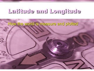
- 1. Latitude and Longitude How the world is measure and plotted
- 2. Learning Objective Latitude and Longitude Coordinates (TEKS (B)(21)(c)(e), (22)(a)(b)(c)(d), (23)(c)(d)) The student is expected to pose and answer questions about geographic distributions and patterns shown on maps A simplified online version of this presentation can be found here .
- 5. Measuring with latitude Latitude is measured in degrees north and south from the equator. At 90° north latitude is the North Pole and at 90° south latitude is the South Pole. These lines of latitude are numbered every 10° north and south from the equator. As the latitude reading Gets larger, the climate tends to get cooler.
- 6. Important lines of latitude The red lines represent the approximate boundaries of the low, middle, and high latitudes at 30 °, 60°, and 90° 66
- 10. Meridians determine time Each 15 ° of longitude determines one hour of time passage, therefore 24 time zones around the world.
- 12. International Dateline The International Date Line runs down the middle of the time zone on the other side of the world from the prime meridian, and so it corresponds to 180 degrees longitude, east and west. Like the other zones, the time zone of the International Date Line spans fifteen degrees and is one hour different from the adjacent zones.
- 14. Northern Hemisphere Southern Hemisphere all area north of the equator Northern Hemisphere Southern Hemisphere all area south of the equator
- 15. Western Hemisphere Area west of the Prime Meridian Measured as Longitude 0-180 ° W. Western Hemisphere
- 16. Eastern Hemisphere Area east of the Prime Meridian Measured as Longitude 0-180° E. Eastern Hemisphere
- 18. Plotting absolute location Your street name and house number furnish your absolute location. Latitude and longitude provide absolute location for a place on the globe. Using the Navstar GPS, satellite, your position can be accurately determined for finding street directions for a map in some cars.
- 19. Navstar GPS
- 20. Global Positioning Systems (GPS) This system uses a series of 24 satellites called the Navstars to beam information to earth about an object and its location of the earth’s surface.
- 21. GPS Navigation
- 22. Mercator Projection The property of the Mercator projection map that made it useful to navigators is that it preserves angles. Lines of constant compass heading (called rhumb lines by sailors) are straight lines on this map.
- 23. Plotting a course To go from Vancouver, Canada to Honolulu, Hawaii with just a compass, just draw a straight line on the map between starting point and destination, then measure the angle.
- 25. Comparing absolute, relative location Which is the most used type of location? Why?" Which is the important factor in the illustrations below ? Downtown Charlotte, N.C . Note the steep rent gradient implied by the height of buildings.