SlideShare ist ein Scribd-Unternehmen logo
1 von 45
Downloaden Sie, um offline zu lesen
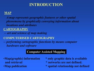
COMPUTERISED CARTOGRAPHY
-- performing cartographic functions by means computer
hardware and software
CARTOGRAPHY
-- art and science of map making
A map represents geographic features or other spatial
phenomena by graphically conveying information about
locations and attributes
MAP
•Map(graphic) information * only graphic data is available
and retrieval * networks are not defined.
•Map publication * spatial relationship not defined
Computer Assisted Mapping
INTRODUCTION
Graphics are holistic:
“a picture says more than a thousand words...”
“First road left, then
cross the railroad and
continue until you
cross the river, then
the first right and right
again on the
crossroads...”
Introduction
Why Use Graphics
Why GIS?
• 70% of the decisions, we make are
based on geographical
considerations
• Ability to assimilate spatial and non-
spatial data
• Visualisation Impact
• Sharing of Information
• Analytical Capability in a spatial
context
GIS is a System of computer software, hardware
and data, and personnel to help manipulate,
analyze and present information that is tied to a
spatial location –
• spatial location – usually a geographic location
• information – visualization of analysis of data
• system – linking software, hardware, data
• personnel – a thinking explorer who is key to
the power of GIS
Geographic Information Systems
A Definition of GIS
What is Not GIS ?
• GPS – Global Positioning System
• A static map – paper or digital
– Maps are often a “product” of a GIS
– A way to visualize the analysis
• A software package
• GIS handles SPATIAL
information
– Information referenced by its location in
space
• GIS makes connections between
activities based on spatial
proximity
9
Why is GIS unique?
Components of GIS
A working GIS system
integrates these five key components:
➢ Hardware
➢ Software
➢ Data
➢ People
➢ Methods
WHY GIS ?
• To inventory and monitor
resources
• To test the sensitivity of our
analysis assumptions
• To simulate potential impacts of
management alternatives
• To make the map the 2nd time,
the 50th time, the 100th time...
• GIS improves efficiency
• GIS identifies opportunities
• GIS improves decisions by
providing needed tools and data
How Does GIS
Provide Benefit?
Uses of a GIS
• Mapping geographical
characteristics for analysis
• Modeling alternative processes
for management plans
• Managing a utility’s assets
• Monitoring changes in
environmental factors
Spatial Data
• Estimates are that 80% of all
data has a spatial component
– Data from most sciences can be
analyzed “spatially”
Two Ways to Input and Visualize Data
• Raster – Grid
– “pixels”
– a location and value
– Satellite images and aerial
photos are already in this
format
• Vector – Linear
– Points, lines & polygons
– “Features” (house, lake, etc.)
– Attributes
– size, type, length, etc.
Real world
• A method to
visualize, manipulate,
analyze, and display
spatial data
• “Smart Maps”
linking a database to
the map
Data Capture Sources
• Digitizing from paper maps
• Scanning
• Traditional surveying
techniques
• Paper records & field notes
• Photogrammetry
• Remote sensing
• GPS
Database
“Not Easy to Interpret”
Visualization
“Worth a Thousand Words”
Combining Data From
Many Sources
States
Five Data Layers
“Alike” Features
Roads
Capitals
Rivers
Lakes
“Spatial Analysis” – not just a map
Turning Data Into Information
Asking A Question – Interaction
Maps and Database are
“Interactive”
Multiple Databases can be
Linked and Related
• Emergency Services – Fire & Police
• Environmental – Monitoring & Modeling
• Business – Site Location, Delivery Systems
• Industry – Transportation, Communication,
Mining, Pipelines, Healthcare
• Government – Local, State, Federal, Military
• Education – Research, Teaching Tool,
Administration
Wherever Spatial Data Analysis
is Needed

Weitere ähnliche Inhalte

Was ist angesagt?

Geographic information system
Geographic information system Geographic information system
Geographic information system Bhavik A Shah
 
GIS and the Neogeographer
GIS and the NeogeographerGIS and the Neogeographer
GIS and the NeogeographerSchuyler Erle
 
Geography basics
Geography basicsGeography basics
Geography basicsLisa Schmidt
 
GIS in Geography
GIS in GeographyGIS in Geography
GIS in Geographyaatkinson7
 
An introduction to geographic information systems (gis) m goulbourne 2007
An introduction to geographic information systems (gis)   m goulbourne 2007An introduction to geographic information systems (gis)   m goulbourne 2007
An introduction to geographic information systems (gis) m goulbourne 2007Michelle Goulbourne @ DiaMind Health
 
Concept, approach, history, trend
Concept, approach, history, trendConcept, approach, history, trend
Concept, approach, history, trendMd Zahirul Islam Faruk
 
Habidatum Intro
Habidatum IntroHabidatum Intro
Habidatum IntroHabidatum
 
Geographic Information System for Egyptian Railway System(GIS)
Geographic Information System for Egyptian Railway System(GIS)Geographic Information System for Egyptian Railway System(GIS)
Geographic Information System for Egyptian Railway System(GIS)Ismail El Gayar
 
Using geobrowsers for thematic mapping
Using geobrowsers for thematic mappingUsing geobrowsers for thematic mapping
Using geobrowsers for thematic mappingBjorn Sandvik
 
Gis (geographic information system)
Gis (geographic information system)Gis (geographic information system)
Gis (geographic information system)Saad Bare
 
Global information system ppt
Global information system pptGlobal information system ppt
Global information system pptGhayasHaiderSajid
 
Free GIS in the Classroom
Free GIS in the ClassroomFree GIS in the Classroom
Free GIS in the ClassroomGeoBlogs
 
Geography Apps
Geography AppsGeography Apps
Geography Appsegill11
 
Definition of gis
Definition of gisDefinition of gis
Definition of gisSumant Diwakar
 

Was ist angesagt? (20)

Geographic information system
Geographic information system Geographic information system
Geographic information system
 
What is gis
What is gisWhat is gis
What is gis
 
GIS and the Neogeographer
GIS and the NeogeographerGIS and the Neogeographer
GIS and the Neogeographer
 
Geography basics
Geography basicsGeography basics
Geography basics
 
GIS in Geography
GIS in GeographyGIS in Geography
GIS in Geography
 
Arabia mountain gis water presentation
Arabia mountain gis water presentationArabia mountain gis water presentation
Arabia mountain gis water presentation
 
An introduction to geographic information systems (gis) m goulbourne 2007
An introduction to geographic information systems (gis)   m goulbourne 2007An introduction to geographic information systems (gis)   m goulbourne 2007
An introduction to geographic information systems (gis) m goulbourne 2007
 
3 introduction gis
3   introduction gis3   introduction gis
3 introduction gis
 
Concept, approach, history, trend
Concept, approach, history, trendConcept, approach, history, trend
Concept, approach, history, trend
 
Habidatum Intro
Habidatum IntroHabidatum Intro
Habidatum Intro
 
Geographic Information System for Egyptian Railway System(GIS)
Geographic Information System for Egyptian Railway System(GIS)Geographic Information System for Egyptian Railway System(GIS)
Geographic Information System for Egyptian Railway System(GIS)
 
Using geobrowsers for thematic mapping
Using geobrowsers for thematic mappingUsing geobrowsers for thematic mapping
Using geobrowsers for thematic mapping
 
Gis (geographic information system)
Gis (geographic information system)Gis (geographic information system)
Gis (geographic information system)
 
Global information system ppt
Global information system pptGlobal information system ppt
Global information system ppt
 
Computer gis
Computer gisComputer gis
Computer gis
 
Free GIS in the Classroom
Free GIS in the ClassroomFree GIS in the Classroom
Free GIS in the Classroom
 
Functions of GIS
Functions of GISFunctions of GIS
Functions of GIS
 
Geography Apps
Geography AppsGeography Apps
Geography Apps
 
GIS_Intro_March_2014
GIS_Intro_March_2014GIS_Intro_March_2014
GIS_Intro_March_2014
 
Definition of gis
Definition of gisDefinition of gis
Definition of gis
 

Ă„hnlich wie Forestry gis 2021

Geographical information system
Geographical information systemGeographical information system
Geographical information systemBipin Karki
 
Geographical information system
Geographical information systemGeographical information system
Geographical information systemBipin Karki
 
Introduction to GIS & Cartography.pdf
Introduction to GIS & Cartography.pdfIntroduction to GIS & Cartography.pdf
Introduction to GIS & Cartography.pdfLareebMoeen1
 
Introduction to GIS and its Applications.pptx
Introduction to GIS and its Applications.pptxIntroduction to GIS and its Applications.pptx
Introduction to GIS and its Applications.pptxalphamale15
 
What is GIS (Course Presentation).pdf
What is GIS (Course Presentation).pdfWhat is GIS (Course Presentation).pdf
What is GIS (Course Presentation).pdfjarriesgado
 
2043213190221_Lec 1 Basics of GISRS.pptx
2043213190221_Lec 1 Basics of GISRS.pptx2043213190221_Lec 1 Basics of GISRS.pptx
2043213190221_Lec 1 Basics of GISRS.pptxHamzaZulfiqar47
 
Geographic information system
Geographic information systemGeographic information system
Geographic information systemSumanta Das
 
GEOGRAPHICAL INFORMATION SYSTEM (GIS)
GEOGRAPHICAL INFORMATION SYSTEM (GIS)GEOGRAPHICAL INFORMATION SYSTEM (GIS)
GEOGRAPHICAL INFORMATION SYSTEM (GIS)Siva Mbbs
 
gis
gisgis
gisyaesh
 
GIS and Remote sensing CIvil Engg by Mrunmayee
GIS and Remote sensing CIvil Engg by MrunmayeeGIS and Remote sensing CIvil Engg by Mrunmayee
GIS and Remote sensing CIvil Engg by MrunmayeeMrunmayee Manjari
 
Gis basic-2
Gis basic-2Gis basic-2
Gis basic-2RJRANJEET1
 
Geographical information systems
Geographical information systemsGeographical information systems
Geographical information systemsGift Musanza
 

Ă„hnlich wie Forestry gis 2021 (20)

Geographical information system
Geographical information systemGeographical information system
Geographical information system
 
Geographical information system
Geographical information systemGeographical information system
Geographical information system
 
Introduction to GIS & Cartography.pdf
Introduction to GIS & Cartography.pdfIntroduction to GIS & Cartography.pdf
Introduction to GIS & Cartography.pdf
 
Introduction to GIS and its Applications.pptx
Introduction to GIS and its Applications.pptxIntroduction to GIS and its Applications.pptx
Introduction to GIS and its Applications.pptx
 
gis.pdf
gis.pdfgis.pdf
gis.pdf
 
gis.pdf
gis.pdfgis.pdf
gis.pdf
 
Lodha govardhan
Lodha govardhanLodha govardhan
Lodha govardhan
 
Gis
GisGis
Gis
 
What is GIS (Course Presentation).pdf
What is GIS (Course Presentation).pdfWhat is GIS (Course Presentation).pdf
What is GIS (Course Presentation).pdf
 
2043213190221_Lec 1 Basics of GISRS.pptx
2043213190221_Lec 1 Basics of GISRS.pptx2043213190221_Lec 1 Basics of GISRS.pptx
2043213190221_Lec 1 Basics of GISRS.pptx
 
Env. mon
Env. monEnv. mon
Env. mon
 
Geographic information system
Geographic information systemGeographic information system
Geographic information system
 
GEOGRAPHICAL INFORMATION SYSTEM (GIS)
GEOGRAPHICAL INFORMATION SYSTEM (GIS)GEOGRAPHICAL INFORMATION SYSTEM (GIS)
GEOGRAPHICAL INFORMATION SYSTEM (GIS)
 
gis
gisgis
gis
 
GIS and Remote sensing CIvil Engg by Mrunmayee
GIS and Remote sensing CIvil Engg by MrunmayeeGIS and Remote sensing CIvil Engg by Mrunmayee
GIS and Remote sensing CIvil Engg by Mrunmayee
 
Gis basic-2
Gis basic-2Gis basic-2
Gis basic-2
 
Introduction to GIS.pptx
Introduction to GIS.pptxIntroduction to GIS.pptx
Introduction to GIS.pptx
 
Geographical information systems
Geographical information systemsGeographical information systems
Geographical information systems
 
Rs unit iii-gis--- [repaired]
Rs unit iii-gis--- [repaired]Rs unit iii-gis--- [repaired]
Rs unit iii-gis--- [repaired]
 
Rs unit iii-gis--- [repaired]
Rs unit iii-gis--- [repaired]Rs unit iii-gis--- [repaired]
Rs unit iii-gis--- [repaired]
 

KĂĽrzlich hochgeladen

How to Make a Pirate ship Primary Education.pptx
How to Make a Pirate ship Primary Education.pptxHow to Make a Pirate ship Primary Education.pptx
How to Make a Pirate ship Primary Education.pptxmanuelaromero2013
 
“Oh GOSH! Reflecting on Hackteria's Collaborative Practices in a Global Do-It...
“Oh GOSH! Reflecting on Hackteria's Collaborative Practices in a Global Do-It...“Oh GOSH! Reflecting on Hackteria's Collaborative Practices in a Global Do-It...
“Oh GOSH! Reflecting on Hackteria's Collaborative Practices in a Global Do-It...Marc Dusseiller Dusjagr
 
Presentation by Andreas Schleicher Tackling the School Absenteeism Crisis 30 ...
Presentation by Andreas Schleicher Tackling the School Absenteeism Crisis 30 ...Presentation by Andreas Schleicher Tackling the School Absenteeism Crisis 30 ...
Presentation by Andreas Schleicher Tackling the School Absenteeism Crisis 30 ...EduSkills OECD
 
Alper Gobel In Media Res Media Component
Alper Gobel In Media Res Media ComponentAlper Gobel In Media Res Media Component
Alper Gobel In Media Res Media ComponentInMediaRes1
 
URLs and Routing in the Odoo 17 Website App
URLs and Routing in the Odoo 17 Website AppURLs and Routing in the Odoo 17 Website App
URLs and Routing in the Odoo 17 Website AppCeline George
 
BASLIQ CURRENT LOOKBOOK LOOKBOOK(1) (1).pdf
BASLIQ CURRENT LOOKBOOK  LOOKBOOK(1) (1).pdfBASLIQ CURRENT LOOKBOOK  LOOKBOOK(1) (1).pdf
BASLIQ CURRENT LOOKBOOK LOOKBOOK(1) (1).pdfSoniaTolstoy
 
Sanyam Choudhary Chemistry practical.pdf
Sanyam Choudhary Chemistry practical.pdfSanyam Choudhary Chemistry practical.pdf
Sanyam Choudhary Chemistry practical.pdfsanyamsingh5019
 
Call Girls in Dwarka Mor Delhi Contact Us 9654467111
Call Girls in Dwarka Mor Delhi Contact Us 9654467111Call Girls in Dwarka Mor Delhi Contact Us 9654467111
Call Girls in Dwarka Mor Delhi Contact Us 9654467111Sapana Sha
 
The Most Excellent Way | 1 Corinthians 13
The Most Excellent Way | 1 Corinthians 13The Most Excellent Way | 1 Corinthians 13
The Most Excellent Way | 1 Corinthians 13Steve Thomason
 
SOCIAL AND HISTORICAL CONTEXT - LFTVD.pptx
SOCIAL AND HISTORICAL CONTEXT - LFTVD.pptxSOCIAL AND HISTORICAL CONTEXT - LFTVD.pptx
SOCIAL AND HISTORICAL CONTEXT - LFTVD.pptxiammrhaywood
 
APM Welcome, APM North West Network Conference, Synergies Across Sectors
APM Welcome, APM North West Network Conference, Synergies Across SectorsAPM Welcome, APM North West Network Conference, Synergies Across Sectors
APM Welcome, APM North West Network Conference, Synergies Across SectorsAssociation for Project Management
 
A Critique of the Proposed National Education Policy Reform
A Critique of the Proposed National Education Policy ReformA Critique of the Proposed National Education Policy Reform
A Critique of the Proposed National Education Policy ReformChameera Dedduwage
 
Accessible design: Minimum effort, maximum impact
Accessible design: Minimum effort, maximum impactAccessible design: Minimum effort, maximum impact
Accessible design: Minimum effort, maximum impactdawncurless
 
microwave assisted reaction. General introduction
microwave assisted reaction. General introductionmicrowave assisted reaction. General introduction
microwave assisted reaction. General introductionMaksud Ahmed
 
Industrial Policy - 1948, 1956, 1973, 1977, 1980, 1991
Industrial Policy - 1948, 1956, 1973, 1977, 1980, 1991Industrial Policy - 1948, 1956, 1973, 1977, 1980, 1991
Industrial Policy - 1948, 1956, 1973, 1977, 1980, 1991RKavithamani
 
Micromeritics - Fundamental and Derived Properties of Powders
Micromeritics - Fundamental and Derived Properties of PowdersMicromeritics - Fundamental and Derived Properties of Powders
Micromeritics - Fundamental and Derived Properties of PowdersChitralekhaTherkar
 

KĂĽrzlich hochgeladen (20)

Model Call Girl in Tilak Nagar Delhi reach out to us at 🔝9953056974🔝
Model Call Girl in Tilak Nagar Delhi reach out to us at 🔝9953056974🔝Model Call Girl in Tilak Nagar Delhi reach out to us at 🔝9953056974🔝
Model Call Girl in Tilak Nagar Delhi reach out to us at 🔝9953056974🔝
 
How to Make a Pirate ship Primary Education.pptx
How to Make a Pirate ship Primary Education.pptxHow to Make a Pirate ship Primary Education.pptx
How to Make a Pirate ship Primary Education.pptx
 
“Oh GOSH! Reflecting on Hackteria's Collaborative Practices in a Global Do-It...
“Oh GOSH! Reflecting on Hackteria's Collaborative Practices in a Global Do-It...“Oh GOSH! Reflecting on Hackteria's Collaborative Practices in a Global Do-It...
“Oh GOSH! Reflecting on Hackteria's Collaborative Practices in a Global Do-It...
 
Presentation by Andreas Schleicher Tackling the School Absenteeism Crisis 30 ...
Presentation by Andreas Schleicher Tackling the School Absenteeism Crisis 30 ...Presentation by Andreas Schleicher Tackling the School Absenteeism Crisis 30 ...
Presentation by Andreas Schleicher Tackling the School Absenteeism Crisis 30 ...
 
Alper Gobel In Media Res Media Component
Alper Gobel In Media Res Media ComponentAlper Gobel In Media Res Media Component
Alper Gobel In Media Res Media Component
 
TataKelola dan KamSiber Kecerdasan Buatan v022.pdf
TataKelola dan KamSiber Kecerdasan Buatan v022.pdfTataKelola dan KamSiber Kecerdasan Buatan v022.pdf
TataKelola dan KamSiber Kecerdasan Buatan v022.pdf
 
URLs and Routing in the Odoo 17 Website App
URLs and Routing in the Odoo 17 Website AppURLs and Routing in the Odoo 17 Website App
URLs and Routing in the Odoo 17 Website App
 
BASLIQ CURRENT LOOKBOOK LOOKBOOK(1) (1).pdf
BASLIQ CURRENT LOOKBOOK  LOOKBOOK(1) (1).pdfBASLIQ CURRENT LOOKBOOK  LOOKBOOK(1) (1).pdf
BASLIQ CURRENT LOOKBOOK LOOKBOOK(1) (1).pdf
 
Sanyam Choudhary Chemistry practical.pdf
Sanyam Choudhary Chemistry practical.pdfSanyam Choudhary Chemistry practical.pdf
Sanyam Choudhary Chemistry practical.pdf
 
Call Girls in Dwarka Mor Delhi Contact Us 9654467111
Call Girls in Dwarka Mor Delhi Contact Us 9654467111Call Girls in Dwarka Mor Delhi Contact Us 9654467111
Call Girls in Dwarka Mor Delhi Contact Us 9654467111
 
The Most Excellent Way | 1 Corinthians 13
The Most Excellent Way | 1 Corinthians 13The Most Excellent Way | 1 Corinthians 13
The Most Excellent Way | 1 Corinthians 13
 
SOCIAL AND HISTORICAL CONTEXT - LFTVD.pptx
SOCIAL AND HISTORICAL CONTEXT - LFTVD.pptxSOCIAL AND HISTORICAL CONTEXT - LFTVD.pptx
SOCIAL AND HISTORICAL CONTEXT - LFTVD.pptx
 
APM Welcome, APM North West Network Conference, Synergies Across Sectors
APM Welcome, APM North West Network Conference, Synergies Across SectorsAPM Welcome, APM North West Network Conference, Synergies Across Sectors
APM Welcome, APM North West Network Conference, Synergies Across Sectors
 
A Critique of the Proposed National Education Policy Reform
A Critique of the Proposed National Education Policy ReformA Critique of the Proposed National Education Policy Reform
A Critique of the Proposed National Education Policy Reform
 
Accessible design: Minimum effort, maximum impact
Accessible design: Minimum effort, maximum impactAccessible design: Minimum effort, maximum impact
Accessible design: Minimum effort, maximum impact
 
microwave assisted reaction. General introduction
microwave assisted reaction. General introductionmicrowave assisted reaction. General introduction
microwave assisted reaction. General introduction
 
Industrial Policy - 1948, 1956, 1973, 1977, 1980, 1991
Industrial Policy - 1948, 1956, 1973, 1977, 1980, 1991Industrial Policy - 1948, 1956, 1973, 1977, 1980, 1991
Industrial Policy - 1948, 1956, 1973, 1977, 1980, 1991
 
Model Call Girl in Bikash Puri Delhi reach out to us at 🔝9953056974🔝
Model Call Girl in Bikash Puri  Delhi reach out to us at 🔝9953056974🔝Model Call Girl in Bikash Puri  Delhi reach out to us at 🔝9953056974🔝
Model Call Girl in Bikash Puri Delhi reach out to us at 🔝9953056974🔝
 
Micromeritics - Fundamental and Derived Properties of Powders
Micromeritics - Fundamental and Derived Properties of PowdersMicromeritics - Fundamental and Derived Properties of Powders
Micromeritics - Fundamental and Derived Properties of Powders
 
Staff of Color (SOC) Retention Efforts DDSD
Staff of Color (SOC) Retention Efforts DDSDStaff of Color (SOC) Retention Efforts DDSD
Staff of Color (SOC) Retention Efforts DDSD
 

Forestry gis 2021

  • 1. COMPUTERISED CARTOGRAPHY -- performing cartographic functions by means computer hardware and software CARTOGRAPHY -- art and science of map making A map represents geographic features or other spatial phenomena by graphically conveying information about locations and attributes MAP •Map(graphic) information * only graphic data is available and retrieval * networks are not defined. •Map publication * spatial relationship not defined Computer Assisted Mapping INTRODUCTION
  • 2. Graphics are holistic: “a picture says more than a thousand words...” “First road left, then cross the railroad and continue until you cross the river, then the first right and right again on the crossroads...” Introduction Why Use Graphics
  • 3. Why GIS? • 70% of the decisions, we make are based on geographical considerations • Ability to assimilate spatial and non- spatial data • Visualisation Impact • Sharing of Information • Analytical Capability in a spatial context
  • 4. GIS is a System of computer software, hardware and data, and personnel to help manipulate, analyze and present information that is tied to a spatial location – • spatial location – usually a geographic location • information – visualization of analysis of data • system – linking software, hardware, data • personnel – a thinking explorer who is key to the power of GIS Geographic Information Systems A Definition of GIS
  • 5.
  • 6.
  • 7.
  • 8. What is Not GIS ? • GPS – Global Positioning System • A static map – paper or digital – Maps are often a “product” of a GIS – A way to visualize the analysis • A software package
  • 9. • GIS handles SPATIAL information – Information referenced by its location in space • GIS makes connections between activities based on spatial proximity 9 Why is GIS unique?
  • 10. Components of GIS A working GIS system integrates these five key components: ➢ Hardware ➢ Software ➢ Data ➢ People ➢ Methods
  • 11. WHY GIS ? • To inventory and monitor resources • To test the sensitivity of our analysis assumptions • To simulate potential impacts of management alternatives • To make the map the 2nd time, the 50th time, the 100th time...
  • 12. • GIS improves efficiency • GIS identifies opportunities • GIS improves decisions by providing needed tools and data How Does GIS Provide Benefit?
  • 13. Uses of a GIS • Mapping geographical characteristics for analysis • Modeling alternative processes for management plans • Managing a utility’s assets • Monitoring changes in environmental factors
  • 14.
  • 15. Spatial Data • Estimates are that 80% of all data has a spatial component – Data from most sciences can be analyzed “spatially”
  • 16.
  • 17.
  • 18.
  • 19. Two Ways to Input and Visualize Data • Raster – Grid – “pixels” – a location and value – Satellite images and aerial photos are already in this format • Vector – Linear – Points, lines & polygons – “Features” (house, lake, etc.) – Attributes – size, type, length, etc. Real world
  • 20.
  • 21.
  • 22.
  • 23.
  • 24.
  • 25.
  • 26.
  • 27. • A method to visualize, manipulate, analyze, and display spatial data • “Smart Maps” linking a database to the map
  • 28. Data Capture Sources • Digitizing from paper maps • Scanning • Traditional surveying techniques • Paper records & field notes • Photogrammetry • Remote sensing • GPS
  • 29. Database “Not Easy to Interpret”
  • 31.
  • 32.
  • 33.
  • 35. States Five Data Layers “Alike” Features Roads Capitals Rivers Lakes
  • 36. “Spatial Analysis” – not just a map Turning Data Into Information
  • 37. Asking A Question – Interaction
  • 38. Maps and Database are “Interactive”
  • 39. Multiple Databases can be Linked and Related
  • 40.
  • 41.
  • 42.
  • 43.
  • 44.
  • 45. • Emergency Services – Fire & Police • Environmental – Monitoring & Modeling • Business – Site Location, Delivery Systems • Industry – Transportation, Communication, Mining, Pipelines, Healthcare • Government – Local, State, Federal, Military • Education – Research, Teaching Tool, Administration Wherever Spatial Data Analysis is Needed